Midland Airpark Airport (KMDD / MDD)
Empty legs and charters from Midland
KMDD airport at a glance
- ICAO code
- KMDD
- IATA code
- MDD
- City
- Midland
- Region
- Texas
- Country
- United States
- Elevation
- 2,803 ft (854 m)
- Time zone
- America/Chicago (UTC-6)
- Coordinates
- 32.0365° N, 102.1010° W
- Empty legs from
- 17
- Empty legs to
- 17
Weather & airport info KMDD
Current weather
No current weather report is available for this airport.
Airport
- Elevation
- 2,803 ft (854 m)
- Sunrise / Sunset
- 07:06 / 17:57 local time
Runways
| Runway | Length | Surface | Lighted |
|---|---|---|---|
| 07/25 | 1,698 m (5,571 ft) | asphalt | yes |
| 16/34 | 1,212 m (3,977 ft) | asphalt | yes |
Radio frequencies
- Clearance: 121.8
- UNICOM: 122.7
For information only, not for flight planning. Weather can change quickly; always rely on official reports. Sources: aviationweather.gov (NOAA), OurAirports.
Airport map KMDD
Full screen →Runways white, taxiways yellow with designators, closed taxiways and runways per NOTAM in red.
Closed per NOTAM: TWY A* (* partly closed)
Official charts (FAA)
Cycle 2611, valid until 0901Z 11/26/26
Instrument approaches (2)
Minimums (2)
For information only, not for navigation. Always use current official charts and NOTAMs.
Current NOTAMs for KMDD(17)
NOTAMs (Notices to Air Missions) announce short-term changes at an airport: closed runways or taxiways, unserviceable approach aids, obstacles, airspace restrictions.
- Out of servicePAPI: unserviceable10/035· until 01 Dec, 06:00 UTC
The PAPI (Precision Approach Path Indicator) for runway 07 is out of service. This system helps pilots find the correct glide path for landing.
Show original text
RWY 07 PAPI U/S
10/035 NOTAMR
Q) KZFW/QLPAS/IV/BO/A/000/999/3202N10206W005
A) KMDD
B) 2610312121
C) 2612010600

E) RWY 07 PAPI U/S
- ClosedTaxiway: closed10/036· until 01 Dec, 06:00 UTC
Taxiway A is closed between Taxiway B and the North Ramp. This means that this section of the taxiway cannot be used.
Show original text
TWY A BTN TWY B AND NORTH RAMP CLSD
10/036 NOTAMR
Q) KZFW/QMXLC/IV/M/A/000/999/3202N10206W005
A) KMDD
B) 2610312121
C) 2612010600

E) TWY A BTN TWY B AND NORTH RAMP CLSDNORTH RAMPRSTRCTN>0? TO|
- Out of servicePAPI: unserviceable10/033· until 01 Dec, 06:00 UTC
The PAPI (Precision Approach Path Indicator) for runway 34 is out of service. The PAPI is a visual aid that helps pilots maintain the correct altitude during approach.
Show original text
RWY 34 PAPI U/S
10/033 NOTAMR
Q) KZFW/QLPAS/IV/BO/A/000/999/3202N10206W005
A) KMDD
B) 2610312120
C) 2612010600

E) RWY 34 PAPI U/S
- Out of servicePAPI: unserviceable10/034· until 01 Dec, 06:00 UTC
The PAPI (Precision Approach Path Indicator) for runway 16 is out of service. This system helps pilots find the correct glide path for landing.
Show original text
RWY 16 PAPI U/S
10/034 NOTAMR
Q) KZFW/QLPAS/IV/BO/A/000/999/3202N10206W005
A) KMDD
B) 2610312120
C) 2612010600

E) RWY 16 PAPI U/S
- ClosedApron: closed10/031· until 01 Dec, 06:00 UTC
The north runup ramp on the apron is closed. This is an area where aircraft test their engines before takeoff.
Show original text
APRON NORTH RUNUP RAMP CLSD
10/031 NOTAMR
Q) KZFW/QMNLC/IV/NBO/A/000/999/3202N10206W005
A) KMDD
B) 2610312119
C) 2612010600

E) NORTH RUNUP RAMP CLSD
- Out of serviceDaylight markings10/030· until 01 Dec, 06:00 UTC
The holding position sign for the approach lighting system at the end of runway 34 on taxiway D is out of service. This may affect orientation on taxiway D.
Show original text
TWY D HLDG PSN SIGN FOR APCH END RWY 34 LGT U/S
10/030 NOTAMR
Q) KZFW/QMMXX/V/M/A/000/999/3202N10206W005
A) KMDD
B) 2610312118
C) 2612010600

E) TWY D HLDG PSN SIGN FOR APCH END RWY 34 LGT U/S
- Out of serviceObstacle lights: unserviceable10/022· until 13 Nov, 09:53 UTC
An obstacle, a tower light with identifier ASR 1049345, 6.9 nautical miles west-northwest of the airport, is out of service. Its top is 3548.9 feet above sea level, 651.9 feet above ground.
Show original text
OBST TOWER LGT (ASR 1049345) 320405.00N1021353.00W (6.9NM WNW MDD) 3548.9FT (651.9FT AGL) U/S
10/022 NOTAMN<br/>
<b>Q) </b>KZFW/QOLAS/IV/M/E/000/036/3202N10206W005<br/>
<b>A) </b>KMDD<br/>
<b>B) </b>2610291053<br/>
<b>C) </b>2611130953<br/>
<b>E) </b> TOWER LGT (ASR 1049345) 320405.00N1021353.00W (6.9NM WNW MDD) 3548.9FT (651.9FT AGL) U/S<br/>
- Out of serviceObstacle lights: unserviceable10/019· until 06 Nov, 07:05 UTC
A tower light 17.4 nautical miles north-northwest of the airport is out of service. The top of the obstacle is 3249.0 ft above sea level, 315.0 ft above ground.
Show original text
OBST TOWER LGT (ASR 1228160) 321918.90N1021023.00W (17.4NM NNW MDD) 3249.0FT (315.0FT AGL) U/S
10/019 NOTAMN<br/>
<b>Q) </b>KZFW/QOLAS/IV/M/E/000/033/3202N10206W005<br/>
<b>A) </b>KMDD<br/>
<b>B) </b>2610220805<br/>
<b>C) </b>2611060705<br/>
<b>E) </b> TOWER LGT (ASR 1228160) 321918.90N1021023.00W (17.4NM NNW MDD) 3249.0FT (315.0FT AGL) U/S<br/>
9 more NOTAMs
- Out of serviceObstacle10/011· until 14 Jan, 23:59 UTC
The lighting on an obstacle tower (ASR 1293094) 2.8 nautical miles southeast of Midland Airpark Airport is out of service. Its top is 3089.9 feet above sea level, 319.9 feet above ground.
Show original text
OBST TOWER LGT (ASR 1293094) 315954.60N1020411.20W (2.8NM SE MDD) 3089.9FT (319.9FT AGL) U/S
- NoticeTaxiway: work in progress10/037· until 01 Dec, 06:00 UTC
Taxiway A between taxiway B and the north ramp is closed due to construction work.
Show original text
TWY A BTN TWY B AND NORTH RAMP WIP CONST
10/037 NOTAMR
Q) KZFW/QMXHW/IV/M/A/000/999/3202N10206W005
A) KMDD
B) 2610312122
C) 2612010600

E) TWY A BTN TWY B AND NORTH RAMP WIP CONST
- NoticeDaylight markings10/032· until 01 Dec, 06:00 UTC
The taxiway centerline markings on taxiway A for the north ramp have been removed. This might affect guidance when taxiing in this area.
Show original text
TWY A CL MARKINGS FOR NORTH RAMP REMOVED
10/032 NOTAMR
Q) KZFW/QMMXX/V/M/A/000/999/3202N10206W005
A) KMDD
B) 2610312119
C) 2612010600

E) TWY A CL MARKINGS FOR NORTH RAMP REMOVED
- NoticeApron: work in progress10/029· until 01 Dec, 06:00 UTC
Maintenance work is in progress on the north ramp (aircraft parking area). This may cause restrictions on the northern part of the apron.
Show original text
APRON NORTH RAMP WIP MAINT
10/029 NOTAMR
Q) KZFW/QMNHW/IV/BO/A/000/999/3202N10206W005
A) KMDD
B) 2610312118
C) 2612010600

E) NORTH RAMP WIP MAINT
- NoticeDeclared distances: changed10/027· until 01 Dec, 06:00 UTC
Runway 34 DECLARED DIST: TORA 3828 ft TODA 3828 ft ASDA 3828 ft LDA 3828 ft.
Show original text
RWY 34 DECLARED DIST: TORA 3828FT TODA 3828FT ASDA 3828FT LDA 3828FT.
10/027 NOTAMR
Q) KZFW/QMDCH/IV/NBO/A/000/999/3202N10206W005
A) KMDD
B)
2610312117
C)
2612010600

E) RWY 34 DECLARED DIST: TORA 3828FT TODA 3828FT ASDA 3828FT LDA 3828FT.
- NoticeDeclared distances: changed10/028· until 01 Dec, 06:00 UTC
For runway 16, the declared distances for takeoff (TORA, TODA, ASDA) and landing (LDA) are each 3828 feet.
Show original text
RWY 16 DECLARED DIST: TORA 3828FT TODA 3828FT ASDA 3828FT LDA 3828FT.
10/028 NOTAMR
Q) KZFW/QMDCH/IV/NBO/A/000/999/3202N10206W005
A) KMDD
B)
2610312117
C)
2612010600

E) RWY 16 DECLARED DIST: TORA 3828FT TODA 3828FT ASDA 3828FT LDA 3828FT.
- NoticeDaylight markings10/026· until 01 Dec, 06:00 UTC
The center line markings on taxiway C are not standard. This might affect orientation on the taxiway.
Show original text
TWY C CL MARKINGS NOT STD
10/026 NOTAMR
Q) KZFW/QMMXX/V/M/A/000/999/3202N10206W005
A) KMDD
B) 2610312116
C) 2612010600

E) TWY C CL MARKINGS NOT STD
- Out of serviceInstrument approach procedure6076/26· until 29 Sept, 13:52 UTC (estimated)
For the RNAV (GPS) approach to runway 25, the LNAV minimum descent altitude is 3240 feet above sea level, which is 440 feet above touchdown. Circling runway 34 is not authorized at night.
Show original text
IAP MIDLAND AIRPARK, MIDLAND, TX. RNAV (GPS) RWY 25, ORIG-B... LNAV MDA 3240/HAT 440 ALL CATS. CIRCLING RWY 34 NA AT NIGHT. 2609291352-2809291352EST
Q) KZFW/QPIXX/I/NBO/A/000/999/3202N10206W005
A) KMDD
B) 2609221529
C) 2705041527EST
E) MDD MIDLAND AIRPARK, MIDLAND, TX.
RNAV (GPS) RWY 25, ORIG-B...
LNAV MDA 3240/HAT 440 ALL CATS. CIRCLING RWY 34 NA AT NIGHT.
- Out of serviceInstrument approach procedure6075/26· until 29 Sept, 13:50 UTC (estimated)
For the RNAV (GPS) approach to runway 34, LPV DA, VDP, straight-in runway 34, and circling runway 34 are not authorized at night. Helicopters are not authorized to reduce visibility below 1 SM. For uncompensated Baro-VNAV systems, LNAV/VNAV is not authorized below -20°C or above 54°C.
Show original text
IAP MIDLAND AIRPARK, MIDLAND, TX. RNAV (GPS) RWY 34, ORIG-B... LPV DA NA. VDP NA. STRAIGHT-IN RWY 34 AND CIRCLING RWY 34 NA AT NIGHT. CHANGE NOTE TO READ: RWY 34 HELICOPTER VISIBILITY REDUCTION BELOW 1 SM NOT AUTHORIZED. DISREGARD NOTE: VDP NA WITH MIDLAND INTL ALTIMETER SETTING. CHANGE NOTE TO READ: FOR UNCOMPENSATED BARO-VNAV SYSTEMS, LNAV/VNAV NA BELOW -20C OR ABOVE 54C. 2609291350-2809291350EST
Q) KZFW/QPIXX/I/NBO/A/000/999/3202N10206W005
A) KMDD
B) 2609221700
C) 2705041700EST
E) MDD MIDLAND AIRPARK, MIDLAND, TX.
RNAV (GPS) RWY 34, ORIG-B...
LPV DA NA. VDP NA. STRAIGHT-IN RWY 34 AND CIRCLING RWY 34 NA AT NIGHT. CHANGE NOTE TO READ: RWY 34 HELICOPTER VISIBILITY REDUCTION BELOW 1 SM NOT AUTHORIZED. DISREGARD NOTE: VDP NA WITH MIDLAND INTL ALTIMETER SETTING. CHANGE NOTE TO READ: FOR UNCOMPENSATED BARO-VNAV SYSTEMS, LNAV/VNAV NA BELOW -20C OR ABOVE 54C.
For information only, not for flight planning or operational use. Always rely on an official pre-flight briefing. This list may be incomplete or out of date. Explanations and expanded abbreviations are generated automatically. The original text is authoritative. Source: FAA NOTAM Management Service (SWIM).
Private jet traffic in Midland Airpark (last 30 days)
- Arrivals
- 305
- Departures
- 190
- Different jets
- 187
Most frequent origins: Fort Worth Meacham International Airport (22), Dallas Love Field (18), Austin Bergstrom International Airport (15), Addison Airport (14), Dallas Fort Worth International Airport (8).
Most frequent destinations: Dallas Love Field (21), Fort Worth Meacham International Airport (15), Odessa Schlemeyer Field (14), William P Hobby Airport (9), Tyler Pounds Regional Airport (6).
Most common aircraft types: Embraer Phenom 300 (74), Beechcraft King Air 300 (37), Beechcraft King Air 350 (37), Cessna Citation Latitude (35), Learjet 45 (35).
Our own analysis of public ADS-B signals from business jets. Not every flight is received, and jets with a removal request are excluded.
Charter operators based here
Operators with a base at this airport.
- Basin AviationTurboprop, Light jet
Empty legs from KMDD
17 departures available
 Tue, Nov 3TodayMidlandKMDD · Midland AirparkSan AntonioKSAT · San Antonio International AirportHawker 4008—On request3NovMidland → San AntonioKMDD → KSAT · TodayHawker 400 · 8 seatsOn request
 Tue, Nov 322:45MidlandKMDD · Midland AirparkSan AntonioKSAT · San Antonio International AirportBeechcraft Beechjet 400A148mOn request3NovMidland → San AntonioKMDD → KSAT · 22:45Beechcraft Beechjet 400A · 1 seat · 48mOn request
- Tue, Nov 3TodayMidlandKMDD · Midland AirparkSan AntonioKSAT · San Antonio International AirportRaytheon Aircraft Company Hawker 400A10—On request3NovMidland → San AntonioKMDD → KSAT · TodayRaytheon Aircraft Company Hawker 400A · 10 seatsOn request
- Wed, Nov 403:45MidlandKMDD · Midland AirparkSan AntonioKSAT · San Antonio IntlBeechcraft Beechjet 400A7—On request4NovMidland → San AntonioKMDD → KSAT · 03:45Beechcraft Beechjet 400A · 7 seatsOn request
 Fri, Nov 606:45MidlandKMDD · Midland AirparkSan AntonioKSAT · San Antonio International AirportBeech Beechjet 400A7—$8,8566NovMidland → San AntonioKMDD → KSAT · 06:45Beech Beechjet 400A · 7 seats$8,856
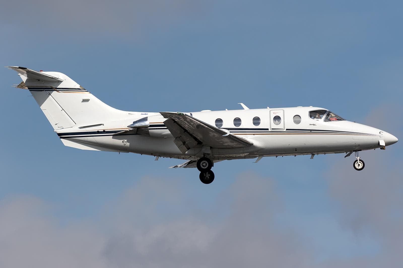 Sun, Nov 15in 12 daysMidlandKMDD · Midland AirparkSan AntonioKSAT · San Antonio International AirportHawker 400XP8—On request15NovMidland → San AntonioKMDD → KSAT · in 12 daysHawker 400XP · 8 seatsOn request
- Sun, Nov 1511:00MidlandKMDD · Midland AirparkCollege StationKCLL · Easterwood FieldBombardier Learjet 758—$7,48015NovMidland → College StationKMDD → KCLL · 11:00Bombardier Learjet 75 · 8 seats$7,480
- Sun, Nov 15in 12 daysMidlandKMDD · Midland AirparkSan AntonioKSAT · San Antonio International AirportRaytheon Aircraft Company Hawker 400A8—On request15NovMidland → San AntonioKMDD → KSAT · in 12 daysRaytheon Aircraft Company Hawker 400A · 8 seatsOn request
 Mon, Nov 1600:51MidlandKMDD · Midland AirparkSan AntonioKSAT · San Antonio International AirportBeechcraft Hawker 400XP148mOn request16NovMidland → San AntonioKMDD → KSAT · 00:51Beechcraft Hawker 400XP · 1 seat · 48mOn request
 KMDD · Midland Airpark
* Total price incl. 10% service fee, converted to your selected currency. Price subject to operator confirmation.
Empty legs to KMDD
17 arrivals available
- Tue, Nov 3TodaySan AntonioKSAT · San Antonio International AirportMidlandKMDD · Midland AirparkBeechcraft Beechjet 400A——On request3NovSan Antonio → MidlandKSAT → KMDD · TodayBeechcraft Beechjet 400AOn request
- Wed, Nov 11in 8 daysSan AntonioKSAT · San Antonio IntlMidlandKMDDHawker 400XP——On request11NovSan Antonio → MidlandKSAT → KMDD · in 8 daysHawker 400XPOn request
- Fri, Nov 1307:15San AntonioKSAT · San Antonio International AirportMidlandKMDD · Midland AirparkHawker 400XP7—$6,71013NovSan Antonio → MidlandKSAT → KMDD · 07:15Hawker 400XP · 7 seats$6,710
- Fri, Nov 1305:40College StationKCLL · Easterwood FieldMidlandKMDD · Midland AirparkBombardier Learjet 758—$5,17013NovCollege Station → MidlandKCLL → KMDD · 05:40Bombardier Learjet 75 · 8 seats$5,170
 Fri, Nov 13in 10 daysCollege StationKCLL · Easterwood FieldMidlandKMDD · Midland AirparkLear 758—On request13NovCollege Station → MidlandKCLL → KMDD · in 10 daysLear 75 · 8 seatsOn request
- Fri, Nov 13in 10 daysSan AntonioKSAT · San Antonio International AirportMidlandKMDD · Midland AirparkRaytheon Aircraft Company Hawker 400A8—On request13NovSan Antonio → MidlandKSAT → KMDD · in 10 daysRaytheon Aircraft Company Hawker 400A · 8 seatsOn request
 Sun, Nov 1523:40College StationKCLL · Easterwood FieldMidlandKMDD · Midland AirparkBombardier Learjet 759—$5,16515NovCollege Station → MidlandKCLL → KMDD · 23:40Bombardier Learjet 75 · 9 seats$5,165
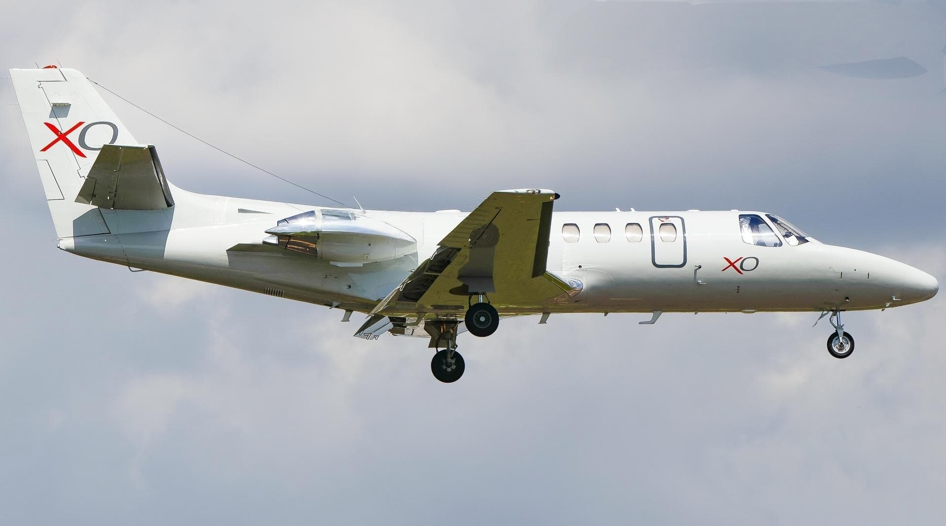 Tue, Nov 17in 14 daysHoustonKHOU · William P Hobby AirportMidlandKMDD · Midland AirparkCitation Ultra7—$5,93217NovHouston → MidlandKHOU → KMDD · in 14 daysCitation Ultra · 7 seats$5,932
 Wed, Nov 1814:54HoustonKHOU · William P Hobby AirportMidlandKMDD · Midland AirparkCessna Citation Ultra11h 24m$5,54418NovHouston → MidlandKHOU → KMDD · 14:54Cessna Citation Ultra · 1 seat · 1h 24m$5,544
* Total price incl. 10% service fee, converted to your selected currency. Price subject to operator confirmation.
Map: Midland Airport
View the location of Midland – MDD/KMDD. Zoom in to explore the area around the airport.
About the airport
Midland Airpark (MDD/KMDD) is the key private jet gateway for Midland. PrivJet gives you instant access to charter flights and empty legs: fast, discreet and globally connected.
KMDD airport FAQ
Are there any restrictions at Midland airport (KMDD) today?
There are currently 17 valid NOTAMs for Midland (KMDD). Affected: Taxiway: closed; Apron: closed; PAPI: unserviceable; Daylight markings and 3 more. For information only, not for flight planning or operational use. Always rely on an official pre-flight briefing. This list may be incomplete or out of date.
How long are the runways at Midland airport (KMDD)?
Midland (KMDD) has 2 runways: runway 07/25 with 1,698 m (5,571 ft), asphalt and runway 16/34 with 1,212 m (3,977 ft), asphalt. The longest is 1,698 m.
What are the airport codes of Midland Airpark?
The ICAO code is KMDD and the IATA code is MDD. ICAO codes are used by air traffic control and pilots, e.g. in flight plans; IATA codes appear on tickets and baggage tags.
What is the elevation of KMDD airport?
Midland Airpark sits at 2,803 ft (854 m) above sea level. Local time zone: America/Chicago.
Can I fly to KMDD by private jet?
Whether a private jet can operate into Midland Airpark depends on runway length, opening hours, customs and immigration rules as well as slot and handling availability, among other things. PrivJet checks this with the operating carrier for every request.
Are there empty legs from or to KMDD?
There are currently 17 empty legs departing from and 17 arriving at Midland Airpark. Empty legs are repositioning flights at heavily reduced prices; the list is updated several times a day.