Chicago Midway Airport (KMDW / MDW)
Empty legs and charters from Chicago
KMDW airport at a glance
- ICAO code
- KMDW
- IATA code
- MDW
- City
- Chicago
- Region
- Illinois
- Country
- United States
- Elevation
- 620 ft (189 m)
- Time zone
- America/Chicago (UTC-6)
- Coordinates
- 41.7860° N, 87.7524° W
- Empty legs from
- 57
- Empty legs to
- 57
Private jet terminal & FBOs at Chicago Midway
- Signature Aviation MDW5821 S Central Avenue, Chicago, IL 60638
- Atlantic Aviation MDW6150 South Laramie Ave., Chicago, IL 60638
Weather & airport info KMDW
Current weather
Good visual conditions (VFR)observed 03 Nov, 20:53 UTC- Wind
- 15 kt (28 km/h) from south (190°), gusts up to 27 kt
- Visibility
- 10 km or more
- Clouds
- overcast at 3,400 ft
- Temperature
- 22 °C (dew point 16 °C)
- Pressure (QNH)
- 1,011 hPa
Original weather report (METAR)
METAR KMDW 032053Z 19015G27KT 10SM OVC034 22/16 A2985 RMK AO2 PK WND 20028/2018 RAB10E39 SLP103 P0000 60000 T02170156 56007
Forecast (TAF)
- 03 Nov, 21:00–07:00 UTC17 kt (31 km/h) from south (190°), gusts up to 29 kt · visibility 10 km or more · Showers in the vicinity · broken clouds at 2,500 ft, overcast at 7,000 ft
- 03 Nov, 21:00–22:00 UTCtemporarilyscattered clouds at 2,500 ft, overcast at 7,000 ft
- 04 Nov, 07:00–12:00 UTCfrom13 kt (24 km/h) from south (180°), gusts up to 22 kt · visibility 8 km · Light rain showers, mist · scattered clouds at 1,500 ft, overcast at 2,500 ft
- 04 Nov, 12:00–18:00 UTCfrom15 kt (28 km/h) from south (190°), gusts up to 24 kt · visibility 10 km or more · Showers in the vicinity · overcast at 1,800 ft
- 04 Nov, 18:00–00:00 UTCfrom15 kt (28 km/h) from southwest (230°), gusts up to 25 kt · visibility 10 km or more · broken clouds at 2,500 ft
Original forecast (TAF)
TAF KMDW 032041Z 0321/0424 19017G29KT P6SM VCSH BKN025 OVC070 TEMPO 0321/0322 SCT025 OVC070 FM040700 18013G22KT 5SM -SHRA BR SCT015 OVC025 FM041200 19015G24KT P6SM VCSH OVC018 FM041800 23015G25KT P6SM BKN025
Airport
- Elevation
- 620 ft (189 m)
- Sunrise / Sunset
- 06:25 / 16:43 local time
Runways
| Runway | Length | Surface | Lighted |
|---|---|---|---|
| 13L/31R | 1,988 m (6,522 ft) | concrete | yes |
| 04R/22L | 1,964 m (6,445 ft) | asphalt/concrete | yes |
| 04L/22R | 1,679 m (5,507 ft) | asphalt | yes |
| 13R/31L | 1,176 m (3,859 ft) | concrete | yes |
Radio frequencies
- ATIS: 132.75
- Clearance: 121.85
- Ground: 121.65
- Tower: 118.7
- UNICOM: 122.95
For information only, not for flight planning. Weather can change quickly; always rely on official reports. Sources: aviationweather.gov (NOAA), OurAirports.
Airport map KMDW
Full screen →Runways white, taxiways yellow with designators, closed taxiways and runways per NOTAM in red.
Closed per NOTAM: RWY 22L, TWY K*, TWY Y4, TWY Y1*, TWY U (* partly closed)
Official charts (FAA)
Cycle 2611, valid until 0901Z 11/26/26
Airport diagram (FAA)
Airport diagram (1)
Instrument approaches (13)
Departure procedures (1)
Minimums (2)
Hot spots (1)
For information only, not for navigation. Always use current official charts and NOTAMs.
Current NOTAMs for KMDW(60)
NOTAMs (Notices to Air Missions) announce short-term changes at an airport: closed runways or taxiways, unserviceable approach aids, obstacles, airspace restrictions.
- ClosedRunway: closed10/214· until 13 Nov, 17:00 UTC
Runway 22L is closed to landings.
Show original text
RWY 22L CLSD TO LDG
A9307/26 NOTAMN
Q) KZAU/QMRLC////000/999/4147N08745W005
A) KMDW
B) 2610192034
C) 2611131700
E) RWY 22L CLSD TO LDG
- ClosedRunway: closedA9307/26· until 13 Nov, 17:00 UTC
Runway 22L is closed for landings.
Show original text
RWY 22L CLSD TO LDG
A9307/26 NOTAMN Q) KZAU/QMRLC////000/999/4147N08745W005 A) KMDW B) 2610192034 C) 2611131700 E) RWY 22L CLSD TO LDG
- ClosedRunway: closed10/213· until 13 Nov, 17:00 UTC
Runway 22L is closed for takeoffs.
Show original text
RWY 22L CLSD TO TKOF
A9306/26 NOTAMN
Q) KZAU/QMRLC////000/999/4147N08745W005
A) KMDW
B) 2610192033
C) 2611131700
E) RWY 22L CLSD TO TKOF
- ClosedRunway: closedA9306/26· until 13 Nov, 17:00 UTC
Runway 22L is closed for takeoffs.
Show original text
RWY 22L CLSD TO TKOF
A9306/26 NOTAMN Q) KZAU/QMRLC////000/999/4147N08745W005 A) KMDW B) 2610192033 C) 2611131700 E) RWY 22L CLSD TO TKOF
- ClosedTaxiway: closedA9666/26· until 06 Nov, 12:00 UTC
Taxiway K between taxiway Y and taxiway F is closed. This means that this section of the taxiway cannot be used.
Show original text
TWY K BTN TWY Y AND TWY F CLSD
A9666/26 NOTAMN
Q) KZAU/QMXLC////000/999/4147N08745W005
A) KMDW
B) 2611030324
C) 2611061200
E) TWY K BTN TWY Y AND TWY F CLSD
- ClosedTaxiway: closedA9664/26· until 06 Nov, 12:00 UTC
Taxiway Y4 is closed.
Show original text
TWY Y4 CLSD
A9664/26 NOTAMN
Q) KZAU/QMXLC////000/999/4147N08745W005
A) KMDW
B) 2611030321
C) 2611061200
E) TWY Y4 CLSD
- Out of serviceObstacle11/015· until 17 Dec, 06:06 UTC
Obstruction lights on a power line 1.5 nautical miles southeast of the airport are out of service. Its top is 703 feet above sea level, 86 feet above ground.
Show original text
OBST POWER LINE LGT (ASN 2017-AGL-1193-OE) 414550N0874411W (1.5NM SSE MDW) 703FT (86FT AGL) U/S
- Out of serviceTaxiwayA9637/26· until 27 Nov, 18:00 UTC
The taxiway Y7 in-pavement runway guard lights are out of service.
Show original text
TWY Y7 IN PAVEMENT RWY GUARD LGT U/S
A9637/26 NOTAMN
Q) KZAU/QMXXX////000/999/4147N08745W005
A) KMDW
B) 2611011814
C) 2611271800
E) TWY Y7 IN PAVEMENT RWY GUARD LGT U/S
52 more NOTAMs
- Out of serviceObstacle11/003· until 16 Dec, 06:03 UTC
An obstacle (OBST), a tower light, is out of service (U/S). Its top is 702 feet above sea level, 86 feet above ground, and it is located 1.6 nautical miles southeast of Chicago Midway International Airport.
Show original text
OBST TOWER LGT (ASN 2017-AGL-1192-OE) 414548N0874405W (1.6NM SSE MDW) 702FT (86FT AGL) U/S
- Out of serviceObstacle11/002· until 16 Nov, 03:48 UTC
A tower obstacle light 1.3 nautical miles northeast of the airport is out of service. Its top is 770.0 feet above sea level, 174.9 feet above ground.
Show original text
OBST TOWER LGT (ASR 1042919) 414827.10N0874452.20W (1.3NM NE MDW) 770.0FT (174.9FT AGL) U/S
- Out of serviceTaxiway10/372· until 27 Nov, 18:00 UTC
The lighting for the taxiway H holding position sign on the northwest side for runway 04R/22L is out of service.
Show original text
TWY H HLDG PSN SIGN NORTHWEST SIDE FOR RWY 04R/22L LGT U/S
- Out of serviceObstacle lights: unserviceableA9520/26· until 11 Dec, 20:00 UTC
Tower light (ASR 1279395) (8.4 NM northeast of MDW) 1974 ft above sea level (1375 ft above ground) out of service
Show original text
TOWER LGT (ASR 1279395) 415320.70N0873736.00W (8.4NM NE MDW) 1974FT (1375FT AGL) U/S
A9520/26 NOTAMN
Q) KZAU/QOLAS/IV/M/E/000/999/4153N08737W001
A) KMDW
B) 2610271400
C) 2612112000
E) TOWER LGT (ASR 1279395) 415320.70N0873736.00W (8.4NM NE MDW) 1974FT (1375FT AGL) U/S
- Out of serviceObstacle lights: unserviceableA9512/26· until 11 Dec, 03:25 UTC
A tower light (ASN 2017-AGL-1186-O) 2 nautical miles southeast of the airport is out of service. Its top is 708 feet above sea level, 91 feet above ground.
Show original text
TOWER LGT (ASN 2017-AGL-1186-O 414539N0874325W (2NM SE MDW) 708FT (91FT AGL) U/S
A9512/26 NOTAMN
Q) KZAU/QOLAS/IV/M/AE/000/999/4145N08743W001
A) KMDW
B) 2610270329
C) 2612110325
E) TOWER LGT (ASN 2017-AGL-1186-OE) 414539N0874325W (2NM SE MDW) 708FT (91FT AGL) U/S
- Out of serviceObstacle10/264· until 06 Dec, 08:39 UTC
A lighted pole, with its top 836 feet above sea level and 247 feet above ground, is out of service 5.4 nautical miles northeast of the airport.
Show original text
OBST POLE LGT (ASN 2017-AGL-4578-OE) 415045N0873943W (5.4NM NE MDW) 836FT (247FT AGL) U/S
- Out of serviceObstacle10/263· until 06 Dec, 08:38 UTC
A lighted pole, with its top 704 feet above sea level and 85 feet above ground, is out of service 1.7 nautical miles south-southeast of the airport.
Show original text
OBST POLE LGT (ASN 2016-AGL-13379-OE) 414545N0874354W (1.7NM SSE MDW) 704FT (85FT AGL) U/S
- Out of serviceObstacle10/262· until 06 Dec, 08:37 UTC
A lighted power line, with its top 704 feet above sea level and 86 feet above ground, is out of service 1.6 nautical miles south-southeast of the airport.
Show original text
OBST POWER LINE LGT (ASN 2016-AGL-13381-OE) 414547N0874360W (1.6NM SSE MDW) 704FT (86FT AGL) U/S
- Out of serviceTaxiway10/240· until 18 Nov, 23:00 UTC
Taxiway Y5 ELEVATED runway GUARD light for runway 04R/22L east SIDE out of service
Show original text
TWY Y5 ELEVATED RWY GUARD LGT FOR RWY 04R/22L EAST SIDE U/S
A9354/26 NOTAMN Q) KZAU/QMXXX////000/999/4147N08745W005 A) KMDW B) 2610211425 C) 2611182300 E) TWY Y5 ELEVATED RWY GUARD LGT FOR RWY 04R/22L EAST SIDE U/S
- ClosedTaxiway: closed10/239· until 30 Nov, 19:00 UTC
Taxiway Y1 between taxiway U and taxiway Y is closed.
Show original text
TWY Y1 BTN TWY U AND TWY Y CLSD
A9353/26 NOTAMN
Q) KZAU/QMXLC////000/999/4147N08745W005
A) KMDW
B) 2610211212
C) 2611301900
E) TWY Y1 BTN TWY U AND TWY Y CLSD
- ClosedTaxiway: closedA9353/26· until 30 Nov, 19:00 UTC
Taxiway Y1 between taxiway U and taxiway Y is closed.
Show original text
TWY Y1 BTN TWY U AND TWY Y CLSD
A9353/26 NOTAMN Q) KZAU/QMXLC////000/999/4147N08745W005 A) KMDW B) 2610211212 C) 2611301900 E) TWY Y1 BTN TWY U AND TWY Y CLSD
- Out of serviceObstacle lights: unserviceableA9313/26· until 04 Dec, 05:31 UTC
A tower light near the airport (1.9 nautical miles southeast of MDW) is out of service. The tower's top is 707 feet above sea level, 90 feet above ground.
Show original text
TOWER LGT (ASN 2017-AGL-1187-O 414541N0874330W (1.9NM SE MDW) 707FT (90FT AGL) U/S
A9313/26 NOTAMN
Q) KZAU/QOLAS/IV/M/AE/000/999/4145N08743W001
A) KMDW
B) 2610200539
C) 2612040531
E) TOWER LGT (ASN 2017-AGL-1187-OE) 414541N0874330W (1.9NM SE MDW) 707FT (90FT AGL) U/S
- Out of serviceOther10/207· until 13 Nov, 23:00 UTC
The Engineered Material Arresting System (EMAS) for runway 22L is out of service. This system is designed to safely stop aircraft at the end of the runway.
Show original text
RWY 22L ENGINEERED MATERIAL ARST SYSTEM U/S
A9299/26 NOTAMN
Q) KZAU/QXXXX////000/999/4147N08745W005
A) KMDW
B) 2610191901
C) 2611132300
E) RWY 22L ENGINEERED MATERIAL ARST SYSTEM U/S
- Out of serviceOtherA9299/26· until 13 Nov, 23:00 UTC
The Engineered Material Arresting System (EMAS) for runway 22L is out of service. This system is designed to safely stop aircraft at the end of the runway.
Show original text
RWY 22L ENGINEERED MATERIAL ARST SYSTEM U/S
A9299/26 NOTAMN Q) KZAU/QXXXX////000/999/4147N08745W005 A) KMDW B) 2610191901 C) 2611132300 E) RWY 22L ENGINEERED MATERIAL ARST SYSTEM U/S
- Out of serviceObstacle10/203· until 03 Dec, 06:22 UTC
A light on a power line 1.4 nautical miles south-southeast of the airport is out of service. Its top is 702 feet above sea level, 86 feet above ground.
Show original text
OBST POWER LINE LGT (ASN 2017-AGL-1198-OE) 414551N0874437W (1.4NM SSE MDW) 702FT (86FT AGL) U/S
- Out of serviceObstacle10/197· until 02 Dec, 06:33 UTC
The lighting on a power line 2.2 nautical miles southeast of the airport is out of service. Its top is 707 feet above sea level, 89 feet above ground.
Show original text
OBST POWER LINE LGT (ASN 2017-AGL-1182-OE) 414533N0874308W (2.2NM SE MDW) 707FT (89FT AGL) U/S
- Out of serviceObstacle10/196· until 02 Dec, 06:31 UTC
The lighting on a tower line 2.1 nautical miles southeast of the airport is out of service. Its top is 707 ft above sea level, 89 ft above ground.
Show original text
OBST TOWER LINE LGT (ASN 2017-AGL-1183-OE) 414536N0874312W (2.1NM SE MDW) 707FT (89FT AGL) U/S
- Out of serviceObstacle10/195· until 02 Dec, 06:30 UTC
The lighting on a power line 1.7 nautical miles southeast of the airport is out of service. Its top is 703 ft above sea level, 84 ft above ground.
Show original text
OBST POWER LINE LGT (ASN 2017-AGL-1190-OE) 414544N0874347W (1.7NM SE MDW) 703FT (84FT AGL) U/S
- Out of serviceObstacle10/194· until 02 Dec, 06:29 UTC
The lighting on a power line 1.4 nautical miles south-southeast of the airport is out of service. Its top is 704 ft above sea level, 88 ft above ground.
Show original text
OBST POWER LINE LGT (ASN 2017-AGL-1196-OE) 414552N0874429W (1.4NM SSE MDW) 704FT (88FT AGL) U/S
10/194 NOTAMN<BR>
<B>Q) </B>KZAU/QOLAS/IV/M/AE/000/008/4147N08745W005<BR>
<B>A) </B>KMDW<BR>
<B>B) </B>2610180629<BR>
<B>C) </B>2612020629<BR>
<B>E) </B> POWER LINE LGT (ASN 2017-AGL-1196-OE) 414552N0874429W (1.4NM SSE MDW) 704FT (88FT AGL) U/S<BR>
- Out of serviceObstacle10/193· until 02 Dec, 06:06 UTC
The lighting on a tower 1.4 nautical miles south-southeast of the airport is out of service. Its top is 703 ft above sea level, 86 ft above ground.
Show original text
OBST TOWER LGT (ASN 2017-AGL-1197-OE) 414551N0874432W (1.4NM SSE MDW) 703FT (86FT AGL) U/S
- ClosedApron: closedA9210/26· until 15 Nov, 12:00 UTC
Apron Y PAD is closed. An apron is an area at an airport where aircraft are parked, unloaded, loaded, refueled, and boarded.
Show original text
APRON Y PAD CLSD
A9210/26 NOTAMN
Q) KZAU/QMNLC////000/999/4147N08745W005
A) KMDW
B) 2610151039
C) 2611151200
E) APRON Y PAD CLSD
- Out of serviceObstacle10/110· until 24 Nov, 06:04 UTC
A light on a power line 1.4 nautical miles southeast of the airport is out of service. Its top is 702 ft above sea level, 85 ft above ground.
Show original text
OBST POWER LINE LGT (ASN 2017-AGL-1195-OE) 414554N0874425W (1.4NM SSE MDW) 702FT (85FT AGL) U/S
- Out of serviceObstacle10/105· until 24 Nov, 06:02 UTC
The lighting of a power line 5.3 nautical miles west-southwest of the airport is out of service. Its top is 865 ft above sea level, 273 ft above ground.
Show original text
OBST POWER LINE LGT (ASN 2018-AGL-17297-OE) 414448N0875132W (5.3NM WSW MDW) 865FT (273FT AGL) U/S
- ClosedTaxiway: closedA9084/26· until 27 Nov, 15:00 UTC
Taxiway U is closed. This may lead to longer taxiing times at the airport.
Show original text
TWY U CLSD
A9084/26 NOTAMN
Q) KZAU/QMXLC////000/999/4147N08745W005
A) KMDW
B) 2610090143
C) 2611271500
E) TWY U CLSD
- Out of serviceObstacle10/077· until 22 Nov, 23:59 UTC
An obstacle, a tower, is located 2.32 nautical miles west of the airport. Its top is 751 ft above sea level, 135 ft above ground, and its lighting is out of service.
Show original text
OBST TOWER LGT (ASR UNKNOWN) 414702.50N0874815.10W (2.32NM W MDW) 751FT (135FT AGL) U/S
- Out of serviceObstacle10/051· until 21 Nov, 06:12 UTC
An obstacle power line light near the airport is out of service; its top is 719 ft above sea level, 101 ft above ground.
Show original text
OBST POWER LINE LGT (ASN 2017-AGL-1185-OE) 414539N0874321W (2.0NM SE MDW) 719FT (101FT AGL) U/S
10/051 NOTAMN<BR>
<B>Q) </B>KZAU/QOLAS/IV/M/AE/000/008/4147N08745W005<BR>
<B>A) </B>KMDW<BR>
<B>B) </B>2610061101<BR>
<B>C) </B>2611210612<BR>
<B>E) </B> POWER LINE LGT (ASN 2017-AGL-1185-OE) 414539N0874321W (2.0NM SE MDW) 719FT (101FT AGL) U/S<BR>
- Out of serviceObstacle09/400· until 14 Nov, 11:37 UTC
An obstacle, a power line light, is out of service. Its top is 704 feet above sea level, 86 feet above ground, 1.5 nautical miles southeast of Chicago Midway International airport.
Show original text
OBST POWER LINE LGT (ASN 2016-AGL-13384-OE) 414552N0874416W (1.5NM SSE MDW) 704FT (86FT AGL) U/S
09/400 NOTAMN<BR>
<B>Q) </B>KZAU/QOLAS/IV/M/AE/000/008/4147N08745W005<BR>
<B>A) </B>KMDW<BR>
<B>B) </B>2609301137<BR>
<B>C) </B>2611141137<BR>
<B>E) </B> POWER LINE LGT (ASN 2016-AGL-13384-OE) 414552N0874416W (1.5NM SSE MDW) 704FT (86FT AGL) U/S<BR>
- NoticeTaxiway11/017· until 27 Apr, 22:00 UTC
The holding position markings for runway 04R/22L on the north side of taxiway Q are obscured.
Show original text
TWY Q HLDG PSN MARKINGS FOR RWY 04R/22L NORTH SIDE OBSC
- NoticeRunway11/011· until 31 Dec, 12:00 UTC
The runway 04R/22L centerline markings at Chicago Midway International Airport are obscured. This may make orientation on the runway more difficult.
Show original text
RWY 04R/22L CL MARKINGS OBSC
- NoticeTaxiway10/333· until 30 Nov, 12:00 UTC
The safety area of taxiway H3 between runway 13L/31R and taxiway N has an irregular surface on the northeast side.
Show original text
TWY H3 SAFETY AREA BTN RWY 13L/31R AND TWY N IRREGULAR SFC NORTH EAST SIDE
A9508/26 NOTAMN
Q) KZAU/QMXXX////000/999/4147N08745W005
A) KMDW
B) 2610262116
C) 2611301200
E) TWY H3 SAFETY AREA BTN RWY 13L/31R AND TWY N IRREGULAR SFC NORTH EAST SIDE
- NoticeTaxiwayA9508/26· until 30 Nov, 12:00 UTC
The safety area of taxiway H3 between runway 13L/31R and taxiway N has an irregular surface on the northeast side.
Show original text
TWY H3 SAFETY AREA BTN RWY 13L/31R AND TWY N IRREGULAR SFC NORTH EAST SIDE
A9508/26 NOTAMN Q) KZAU/QMXXX////000/999/4147N08745W005 A) KMDW B) 2610262116 C) 2611301200 E) TWY H3 SAFETY AREA BTN RWY 13L/31R AND TWY N IRREGULAR SFC NORTH EAST SIDE
- NoticeRunway10/316· until 28 Nov, 18:00 UTC
The safety area of runway 04R/22L between taxiway V and taxiway Y2 has an irregular surface on the southeast side. This may affect aircraft taxiing.
Show original text
RWY 04R/22L SAFETY AREA BTN TWY V AND TWY Y2 IRREGULAR SFC SE SIDE
A9481/26 NOTAMN Q) KZAU/QMRXX////000/999/4147N08745W005 A) KMDW B) 2610251738 C) 2611281800 E) RWY 04R/22L SAFETY AREA BTN TWY V AND TWY Y2 IRREGULAR SFC SE SIDE
- NoticeTaxiway10/315· until 28 Nov, 18:00 UTC
The safety area of taxiway K between taxiway Y and taxiway F has an irregular surface on the south side.
Show original text
TWY K SAFETY AREA BTN TWY Y AND TWY F IRREGULAR SFC SOUTH SIDE
A9480/26 NOTAMN
Q) KZAU/QMXXX////000/999/4147N08745W005
A) KMDW
B) 2610251448
C) 2611281800
E) TWY K SAFETY AREA BTN TWY Y AND TWY F IRREGULAR SFC SOUTH SIDE
- NoticeTaxiwayA9480/26· until 28 Nov, 18:00 UTC
The safety area of taxiway K between taxiway Y and taxiway F has an irregular surface on the south side.
Show original text
TWY K SAFETY AREA BTN TWY Y AND TWY F IRREGULAR SFC SOUTH SIDE
A9480/26 NOTAMN Q) KZAU/QMXXX////000/999/4147N08745W005 A) KMDW B) 2610251448 C) 2611281800 E) TWY K SAFETY AREA BTN TWY Y AND TWY F IRREGULAR SFC SOUTH SIDE
- NoticeTaxiway10/313· until 28 Nov, 18:00 UTC
The safety area of taxiway K between taxiway Y and taxiway F has an irregular surface on the north side.
Show original text
TWY K SAFETY AREA BTN TWY Y AND TWY F IRREGULAR SFC NORTH SIDE
A9477/26 NOTAMN Q) KZAU/QMXXX////000/999/4147N08745W005 A) KMDW B) 2610251438 C) 2611281800 E) TWY K SAFETY AREA BTN TWY Y AND TWY F IRREGULAR SFC NORTH SIDE
- NoticeTaxiway10/297· until 15 Jan, 18:00 UTC
Taxiway Y1 NONMOVEMENT area surface MARKING south SHOULDER not STD INCORRECT SPACING
Show original text
TWY Y1 NONMOVEMENT AREA SFC MARKING SOUTH SHOULDER NOT STD INCORRECT SPACING
- NoticeTaxiway10/292· until 06 Nov, 12:00 UTC
The south edge of taxiway K between runway 13L/31R and runway 13R/31L has an irregular surface.
Show original text
TWY K BTN RWY 13L/31R AND RWY 13R/31L SOUTH EDGE IRREGULAR SFC
A9437/26 NOTAMN
Q) KZAU/QMXXX////000/999/4147N08745W005
A) KMDW
B) 2610232130
C) 2611061200
E) TWY K BTN RWY 13L/31R AND RWY 13R/31L SOUTH EDGE IRREGULAR SFC
- NoticeTaxiwayA9437/26· until 06 Nov, 12:00 UTC
The south edge of taxiway K between runway 13L/31R and runway 13R/31L has an irregular surface.
Show original text
TWY K BTN RWY 13L/31R AND RWY 13R/31L SOUTH EDGE IRREGULAR SFC
A9437/26 NOTAMN Q) KZAU/QMXXX////000/999/4147N08745W005 A) KMDW B) 2610232130 C) 2611061200 E) TWY K BTN RWY 13L/31R AND RWY 13R/31L SOUTH EDGE IRREGULAR SFC
- NoticeRunway10/290· until 06 Nov, 12:00 UTC
Runway 04L/22R SAFETY area IRREGULAR surface NW edge between runway 13L and taxiway H
Show original text
RWY 04L/22R SAFETY AREA IRREGULAR SFC NW EDGE BTN RWY 13L AND TWY H
A9435/26 NOTAMN
Q) KZAU/QMRXX////000/999/4147N08745W005
A) KMDW
B) 2610232126
C) 2611061200
E) RWY 04L/22R SAFETY AREA IRREGULAR SFC NW EDGE BTN RWY 13L AND TWY H
- NoticeRunwayA9435/26· until 06 Nov, 12:00 UTC
The northwest edge of the safety area for runway 04L/22R between runway 13L and taxiway H has an irregular surface.
Show original text
RWY 04L/22R SAFETY AREA IRREGULAR SFC NW EDGE BTN RWY 13L AND TWY H
A9435/26 NOTAMN Q) KZAU/QMRXX////000/999/4147N08745W005 A) KMDW B) 2610232126 C) 2611061200 E) RWY 04L/22R SAFETY AREA IRREGULAR SFC NW EDGE BTN RWY 13L AND TWY H
- NoticeTaxiway: work in progress10/255· until 30 Nov, 12:00 UTC
Taxiway Y between taxiway Y1 and taxiway Y3 has work in progress with an open excavation adjacent to the southwest side.
Show original text
TWY Y BTN TWY Y1 AND TWY Y3 WIP OPN EXCAVATION ADJ SOUTHWEST SIDE
A9375/26 NOTAMN
Q) KZAU/QMXHW////000/999/4147N08745W005
A) KMDW
B) 2610220029
C) 2611301200
E) TWY Y BTN TWY Y1 AND TWY Y3 WIP OPN EXCAVATION ADJ SOUTHWEST SIDE
- NoticeTaxiway: work in progressA9375/26· until 30 Nov, 12:00 UTC
Taxiway Y between taxiway Y1 and taxiway Y3 has work in progress with an open excavation adjacent to the southwest side.
Show original text
TWY Y BTN TWY Y1 AND TWY Y3 WIP OPN EXCAVATION ADJ SOUTHWEST SIDE
A9375/26 NOTAMN Q) KZAU/QMXHW////000/999/4147N08745W005 A) KMDW B) 2610220029 C) 2611301200 E) TWY Y BTN TWY Y1 AND TWY Y3 WIP OPN EXCAVATION ADJ SOUTHWEST SIDE
- NoticeTaxiway10/254· until 30 Nov, 12:00 UTC
Taxiway T safety area between taxiway H and taxiway P has an irregular surface on the west side.
Show original text
TWY T SAFETY AREA BTN TWY H AND TWY P IRREGULAR SFC WEST SIDE
A9374/26 NOTAMN
Q) KZAU/QMXXX////000/999/4147N08745W005
A) KMDW
B) 2610212213
C) 2611301200
E) TWY T SAFETY AREA BTN TWY H AND TWY P IRREGULAR SFC WEST SIDE
- NoticeTaxiwayA9374/26· until 30 Nov, 12:00 UTC
Taxiway T SAFETY area between taxiway H and taxiway P IRREGULAR surface west SIDE
Show original text
TWY T SAFETY AREA BTN TWY H AND TWY P IRREGULAR SFC WEST SIDE
A9374/26 NOTAMN Q) KZAU/QMXXX////000/999/4147N08745W005 A) KMDW B) 2610212213 C) 2611301200 E) TWY T SAFETY AREA BTN TWY H AND TWY P IRREGULAR SFC WEST SIDE
- NoticeTaxiway10/241· until 25 Nov, 23:00 UTC
Taxiway A safety area between runway 13L and runway 13R has an irregular surface on the south side.
Show original text
TWY A SAFETY AREA BTN RWY 13L AND RWY 13R IRREGULAR SFC S SIDE
A9355/26 NOTAMN
Q) KZAU/QMXXX////000/999/4147N08745W005
A) KMDW
B) 2610211549
C) 2611252300
E) TWY A SAFETY AREA BTN RWY 13L AND RWY 13R IRREGULAR SFC S SIDE
- NoticeTaxiwayA9355/26· until 25 Nov, 23:00 UTC
Taxiway A safety area between runway 13L and runway 13R has an irregular surface on the south side.
Show original text
TWY A SAFETY AREA BTN RWY 13L AND RWY 13R IRREGULAR SFC S SIDE
A9355/26 NOTAMN Q) KZAU/QMXXX////000/999/4147N08745W005 A) KMDW B) 2610211549 C) 2611252300 E) TWY A SAFETY AREA BTN RWY 13L AND RWY 13R IRREGULAR SFC S SIDE
- NoticeRunway10/205· until 31 Dec, 15:00 UTC
The Engineered Material Arresting System (EMAS) bed at the departure end of runway 22L has an irregular surface. An EMAS is a system designed to safely stop aircraft at the end of a runway.
Show original text
RWY 22L DEP END EMAS BED IRREGULAR SFC
A9296/26 NOTAMN
Q) KZAU/QMRXX////000/999/4147N08745W005
A) KMDW
B) 2610191531
C) 2612311500
E) RWY 22L DEP END EMAS BED IRREGULAR SFC
- NoticeRunwayA9296/26· until 31 Dec, 15:00 UTC
The Engineered Material Arresting System (EMAS) bed at the departure end of runway 22L has an irregular surface. An EMAS is a system designed to safely stop aircraft at the end of a runway.
Show original text
RWY 22L DEP END EMAS BED IRREGULAR SFC
A9296/26 NOTAMN Q) KZAU/QMRXX////000/999/4147N08745W005 A) KMDW B) 2610191531 C) 2612311500 E) RWY 22L DEP END EMAS BED IRREGULAR SFC
- NoticeRunwayA9261/26· until 13 Nov, 18:00 UTC
The runway 04R safety area between taxiway Y1 and taxiway V has an irregular surface on the southeast side.
Show original text
RWY 04R SAFETY AREA BTN TWY Y1 AND TWY V IRREGULAR SFC SE SIDE
A9261/26 NOTAMN
Q) KZAU/QMRXX////000/999/4147N08745W005
A) KMDW
B) 2610162215
C) 2611131800
E) RWY 04R SAFETY AREA BTN TWY Y1 AND TWY V IRREGULAR SFC SE SIDE
- NoticeTaxiwayA9194/26· until 14 Nov, 12:00 UTC
Taxiway H2 safety area is not standard on the north side due to a 3 inch drop.
Show original text
TWY H2 SAFETY AREA NOT STD N SIDE 3IN DROP
A9194/26 NOTAMN
Q) KZAU/QMXXX////000/999/4147N08745W005
A) KMDW
B) 2610142143
C) 2611141200
E) TWY H2 SAFETY AREA NOT STD N SIDE 3IN DROP
- NoticeRunwayA9193/26· until 14 Nov, 12:00 UTC
Runway 13L/31R safety area is not standard on the southwest edge between taxiway A and runway 4L.
Show original text
RWY 13L/31R SAFETY AREA NOT STD SW EDGE BTN TWY A AND RWY 4L
A9193/26 NOTAMN
Q) KZAU/QMRXX////000/999/4147N08745W005
A) KMDW
B) 2610142135
C) 2611141200
E) RWY 13L/31R SAFETY AREA NOT STD SW EDGE BTN TWY A AND RWY 4L
- NoticeTaxiway: work in progressA9153/26· until 09 Nov, 15:00 UTC
Taxiway Y between taxiway Y3 and taxiway Y4 has work in progress with an open excavation on the southwest side.
Show original text
TWY Y BTN TWY Y3 AND TWY Y4 WIP OPN EXCAVATION ADJ SOUTHWEST SIDE
A9153/26 NOTAMN
Q) KZAU/QMXHW////000/999/4147N08745W005
A) KMDW
B) 2610122107
C) 2611091500
E) TWY Y BTN TWY Y3 AND TWY Y4 WIP OPN EXCAVATION ADJ SOUTHWEST SIDE
For information only, not for flight planning or operational use. Always rely on an official pre-flight briefing. This list may be incomplete or out of date. Explanations and expanded abbreviations are generated automatically. The original text is authoritative. Source: FAA NOTAM Management Service (SWIM).
Private jet traffic in Chicago Midway International Airport (last 30 days)
- Arrivals
- 1,995
- Departures
- 1,718
- Different jets
- 1,395
Most frequent origins: Teterboro Airport (130), Dupage Airport (39), Chicago Executive Airport (38), Washington Dulles International Airport (33), Oakland County International Airport (27).
Most frequent destinations: Teterboro Airport (123), Dupage Airport (38), Oakland County International Airport (37), Chicago Executive Airport (33), Washington Dulles International Airport (31).
Most common aircraft types: Cessna Citation Latitude (377), Bombardier Challenger 350/3500 (354), Embraer Phenom 300 (335), Cessna Citation Excel/XLS (206), Cessna Citation Longitude (201).
Monday is the busiest day.
Our own analysis of public ADS-B signals from business jets. Not every flight is received, and jets with a removal request are excluded.
Charter operators based here
Operators with a base at this airport.
- Executive Jet ManagementWhite Plains (Westchester County) (KHPN) · Light jet, Midsize jet, Super midsize jet
- Jet Aviation Flight ServicesTeterboro (KTEB) · Light jet, Super midsize jet, Heavy jet
- Fly AllianceOrlando Executive (KORL) · Light jet, Midsize jet, Super midsize jet
Empty legs from KMDW
57 departures available
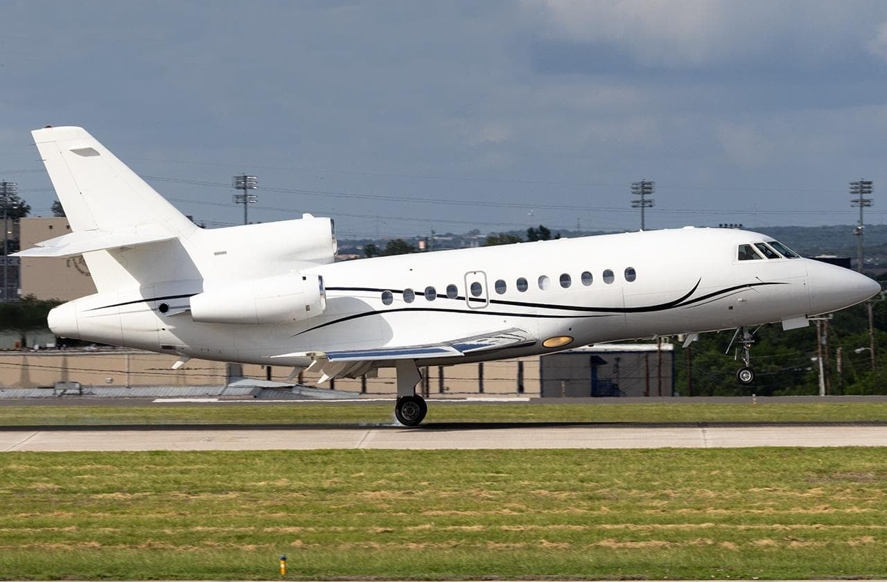 Tue, Nov 3TodayChicagoKMDW · Chicago Midway International AirportDenverKAPA · Centennial AirportFalcon 900B13—On request3NovChicago → DenverKMDW → KAPA · TodayFalcon 900B · 13 seatsOn request
- Tue, Nov 3TodayChicagoKMDW · Chicago Midway International AirportChicago/West ChicagoKDPA · Dupage AirportHawker 7508—On request3NovChicago → Chicago/West ChicagoKMDW → KDPA · TodayHawker 750 · 8 seatsOn request
- Tue, Nov 3TodayChicagoKMDW · Chicago Midway International AirportNaplesKAPF · Naples Municipal AirportRaytheon Aircraft Company Hawker 400A7—$14,8503NovChicago → NaplesKMDW → KAPF · TodayRaytheon Aircraft Company Hawker 400A · 7 seats$14,850
- Wed, Nov 4TomorrowChicagoKMDW · Chicago Midway International AirportChicago/West ChicagoKDPA · Dupage AirportHawker 750——On request4NovChicago → Chicago/West ChicagoKMDW → KDPA · TomorrowHawker 750On request
- Wed, Nov 4TomorrowChicagoKMDW · Chicago Midway International AirportPontiacKPTK · Oakland County International AirportCessna Citation CJ48—On request4NovChicago → PontiacKMDW → KPTK · TomorrowCessna Citation CJ4 · 8 seatsOn request
- Wed, Nov 4TomorrowChicagoKMDW · Chicago Midway International AirportAllentownKABE · Lehigh Valley International AirportBombardier Challenger 604121h 36mOn request4NovChicago → AllentownKMDW → KABE · TomorrowBombardier Challenger 604 · 12 seats · 1h 36mOn request
 Thu, Nov 5in 2 daysChicagoKMDW · Chicago Midway International AirportAllentownKABE · Lehigh Valley International AirportChallenger 60412—On request5NovChicago → AllentownKMDW → KABE · in 2 daysChallenger 604 · 12 seatsOn request
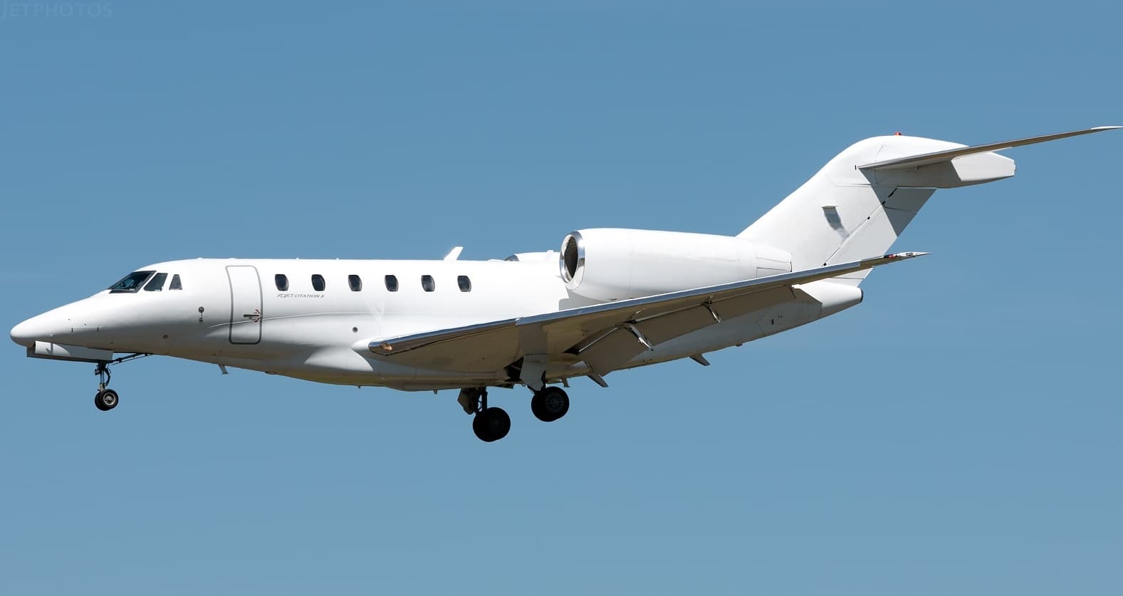 Thu, Nov 5in 2 daysChicagoKMDW · Chicago Midway International AirportIslipKISP · Long Island Mac Arthur AirportCitation X8—On request5NovChicago → IslipKMDW → KISP · in 2 daysCitation X · 8 seatsOn request
- Thu, Nov 523:00ChicagoKMDW · Chicago Midway IntlJacksonvilleKJAX · Jacksonville IntlBombardier Learjet 607—On request5NovChicago → JacksonvilleKMDW → KJAX · 23:00Bombardier Learjet 60 · 7 seatsOn request
 KMDW · Chicago Midway International Airport
* Total price incl. 10% service fee, converted to your selected currency. Price subject to operator confirmation.
Empty legs to KMDW
57 arrivals available
- Tue, Nov 3TodayFort LauderdaleKFXE · Fort Lauderdale Executive AirportChicagoKMDW · Chicago Midway International AirportBeechcraft Hawker 800XP82h 58mOn request3NovFort Lauderdale → ChicagoKFXE → KMDW · TodayBeechcraft Hawker 800XP · 8 seats · 2h 58mOn request
 Wed, Nov 4TomorrowColumbusKCMH · John Glenn Columbus International AirportChicagoKMDW · Chicago Midway International AirportCitation CJ15—$1,3184NovColumbus → ChicagoKCMH → KMDW · TomorrowCitation CJ1 · 5 seats$1,318
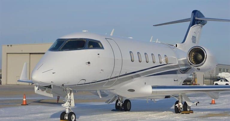 Wed, Nov 4TomorrowFort WorthKFTW · Fort Worth Meacham International AirportChicagoKMDW · Chicago Midway International AirportChallenger 3008—On request4NovFort Worth → ChicagoKFTW → KMDW · TomorrowChallenger 300 · 8 seatsOn request
- Wed, Nov 412:01ScottsdaleKSDL · Scottsdale AirportChicagoKMDW · Chicago Midway International AirportHawker 800XP8—$17,4904NovScottsdale → ChicagoKSDL → KMDW · 12:01Hawker 800XP · 8 seats$17,490
- Wed, Nov 412:00LouisvilleKSDF · Louisville Muhammad Ali International AirportChicagoKMDW · Chicago Midway International AirportCessna Citation CJ5—$7,4804NovLouisville → ChicagoKSDF → KMDW · 12:00Cessna Citation CJ · 5 seats$7,480
- Wed, Nov 4TomorrowBurlingtonKBUY · Burlington Alamance Regional AirportChicagoKMDW · Chicago Midway International AirportChallenger 3009—$16,5554NovBurlington → ChicagoKBUY → KMDW · TomorrowChallenger 300 · 9 seats$16,555
- Wed, Nov 4TomorrowStuartKSUA · Witham FieldChicagoKMDW · Chicago Midway International AirportChallenger 30010—$23,6504NovStuart → ChicagoKSUA → KMDW · TomorrowChallenger 300 · 10 seats$23,650
- Thu, Nov 515:01Fort LauderdaleKFXE · Fort Lauderdale ExecutiveChicagoKMDW · Chicago Midway IntlLearjet 60XR—2h 59mOn request5NovFort Lauderdale → ChicagoKFXE → KMDW · 15:01Learjet 60XR · 2h 59mOn request
- Thu, Nov 515:01Fort LauderdaleKFXE · Fort Lauderdale ExecutiveChicagoKMDW · Chicago Midway IntlLearjet 60XR6—On request5NovFort Lauderdale → ChicagoKFXE → KMDW · 15:01Learjet 60XR · 6 seatsOn request
* Total price incl. 10% service fee, converted to your selected currency. Price subject to operator confirmation.
Map: Chicago Airport
View the location of Chicago – MDW/KMDW. Zoom in to explore the area around the airport.
About the airport
Chicago Midway International Airport (MDW/KMDW) is the key private jet gateway for Chicago. PrivJet gives you instant access to charter flights and empty legs: fast, discreet and globally connected.
KMDW airport FAQ
Are there any restrictions at Chicago airport (KMDW) today?
There are currently 61 valid NOTAMs for Chicago (KMDW). According to NOTAM, at least one runway or the aerodrome itself is closed. Affected: Runway: closed; Taxiway: closed; Apron: closed; Obstacle: out of service and 4 more. For information only, not for flight planning or operational use. Always rely on an official pre-flight briefing. This list may be incomplete or out of date.
What is the weather at Chicago airport (KMDW)?
According to the latest weather report for KMDW (METAR, 03 Nov, 20:53 UTC): Good visual conditions (VFR). Wind 15 kt (28 km/h) from south (190°), gusts up to 27 kt, visibility 10 km or more, temperature 22 °C (dew point 16 °C). For information only, not for flight planning. Weather can change quickly; always rely on official reports.
How long are the runways at Chicago airport (KMDW)?
Chicago (KMDW) has 4 runways: runway 13L/31R with 1,988 m (6,522 ft), concrete, runway 04R/22L with 1,964 m (6,445 ft), asphalt/concrete, runway 04L/22R with 1,679 m (5,507 ft), asphalt and runway 13R/31L with 1,176 m (3,859 ft), concrete. The longest is 1,988 m.
What are the radio frequencies at Chicago airport (KMDW)?
Frequencies at KMDW: Tower 118.7 MHz, Ground 121.65 MHz and ATIS 132.75 MHz. For information only. Always rely on the published AIP.
What are the airport codes of Chicago Midway International Airport?
The ICAO code is KMDW and the IATA code is MDW. ICAO codes are used by air traffic control and pilots, e.g. in flight plans; IATA codes appear on tickets and baggage tags.
What is the elevation of KMDW airport?
Chicago Midway International Airport sits at 620 ft (189 m) above sea level. Local time zone: America/Chicago.
Where do private jets land at Chicago Midway?
KMDW has 2 private jet terminals or FBOs: Signature Aviation MDW and Atlantic Aviation MDW. Your flight confirmation says which one your operator uses.
Can I fly to KMDW by private jet?
Whether a private jet can operate into Chicago Midway International Airport depends on runway length, opening hours, customs and immigration rules as well as slot and handling availability, among other things. PrivJet checks this with the operating carrier for every request.
Are there empty legs from or to KMDW?
There are currently 57 empty legs departing from and 57 arriving at Chicago Midway International Airport. Empty legs are repositioning flights at heavily reduced prices; the list is updated several times a day.