Memphis Airport (KMEM / MEM)
Empty legs and charters from Memphis
KMEM airport at a glance
- ICAO code
- KMEM
- IATA code
- MEM
- City
- Memphis
- Region
- Tennessee
- Country
- United States
- Elevation
- 341 ft (104 m)
- Time zone
- America/Chicago (UTC-6)
- Coordinates
- 35.0424° N, 89.9767° W
- Empty legs from
- 19
- Empty legs to
- 17
Weather & airport info KMEM
Current weather
No current weather report is available for this airport.
Airport
- Elevation
- 341 ft (104 m)
- Sunrise / Sunset
- 06:22 / 17:04 local time
Runways
| Runway | Length | Surface | Lighted |
|---|---|---|---|
| 18C/36C | 3,389 m (11,120 ft) | concrete | yes |
| 18R/36L | 2,841 m (9,320 ft) | concrete | yes |
| 18L/36R | 2,743 m (9,000 ft) | concrete | yes |
| 09/27 | 2,727 m (8,946 ft) | asphalt | yes |
Radio frequencies
- Approach: 33.83
- Approach: 119.1
- ATIS: 127.75
- Clearance: 125.2
- Ground: 121.65
- Tower: 118.3
- UNICOM: 122.95
For information only, not for flight planning. Weather can change quickly; always rely on official reports. Sources: aviationweather.gov (NOAA), OurAirports.
Airport map KMEM
Full screen →Runways white, taxiways yellow with designators, closed taxiways and runways per NOTAM in red.
Official charts (FAA)
Cycle 2611, valid until 0901Z 11/26/26
Airport diagram (FAA)
Airport diagram (1)
Instrument approaches (24)
- ILS OR LOC RWY 09
- ILS OR LOC RWY 18C
- ILS OR LOC RWY 18L
- ILS OR LOC RWY 18R
- ILS OR LOC RWY 27
- ILS OR LOC RWY 36C
- ILS OR LOC RWY 36L
- ILS OR LOC RWY 36R
- ILS RWY 36C (CAT II - III)
- ILS RWY 36L (CAT II - III)
- ILS RWY 36R (CAT II - III)
- RNAV (RNP) X RWY 18L
- RNAV (RNP) X RWY 18R
- RNAV (RNP) Y RWY 18C
- RNAV (RNP) Y RWY 18L
- RNAV (RNP) Y RWY 18R
- RNAV (GPS) RWY 09
- RNAV (GPS) RWY 27
- RNAV (GPS) RWY 36C
- RNAV (GPS) RWY 36L
- RNAV (GPS) RWY 36R
- RNAV (GPS) Z RWY 18C
- RNAV (GPS) Z RWY 18L
- RNAV (GPS) Z RWY 18R
Departure procedures (39)
- AUTMN SIX (RNAV)
- AUTMN SIX (RNAV), CONT.1
- AZONE SEVEN (RNAV)
- AZONE SEVEN (RNAV), CONT.1
- BBKNG SEVEN (RNAV)
- BBKNG SEVEN (RNAV), CONT.1
- BINKY SIX (RNAV)
- BINKY SIX (RNAV), CONT.1
- CHLDR FIVE (RNAV)
- CHLDR FIVE (RNAV), CONT.1
- CRSON SEVEN (RNAV)
- CRSON SEVEN (RNAV), CONT.1
- DUCKZ FIVE (RNAV)
- DUCKZ FIVE (RNAV), CONT.1
- ELVIS FOUR
- ELVIS FOUR, CONT.1
- ELVIS FOUR, CONT.2
- GENEH SEVEN (RNAV)
- GENEH SEVEN (RNAV), CONT.1
- GMBUD SEVEN (RNAV)
- GMBUD SEVEN (RNAV), CONT.1
- GOETZ SEVEN (RNAV)
- GOETZ SEVEN (RNAV), CONT.1
- GRRIZ FIVE (RNAV)
- GRRIZ FIVE (RNAV), CONT.1
- HOTRD FIVE (RNAV)
- HOTRD FIVE (RNAV), CONT.1
- JTEEE FIVE (RNAV)
- JTEEE FIVE (RNAV), CONT.1
- NIKEI FIVE (RNAV)
- NIKEI FIVE (RNAV), CONT.1
- OLEMS SIX (RNAV)
- OLEMS SIX (RNAV), CONT.1
- PIEPE SIX (RNAV)
- PIEPE SIX (RNAV), CONT.1
- SELPH SEVEN (RNAV)
- SELPH SEVEN (RNAV), CONT.1
- ZUMIT FIVE (RNAV)
- ZUMIT FIVE (RNAV), CONT.1
Minimums (2)
Hot spots (1)
LAHSO (1)
For information only, not for navigation. Always use current official charts and NOTAMs.
Current NOTAMs for KMEM(35)
NOTAMs (Notices to Air Missions) announce short-term changes at an airport: closed runways or taxiways, unserviceable approach aids, obstacles, airspace restrictions.
- Out of serviceTerminal area surveillance radar: unserviceableA8401/26· from 09 Nov, 14:00 UTC · until 09 Nov, 22:00 UTC
The radar service for air traffic control (TAR/SSR), which identifies and tracks aircraft at Memphis airport, is out of service.
Show original text
SVC TAR/SSR U/S
A8401/26 NOTAMN
Q) KZME/QCTAS////000/999/3502N08958W005
A) KMEM
B) 2611091400
C) 2611092200
E) SVC TAR/SSR U/S
- Out of serviceTerminal area surveillance radar: unserviceableA8327/26· from 05 Nov, 14:00 UTC · until 05 Nov, 22:00 UTC
The Terminal Area Radar (TAR) and Secondary Surveillance Radar (SSR) are out of service. These radar systems are used for air traffic control.
Show original text
SVC TAR/SSR U/S
A8327/26 NOTAMN
Q) KZME/QCTAS////000/999/3502N08958W005
A) KMEM
B) 2611051400
C) 2611052200
E) SVC TAR/SSR U/S
- Out of serviceILS: unserviceableA8306/26· from 05 Nov, 12:00 UTC · until 05 Nov, 20:00 UTC
MEM navigation: ILS (instrument landing system) runway 18C out of service
Show original text
MEM NAV ILS RWY 18C U/S
A8306/26 NOTAMN
Q) KZME/QICAS////000/999/3502N08958W005
A) KMEM
B) 2611051200
C) 2611052000
E) MEM NAV ILS RWY 18C U/S
- Out of serviceILS: unserviceableA8307/26· from 05 Nov, 12:00 UTC · until 05 Nov, 20:00 UTC
The instrument landing system (ILS) for runway 36C is out of service.
Show original text
MEM NAV ILS RWY 36C U/S
A8307/26 NOTAMN
Q) KZME/QICAS////000/999/3502N08958W005
A) KMEM
B) 2611051200
C) 2611052000
E) MEM NAV ILS RWY 36C U/S
- Out of serviceLanding direction indicator: unserviceableA8436/26· from 04 Nov, 14:00 UTC · until 04 Nov, 21:00 UTC
All runway visual range (RVR) measurements at the airport are out of service.
Show original text
AD AP RVR ALL U/S
A8436/26 NOTAMN
Q) KZME/QFTAS////000/999/3502N08958W005
A) KMEM
B) 2611041400
C) 2611042100
E) AD AP RVR ALL U/S
- Out of serviceILS: unserviceableA8291/26· from 04 Nov, 12:00 UTC · until 04 Nov, 20:00 UTC
The instrument landing system (ILS) for runway 36C is out of service. The ILS guides aircraft to the runway in poor visibility.
Show original text
MEM NAV ILS RWY 36C U/S
A8291/26 NOTAMN
Q) KZME/QICAS////000/999/3502N08958W005
A) KMEM
B) 2611041200
C) 2611042000
E) MEM NAV ILS RWY 36C U/S
- Out of serviceILS: unserviceableA8292/26· from 04 Nov, 12:00 UTC · until 04 Nov, 20:00 UTC
The instrument landing system (ILS) for runway 18C is out of service. The ILS guides aircraft to the runway in poor visibility.
Show original text
MEM NAV ILS RWY 18C U/S
A8292/26 NOTAMN
Q) KZME/QICAS////000/999/3502N08958W005
A) KMEM
B) 2611041200
C) 2611042000
E) MEM NAV ILS RWY 18C U/S
- ClosedApron: closedA8443/26· from 03 Nov, 14:30 UTC · until 03 Nov, 20:30 UTC
The west exit of the Wilson Air Center Ramp on the apron is closed. This may affect access to or from aircraft in this part of the apron.
Show original text
APRON WILSON AIR CENTER RAMP WEST EXIT CLSD
A8443/26 NOTAMN
Q) KZME/QMNLC////000/999/3502N08958W005
A) KMEM
B) 2611031430
C) 2611032030
E) APRON WILSON AIR CENTER RAMP WEST EXIT CLSD
27 more NOTAMs
- ClosedTaxiway: closedA8440/26· from 03 Nov, 14:00 UTC · until 03 Nov, 20:30 UTC
Taxiway Y is closed between taxiway A and the UPS ramp. This means that this section of the taxiway cannot be used.
Show original text
TWY Y BTN TWY A AND UPS RAMP CLSD
A8440/26 NOTAMN
Q) KZME/QMXLC////000/999/3502N08958W005
A) KMEM
B) 2611031400
C) 2611032030
E) TWY Y BTN TWY A AND UPS RAMP CLSD
- ClosedTaxiway: closedA8442/26· from 03 Nov, 14:00 UTC · until 03 Nov, 20:30 UTC
Taxiway Y3 and taxiway Y between taxiway D and taxiway Y2 are closed.
Show original text
TWY Y3, TWY Y BTN TWY D AND TWY Y2 CLSD
A8442/26 NOTAMN
Q) KZME/QMXLC////000/999/3502N08958W005
A) KMEM
B) 2611031400
C) 2611032030
E) TWY Y3, TWY Y BTN TWY D AND TWY Y2 CLSD
- Out of serviceObstacle lights: unserviceable11/061· until 01 Feb, 05:07 UTC
The lighting of a tower (ASR 1012249) 9.9 nautical miles west-southwest of the airport is out of service. Its top is 501.0 feet above sea level, 294.0 feet above ground.
Show original text
OBST TOWER LGT (ASR 1012249) 345758.20N0900912.40W (9.9NM WSW MEM) 501.0FT (294.0FT AGL) U/S
11/061 NOTAMN<br/>
<b>Q) </b>KZME/QOLAS/IV/M/E/000/006/3502N08958W005<br/>
<b>A) </b>KMEM<br/>
<b>B) </b>2611030507<br/>
<b>C) </b>2702010507<br/>
<b>E) </b> TOWER LGT (ASR 1012249) 345758.20N0900912.40W (9.9NM WSW MEM) 501.0FT (294.0FT AGL) U/S<br/>
- Out of serviceTaxiway11/060· until 16 Nov, 23:59 UTC
The holding position sign light on taxiway M2, between runway 18R/36L and taxiway M, is out of service.
Show original text
TWY M2 HLDG PSN SIGN BTN RWY 18R/36L AND TWY M LGT U/S
- Out of serviceTaxiway11/059· until 23 Nov, 23:59 UTC
The lighting for the taxiway N holding position sign for the Instrument Landing System (ILS) between taxiway A and the Signature Ramp is out of service. The ILS guides aircraft to the runway in poor visibility.
Show original text
TWY N HLDG PSN SIGN FOR ILS BTN TWY A AND SIGNATURE RAMP LGT U/S
- Out of serviceObstacle lights: unserviceableA8237/26· until 11 Dec, 15:39 UTC
The lighting on a tower 6.3 nautical miles southwest of the airport is out of service. Its top is 526 feet above sea level, 216 feet above ground.
Show original text
TOWER LGT (ASR 1053137) 345800.00N0900356.00W (6.3NM SW MEM) 526FT (216FT AGL) U/S
A8237/26 NOTAMN
Q) KZME/QOLAS/IV/M/E/000/999/3458N09003W001
A) KMEM
B) 2610270939
C) 2612111539
E) TOWER LGT (ASR 1053137) 345800.00N0900356.00W (6.3NM SW MEM) 526FT (216FT AGL) U/S
- Out of serviceObstacle10/239· until 23 Jan, 08:04 UTC
A tower light 4.7 nautical miles north-northeast of the airport is out of service. Its top is 600.7 ft above sea level, 300.9 ft above ground.
Show original text
OBST TOWER LGT (ASR 1043587) 350656.20N0895635.50W (4.7NM NNE MEM) 600.7FT (300.9FT AGL) U/S
- Out of serviceDME associated with ILS: unserviceable10/215· until 13 Nov, 20:00 UTC
The DME (distance measuring equipment) for the Instrument Landing System (ILS) on runway 36L is out of service. The ILS guides aircraft to the runway in poor visibility.
Show original text
MEM NAV ILS RWY 36L DME U/S
A8192/26 NOTAMN
Q) KZME/QIDAS////000/999/3502N08958W005
A) KMEM
B) 2610221412
C) 2611132000
E) MEM NAV ILS RWY 36L DME U/S
- Out of serviceDME associated with ILS: unserviceableA8192/26· until 13 Nov, 20:00 UTC
The DME (distance measuring equipment) for the Instrument Landing System (ILS) on runway 36L is out of service. The ILS guides aircraft to the runway in poor visibility.
Show original text
MEM NAV ILS RWY 36L DME U/S
A8192/26 NOTAMN Q) KZME/QIDAS////000/999/3502N08958W005 A) KMEM B) 2610221412 C) 2611132000 E) MEM NAV ILS RWY 36L DME U/S
- Out of serviceObstacle10/137· until 12 Jan, 09:28 UTC
An obstacle, a tower with its top at 545.3 feet above sea level (242.1 feet above ground), located west-southwest of the airport, has its lighting out of service.
Show original text
OBST TOWER LGT (ASR 1040510) 345840.90N0900757.30W (8.6NM WSW MEM) 545.3FT (242.1FT AGL) U/S
- Out of serviceRunway alignment indicator lights: unserviceableA7866/26· until 01 Apr, 20:00 UTC
The runway alignment indicator lights (RAI LGT) for runway 18R are out of service. These lights assist pilots with runway alignment during approach.
Show original text
RWY 18R RAI LGT U/S
A7866/26 NOTAMN
Q) KZME/QLJAS////000/999/3502N08958W005
A) KMEM
B) 2610021107
C) 2704012000
E) RWY 18R RAI LGT U/S
- Out of serviceILS category II: not availableA8435/26· from 04 Nov, 14:00 UTC · until 04 Nov, 21:00 UTC
MEM navigation: ILS (instrument landing system) runway 36L category II/III not available
Show original text
MEM NAV ILS RWY 36L CAT II/III NA
A8435/26 NOTAMN
Q) KZME/QITAU////000/999/3502N08958W005
A) KMEM
B) 2611041400
C) 2611042100
E) MEM NAV ILS RWY 36L CAT II/III NA
- Out of serviceILS: not availableA8437/26· from 04 Nov, 14:00 UTC · until 04 Nov, 21:00 UTC
The Category II/III instrument landing system (ILS) for runway 36R is not available. The ILS guides aircraft to the runway in poor visibility.
Show original text
MEM NAV ILS RWY 36R CAT II/III NA
A8437/26 NOTAMN
Q) KZME/QICAU////000/999/3502N08958W005
A) KMEM
B) 2611041400
C) 2611042100
E) MEM NAV ILS RWY 36R CAT II/III NA
- Out of serviceILS: not availableA8438/26· from 04 Nov, 14:00 UTC · until 04 Nov, 21:00 UTC
The Category II/III instrument landing system (ILS) for runway 36C is not available. The ILS guides aircraft to the runway in poor visibility.
Show original text
MEM NAV ILS RWY 36C CAT II/III NA
A8438/26 NOTAMN
Q) KZME/QICAU////000/999/3502N08958W005
A) KMEM
B) 2611041400
C) 2611042100
E) MEM NAV ILS RWY 36C CAT II/III NA
- NoticeTaxiway: work in progressA8441/26· from 03 Nov, 13:00 UTC · until 03 Nov, 23:00 UTC
Taxiway B between taxiway A and taxiway S, taxiway S between taxiway A and taxiway B, and taxiway A between taxiway S and taxiway B have work in progress for utility locating.
Show original text
TWY B BTN TWY A AND TWY S, TWY S BTN TWY A AND TWY B, TWY A BTN TWY S AND TWY B WIP UTILITY LOCATING
A8441/26 NOTAMN
Q) KZME/QMXHW////000/999/3502N08958W005
A) KMEM
B) 2611031300
C) 2611032300
E) TWY B BTN TWY A AND TWY S, TWY S BTN TWY A AND TWY B, TWY A BTN TWY S AND TWY B WIP UTILITY LOCATING
- NoticeTaxiway10/312· until 30 Nov, 23:59 UTC
The surface painted holding position signs on taxiway M8 for runway 18R/36L are not standard.
Show original text
TWY M8 SFC PAINTED HLDG PSN SIGNS AT RWY 18R/36L NOT STD
- NoticeTaxiway10/310· until 30 Nov, 23:59 UTC
Taxiway S edge MARKINGS between taxiway P and taxiway E REMOVED
Show original text
TWY S EDGE MARKINGS BTN TWY P AND TWY E REMOVED
- NoticeAirspace10/226· until 06 Nov, 22:00 UTC
The airspace within a 0.5 nautical mile radius of 350825N0894749W (9.7 nautical miles north of OLV) from the surface to 400 feet above ground is restricted for Unmanned Aircraft Systems (UAS) daily from 14:00 to 22:00.
Show original text
AIRSPACE UAS WI AN AREA DEFINED AS .5NM RADIUS OF 350825N0894749W (9.7NM N OLV) SFC-400FT AGL DLY 1400-2200
- NoticeOtherM0040/26· until 23 Jan, 23:59 UTC
Military ramp ARFF STATUS YELLOW for military aircraft only until further notice
Show original text
MIL RAMP ARFF STATUS YELLOW FOR MIL ACFT ONLY UNTIL FURTHER NOTICE
M0040/26 NOTAMN
Q) ZME/QXXXX/IV/NBO/A/000/999/3502N08958W005
A) KMEM
B) 2610261754
C) 2701232359
E) MIL RAMP ARFF STATUS YELLOW FOR MIL ACFT ONLY UNTIL FURTHER NOTICE
- NoticeAirspace10/228· until 01 Jan, 18:00 UTC
The airspace is restricted for unmanned aircraft systems (UAS) within an area defined as a 0.5 nautical mile radius of 351225N0894658W (9.5 nautical miles southeast of 2M8) from the surface to 200 feet above ground.
Show original text
AIRSPACE UAS WI AN AREA DEFINED AS .5NM RADIUS OF 351225N0894658W (9.5NM SE 2M8) SFC-200FT AGL
- NoticeInstrument approach procedure1662/26· until 08 Jul, 14:03 UTC (estimated)
A temporary crane, with its top at 495 ft above mean sea level, is located 2043 ft southeast of runway 18R. This may affect the instrument approach procedures (IAP) for the RNAV (GPS) Z approach to runway 18R.
Show original text
IAP FREDERICK W SMITH INTL/MEMPHIS, MEMPHIS, TN. RNAV (GPS) Z RWY 18R, AMDT 2G... LPV DA 585/HAT 290 ALL CATS, VIS ALL CATS RVR 2200. TEMPORARY CRANE 495 MSL 2043FT SE OF RWY 18R (2026-ASO-4688-NRA). 2610221403-2707081403EST
Q) KZME/QPIXX/I/NBO/A/000/999/3502N08958W005
A) KMEM
B) 2610221401
C) 2706031400EST
E) MEM FREDERICK W SMITH INTL/MEMPHIS, MEMPHIS, TN.
RNAV (GPS) Z RWY 18R, AMDT 2G...
LPV DA 585/HAT 290 ALL CATS, VIS ALL CATS RVR 2200.  TEMPORARY CRANE 495 MSL 2043FT SE OF RWY 18R (2026-ASO-4688-NRA).
- NoticeInstrument approach procedure1663/26· until 08 Jul, 14:03 UTC (estimated)
A temporary crane, with its top at 495 ft above mean sea level, is located 2043 ft southeast of runway 18R. This may affect the instrument approach procedures (IAP) for the ILS or LOC approach to runway 18R.
Show original text
IAP FREDERICK W SMITH INTL/MEMPHIS, MEMPHIS, TN. ILS OR LOC RWY 18R, AMDT 14E... S-ILS 18R DA 585/HAT 290 ALL CATS, VIS ALL CATS RVR 2200. TEMPORARY CRANE 495 MSL 2043FT SE OF RWY 18R (2026-ASO-4688-NRA). 2610221403-2707081403EST
Q) KZME/QPIXX/I/NBO/A/000/999/3502N08958W005
A) KMEM
B) 2610221403
C) 2706031403EST
E) MEM FREDERICK W SMITH INTL/MEMPHIS, MEMPHIS, TN.
ILS OR LOC RWY 18R, AMDT 14E...
S-ILS 18R DA 585/HAT 290 ALL CATS, VIS ALL CATS RVR 2200.  TEMPORARY CRANE 495 MSL 2043FT SE OF RWY 18R (2026-ASO-4688-NRA).
- NoticeInstrument approach procedure: changedA8189/26· until 08 Jul, 14:03 UTC
A temporary crane, with its top at 495 ft above mean sea level, is located 2043 ft southeast of runway 18R. This may affect the instrument approach procedures (IAP) for the ILS or LOC approach to runway 18R.
Show original text
IAP FREDERICK W SMITH INTL/MEMPHIS, MEMPHIS, TN. ILS OR LOC RWY 18R, AMDT 14E... S-ILS 18R DA 585/HAT 290 ALL CATS, VIS ALL CATS RVR 2200. TEMPORARY CRANE 495 MSL 2043FT SE OF RWY 18R (2026-ASO-4688-NRA).
A8189/26 NOTAMN
Q) KZME/QPICH/I/NBO/A/000/999/3502N08958W005
A) KMEM
B) 2610221403
C) 2707081403
E) IAP FREDERICK W SMITH INTL/MEMPHIS, MEMPHIS, TN. ILS OR LOC RWY 18R, AMDT 14E... S-ILS 18R DA 585/HAT 290 ALL CATS, VIS ALL CATS RVR 2200. TEMPORARY CRANE 495 MSL 2043FT SE OF RWY 18R (2026-ASO-4688-NRA).
- NoticeInstrument approach procedure: changedA8190/26· until 08 Jul, 14:03 UTC
A temporary crane, with its top at 495 ft above mean sea level, is located 2043 ft southeast of runway 18R. This may affect the instrument approach procedures (IAP) for the RNAV (GPS) Z approach to runway 18R.
Show original text
IAP FREDERICK W SMITH INTL/MEMPHIS, MEMPHIS, TN. RNAV (GPS) Z RWY 18R, AMDT 2G... LPV DA 585/HAT 290 ALL CATS, VIS ALL CATS RVR 2200. TEMPORARY CRANE 495 MSL 2043FT SE OF RWY 18R (2026-ASO-4688-NRA).
A8190/26 NOTAMN
Q) KZME/QPICH/I/NBO/A/000/999/3502N08958W005
A) KMEM
B) 2610221403
C) 2707081403
E) IAP FREDERICK W SMITH INTL/MEMPHIS, MEMPHIS, TN. RNAV (GPS) Z RWY 18R, AMDT 2G... LPV DA 585/HAT 290 ALL CATS, VIS ALL CATS RVR 2200. TEMPORARY CRANE 495 MSL 2043FT SE OF RWY 18R (2026-ASO-4688-NRA).
- NoticeAirspace10/176· until 10 Nov, 22:57 UTC
The airspace within a 0.50 nautical mile radius area 8.6 nautical miles east-southeast of the airport is restricted for unmanned aircraft systems (UAS) from the surface to 400 feet above ground (AGL) from Monday to Friday, sunrise to sunset.
Show original text
AIRSPACE UAS WI AN AREA DEFINED AS .50NM RADIUS OF 351220N0894700W (8.6NM ESE 2M8) SFC-400FT AGL MON-FRI SR-SS
- NoticeInstrument approach procedure7876/26· until 08 Jul, 11:45 UTC (estimated)
A temporary crane is located 2043 ft southeast of runway 18R; its top is 495 ft above mean sea level.
Show original text
IAP FREDERICK W SMITH INTL/MEMPHIS, MEMPHIS, TN. RNAV (RNP) Y RWY 18R, ORIG-E... RNP 0.19 DA 646/HAT 351 ALL CATS. TEMPORARY CRANE 495 MSL 2043FT SE OF RWY 18R (2026-ASO-4688-NRA). 2610071145-2707081145EST
Q) KZME/QPIXX/I/NBO/A/000/999/3502N08958W005
A) KMEM
B) 2610061205
C) 2705181205EST
E) MEM FREDERICK W SMITH INTL/MEMPHIS, MEMPHIS, TN.
RNAV (RNP) Y RWY 18R, ORIG-E...
RNP 0.19 DA 646/HAT 351 ALL CATS.  TEMPORARY CRANE 495 MSL 2043FT SE OF RWY 18R (2026-ASO-4688-NRA).
- NoticeInstrument approach procedure: changedA7982/26· until 08 Jul, 11:45 UTC
A temporary crane is located 2043 ft southeast of runway 18R; its top is 495 ft above mean sea level.
Show original text
IAP FREDERICK W SMITH INTL/MEMPHIS, MEMPHIS, TN. RNAV (RNP) Y RWY 18R, ORIG-E... RNP 0.19 DA 646/HAT 351 ALL CATS. TEMPORARY CRANE 495 MSL 2043FT SE OF RWY 18R (2026-ASO-4688-NRA).
A7982/26 NOTAMN
Q) KZME/QPICH/I/NBO/A/000/999/3502N08958W005
A) KMEM
B) 2610071145
C) 2707081145
E) IAP FREDERICK W SMITH INTL/MEMPHIS, MEMPHIS, TN. RNAV (RNP) Y RWY 18R, ORIG-E... RNP 0.19 DA 646/HAT 351 ALL CATS. TEMPORARY CRANE 495 MSL 2043FT SE OF RWY 18R (2026-ASO-4688-NRA).
For information only, not for flight planning or operational use. Always rely on an official pre-flight briefing. This list may be incomplete or out of date. Explanations and expanded abbreviations are generated automatically. The original text is authoritative. Source: FAA NOTAM Management Service (SWIM).
Private jet traffic in Memphis International Airport (last 30 days)
- Arrivals
- 794
- Departures
- 600
- Different jets
- 469
Most frequent origins: Nashville International Airport (24), McGhee Tyson Airport (18), John C Tune Airport (18), Gwinnett County Briscoe Field (18), Lovell Field (16).
Most frequent destinations: Nashville International Airport (32), McGhee Tyson Airport (23), Dallas Love Field (22), John C Tune Airport (21), Pittsburgh International Airport (15).
Most common aircraft types: Pilatus PC-12 (152), Embraer Phenom 300 (125), Cessna Citation Excel/XLS (109), Cessna Citation Latitude (92), Bombardier Challenger 300 (82).
Thursday is the busiest day.
Our own analysis of public ADS-B signals from business jets. Not every flight is received, and jets with a removal request are excluded.
Charter operators based here
Operators with a base at this airport.
- AB JetsMidsize jet, Super midsize jet
- Mid South JetsLight jet, Super midsize jet
- Richards AviationLight jet
Empty legs from KMEM
19 departures available
- Tue, Nov 17in 14 daysMemphisKMEM · Memphis International AirportPlacidaFA54 · Coral Creek AirportCitation CJ38—On request17NovMemphis → PlacidaKMEM → FA54 · in 14 daysCitation CJ3 · 8 seatsOn request
- Wed, Nov 18in 15 daysMemphisKMEM · Memphis International AirportNew OrleansKMSY · Louis Armstrong New Orleans International AirportCessna Citation Sovereign8—On request18NovMemphis → New OrleansKMEM → KMSY · in 15 daysCessna Citation Sovereign · 8 seatsOn request
- Wed, Nov 18in 15 daysMemphisKMEM · Memphis International AirportMobileKMOB · Mobile Regional AirportCessna Citation Bravo81h 12mOn request18NovMemphis → MobileKMEM → KMOB · in 15 daysCessna Citation Bravo · 8 seats · 1h 12mOn request
- Thu, Nov 19in 16 daysMemphisKMEM · Memphis International AirportMobileKMOB · Mobile Regional AirportHawker 9008—$14,19019NovMemphis → MobileKMEM → KMOB · in 16 daysHawker 900 · 8 seats$14,190
 Mon, Nov 2321:32MemphisKMEM · Memphis International AirportHoustonKHOU · William P Hobby AirportCessna Citation Ultra11h 30m$6,40623NovMemphis → HoustonKMEM → KHOU · 21:32Cessna Citation Ultra · 1 seat · 1h 30m$6,406
- Mon, Nov 23in 20 daysMemphisKMEM · Memphis International AirportHoustonKHOU · William P Hobby AirportCessna Citation V7—$6,17823NovMemphis → HoustonKMEM → KHOU · in 20 daysCessna Citation V · 7 seats$6,178
- Tue, Nov 2402:32MemphisKMEM · Memphis IntlHoustonKHOU · William P HobbyCessna Citation Ultra7—$7,86524NovMemphis → HoustonKMEM → KHOU · 02:32Cessna Citation Ultra · 7 seats$7,865
- Wed, Nov 25in 22 daysMemphisKMEM · Memphis International AirportAtlantaKATL · Hartsfield Jackson Atlanta International AirportHawker 9008—$22,11025NovMemphis → AtlantaKMEM → KATL · in 22 daysHawker 900 · 8 seats$22,110
- Wed, Nov 25in 22 daysMemphisKMEM · Memphis International AirportAtlantaKY93 · Atlanta Municipal AirportHawker 9008—$15,07025NovMemphis → AtlantaKMEM → KY93 · in 22 daysHawker 900 · 8 seats$15,070
 KMEM · Memphis International Airport
* Total price incl. 10% service fee, converted to your selected currency. Price subject to operator confirmation.
Empty legs to KMEM
17 arrivals available
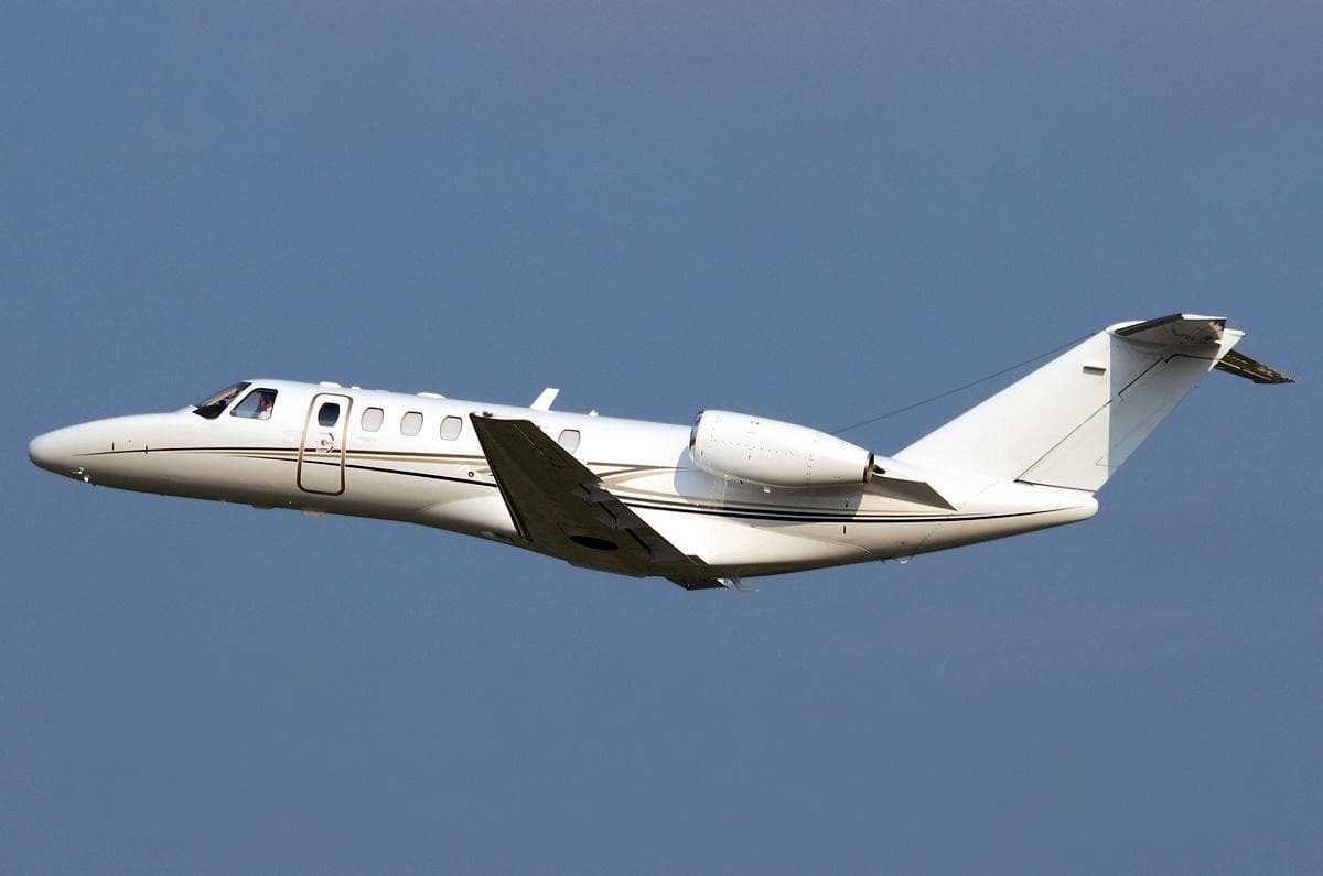 Tue, Nov 3TodayOrlandoKORL · Orlando Executive AirportMemphisKMEM · Memphis International AirportCitation CJ37—$15,8213NovOrlando → MemphisKORL → KMEM · TodayCitation CJ3 · 7 seats$15,821
- Fri, Nov 13in 10 daysAtlantaKPDK · DeKalb Peachtree AirportMemphisKMEM · Memphis International AirportCessna Citation X8—On request13NovAtlanta → MemphisKPDK → KMEM · in 10 daysCessna Citation X · 8 seatsOn request
 Wed, Nov 1815:10TuscaloosaKTCL · Tuscaloosa Regional AirportMemphisKMEM · Memphis International AirportEmbraer Phenom 300148m$4,84018NovTuscaloosa → MemphisKTCL → KMEM · 15:10Embraer Phenom 300 · 1 seat · 48m$4,840
- Fri, Nov 2012:44HoustonKHOU · William P Hobby AirportMemphisKMEM · Memphis International AirportCessna Citation Ultra11h 24m$5,17420NovHouston → MemphisKHOU → KMEM · 12:44Cessna Citation Ultra · 1 seat · 1h 24m$5,174
- Fri, Nov 20in 17 daysHoustonKHOU · William P Hobby AirportMemphisKMEM · Memphis International AirportCessna Citation V7—$4,99020NovHouston → MemphisKHOU → KMEM · in 17 daysCessna Citation V · 7 seats$4,990
- Mon, Nov 23in 20 daysClevelandKCGF · Cuyahoga County AirportMemphisKMEM · Memphis International AirportCitation CJ38—On request23NovCleveland → MemphisKCGF → KMEM · in 20 daysCitation CJ3 · 8 seatsOn request
- Tue, Nov 24in 21 daysTulsaKTUL · Tulsa International AirportMemphisKMEM · Memphis International AirportBeechcraft Beechjet 400A71hOn request24NovTulsa → MemphisKTUL → KMEM · in 21 daysBeechcraft Beechjet 400A · 7 seats · 1hOn request
- Wed, Nov 25in 22 daysAtlantaKRYY · Cobb County-Mc Collum FieldMemphisKMEM · Memphis International AirportCessna Citation V81h 6mOn request25NovAtlanta → MemphisKRYY → KMEM · in 22 daysCessna Citation V · 8 seats · 1h 6mOn request
- Sat, Nov 28in 25 daysAtlantaKY93 · Atlanta Municipal AirportMemphisKMEM · Memphis International AirportHawker 9008—$15,29028NovAtlanta → MemphisKY93 → KMEM · in 25 daysHawker 900 · 8 seats$15,290
* Total price incl. 10% service fee, converted to your selected currency. Price subject to operator confirmation.
Map: Memphis Airport
View the location of Memphis – MEM/KMEM. Zoom in to explore the area around the airport.
About the airport
Memphis International Airport (MEM/KMEM) is the key private jet gateway for Memphis. PrivJet gives you instant access to charter flights and empty legs: fast, discreet and globally connected.
KMEM airport FAQ
Are there any restrictions at Memphis airport (KMEM) today?
There are currently 21 valid NOTAMs for Memphis (KMEM). Affected: Obstacle lights: unserviceable; Taxiway: out of service; Obstacle: out of service; DME associated with ILS: unserviceable and 1 more. 14 more NOTAMs start in the coming days. For information only, not for flight planning or operational use. Always rely on an official pre-flight briefing. This list may be incomplete or out of date.
How long are the runways at Memphis airport (KMEM)?
Memphis (KMEM) has 4 runways: runway 18C/36C with 3,389 m (11,120 ft), concrete, runway 18R/36L with 2,841 m (9,320 ft), concrete, runway 18L/36R with 2,743 m (9,000 ft), concrete and runway 09/27 with 2,727 m (8,946 ft), asphalt. The longest is 3,389 m.
What are the radio frequencies at Memphis airport (KMEM)?
Frequencies at KMEM: Tower 118.3 MHz, Ground 121.65 MHz and ATIS 127.75 MHz. For information only. Always rely on the published AIP.
What are the airport codes of Memphis International Airport?
The ICAO code is KMEM and the IATA code is MEM. ICAO codes are used by air traffic control and pilots, e.g. in flight plans; IATA codes appear on tickets and baggage tags.
What is the elevation of KMEM airport?
Memphis International Airport sits at 341 ft (104 m) above sea level. Local time zone: America/Chicago.
Can I fly to KMEM by private jet?
Whether a private jet can operate into Memphis International Airport depends on runway length, opening hours, customs and immigration rules as well as slot and handling availability, among other things. PrivJet checks this with the operating carrier for every request.
Are there empty legs from or to KMEM?
There are currently 19 empty legs departing from and 17 arriving at Memphis International Airport. Empty legs are repositioning flights at heavily reduced prices; the list is updated several times a day.