Minneapolis-St Paul International/Wold-Chamberlain Airport (KMSP / MSP)
Empty legs and charters from Minneapolis
KMSP airport at a glance
- ICAO code
- KMSP
- IATA code
- MSP
- City
- Minneapolis
- Region
- Minnesota
- Country
- United States
- Elevation
- 841 ft (256 m)
- Time zone
- America/Chicago (UTC-6)
- Coordinates
- 44.8820° N, 93.2218° W
- Empty legs from
- 21
- Empty legs to
- 13
Weather & airport info KMSP
Current weather
Poor visibility, instrument conditions (IFR)observed 03 Nov, 10:53 UTC- Wind
- 6 kt (11 km/h) from southwest (220°)
- Visibility
- 10 km or more
- Clouds
- overcast at 600 ft
- Temperature
- 14 °C (dew point 14 °C)
- Pressure (QNH)
- 1,005 hPa
Original weather report (METAR)
METAR KMSP 031053Z 22006KT 10SM OVC006 14/14 A2968 RMK AO2 RAE00 SLP050 P0000 T01440139
Forecast (TAF)
- 03 Nov, 12:00–19:00 UTC7 kt (13 km/h) from west (280°) · visibility 10 km or more · Light rain showers, mist · overcast at 800 ft
- 03 Nov, 13:00–16:00 UTCpossible, 30 % probabilityvisibility 6 km · Light rain, mist · broken clouds at 600 ft
- 03 Nov, 19:00–23:00 UTCfrom8 kt (15 km/h) from northwest (320°) · visibility 5 km · Light rain, mist · broken clouds at 600 ft, overcast at 1,200 ft
- 03 Nov, 23:00–07:00 UTCfrom8 kt (15 km/h) from north-northwest (340°) · visibility 8 km · Light rain showers · overcast at 800 ft
- 04 Nov, 07:00–11:00 UTCfrom8 kt (15 km/h) from north (360°) · visibility 6 km · Light rain, mist · overcast at 500 ft
Original forecast (TAF)
TAF KMSP 031120Z 0312/0418 28007KT 6SM -SHRA BR OVC008 PROB30 0313/0316 4SM -RA BR BKN006 FM031900 32008KT 3SM -RA BR BKN006 OVC012 FM032300 34008KT 5SM -SHRA OVC008 FM040700 36008KT 4SM -RA BR OVC005 FM041100 36006KT 5SM -SHRA BR OVC009
Airport
- Elevation
- 841 ft (256 m)
- Sunrise / Sunset
- 06:53 / 16:59 local time
Runways
| Runway | Length | Surface | Lighted |
|---|---|---|---|
| 04/22 | 3,355 m (11,006 ft) | concrete | yes |
| 12R/30L | 3,048 m (10,000 ft) | asphalt/concrete | yes |
| 12L/30R | 2,499 m (8,200 ft) | asphalt/concrete | yes |
| 17/35 | 2,438 m (8,000 ft) | concrete | yes |
Radio frequencies
- Approach: 118.72
- ATIS: 120.8
- Clearance: 133.2
- Ground: 121.8
- Tower: 123.675
- UNICOM: 122.95
For information only, not for flight planning. Weather can change quickly; always rely on official reports. Sources: aviationweather.gov (NOAA), OurAirports.
Airport map KMSP
Full screen →Runways white, taxiways yellow with designators, closed taxiways and runways per NOTAM in red.
Closed per NOTAM: RWY 4/22
Official charts (FAA)
Cycle 2611, valid until 0901Z 11/26/26
Airport diagram (FAA)
Airport diagram (1)
Instrument approaches (28)
- ILS OR LOC RWY 12L
- ILS OR LOC RWY 12R
- ILS OR LOC RWY 30L
- ILS OR LOC RWY 30R
- ILS Z OR LOC RWY 35
- ILS RWY 12L (SA CAT I)
- ILS RWY 12R (SA CAT I)
- ILS Z RWY 35 (SA CAT I)
- ILS RWY 30L (CAT II)
- ILS RWY 12L (CAT II - III)
- ILS RWY 12R (CAT II - III)
- ILS Z RWY 35 (CAT II - III)
- ILS V RWY 35 (CONVERGING)
- RNAV (RNP) Y RWY 12L
- RNAV (RNP) Y RWY 12R
- RNAV (RNP) Y RWY 30L
- RNAV (RNP) Y RWY 30R
- RNAV (RNP) Y RWY 35
- RNAV (GPS) RWY 04
- RNAV (GPS) RWY 22
- RNAV (GPS) Z RWY 12L
- RNAV (GPS) Z RWY 12R
- RNAV (GPS) Z RWY 30L
- RNAV (GPS) Z RWY 30R
- RNAV (GPS) Z RWY 35
- LOC RWY 04
- LOC RWY 17
- LOC RWY 22
Departure procedures (13)
Minimums (2)
Hot spots (1)
LAHSO (1)
Other (15)
For information only, not for navigation. Always use current official charts and NOTAMs.
Current NOTAMs for KMSP(33)
NOTAMs (Notices to Air Missions) announce short-term changes at an airport: closed runways or taxiways, unserviceable approach aids, obstacles, airspace restrictions.
- ClosedRunway: closed10/600· until 31 Jan, 23:59 UTC
Runway 04/22 is closed, except for taxiing. A prior permission request 30 minutes in advance is required on frequency 121.9.
Show original text
RWY 04/22 CLSD EXC TAX 30MIN PPR 121.9
A1839/26 NOTAMN Q) KZMP/QMRLC////000/999/4452N09313W005 A) KMSP B) 2610270927 C) 2701312359 E) RWY 04/22 CLSD EXC TAX 30MIN PPR 121.9
- Out of serviceDME associated with ILS: unserviceableA1973/26· from 04 Nov, 19:00 UTC · until 05 Nov, 00:01 UTC
The distance measuring equipment (DME) for the instrument landing system (ILS) on runway 30L is out of service. The ILS guides aircraft to the runway in poor visibility.
Show original text
MSP NAV ILS RWY 30L DME U/S
A1973/26 NOTAMN
Q) KZMP/QIDAS////000/999/4452N09313W005
A) KMSP
B) 2611041900
C) 2611050001
E) MSP NAV ILS RWY 30L DME U/S
- Out of serviceDME associated with ILS: unserviceableA1974/26· from 04 Nov, 19:00 UTC · until 05 Nov, 00:01 UTC
The distance measuring equipment (DME) for the instrument landing system (ILS) on runway 12R is out of service. The ILS guides aircraft to the runway in poor visibility.
Show original text
MSP NAV ILS RWY 12R DME U/S
A1974/26 NOTAMN
Q) KZMP/QIDAS////000/999/4452N09313W005
A) KMSP
B) 2611041900
C) 2611050001
E) MSP NAV ILS RWY 12R DME U/S
- Out of serviceApproach lighting: unserviceableA2061/26· from 04 Nov, 14:00 UTC · until 04 Nov, 22:00 UTC
The approach lighting system (ALS) for runway 30R is out of service. The ALS helps pilots locate the runway in poor visibility.
Show original text
RWY 30R ALS U/S
A2061/26 NOTAMN
Q) KZMP/QLAAS////000/999/4452N09313W005
A) KMSP
B) 2611041400
C) 2611042200
E) RWY 30R ALS U/S
- Out of serviceObstacle lights: unserviceableA2072/26· until 17 Dec, 17:51 UTC
The tower lighting (ASR 1226455) near the airport is out of service. Its top is 984 FT above sea level, 153 FT above ground.
Show original text
TOWER LGT (ASR 1226455) 445204.50N0931328.00W (0.9NM S MSP) 984FT (153FT AGL) U/S
A2072/26 NOTAMN
Q) KZMP/QOLAS/IV/M/AE/000/999/4452N09313W001
A) KMSP
B) 2611021751
C) 2612171751
E) TOWER LGT (ASR 1226455) 445204.50N0931328.00W (0.9NM S MSP) 984FT (153FT AGL) U/S
- Out of serviceOtherM0093/26· until 27 Nov, 22:00 UTC
The Air Force Reserve Ramp Building 870 is out of service. This affects the use of this area.
Show original text
AIR FORCE RESERVE RAMP BLDG 870 TOP OBS OTS
M0093/26 NOTAMN
Q) ZMP/QXXXX/IV/NBO/A/000/999/4452N09313W005
A) KMSP
B) 2610261434
C) 2611272200
E) AIR FORCE RESERVE RAMP BLDG 870 TOP OBS OTS
- Out of serviceApron10/491· until 21 Jan, 22:00 UTC
The centerline lighting for the de-icing pad for runway 30R at Minneapolis-St Paul International Airport is out of service.
Show original text
APRON DEICE PAD FOR RWY 30R CL LGT U/S
A1604/26 NOTAMN
Q) KZMP/QMNXX////000/999/4452N09313W005
A) KMSP
B) 2610211410
C) 2701212200
E) APRON DEICE PAD FOR RWY 30R CL LGT U/S
- Out of serviceApronA1604/26· until 21 Jan, 22:00 UTC
The centerline lighting for the de-icing pad for runway 30R at Minneapolis-St Paul International Airport is out of service.
Show original text
APRON DEICE PAD FOR RWY 30R CL LGT U/S
A1604/26 NOTAMN Q) KZMP/QMNXX////000/999/4452N09313W005 A) KMSP B) 2610211410 C) 2701212200 E) APRON DEICE PAD FOR RWY 30R CL LGT U/S
25 more NOTAMs
- Out of serviceILS inner marker: unserviceableA0867/26· until 14 Nov, 21:11 UTC
The instrument landing system (ILS) for runway 12R is out of service. The ILS guides aircraft to the runway in poor visibility.
Show original text
NAV ILS RWY 12R IM U/S
A0867/26 NOTAMN
Q) KZMP/QIIAS////000/999/4452N09313W005
A) KMSP
B) 2610061303
C) 2711142111
E) NAV ILS RWY 12R IM U/S
- NoticeRunwayA2105/26· until 04 Nov, 11:03 UTC
Runway 30L surface condition 5/5/5 100 percent wet observed at 3 Nov 11:03 UTC.
Show original text
RWY 30L FICON 5/5/5 100 PCT WET OBS AT 2611031103.
A2105/26 NOTAMN
Q) KZMP/QMRXX////000/999/4452N09313W005
A) KMSP
B) 2611031103
C) 2611041103
E) RWY 30L FICON 5/5/5 100 PCT WET OBS AT 2611031103.
- NoticeRunwayA2103/26· until 04 Nov, 10:55 UTC
Runway 30R surface condition 5/5/5 100 percent wet observed at 3 Nov 10:55 UTC.
Show original text
RWY 30R FICON 5/5/5 100 PCT WET OBS AT 2611031055.
A2103/26 NOTAMN
Q) KZMP/QMRXX////000/999/4452N09313W005
A) KMSP
B) 2611031055
C) 2611041055
E) RWY 30R FICON 5/5/5 100 PCT WET OBS AT 2611031055.
- NoticeTaxiwayA2096/26· until 04 Nov, 08:36 UTC
Taxiway all surface condition wet observed at 3 Nov 08:36 UTC.
Show original text
TWY ALL FICON WET OBS AT 2611030836.
A2096/26 NOTAMN
Q) KZMP/QMXXX////000/999/4452N09313W005
A) KMSP
B) 2611030836
C) 2611040836
E) TWY ALL FICON WET OBS AT 2611030836.
- NoticeApronA2097/26· until 04 Nov, 08:36 UTC
Apron all surface condition wet observed at 3 Nov 08:36 UTC.
Show original text
APRON ALL FICON WET OBS AT 2611030836.
A2097/26 NOTAMN
Q) KZMP/QMNXX////000/999/4452N09313W005
A) KMSP
B) 2611030836
C) 2611040836
E) APRON ALL FICON WET OBS AT 2611030836.
- NoticeRunwayA2100/26· until 04 Nov, 08:36 UTC
Runway 17 surface condition 5/5/5 100 percent wet observed at 3 Nov 08:36 UTC.
Show original text
RWY 17 FICON 5/5/5 100 PCT WET OBS AT 2611030836.
A2100/26 NOTAMN
Q) KZMP/QMRXX////000/999/4452N09313W005
A) KMSP
B) 2611030836
C) 2611040836
E) RWY 17 FICON 5/5/5 100 PCT WET OBS AT 2611030836.
- NoticeTaxiway10/704· until 31 May, 21:00 UTC
The geographic position markings on taxiway W between taxiway W6 and taxiway W7 are not standard. This might affect orientation on the taxiway.
Show original text
TWY W GEOGRAPHIC PSN MARKINGS BTN TWY W6 AND TWY W7 NOT STD
- NoticeTaxiwayA2029/26· until 31 Jan, 23:59 UTC
Taxiway T between taxiway C and taxiway D IRREGULAR surface
Show original text
TWY T BTN TWY C AND TWY D IRREGULAR SFC
A2029/26 NOTAMN
Q) KZMP/QMXXX////000/999/4452N09313W005
A) KMSP
B) 2610311847
C) 2701312359
E) TWY T BTN TWY C AND TWY D IRREGULAR SFC
- NoticeServices10/688· until 15 Dec, 20:00 UTC
The automatic terminal information service (ATIS) is now available at phone number 612-713-4027, no longer at 612-726-9240.
Show original text
SVC ATIS 612-726-9240 NOW 612-713-4027
- NoticeOther2291/26· until 29 Oct, 13:29 UTC (estimated)
For the Standard Departure Routes (SID) TOTTZ ONE DEPARTURE and HTDSH ONE DEPARTURE at Minneapolis-St Paul Intl/Wold-Chamberlain airport, Minneapolis, MN, there is a chart note: Do not file OANNA Transition, it is to be assigned by Air Traffic Control. All other data remains as published.
Show original text
SID MINNEAPOLIS-ST PAUL INTL/WOLD-CHAMBERLAIN, MINNEAPOLIS, MN. TOTTZ ONE DEPARTURE ... HTDSH ONE DEPARTURE ... CHART NOTE: DO NOT FILE OANNA TRANSITION - TO BE ASSIGNED BY ATC. ALL OTHER DATA REMAINS AS PUBLISHED. 2610290500-2810291329EST
Q) KZMP/QXXXX/I/NBO/A/000/999/4452N09313W025
A) KMSP
B) 2610261329
C) 2706071329EST
E) SID MINNEAPOLIS-ST PAUL INTL/WOLD-CHAMBERLAIN, MINNEAPOLIS, MN.
TOTTZ ONE DEPARTURE ...
HTDSH ONE DEPARTURE ...
CHART NOTE: DO NOT FILE OANNA TRANSITION - TO BE ASSIGNED BY ATC.
ALL OTHER DATA REMAINS AS PUBLISHED.
- NoticeOther3169/26· until 29 Oct, 13:37 UTC (estimated)
For the SNOWZ ONE DEPARTURE standard departure route at Minneapolis-St Paul International Airport, the SMTHA transition is for FSD landing traffic only.
Show original text
SID MINNEAPOLIS-ST PAUL INTL/WOLD-CHAMBERLAIN, MINNEAPOLIS, MN. SNOWZ ONE DEPARTURE ... CHART NOTE: SMTHA TRANSITION FOR FSD LANDING TRAFFIC ONLY. ALL OTHER DATA REMAINS THE SAME. 2610290500-2810291337EST
Q) KZMP/QXXXX/I/NBO/A/000/999/4452N09313W025
A) KMSP
B) 2610281335
C) 2706091335EST
E) SID MINNEAPOLIS-ST PAUL INTL/WOLD-CHAMBERLAIN, MINNEAPOLIS, MN.
SNOWZ ONE DEPARTURE ...
CHART NOTE: SMTHA TRANSITION FOR FSD LANDING TRAFFIC ONLY.
ALL OTHER DATA REMAINS THE SAME.
- NoticeOther3171/26· until 29 Oct, 13:41 UTC (estimated)
For the TOTTZ ONE DEPARTURE standard departure route at Minneapolis-St Paul International Airport, the ZZIPR transition is for ORD landing traffic only, and the OHHMY transition is for MDW landing traffic only.
Show original text
SID MINNEAPOLIS-ST PAUL INTL/WOLD-CHAMBERLAIN, MINNEAPOLIS, MN. TOTTZ ONE DEPARTURE ... CHART NOTE: ZZIPR TRANSITION FOR ORD LANDING TRAFFIC ONLY. CHART NOTE: OHHMY TRANSITION FOR MDW LANDING TRAFFIC ONLY. ALL OTHER DATA REMAINS THE SAME. 2610290500-2810291341EST
Q) KZMP/QXXXX/I/NBO/A/000/999/4452N09313W025
A) KMSP
B) 2610281341
C) 2706091340EST
E) SID MINNEAPOLIS-ST PAUL INTL/WOLD-CHAMBERLAIN, MINNEAPOLIS, MN.
TOTTZ ONE DEPARTURE ...
CHART NOTE: ZZIPR TRANSITION FOR ORD LANDING TRAFFIC ONLY.
CHART NOTE: OHHMY TRANSITION FOR MDW LANDING TRAFFIC ONLY.
ALL OTHER DATA REMAINS THE SAME.
- NoticeStandard instrument departure: changedA1776/26· until 29 Oct, 13:29 UTC
For the Standard Departure Routes (SID) TOTTZ ONE DEPARTURE and HTDSH ONE DEPARTURE at Minneapolis-St Paul Intl/Wold-Chamberlain airport, Minneapolis, MN, there is a chart note: Do not file OANNA Transition, it is to be assigned by Air Traffic Control. All other data remains as published.
Show original text
SID MINNEAPOLIS-ST PAUL INTL/WOLD-CHAMBERLAIN, MINNEAPOLIS, MN. TOTTZ ONE DEPARTURE ... HTDSH ONE DEPARTURE ... CHART NOTE: DO NOT FILE OANNA TRANSITION - TO BE ASSIGNED BY ATC. ALL OTHER DATA REMAINS AS PUBLISHED.
A1776/26 NOTAMN
Q) KZMP/QPDCH/I/NBO/A/000/999/4452N09313W005
A) KMSP
B) 2610290500
C) 2810291329
E) SID MINNEAPOLIS-ST PAUL INTL/WOLD-CHAMBERLAIN, MINNEAPOLIS, MN. TOTTZ ONE DEPARTURE ... HTDSH ONE DEPARTURE ... CHART NOTE: DO NOT FILE OANNA TRANSITION - TO BE ASSIGNED BY ATC. ALL OTHER DATA REMAINS AS PUBLISHED.
- NoticeStandard instrument departure: changedA1908/26· until 29 Oct, 13:37 UTC
For the SNOWZ ONE DEPARTURE standard departure route at Minneapolis-St Paul International Airport, the SMTHA transition is for FSD landing traffic only.
Show original text
SID MINNEAPOLIS-ST PAUL INTL/WOLD-CHAMBERLAIN, MINNEAPOLIS, MN. SNOWZ ONE DEPARTURE ... CHART NOTE: SMTHA TRANSITION FOR FSD LANDING TRAFFIC ONLY. ALL OTHER DATA REMAINS THE SAME.
A1908/26 NOTAMN
Q) KZMP/QPDCH/I/NBO/A/000/999/4452N09313W005
A) KMSP
B) 2610290500
C) 2810291337
E) SID MINNEAPOLIS-ST PAUL INTL/WOLD-CHAMBERLAIN, MINNEAPOLIS, MN. SNOWZ ONE DEPARTURE ... CHART NOTE: SMTHA TRANSITION FOR FSD LANDING TRAFFIC ONLY. ALL OTHER DATA REMAINS THE SAME.
- NoticeStandard instrument departure: changedA1910/26· until 29 Oct, 13:41 UTC
For the TOTTZ ONE DEPARTURE standard departure route at Minneapolis-St Paul International Airport, the ZZIPR transition is for ORD landing traffic only, and the OHHMY transition is for MDW landing traffic only.
Show original text
SID MINNEAPOLIS-ST PAUL INTL/WOLD-CHAMBERLAIN, MINNEAPOLIS, MN. TOTTZ ONE DEPARTURE ... CHART NOTE: ZZIPR TRANSITION FOR ORD LANDING TRAFFIC ONLY. CHART NOTE: OHHMY TRANSITION FOR MDW LANDING TRAFFIC ONLY. ALL OTHER DATA REMAINS THE SAME.
A1910/26 NOTAMN
Q) KZMP/QPDCH/I/NBO/A/000/999/4452N09313W005
A) KMSP
B) 2610290500
C) 2810291341
E) SID MINNEAPOLIS-ST PAUL INTL/WOLD-CHAMBERLAIN, MINNEAPOLIS, MN. TOTTZ ONE DEPARTURE ... CHART NOTE: ZZIPR TRANSITION FOR ORD LANDING TRAFFIC ONLY. CHART NOTE: OHHMY TRANSITION FOR MDW LANDING TRAFFIC ONLY. ALL OTHER DATA REMAINS THE SAME.
- NoticeInstrument approach procedure2778/26· until 27 Jun, 20:00 UTC (estimated)
There is a temporary crane near runway 12R. Its top is 979 feet above sea level, 1543 feet northeast of runway 12R.
Show original text
IAP MINNEAPOLIS-ST PAUL INTL/WOLD-CHAMBERLAIN, MINNEAPOLIS, MN. RNAV (GPS) Z RWY 12R, AMDT 5... LNAV MDA 1240/HAT 398 ALL CATS, VIS CAT C/D/E RVR 3500. FOR INOP ALS, INCREASE LPV CAT E VISIBILITY TO RVR 4000, INCREASE LNAV/VNAV CAT E VISIBILITY TO 1 1/4 SM, AND INCREASE LNAV CAT E VISIBILITY TO RVR 6000. TEMPORARY CRANE 979 MSL 1543FT NE OF RWY 12R (2024-AGL-6447 TO 6461-NRA). 2610271529-2706272000EST
Q) KZMP/QPIXX/I/NBO/A/000/999/4452N09313W005
A) KMSP
B) 2610271528
C) 2706081528EST
E) MSP MINNEAPOLIS-ST PAUL INTL/WOLD-CHAMBERLAIN, MINNEAPOLIS, MN.
RNAV (GPS) Z RWY 12R, AMDT 5...
LNAV MDA 1240/HAT 398 ALL CATS, VIS CAT C/D/E RVR 3500. FOR INOP ALS, INCREASE LPV CAT E VISIBILITY TO RVR 4000, INCREASE LNAV/VNAV CAT E VISIBILITY TO 1 1/4 SM, AND INCREASE LNAV CAT E VISIBILITY TO RVR 6000. TEMPORARY CRANE 979 MSL 1543FT NE OF RWY 12R (2024-AGL-6447 TO 6461-NRA).
- NoticeInstrument approach procedure: changedA1849/26· until 27 Jun, 20:00 UTC
There is a temporary crane near runway 12R. Its top is 979 feet above sea level, 1543 feet northeast of runway 12R.
Show original text
IAP MINNEAPOLIS-ST PAUL INTL/WOLD-CHAMBERLAIN, MINNEAPOLIS, MN. RNAV (GPS) Z RWY 12R, AMDT 5... LNAV MDA 1240/HAT 398 ALL CATS, VIS CAT C/D/E RVR 3500. FOR INOP ALS, INCREASE LPV CAT E VISIBILITY TO RVR 4000, INCREASE LNAV/VNAV CAT E VISIBILITY TO 1 1/4 SM, AND INCREASE LNAV CAT E VISIBILITY TO RVR 6000. TEMPORARY CRANE 979 MSL 1543FT NE OF RWY 12R (2024-AGL-6447 TO 6461-NRA).
A1849/26 NOTAMN
Q) KZMP/QPICH/I/NBO/A/000/999/4452N09313W005
A) KMSP
B) 2610271529
C) 2706272000
E) IAP MINNEAPOLIS-ST PAUL INTL/WOLD-CHAMBERLAIN, MINNEAPOLIS, MN. RNAV (GPS) Z RWY 12R, AMDT 5... LNAV MDA 1240/HAT 398 ALL CATS, VIS CAT C/D/E RVR 3500. FOR INOP ALS, INCREASE LPV CAT E VISIBILITY TO RVR 4000, INCREASE LNAV/VNAV CAT E VISIBILITY TO 1 1/4 SM, AND INCREASE LNAV CAT E VISIBILITY TO RVR 6000. TEMPORARY CRANE 979 MSL 1543FT NE OF RWY 12R (2024-AGL-6447 TO 6461-NRA).
- NoticeRunway10/553· until 25 Jan, 23:00 UTC
The runway 12R/30L centerline markings are obscured.
Show original text
RWY 12R/30L CL MARKINGS OBSC
- NoticeTaxiway10/521· until 22 Jan, 23:59 UTC
Taxiway T between the Infield Cargo Apron and taxiway Y has an irregular surface.
Show original text
TWY T BTN INFIELD CARGO APN AND TWY Y IRREGULAR SFC
A1683/26 NOTAMN
Q) KZMP/QMXXX////000/999/4452N09313W005
A) KMSP
B) 2610222314
C) 2701222359
E) TWY T BTN INFIELD CARGO APN AND TWY Y IRREGULAR SFC
- NoticeTaxiwayA1683/26· until 22 Jan, 23:59 UTC
Taxiway T between the Infield Cargo Apron and taxiway Y has an irregular surface. This may result in a bumpy ride.
Show original text
TWY T BTN INFIELD CARGO APN AND TWY Y IRREGULAR SFC
A1683/26 NOTAMN Q) KZMP/QMXXX////000/999/4452N09313W005 A) KMSP B) 2610222314 C) 2701222359 E) TWY T BTN INFIELD CARGO APN AND TWY Y IRREGULAR SFC
- NoticeObstacle: erected10/485· until 04 Jan, 22:00 UTC
A crane near Minneapolis-St. Paul airport is an obstacle. Its top is 972 feet above sea level, 140 feet above ground, and it is flagged and lighted.
Show original text
OBST CRANE (ASN 2023-AGL-12250-NRA) 445321N0931335W (0.5NM NNW MSP) 972FT (140FT AGL) FLAGGED AND LGTD
A1594/26 NOTAMN
Q) KZMP/QOBCE/IV/M/AE/000/999/4452N09313W005
A) KMSP
B) 2610210803
C) 2701042200
E) OBST CRANE (ASN 2023-AGL-12250-NRA) 445321N0931335W (0.5NM NNW MSP) 972FT (140FT AGL) FLAGGED AND LGTD
- NoticeObstacle: erectedA1594/26· until 04 Jan, 22:00 UTC
A crane near Minneapolis-St. Paul airport is an obstacle. Its top is 972 feet above sea level, 140 feet above ground, and it is flagged and lighted.
Show original text
OBST CRANE (ASN 2023-AGL-12250-NRA) 445321N0931335W (0.5NM NNW MSP) 972FT (140FT AGL) FLAGGED AND LGTD
A1594/26 NOTAMN Q) KZMP/QOBCE/IV/M/AE/000/999/4452N09313W005 A) KMSP B) 2610210803 C) 2701042200 E) OBST CRANE (ASN 2023-AGL-12250-NRA) 445321N0931335W (0.5NM NNW MSP) 972FT (140FT AGL) FLAGGED AND LGTD
- NoticeObstacle: erectedA1304/26· until 13 Nov, 22:46 UTC
An unknown crane is located 0.51 nautical miles northwest of the approach end of runway 30L. Its top is 90 feet above ground and it is flagged and lighted.
Show original text
OBST CRANE (ASN UNKNOWN) 445249N0931231W (0.51NM NW APCH END RWY 30L) UNKNOWN (90FT AGL) FLAGGED AND LGTD
A1304/26 NOTAMN
Q) KZMP/QOBCE/IV/M/AE/000/999/4452N09313W005
A) KMSP
B) 2610161238
C) 2611132246
D) DLY SR-SS
E) OBST CRANE (ASN UNKNOWN) 445249N0931231W (0.51NM NW APCH END RWY 30L)
UNKNOWN (90FT AGL) FLAGGED AND LGTD
Hours: DLY SR-SS
- NoticeTaxiway09/633· until 31 Dec, 23:59 UTC
The intermediate holding position markings on taxiway B at the east side of the tunnel are not standard due to fading.
Show original text
TWY B INTERMEDIATE HLDG PSN MARKINGS AT TUNNEL EAST SIDE NOT STD DUE TO FADED
- NoticeDaylight markings09/631· until 31 Dec, 23:59 UTC
The lead-off centerline markings for runway 30L at taxiway A8 and taxiway W8 are obscured.
Show original text
RWY 30L LEAD OFF CL MARKINGS AT TWY A8 AND TWY W8 OBSC
09/631 NOTAMR
Q) KZMP/QMMXX/V/M/A/000/999/4452N09313W005
A) KMSP
B) 2609302026
C) 2612312359

E) RWY 30L LEAD OFF CL MARKINGS AT TWY A8 AND TWY W8 OBSC
For information only, not for flight planning or operational use. Always rely on an official pre-flight briefing. This list may be incomplete or out of date. Explanations and expanded abbreviations are generated automatically. The original text is authoritative. Source: FAA NOTAM Management Service (SWIM).
Private jet traffic in Minneapolis-St Paul International/Wold-Chamberlain Airport (last 30 days)
- Arrivals
- 583
- Departures
- 582
- Different jets
- 451
Most frequent origins: Teterboro Airport (17), Centennial Airport (15), Chicago Midway International Airport (12), Chicago Executive Airport (10), Joe Foss Field Airport (8).
Most frequent destinations: Teterboro Airport (24), Chicago Midway International Airport (18), Wichita Mid Continent Airport (13), Centennial Airport (13), Naples Municipal Airport (9).
Most common aircraft types: Cessna Citation Latitude (129), Embraer Phenom 300 (115), Gulfstream G280 (81), Bombardier Challenger 350/3500 (79), Cessna Citation Longitude (62).
Monday is the busiest day.
Our own analysis of public ADS-B signals from business jets. Not every flight is received, and jets with a removal request are excluded.
Empty legs from KMSP
21 departures available
 Thu, Nov 5in 2 daysMinneapolisKMSP · Minneapolis-St Paul International/Wold-Chamberlain AirportCartersvilleKVPC · Cartersville AirportGulfstream GV14—$16,5005NovMinneapolis → CartersvilleKMSP → KVPC · in 2 daysGulfstream GV · 14 seats$16,500
 Fri, Nov 6in 3 daysMinneapolisKMSP · Minneapolis-St Paul International/Wold-Chamberlain AirportNew YorkKTEB · Teterboro AirportGulfstream G30014—$32,8966NovMinneapolis → New YorkKMSP → KTEB · in 3 daysGulfstream G300 · 14 seats$32,896
- Fri, Nov 6in 3 daysMinneapolisKMSP · Minneapolis St Paul Intl WoldProvincetownKPVC · Provincetown MunGulfstream V——On request6NovMinneapolis → ProvincetownKMSP → KPVC · in 3 daysGulfstream VOn request
 Fri, Nov 6in 3 daysMinneapolisKMSP · Minneapolis-St Paul International/Wold-Chamberlain AirportCartersvilleKVPC · Cartersville AirportGulfstream G V11h 54m$16,5006NovMinneapolis → CartersvilleKMSP → KVPC · in 3 daysGulfstream G V · 1 seat · 1h 54m$16,500
 Sat, Nov 7in 4 daysMinneapolisKMSP · Minneapolis-St Paul International/Wold-Chamberlain AirportPhiladelphiaKTTN · Trenton Mercer AirportLearjet 608—$13,6227NovMinneapolis → PhiladelphiaKMSP → KTTN · in 4 daysLearjet 60 · 8 seats$13,622
- Sat, Nov 7in 4 daysMinneapolisKMSP · Minneapolis-St Paul International/Wold-Chamberlain AirportTrentonKTTN · Trenton Mercer AirportLearjet Lear 607—$13,6227NovMinneapolis → TrentonKMSP → KTTN · in 4 daysLearjet Lear 60 · 7 seats$13,622
- Tue, Nov 10in 7 daysMinneapolisKMSP · Minneapolis-St Paul International/Wold-Chamberlain AirportTrentonKTTN · Trenton Mercer AirportBombardier Learjet 60XR7—On request10NovMinneapolis → TrentonKMSP → KTTN · in 7 daysBombardier Learjet 60XR · 7 seatsOn request
 Tue, Nov 1020:12MinneapolisKMSP · Minneapolis-St Paul International/Wold-Chamberlain AirportTrentonKTTN · Trenton Mercer AirportBombardier Learjet 608—$13,64010NovMinneapolis → TrentonKMSP → KTTN · 20:12Bombardier Learjet 60 · 8 seats$13,640
 Wed, Nov 11in 8 daysMinneapolisKMSP · Minneapolis-St Paul International/Wold-Chamberlain AirportEast FarmingdaleKFRG · Republic AirportLearjet 608—$17,43511NovMinneapolis → East FarmingdaleKMSP → KFRG · in 8 daysLearjet 60 · 8 seats$17,435
 KMSP · Minneapolis-St Paul International/Wold-Chamberlain Airport
* Total price incl. 10% service fee, converted to your selected currency. Price subject to operator confirmation.
Empty legs to KMSP
13 arrivals available
- Tue, Nov 319:48Eau ClaireKEAU · Chippewa Valley Regional AirportMinneapolisKMSP · Minneapolis-Saint Paul International Airport / Wold-Chamberlain FieldCessna Citation X8—$3,6303NovEau Claire → MinneapolisKEAU → KMSP · 19:48Cessna Citation X · 8 seats$3,630
 Wed, Nov 4TomorrowWashingtonKIAD · Washington Dulles International AirportMinneapolisKMSP · Minneapolis-St Paul International/Wold-Chamberlain AirportFalcon 900B15—$25,4104NovWashington → MinneapolisKIAD → KMSP · TomorrowFalcon 900B · 15 seats$25,410
- Wed, Nov 4TomorrowWashingtonKIAD · Washington Dulles IntlMinneapolisKMSP · Minneapolis St Paul Intl WoldFalcon 900B——On request4NovWashington → MinneapolisKIAD → KMSP · TomorrowFalcon 900BOn request
- Wed, Nov 416:16DullesKIAD · Washington Dulles International AirportMinneapolisKMSP · Minneapolis-Saint Paul International Airport / Wold-Chamberlain FieldDassault Falcon 90012—$20,5704NovDulles → MinneapolisKIAD → KMSP · 16:16Dassault Falcon 900 · 12 seats$20,570
 Sat, Nov 709:16DullesKIAD · Washington Dulles International AirportMinneapolisKMSP · Minneapolis–Saint Paul International Airport / Wold–Chamberlain FieldDassault Falcon 90016—$18,0117NovDulles → MinneapolisKIAD → KMSP · 09:16Dassault Falcon 900 · 16 seats$18,011
 Thu, Nov 12in 9 daysBuffaloKBUF · Buffalo Niagara International AirportMinneapolisKMSP · Minneapolis-St Paul International/Wold-Chamberlain AirportGulfstream G2009—On request12NovBuffalo → MinneapolisKBUF → KMSP · in 9 daysGulfstream G200 · 9 seatsOn request
- Sun, Nov 22in 19 daysVancouverCYVR · Vancouver International AirportMinneapolisKMSP · Minneapolis-St Paul International/Wold-Chamberlain AirportDassault Falcon 900B143h 6mOn request22NovVancouver → MinneapolisCYVR → KMSP · in 19 daysDassault Falcon 900B · 14 seats · 3h 6mOn request
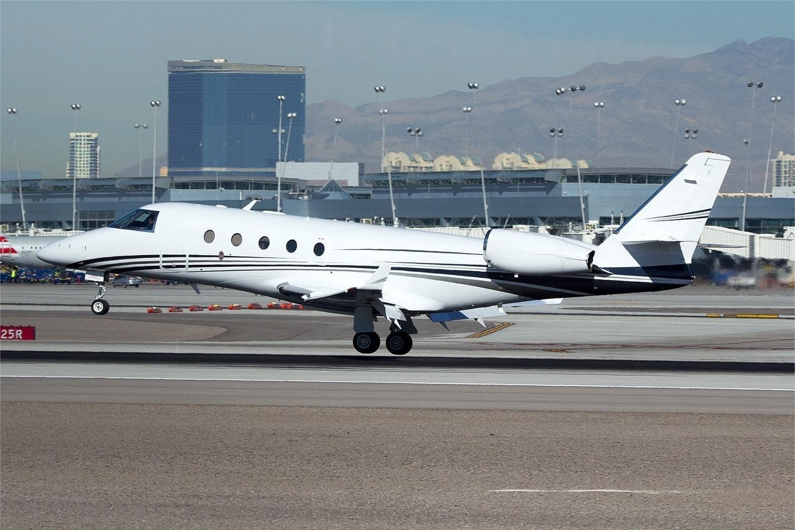 Mon, Nov 23in 20 daysVancouverCYVR · Vancouver International AirportMinneapolisKMSP · Minneapolis-St Paul International/Wold-Chamberlain AirportFalcon 900B14—$45,81723NovVancouver → MinneapolisCYVR → KMSP · in 20 daysFalcon 900B · 14 seats$45,817
- Sun, Nov 29in 26 daysWilmingtonKILG · Wilmington AirportMinneapolisKMSP · Minneapolis-Saint Paul International Airport / Wold-Chamberlain FieldEmbraer Phenom 1004—$20,24029NovWilmington → MinneapolisKILG → KMSP · in 26 daysEmbraer Phenom 100 · 4 seats$20,240
 CYVR · Vancouver International Airport
* Total price incl. 10% service fee, converted to your selected currency. Price subject to operator confirmation.
Map: Minneapolis Airport
View the location of Minneapolis – MSP/KMSP. Zoom in to explore the area around the airport.
About the airport
Minneapolis-St Paul International/Wold-Chamberlain Airport (MSP/KMSP) is the key private jet gateway for Minneapolis. PrivJet gives you instant access to charter flights and empty legs: fast, discreet and globally connected.
KMSP airport FAQ
Are there any restrictions at Minneapolis airport (KMSP) today?
There are currently 30 valid NOTAMs for Minneapolis (KMSP). According to NOTAM, at least one runway or the aerodrome itself is closed. Affected: Runway: closed; Obstacle lights: unserviceable; Other: out of service; Apron and 1 more. 3 more NOTAMs start in the coming days. For information only, not for flight planning or operational use. Always rely on an official pre-flight briefing. This list may be incomplete or out of date.
What is the weather at Minneapolis airport (KMSP)?
According to the latest weather report for KMSP (METAR, 03 Nov, 10:53 UTC): Poor visibility, instrument conditions (IFR). Wind 6 kt (11 km/h) from southwest (220°), visibility 10 km or more, temperature 14 °C (dew point 14 °C). For information only, not for flight planning. Weather can change quickly; always rely on official reports.
How long are the runways at Minneapolis airport (KMSP)?
Minneapolis (KMSP) has 4 runways: runway 04/22 with 3,355 m (11,006 ft), concrete, runway 12R/30L with 3,048 m (10,000 ft), asphalt/concrete, runway 12L/30R with 2,499 m (8,200 ft), asphalt/concrete and runway 17/35 with 2,438 m (8,000 ft), concrete. The longest is 3,355 m.
What are the radio frequencies at Minneapolis airport (KMSP)?
Frequencies at KMSP: Tower 123.675 MHz, Ground 121.8 MHz and ATIS 120.8 MHz. For information only. Always rely on the published AIP.
What are the airport codes of Minneapolis-St Paul International/Wold-Chamberlain Airport?
The ICAO code is KMSP and the IATA code is MSP. ICAO codes are used by air traffic control and pilots, e.g. in flight plans; IATA codes appear on tickets and baggage tags.
What is the elevation of KMSP airport?
Minneapolis-St Paul International/Wold-Chamberlain Airport sits at 841 ft (256 m) above sea level. Local time zone: America/Chicago.
Can I fly to KMSP by private jet?
Whether a private jet can operate into Minneapolis-St Paul International/Wold-Chamberlain Airport depends on runway length, opening hours, customs and immigration rules as well as slot and handling availability, among other things. PrivJet checks this with the operating carrier for every request.
Are there empty legs from or to KMSP?
There are currently 21 empty legs departing from and 13 arriving at Minneapolis-St Paul International/Wold-Chamberlain Airport. Empty legs are repositioning flights at heavily reduced prices; the list is updated several times a day.