Myrtle Beach Airport (KMYR / MYR)
Empty legs and charters from Myrtle Beach
KMYR airport at a glance
- ICAO code
- KMYR
- IATA code
- MYR
- City
- Myrtle Beach
- Region
- South Carolina
- Country
- United States
- Elevation
- 25 ft (8 m)
- Time zone
- America/New York (UTC-5)
- Coordinates
- 33.6797° N, 78.9283° W
- Empty legs from
- 3
- Empty legs to
- 4
Weather & airport info KMYR
Current weather
No current weather report is available for this airport.
Airport
- Elevation
- 25 ft (8 m)
- Sunrise / Sunset
- 06:36 / 17:22 local time
Runways
| Runway | Length | Surface | Lighted |
|---|---|---|---|
| 18/36 | 2,897 m (9,503 ft) | asphalt | yes |
Radio frequencies
- ATIS: 123.925
- Clearance: 119.7
- CTAF: 128.45
- Ground: 120.3
- Tower: 128.45
- UNICOM: 122.95
For information only, not for flight planning. Weather can change quickly; always rely on official reports. Sources: aviationweather.gov (NOAA), OurAirports.
Airport map KMYR
Full screen →Runways white, taxiways yellow with designators, closed taxiways and runways per NOTAM in red.
Closed per NOTAM: RWY 18/36, TWY B*, TWY B2 (* partly closed)
Official charts (FAA)
Cycle 2611, valid until 0901Z 11/26/26
Airport diagram (FAA)
Airport diagram (1)
Instrument approaches (7)
Minimums (2)
For information only, not for navigation. Always use current official charts and NOTAMs.
Current NOTAMs for KMYR(21)
NOTAMs (Notices to Air Missions) announce short-term changes at an airport: closed runways or taxiways, unserviceable approach aids, obstacles, airspace restrictions.
- ClosedRunway: closedA0852/26· from 05 Nov, 06:00 UTC · until 22 Nov, 10:00 UTC
Runway 18/36 is closed.
Show original text
RWY 18/36 CLSD
A0852/26 NOTAMN
Q) KZJX/QMRLC////000/999/3340N07855W005
A) KMYR
B) 2611050600
C) 2611221000
D) THU FRI SUN 0600-1000
E) RWY 18/36 CLSD
Hours: THU FRI SUN 0600-1000
- ClosedRunway: closedA0850/26· until 22 Nov, 11:00 UTC
Runway 18/36 at the airport is closed.
Show original text
RWY 18/36 CLSD
A0850/26 NOTAMN
Q) KZJX/QMRLC////000/999/3340N07855W005
A) KMYR
B) 2611020600
C) 2611221100
D) MON TUE WED SAT 0600-1100
E) RWY 18/36 CLSD
Hours: MON TUE WED SAT 0600-1100
- ClosedRunway: closedA0844/26· until 23 Nov, 06:00 UTC
Runway 18/36 is closed daily from 04:00 to 06:00, except for scheduled air carriers.
Show original text
RWY 18/36 CLSD EXC SKED AIR CARRIERS DLY 0400-0600
A0844/26 NOTAMN
Q) KZJX/QMRLC////000/999/3340N07855W005
A) KMYR
B) 2611020400
C) 2611230600
E) RWY 18/36 CLSD EXC SKED AIR CARRIERS DLY 0400-0600
- Out of serviceObstacle10/055· until 09 Nov, 04:05 UTC
The lighting of an obstacle tower 2.0 nautical miles northeast of the airport is out of service. Its top is 258.9 feet above mean sea level (237.9 feet above ground).
Show original text
OBST TOWER LGT (ASR 1256247) 334217.40N0785405.40W (2.0NM NE MYR) 258.9FT (237.9FT AGL) U/S
- Out of servicePilot-controlled lighting: unserviceableA0776/26· until 29 Mar, 20:00 UTC
The precision approach path indicator (PAPI) for runway 36 is out of service. The PAPI helps pilots maintain the correct glide path to the runway.
Show original text
SVC PCL RWY 36 PAPI U/S
A0776/26 NOTAMN
Q) KZJX/QLGAS////000/999/3340N07855W005
A) KMYR
B) 2610021243
C) 2703292000
E) SVC PCL RWY 36 PAPI U/S
- ClosedTaxiway: closedA0768/26· until 04 Jan, 22:00 UTC
Taxiway B between 135 ft south of north edge GA ramp and 1921 ft south of north edge GA ramp closed
Show original text
TWY B BTN 135FT SOUTH OF NORTH EDGE GA RAMP AND 1921FT SOUTH OF NORTH EDGE GA RAMP CLSD
A0768/26 NOTAMN
Q) KZJX/QMXLC////000/999/3340N07855W005
A) KMYR
B) 2609281856
C) 2701042200
E) TWY B BTN 135FT SOUTH OF NORTH EDGE GA RAMP AND 1921FT SOUTH OF NORTH EDGE GA RAMP CLSD
- ClosedApron: closedA0762/26· until 04 Jan, 22:00 UTC
The northern part of the general aviation apron (GA RAMP N), 1150 feet long, is closed to aircraft with a wingspan greater than 117 feet.
Show original text
APRON GA RAMP N 1150FT CLSD TO ACFT WINGSPAN MORE THAN 117FT
A0762/26 NOTAMN
Q) KZJX/QMNLC////000/999/3340N07855W005
A) KMYR
B) 2609242008
C) 2701042200
E) APRON GA RAMP N 1150FT CLSD TO ACFT WINGSPAN MORE THAN 117FT
- ClosedApron: closedA0757/26· until 04 Jan, 22:00 UTC
The northeast part of the general aviation apron (GA RAMP NE), between 135 feet south of the north edge and 1921 feet south of the north edge, is closed, lit, and barricaded.
Show original text
APRON GA RAMP NE BTN 135FT S OF N EDGE TO 1921FT S OF N EDGE CLSD LGTD AND BARRICADED
A0757/26 NOTAMN
Q) KZJX/QMNLC////000/999/3340N07855W005
A) KMYR
B) 2609241953
C) 2701042200
E) APRON GA RAMP NE BTN 135FT S OF N EDGE TO 1921FT S OF N EDGE CLSD LGTD AND BARRICADED
13 more NOTAMs
- ClosedTaxiway: closedA0750/26· until 04 Jan, 11:00 UTC
Taxiway B is closed to aircraft with a wingspan of more than 92 ft between the south edge of taxiway B3 and 135 ft south of the north edge of the GA ramp.
Show original text
TWY B BTN SOUTH EDGE TWY B3 AND 135FT SOUTH OF NORTH EDGE OF GA RAMP CLSD TO ACFT WINGSPAN MORE THAN 92FT
A0750/26 NOTAMN
Q) KZJX/QMXLC////000/999/3340N07855W005
A) KMYR
B) 2609241144
C) 2701041100
E) TWY B BTN SOUTH EDGE TWY B3 AND 135FT SOUTH OF NORTH EDGE OF GA RAMP CLSD TO ACFT WINGSPAN MORE THAN 92FT
- ClosedTaxiway: closedA0747/26· until 04 Jan, 22:00 UTC
Taxiway B2 is closed. This may lead to changes in taxiing routes at the airport.
Show original text
TWY B2 CLSD
A0747/26 NOTAMN
Q) KZJX/QMXLC////000/999/3340N07855W005
A) KMYR
B) 2609241140
C) 2701042200
E) TWY B2 CLSD
- Out of serviceAerodrome09/037· until 04 Jan, 11:00 UTC
The wind cone for runway 36 at the airport is out of service. Pilots will need to get wind direction and speed information from other sources.
Show original text
AD AP WINDCONE FOR RWY 36 U/S
- NoticeAirspace10/074· until 11 Dec, 20:00 UTC
Unmanned Aircraft Systems (UAS) are present in the airspace southeast of the airport. These are active within a 0.1 nautical mile radius and up to 75 ft above ground.
Show original text
AIRSPACE UAS WI AN AREA DEFINED AS 0.1NM RADIUS OF 334022N0785439W (1.0NM SE MYR) SFC-75FT AGL
- Out of serviceInstrument approach procedure: not available3576/26· until 10 Jun, 10:23 UTC (estimated)
The Instrument Landing System (ILS) or Localizer (LOC) approach for runway 36 and the RNAV (GPS) approach for runway 36 at Myrtle Beach International Airport are not available.
Show original text
IAP MYRTLE BEACH INTL, MYRTLE BEACH, SC. ILS OR LOC RWY 36, AMDT 6... RNAV (GPS) RWY 36, AMDT 5... PROCEDURE NA. 2610291023-2706101023EST
Q) KZJX/QPIAU/I/NBO/A/000/999/3340N07855W005
A) KMYR
B) 2610281021
C) 2706091021EST
E) MYR MYRTLE BEACH INTL, MYRTLE BEACH, SC.
ILS OR LOC RWY 36, AMDT 6...
RNAV (GPS) RWY 36, AMDT 5...
PROCEDURE NA.
- Out of serviceInstrument approach procedure: changedA0851/26· until 10 Jun, 10:23 UTC
The Instrument Landing System (ILS) or Localizer (LOC) approach for runway 36 and the RNAV (GPS) approach for runway 36 at Myrtle Beach International Airport are not available.
Show original text
IAP MYRTLE BEACH INTL, MYRTLE BEACH, SC. ILS OR LOC RWY 36, AMDT 6... RNAV (GPS) RWY 36, AMDT 5... PROCEDURE NA.
A0851/26 NOTAMN
Q) KZJX/QPICH/I/NBO/A/000/999/3340N07855W005
A) KMYR
B) 2610291023
C) 2706101023
E) IAP MYRTLE BEACH INTL, MYRTLE BEACH, SC. ILS OR LOC RWY 36, AMDT 6... RNAV (GPS) RWY 36, AMDT 5... PROCEDURE NA.
- NoticeTaxiway09/052· until 04 Jan, 22:00 UTC
The centerline and edge markings for taxiway B, 1474 feet north of the GA ramp, are non-standard.
Show original text
TWY B CL AND EDGE MARKINGS 1474FT N OF GA RAMP NON STD
- NoticeTaxiway09/041· until 04 Jan, 21:00 UTC
The taxiway B centerline lighting is not standard between the GA ramp north edge and 152 ft south of the GA ramp north edge.
Show original text
TWY B CL BTN GA RAMP NORTH EDGE AND 152FT SOUTH OF GA RAMP NORTH EDGE NOT STD
- NoticeTaxiway09/042· until 04 Jan, 22:00 UTC
The taxiway B centerline lighting is not standard between the GA ramp south edge and 704 ft north of the south edge of the GA ramp.
Show original text
TWY B CL BTN GA RAMP SOUTH EDGE AND 704FT NORTH OF SOUTH EDGE OF GA RAMP NOT STD
- NoticeTaxiway: work in progressA0746/26· until 04 Jan, 22:00 UTC
Work in progress on taxiways B, B1, B3, B5 with men and equipment nearby. This may lead to restrictions for taxiing.
Show original text
TWY B, B1, B3, B5 WIP ADJ MEN AND EQPT
A0746/26 NOTAMN
Q) KZJX/QMXHW////000/999/3340N07855W005
A) KMYR
B) 2609241136
C) 2701042200
E) TWY B, B1, B3, B5 WIP ADJ MEN AND EQPT
- NoticeTaxiway: work in progressA0743/26· until 04 Jan, 11:00 UTC
Work in progress on taxiway B with construction adjacent to the general aviation ramp. This may lead to restrictions for taxiing.
Show original text
TWY B WIP CONST ADJ GA RAMP
A0743/26 NOTAMN
Q) KZJX/QMXHW////000/999/3340N07855W005
A) KMYR
B) 2609241135
C) 2701041100
E) TWY B WIP CONST ADJ GA RAMP
- NoticeApron: work in progressA0741/26· until 04 Jan, 11:00 UTC
Work in progress on the general aviation ramp. There are maintenance men and equipment adjacent to taxiway B.
Show original text
APRON GA RAMP WIP MAINT MEN AND EQPT ADJ TWY B
A0741/26 NOTAMN
Q) KZJX/QMNHW////000/999/3340N07855W005
A) KMYR
B) 2609241129
C) 2701041100
E) APRON GA RAMP WIP MAINT MEN AND EQPT ADJ TWY B
- NoticeTaxiway: work in progressA0739/26· until 04 Jan, 11:00 UTC
Construction work is in progress along the northwest edge of taxiway B5. Exercise caution in this area.
Show original text
TWY B5 WIP CONST ADJ NORTHWEST EDGE
A0739/26 NOTAMN
Q) KZJX/QMXHW////000/999/3340N07855W005
A) KMYR
B) 2609241128
C) 2701041100
E) TWY B5 WIP CONST ADJ NORTHWEST EDGE
For information only, not for flight planning or operational use. Always rely on an official pre-flight briefing. This list may be incomplete or out of date. Explanations and expanded abbreviations are generated automatically. The original text is authoritative. Source: FAA NOTAM Management Service (SWIM).
Private jet traffic in Myrtle Beach International Airport (last 30 days)
- Arrivals
- 159
- Departures
- 28
- Different jets
- 128
Most frequent origins: Raleigh Durham International Airport (7), Charlotte Douglas International Airport (5), DeKalb Peachtree Airport (5), Columbia Metropolitan Airport (4), Fort Lauderdale Hollywood International Airport (3).
Most frequent destinations: Raleigh Durham International Airport (3).
Most common aircraft types: Embraer Phenom 300 (22), Pilatus PC-12 (21), Cessna Citation Excel/XLS (11), Cirrus Vision Jet (10), Beechcraft King Air 200/250 (9).
Sunday is the busiest day.
Our own analysis of public ADS-B signals from business jets. Not every flight is received, and jets with a removal request are excluded.
Charter operators based here
Operators with a base at this airport.
- Mira Vista AviationVan Nuys (KVNY) · Light jet, Heavy jet
- Executive Helijet ChartersPiston aircraft
Empty legs from KMYR
3 departures available
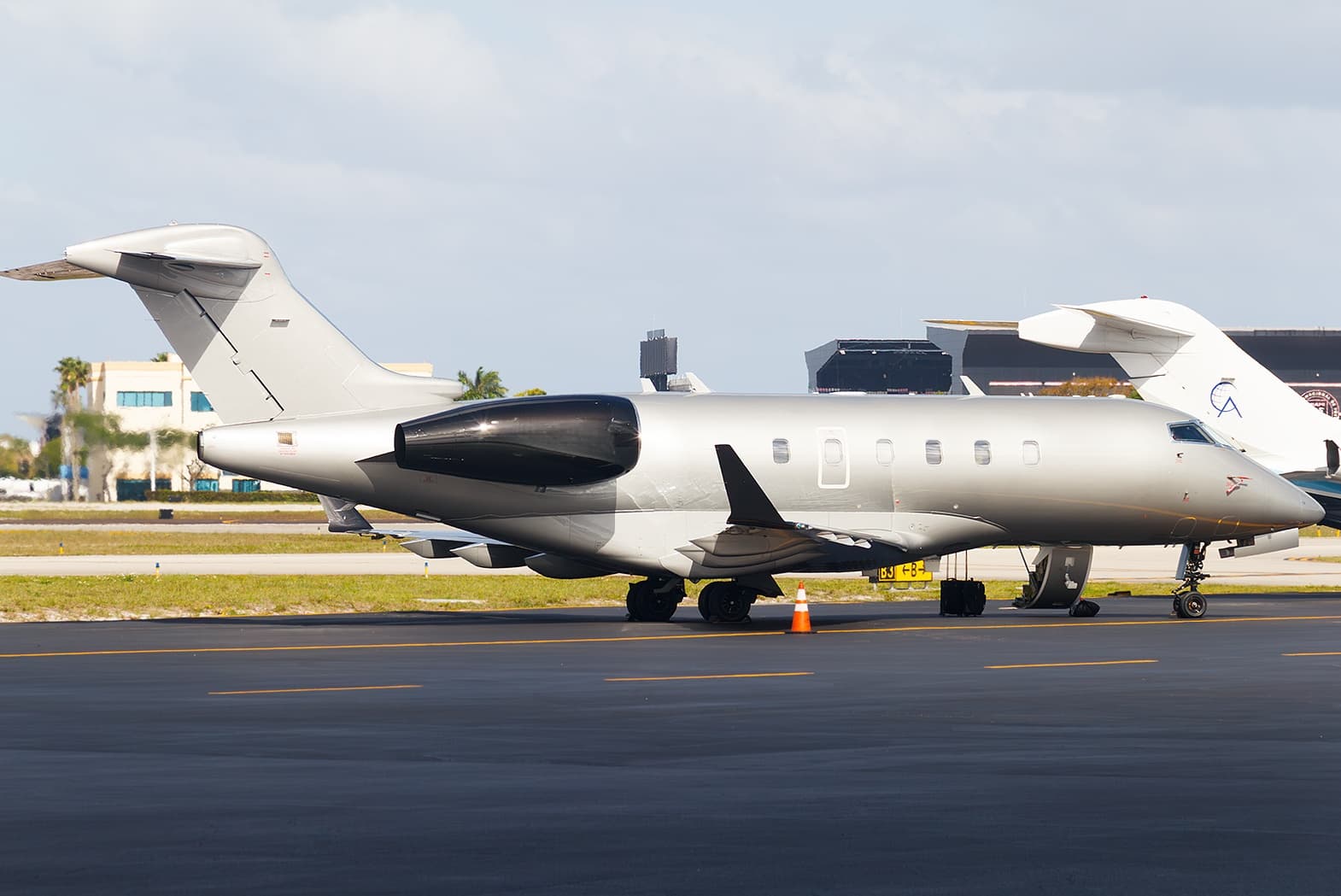 Wed, Nov 4TomorrowMyrtle BeachKMYR · Myrtle Beach International AirportRochesterKROC · Greater Rochester International AirportChallenger 3009—$16,8764NovMyrtle Beach → RochesterKMYR → KROC · TomorrowChallenger 300 · 9 seats$16,876
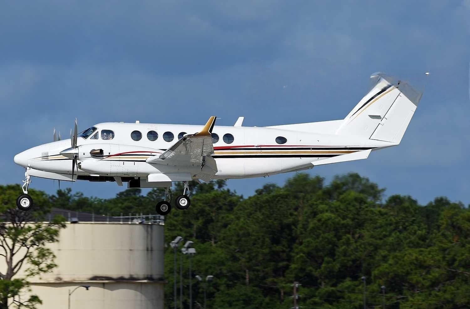 Thu, Nov 5in 2 daysMyrtle BeachKMYR · Myrtle Beach International AirportLondonKLOZ · London Corbin Airport Magee FieldKing Air 3509—$9,8885NovMyrtle Beach → LondonKMYR → KLOZ · in 2 daysKing Air 350 · 9 seats$9,888
- Wed, Feb 3in 92 daysMyrtle BeachKMYR · Myrtle Beach International AirportFort LauderdaleKFLL · Fort Lauderdale Hollywood International AirportCessna CitationJet5—$7,7003FebMyrtle Beach → Fort LauderdaleKMYR → KFLL · in 92 daysCessna CitationJet · 5 seats$7,700
 KMYR · Myrtle Beach International Airport
* Total price incl. 10% service fee, converted to your selected currency. Price subject to operator confirmation.
Empty legs to KMYR
4 arrivals available
- Thu, Nov 523:36SavannahKSAV · Savannah / Hilton Head IntlMyrtle BeachKMYR · Myrtle Beach IntlCessna Citation X8—$2,7315NovSavannah → Myrtle BeachKSAV → KMYR · 23:36Cessna Citation X · 8 seats$2,731
- Sat, Nov 7in 4 daysGainesvilleKGNV · Gainesville Regional AirportMyrtle BeachKMYR · Myrtle Beach International AirportKing Air 3509—$6,5927NovGainesville → Myrtle BeachKGNV → KMYR · in 4 daysKing Air 350 · 9 seats$6,592
- Thu, Nov 1207:39OcalaKOCF · Ocala International Airport - Jim Taylor FieldMyrtle BeachKMYR · Myrtle Beach International AirportBombardier Learjet 607—$14,85012NovOcala → Myrtle BeachKOCF → KMYR · 07:39Bombardier Learjet 60 · 7 seats$14,850
- Wed, Jan 27in 85 daysFort LauderdaleKFLL · Fort Lauderdale Hollywood International AirportMyrtle BeachKMYR · Myrtle Beach International AirportCessna CitationJet5—$7,37027JanFort Lauderdale → Myrtle BeachKFLL → KMYR · in 85 daysCessna CitationJet · 5 seats$7,370
* Total price incl. 10% service fee, converted to your selected currency. Price subject to operator confirmation.
Map: Myrtle Beach Airport
View the location of Myrtle Beach – MYR/KMYR. Zoom in to explore the area around the airport.
About the airport
Myrtle Beach International Airport (MYR/KMYR) is the key private jet gateway for Myrtle Beach. PrivJet gives you instant access to charter flights and empty legs: fast, discreet and globally connected.
KMYR airport FAQ
Are there any restrictions at Myrtle Beach airport (KMYR) today?
There are currently 20 valid NOTAMs for Myrtle Beach (KMYR). According to NOTAM, at least one runway or the aerodrome itself is closed. Affected: Runway: closed; Taxiway: closed; Apron: closed; Obstacle: out of service and 4 more. 1 more NOTAM starts in the coming days. For information only, not for flight planning or operational use. Always rely on an official pre-flight briefing. This list may be incomplete or out of date.
How long are the runways at Myrtle Beach airport (KMYR)?
Myrtle Beach (KMYR) has one runway: runway 18/36 with 2,897 m (9,503 ft), asphalt.
What are the radio frequencies at Myrtle Beach airport (KMYR)?
Frequencies at KMYR: Tower 128.45 MHz, Ground 120.3 MHz and ATIS 123.925 MHz. For information only. Always rely on the published AIP.
What are the airport codes of Myrtle Beach International Airport?
The ICAO code is KMYR and the IATA code is MYR. ICAO codes are used by air traffic control and pilots, e.g. in flight plans; IATA codes appear on tickets and baggage tags.
What is the elevation of KMYR airport?
Myrtle Beach International Airport sits at 25 ft (8 m) above sea level. Local time zone: America/New York.
Can I fly to KMYR by private jet?
Whether a private jet can operate into Myrtle Beach International Airport depends on runway length, opening hours, customs and immigration rules as well as slot and handling availability, among other things. PrivJet checks this with the operating carrier for every request.
Are there empty legs from or to KMYR?
There are currently 3 empty legs departing from and 4 arriving at Myrtle Beach International Airport. Empty legs are repositioning flights at heavily reduced prices; the list is updated several times a day.