Yuma MCAS/Yuma Airport (KNYL / YUM)
Empty legs and charters from Yuma
KNYL airport at a glance
- ICAO code
- KNYL
- IATA code
- YUM
- City
- Yuma
- Region
- Arizona
- Country
- United States
- Elevation
- 213 ft (65 m)
- Time zone
- America/Phoenix (UTC-7)
- Coordinates
- 32.6566° N, 114.6060° W
- Empty legs from
- 3
- Empty legs to
- 2
Weather & airport info KNYL
Current weather
Good visual conditions (VFR)observed 03 Nov, 20:57 UTC- Wind
- 5 kt (9 km/h) from north-northeast (20°)
- Visibility
- 10 km or more
- Clouds
- few clouds at 18,000 ft
- Temperature
- 25 °C (dew point 8 °C)
- Pressure (QNH)
- 1,015 hPa
Original weather report (METAR)
METAR KNYL 032057Z 02005KT 10SM FEW180 25/08 A2997 RMK AO2 SLP145 T02500078 56032
Airport
- Elevation
- 213 ft (65 m)
- Sunrise / Sunset
- 06:57 / 17:46 local time
Runways
| Runway | Length | Surface | Lighted |
|---|---|---|---|
| 03L/21R | 4,054 m (13,300 ft) | concrete | yes |
| 03R/21L | 2,816 m (9,240 ft) | asphalt/concrete | yes |
| 08/26 | 1,873 m (6,146 ft) | asphalt/concrete | yes |
Radio frequencies
- Approach: 124.7
- ATIS: 118.8
- Clearance: 118
- Ground: 121.9
- Tower: 119.3
- UNICOM: 119.3
For information only, not for flight planning. Weather can change quickly; always rely on official reports. Sources: aviationweather.gov (NOAA), OurAirports.
Airport map KNYL
Full screen →Runways white, taxiways yellow with designators, closed taxiways and runways per NOTAM in red.
Closed per NOTAM: RWY 8/26
Official charts (FAA)
Cycle 2611, valid until 0901Z 11/26/26
Airport diagram (FAA)
Airport diagram (1)
Instrument approaches (7)
Departure procedures (1)
Obstacle departure procedures (1)
For information only, not for navigation. Always use current official charts and NOTAMs.
Current NOTAMs for KNYL(19)
NOTAMs (Notices to Air Missions) announce short-term changes at an airport: closed runways or taxiways, unserviceable approach aids, obstacles, airspace restrictions.
- ClosedRunway: closedA0281/26· until 02 Feb, 14:30 UTC
Runway 08/26 closed
Show original text
RWY 08/26 CLSD
A0281/26 NOTAMN
Q) KZLA/QMRLC////000/999/3239N11436W005
A) KNYL
B) 2611020701
C) 2702021430
E) RWY 08/26 CLSD
- ClosedAerodrome control tower: closedA0285/26· from 10 Nov, 14:30 UTC · until 13 Nov, 14:30 UTC
Service: tower closed
Show original text
SVC TWR CLSD
A0285/26 NOTAMN
Q) KZLA/QSTLC////000/999/3239N11436W005
A) KNYL
B) 2611101430
C) 2611131430
E) SVC TWR CLSD
- ClosedOtherM0281/26· from 10 Nov, 14:30 UTC · until 13 Nov, 14:30 UTC
A/D closed to all military flight operations
Show original text
A/D CLSD TO ALL MIL FLT OPS
M0281/26 NOTAMN
Q) ZLA/QXXXX/IV/NBO/A/000/999/3239N11436W005
A) KNYL
B) 2611101430
C) 2611131430
E) A/D CLSD TO ALL MIL FLT OPS
- Out of serviceILS: unserviceableA0286/26· until 25 Nov, 23:59 UTC
NYL navigation: ILS (instrument landing system) runway 21R out of service
Show original text
NYL NAV ILS RWY 21R U/S
A0286/26 NOTAMN
Q) KZLA/QICAS////000/999/3239N11436W005
A) KNYL
B) 2611031922
C) 2611252359
E) NYL NAV ILS RWY 21R U/S
- Out of serviceILS: unserviceableA0284/26· until 14 Nov, 06:00 UTC
The Instrument Landing System (ILS) for runway 21R is out of service. The ILS guides aircraft to the runway in poor visibility.
Show original text
NYL NAV ILS RWY 21R U/S
A0284/26 NOTAMN
Q) KZLA/QICAS////000/999/3239N11436W005
A) KNYL
B) 2611021930
C) 2611140600
E) NYL NAV ILS RWY 21R U/S
- ClosedOtherM0279/26· until 02 Jan, 14:30 UTC
Taxiway N is closed.
Show original text
TWY N CLSD.
M0279/26 NOTAMN
Q) ZLA/QXXXX/IV/NBO/A/000/999/3239N11436W005
A) KNYL
B) 2611021844
C) 2701021430
E) TWY N CLSD.
- Out of serviceObstacle10/025· until 15 Nov, 09:58 UTC
A tower light southwest of the airport is out of service. The obstacle's top is 280.8 feet above sea level, 107.9 feet above ground.
Show original text
OBST TOWER LGT (ASR 1269979) 323551.70N1144005.40W (4.6NM SW NYL) 280.8FT (107.9FT AGL) U/S
- Out of serviceObstacle10/023· until 13 Nov, 20:15 UTC
A tower obstacle light (ASR 1215886) 5.7 nautical miles east of the airport is out of service. Its top is 411.7 feet above sea level, 198.8 feet above ground.
Show original text
OBST TOWER LGT (ASR 1215886) 324020.50N1142945.40W (5.7NM E NYL) 411.7FT (198.8FT AGL) U/S
11 more NOTAMs
- Out of serviceObstacle lights: unserviceableA0276/26· until 11 Dec, 17:45 UTC
The lighting on a tower obstacle 4.5 nautical miles northwest of the airport is out of service. Its top is 442 feet above sea level, 315 feet above ground.
Show original text
TOWER LGT (ASR 1003621) 324326.30N1143837.30W (4.5NM NW NYL) 442FT (315FT AGL) U/S
A0276/26 NOTAMN
Q) KZLA/QOLAS/IV/M/E/000/999/3243N11438W001
A) KNYL
B) 2610271145
C) 2612111745
E) TOWER LGT (ASR 1003621) 324326.30N1143837.30W (4.5NM NW NYL) 442FT (315FT AGL) U/S
- Out of serviceObstacle10/017· until 09 Nov, 03:40 UTC
Obstacle light on tower (ASR 1236358) (5.2 NM north-northwest of NYL) 324.8 ft above sea level (190.9 ft above ground) out of service
Show original text
OBST TOWER LGT (ASR 1236358) 324416.70N1143817.20W (5.2NM NNW NYL) 324.8FT (190.9FT AGL) U/S
- Out of serviceObstacle lights: unserviceableA0271/26· until 30 Nov, 18:31 UTC
An obstacle tower light 4.4 nautical miles northwest of the airport is out of service. Its top is 442 ft above sea level, 315 ft above ground.
Show original text
TOWER LGT (ASR 1003620) 324322.50N1143837.30W (4.4NM NW NYL) 442FT (315FT AGL) U/S
A0271/26 NOTAMN
Q) KZLA/QOLAS/IV/M/E/000/999/3243N11438W001
A) KNYL
B) 2610161831
C) 2611301831
E) TOWER LGT (ASR 1003620) 324322.50N1143837.30W (4.4NM NW NYL) 442FT (315FT AGL) U/S
- Out of serviceRunway end identifier lights: unserviceableA0267/26· until 11 Nov, 06:00 UTC
The runway end identification lights for runway 21L at Yuma MCAS/Yuma International Airport are out of service. These lights mark the end of the runway.
Show original text
RWY 21L RWY END ID LGT U/S
A0267/26 NOTAMN
Q) KZLA/QLIAS////000/999/3239N11436W005
A) KNYL
B) 2610110308
C) 2611110600
E) RWY 21L RWY END ID LGT U/S
- NoticeOtherM0280/26· from 09 Nov, 17:00 UTC · until 09 Nov, 17:45 UTC
QUIET hours in EFF. all ARR STR-in FSL only. military DEP, OVERHEAD or PRACTICE approach, ENG STARTS, AUX PWR UNITS, INTEGRATED PWR PACKS, F-35B VERT LDG UNAUTHD.MALS-13 RETIREMENT CEREMONY at hangar 109.
Show original text
QUIET HR IN EFF. ALL ARR STR-IN FSL ONLY. MIL DEP, OVERHEAD OR PRACTICE APCH, ENG STARTS, AUX PWR UNITS, INTEGRATED PWR PACKS, F-35B VERT LDG UNAUTHD.MALS-13 RETIREMENT CEREMONY AT HANGAR 109.
M0280/26 NOTAMN
Q) ZLA/QXXXX/IV/NBO/A/000/999/3239N11436W005
A) KNYL
B) 2611091700
C) 2611091745
E) QUIET HR IN EFF. ALL ARR STR-IN FSL ONLY. MIL DEP, OVERHEAD OR PRACTICE APCH, ENG STARTS, AUX PWR UNITS, INTEGRATED PWR PACKS, F-35B VERT LDG UNAUTHD.MALS-13 RETIREMENT CEREMONY AT HANGAR 109.
- NoticeAirspace11/001· from 07 Nov, 02:50 UTC · until 07 Nov, 04:30 UTC
A pyrotechnic demonstration is taking place within a 0.5 nautical mile radius, 1.6 nautical miles northwest of the airport. It extends from the surface up to 300 feet above ground.
Show original text
AIRSPACE PYROTECHNIC DEMONSTRATION WI AN AREA DEFINED AS .5NM RADIUS OF 324032N1143833W (1.6NM NW NYL) SFC-300FT AGL
- NoticeOtherM0271/26· from 05 Nov, 17:00 UTC · until 05 Nov, 18:00 UTC
Quiet hours are in effect at Yuma Airport. All arrivals must be straight-in full stop landings only. Military departures, overhead or practice approaches, engine starts, auxiliary power units, integrated power packs, and F-35B vertical landings are unauthorized.
Show original text
QUIET HR IN EFF. ALL ARR STR-IN FSL ONLY. MIL DEP, OVERHEAD OR PRACTICE APCH, ENG STARTS, AUX PWR UNITS, INTERGRATED PWR PACKS, F-35B VERT LDG UNAUTHD. CAKE CUTTING CEREMONY AT PARADE DECK.
M0271/26 NOTAMN
Q) ZLA/QXXXX/IV/NBO/A/000/999/3239N11436W005
A) KNYL
B) 2611051700
C) 2611051800
E) QUIET HR IN EFF. ALL ARR STR-IN FSL ONLY. MIL DEP, OVERHEAD OR PRACTICE APCH, ENG STARTS, AUX PWR UNITS, INTERGRATED PWR PACKS, F-35B VERT LDG UNAUTHD. CAKE CUTTING CEREMONY AT PARADE DECK.
- NoticeOtherM0282/26· from 05 Nov, 15:00 UTC · until 07 Nov, 00:01 UTC
Drones (UAS) OPERATIONS are SCHEDULED for 5-6 OCTOBER 2026 from 1500-0000Z DAILY. OPERATING ALTITUDE is restricted to at or BELOW 400 ft above ground
Show original text
UAS OPERATIONS ARE SCHEDULED FOR 5-6 OCTOBER 2026 FROM 1500-0000Z DAILY. OPERATING ALTITUDE IS RESTRICTED TO AT OR BELOW 400 FT AGL
M0282/26 NOTAMN
Q) ZLA/QXXXX/IV/NBO/A/000/999/3239N11436W005
A) KNYL
B) 2611051500
C) 2611070001
E) UAS OPERATIONS ARE SCHEDULED FOR 5-6 OCTOBER 2026 FROM 1500-0000Z DAILY. OPERATING ALTITUDE IS RESTRICTED TO AT OR BELOW 400 FT AGL
- NoticeTaxiway: work in progress10/021· from 03 Nov, 23:00 UTC · until 04 Nov, 06:00 UTC
Taxiway C between FIXED WINGED HOTPIT and ROTARY WING HOTPIT work in progress MEN and equipment adjacent to
Show original text
TWY C BTN FIXED WINGED HOTPIT AND ROTARY WING HOTPIT WIP MEN AND EQPT ADJ
A0278/26 NOTAMN
Q) KZLA/QMXHW////000/999/3239N11436W005
A) KNYL
B) 2611032300
C) 2611040600
E) TWY C BTN FIXED WINGED HOTPIT AND ROTARY WING HOTPIT WIP MEN AND EQPT ADJ
- NoticeTaxiway: work in progressA0278/26· from 03 Nov, 23:00 UTC · until 04 Nov, 06:00 UTC
Work in progress (WIP) is occurring on Taxiway C between the fixed-wing hotpit and the rotary-wing hotpit, with men and equipment adjacent.
Show original text
TWY C BTN FIXED WINGED HOTPIT AND ROTARY WING HOTPIT WIP MEN AND EQPT ADJ
A0278/26 NOTAMN Q) KZLA/QMXHW////000/999/3239N11436W005 A) KNYL B) 2611032300 C) 2611040600 E) TWY C BTN FIXED WINGED HOTPIT AND ROTARY WING HOTPIT WIP MEN AND EQPT ADJ
- NoticeOtherM0261/26· until 04 Nov, 14:00 UTC
There is a cautionary hole on taxiway B, measuring 18 inches by 7 inches and 3 inches deep.
Show original text
CAUTIONARY HOLE TWY B: 18IN X 7IN X 3IN DEEP
M0261/26 NOTAMN
Q) ZLA/QXXXX/IV/NBO/A/000/999/3239N11436W005
A) KNYL
B) 2610270227
C) 2611041400
E) CAUTIONARY HOLE TWY B: 18IN X 7IN X 3IN DEEP
For information only, not for flight planning or operational use. Always rely on an official pre-flight briefing. This list may be incomplete or out of date. Explanations and expanded abbreviations are generated automatically. The original text is authoritative. Source: FAA NOTAM Management Service (SWIM).
Charter operators based here
Operators with a base at this airport.
- PHI Air MedicalRedding Municipal (KRDD) · Turboprop
Empty legs from KNYL
3 departures available
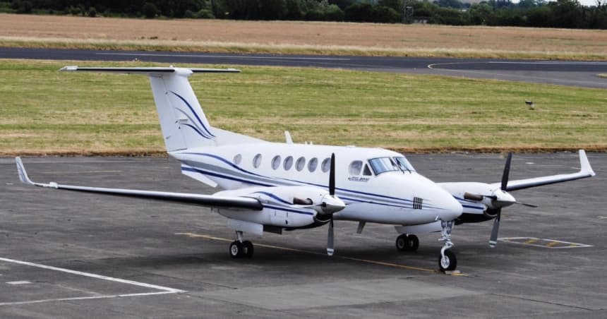 Tue, Nov 3TodayYumaKNYL · Yuma MCAS/Yuma International AirportCamarilloKCMA · Camarillo AirportKing Air 2008—On request3NovYuma → CamarilloKNYL → KCMA · TodayKing Air 200 · 8 seatsOn request
- Wed, Nov 415:30YumaKNYL · Yuma International Airport / Marine Corps Air Station YumaLake Havasu CityKHII · Lake Havasu City International AirportBeechcraft King Air 2008—$4,0704NovYuma → Lake Havasu CityKNYL → KHII · 15:30Beechcraft King Air 200 · 8 seats$4,070
 Fri, Nov 6in 3 daysYumaKNYL · Yuma MCAS/Yuma International AirportMontereyKMRY · Monterey Peninsula AirportCitation CJ2+5—On request6NovYuma → MontereyKNYL → KMRY · in 3 daysCitation CJ2+ · 5 seatsOn request
 KNYL · Yuma MCAS/Yuma International Airport
* Total price incl. 10% service fee, converted to your selected currency. Price subject to operator confirmation.
Empty legs to KNYL
2 arrivals available
- Wed, Nov 412:00Cabo San LucasMMSL · Cabo San Lucas International AirportYumaKNYL · Yuma International Airport / Marine Corps Air Station YumaBeechcraft King Air 2008—$8,0304NovCabo San Lucas → YumaMMSL → KNYL · 12:00Beechcraft King Air 200 · 8 seats$8,030
- Thu, Nov 510:00MesaKIWA · Mesa Gateway AirportYumaKNYL · Yuma International Airport / Marine Corps Air Station YumaPilatus PC-12 NG8—$2,3105NovMesa → YumaKIWA → KNYL · 10:00Pilatus PC-12 NG · 8 seats$2,310
 MMSL · Cabo San Lucas International Airport
* Total price incl. 10% service fee, converted to your selected currency. Price subject to operator confirmation.
Map: Yuma Airport
View the location of Yuma – YUM/KNYL. Zoom in to explore the area around the airport.
About the airport
Yuma MCAS/Yuma International Airport (YUM/KNYL) is the key private jet gateway for Yuma. PrivJet gives you instant access to charter flights and empty legs: fast, discreet and globally connected.
KNYL airport FAQ
Are there any restrictions at Yuma airport (KNYL) today?
There are currently 11 valid NOTAMs for Yuma (KNYL). According to NOTAM, at least one runway or the aerodrome itself is closed. Affected: Runway: closed; Other: closed; ILS: unserviceable; Obstacle: out of service and 2 more. 8 more NOTAMs start in the coming days. For information only, not for flight planning or operational use. Always rely on an official pre-flight briefing. This list may be incomplete or out of date.
What is the weather at Yuma airport (KNYL)?
According to the latest weather report for KNYL (METAR, 03 Nov, 20:57 UTC): Good visual conditions (VFR). Wind 5 kt (9 km/h) from north-northeast (20°), visibility 10 km or more, temperature 25 °C (dew point 8 °C). For information only, not for flight planning. Weather can change quickly; always rely on official reports.
How long are the runways at Yuma airport (KNYL)?
Yuma (KNYL) has 3 runways: runway 03L/21R with 4,054 m (13,300 ft), concrete, runway 03R/21L with 2,816 m (9,240 ft), asphalt/concrete and runway 08/26 with 1,873 m (6,146 ft), asphalt/concrete. The longest is 4,054 m.
What are the radio frequencies at Yuma airport (KNYL)?
Frequencies at KNYL: Tower 119.3 MHz, Ground 121.9 MHz and ATIS 118.8 MHz. For information only. Always rely on the published AIP.
What are the airport codes of Yuma MCAS/Yuma International Airport?
The ICAO code is KNYL and the IATA code is YUM. ICAO codes are used by air traffic control and pilots, e.g. in flight plans; IATA codes appear on tickets and baggage tags.
What is the elevation of KNYL airport?
Yuma MCAS/Yuma International Airport sits at 213 ft (65 m) above sea level. Local time zone: America/Phoenix.
Can I fly to KNYL by private jet?
Whether a private jet can operate into Yuma MCAS/Yuma International Airport depends on runway length, opening hours, customs and immigration rules as well as slot and handling availability, among other things. PrivJet checks this with the operating carrier for every request.
Are there empty legs from or to KNYL?
There are currently 3 empty legs departing from and 2 arriving at Yuma MCAS/Yuma International Airport. Empty legs are repositioning flights at heavily reduced prices; the list is updated several times a day.