Everett Snohomish County (Paine Field) Airport (KPAE / PAE)
Empty legs and charters from Everett
KPAE airport at a glance
- ICAO code
- KPAE
- IATA code
- PAE
- City
- Everett
- Region
- Washington
- Country
- United States
- Elevation
- 606 ft (185 m)
- Time zone
- America/Los Angeles (UTC-8)
- Coordinates
- 47.9063° N, 122.2820° W
- Empty legs from
- 8
- Empty legs to
- 13
Weather & airport info KPAE
Current weather
Good visual conditions (VFR)observed 03 Nov, 09:53 UTC- Wind
- 5 kt (9 km/h) from variable directions
- Visibility
- 10 km or more
- Clouds
- no significant clouds
- Temperature
- 9 °C (dew point 3 °C)
- Pressure (QNH)
- 1,019 hPa
Original weather report (METAR)
METAR KPAE 030953Z AUTO VRB05KT 10SM CLR 09/03 A3010 RMK AO2 SLP194 T00890028
Forecast (TAF)
- 03 Nov, 06:00–11:00 UTC3 kt (6 km/h) from north (10°) · visibility 10 km or more · Showers in the vicinity · overcast at 9,000 ft
- 03 Nov, 11:00–15:00 UTCfrom5 kt (9 km/h) from east-northeast (70°) · visibility 10 km or more · overcast at 7,000 ft
- 03 Nov, 15:00–19:00 UTCfrom3 kt (6 km/h) from east-southeast (110°) · visibility 10 km or more · Mist · overcast at 10,000 ft
- 03 Nov, 19:00–00:00 UTCfrom3 kt (6 km/h) from north-northwest (330°) · visibility 10 km or more · overcast at 10,000 ft
- 04 Nov, 00:00–06:00 UTCfrom4 kt (7 km/h) from northwest (310°) · visibility 10 km or more · broken clouds at 25,000 ft
Original forecast (TAF)
TAF KPAE 030520Z 0306/0406 01003KT P6SM VCSH OVC090 FM031100 07005KT P6SM OVC070 FM031500 11003KT 6SM BR OVC100 FM031900 33003KT P6SM OVC100 FM040000 31004KT P6SM BKN250
Airport
- Elevation
- 606 ft (185 m)
- Sunrise / Sunset
- 06:56 / 16:48 local time
Runways
| Runway | Length | Surface | Lighted |
|---|---|---|---|
| 16R/34L | 2,746 m (9,010 ft) | asphalt | yes |
| 16L/34R | 916 m (3,004 ft) | asphalt | yes |
Radio frequencies
- ATIS: 128.65
- Clearance: 126.75
- CTAF: 132.95
- Ground: 121.8
- Tower: 120.2
- Tower: 132.95
- UNICOM: 122.95
For information only, not for flight planning. Weather can change quickly; always rely on official reports. Sources: aviationweather.gov (NOAA), OurAirports.
Airport map KPAE
Full screen →Runways white, taxiways yellow with designators, closed taxiways and runways per NOTAM in red.
Closed per NOTAM: RWY 16R/34L, TWY AA, TWY A* (* partly closed)
Official charts (FAA)
Cycle 2611, valid until 0901Z 11/26/26
Airport diagram (FAA)
Airport diagram (1)
Instrument approaches (7)
Departure procedures (1)
Hot spots (1)
For information only, not for navigation. Always use current official charts and NOTAMs.
Current NOTAMs for KPAE(19)
NOTAMs (Notices to Air Missions) announce short-term changes at an airport: closed runways or taxiways, unserviceable approach aids, obstacles, airspace restrictions.
- ClosedRunway: closedA1144/26· from 04 Nov, 07:59 UTC · until 05 Nov, 15:00 UTC
Runway 16R/34L at Seattle Paine Field International Airport is closed.
Show original text
RWY 16R/34L CLSD
A1144/26 NOTAMN
Q) KZSE/QMRLC////000/999/4754N12216W005
A) KPAE
B) 2611040759
C) 2611051500
D) DLY 0759-1500
E) RWY 16R/34L CLSD
Hours: DLY 0759-1500
- ClosedRunway: closedA1143/26· until 03 Nov, 15:00 UTC
Runway 16R/34L is closed. This may affect flight operations at the airport.
Show original text
RWY 16R/34L CLSD
A1143/26 NOTAMN
Q) KZSE/QMRLC////000/999/4754N12216W005
A) KPAE
B) 2611030810
C) 2611031500
E) RWY 16R/34L CLSD
- Out of serviceServices11/017· from 10 Nov, 07:00 UTC · until 10 Nov, 12:00 UTC
The remote communication outlet 121.5 is out of service.
Show original text
COM REMOTE COM OUTLET 121.5 U/S
- Out of serviceServices11/008· from 04 Nov, 05:00 UTC · until 04 Nov, 13:55 UTC
The Automatic Terminal Information Service (ATIS) on frequency 128.65 is out of service. This service provides pilots with essential airport information.
Show original text
SVC ATIS 128.65 U/S
- Out of serviceStandard instrument departure: not available4520/26· from 03 Nov, 16:00 UTC · until 03 Nov, 23:59 UTC (estimated)
The departure procedure is not available, except for aircraft equipped with a suitable RNAV system with GPS, because the PAE VOR/DME is out of service.
Show original text
ODP SEATTLE PAINE FLD INTL, EVERETT, WA. TAKEOFF MINIMUMS AND (OBSTACLE) DEPARTURE PROCEDURES AMDT 3... DEPARTURE PROCEDURE NA EXCEPT FOR ACFT EQUIPPED WITH SUITABLE RNAV SYSTEM WITH GPS, PAE VOR/DME OUT OF SERVICE. 2611031600-2611032359EST
Q) KZSE/QPDAU/I/NBO/A/000/999/4754N12216W005
A) KPAE
B) 2609230357
C) 2705050357EST
E) PAE SEATTLE PAINE FLD INTL, EVERETT, WA.
TAKEOFF MINIMUMS AND (OBSTACLE) DEPARTURE PROCEDURES AMDT 3...
DEPARTURE PROCEDURE NA EXCEPT FOR ACFT EQUIPPED WITH SUITABLE RNAV SYSTEM WITH GPS,
PAE VOR/DME U/S.
- Out of serviceStandard instrument departure: operational4521/26· from 03 Nov, 16:00 UTC · until 03 Nov, 23:59 UTC (estimated)
The lost communications procedure for the standard departure route (SID) PAINE SIX DEPARTURE is not available, except for aircraft equipped with a suitable RNAV system with GPS, because the PAE VOR/DME is out of service.
Show original text
SID SEATTLE PAINE FLD INTL, EVERETT, WA. PAINE SIX DEPARTURE... LOST COMMUNICATIONS PROCEDURE NA EXCEPT FOR AIRCRAFT EQUIPPED WITH SUITABLE RNAV SYSTEM WITH GPS, PAE VOR/DME OUT OF SERVICE. 2611031600-2611032359EST
Q) KZSE/QPDAO/I/NBO/A/000/999/4754N12216W005
A) KPAE
B) 2609230357
C) 2705050357EST
E) PAE SEATTLE PAINE FLD INTL, EVERETT, WA.
PAINE SIX DEPARTURE...
LOST COMMUNICATIONS PROCEDURE NA EXCEPT FOR AIRCRAFT EQUIPPED WITH SUITABLE RNAV SYSTEM WITH GPS,
PAE VOR/DME U/S.
- Out of serviceInstrument approach procedure4524/26· from 03 Nov, 16:00 UTC · until 03 Nov, 23:59 UTC (estimated)
The instrument approach procedures ILS Y or LOC Y RWY 16R, ILS Z or LOC Z RWY 16R, and ILS Z RWY 16R (SA CAT II) are not available, except for aircraft equipped with a suitable RNAV system with GPS, because the PAE VOR/DME is out of service.
Show original text
IAP SEATTLE PAINE FLD INTL, EVERETT, WA. ILS Y OR LOC Y RWY 16R, AMDT 23... ILS Z OR LOC Z RWY 16R, AMDT 1A... ILS Z RWY 16R (SA CAT II), AMDT 1A... PROCEDURE NA EXCEPT FOR ACFT EQUIPPED WITH SUITABLE RNAV SYSTEM WITH GPS, PAE VOR/DME OUT OF SERVICE. 2611031600-2611032359EST
Q) KZSE/QPIXX/I/NBO/A/000/999/4754N12216W005
A) KPAE
B) 2609230358
C) 2705050358EST
E) PAE SEATTLE PAINE FLD INTL, EVERETT, WA.
ILS Y OR LOC Y RWY 16R, AMDT 23...
ILS Z OR LOC Z RWY 16R, AMDT 1A...
ILS Z RWY 16R (SA CAT II), AMDT 1A...
PROCEDURE NA EXCEPT FOR ACFT EQUIPPED WITH SUITABLE RNAV SYSTEM WITH GPS,
PAE VOR/DME U/S.
- Out of serviceVOR/DME: unserviceableA1130/26· from 03 Nov, 16:00 UTC · until 03 Nov, 23:59 UTC
The VOR/DME navigation system at Seattle Paine Field International airport is out of service. This system helps aircraft with navigation.
Show original text
PAE NAV VOR/DME U/S
A1130/26 NOTAMN
Q) KZSE/QNMAS////000/999/4754N12216W005
A) KPAE
B) 2611031600
C) 2611032359
E) PAE NAV VOR/DME U/S
11 more NOTAMs
- Out of serviceObstacle clearance altitude: changedA1136/26· from 03 Nov, 16:00 UTC · until 03 Nov, 23:59 UTC
The departure procedure is not available, except for aircraft equipped with a suitable RNAV system with GPS, because the PAE VOR/DME is out of service.
Show original text
ODP SEATTLE PAINE FLD INTL, EVERETT, WA. TAKEOFF MINIMUMS AND (OBSTACLE) DEPARTURE PROCEDURES AMDT 3... DEPARTURE PROCEDURE NA EXCEPT FOR ACFT EQUIPPED WITH SUITABLE RNAV SYSTEM WITH GPS, PAE VOR/DME OUT OF SERVICE.
A1136/26 NOTAMN
Q) KZSE/QPOCH/I/NBO/A/000/999/4754N12216W005
A) KPAE
B) 2611031600
C) 2611032359
E) ODP SEATTLE PAINE FLD INTL, EVERETT, WA. TAKEOFF MINIMUMS AND (OBSTACLE) DEPARTURE PROCEDURES AMDT 3... DEPARTURE PROCEDURE NA EXCEPT FOR ACFT EQUIPPED WITH SUITABLE RNAV SYSTEM WITH GPS, PAE VOR/DME OUT OF SERVICE.
- Out of serviceStandard instrument departure: changedA1137/26· from 03 Nov, 16:00 UTC · until 03 Nov, 23:59 UTC
The lost communications procedure for the PAINE SIX DEPARTURE Standard Instrument Departure (SID) is not available, except for aircraft equipped with a suitable RNAV system with GPS, because the PAE VOR/DME is out of service.
Show original text
SID SEATTLE PAINE FLD INTL, EVERETT, WA. PAINE SIX DEPARTURE... LOST COMMUNICATIONS PROCEDURE NA EXCEPT FOR AIRCRAFT EQUIPPED WITH SUITABLE RNAV SYSTEM WITH GPS, PAE VOR/DME OUT OF SERVICE.
A1137/26 NOTAMN
Q) KZSE/QPDCH/I/NBO/A/000/999/4754N12216W005
A) KPAE
B) 2611031600
C) 2611032359
E) SID SEATTLE PAINE FLD INTL, EVERETT, WA. PAINE SIX DEPARTURE... LOST COMMUNICATIONS PROCEDURE NA EXCEPT FOR AIRCRAFT EQUIPPED WITH SUITABLE RNAV SYSTEM WITH GPS, PAE VOR/DME OUT OF SERVICE.
- Out of serviceInstrument approach procedure: changedA1138/26· from 03 Nov, 16:00 UTC · until 03 Nov, 23:59 UTC
The instrument approach procedures (IAP) ILS Y or LOC Y runway 16R, ILS Z or LOC Z runway 16R, and ILS Z runway 16R (SA CAT II) are not available, except for aircraft equipped with a suitable RNAV system with GPS, because the PAE VOR/DME is out of service.
Show original text
IAP SEATTLE PAINE FLD INTL, EVERETT, WA. ILS Y OR LOC Y RWY 16R, AMDT 23... ILS Z OR LOC Z RWY 16R, AMDT 1A... ILS Z RWY 16R (SA CAT II), AMDT 1A... PROCEDURE NA EXCEPT FOR ACFT EQUIPPED WITH SUITABLE RNAV SYSTEM WITH GPS, PAE VOR/DME OUT OF SERVICE.
A1138/26 NOTAMN
Q) KZSE/QPICH/I/NBO/A/000/999/4754N12216W005
A) KPAE
B) 2611031600
C) 2611032359
E) IAP SEATTLE PAINE FLD INTL, EVERETT, WA. ILS Y OR LOC Y RWY 16R, AMDT 23... ILS Z OR LOC Z RWY 16R, AMDT 1A... ILS Z RWY 16R (SA CAT II), AMDT 1A... PROCEDURE NA EXCEPT FOR ACFT EQUIPPED WITH SUITABLE RNAV SYSTEM WITH GPS, PAE VOR/DME OUT OF SERVICE.
- ClosedTaxiway: closedA1145/26· until 03 Nov, 15:00 UTC
Taxiway AA is closed. This means aircraft cannot use this part of the airport.
Show original text
TWY AA CLSD
A1145/26 NOTAMN
Q) KZSE/QMXLC////000/999/4754N12216W005
A) KPAE
B) 2611030720
C) 2611031500
E) TWY AA CLSD
- ClosedTaxiway: closedA1147/26· until 03 Nov, 15:00 UTC
Taxiway A between taxiway AA and taxiway A1 is closed. This means aircraft cannot use this part of the airport.
Show original text
TWY A BTN TWY AA AND TWY A1 CLSD
A1147/26 NOTAMN
Q) KZSE/QMXLC////000/999/4754N12216W005
A) KPAE
B) 2611030720
C) 2611031500
E) TWY A BTN TWY AA AND TWY A1 CLSD
- Out of serviceTaxiway11/011· until 05 Nov, 15:00 UTC
The holding position sign lighting in the approach area of taxiway AA is out of service.
Show original text
TWY AA APCH AREA HLDG PSN SIGN LGT U/S
- Out of serviceObstacle10/036· until 30 Nov, 23:59 UTC
An obstacle, a tower, whose light is out of service, is located 2.6 nautical miles south of Seattle Paine Field airport. Its top is 804.8 feet above sea level, 174.9 feet above ground.
Show original text
OBST TOWER LGT (ASR 1228601) 475141.30N1221701.40W (2.6NM S PAE) 804.8FT (174.9FT AGL) U/S
- NoticeAirspace11/007· from 03 Nov, 17:00 UTC · until 04 Nov, 01:00 UTC
An unmanned aircraft system (drone) is present within a 1 nautical mile radius, 5.1 nautical miles east-southeast of S60, from the surface up to 400 feet above ground.
Show original text
AIRSPACE UAS WI AN AREA DEFINED AS 1NM RADIUS OF 474238.50N1220911.20W (5.1NM ESE S60) SFC-400FT AGL
- NoticeRunwayA1128/26· until 03 Nov, 15:00 UTC
Runway 16L/34R is open.
Show original text
RWY 16L/34R OPN
A1128/26 NOTAMN
Q) KZSE/QMRXX////000/999/4754N12216W005
A) KPAE
B) 2611030759
C) 2611031500
E) RWY 16L/34R OPN
- NoticeRunway centre line lightsA1141/26· until 05 Nov, 15:00 UTC
The runway centerline lighting (RCLL) for runway 16R/34L is not standard.
Show original text
RWY 16R/34L RCLL NOT STD
A1141/26 NOTAMN
Q) KZSE/QLCXX////000/999/4754N12216W005
A) KPAE
B) 2611022248
C) 2611051500
E) RWY 16R/34L RCLL NOT STD
- NoticeAirspace10/041· until 18 Dec, 23:59 UTC
An area of airspace near Seattle Paine Field airport is reserved for unmanned aircraft systems (UAS). This area extends from the surface up to 400 feet above ground.
Show original text
AIRSPACE UAS WI AN AREA DEFINED AS 480202N1221120W (7.7NM S AWO) TO 480115N1221330W (7.3NM N PAE) TO 475945N1221421W (5.7NM N PAE) TO 475939N1221250W (6.0NM N PAE) TO 475917N1221250W (5.7NM NNE PAE) TO 475755N1221458W (3.8NM N PAE) TO 475518N1221509W (1.5NM NNE PAE) TO 475320N1221510W (1.5NM ESE PAE) TO 475254N1221417W (2.2NM ESE PAE) TO 475214N1221250W (3.4NM ESE PAE) TO 475332N1221105W (3.4NM WSW S43) TO 475509N1221049W (3.2NM W S43) TO 475700N1221015W (3.9NM WNW S43) TO 480122N1221022W (7.6NM NW S43) TO POINT OF ORIGIN SFC-400FT AGL
For information only, not for flight planning or operational use. Always rely on an official pre-flight briefing. This list may be incomplete or out of date. Explanations and expanded abbreviations are generated automatically. The original text is authoritative. Source: FAA NOTAM Management Service (SWIM).
Private jet traffic in Snohomish County (Paine Field) Airport (last 30 days)
- Arrivals
- 165
- Departures
- 140
- Different jets
- 82
Most frequent origins: Boeing Field King County International Airport (26), Metropolitan Oakland International Airport (5), Bellingham International Airport (5), Portland International Airport (4), Renton Municipal Airport (4).
Most frequent destinations: Boeing Field King County International Airport (17), Portland International Airport (5), Metropolitan Oakland International Airport (4), Southwest Oregon Regional Airport (3), Bremerton National Airport (3).
Most common aircraft types: Pilatus PC-12 (53), Cessna Citation Excel/XLS (25), Piper M500/M600 (23), Gulfstream G200 (20), Daher TBM 700 (16).
Sunday is the busiest day.
Our own analysis of public ADS-B signals from business jets. Not every flight is received, and jets with a removal request are excluded.
Charter operators based here
Operators with a base at this airport.
- Kenmore AirTurboprop
- Eleven AviationSuper midsize jet
- Lynk AirTurboprop
Empty legs from KPAE
8 departures available
- Fri, Nov 606:22EverettKPAE · Seattle Paine Field International AirportCoeur d'AleneKCOE · Coeur D'Alene Airport - Pappy Boyington FieldCessna Citation Excel8—$9,4606NovEverett → Coeur d'AleneKPAE → KCOE · 06:22Cessna Citation Excel · 8 seats$9,460
- Sun, Nov 1512:00EverettKPAE · Seattle Paine Field International AirportLas VegasKHND · Henderson Executive AirportGulfstream G2009—$29,37015NovEverett → Las VegasKPAE → KHND · 12:00Gulfstream G200 · 9 seats$29,370
 Mon, Nov 23in 20 daysEverettKPAE · Snohomish County (Paine Field) AirportCamarilloKCMA · Camarillo AirportLearjet 608—On request23NovEverett → CamarilloKPAE → KCMA · in 20 daysLearjet 60 · 8 seatsOn request
- Tue, Nov 24in 21 daysEverettKPAE · Snohomish County (Paine Field) AirportWalla WallaKALW · Walla Walla Regional AirportPilatus PC-12 NG61h 6mOn request24NovEverett → Walla WallaKPAE → KALW · in 21 daysPilatus PC-12 NG · 6 seats · 1h 6mOn request
- Wed, Nov 25in 22 daysEverettKPAE · Snohomish County (Paine Field) AirportVancouverKVUO · Pearson FieldPilatus PC-12 NG——On request25NovEverett → VancouverKPAE → KVUO · in 22 daysPilatus PC-12 NGOn request
- Mon, Dec 7in 34 daysEverettKPAE · Snohomish County (Paine Field) AirportBandonKS05 · Bandon State AirportPilatus PC-12 NG——On request7DecEverett → BandonKPAE → KS05 · in 34 daysPilatus PC-12 NGOn request
- Thu, Dec 31in 58 daysEverettKPAE · Snohomish County (Paine Field) AirportComoxCYQQ · Comox AirportPilatus PC-12 NG——On request31DecEverett → ComoxKPAE → CYQQ · in 58 daysPilatus PC-12 NGOn request
 Sun, Feb 2118:25EverettKPAE · Snohomish County (Paine Field) AirportLas VegasKLAS · Harry Reid International AirportGulfstream G55011h 54mOn request21FebEverett → Las VegasKPAE → KLAS · 18:25Gulfstream G550 · 1 seat · 1h 54mOn request
 KPAE · Seattle Paine Field International Airport
 CYQQ · Comox Airport
* Total price incl. 10% service fee, converted to your selected currency. Price subject to operator confirmation.
Empty legs to KPAE
13 arrivals available
- Tue, Nov 3TodayEugeneKEUG · Mahlon Sweet FieldEverettKPAE · Snohomish County (Paine Field) AirportPiper/Michmerhuizen P J Piper PA-31-3506—$6,0573NovEugene → EverettKEUG → KPAE · TodayPiper/Michmerhuizen P J Piper PA-31-350 · 6 seats$6,057
 Tue, Nov 10in 7 daysLas VegasKHND · Henderson Executive AirportEverettKPAE · Snohomish County (Paine Field) AirportCitation Excel8—$13,75010NovLas Vegas → EverettKHND → KPAE · in 7 daysCitation Excel · 8 seats$13,750
- Thu, Nov 1215:20Coeur d'AleneKCOE · Coeur D'Alene Airport - Pappy Boyington FieldEverettKPAE · Seattle Paine Field International AirportCessna Citation Excel8—$9,57012NovCoeur d'Alene → EverettKCOE → KPAE · 15:20Cessna Citation Excel · 8 seats$9,570
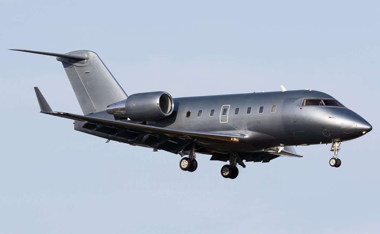 Mon, Nov 16in 13 daysPuerto VallartaMMPR · Licenciado Gustavo Diaz Ordaz International AirportEverettKPAE · Snohomish County (Paine Field) AirportChallenger 60412—On request16NovPuerto Vallarta → EverettMMPR → KPAE · in 13 daysChallenger 604 · 12 seatsOn request
- Sat, Nov 28in 25 daysVancouverKVUO · Pearson FieldEverettKPAE · Snohomish County (Paine Field) AirportPilatus PC-12 NG——On request28NovVancouver → EverettKVUO → KPAE · in 25 daysPilatus PC-12 NGOn request
 Sun, Nov 2919:30Fort LauderdaleKFXE · Fort Lauderdale Executive AirportEverettKPAE · Snohomish County (Paine Field) AirportBombardier Learjet 60XR6—$38,50029NovFort Lauderdale → EverettKFXE → KPAE · 19:30Bombardier Learjet 60XR · 6 seats$38,500
- Sun, Nov 29in 26 daysFort LauderdaleKFXE · Fort Lauderdale Executive AirportEverettKPAE · Snohomish County (Paine Field) AirportLearjet Lear 60XR6—$41,58029NovFort Lauderdale → EverettKFXE → KPAE · in 26 daysLearjet Lear 60XR · 6 seats$41,580
- Mon, Nov 3000:30Fort LauderdaleKFXE · Fort Lauderdale ExecutiveEverettKPAE · Snohomish County (Paine Fld)Learjet 60XR—6h 16mOn request30NovFort Lauderdale → EverettKFXE → KPAE · 00:30Learjet 60XR · 6h 16mOn request
- Mon, Nov 3000:30Fort LauderdaleKFXE · Fort Lauderdale ExecutiveEverettKPAE · Snohomish Co.Paine FieldLearjet 60XR6—On request30NovFort Lauderdale → EverettKFXE → KPAE · 00:30Learjet 60XR · 6 seatsOn request
 MMPR · Licenciado Gustavo Diaz Ordaz International Airport
* Total price incl. 10% service fee, converted to your selected currency. Price subject to operator confirmation.
Map: Everett Airport
View the location of Everett – PAE/KPAE. Zoom in to explore the area around the airport.
About the airport
Snohomish County (Paine Field) Airport (PAE/KPAE) is the key private jet gateway for Everett. PrivJet gives you instant access to charter flights and empty legs: fast, discreet and globally connected.
KPAE airport FAQ
Are there any restrictions at Everett airport (KPAE) today?
There are currently 8 valid NOTAMs for Everett (KPAE). According to NOTAM, at least one runway or the aerodrome itself is closed. Affected: Runway: closed; Taxiway: closed; Taxiway: out of service; Obstacle: out of service. 11 more NOTAMs start in the coming days. For information only, not for flight planning or operational use. Always rely on an official pre-flight briefing. This list may be incomplete or out of date.
What is the weather at Everett airport (KPAE)?
According to the latest weather report for KPAE (METAR, 03 Nov, 09:53 UTC): Good visual conditions (VFR). Wind 5 kt (9 km/h) from variable directions, visibility 10 km or more, temperature 9 °C (dew point 3 °C). For information only, not for flight planning. Weather can change quickly; always rely on official reports.
How long are the runways at Everett airport (KPAE)?
Everett (KPAE) has 2 runways: runway 16R/34L with 2,746 m (9,010 ft), asphalt and runway 16L/34R with 916 m (3,004 ft), asphalt. The longest is 2,746 m.
What are the radio frequencies at Everett airport (KPAE)?
Frequencies at KPAE: Tower 120.2 / 132.95 MHz, Ground 121.8 MHz and ATIS 128.65 MHz. For information only. Always rely on the published AIP.
What are the airport codes of Snohomish County (Paine Field) Airport?
The ICAO code is KPAE and the IATA code is PAE. ICAO codes are used by air traffic control and pilots, e.g. in flight plans; IATA codes appear on tickets and baggage tags.
What is the elevation of KPAE airport?
Snohomish County (Paine Field) Airport sits at 606 ft (185 m) above sea level. Local time zone: America/Los Angeles.
Can I fly to KPAE by private jet?
Whether a private jet can operate into Snohomish County (Paine Field) Airport depends on runway length, opening hours, customs and immigration rules as well as slot and handling availability, among other things. PrivJet checks this with the operating carrier for every request.
Are there empty legs from or to KPAE?
There are currently 8 empty legs departing from and 13 arriving at Snohomish County (Paine Field) Airport. Empty legs are repositioning flights at heavily reduced prices; the list is updated several times a day.