Atlanta DeKalb Peachtree Airport (KPDK / PDK)
Empty legs and charters from Atlanta
KPDK airport at a glance
- ICAO code
- KPDK
- IATA code
- PDK
- City
- Atlanta
- Region
- Georgia
- Country
- United States
- Elevation
- 1,003 ft (306 m)
- Time zone
- America/New York (UTC-5)
- Coordinates
- 33.8756° N, 84.3020° W
- Empty legs from
- 72
- Empty legs to
- 72
Private jet terminal & FBOs at Atlanta DeKalb Peachtree
- Signature Aviation PDK3150 Corsair Drive, Atlanta, GA 30341
- Atlantic Aviation PDK2040 Airport Road, Atlanta, GA 30341
- Aero Center Atlanta (formerly Epps Aviation)1 Aviation Way, Atlanta, GA 30341
Weather & airport info KPDK
Current weather
No current weather report is available for this airport.
Forecast (TAF)
- 03 Nov, 14:00–04:00 UTC11 kt (20 km/h) from east (100°) · visibility 10 km or more · broken clouds at 3,000 ft, broken clouds at 4,000 ft
- 04 Nov, 04:00–08:00 UTCfrom8 kt (15 km/h) from east-southeast (120°) · visibility 10 km or more · broken clouds at 2,000 ft
- 04 Nov, 08:00–12:00 UTCfrom8 kt (15 km/h) from southeast (130°) · visibility 10 km or more · broken clouds at 1,000 ft, overcast at 1,500 ft
- 04 Nov, 10:00–12:00 UTCpossible, 30 % probabilityvisibility 10 km or more · Light rain showers, mist · broken clouds at 800 ft
Original forecast (TAF)
TAF KPDK 031343Z 0314/0412 10011KT P6SM BKN030 BKN040 TEMPO 0314/0316 -SHRA BKN018 FM040400 12008KT P6SM BKN020 FM040800 13008KT P6SM BKN010 OVC015 PROB30 0410/0412 6SM -SHRA BR BKN008
Airport
- Elevation
- 1,003 ft (306 m)
- Sunrise / Sunset
- 06:58 / 17:43 local time
Runways
| Runway | Length | Surface | Lighted |
|---|---|---|---|
| 3R/21L | 1,829 m (6,001 ft) | concrete | yes |
| 16/34 | 1,209 m (3,968 ft) | asphalt | yes |
| 3L/21R | 1,142 m (3,746 ft) | asphalt | yes |
| H1 | 17 m (56 ft) | concrete | yes |
Radio frequencies
- ATIS: 128.4
- Clearance: 120.9
- CTAF: 120.9
- Ground: 121.6
- Tower: 120.9
- UNICOM: 122.95
For information only, not for flight planning. Weather can change quickly; always rely on official reports. Sources: aviationweather.gov (NOAA), OurAirports.
Airport map KPDK
Full screen →Runways white, taxiways yellow with designators, closed taxiways and runways per NOTAM in red.
Official charts (FAA)
Cycle 2611, valid until 0901Z 11/26/26
Airport diagram (FAA)
Airport diagram (1)
Instrument approaches (5)
Minimums (2)
Hot spots (1)
For information only, not for navigation. Always use current official charts and NOTAMs.
Current NOTAMs for KPDK(12)
NOTAMs (Notices to Air Missions) announce short-term changes at an airport: closed runways or taxiways, unserviceable approach aids, obstacles, airspace restrictions.
- Out of serviceOther10/068· from 04 Nov, 05:00 UTC · until 04 Nov, 06:30 UTC
Communications CLR DELIVERY 120.9 out of service contact ATLANTA approach at 678-364-6131.
Show original text
COM CLR DELIVERY 120.9 U/S CTC ATLANTA APP AT 678-364-6131.
10/068 NOTAMN
Q)KZTL/QXXXX/IV/NBO/A/000/999/3352N08418W005
A) KPDK
B) 2611040500
C) 2611040630
E) COM CLR DELIVERY 120.9 U/S CTC ATLANTA APP AT 678-364-6131.
- Out of serviceRunway end identifier lights: unserviceable11/002· until 08 Dec, 23:59 UTC (estimated)
Runway 03R runway END ID light out of service
Show original text
RWY 03R RWY END ID LGT U/S
11/002 NOTAMR
Q) KZTL/QLIAS/IV/BO/A/000/999/3352N08418W005
A) KPDK
B) 2611022037
C) 2612082359EST

E) RWY 03R RWY END ID LGT
 U/S
- Out of serviceObstacle11/001· until 15 Nov, 23:59 UTC
A tower near the airport, with its top at 2049.9 ft above sea level and 1144.4 ft above ground, has an out of service light.
Show original text
OBST TOWER LGT (ASR 1206917) 334751.40N0842001.70W (5.0NM SSW PDK) 2049.9FT (1144.4FT AGL) U/S
11/001 NOTAMN<BR> <B>Q) </B>KZTL/QOLAS/IV/M/AE/000/021/3352N08418W005<BR> <B>A) </B>KPDK<BR> <B>B) </B>2611010502<BR> <B>C) </B>2611152359<BR> <B>E) </B> TOWER LGT (ASR 1206917) 334751.40N0842001.70W (5.0NM SSW PDK) 2049.9FT (1144.4FT AGL) U/S<BR>
- ClosedApron10/070· until 31 Jan, 22:00 UTC
The apron Signature Ramp E entrance, south of taxiway J, is closed, barricaded, and not lighted. This may restrict access to this area.
Show original text
APRON SIGNATURE RAMP E ENTRANCE S OF TWY J CLSD BARRICADED NOT LGTD
- Out of serviceVASIS: unserviceable10/059· until 24 Nov, 23:59 UTC (estimated)
The visual approach slope indicator (VASI) for runway 34 has low intensity and is out of service. The VASI helps pilots maintain the correct approach angle to the runway.
Show original text
RWY 34 VASI LOW INTST U/S
10/059 NOTAMR
Q) KZTL/QLVAS/IV/BO/A/000/999/3352N08418W005
A) KPDK
B) 2610221030
C) 2611242359EST

E) RWY 34 VASIS LOW INTST U/S
- Out of serviceObstacle10/035· until 15 Nov, 23:00 UTC
A tower light 7.2 nautical miles south-southwest of DeKalb-Peachtree airport is out of service. Its top is 2052.5 ft above sea level, 1062.3 ft above ground.
Show original text
OBST TOWER LGT (ASR 1028278) 334533.00N0842005.00W (7.2NM SSW PDK) 2052.5FT (1062.3FT AGL) U/S
- Out of serviceInstrument approach procedure: not available8394/26· until 20 May, 16:52 UTC (estimated)
The instrument approach procedure for runway 21L is not available, except for aircraft equipped with a suitable RNAV system with GPS, because the RMG VOR is out of service.
Show original text
IAP DEKALB-PEACHTREE, ATLANTA, GA. ILS OR LOC RWY 21L, AMDT 10... PROCEDURE NA EXCEPT FOR ACFT EQUIPPED WITH SUITABLE RNAV SYSTEM WITH GPS, RMG VOR OUT OF SERVICE. 2610081652-2705201652EST
Q) KZTL/QPIAU/I/NBO/A/000/999/3352N08418W005
A) KPDK
B) 2610081646
C) 2705201646EST
E) PDK DEKALB-PEACHTREE, ATLANTA, GA.
ILS OR LOC RWY 21L, AMDT 10...
PROCEDURE NA EXCEPT FOR ACFT EQUIPPED WITH SUITABLE RNAV SYSTEM WITH GPS,
RMG VOR U/S.
- Out of serviceObstacle lights: unserviceable10/007· until 03 Jan, 19:19 UTC
An obstacle tower light 9.6 nautical miles north-northwest of the airport is out of service; its top is 1278.9 ft above sea level, 189.0 ft above ground.
Show original text
OBST TOWER LGT (ASR 1058902) 340149.60N0842130.00W (9.6NM NNW PDK) 1278.9FT (189.0FT AGL) U/S
10/007 NOTAMN<br/>
<b>Q) </b>KZTL/QOLAS/IV/M/E/000/013/3352N08418W005<br/>
<b>A) </b>KPDK<br/>
<b>B) </b>2610051819<br/>
<b>C) </b>2701031919<br/>
<b>E) </b> TOWER LGT (ASR 1058902) 340149.60N0842130.00W (9.6NM NNW PDK) 1278.9FT (189.0FT AGL) U/S<br/>
4 more NOTAMs
- NoticeInstrument approach procedure3654/26· until 06 May, 23:55 UTC (estimated)
A temporary crane with its top at 1256 ft above mean sea level is located 911 ft southeast of runway 21L. This affects the RNAV (GPS) Y approach to runway 21L.
Show original text
IAP DEKALB-PEACHTREE, ATLANTA, GA. RNAV (GPS) Y RWY 21L, AMDT 3... LNAV MDA 1560/HAT 569 ALL CATS, VIS CATS C/D 1 3/8. CIRCLING CAT A/B MDA 1620/HAA 622. VDP 1.2 NM TO JOPUN. CHANGE NOTE TO READ: FOR INOP ALS, INCREASE LNAV/VNAV ALL CATS VISIBILITY TO 1 3/8 SM. TEMPORARY CRANE 1256 MSL 911FT SE OF RWY 21L (2024-ASO-10348-OE). 2610291345-2705062355EST
Q) KZTL/QPIXX/I/NBO/A/000/999/3352N08418W005
A) KPDK
B) 2610291344
C) 2706101344EST
E) PDK DEKALB-PEACHTREE, ATLANTA, GA.
RNAV (GPS) Y RWY 21L, AMDT 3...
LNAV MDA 1560/HAT 569 ALL CATS, VIS CATS C/D 1 3/8. CIRCLING CAT A/B MDA 1620/HAA 622. VDP 1.2 NM TO JOPUN. CHANGE NOTE TO READ: FOR INOP ALS, INCREASE LNAV/VNAV ALL CATS VISIBILITY TO 1 3/8 SM. TEMPORARY CRANE 1256 MSL 911FT SE OF RWY 21L (2024-ASO-10348-OE).
- NoticeInstrument approach procedure3627/26· until 29 Oct, 13:17 UTC (estimated)
For the RNAV (GPS) Y Runway 21L instrument approach, visibility for category C/D is limited to 1 3/8 miles. The inoperative table does not apply to LPV all categories and LNAV category A/B.
Show original text
IAP DEKALB-PEACHTREE, ATLANTA, GA. RNAV (GPS) Y RWY 21L, AMDT 3... LNAV VIS CAT C/D 1 3/8. INOPERATIVE TABLE DOES NOT APPLY TO LPV ALL CATS AND LNAV CAT A/B. 2610291317-2810291317EST
Q) KZTL/QPIXX/I/NBO/A/000/999/3352N08418W005
A) KPDK
B) 2610291317
C) 2706101317EST
E) PDK DEKALB-PEACHTREE, ATLANTA, GA.
RNAV (GPS) Y RWY 21L, AMDT 3...
LNAV VIS CAT C/D 1 3/8. INOPERATIVE TABLE DOES NOT APPLY TO LPV ALL CATS AND LNAV CAT A/B.
- NoticeInstrument approach procedure5329/26· until 06 May, 23:55 UTC (estimated)
A temporary crane is located 2582 feet northeast of DeKalb-Peachtree airport. Its top is 1256 feet above mean sea level and may affect the circling minimum descent altitude for certain aircraft categories in poor visibility.
Show original text
IAP DEKALB-PEACHTREE, ATLANTA, GA. RNAV (GPS)-A, ORIG-A... CIRCLING CAT A/B MDA 1620/HAA 622. TEMPORARY CRANE 1256 MSL 2582FT NE OF PDK AIRPORT (2024-ASO-10348-OE). 2609241528-2705062355EST
Q) KZTL/QPIXX/I/NBO/A/000/999/3352N08418W005
A) KPDK
B) 2609241527
C) 2705061527EST
E) PDK DEKALB-PEACHTREE, ATLANTA, GA.
RNAV (GPS)-A, ORIG-A...
CIRCLING CAT A/B MDA 1620/HAA 622.  TEMPORARY CRANE 1256 MSL 2582FT NE OF PDK AIRPORT (2024-ASO-10348-OE).
- NoticeInstrument approach procedure5326/26· until 06 May, 23:55 UTC (estimated)
For the instrument approach ILS or LOC runway 21L, the visibility for all categories has been changed to 5000 ft. If the approach lighting system is out of service, the required visibility for ILS 21L increases to 6000 ft and for LOC 21L category A/B to 5500 ft. A temporary crane, with its top at 1256 ft above mean sea level, is located 911 ft southeast of runway 21L.
Show original text
IAP DEKALB-PEACHTREE, ATLANTA, GA. ILS OR LOC RWY 21L, AMDT 10... S-ILS 21L DA 1393/HAT 402 ALL CATS, VIS ALL CATS RVR 5000. CIRCLING CAT A/B MDA 1620/HAA 622. CHANGE NOTE TO READ: FOR INOP ALS, INCREASE S-ILS 21 ALL CATS VISIBILITY TO RVR 6000 AND S-LOC 21L CAT A/B VISIBILITY TO RVR 5500. TEMPORARY CRANE 1256 MSL 911FT SE OF RWY 21L (2024-ASO-10348-OE). 2609241523-2705062355EST
Q) KZTL/QPIXX/I/NBO/A/000/999/3352N08418W005
A) KPDK
B) 2609241523
C) 2705061523EST
E) PDK DEKALB-PEACHTREE, ATLANTA, GA.
ILS OR LOC RWY 21L, AMDT 10...
S-ILS 21L DA 1393/HAT 402 ALL CATS, VIS ALL CATS RVR 5000. CIRCLING CAT A/B MDA 1620/HAA 622. CHANGE NOTE TO READ: FOR INOP ALS, INCREASE S-ILS 21 ALL CATS VISIBILITY TO RVR 6000 AND S-LOC 21L CAT A/B VISIBILITY TO RVR 5500. TEMPORARY CRANE 1256 MSL 911FT SE OF RWY 21L (2024-ASO-10348-OE).
For information only, not for flight planning or operational use. Always rely on an official pre-flight briefing. This list may be incomplete or out of date. Explanations and expanded abbreviations are generated automatically. The original text is authoritative. Source: FAA NOTAM Management Service (SWIM).
Private jet traffic in DeKalb Peachtree Airport (last 30 days)
- Arrivals
- 2,793
- Departures
- 2,595
- Different jets
- 1,482
Most frequent origins: Teterboro Airport (96), Birmingham-Shuttlesworth International Airport (62), Charlotte Douglas International Airport (52), Savannah Hilton Head International Airport (51), Raleigh Durham International Airport (42).
Most frequent destinations: Birmingham-Shuttlesworth International Airport (87), Teterboro Airport (81), St. Simons Island Airport at McKinnon Field (77), Charlotte Douglas International Airport (65), Savannah Hilton Head International Airport (53).
Most common aircraft types: Embraer Phenom 300 (660), Pilatus PC-12 (608), Cessna Citation Excel/XLS (345), Cessna Citation Latitude (279), Bombardier Challenger 350/3500 (216).
Our own analysis of public ADS-B signals from business jets. Not every flight is received, and jets with a removal request are excluded.
Charter operators based here
Operators with a base at this airport.
- Talon AirFarmingdale (Republic) (KFRG) · Midsize jet, Super midsize jet, Heavy jet
- Helicopter ExpressHelicopter
- EAS Charter & ManagementMiami (Opa Locka) (KOPF) · Light jet, Super midsize jet, Heavy jet
- FlightWorksAtlanta (Cobb County-McCollum Field) (KRYY) · Turboprop, Midsize jet, Super midsize jet
- Helicopters Inc.Helicopter
- Aero Center AtlantaTurboprop
- AirStar CharterLight jet
- Park AirTurboprop
- Prestige HelicopersHelicopter
- Quality-AviationPiston aircraft
Empty legs from KPDK
72 departures available
 Tue, Nov 3TodayAtlantaKPDK · DeKalb Peachtree AirportLos AngelesKVNY · Van Nuys AirportChallenger 60411—$51,4213NovAtlanta → Los AngelesKPDK → KVNY · TodayChallenger 604 · 11 seats$51,421
- Tue, Nov 322:18AtlantaKPDK · DeKalb Peachtree AirportWest Palm BeachKLNA · Palm Beach County Park AirportCessna CitationJet5—$4,7303NovAtlanta → West Palm BeachKPDK → KLNA · 22:18Cessna CitationJet · 5 seats$4,730
- Tue, Nov 3TodayAtlantaKPDK · DeKalb Peachtree AirportWest Palm BeachKLNA · Palm Beach County Park AirportEpic E1000 GX42hOn request3NovAtlanta → West Palm BeachKPDK → KLNA · TodayEpic E1000 GX · 4 seats · 2hOn request
- Tue, Nov 3TodayAtlantaKPDK · DeKalb Peachtree AirportColumbiaKCAE · Columbia Metropolitan AirportCessna Citation V742mOn request3NovAtlanta → ColumbiaKPDK → KCAE · TodayCessna Citation V · 7 seats · 42mOn request
- Tue, Nov 3TodayAtlantaKPDK · DeKalb Peachtree AirportPittsburghKAGC · Allegheny County AirportCessna Citation Excel 560XLS9—On request3NovAtlanta → PittsburghKPDK → KAGC · TodayCessna Citation Excel 560XLS · 9 seatsOn request
 Wed, Nov 4TomorrowAtlantaKPDK · DeKalb Peachtree AirportWest Palm BeachKLNA · Palm Beach County Park AirportEpic E10004—On request4NovAtlanta → West Palm BeachKPDK → KLNA · TomorrowEpic E1000 · 4 seatsOn request
 Wed, Nov 403:18AtlantaKPDK · DeKalb Peachtree AirportWest Palm BeachKLNA · Palm Beach County Park AirportEpic E100011h 48mOn request4NovAtlanta → West Palm BeachKPDK → KLNA · 03:18Epic E1000 · 1 seat · 1h 48mOn request
- Wed, Nov 4TomorrowAtlantaKPDK · DeKalb Peachtree AirportClemsonKCEU · Oconee County Regional AirportEpic E1000 GX448mOn request4NovAtlanta → ClemsonKPDK → KCEU · TomorrowEpic E1000 GX · 4 seats · 48mOn request
 Thu, Nov 5in 2 daysAtlantaKPDK · DeKalb Peachtree AirportBrunswickKBXM · Brunswick Executive AirportCitation X8—On request5NovAtlanta → BrunswickKPDK → KBXM · in 2 daysCitation X · 8 seatsOn request
 KPDK · DeKalb Peachtree Airport
* Total price incl. 10% service fee, converted to your selected currency. Price subject to operator confirmation.
Empty legs to KPDK
72 arrivals available
 Tue, Nov 3TodayMiamiKOPF · Miami-Opa Locka Executive AirportAtlantaKPDK · DeKalb Peachtree AirportHawker 4006—$7,1503NovMiami → AtlantaKOPF → KPDK · TodayHawker 400 · 6 seats$7,150
- Tue, Nov 3TodayColumbiaKCAE · Columbia Metropolitan AirportAtlantaKPDK · DeKalb Peachtree AirportCessna Citation V748mOn request3NovColumbia → AtlantaKCAE → KPDK · TodayCessna Citation V · 7 seats · 48mOn request
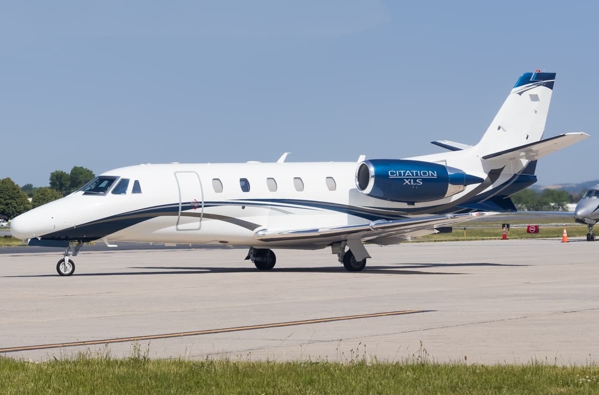 Wed, Nov 4TomorrowSarasotaKSRQ · Sarasota Bradenton International AirportAtlantaKPDK · DeKalb Peachtree AirportCitation XLS9—$13,5144NovSarasota → AtlantaKSRQ → KPDK · TomorrowCitation XLS · 9 seats$13,514
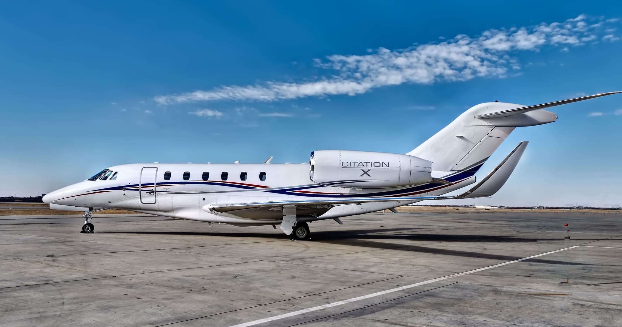 Wed, Nov 4TomorrowTampaKTPA · Tampa International AirportAtlantaKPDK · DeKalb Peachtree AirportCitation X8—$11,8664NovTampa → AtlantaKTPA → KPDK · TomorrowCitation X · 8 seats$11,866
- Wed, Nov 408:24Fort LauderdaleKFLL · Fort Lauderdale Hollywood International AirportAtlantaKPDK · DeKalb Peachtree AirportDassault Falcon 900B12—$21,4504NovFort Lauderdale → AtlantaKFLL → KPDK · 08:24Dassault Falcon 900B · 12 seats$21,450
- Wed, Nov 410:18NaplesKAPF · Naples Municipal AirportAtlantaKPDK · DeKalb Peachtree AirportCessna Citation Excel8—$7,5904NovNaples → AtlantaKAPF → KPDK · 10:18Cessna Citation Excel · 8 seats$7,590
- Wed, Nov 4TomorrowMiamiKOPF · Miami-Opa Locka Executive AirportAtlantaKPDK · DeKalb Peachtree AirportHawker 400XP7—$9,6804NovMiami → AtlantaKOPF → KPDK · TomorrowHawker 400XP · 7 seats$9,680
 Wed, Nov 4TomorrowNaplesKAPF · Naples Municipal AirportAtlantaKPDK · DeKalb Peachtree AirportCessna Citation XLS11h 36m$10,2854NovNaples → AtlantaKAPF → KPDK · TomorrowCessna Citation XLS · 1 seat · 1h 36m$10,285
 Wed, Nov 4TomorrowCharlestonKCHS · Charleston Air Force Base-International AirportAtlantaKPDK · DeKalb Peachtree AirportCessna Citation III154mOn request4NovCharleston → AtlantaKCHS → KPDK · TomorrowCessna Citation III · 1 seat · 54mOn request
* Total price incl. 10% service fee, converted to your selected currency. Price subject to operator confirmation.
Map: Atlanta Airport
View the location of Atlanta – PDK/KPDK. Zoom in to explore the area around the airport.
About the airport
DeKalb Peachtree Airport (PDK/KPDK) is the key private jet gateway for Atlanta. PrivJet gives you instant access to charter flights and empty legs: fast, discreet and globally connected.
KPDK airport FAQ
Are there any restrictions at Atlanta airport (KPDK) today?
There are currently 11 valid NOTAMs for Atlanta (KPDK). Affected: Apron: closed; Runway end identifier lights: unserviceable; Obstacle: out of service; VASIS: unserviceable and 2 more. 1 more NOTAM starts in the coming days. For information only, not for flight planning or operational use. Always rely on an official pre-flight briefing. This list may be incomplete or out of date.
How long are the runways at Atlanta airport (KPDK)?
Atlanta (KPDK) has 4 runways: runway 3R/21L with 1,829 m (6,001 ft), concrete, runway 16/34 with 1,209 m (3,968 ft), asphalt, runway 3L/21R with 1,142 m (3,746 ft), asphalt and runway H1 with 17 m (56 ft), concrete. The longest is 1,829 m.
What are the radio frequencies at Atlanta airport (KPDK)?
Frequencies at KPDK: Tower 120.9 MHz, Ground 121.6 MHz and ATIS 128.4 MHz. For information only. Always rely on the published AIP.
What are the airport codes of DeKalb Peachtree Airport?
The ICAO code is KPDK and the IATA code is PDK. ICAO codes are used by air traffic control and pilots, e.g. in flight plans; IATA codes appear on tickets and baggage tags.
What is the elevation of KPDK airport?
DeKalb Peachtree Airport sits at 1,003 ft (306 m) above sea level. Local time zone: America/New York.
Where do private jets land at Atlanta DeKalb Peachtree?
KPDK has 3 private jet terminals or FBOs: Signature Aviation PDK, Atlantic Aviation PDK and Aero Center Atlanta (formerly Epps Aviation). Your flight confirmation says which one your operator uses.
Can I fly to KPDK by private jet?
Whether a private jet can operate into DeKalb Peachtree Airport depends on runway length, opening hours, customs and immigration rules as well as slot and handling availability, among other things. PrivJet checks this with the operating carrier for every request.
Are there empty legs from or to KPDK?
There are currently 72 empty legs departing from and 72 arriving at DeKalb Peachtree Airport. Empty legs are repositioning flights at heavily reduced prices; the list is updated several times a day.