St Petersburg Clearwater Airport (KPIE / PIE)
Empty legs and charters from St Petersburg Clearwater
KPIE airport at a glance
- ICAO code
- KPIE
- IATA code
- PIE
- City
- St Petersburg Clearwater
- Region
- Florida
- Country
- United States
- Elevation
- 11 ft (3 m)
- Time zone
- America/New York (UTC-5)
- Coordinates
- 27.9102° N, 82.6874° W
- Empty legs from
- 38
- Empty legs to
- 24
Weather & airport info KPIE
Current weather
No current weather report is available for this airport.
Airport
- Elevation
- 11 ft (3 m)
- Sunrise / Sunset
- 06:43 / 17:45 local time
Runways
| Runway | Length | Surface | Lighted |
|---|---|---|---|
| 18/36 | 2,966 m (9,730 ft) | concrete | yes |
| 04/22 | 1,829 m (6,000 ft) | asphalt | yes |
Radio frequencies
- ATIS: 134.5
- Clearance: 120.6
- CTAF: 118.3
- Ground: 121.9
- Tower: 118.3
- UNICOM: 122.95
For information only, not for flight planning. Weather can change quickly; always rely on official reports. Sources: aviationweather.gov (NOAA), OurAirports.
Airport map KPIE
Full screen →Runways white, taxiways yellow with designators, closed taxiways and runways per NOTAM in red.
Closed per NOTAM: RWY 18/36
Official charts (FAA)
Cycle 2611, valid until 0901Z 11/26/26
Airport diagram (FAA)
Airport diagram (1)
Instrument approaches (9)
Departure procedures (7)
Minimums (2)
Hot spots (1)
LAHSO (1)
For information only, not for navigation. Always use current official charts and NOTAMs.
Current NOTAMs for KPIE(25)
NOTAMs (Notices to Air Missions) announce short-term changes at an airport: closed runways or taxiways, unserviceable approach aids, obstacles, airspace restrictions.
- ClosedRunway: closedA1893/26· from 06 Nov, 04:00 UTC · until 06 Nov, 11:00 UTC
Runway 18/36 is closed, except for crossings.
Show original text
RWY 18/36 CLSD EXC XNG
A1893/26 NOTAMN
Q) KZMA/QMRLC////000/999/2754N08241W005
A) KPIE
B) 2611060400
C) 2611061100
E) RWY 18/36 CLSD EXC XNG
- ClosedRunway: closedA1892/26· from 05 Nov, 04:00 UTC · until 05 Nov, 11:00 UTC
Runway 18/36 closed except XNG
Show original text
RWY 18/36 CLSD EXC XNG
A1892/26 NOTAMN
Q) KZMA/QMRLC////000/999/2754N08241W005
A) KPIE
B) 2611050400
C) 2611051100
E) RWY 18/36 CLSD EXC XNG
- ClosedRunway: closedA1891/26· from 04 Nov, 04:00 UTC · until 04 Nov, 11:00 UTC
Runway 18/36 is closed, except for crossings.
Show original text
RWY 18/36 CLSD EXC XNG
A1891/26 NOTAMN
Q) KZMA/QMRLC////000/999/2754N08241W005
A) KPIE
B) 2611040400
C) 2611041100
E) RWY 18/36 CLSD EXC XNG
- ClosedRunway: closedA1889/26· until 03 Nov, 22:00 UTC
Runway 18/36 is closed, except for crossings. Takeoffs and landings on this runway are not possible.
Show original text
RWY 18/36 CLSD EXC XNG
A1889/26 NOTAMN
Q) KZMA/QMRLC////000/999/2754N08241W005
A) KPIE
B) 2611030400
C) 2611032200
E) RWY 18/36 CLSD EXC XNG
- ClosedTaxiway: closedA1890/26· from 03 Nov, 12:00 UTC · until 03 Nov, 22:00 UTC
Taxiway A between runway 04/22 and taxiway A8 is closed. This may affect aircraft movement on the airport.
Show original text
TWY A BTN RWY 04/22 AND TWY A8 CLSD
A1890/26 NOTAMN
Q) KZMA/QMXLC////000/999/2754N08241W005
A) KPIE
B) 2611031200
C) 2611032200
E) TWY A BTN RWY 04/22 AND TWY A8 CLSD
- ClosedTaxiway: closedA1898/26· from 03 Nov, 12:00 UTC · until 03 Nov, 22:00 UTC
Taxiway A8 is closed. This may mean aircraft need to use alternative routes for takeoff or to reach their parking position.
Show original text
TWY A8 CLSD
A1898/26 NOTAMN
Q) KZMA/QMXLC////000/999/2754N08241W005
A) KPIE
B) 2611031200
C) 2611032200
E) TWY A8 CLSD
- Out of serviceILS: unserviceableA1916/26· until 09 Nov, 20:00 UTC
The instrument landing system (ILS) for runway 36, specifically the localizer (LOC) and distance measuring equipment (DME), is out of service. The ILS guides aircraft to the runway in poor visibility.
Show original text
PIE NAV ILS RWY 36 LOC/DME U/S
A1916/26 NOTAMN
Q) KZMA/QICAS////000/999/2754N08241W005
A) KPIE
B) 2611022203
C) 2611092000
E) PIE NAV ILS RWY 36 LOC/DME U/S
- Out of serviceObstacle10/355· until 15 Nov, 10:14 UTC
An obstacle, a tower with identifier ASR 1038786, 8.0 nautical miles west-southwest of the airport, is out of service. Its top is 529.9 ft above sea level, 500.0 ft above ground.
Show original text
OBST TOWER LGT (ASR 1038786) 275033.10N0824851.40W (8.0NM WSW PIE) 529.9FT (500.0FT AGL) U/S
17 more NOTAMs
- Out of serviceILS: unserviceable10/295· until 10 Nov, 20:00 UTC
The Instrument Landing System (ILS) for runway 36 is out of service. The ILS guides aircraft to the runway in poor visibility.
Show original text
PIE NAV ILS RWY 36 U/S
A1871/26 NOTAMN Q) KZMA/QICAS////000/999/2754N08241W005 A) KPIE B) 2610261342 C) 2611102000 E) PIE NAV ILS RWY 36 U/S
- Out of serviceLanding direction indicator: unserviceable10/283· until 20 Nov, 20:00 UTC
The runway visual range measurement (RVR) for the threshold of runway 18 is out of service.
Show original text
RWY 18 RVRT U/S
A1868/26 NOTAMN Q) KZMA/QFTAS////000/999/2754N08241W005 A) KPIE B) 2610241651 C) 2611202000 E) RWY 18 RVRT U/S
- Out of serviceLanding direction indicator: unserviceable10/284· until 20 Nov, 20:00 UTC
Runway 36 RVRR out of service
Show original text
RWY 36 RVRR U/S
A1867/26 NOTAMN Q) KZMA/QFTAS////000/999/2754N08241W005 A) KPIE B) 2610241651 C) 2611202000 E) RWY 36 RVRR U/S
- Out of serviceILS localizer: unserviceable10/270· until 19 Nov, 20:00 UTC
The localizer (LOC) for the Instrument Landing System (ILS) on runway 36 is out of service. The localizer is part of the ILS, which guides aircraft to the runway in poor visibility.
Show original text
PIE NAV LOC RWY 36 U/S
A1846/26 NOTAMN Q) KZMA/QILAS////000/999/2754N08241W005 A) KPIE B) 2610221421 C) 2611192000 E) PIE NAV LOC RWY 36 U/S
- Out of serviceObstacle10/214· until 16 Dec, 23:59 UTC
A tower light 6.0 nautical miles southwest of the airport is out of service. The top of the obstacle is 349.7 ft above sea level, 343.8 ft above ground.
Show original text
OBST TOWER LGT (ASR 1060088) 275051.00N0824621.00W (6.0NM SW PIE) 349.7FT (343.8FT AGL) U/S
- Out of serviceObstacle10/184· until 30 Nov, 23:59 UTC
The lighting of a tower obstacle 5.5 nautical miles east-southeast of the airport is out of service. Its top is 376.0 feet above sea level, 375.0 feet above ground.
Show original text
OBST TOWER LGT (ASR 1035348) 275236.00N0823522.00W (5.5NM ESE PIE) 376.0FT (375.0FT AGL) U/S
10/184 NOTAMN<BR>
<B>Q) </B>KZMA/QOLAS/IV/M/E/000/004/2754N08241W005<BR>
<B>A) </B>KPIE<BR>
<B>B) </B>2610141450<BR>
<B>C) </B>2611302359<BR>
<B>E) </B> TOWER LGT (ASR 1035348) 275236.00N0823522.00W (5.5NM ESE PIE) 376.0FT (375.0FT AGL) U/S<BR>
- Out of servicePAPI: unserviceableA1801/26· until 30 Apr, 20:00 UTC
The PAPI (Precision Approach Path Indicator) for runway 18 is out of service. The PAPI helps pilots maintain the correct glide path to the runway.
Show original text
RWY 18 PAPI U/S
A1801/26 NOTAMN
Q) KZMA/QLPAS////000/999/2754N08241W005
A) KPIE
B) 2610132307
C) 2704302000
E) RWY 18 PAPI U/S
- Out of serviceObstacle10/157· until 10 Jan, 15:55 UTC
The tower obstacle light (ASR 1037654) at 275052.90N0824548.30W (5.6 nautical miles southwest of PIE) is out of service. Its top is 649.0 feet above sea level, 639.1 feet above ground.
Show original text
OBST TOWER LGT (ASR 1037654) 275052.90N0824548.30W (5.6NM SW PIE) 649.0FT (639.1FT AGL) U/S
- Out of serviceObstacle09/325· until 22 Jan, 18:26 UTC
The lighting of a tower (ASR 1020779) 4.1 nautical miles southeast of the airport is out of service. Its top is 659.8 feet above sea level, 654.9 feet above ground.
Show original text
OBST TOWER LGT (ASR 1020779) 275201.60N0823725.90W (4.1NM SE PIE) 659.8FT (654.9FT AGL) U/S
- NoticeAirspace11/013· from 03 Nov, 12:00 UTC · until 05 Nov, 18:00 UTC
An unmanned aircraft system (UAS) is present within an area defined as a 1 nautical mile radius (8.6 nautical miles west of X39) from the surface to 400 feet above ground.
Show original text
AIRSPACE UAS WI AN AREA DEFINED AS 1NM RADIUS OF 281113.20N0823157.70W (8.6NM W X39) SFC-400FT AGL
- NoticeAirspace11/014· from 03 Nov, 12:00 UTC · until 05 Nov, 18:00 UTC
An unmanned aircraft system (UAS) is present within an area defined as a 2 nautical mile radius (7.6 nautical miles west of X39) from the surface to 400 feet above ground.
Show original text
AIRSPACE UAS WI AN AREA DEFINED AS 2NM RADIUS OF 281211.90N0823058.90W (7.6NM W X39) SFC-400FT AGL
- NoticeStandard instrument departure: changed4628/26· until 02 Oct, 17:57 UTC (estimated)
For runway 22, takeoff minimums and obstacle departure procedures have been amended. Takeoff must occur no later than 1700 FT prior to the departure end of the runway when using standard takeoff minimums and a normal 200 FT per nautical mile climb gradient.
Show original text
ODP ST PETE-CLEARWATER INTL, ST PETERSBURG-CLEARWATER, FL. TAKEOFF MINIMUMS AND (OBSTACLE) DEPARTURE PROCEDURES AMDT 3B... TAKEOFF MINIMUMS RWY 22: 300-1 1/8 OR STANDARD WITH MINIMUM CLIMB OF 230 FT/NM TO 300, OR ALTERNATIVELY, WITH STANDARD TAKEOFF MINIMUMS AND A NORMAL 200 FT/NM CLIMB GRADIENT, TAKEOFF MUST OCCUR NO LATER THAN 1700 FT PRIOR TO DER.. ALL OTHER DATA REMAINS AS PUBLISHED. 2611021757-2810021757EST
Q) KZMA/QPDCH/I/NBO/A/000/999/2754N08241W005
A) KPIE
B) 2611021757
C) 2810021757EST
E) PIE ST PETE-CLEARWATER INTL, ST PETERSBURG-CLEARWATER, FL.
TAKEOFF MINIMUMS AND (OBSTACLE) DEPARTURE PROCEDURES AMDT 3B...
TAKEOFF MINIMUMS RWY 22: 300-1 1/8 OR STANDARD WITH MINIMUM CLIMB OF 230 FT/NM TO 300, OR ALTERNATIVELY, WITH STANDARD TAKEOFF MINIMUMS AND A NORMAL 200 FT/NM CLIMB GRADIENT, TAKEOFF
MUST OCCUR NO LATER THAN 1700 FT PRIOR TO DER..
ALL OTHER DATA REMAINS AS PUBLISHED.
- NoticeObstacle clearance altitude: changedA1915/26· until 02 Oct, 17:57 UTC
ODP ST PETE-CLEARWATER INTL, ST PETERSBURG-CLEARWATER, FL. TAKEOFF MINIMUMS and (obstacle) DEPARTURE PROCEDURES amendment 3B... TAKEOFF MINIMUMS runway 22: 300-1 1/8 or STANDARD with MINIMUM CLIMB of 230 ft /NM to 300, or ALTERNATIVELY, with STANDARD TAKEOFF MINIMUMS and A NORMAL 200 ft /NM CLIMB GRADIENT, TAKEOFF MUST OCCUR no LATER THAN 1700 ft PRIOR to DER.. all OTHER DATA REMAINS as PUBLISHED.
Show original text
ODP ST PETE-CLEARWATER INTL, ST PETERSBURG-CLEARWATER, FL. TAKEOFF MINIMUMS AND (OBSTACLE) DEPARTURE PROCEDURES AMDT 3B... TAKEOFF MINIMUMS RWY 22: 300-1 1/8 OR STANDARD WITH MINIMUM CLIMB OF 230 FT/NM TO 300, OR ALTERNATIVELY, WITH STANDARD TAKEOFF MINIMUMS AND A NORMAL 200 FT/NM CLIMB GRADIENT, TAKEOFF MUST OCCUR NO LATER THAN 1700 FT PRIOR TO DER.. ALL OTHER DATA REMAINS AS PUBLISHED.
A1915/26 NOTAMN
Q) KZMA/QPOCH/I/NBO/A/000/999/2754N08241W005
A) KPIE
B) 2611021757
C) 2810021757
E) ODP ST PETE-CLEARWATER INTL, ST PETERSBURG-CLEARWATER, FL. TAKEOFF MINIMUMS AND (OBSTACLE) DEPARTURE PROCEDURES AMDT 3B... TAKEOFF MINIMUMS RWY 22: 300-1 1/8 OR STANDARD WITH MINIMUM CLIMB OF 230 FT/NM TO 300, OR ALTERNATIVELY, WITH STANDARD TAKEOFF MINIMUMS AND A NORMAL 200 FT/NM CLIMB GRADIENT, TAKEOFF MUST OCCUR NO LATER THAN 1700 FT PRIOR TO DER.. ALL OTHER DATA REMAINS AS PUBLISHED.
- NoticeTaxiwayA1913/26· until 03 Nov, 11:21 UTC
The surface condition of all taxiways is wet.
Show original text
TWY ALL FICON WET OBS AT 2611021121.
A1913/26 NOTAMN
Q) KZMA/QMXXX////000/999/2754N08241W005
A) KPIE
B) 2611021121
C) 2611031121
E) TWY ALL FICON WET OBS AT 2611021121.
- NoticeOther3886/26· until 05 Jan, 19:15 UTC (estimated)
A temporary crane is located 4786 ft south of runway 18 at St Pete-Clearwater International Airport. Its top is 143 ft above mean sea level.
Show original text
IAP ST PETE-CLEARWATER INTL, ST PETERSBURG-CLEARWATER, FL. ILS RWY 18 (SA CAT I AND II), AMDT 1 ... S-ILS 18 SA CAT I VIS RVR 1600. S-ILS 18 SA CAT II VIS RVR 1600. TEMPORARY CRANE 143 MSL 4786FT S OF RWY 18 (2023-ASO-7316-NRA). 2610291915-2701051915EST
Q) KZMA/QXXXX/I/NBO/A/000/999/2754N08241W025
A) KPIE
B) 2610291915
C) 2706101915EST
E) IAP ST PETE-CLEARWATER INTL, ST PETERSBURG-CLEARWATER, FL.
ILS RWY 18 (SA CAT I AND II), AMDT 1 ...
S-ILS 18 SA CAT I VIS RVR 1600.  S-ILS 18 SA CAT II VIS RVR 1600.  TEMPORARY CRANE 143 MSL 4786FT S OF RWY 18 (2023-ASO-7316-NRA).
- NoticeInstrument approach procedure: changedA1885/26· until 05 Jan, 19:15 UTC
A temporary crane is located 4786 ft south of runway 18 at St Pete-Clearwater International Airport. Its top is 143 ft above mean sea level.
Show original text
IAP ST PETE-CLEARWATER INTL, ST PETERSBURG-CLEARWATER, FL. ILS RWY 18 (SA CAT I AND II), AMDT 1 ... S-ILS 18 SA CAT I VIS RVR 1600. S-ILS 18 SA CAT II VIS RVR 1600. TEMPORARY CRANE 143 MSL 4786FT S OF RWY 18 (2023-ASO-7316-NRA).
A1885/26 NOTAMN
Q) KZMA/QPICH/I/NBO/A/000/999/2754N08241W005
A) KPIE
B) 2610291915
C) 2701051915
E) IAP ST PETE-CLEARWATER INTL, ST PETERSBURG-CLEARWATER, FL. ILS RWY 18 (SA CAT I AND II), AMDT 1 ... S-ILS 18 SA CAT I VIS RVR 1600. S-ILS 18 SA CAT II VIS RVR 1600. TEMPORARY CRANE 143 MSL 4786FT S OF RWY 18 (2023-ASO-7316-NRA).
- Out of serviceILS category II: not available10/285· until 20 Nov, 20:00 UTC
The instrument landing system (ILS) for runway 18, Category II, is not available. The ILS guides aircraft to the runway in poor visibility.
Show original text
PIE NAV ILS RWY 18 CAT II NA
A1866/26 NOTAMN Q) KZMA/QITAU////000/999/2754N08241W005 A) KPIE B) 2610241651 C) 2611202000 E) PIE NAV ILS RWY 18 CAT II NA
For information only, not for flight planning or operational use. Always rely on an official pre-flight briefing. This list may be incomplete or out of date. Explanations and expanded abbreviations are generated automatically. The original text is authoritative. Source: FAA NOTAM Management Service (SWIM).
Private jet traffic in St Petersburg Clearwater International Airport (last 30 days)
- Arrivals
- 916
- Departures
- 764
- Different jets
- 609
Most frequent origins: Tampa International Airport (26), DeKalb Peachtree Airport (18), Miami-Opa Locka Executive Airport (17), Palm Beach International Airport (15), Sarasota Bradenton International Airport (15).
Most frequent destinations: Miami-Opa Locka Executive Airport (22), DeKalb Peachtree Airport (20), Teterboro Airport (18), Palm Beach International Airport (17), Boca Raton Airport (17).
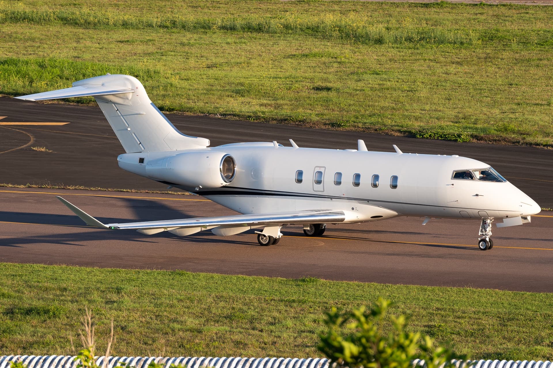
Most common aircraft types: Embraer Phenom 300 (144), Pilatus PC-12 (121), Bombardier Challenger 350/3500 (117), Cessna Citation Latitude (98), Cessna Citation Excel/XLS (88).
Monday is the busiest day.
Our own analysis of public ADS-B signals from business jets. Not every flight is received, and jets with a removal request are excluded.
Charter operators based here
Operators with a base at this airport.
- flyExclusiveKinston (Regional Jetport) (KISO) · Turboprop, Light jet, Midsize jet
- Elite AirTurboprop, Light jet, Midsize jet
- Hera FlightFort Lauderdale Executive (KFXE) · Midsize jet, Super midsize jet, Heavy jet
- Skyway Aviation ServicesTampa International (KTPA) · Light jet, Midsize jet
- Elite JetLight jet, Midsize jet
- Tryp Air CharterTurboprop
- REVAFort Lauderdale Executive (KFXE) · Light jet, Piston aircraft
- Air Ambulance WorldwideLight jet, Midsize jet
Empty legs from KPIE
38 departures available
- Tue, Nov 3TodaySt Petersburg-ClearwaterKPIE · ST. PETE-CLEARWATER INTLTeterboroKTEB · TETERBOROChallenger 3509—$24,2883NovSt Petersburg-Clearwater → TeterboroKPIE → KTEB · TodayChallenger 350 · 9 seats$24,288
- Tue, Nov 3TodaySt PetersburgKPIE · St. Pete - Clearwater IntlTorontoCYYZ · Lester B. Pearson IntlConquest II-104—On request3NovSt Petersburg → TorontoKPIE → CYYZ · TodayConquest II-10 · 4 seatsOn request
- Tue, Nov 3TodaySt Petersburg-ClearwaterKPIE · St Petersburg Clearwater International AirportSt LouisKSTL · Lambert St Louis International AirportBombardier Challenger 30082h 9m€8,5453NovSt Petersburg-Clearwater → St LouisKPIE → KSTL · TodayBombardier Challenger 300 · 8 seats · 2h 9m€8,545
- Wed, Nov 4TomorrowPinellas ParkKPIE · St. Petersburg Clearwater International AirportBar HarborKBHB · Hancock County-Bar Harbor AirportHawker 400XP7—$24,6404NovPinellas Park → Bar HarborKPIE → KBHB · TomorrowHawker 400XP · 7 seats$24,640
- Fri, Nov 618:20Pinellas ParkKPIE · St. Petersburg Clearwater International AirportWaukeshaKUES · Waukesha County AirportCessna Citation CJ48—$15,8406NovPinellas Park → WaukeshaKPIE → KUES · 18:20Cessna Citation CJ4 · 8 seats$15,840
 Mon, Nov 922:00St Petersburg-ClearwaterKPIE · St Petersburg Clearwater International AirportJacksonvilleKJAX · Jacksonville International AirportCessna Citation XLS+148mOn request9NovSt Petersburg-Clearwater → JacksonvilleKPIE → KJAX · 22:00Cessna Citation XLS+ · 1 seat · 48mOn request
- Tue, Nov 1003:00St PetersburgKPIE · St. Pete - Clearwater IntlJacksonvilleKJAX · Jacksonville IntlCessna Citation XLS+8—On request10NovSt Petersburg → JacksonvilleKPIE → KJAX · 03:00Cessna Citation XLS+ · 8 seatsOn request
- Fri, Nov 13in 10 daysSt Petersburg-ClearwaterKPIE · St Petersburg Clearwater International AirportKalamazooKAZO · Kalamazoo Battle Creek International AirportCitation X——On request13NovSt Petersburg-Clearwater → KalamazooKPIE → KAZO · in 10 daysCitation XOn request
- Sat, Nov 14in 11 daysSt Petersburg-ClearwaterKPIE · St Petersburg Clearwater International AirportGreenvilleKGSP · Greenville Spartanburg International AirportBombardier Challenger 35091h 24mOn request14NovSt Petersburg-Clearwater → GreenvilleKPIE → KGSP · in 11 daysBombardier Challenger 350 · 9 seats · 1h 24mOn request
 KPIE · ST. PETE-CLEARWATER INTL
 CYYZ · Lester B. Pearson Intl
* Total price incl. 10% service fee, converted to your selected currency. Price subject to operator confirmation.
Empty legs to KPIE
24 arrivals available
- Tue, Nov 3TodayPattersonKPTN · Harry P Williams Memorial AirportSt Petersburg-ClearwaterKPIE · St Petersburg Clearwater International AirportBombardier Challenger 30091h 24mOn request3NovPatterson → St Petersburg-ClearwaterKPTN → KPIE · TodayBombardier Challenger 300 · 9 seats · 1h 24mOn request
- Wed, Nov 4TomorrowPattersonKPTN · Harry P Williams Memorial AirportPinellas ParkKPIE · St. Petersburg Clearwater International AirportBombardier Challenger 3009—$20,2404NovPatterson → Pinellas ParkKPTN → KPIE · TomorrowBombardier Challenger 300 · 9 seats$20,240
 Fri, Nov 6in 3 daysNew YorkKTEB · Teterboro AirportTampaKPIE · St Petersburg Clearwater International AirportChallenger 3509—$36,3006NovNew York → TampaKTEB → KPIE · in 3 daysChallenger 350 · 9 seats$36,300
 Sat, Nov 718:57West Palm BeachKDJT · President Donald J. Trump International AirportSt Petersburg-ClearwaterKPIE · St Petersburg Clearwater International AirportBombardier Learjet 60142m$4,6207NovWest Palm Beach → St Petersburg-ClearwaterKDJT → KPIE · 18:57Bombardier Learjet 60 · 1 seat · 42m$4,620
- Sat, Nov 7in 4 daysGreenvilleKGSP · Greenville Spartanburg International AirportSt Petersburg-ClearwaterKPIE · St Petersburg Clearwater International AirportBombardier Challenger 35091h 24mOn request7NovGreenville → St Petersburg-ClearwaterKGSP → KPIE · in 4 daysBombardier Challenger 350 · 9 seats · 1h 24mOn request
- Tue, Nov 10in 7 daysMarsh HarbourMYAM · Leonard M Thompson International AirportPinellas ParkKPIE · St. Petersburg Clearwater International AirportBombardier Learjet 406—$11,77010NovMarsh Harbour → Pinellas ParkMYAM → KPIE · in 7 daysBombardier Learjet 40 · 6 seats$11,770
- Tue, Nov 10in 7 daysMarsh HarbourMYAM · Marsh Harbour International AirportSt Petersburg-ClearwaterKPIE · St Petersburg Clearwater International AirportBombardier Lear 4061h 12mOn request10NovMarsh Harbour → St Petersburg-ClearwaterMYAM → KPIE · in 7 daysBombardier Lear 40 · 6 seats · 1h 12mOn request
- Wed, Nov 11in 8 daysMiamiKOPF · Miami-Opa Locka Executive AirportSt Petersburg-ClearwaterKPIE · St Petersburg Clearwater International AirportGulfstream G200948mOn request11NovMiami → St Petersburg-ClearwaterKOPF → KPIE · in 8 daysGulfstream G200 · 9 seats · 48mOn request
- Thu, Nov 1214:00StuartKSUA · Witham FieldPinellas ParkKPIE · St. Petersburg Clearwater International AirportCessna Citation X8—$5,72012NovStuart → Pinellas ParkKSUA → KPIE · 14:00Cessna Citation X · 8 seats$5,720
 MYAM · Leonard M Thompson International Airport
* Total price incl. 10% service fee, converted to your selected currency. Price subject to operator confirmation.
Map: St Petersburg Clearwater Airport
View the location of St Petersburg Clearwater – PIE/KPIE. Zoom in to explore the area around the airport.
About the airport
St Petersburg Clearwater International Airport (PIE/KPIE) is the key private jet gateway for St Petersburg Clearwater. PrivJet gives you instant access to charter flights and empty legs: fast, discreet and globally connected.
KPIE airport FAQ
Are there any restrictions at St Petersburg Clearwater airport (KPIE) today?
There are currently 18 valid NOTAMs for St Petersburg Clearwater (KPIE). According to NOTAM, at least one runway or the aerodrome itself is closed. Affected: Runway: closed; ILS: unserviceable; Obstacle: out of service; Landing direction indicator: unserviceable and 3 more. 7 more NOTAMs start in the coming days. For information only, not for flight planning or operational use. Always rely on an official pre-flight briefing. This list may be incomplete or out of date.
How long are the runways at St Petersburg Clearwater airport (KPIE)?
St Petersburg Clearwater (KPIE) has 2 runways: runway 18/36 with 2,966 m (9,730 ft), concrete and runway 04/22 with 1,829 m (6,000 ft), asphalt. The longest is 2,966 m.
What are the radio frequencies at St Petersburg Clearwater airport (KPIE)?
Frequencies at KPIE: Tower 118.3 MHz, Ground 121.9 MHz and ATIS 134.5 MHz. For information only. Always rely on the published AIP.
What are the airport codes of St Petersburg Clearwater International Airport?
The ICAO code is KPIE and the IATA code is PIE. ICAO codes are used by air traffic control and pilots, e.g. in flight plans; IATA codes appear on tickets and baggage tags.
What is the elevation of KPIE airport?
St Petersburg Clearwater International Airport sits at 11 ft (3 m) above sea level. Local time zone: America/New York.
Can I fly to KPIE by private jet?
Whether a private jet can operate into St Petersburg Clearwater International Airport depends on runway length, opening hours, customs and immigration rules as well as slot and handling availability, among other things. PrivJet checks this with the operating carrier for every request.
Are there empty legs from or to KPIE?
There are currently 38 empty legs departing from and 24 arriving at St Petersburg Clearwater International Airport. Empty legs are repositioning flights at heavily reduced prices; the list is updated several times a day.