Portsmouth International at Pease Airport (KPSM / PSM)
Empty legs and charters from Portsmouth
KPSM airport at a glance
- ICAO code
- KPSM
- IATA code
- PSM
- City
- Portsmouth
- Region
- New Hampshire
- Country
- United States
- Elevation
- 100 ft (30 m)
- Time zone
- America/New York (UTC-5)
- Coordinates
- 43.0779° N, 70.8233° W
- Empty legs from
- 17
- Empty legs to
- 17
Weather & airport info KPSM
Current weather
Good visual conditions (VFR)observed 03 Nov, 04:55 UTC- Wind
- 3 kt (6 km/h) from west (270°)
- Visibility
- 10 km or more
- Clouds
- overcast at 16,000 ft
- Temperature
- 15 °C (dew point 4 °C)
- Pressure (QNH)
- 1,023 hPa
Original weather report (METAR)
METAR KPSM 030455Z 27003KT 10SM OVC160 15/04 A3020 RMK AO2A SLP229 T01460037 402280071
Forecast (TAF)
- 03 Nov, 06:00–06:00 UTC5 kt (9 km/h) from variable directions · visibility 10 km or more · broken clouds at 23,000 ft
Original forecast (TAF)
TAF KPSM 030520Z 0306/0406 VRB05KT P6SM BKN230
Airport
- Elevation
- 100 ft (30 m)
- Sunrise / Sunset
- 06:20 / 16:33 local time
Runways
| Runway | Length | Surface | Lighted |
|---|---|---|---|
| 16/34 | 3,451 m (11,321 ft) | asphalt/concrete | yes |
Radio frequencies
- Approach: 125.05
- ATIS: 132.05
- Clearance: 33.58
- Ground: 120.95
- Tower: 128.4
- UNICOM: 122.95
For information only, not for flight planning. Weather can change quickly; always rely on official reports. Sources: aviationweather.gov (NOAA), OurAirports.
Airport map KPSM
Full screen →Runways white, taxiways yellow with designators, closed taxiways and runways per NOTAM in red.
Closed per NOTAM: TWY K, TWY D
Official charts (FAA)
Cycle 2611, valid until 0901Z 11/26/26
Airport diagram (FAA)
Airport diagram (1)
Instrument approaches (4)
Departure procedures (2)
Minimums (3)
For information only, not for navigation. Always use current official charts and NOTAMs.
Current NOTAMs for KPSM(11)
NOTAMs (Notices to Air Missions) announce short-term changes at an airport: closed runways or taxiways, unserviceable approach aids, obstacles, airspace restrictions.
- ClosedApron: closedA3870/26· until 04 Nov, 21:00 UTC
The southwest 200 feet of the North General Aviation Apron is closed.
Show original text
APRON NORTH GA APN SW 200FT CLSD
A3870/26 NOTAMN
Q) KZBW/QMNLC////000/999/4304N07049W005
A) KPSM
B) 2611021806
C) 2611042100
E) APRON NORTH GA APN SW 200FT CLSD
- ClosedApron: closedA3867/26· until 01 Dec, 05:00 UTC
The North General Aviation Apron is closed, except for aircraft taxiing in and being towed out.
Show original text
APRON NORTH GA APN N SIDE CLSD EXC TAX IN AND TOW OUT
A3867/26 NOTAMN
Q) KZBW/QMNLC////000/999/4304N07049W005
A) KPSM
B) 2611010149
C) 2612010500
E) APRON NORTH GA APN N SIDE CLSD EXC TAX IN AND TOW OUT
- ClosedApron: closedA3865/26· until 01 Dec, 05:00 UTC
The north apron area is closed to fixed-wing aircraft and helicopters. This means this area at the airport cannot be used.
Show original text
APRON NORTH APN CLSD TO FIXED WING AND ROTARY WING
A3865/26 NOTAMN
Q) KZBW/QMNLC////000/999/4304N07049W005
A) KPSM
B) 2611010144
C) 2612010500
E) APRON NORTH APN CLSD TO FIXED WING AND ROTARY WING
- ClosedApron: closedA3863/26· until 01 Dec, 05:00 UTC
The ground run-up enclosure on the apron is closed. This means aircraft cannot test their engines there.
Show original text
APRON GND RUNUP ENCLOSURE CLSD
A3863/26 NOTAMN
Q) KZBW/QMNLC////000/999/4304N07049W005
A) KPSM
B) 2611010142
C) 2612010500
E) APRON GND RUNUP ENCLOSURE CLSD
- ClosedTaxiway: closedA3861/26· until 01 Dec, 05:00 UTC
Taxiway K is closed. This means that this specific path for aircraft at Portsmouth International at Pease airport is not usable.
Show original text
TWY K CLSD
A3861/26 NOTAMN
Q) KZBW/QMXLC////000/999/4304N07049W005
A) KPSM
B) 2611010141
C) 2612010500
E) TWY K CLSD
- Out of serviceServices10/116· until 25 Nov, 23:59 UTC
The remote transmitters and receivers for frequencies 125.05 and 269.4 are out of service. These systems are used for radio communication.
Show original text
COM REMOTE TRANS/REC 125.05, 269.4 U/S
- Out of serviceILS: unserviceableA3809/26· until 19 Nov, 23:59 UTC
The instrument landing system (ILS) for runway 34 is out of service. The ILS guides aircraft to the runway in poor visibility.
Show original text
NAV ILS RWY 34 U/S
A3809/26 NOTAMN
Q) KZBW/QICAS////000/999/4304N07049W005
A) KPSM
B) 2610151757
C) 2611192359
E) NAV ILS RWY 34 U/S
- ClosedTaxiway: limited toA3806/26· until 15 Nov, 17:00 UTC
Taxiway D is closed, except for military aircraft based at the airport.
Show original text
TWY D CLSD EXC BASED MIL ACFT
A3806/26 NOTAMN
Q) KZBW/QMXLT////000/999/4304N07049W005
A) KPSM
B) 2610141551
C) 2611151700
E) TWY D CLSD EXC BASED MIL ACFT
3 more NOTAMs
- NoticeTaxiway11/005· until 01 Dec, 05:00 UTC
The holding position markings for taxiway A at the south run-up pad are not standard.
Show original text
TWY A SOUTH RUN UP PAD HLDG PSN MARKINGS FOR TWY A NOT STD
- Out of serviceInstrument approach procedure2063/26· until 06 Nov, 23:59 UTC
For the instrument approach ILS or LOC runway 34, alternate minimums are not available, except for aircraft equipped with a suitable RNAV system with GPS, as the ENE VOR/DME is unmonitored.
Show original text
IAP PORTSMOUTH INTL AT PEASE, PORTSMOUTH, NH. ILS OR LOC RWY 34, AMDT 4... ALTERNATE MINIMUMS NA EXCEPT FOR ACFT EQUIPPED WITH SUITABLE RNAV SYSTEM WITH GPS, ENE VOR/DME UNMONITORED. 2610241424-2611062359EST
Q) KZBW/QPIXX/I/NBO/A/000/999/4304N07049W005
A) KPSM
B) 2307250136
C) 2403050136EST
E) PSM PORTSMOUTH INTL AT PEASE, PORTSMOUTH, NH.
ILS OR LOC RWY 34, AMDT 4...
ALTERNATE MNM NA EXCEPT FOR ACFT EQUIPPED WITH SUITABLE RNAV SYSTEM WITH GPS,
ENE VOR/DME NOT MNT.
- Out of serviceInstrument approach procedure: changedA3845/26· until 06 Nov, 23:59 UTC
For the instrument approach ILS or LOC runway 34, alternate minimums are not available, except for aircraft equipped with a suitable RNAV system with GPS, as the ENE VOR/DME is unmonitored.
Show original text
IAP PORTSMOUTH INTL AT PEASE, PORTSMOUTH, NH. ILS OR LOC RWY 34, AMDT 4... ALTERNATE MINIMUMS NA EXCEPT FOR ACFT EQUIPPED WITH SUITABLE RNAV SYSTEM WITH GPS, ENE VOR/DME UNMONITORED.
A3845/26 NOTAMN
Q) KZBW/QPICH/I/NBO/A/000/999/4304N07049W005
A) KPSM
B) 2610241424
C) 2611062359
E) IAP PORTSMOUTH INTL AT PEASE, PORTSMOUTH, NH. ILS OR LOC RWY 34, AMDT 4... ALTERNATE MINIMUMS NA EXCEPT FOR ACFT EQUIPPED WITH SUITABLE RNAV SYSTEM WITH GPS, ENE VOR/DME UNMONITORED.
For information only, not for flight planning or operational use. Always rely on an official pre-flight briefing. This list may be incomplete or out of date. Explanations and expanded abbreviations are generated automatically. The original text is authoritative. Source: FAA NOTAM Management Service (SWIM).
Private jet traffic in Portsmouth International at Pease Airport (last 30 days)
- Arrivals
- 499
- Departures
- 432
- Different jets
- 284
Most frequent origins: Laurence G Hanscom Field (37), Teterboro Airport (27), Westchester County Airport (19), Washington Dulles International Airport (18), General Edward Lawrence Logan International Airport (14).
Most frequent destinations: Laurence G Hanscom Field (30), Teterboro Airport (29), Westchester County Airport (27), Nantucket Memorial Airport (15), Concord Municipal Airport (10).
Most common aircraft types: Pilatus PC-12 (306), Pilatus PC-24 (109), Embraer Phenom 300 (59), Bombardier Challenger 350/3500 (50), Cessna Citation Latitude (28).
Sunday is the busiest day.
Our own analysis of public ADS-B signals from business jets. Not every flight is received, and jets with a removal request are excluded.
Charter operators based here
Operators with a base at this airport.
- Air New EnglandTurboprop, Light jet, Piston aircraft
- Elevate JetBedford (Hanscom Field) (KBED) · Light jet, Super midsize jet, Heavy jet
Empty legs from KPSM
17 departures available
- Wed, Nov 4TomorrowPortsmouthKPSM · Portsmouth International at Pease AirportRocklandKRKD · Knox County Regional AirportBeechcraft King Air 250750mOn request4NovPortsmouth → RocklandKPSM → KRKD · TomorrowBeechcraft King Air 250 · 7 seats · 50mOn request
 Fri, Nov 6in 3 daysBostonKPSM · Portsmouth International at Pease AirportHyannisKHYA · Cape Cod Gateway AirportKing Air 906—On request6NovBoston → HyannisKPSM → KHYA · in 3 daysKing Air 90 · 6 seatsOn request
- Fri, Nov 6in 3 daysPortsmouthKPSM · Portsmouth International at Pease AirportHyannisKHYA · Cape Cod Gateway AirportBeechcraft King Air C90551mOn request6NovPortsmouth → HyannisKPSM → KHYA · in 3 daysBeechcraft King Air C90 · 5 seats · 51mOn request
 Sun, Nov 8in 5 daysBostonKPSM · Portsmouth International at Pease AirportHarrisburgKMDT · Harrisburg International AirportGulfstream G45016—On request8NovBoston → HarrisburgKPSM → KMDT · in 5 daysGulfstream G450 · 16 seatsOn request
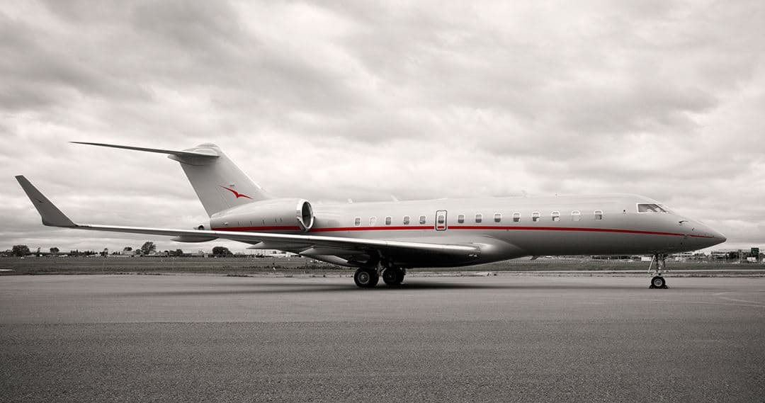 Sun, Nov 8in 5 daysBostonKPSM · Portsmouth International at Pease AirportHarrisburgKMDT · Harrisburg International AirportGlobal 500012—On request8NovBoston → HarrisburgKPSM → KMDT · in 5 daysGlobal 5000 · 12 seatsOn request
- Sun, Nov 8in 5 daysPortsmouthKPSM · Portsmouth International at Pease AirportPlymouthKPYM · Plymouth Municipal AirportBeechcraft King Air C90545mOn request8NovPortsmouth → PlymouthKPSM → KPYM · in 5 daysBeechcraft King Air C90 · 5 seats · 45mOn request
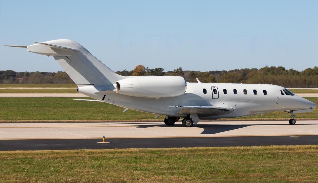 Wed, Nov 11in 8 daysBostonKPSM · Portsmouth International at Pease AirportGeorgetownKGED · Delaware Coastal AirportCitation X8—On request11NovBoston → GeorgetownKPSM → KGED · in 8 daysCitation X · 8 seatsOn request
- Thu, Nov 12in 9 daysBostonKPSM · Portsmouth International at Pease AirportPlymouthKPYM · Plymouth Municipal AirportKing Air 906—On request12NovBoston → PlymouthKPSM → KPYM · in 9 daysKing Air 90 · 6 seatsOn request
- Tue, Nov 17in 14 daysPortsmouthKPSM · Portsmouth International at Pease AirportBedfordKBED · Laurence G Hanscom FieldBeechcraft King Air 250738mOn request17NovPortsmouth → BedfordKPSM → KBED · in 14 daysBeechcraft King Air 250 · 7 seats · 38mOn request
 KPSM · Portsmouth International at Pease Airport
* Total price incl. 10% service fee, converted to your selected currency. Price subject to operator confirmation.
Empty legs to KPSM
17 arrivals available
- Tue, Nov 318:54ColumbusKCMH · John Glenn Columbus IntlPortsmouthKPSM · Portsmouth IntlBombardier Learjet 608—$13,7643NovColumbus → PortsmouthKCMH → KPSM · 18:54Bombardier Learjet 60 · 8 seats$13,764
- Wed, Nov 416:26TeterboroKTEBPortsmouthKPSM · Portsmouth IntlBombardier Learjet 607—$6,3534NovTeterboro → PortsmouthKTEB → KPSM · 16:26Bombardier Learjet 60 · 7 seats$6,353
 Wed, Nov 4TomorrowTeterboroKTEB · Teterboro AirportPortsmouthKPSM · Portsmouth International at Pease AirportLear 607—$6,4524NovTeterboro → PortsmouthKTEB → KPSM · TomorrowLear 60 · 7 seats$6,452
- Fri, Nov 6in 3 daysNew YorkKTEB · Teterboro AirportBostonKPSM · Portsmouth International at Pease AirportKing Air 906—On request6NovNew York → BostonKTEB → KPSM · in 3 daysKing Air 90 · 6 seatsOn request
- Fri, Nov 6in 3 daysTeterboroKTEB · Teterboro AirportPortsmouthKPSM · Portsmouth International at Pease AirportBeechcraft King Air C9051h 15mOn request6NovTeterboro → PortsmouthKTEB → KPSM · in 3 daysBeechcraft King Air C90 · 5 seats · 1h 15mOn request
- Mon, Nov 16in 13 daysPlymouthKPYM · Plymouth Municipal AirportBostonKPSM · Portsmouth International at Pease AirportKing Air 906—On request16NovPlymouth → BostonKPYM → KPSM · in 13 daysKing Air 90 · 6 seatsOn request
- Mon, Nov 16in 13 daysPlymouthKPYM · Plymouth Municipal AirportPortsmouthKPSM · Portsmouth International at Pease AirportBeechcraft King Air C90545mOn request16NovPlymouth → PortsmouthKPYM → KPSM · in 13 daysBeechcraft King Air C90 · 5 seats · 45mOn request
- Wed, Nov 18in 15 daysBedfordKBED · Laurence G Hanscom FieldPortsmouthKPSM · Portsmouth International at Pease AirportBeechcraft King Air 250738mOn request18NovBedford → PortsmouthKBED → KPSM · in 15 daysBeechcraft King Air 250 · 7 seats · 38mOn request
- Thu, Nov 19in 16 daysRocklandKRKD · Knox County Regional AirportPortsmouthKPSM · Portsmouth International at Pease AirportBeechcraft King Air 250750mOn request19NovRockland → PortsmouthKRKD → KPSM · in 16 daysBeechcraft King Air 250 · 7 seats · 50mOn request
* Total price incl. 10% service fee, converted to your selected currency. Price subject to operator confirmation.
Map: Portsmouth Airport
View the location of Portsmouth – PSM/KPSM. Zoom in to explore the area around the airport.
About the airport
Portsmouth International at Pease Airport (PSM/KPSM) is the key private jet gateway for Portsmouth. PrivJet gives you instant access to charter flights and empty legs: fast, discreet and globally connected.
KPSM airport FAQ
Are there any restrictions at Portsmouth airport (KPSM) today?
There are currently 11 valid NOTAMs for Portsmouth (KPSM). Affected: Apron: closed; Taxiway: closed; Taxiway: limited to; Services: out of service and 3 more. For information only, not for flight planning or operational use. Always rely on an official pre-flight briefing. This list may be incomplete or out of date.
What is the weather at Portsmouth airport (KPSM)?
According to the latest weather report for KPSM (METAR, 03 Nov, 04:55 UTC): Good visual conditions (VFR). Wind 3 kt (6 km/h) from west (270°), visibility 10 km or more, temperature 15 °C (dew point 4 °C). For information only, not for flight planning. Weather can change quickly; always rely on official reports.
How long are the runways at Portsmouth airport (KPSM)?
Portsmouth (KPSM) has one runway: runway 16/34 with 3,451 m (11,321 ft), asphalt/concrete.
What are the radio frequencies at Portsmouth airport (KPSM)?
Frequencies at KPSM: Tower 128.4 MHz, Ground 120.95 MHz and ATIS 132.05 MHz. For information only. Always rely on the published AIP.
What are the airport codes of Portsmouth International at Pease Airport?
The ICAO code is KPSM and the IATA code is PSM. ICAO codes are used by air traffic control and pilots, e.g. in flight plans; IATA codes appear on tickets and baggage tags.
What is the elevation of KPSM airport?
Portsmouth International at Pease Airport sits at 100 ft (30 m) above sea level. Local time zone: America/New York.
Can I fly to KPSM by private jet?
Whether a private jet can operate into Portsmouth International at Pease Airport depends on runway length, opening hours, customs and immigration rules as well as slot and handling availability, among other things. PrivJet checks this with the operating carrier for every request.
Are there empty legs from or to KPSM?
There are currently 17 empty legs departing from and 17 arriving at Portsmouth International at Pease Airport. Empty legs are repositioning flights at heavily reduced prices; the list is updated several times a day.