Providence Rhode Island TF Green Airport (KPVD / PVD)
Empty legs and charters from Providence
KPVD airport at a glance
- ICAO code
- KPVD
- IATA code
- PVD
- City
- Providence
- Region
- Rhode Island
- Country
- United States
- Elevation
- 55 ft (17 m)
- Time zone
- America/New York (UTC-5)
- Coordinates
- 41.7326° N, 71.4204° W
- Empty legs from
- 18
- Empty legs to
- 19
Weather & airport info KPVD
Current weather
Good visual conditions (VFR)observed 03 Nov, 13:51 UTC- Wind
- 4 kt (7 km/h) from southwest (230°)
- Visibility
- 10 km or more
- Clouds
- few clouds at 8,000 ft, few clouds at 13,000 ft, broken clouds at 25,000 ft
- Temperature
- 16 °C (dew point 8 °C)
- Pressure (QNH)
- 1,026 hPa
Original weather report (METAR)
METAR KPVD 031351Z 23004KT 10SM FEW080 FEW130 BKN250 16/08 A3029 RMK AO2 SLP257 T01560078 $
Forecast (TAF)
- 03 Nov, 12:00–06:00 UTC8 kt (15 km/h) from southwest (220°) · visibility 10 km or more · few clouds at 20,000 ft
- 04 Nov, 06:00–09:00 UTCfrom4 kt (7 km/h) from southwest (220°) · visibility 10 km or more · overcast at 5,000 ft
- 04 Nov, 09:00–12:00 UTCfrom4 kt (7 km/h) from southwest (220°) · visibility 10 km or more · overcast at 1,000 ft
Original forecast (TAF)
TAF KPVD 031120Z 0312/0412 22008KT P6SM FEW200 FM040600 22004KT P6SM OVC050 FM040900 22004KT P6SM OVC010
Airport
- Elevation
- 55 ft (17 m)
- Sunrise / Sunset
- 06:20 / 16:38 local time
Runways
| Runway | Length | Surface | Lighted |
|---|---|---|---|
| 05/23 | 2,652 m (8,700 ft) | asphalt | yes |
| 16/34 | 1,853 m (6,081 ft) | asphalt | yes |
Radio frequencies
- ATIS: 124.2
- Clearance: 126.65
- CTAF: 120.7
- Ground: 121.9
- Tower: 120.7
For information only, not for flight planning. Weather can change quickly; always rely on official reports. Sources: aviationweather.gov (NOAA), OurAirports.
Airport map KPVD
Full screen →Runways white, taxiways yellow with designators, closed taxiways and runways per NOTAM in red.
Closed per NOTAM: RWY 5/23, RWY 16/34, TWY B* (* partly closed)
Official charts (FAA)
Cycle 2611, valid until 0901Z 11/26/26
Airport diagram (FAA)
Airport diagram (1)
Instrument approaches (10)
Minimums (2)
Hot spots (1)
Other (2)
For information only, not for navigation. Always use current official charts and NOTAMs.
Current NOTAMs for KPVD(37)
NOTAMs (Notices to Air Missions) announce short-term changes at an airport: closed runways or taxiways, unserviceable approach aids, obstacles, airspace restrictions.
- ClosedRunway: closedA5326/26· until 04 Nov, 10:30 UTC
Runway 05/23 is closed, except for crossing. This means the runway cannot be used for takeoffs and landings.
Show original text
RWY 05/23 CLSD EXC XNG
A5326/26 NOTAMN
Q) KZBW/QMRLC////000/999/4143N07125W005
A) KPVD
B) 2611031000
C) 2611041030
D) DLY 1000-1030
E) RWY 05/23 CLSD EXC XNG
Hours: DLY 1000-1030
- ClosedRunway: closedA5328/26· until 04 Nov, 10:30 UTC
Runway 16/34 at Rhode Island TF Green International Airport is closed.
Show original text
RWY 16/34 CLSD
A5328/26 NOTAMN
Q) KZBW/QMRLC////000/999/4143N07125W005
A) KPVD
B) 2611030515
C) 2611041030
D) DLY 0515-1030
E) RWY 16/34 CLSD
Hours: DLY 0515-1030
- ClosedAerodrome: closedA5330/26· until 04 Nov, 10:30 UTC
Rhode Island TF Green International Airport is closed for all flights, except for helicopters.
Show original text
AD AP CLSD EXC HEL
A5330/26 NOTAMN
Q) KZBW/QFALC////000/999/4143N07125W005
A) KPVD
B) 2611030515
C) 2611041030
D) DLY 0515-1030
E) AD AP CLSD EXC HEL
Hours: DLY 0515-1030
- ClosedRunway: closedA5320/26· until 17 Nov, 10:00 UTC
Runway 05/23 is closed except for crossing. This means aircraft may only cross the runway, but not use it for takeoffs or landings.
Show original text
RWY 05/23 CLSD EXC XNG
A5320/26 NOTAMN
Q) KZBW/QMRLC////000/999/4143N07125W005
A) KPVD
B) 2611020300
C) 2611171000
D) DLY 0300-1000
E) RWY 05/23 CLSD EXC XNG
Hours: DLY 0300-1000
- ClosedRunway: closed10/122· until 17 Nov, 09:00 UTC
Runway 05/23 is closed, except for crossings.
Show original text
RWY 05/23 CLSD EXC XNG
A5241/26 NOTAMN Q) KZBW/QMRLC////000/999/4143N07125W005 A) KPVD B) 2610270200 C) 2611170900 D) DLY 0200-0900 E) RWY 05/23 CLSD EXC XNG
Hours: DLY 0200-0900
- Out of serviceServices11/021· from 04 Nov, 05:30 UTC · until 04 Nov, 12:30 UTC
The Surface Movement Radar (SMR) is out of service. This radar system helps air traffic control monitor aircraft and vehicles on the ground.
Show original text
SVC SMR U/S
- Out of serviceApproach lighting: unserviceableA5336/26· until 03 Nov, 17:00 UTC
Runway 34 approach lighting out of service
Show original text
RWY 34 ALS U/S
A5336/26 NOTAMN
Q) KZBW/QLAAS////000/999/4143N07125W005
A) KPVD
B) 2611031400
C) 2611031700
E) RWY 34 ALS U/S
- Out of serviceInstrument approach procedure4726/26· until 03 Nov, 20:00 UTC
The VOR/DME system at Rhode Island TF Green International airport is out of service. This system helps aircraft with navigation.
Show original text
IAP RHODE ISLAND TF GREEN INTL, PROVIDENCE, RI. ILS OR LOC RWY 5, AMDT 20... ILS RWY 5, (CAT II AND III), AMDT 20... MISSED APPROACH: CLIMB TO 800 THEN CLIMBING LEFT TURN TO 2500 DIRECT FOSTY AND HOLD (GPS REQUIRED). RADAR REQUIRED EXCEPT FOR ACFT EQUIPPED WITH SUITABLE RNAV SYSTEM WITH GPS, PVD VOR/DME OUT OF SERVICE. 2611031300-2611032000EST
Q) KZBW/QPIXX/I/NBO/A/000/999/4143N07125W005
A) KPVD
B) 2603030010
C) 2610130010EST
E) PVD RHODE ISLAND TF GREEN INTL, PROVIDENCE, RI.
ILS OR LOC RWY 5, AMDT 20...
ILS RWY 5, (CAT II AND III), AMDT 20...
MISSED APPROACH: CLIMB TO 800 THEN CLIMBING LEFT TURN TO 2500 DIRECT FOSTY AND HOLD (GPS REQUIRED).
RADAR REQUIRED EXCEPT FOR ACFT EQUIPPED WITH SUITABLE RNAV SYSTEM WITH GPS,
PVD VOR/DME U/S.
29 more NOTAMs
- Out of serviceInstrument approach procedure4727/26· until 03 Nov, 20:00 UTC
Instrument approach procedure RHODE ISLAND TF GREEN INTL, PROVIDENCE, RI. ILS (instrument landing system) or localizer runway 23, amendment 8A... ILS (instrument landing system) runway 23 (SA category I - II), amendment 8A... MISSED APPROACH: CLIMB to 700 THEN CLIMBING RIGHT TURN to 2500 on HEADING 350 and PUT VOR/DME R-141 to FOSTY INT/ORW 23.53 DME (distance measuring) and HOLD, PVD VOR/DME out of service. 3 Nov 13:00 UTC -2611032000EST
Show original text
IAP RHODE ISLAND TF GREEN INTL, PROVIDENCE, RI. ILS OR LOC RWY 23, AMDT 8A... ILS RWY 23 (SA CAT I - II), AMDT 8A... MISSED APPROACH: CLIMB TO 700 THEN CLIMBING RIGHT TURN TO 2500 ON HEADING 350 AND PUT VOR/DME R-141 TO FOSTY INT/ORW 23.53 DME AND HOLD, PVD VOR/DME OUT OF SERVICE. 2611031300-2611032000EST
Q) KZBW/QPIXX/I/NBO/A/000/999/4143N07125W005
A) KPVD
B) 2603030010
C) 2610130010EST
E) PVD RHODE ISLAND TF GREEN INTL, PROVIDENCE, RI.
ILS OR LOC RWY 23, AMDT 8A...
ILS RWY 23 (SA CAT I - II), AMDT 8A...
MISSED APPROACH: CLIMB TO 700 THEN CLIMBING RIGHT TURN TO 2500 ON HEADING 350 AND PUT VOR/DME R-141 TO FOSTY INT/ORW 23.53 DME AND HOLD,
PVD VOR/DME U/S.
- Out of serviceInstrument approach procedure4728/26· until 03 Nov, 20:00 UTC
The PVD VOR/DME, a navigation system that guides aircraft to and from airports, is out of service. This affects the Instrument Landing System (ILS) or Localizer (LOC) for runway 34 and the missed approach procedures.
Show original text
IAP RHODE ISLAND TF GREEN INTL, PROVIDENCE, RI. ILS OR LOC RWY 34, AMDT 12B... MISSED APPROACH: CLIMB TO 700 THEN CLIMBING LEFT TURN TO 2500 ON HEADING 300 AND PUT VOR/DME R-141 TO FOSTY INT/ORW 23.53 DME AND HOLD, PVD VOR/DME OUT OF SERVICE. 2611031300-2611032000EST
Q) KZBW/QPIXX/I/NBO/A/000/999/4143N07125W005
A) KPVD
B) 2603030011
C) 2610130011EST
E) PVD RHODE ISLAND TF GREEN INTL, PROVIDENCE, RI.
ILS OR LOC RWY 34, AMDT 12B...
MISSED APPROACH:  CLIMB TO 700 THEN CLIMBING LEFT TURN TO 2500 ON HEADING 300 AND PUT VOR/DME R-141 TO FOSTY INT/ORW 23.53 DME AND HOLD,
PVD VOR/DME U/S.
- Out of serviceVOR/DME: unserviceableA5339/26· until 03 Nov, 20:00 UTC
The VOR/DME navigation system at the airport is out of service. This system helps aircraft with navigation.
Show original text
PVD NAV VOR/DME U/S
A5339/26 NOTAMN
Q) KZBW/QNMAS////000/999/4143N07125W005
A) KPVD
B) 2611031300
C) 2611032000
E) PVD NAV VOR/DME U/S
- Out of serviceInstrument approach procedure: changedA5346/26· until 03 Nov, 20:00 UTC
The VOR/DME system (a navigation system) at Rhode Island TF Green International Airport is out of service. This affects the missed approach procedure for the instrument approach to runway 34.
Show original text
IAP RHODE ISLAND TF GREEN INTL, PROVIDENCE, RI. ILS OR LOC RWY 34, AMDT 12B... MISSED APPROACH: CLIMB TO 700 THEN CLIMBING LEFT TURN TO 2500 ON HEADING 300 AND PUT VOR/DME R-141 TO FOSTY INT/ORW 23.53 DME AND HOLD, PVD VOR/DME OUT OF SERVICE.
A5346/26 NOTAMN
Q) KZBW/QPICH/I/NBO/A/000/999/4143N07125W005
A) KPVD
B) 2611031300
C) 2611032000
E) IAP RHODE ISLAND TF GREEN INTL, PROVIDENCE, RI. ILS OR LOC RWY 34, AMDT 12B... MISSED APPROACH: CLIMB TO 700 THEN CLIMBING LEFT TURN TO 2500 ON HEADING 300 AND PUT VOR/DME R-141 TO FOSTY INT/ORW 23.53 DME AND HOLD, PVD VOR/DME OUT OF SERVICE.
- Out of serviceInstrument approach procedure: changedA5347/26· until 03 Nov, 20:00 UTC
The Instrument Landing System (ILS) or Localizer (LOC) for runway 23 has been amended. The PVD VOR/DME navigation system is out of service, which affects the missed approach procedures.
Show original text
IAP RHODE ISLAND TF GREEN INTL, PROVIDENCE, RI. ILS OR LOC RWY 23, AMDT 8A... ILS RWY 23 (SA CAT I - II), AMDT 8A... MISSED APPROACH: CLIMB TO 700 THEN CLIMBING RIGHT TURN TO 2500 ON HEADING 350 AND PUT VOR/DME R-141 TO FOSTY INT/ORW 23.53 DME AND HOLD, PVD VOR/DME OUT OF SERVICE.
A5347/26 NOTAMN
Q) KZBW/QPICH/I/NBO/A/000/999/4143N07125W005
A) KPVD
B) 2611031300
C) 2611032000
E) IAP RHODE ISLAND TF GREEN INTL, PROVIDENCE, RI. ILS OR LOC RWY 23, AMDT 8A... ILS RWY 23 (SA CAT I - II), AMDT 8A... MISSED APPROACH: CLIMB TO 700 THEN CLIMBING RIGHT TURN TO 2500 ON HEADING 350 AND PUT VOR/DME R-141 TO FOSTY INT/ORW 23.53 DME AND HOLD, PVD VOR/DME OUT OF SERVICE.
- Out of serviceInstrument approach procedure: changedA5348/26· until 03 Nov, 20:00 UTC
The Instrument Landing System (ILS) or Localizer (LOC) for runway 5 has been amended. The PVD VOR/DME navigation system is out of service, which affects the missed approach procedures and requires GPS.
Show original text
IAP RHODE ISLAND TF GREEN INTL, PROVIDENCE, RI. ILS OR LOC RWY 5, AMDT 20... ILS RWY 5, (CAT II AND III), AMDT 20... MISSED APPROACH: CLIMB TO 800 THEN CLIMBING LEFT TURN TO 2500 DIRECT FOSTY AND HOLD (GPS REQUIRED). RADAR REQUIRED EXCEPT FOR ACFT EQUIPPED WITH SUITABLE RNAV SYSTEM WITH GPS, PVD VOR/DME OUT OF SERVICE.
A5348/26 NOTAMN
Q) KZBW/QPICH/I/NBO/A/000/999/4143N07125W005
A) KPVD
B) 2611031300
C) 2611032000
E) IAP RHODE ISLAND TF GREEN INTL, PROVIDENCE, RI. ILS OR LOC RWY 5, AMDT 20... ILS RWY 5, (CAT II AND III), AMDT 20... MISSED APPROACH: CLIMB TO 800 THEN CLIMBING LEFT TURN TO 2500 DIRECT FOSTY AND HOLD (GPS REQUIRED). RADAR REQUIRED EXCEPT FOR ACFT EQUIPPED WITH SUITABLE RNAV SYSTEM WITH GPS, PVD VOR/DME OUT OF SERVICE.
- ClosedTaxiway: closedA5352/26· until 03 Nov, 17:00 UTC
Taxiway B is closed between taxiway M and runway 16/34. This means that this part of the taxiway cannot be used.
Show original text
TWY B BTN TWY M AND RWY 16/34 CLSD
A5352/26 NOTAMN
Q) KZBW/QMXLC////000/999/4143N07125W005
A) KPVD
B) 2611031019
C) 2611031700
E) TWY B BTN TWY M AND RWY 16/34 CLSD
- Out of serviceILS: unserviceable10/127· until 04 Nov, 10:30 UTC
The instrument landing system (ILS) for runway 34 is out of service. The ILS guides aircraft to the runway in poor visibility.
Show original text
PVD NAV ILS RWY 34 U/S
A5248/26 NOTAMN Q) KZBW/QICAS////000/999/4143N07125W005 A) KPVD B) 2611020515 C) 2611041030 D) DLY 0515-1030 E) PVD NAV ILS RWY 34 U/S
Hours: DLY 0515-1030
- Out of serviceApproach lighting: unserviceable10/128· until 04 Nov, 10:30 UTC
The approach lighting system (ALS) for runway 34 is out of service. The ALS helps pilots locate the runway in poor visibility.
Show original text
RWY 34 ALS U/S
A5247/26 NOTAMN
Q) KZBW/QLAAS////000/999/4143N07125W005
A) KPVD
B) 2611020515
C) 2611041030
D) DLY 0515-1030
E) RWY 34 ALS U/S
Hours: DLY 0515-1030
- Out of serviceApproach lighting: unserviceableA5247/26· until 04 Nov, 10:30 UTC
The approach lighting system (ALS) for runway 34 is out of service. The ALS helps pilots locate the runway in poor visibility.
Show original text
RWY 34 ALS U/S
A5247/26 NOTAMN Q) KZBW/QLAAS////000/999/4143N07125W005 A) KPVD B) 2611020515 C) 2611041030 D) DLY 0515-1030 E) RWY 34 ALS U/S
Hours: DLY 0515-1030
- Out of serviceILS: unserviceableA5248/26· until 04 Nov, 10:30 UTC
PVD navigation: ILS (instrument landing system) runway 34 out of service
Show original text
PVD NAV ILS RWY 34 U/S
A5248/26 NOTAMN
Q) KZBW/QICAS////000/999/4143N07125W005
A) KPVD
B) 2611020515
C) 2611041030
D) DLY 0515-1030
E) PVD NAV ILS RWY 34 U/S
Hours: DLY 0515-1030
- Out of serviceObstacle lights: unserviceableA5306/26· until 13 Nov, 21:16 UTC
A tower 4.1 nautical miles southwest of the airport has a light that is out of service. Its top is 269 feet above sea level, 100 feet above ground.
Show original text
TOWER LGT (ASN 2022-ANE-3905-O 414010N0712908W (4.1NM SW PVD) 269FT (100FT AGL) U/S
A5306/26 NOTAMN
Q) KZBW/QOLAS/IV/M/AE/000/999/4140N07129W001
A) KPVD
B) 2610302116
C) 2611132116
E) TOWER LGT (ASN 2022-ANE-3905-OE) 414010N0712908W (4.1NM SW PVD) 269FT (100FT AGL) U/S
- Out of serviceObstacle lights: unserviceableA5308/26· until 13 Nov, 21:16 UTC
A tower 4.3 nautical miles southwest of the airport has a light that is out of service. Its top is 279 feet above sea level, 90 feet above ground.
Show original text
TOWER LGT (ASN 2022-ANE-3907-O 413959N0712913W (4.3NM SW PVD) 279FT (90FT AGL) U/S
A5308/26 NOTAMN
Q) KZBW/QOLAS/IV/M/AE/000/999/4139N07129W001
A) KPVD
B) 2610302116
C) 2611132116
E) TOWER LGT (ASN 2022-ANE-3907-OE) 413959N0712913W (4.3NM SW PVD) 279FT (90FT AGL) U/S
- Out of serviceRunway end identifier lights: unserviceableA5298/26· until 13 Nov, 23:59 UTC
The Runway End Identification Lighting (RWY END ID LGT) for runway 16 is out of service. These lights help mark the end of the runway.
Show original text
RWY 16 RWY END ID LGT U/S
A5298/26 NOTAMN
Q) KZBW/QLIAS////000/999/4143N07125W005
A) KPVD
B) 2610301503
C) 2611132359
E) RWY 16 RWY END ID LGT U/S
- Out of serviceInstrument approach procedure3669/26· until 13 Nov, 20:00 UTC (estimated)
For the ILS or LOC approach to runway 23 at Rhode Island TF Green International Airport, a DME system is required, except for aircraft equipped with a suitable RNAV system with GPS, as the VOR/DME is out of service.
Show original text
IAP RHODE ISLAND TF GREEN INTL, PROVIDENCE, RI. ILS OR LOC RWY 23, AMDT 8A... ILS RWY 23 (SA CAT I-II), AMDT 8A... DME REQUIRED EXCEPT FOR ACFT EQUIPPED WITH SUITABLE RNAV SYSTEM WITH GPS, PUT VOR/DME OUT OF SERVICE. 2610291409-2611132000EST
Q) KZBW/QPIXX/I/NBO/A/000/999/4143N07125W005
A) KPVD
B) 2610291409
C) 2611132000EST
E) PVD RHODE ISLAND TF GREEN INTL, PROVIDENCE, RI.
ILS OR LOC RWY 23, AMDT 8A...
ILS RWY 23 (SA CAT I-II), AMDT 8A...
DME REQUIRED EXCEPT FOR ACFT EQUIPPED WITH SUITABLE RNAV SYSTEM WITH GPS,
PUT VOR/DME U/S.
- Out of serviceInstrument approach procedure: changedA5293/26· until 13 Nov, 20:00 UTC
For the ILS or LOC approach to runway 23 at Rhode Island TF Green International Airport, a DME system is required, except for aircraft equipped with a suitable RNAV system with GPS, as the VOR/DME is out of service.
Show original text
IAP RHODE ISLAND TF GREEN INTL, PROVIDENCE, RI. ILS OR LOC RWY 23, AMDT 8A... ILS RWY 23 (SA CAT I-II), AMDT 8A... DME REQUIRED EXCEPT FOR ACFT EQUIPPED WITH SUITABLE RNAV SYSTEM WITH GPS, PUT VOR/DME OUT OF SERVICE.
A5293/26 NOTAMN
Q) KZBW/QPICH/I/NBO/A/000/999/4143N07125W005
A) KPVD
B) 2610291409
C) 2611132000
E) IAP RHODE ISLAND TF GREEN INTL, PROVIDENCE, RI. ILS OR LOC RWY 23, AMDT 8A... ILS RWY 23 (SA CAT I-II), AMDT 8A... DME REQUIRED EXCEPT FOR ACFT EQUIPPED WITH SUITABLE RNAV SYSTEM WITH GPS, PUT VOR/DME OUT OF SERVICE.
- Out of serviceBraking action: unserviceableA5290/26· until 31 Dec, 23:59 UTC
The airport's (AD AP) friction measuring device is out of service (U/S).
Show original text
AD AP FRICTION MEASURING DEVICE U/S
A5290/26 NOTAMN
Q) KZBW/QFBAS////000/999/4143N07125W005
A) KPVD
B) 2610291147
C) 2612312359
E) AD AP FRICTION MEASURING DEVICE U/S
- ClosedApron: closedA5288/26· until 31 Dec, 23:59 UTC
The south cargo ramp on the apron is closed.
Show original text
APRON SOUTH CARGO RAMP CLSD
A5288/26 NOTAMN
Q) KZBW/QMNLC////000/999/4143N07125W005
A) KPVD
B) 2610290903
C) 2612312359
E) APRON SOUTH CARGO RAMP CLSD
- Out of serviceTerminal area surveillance radar: unserviceableA5144/26· until 29 Dec, 21:00 UTC
The Transponder/Secondary Surveillance Radar (TAR/SSR) service is out of service. This service helps air traffic control identify and track aircraft.
Show original text
SVC TAR/SSR U/S
A5144/26 NOTAMN
Q) KZBW/QCTAS////000/999/4143N07125W005
A) KPVD
B) 2610191200
C) 2612292100
E) SVC TAR/SSR U/S
- Out of serviceObstacle09/152· until 10 Nov, 20:30 UTC
A tower light near the airport is out of service. The top of the tower is 654 ft above sea level, 181 ft above ground.
Show original text
OBST TOWER LGT (ASR UNKNOWN) 413719.90N0713401.30W (7.11NM WNW OQU) 654FT (181FT AGL) U/S
- NoticeAirspace11/014· until 16 Nov, 21:00 UTC
Overwater wing in ground craft testing is taking place within an area 2 nautical miles radius, 3 nautical miles east-northeast of OQU. This affects the airspace from the surface to 60 ft above ground.
Show original text
AIRSPACE OVERWATER WING IN GROUND CRAFT TESTING WI AN AREA DEFINED AS 2NM RADIUS OF 413820N0712254W (3NM ENE OQU) SFC-60FT DLY 1300-2100
- NoticeTaxiway11/020· until 04 Nov, 10:30 UTC
Taxiway B holding position MARKINGS for runway 05/23 east SIDE not MARKED
Show original text
TWY B HLDG PSN MARKINGS FOR RWY 05/23 EAST SIDE NOT MARKED
- NoticeRunway: work in progressA5322/26· until 04 Nov, 10:30 UTC
Runway 05/23 has construction work in progress. This may lead to operational restrictions.
Show original text
RWY 05/23 WIP CONSTRUCTION
A5322/26 NOTAMN
Q) KZBW/QMRHW////000/999/4143N07125W005
A) KPVD
B) 2611031000
C) 2611041030
D) DLY 1000-1030
E) RWY 05/23 WIP CONSTRUCTION
Hours: DLY 1000-1030
- NoticeObstacle11/017· until 06 Nov, 23:59 UTC
North of RHODE ISLAND TF GREEN INTL airport, there is an unlit building as an obstacle. Its top is 90 feet above sea level, 38 feet above ground.
Show original text
OBST BLDG (ASN 1996-ANE-269-OE) 414359N0712532W (0.6NM NNE PVD) 90FT (38FT AGL) NOT LGTD
- NoticeOtherA5332/26· until 16 Nov, 21:00 UTC
Airspace OVERWATER WING in GROUND EFFECT CRAFT TESTING within an area defined as 2 NM radius of a defined point (4 NM south of OQU) surface- 60 ft daily 1300-2100
Show original text
AIRSPACE OVERWATER WING IN GROUND EFFECT CRAFT TESTING WI AN AREA DEFINED AS 2NM RADIUS OF 413245N0712404W (4NM S OQU) SFC-60FT DLY 1300-2100
A5332/26 NOTAMN
Q) KZBW/QXXXX////000/001/4143N07125W005
A) KPVD
B) 2611021300
C) 2611162100
E) AIRSPACE OVERWATER WING IN GROUND EFFECT CRAFT TESTING WI AN AREA DEFINED AS 2NM RADIUS OF 413245N0712404W (4NM S OQU) SFC-60FT DLY 1300-2100
F) SFC
G) 60FT AMSL
- NoticeRunway: work in progressA5317/26· until 17 Nov, 10:00 UTC
Runway 05/23 has work in progress due to construction. This may lead to operational restrictions.
Show original text
RWY 05/23 WIP CONST
A5317/26 NOTAMN
Q) KZBW/QMRHW////000/999/4143N07125W005
A) KPVD
B) 2611020300
C) 2611171000
D) DLY 0300-1000
E) RWY 05/23 WIP CONST
Hours: DLY 0300-1000
- NoticeRunwayA5310/26· until 17 Nov, 09:00 UTC
Runway 05/23 between taxiway C and taxiway A not GROOVED
Show original text
RWY 05/23 BTN TWY C AND TWY A NOT GROOVED
A5310/26 NOTAMN
Q) KZBW/QMRXX////000/999/4143N07125W005
A) KPVD
B) 2610302111
C) 2611170900
E) RWY 05/23 BTN TWY C AND TWY A NOT GROOVED
- NoticeRunway: work in progress10/150· until 17 Nov, 09:00 UTC
Work in progress (WIP) construction is taking place on runway 05/23. This may lead to restrictions or delays.
Show original text
RWY 05/23 WIP CONST
A5280/26 NOTAMN Q) KZBW/QMRHW////000/999/4143N07125W005 A) KPVD B) 2610280200 C) 2611170900 D) DLY 0200-0900 E) RWY 05/23 WIP CONST
Hours: DLY 0200-0900
- NoticeRunway10/001· until 30 Nov, 23:59 UTC
The edge markings for runway 16/34 are not standard.
Show original text
RWY 16/34 EDGE MARKINGS NOT STD
For information only, not for flight planning or operational use. Always rely on an official pre-flight briefing. This list may be incomplete or out of date. Explanations and expanded abbreviations are generated automatically. The original text is authoritative. Source: FAA NOTAM Management Service (SWIM).
Private jet traffic in Rhode Island TF Green International Airport (last 30 days)
- Arrivals
- 428
- Departures
- 383
- Different jets
- 332
Most frequent origins: Teterboro Airport (52), Laurence G Hanscom Field (14), Morristown Municipal Airport (10), Westchester County Airport (9), Washington Dulles International Airport (7).
Most frequent destinations: Teterboro Airport (44), Westchester County Airport (14), Morristown Municipal Airport (13), Laurence G Hanscom Field (13), Bradley International Airport (7).
Most common aircraft types: Embraer Phenom 300 (66), Dassault Falcon 2000 (57), Bombardier Challenger 350/3500 (52), Pilatus PC-12 (50), Cessna Citation Excel/XLS (48).
Thursday is the busiest day.
Our own analysis of public ADS-B signals from business jets. Not every flight is received, and jets with a removal request are excluded.
Charter operators based here
Operators with a base at this airport.
- Executive Jet ManagementWhite Plains (Westchester County) (KHPN) · Light jet, Midsize jet, Super midsize jet
- Jet Aviation Flight ServicesTeterboro (KTEB) · Light jet, Super midsize jet, Heavy jet
Empty legs from KPVD
18 departures available
 Sun, Nov 8in 5 daysProvidenceKPVD · Rhode Island TF Green International AirportWatertownKART · Watertown International AirportLearjet 607—$7,3708NovProvidence → WatertownKPVD → KART · in 5 daysLearjet 60 · 7 seats$7,370
 Sun, Nov 816:31ProvidenceKPVD · Rhode Island TF Green International AirportTeterboroKTEB · Teterboro AirportDassault Falcon 2000142m$12,1708NovProvidence → TeterboroKPVD → KTEB · 16:31Dassault Falcon 2000 · 1 seat · 42m$12,170
- Mon, Nov 9in 6 daysProvidenceKPVD · Rhode Island TF Green International AirportRaleigh/DurhamKRDU · Raleigh Durham International AirportBombardier Learjet 60XR7—On request9NovProvidence → Raleigh/DurhamKPVD → KRDU · in 6 daysBombardier Learjet 60XR · 7 seatsOn request
 Mon, Nov 918:24ProvidenceKPVD · Rhode Island TF Green International AirportRaleigh/DurhamKRDU · Raleigh Durham International AirportBombardier Learjet 6011h 30m$17,0949NovProvidence → Raleigh/DurhamKPVD → KRDU · 18:24Bombardier Learjet 60 · 1 seat · 1h 30m$17,094
- Mon, Nov 920:12ProvidenceKPVD · T.F. Green IntlBelmarKBLM · Monmouth ExecutiveBombardier Learjet 607—$7,2609NovProvidence → BelmarKPVD → KBLM · 20:12Bombardier Learjet 60 · 7 seats$7,260
 Mon, Nov 9in 6 daysProvidenceKPVD · Rhode Island TF Green International AirportBelmar/farmingdaleKBLM · Monmouth Executive AirportLear 607—$7,1619NovProvidence → Belmar/farmingdaleKPVD → KBLM · in 6 daysLear 60 · 7 seats$7,161
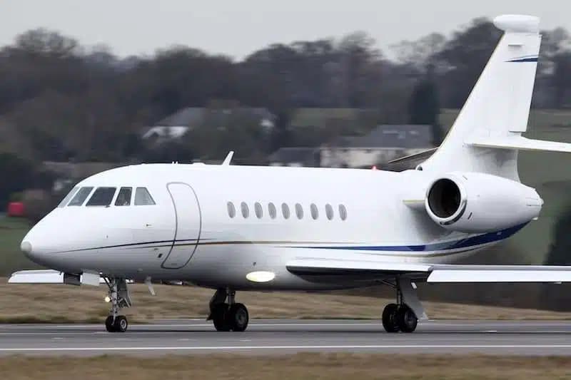 Mon, Nov 9in 6 daysProvidenceKPVD · Rhode Island TF Green International AirportTeterboroKTEB · Teterboro AirportFalcon 20008—$10,8309NovProvidence → TeterboroKPVD → KTEB · in 6 daysFalcon 2000 · 8 seats$10,830
- Mon, Nov 9in 6 daysProvidenceKPVD · Rhode Island TF Green International AirportRaleigh/DurhamKRDU · Raleigh Durham International AirportLearjet Lear 607—$9,0829NovProvidence → Raleigh/DurhamKPVD → KRDU · in 6 daysLearjet Lear 60 · 7 seats$9,082
- Tue, Nov 10in 7 daysWarwickKPVD · Theodore Francis Green State AirportRaleigh/DurhamKRDU · Raleigh Durham International AirportBombardier Learjet 607—$15,18010NovWarwick → Raleigh/DurhamKPVD → KRDU · in 7 daysBombardier Learjet 60 · 7 seats$15,180
 KPVD · Rhode Island TF Green International Airport
* Total price incl. 10% service fee, converted to your selected currency. Price subject to operator confirmation.
Empty legs to KPVD
19 arrivals available
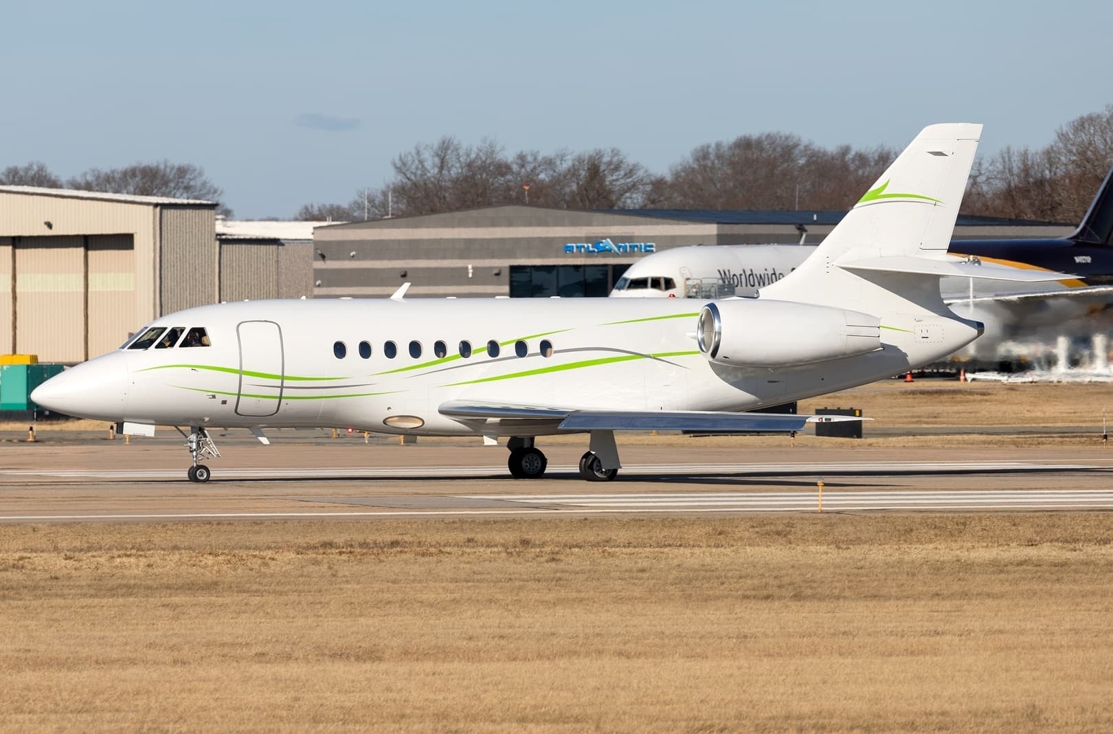 Fri, Nov 6in 3 daysNew YorkKTEB · Teterboro AirportProvidenceKPVD · Rhode Island TF Green International AirportFalcon 2000EX EASy10—$9,6256NovNew York → ProvidenceKTEB → KPVD · in 3 daysFalcon 2000EX EASy · 10 seats$9,625
- Fri, Nov 612:48TeterboroKTEB · Teterboro AirportProvidenceKPVD · Rhode Island TF Green International AirportDassault Falcon 2000136m$10,1426NovTeterboro → ProvidenceKTEB → KPVD · 12:48Dassault Falcon 2000 · 1 seat · 36m$10,142
- Fri, Nov 6in 3 daysTeterboroKTEB · Teterboro AirportProvidenceKPVD · Rhode Island TF Green International AirportFalcon 20008—$9,2726NovTeterboro → ProvidenceKTEB → KPVD · in 3 daysFalcon 2000 · 8 seats$9,272
- Sat, Nov 7in 4 daysValparaisoKVPZ · Porter County Municipal AirportProvidenceKPVD · Rhode Island TF Green International AirportBombardier Learjet 60XR7—On request7NovValparaiso → ProvidenceKVPZ → KPVD · in 4 daysBombardier Learjet 60XR · 7 seatsOn request
- Sat, Nov 7in 4 daysGreensboroK3J7 · Greene County Regional AirportWarwickKPVD · Theodore Francis Green State AirportBombardier Learjet 607—$14,0807NovGreensboro → WarwickK3J7 → KPVD · in 4 daysBombardier Learjet 60 · 7 seats$14,080
- Sat, Nov 712:06ValparaisoKVPZ · Porter County Municipal AirportProvidenceKPVD · Rhode Island TF Green International AirportBombardier Learjet 6011h 54m$16,0167NovValparaiso → ProvidenceKVPZ → KPVD · 12:06Bombardier Learjet 60 · 1 seat · 1h 54m$16,016
- Sat, Nov 715:24San AngeloKSJT · Mathis FieldProvidenceKPVD · T.F. Green IntlBombardier Learjet 608—$33,4277NovSan Angelo → ProvidenceKSJT → KPVD · 15:24Bombardier Learjet 60 · 8 seats$33,427
- Sat, Nov 713:54Palm SpringsKPSP · Palm Springs IntlProvidenceKPVD · T.F. Green IntlBombardier Learjet 608—$46,2837NovPalm Springs → ProvidenceKPSP → KPVD · 13:54Bombardier Learjet 60 · 8 seats$46,283
- Sat, Nov 718:18MorristownKMMU · Morristown MunicipalProvidenceKPVD · T.F. Green IntlBombardier Learjet 607—$4,5387NovMorristown → ProvidenceKMMU → KPVD · 18:18Bombardier Learjet 60 · 7 seats$4,538
* Total price incl. 10% service fee, converted to your selected currency. Price subject to operator confirmation.
Map: Providence Airport
View the location of Providence – PVD/KPVD. Zoom in to explore the area around the airport.
About the airport
Rhode Island TF Green International Airport (PVD/KPVD) is the key private jet gateway for Providence. PrivJet gives you instant access to charter flights and empty legs: fast, discreet and globally connected.
KPVD airport FAQ
Are there any restrictions at Providence airport (KPVD) today?
There are currently 36 valid NOTAMs for Providence (KPVD). According to NOTAM, at least one runway or the aerodrome itself is closed. Affected: Runway: closed; Aerodrome: closed; Taxiway: closed; Apron: closed and 10 more. 1 more NOTAM starts in the coming days. For information only, not for flight planning or operational use. Always rely on an official pre-flight briefing. This list may be incomplete or out of date.
What is the weather at Providence airport (KPVD)?
According to the latest weather report for KPVD (METAR, 03 Nov, 13:51 UTC): Good visual conditions (VFR). Wind 4 kt (7 km/h) from southwest (230°), visibility 10 km or more, temperature 16 °C (dew point 8 °C). For information only, not for flight planning. Weather can change quickly; always rely on official reports.
How long are the runways at Providence airport (KPVD)?
Providence (KPVD) has 2 runways: runway 05/23 with 2,652 m (8,700 ft), asphalt and runway 16/34 with 1,853 m (6,081 ft), asphalt. The longest is 2,652 m.
What are the radio frequencies at Providence airport (KPVD)?
Frequencies at KPVD: Tower 120.7 MHz, Ground 121.9 MHz and ATIS 124.2 MHz. For information only. Always rely on the published AIP.
What are the airport codes of Rhode Island TF Green International Airport?
The ICAO code is KPVD and the IATA code is PVD. ICAO codes are used by air traffic control and pilots, e.g. in flight plans; IATA codes appear on tickets and baggage tags.
What is the elevation of KPVD airport?
Rhode Island TF Green International Airport sits at 55 ft (17 m) above sea level. Local time zone: America/New York.
Can I fly to KPVD by private jet?
Whether a private jet can operate into Rhode Island TF Green International Airport depends on runway length, opening hours, customs and immigration rules as well as slot and handling availability, among other things. PrivJet checks this with the operating carrier for every request.
Are there empty legs from or to KPVD?
There are currently 18 empty legs departing from and 19 arriving at Rhode Island TF Green International Airport. Empty legs are repositioning flights at heavily reduced prices; the list is updated several times a day.