Reno Tahoe Airport (KRNO / RNO)
Empty legs and charters from Reno
KRNO airport at a glance
- ICAO code
- KRNO
- IATA code
- RNO
- City
- Reno
- Region
- Nevada
- Country
- United States
- Elevation
- 4,415 ft (1,346 m)
- Time zone
- America/Los Angeles (UTC-8)
- Coordinates
- 39.4991° N, 119.7680° W
- Empty legs from
- 47
- Empty legs to
- 58
Weather & airport info KRNO
Current weather
No current weather report is available for this airport.
Airport
- Elevation
- 4,415 ft (1,346 m)
- Sunrise / Sunset
- 06:29 / 16:55 local time
Runways
| Runway | Length | Surface | Lighted |
|---|---|---|---|
| 17R/35L | 3,353 m (11,001 ft) | concrete | yes |
| 17L/35R | 2,743 m (9,000 ft) | concrete | yes |
| 08/26 | 1,860 m (6,102 ft) | concrete | yes |
Radio frequencies
- ATIS: 135.8
- Clearance: 124.9
- Ground: 121.9
- Tower: 118.7
- UNICOM: 122.95
For information only, not for flight planning. Weather can change quickly; always rely on official reports. Sources: aviationweather.gov (NOAA), OurAirports.
Airport map KRNO
Full screen →Runways white, taxiways yellow with designators, closed taxiways and runways per NOTAM in red.
Closed per NOTAM: RWY 17L/35R
Official charts (FAA)
Cycle 2611, valid until 0901Z 11/26/26
Airport diagram (FAA)
Airport diagram (1)
Instrument approaches (21)
- ILS OR LOC RWY 35L
- ILS X OR LOC X RWY 17R
- ILS Z OR LOC Z RWY 17R
- ILS Y RWY 17R
- RNAV (RNP) W RWY 35L
- RNAV (RNP) W RWY 35R
- RNAV (RNP) Y RWY 17L
- RNAV (RNP) Y RWY 17R
- RNAV (RNP) Z RWY 17L
- RNAV (RNP) Z RWY 17R
- RNAV (RNP) Z RWY 35L
- RNAV (RNP) Z RWY 35R
- RNAV (GPS) X RWY 17L
- RNAV (GPS) X RWY 17R
- RNAV (GPS) X RWY 35L
- RNAV (GPS) X RWY 35R
- RNAV (GPS) Y RWY 35L
- RNAV (GPS) Y RWY 35R
- LOC Y RWY 17R
- VOR-D
- TACAN-F
Departure procedures (7)
Obstacle departure procedures (3)
Minimums (2)
For information only, not for navigation. Always use current official charts and NOTAMs.
Current NOTAMs for KRNO(23)
NOTAMs (Notices to Air Missions) announce short-term changes at an airport: closed runways or taxiways, unserviceable approach aids, obstacles, airspace restrictions.
- ClosedRunway: closedA1609/26· from 05 Nov, 17:00 UTC · until 05 Nov, 20:00 UTC
Runway 08/26 is closed. This means the runway is not available for flight operations.
Show original text
RWY 08/26 CLSD
A1609/26 NOTAMN
Q) KZOA/QMRLC////000/999/3929N11946W005
A) KRNO
B) 2611051700
C) 2611052000
E) RWY 08/26 CLSD
- ClosedRunway: closedA1450/26· until 14 Dec, 23:59 UTC
Runway 17L/35R is closed.
Show original text
RWY 17L/35R CLSD
A1450/26 NOTAMN
Q) KZOA/QMRLC////000/999/3929N11946W005
A) KRNO
B) 2609281400
C) 2612142359
E) RWY 17L/35R CLSD
- Out of serviceDME associated with ILS: unserviceableA1610/26· from 03 Nov, 16:00 UTC · until 03 Nov, 19:00 UTC
The DME (distance measuring equipment) for the instrument landing system (ILS) of runway 17R is out of service. The ILS guides aircraft to the runway in poor visibility.
Show original text
RNO NAV ILS RWY 17R DME U/S
A1610/26 NOTAMN
Q) KZOA/QIDAS////000/999/3929N11946W005
A) KRNO
B) 2611031600
C) 2611031900
E) RNO NAV ILS RWY 17R DME U/S
- Out of serviceILS localizer: unserviceableA1611/26· from 03 Nov, 16:00 UTC · until 03 Nov, 19:00 UTC
The instrument landing system (ILS) for runway 17, specifically the localizer (LOC) for the back course (BC), is out of service. The ILS guides aircraft to the runway in poor visibility.
Show original text
RNO NAV ILS RWY 17 LOC BC U/S
A1611/26 NOTAMN
Q) KZOA/QILAS////000/999/3929N11946W005
A) KRNO
B) 2611031600
C) 2611031900
E) RNO NAV ILS RWY 17 LOC BC U/S
- Out of serviceILS: unserviceableA1607/26· until 16 Nov, 23:00 UTC
The instrument landing system (ILS) for runway 35L is out of service. The ILS guides aircraft to the runway in poor visibility.
Show original text
RNO NAV ILS RWY 35L U/S
A1607/26 NOTAMN
Q) KZOA/QICAS////000/999/3929N11946W005
A) KRNO
B) 2611021659
C) 2611162300
E) RNO NAV ILS RWY 35L U/S
- Out of serviceILS: unserviceableA1606/26· until 16 Nov, 23:00 UTC
The localizer (LOC) and glideslope (GP) components of the instrument landing system (ILS) for runway 17R are out of service. The ILS guides aircraft to the runway in poor visibility.
Show original text
RNO NAV ILS RWY 17R LOC/GP U/S
A1606/26 NOTAMN
Q) KZOA/QICAS////000/999/3929N11946W005
A) KRNO
B) 2611021658
C) 2611162300
E) RNO NAV ILS RWY 17R LOC/GP U/S
- Out of serviceILS glide path: unserviceableA1587/26· until 09 Nov, 23:59 UTC
The glide path (GP) of the Instrument Landing System (ILS) for runway 17R is out of service. The glide path helps aircraft maintain the correct descent angle to the runway.
Show original text
RNO NAV ILS RWY 17R GP U/S
A1587/26 NOTAMN
Q) KZOA/QIGAS////000/999/3929N11946W005
A) KRNO
B) 2610301527
C) 2611092359
E) RNO NAV ILS RWY 17R GP U/S
- Out of serviceServices10/196· until 11 Nov, 23:59 UTC (estimated)
The ground communication outlet (COM GND COM OUTLET) on frequency 119.77 at Reno/Tahoe International Airport is out of service.
Show original text
COM GND COM OUTLET 119.77 U/S
15 more NOTAMs
- Out of serviceTaxiway10/023· until 30 Nov, 23:59 UTC
All taxiway signs for runway 17L/35R lighting are out of service. This may make taxiway navigation more difficult.
Show original text
TWY ALL SIGNS FOR RWY 17L/35R LGT U/S
- NoticeObstacle: erectedA1608/26· from 03 Nov, 15:00 UTC · until 03 Nov, 21:00 UTC
An unknown crane is an obstacle 1.2 nautical miles east of the airport. Its top is 80 feet above ground and it is flagged.
Show original text
OBST CRANE (ASN UNKNOWN) 393037N1194439W (1.2NM E RNO) UNKNOWN (80FT AGL) FLAGGED
A1608/26 NOTAMN
Q) KZOA/QOBCE/IV/M/AE/000/999/3929N11946W005
A) KRNO
B) 2611031500
C) 2611032100
E) OBST CRANE (ASN UNKNOWN) 393037N1194439W (1.2NM E RNO)
UNKNOWN (80FT AGL) FLAGGED
- NoticeObstacle: erected10/193· until 31 Mar, 23:59 UTC
A crane 0.8 nautical miles north-northwest of the airport is an obstacle. Its top is 4666 feet above sea level, 250 feet above ground, and it is flagged and lighted.
Show original text
OBST CRANE (ASN 2026-AWP-321-NRA) 393040N1194633W (0.8NM NNW RNO) 4666FT (250FT AGL) FLAGGED AND LGTD
A1576/26 NOTAMN
Q) KZOA/QOBCE/IV/M/AE/000/999/3929N11946W005
A) KRNO
B) 2610272125
C) 2703312359
E) OBST CRANE (ASN 2026-AWP-321-NRA) 393040N1194633W (0.8NM NNW RNO) 4666FT (250FT AGL) FLAGGED AND LGTD
- NoticeObstacle: erectedA1576/26· until 31 Mar, 23:59 UTC
A crane 0.8 nautical miles north-northwest of the airport is an obstacle. Its top is 4666 feet above sea level, 250 feet above ground, and it is flagged and lighted.
Show original text
OBST CRANE (ASN 2026-AWP-321-NRA) 393040N1194633W (0.8NM NNW RNO) 4666FT (250FT AGL) FLAGGED AND LGTD
A1576/26 NOTAMN Q) KZOA/QOBCE/IV/M/AE/000/999/3929N11946W005 A) KRNO B) 2610272125 C) 2703312359 E) OBST CRANE (ASN 2026-AWP-321-NRA) 393040N1194633W (0.8NM NNW RNO) 4666FT (250FT AGL) FLAGGED AND LGTD
- NoticeRunway: work in progress10/105· until 14 Dec, 23:59 UTC
Work in progress on runway 17L/35R. This may lead to restrictions or a partial closure of the runway.
Show original text
RWY 17L/35R WIP
A1500/26 NOTAMN
Q) KZOA/QMRHW////000/999/3929N11946W005
A) KRNO
B) 2610190454
C) 2612142359
E) RWY 17L/35R WIP
- NoticeRunway: work in progressA1500/26· until 14 Dec, 23:59 UTC
Work in progress on runway 17L/35R. This means there may be restrictions on this runway.
Show original text
RWY 17L/35R WIP
A1500/26 NOTAMN Q) KZOA/QMRHW////000/999/3929N11946W005 A) KRNO B) 2610190454 C) 2612142359 E) RWY 17L/35R WIP
- NoticeRunway10/052· until 09 Nov, 23:59 UTC
The center line markings on the north side of runway 17R/35L are obscured. This may affect orientation when taxiing on the runway.
Show original text
RWY 17R/35L CL MARKINGS N SIDE OBSC
- NoticeInstrument approach procedure8232/26· until 07 Oct, 21:23 UTC (estimated)
For Reno/Tahoe International Airport, there is an amendment to the RNAV (RNP) W approach procedures for runway 35L. The decision altitude (DA) for RNP 0.30 is 5351 feet.
Show original text
IAP RENO/TAHOE INTL, RENO, NV. RNAV (RNP) W RWY 35L, ORIG... RNP 0.30 DA 5351/HAT 941. 2610072123-2810072123EST
Q) KZOA/QPIXX/I/NBO/A/000/999/3929N11946W005
A) KRNO
B) 2610072114
C) 2705192114EST
E) RNO RENO/TAHOE INTL, RENO, NV.
RNAV (RNP) W RWY 35L, ORIG...
RNP 0.30 DA 5351/HAT 941.
- NoticeInstrument approach procedure8233/26· until 07 Oct, 21:23 UTC (estimated)
For Reno/Tahoe International Airport, there is an amendment to the RNAV (RNP) Z approach procedures for runway 35L. The decision altitude (DA) for RNP 0.20 is 5194 feet, and for RNP 0.30 it is 5355 feet.
Show original text
IAP RENO/TAHOE INTL, RENO, NV. RNAV (RNP) Z RWY 35L, AMDT 2... RNP 0.20 DA# 5194 DA/784 HAT. RNP 0.30 DA 5355 DA/945 HAT. 2610072123-2810072123EST
Q) KZOA/QPIXX/I/NBO/A/000/999/3929N11946W005
A) KRNO
B) 2610072122
C) 2705192122EST
E) RNO RENO/TAHOE INTL, RENO, NV.
RNAV (RNP) Z RWY 35L, AMDT 2...
RNP 0.20 DA# 5194 DA/784 HAT. RNP 0.30 DA 5355 DA/945 HAT.
- NoticeInstrument approach procedure8234/26· until 07 Oct, 21:23 UTC (estimated)
For Reno/Tahoe International Airport, there is an amendment to the RNAV (RNP) W approach procedures for runway 35R. The decision altitude (DA) for RNP 0.30 is 5351 feet.
Show original text
IAP RENO/TAHOE INTL, RENO, NV. RNAV (RNP) W RWY 35R, ORIG... RNP 0.30 DA 5351/HAT 943. 2610072123-2810072123EST
Q) KZOA/QPIXX/I/NBO/A/000/999/3929N11946W005
A) KRNO
B) 2610072116
C) 2705192116EST
E) RNO RENO/TAHOE INTL, RENO, NV.
RNAV (RNP) W RWY 35R, ORIG...
RNP 0.30 DA 5351/HAT 943.
- NoticeInstrument approach procedure8235/26· until 07 Oct, 21:23 UTC (estimated)
For Reno/Tahoe International Airport, there is an amendment to the RNAV (RNP) Z approach procedures for runway 35R. The decision altitude (DA) for RNP 0.30 is 5355 feet.
Show original text
IAP RENO/TAHOE INTL, RENO, NV. RNAV (RNP) Z RWY 35R, AMDT 2... RNP 0.30 DA 5355 DA/947 HAT. 2610072123-2810072123EST
Q) KZOA/QPIXX/I/NBO/A/000/999/3929N11946W005
A) KRNO
B) 2610072121
C) 2705192118EST
E) RNO RENO/TAHOE INTL, RENO, NV.
RNAV (RNP) Z RWY 35R, AMDT 2...
RNP 0.30 DA 5355 DA/947 HAT.
- NoticeInstrument approach procedure: changedA1484/26· until 07 Oct, 21:23 UTC
For Reno/Tahoe International Airport, there is an amendment to the RNAV (RNP) W approach procedures for runway 35R. The decision altitude (DA) for RNP 0.30 is 5351 feet.
Show original text
IAP RENO/TAHOE INTL, RENO, NV. RNAV (RNP) W RWY 35R, ORIG... RNP 0.30 DA 5351/HAT 943.
A1484/26 NOTAMN
Q) KZOA/QPICH/I/NBO/A/000/999/3929N11946W005
A) KRNO
B) 2610072123
C) 2810072123
E) IAP RENO/TAHOE INTL, RENO, NV. RNAV (RNP) W RWY 35R, ORIG... RNP 0.30 DA 5351/HAT 943.
- NoticeInstrument approach procedure: changedA1485/26· until 07 Oct, 21:23 UTC
For Reno/Tahoe International Airport, there is an amendment to the RNAV (RNP) W approach procedures for runway 35L. The decision altitude (DA) for RNP 0.30 is 5351 feet.
Show original text
IAP RENO/TAHOE INTL, RENO, NV. RNAV (RNP) W RWY 35L, ORIG... RNP 0.30 DA 5351/HAT 941.
A1485/26 NOTAMN
Q) KZOA/QPICH/I/NBO/A/000/999/3929N11946W005
A) KRNO
B) 2610072123
C) 2810072123
E) IAP RENO/TAHOE INTL, RENO, NV. RNAV (RNP) W RWY 35L, ORIG... RNP 0.30 DA 5351/HAT 941.
- NoticeInstrument approach procedure: changedA1486/26· until 07 Oct, 21:23 UTC
For Reno/Tahoe International Airport, there is an amendment to the RNAV (RNP) Z approach procedures for runway 35R. The decision altitude (DA) for RNP 0.30 is 5355 feet.
Show original text
IAP RENO/TAHOE INTL, RENO, NV. RNAV (RNP) Z RWY 35R, AMDT 2... RNP 0.30 DA 5355 DA/947 HAT.
A1486/26 NOTAMN
Q) KZOA/QPICH/I/NBO/A/000/999/3929N11946W005
A) KRNO
B) 2610072123
C) 2810072123
E) IAP RENO/TAHOE INTL, RENO, NV. RNAV (RNP) Z RWY 35R, AMDT 2... RNP 0.30 DA 5355 DA/947 HAT.
- NoticeInstrument approach procedure: changedA1487/26· until 07 Oct, 21:23 UTC
For Reno/Tahoe International Airport, there is an amendment to the RNAV (RNP) Z approach procedures for runway 35L. The decision altitude (DA) for RNP 0.20 is 5194 feet, and for RNP 0.30 it is 5355 feet.
Show original text
IAP RENO/TAHOE INTL, RENO, NV. RNAV (RNP) Z RWY 35L, AMDT 2... RNP 0.20 DA# 5194 DA/784 HAT. RNP 0.30 DA 5355 DA/945 HAT.
A1487/26 NOTAMN
Q) KZOA/QPICH/I/NBO/A/000/999/3929N11946W005
A) KRNO
B) 2610072123
C) 2810072123
E) IAP RENO/TAHOE INTL, RENO, NV. RNAV (RNP) Z RWY 35L, AMDT 2... RNP 0.20 DA# 5194 DA/784 HAT. RNP 0.30 DA 5355 DA/945 HAT.
For information only, not for flight planning or operational use. Always rely on an official pre-flight briefing. This list may be incomplete or out of date. Explanations and expanded abbreviations are generated automatically. The original text is authoritative. Source: FAA NOTAM Management Service (SWIM).
Private jet traffic in Reno Tahoe International Airport (last 30 days)
- Arrivals
- 701
- Departures
- 617
- Different jets
- 370
Most frequent origins: Norman Y. Mineta San Jose International Airport (36), Harry Reid International Airport (30), San Francisco International Airport (25), Falcon Field (18), Sacramento Mather Airport (17).
Most frequent destinations: Norman Y. Mineta San Jose International Airport (34), Salt Lake City International Airport (33), Harry Reid International Airport (28), Van Nuys Airport (18), Metropolitan Oakland International Airport (16).
Most common aircraft types: Pilatus PC-12 (365), Cessna Citation Latitude (78), Bombardier Challenger 350/3500 (66), Embraer Phenom 300 (53), Beechcraft King Air 200/250 (52).
Our own analysis of public ADS-B signals from business jets. Not every flight is received, and jets with a removal request are excluded.
Charter operators based here
Operators with a base at this airport.
- Silver Air Private JetsVan Nuys (KVNY) · Turboprop, Light jet, Super midsize jet
- Dreamline AviationVan Nuys (KVNY) · Turboprop, Light jet, Midsize jet
- Heli-1 CorporationHelicopter
- Freedom Air ServicesTurboprop, Helicopter
- Blue Skies Aviation & LogisticsWhite Plains (Westchester County) (KHPN) · Turboprop, Super midsize jet
- Executive Aviation CorporationMiami (Executive) (KTMB) · Midsize jet, Super midsize jet
- Mountain Lion AviationTruckee (Truckee-Tahoe) (KTRK) · Turboprop
- Guardian Flight (UT)Anchorage (Ted Stevens International) (PANC) · Turboprop, Light jet
Empty legs from KRNO
47 departures available
 Wed, Nov 416:07RenoKRNO · Reno Tahoe International AirportLas VegasKLAS · Harry Reid International AirportCessna Citation Longitude148mOn request4NovReno → Las VegasKRNO → KLAS · 16:07Cessna Citation Longitude · 1 seat · 48mOn request
- Thu, Nov 5in 2 daysRenoKRNO · Reno Tahoe International AirportOaklandKOAK · Metropolitan Oakland International AirportPilatus PC-128—$8255NovReno → OaklandKRNO → KOAK · in 2 daysPilatus PC-12 · 8 seats$825
- Fri, Nov 617:18RenoKRNO · Reno Tahoe International AirportSacramentoKMHR · Sacramento Mather AirportCessna Citation CJ3+7—$4,5106NovReno → SacramentoKRNO → KMHR · 17:18Cessna Citation CJ3+ · 7 seats$4,510
- Fri, Nov 6in 3 daysRenoKRNO · Reno Tahoe International AirportVan NuysKVNY · Van Nuys AirportCessna Citation CJ361h 12mOn request6NovReno → Van NuysKRNO → KVNY · in 3 daysCessna Citation CJ3 · 6 seats · 1h 12mOn request
- Mon, Nov 907:45RenoKRNO · Reno Tahoe International AirportLas VegasKLAS · Harry Reid International AirportGulfstream GV14—$23,1009NovReno → Las VegasKRNO → KLAS · 07:45Gulfstream GV · 14 seats$23,100
- Mon, Nov 9in 6 daysRenoKRNO · Reno Tahoe International AirportDenverKAPA · Centennial AirportEpic E1000 GX42h 30mOn request9NovReno → DenverKRNO → KAPA · in 6 daysEpic E1000 GX · 4 seats · 2h 30mOn request
- Mon, Nov 9in 6 daysRenoKRNO · Reno Tahoe International AirportSalt Lake CityKSLC · Salt Lake City International AirportPilatus PC-2481h 18mOn request9NovReno → Salt Lake CityKRNO → KSLC · in 6 daysPilatus PC-24 · 8 seats · 1h 18mOn request
- Tue, Nov 10in 7 daysRenoKRNO · Reno Tahoe International AirportBurbankKBUR · Hollywood Burbank AirportCessna CitationJet5—$6,60010NovReno → BurbankKRNO → KBUR · in 7 daysCessna CitationJet · 5 seats$6,600
- Tue, Nov 10in 7 daysRenoKRNO · Reno Tahoe International AirportNapaKAPC · Napa County AirportCessna CitationJet5—$4,62010NovReno → NapaKRNO → KAPC · in 7 daysCessna CitationJet · 5 seats$4,620
 KRNO · Reno Tahoe International Airport
* Total price incl. 10% service fee, converted to your selected currency. Price subject to operator confirmation.
Empty legs to KRNO
58 arrivals available
 Tue, Nov 303:42San FranciscoKSFO · San Francisco International AirportRenoKRNO · Reno Tahoe International AirportGulfstream G200136mOn request3NovSan Francisco → RenoKSFO → KRNO · 03:42Gulfstream G200 · 1 seat · 36mOn request
- Tue, Nov 3TodayVan NuysKVNY · Van Nuys AirportRenoKRNO · Reno Tahoe International AirportPilatus PC-2481h 24mOn request3NovVan Nuys → RenoKVNY → KRNO · TodayPilatus PC-24 · 8 seats · 1h 24mOn request
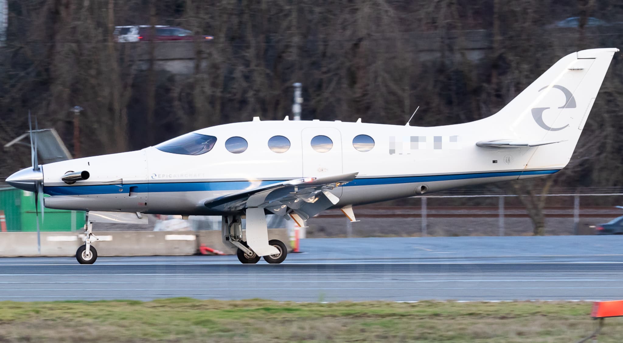 Wed, Nov 4TomorrowSan JoseKSJC · Norman Y. Mineta San Jose International AirportRenoKRNO · Reno Tahoe International AirportEpic E10004—On request4NovSan Jose → RenoKSJC → KRNO · TomorrowEpic E1000 · 4 seatsOn request
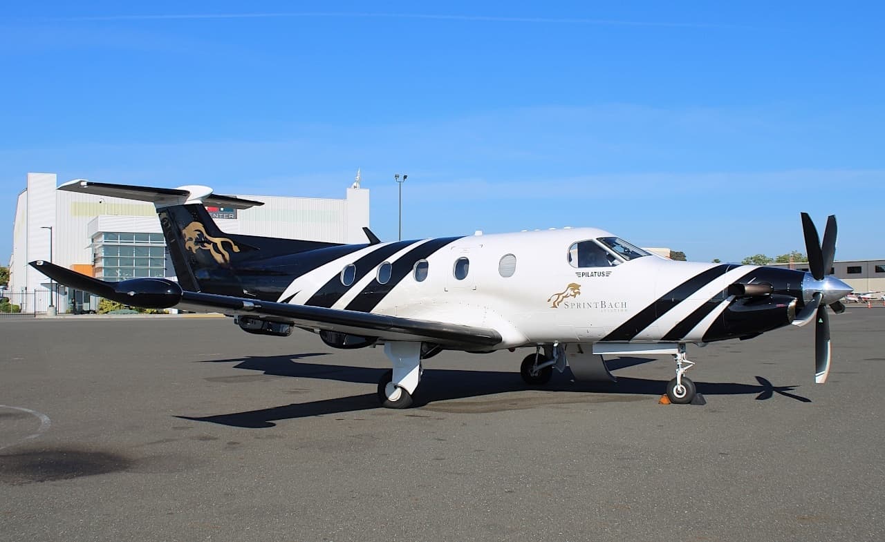 Wed, Nov 4TomorrowSanta BarbaraKSBA · Santa Barbara Municipal AirportRenoKRNO · Reno Tahoe International AirportPilatus PC-128—$3,6304NovSanta Barbara → RenoKSBA → KRNO · TomorrowPilatus PC-12 · 8 seats$3,630
- Wed, Nov 4TomorrowBountifulKBTF · Skypark AirportRenoKRNO · Reno Tahoe International AirportEpic E1000 GX41h 42mOn request4NovBountiful → RenoKBTF → KRNO · TomorrowEpic E1000 GX · 4 seats · 1h 42mOn request
- Wed, Nov 4TomorrowSan JoseKSJC · Norman Y. Mineta San Jose International AirportRenoKRNO · Reno Tahoe International AirportEpic E1000 GX454mOn request4NovSan Jose → RenoKSJC → KRNO · TomorrowEpic E1000 GX · 4 seats · 54mOn request
- Wed, Nov 4TomorrowOaklandKOAK · Metropolitan Oakland International AirportRenoKRNO · Reno Tahoe International AirportPilatus PC-128—$8254NovOakland → RenoKOAK → KRNO · TomorrowPilatus PC-12 · 8 seats$825
- Thu, Nov 5in 2 daysSalt Lake CityKSLC · Salt Lake City International AirportRenoKRNO · Reno Tahoe International AirportPilatus PC-248—On request5NovSalt Lake City → RenoKSLC → KRNO · in 2 daysPilatus PC-24 · 8 seatsOn request
 Fri, Nov 6in 3 daysSalt Lake CityKSLC · Salt Lake City International AirportRenoKRNO · Reno Tahoe International AirportLearjet 608—$7,9206NovSalt Lake City → RenoKSLC → KRNO · in 3 daysLearjet 60 · 8 seats$7,920
* Total price incl. 10% service fee, converted to your selected currency. Price subject to operator confirmation.
Map: Reno Airport
View the location of Reno – RNO/KRNO. Zoom in to explore the area around the airport.
About the airport
Reno Tahoe International Airport (RNO/KRNO) is the key private jet gateway for Reno. PrivJet gives you instant access to charter flights and empty legs: fast, discreet and globally connected.
KRNO airport FAQ
Are there any restrictions at Reno airport (KRNO) today?
There are currently 19 valid NOTAMs for Reno (KRNO). According to NOTAM, at least one runway or the aerodrome itself is closed. Affected: Runway: closed; ILS: unserviceable; ILS glide path: unserviceable; Services: out of service and 1 more. 4 more NOTAMs start in the coming days. For information only, not for flight planning or operational use. Always rely on an official pre-flight briefing. This list may be incomplete or out of date.
How long are the runways at Reno airport (KRNO)?
Reno (KRNO) has 3 runways: runway 17R/35L with 3,353 m (11,001 ft), concrete, runway 17L/35R with 2,743 m (9,000 ft), concrete and runway 08/26 with 1,860 m (6,102 ft), concrete. The longest is 3,353 m.
What are the radio frequencies at Reno airport (KRNO)?
Frequencies at KRNO: Tower 118.7 MHz, Ground 121.9 MHz and ATIS 135.8 MHz. For information only. Always rely on the published AIP.
What are the airport codes of Reno Tahoe International Airport?
The ICAO code is KRNO and the IATA code is RNO. ICAO codes are used by air traffic control and pilots, e.g. in flight plans; IATA codes appear on tickets and baggage tags.
What is the elevation of KRNO airport?
Reno Tahoe International Airport sits at 4,415 ft (1,346 m) above sea level. Local time zone: America/Los Angeles.
Can I fly to KRNO by private jet?
Whether a private jet can operate into Reno Tahoe International Airport depends on runway length, opening hours, customs and immigration rules as well as slot and handling availability, among other things. PrivJet checks this with the operating carrier for every request.
Are there empty legs from or to KRNO?
There are currently 47 empty legs departing from and 58 arriving at Reno Tahoe International Airport. Empty legs are repositioning flights at heavily reduced prices; the list is updated several times a day.