Greater Rochester Airport (KROC / ROC)
Empty legs and charters from Rochester
KROC airport at a glance
- ICAO code
- KROC
- IATA code
- ROC
- City
- Rochester
- Region
- New York
- Country
- United States
- Elevation
- 559 ft (170 m)
- Time zone
- America/New York (UTC-5)
- Coordinates
- 43.1189° N, 77.6724° W
- Empty legs from
- 6
- Empty legs to
- 12
Weather & airport info KROC
Current weather
No current weather report is available for this airport.
Airport
- Elevation
- 559 ft (170 m)
- Sunrise / Sunset
- 06:47 / 17:00 local time
Runways
| Runway | Length | Surface | Lighted |
|---|---|---|---|
| 04/22 | 2,439 m (8,001 ft) | asphalt | yes |
| 10/28 | 1,951 m (6,402 ft) | asphalt | yes |
| 07/25 | 1,219 m (4,000 ft) | asphalt | yes |
Radio frequencies
- ATIS: 124.825
- Clearance: 118.3
- Ground: 121.7
- Tower: 118.3
- UNICOM: 122.95
For information only, not for flight planning. Weather can change quickly; always rely on official reports. Sources: aviationweather.gov (NOAA), OurAirports.
Airport map KROC
Full screen →Runways white, taxiways yellow with designators, closed taxiways and runways per NOTAM in red.
Official charts (FAA)
Cycle 2611, valid until 0901Z 11/26/26
Airport diagram (FAA)
Airport diagram (1)
Instrument approaches (12)
Departure procedures (2)
Minimums (2)
For information only, not for navigation. Always use current official charts and NOTAMs.
Current NOTAMs for KROC(14)
NOTAMs (Notices to Air Missions) announce short-term changes at an airport: closed runways or taxiways, unserviceable approach aids, obstacles, airspace restrictions.
- Out of serviceObstacle10/174· until 15 Dec, 06:03 UTC
An obstacle tower light, with its top at 823.2 feet above sea level and 283.1 feet above ground, is out of service 3.1 nautical miles east-southeast of the airport.
Show original text
OBST TOWER LGT (ASR 1002817) 430538.20N0773637.10W (3.1NM ESE ROC) 823.2FT (283.1FT AGL) U/S
10/174 NOTAMN<BR>
<B>Q) </B>KZOB/QOLAS/IV/M/AE/000/009/4307N07740W005<BR>
<B>A) </B>KROC<BR>
<B>B) </B>2610310506<BR>
<B>C) </B>2612150603<BR>
<B>E) </B> TOWER LGT (ASR 1002817) 430538.20N0773637.10W (3.1NM ESE ROC) 823.2FT (283.1FT AGL) U/S<BR>
- Out of serviceObstacle10/160· until 26 Jan, 23:59 UTC
The lighting of an obstacle tower 6.1 nautical miles northeast of IUA is out of service. The tower is 765 feet above sea level, 196 feet above ground.
Show original text
OBST TOWER LGT (ASR UNKNOWN) 425830.06N0771307.00W (6.1NM NE IUA) 765FT (196FT AGL) U/S
- Out of serviceOther10/156· until 23 Feb, 05:47 UTC
An obstacle, a tower with the identifier ASR 1228608, is out of service. Its top is 1029.9 feet above sea level, 319.9 feet above ground, and it is located 3.9 nautical miles east-northeast of the airport.
Show original text
OBST TOWER LGT (ASR 1228608) 430805.50N0773505.70W (3.9NM ENE ROC) 1029.9FT (319.9FT AGL) U/S
A8138/26 NOTAMN Q) KZOB/QXXXX////000/999/4307N07740W005 A) KROC B) 2610260547 C) 2702230547 E) OBST TOWER LGT (ASR 1228608) 430805.50N0773505.70W (3.9NM ENE ROC) 1029.9FT (319.9FT AGL) U/S
- Out of serviceObstacle10/149· until 22 Jan, 23:59 UTC
An obstacle, a tower, whose light is out of service, is located 4.4 nautical miles east-southeast of Rochester airport. Its top is 692.3 feet above sea level, 203.4 feet above ground.
Show original text
OBST TOWER LGT (ASR 1003957) 430600.00N0773424.00W (4.4NM ESE ROC) 692.3FT (203.4FT AGL) U/S
- Out of serviceObstacle10/147· until 22 Jan, 23:59 UTC
An obstacle, a tower, whose light is out of service, is located 4.5 nautical miles east-southeast of Rochester airport. Its top is 692.3 feet above sea level, 203.4 feet above ground.
Show original text
OBST TOWER LGT (ASR 1003955) 430602.00N0773420.00W (4.5NM ESE ROC) 692.3FT (203.4FT AGL) U/S
- Out of serviceObstacle10/148· until 22 Jan, 23:59 UTC
An obstacle, a tower, whose light is out of service, is located 4.4 nautical miles east-southeast of Rochester airport. Its top is 692.3 feet above sea level, 203.4 feet above ground.
Show original text
OBST TOWER LGT (ASR 1003956) 430602.00N0773424.00W (4.4NM ESE ROC) 692.3FT (203.4FT AGL) U/S
- Out of serviceObstacle10/146· until 22 Jan, 23:59 UTC
Obstacle light on tower (ASR 1003954) (4.5 NM east-southeast of ROC) 692.3 ft above sea level (203.4 ft above ground) out of service
Show original text
OBST TOWER LGT (ASR 1003954) 430600.00N0773420.00W (4.5NM ESE ROC) 692.3FT (203.4FT AGL) U/S
- Out of serviceObstacle10/044· until 15 Nov, 16:00 UTC
An obstacle tower light (ASR 1011757) 4.0 nautical miles east-northeast of the airport is out of service. Its top is 1030.8 feet above sea level, 357.9 feet above ground.
Show original text
OBST TOWER LGT (ASR 1011757) 430807.00N0773502.00W (4.0NM ENE ROC) 1030.8FT (357.9FT AGL) U/S
6 more NOTAMs
- NoticeILSA8167/26· from 06 Nov, 09:00 UTC · until 06 Nov, 10:00 UTC
The localizer (LOC) of the Instrument Landing System (ILS) for runway 04 at Frederick Douglass/Greater Rochester International Airport is not monitored. The localizer is part of the ILS that guides aircraft horizontally to the runway.
Show original text
ROC NAV ILS RWY 04 LOC NOT MNT
A8167/26 NOTAMN
Q) KZOB/QICXX////000/999/4307N07740W005
A) KROC
B) 2611060900
C) 2611061000
E) ROC NAV ILS RWY 04 LOC NOT MNT
- Out of serviceInstrument approach procedure4733/26· until 11 Nov, 20:00 UTC (estimated)
Alternate minimums are not available for the approach procedures ILS or LOC runway 22, ILS or LOC runway 28, ILS or LOC runway 4, VOR runway 4, ILS runway 4 (SA CAT I), and ILS runway 4 (CAT II), except for aircraft equipped with a suitable RNAV system with GPS. The VOR/DME system is unmonitored.
Show original text
IAP FREDERICK DOUGLASS/GREATER ROCHESTER INTL, ROCHESTER, NY. ILS OR LOC RWY 22, AMDT 9... ILS OR LOC RWY 28, AMDT 32... ILS OR LOC RWY 4, AMDT 21C... VOR RWY 4, AMDT 12A... ILS RWY 4 (SA CAT I), AMDT 21C... ILS RWY 4 (CAT II), AMDT 21C... ALTERNATE MINIMUMS NA EXCEPT FOR ACFT EQUIPPED WITH SUITABLE RNAV SYSTEM WITH GPS, GEE VOR/DME UNMONITORED. 2611022202-2611112000EST
Q) KZOB/QPIXX/I/NBO/A/000/999/4307N07740W005
A) KROC
B) 2610302055
C) 2706112055EST
E) ROC FREDERICK DOUGLASS/GREATER ROCHESTER INTL, ROCHESTER, NY.
ILS OR LOC  RWY 22, AMDT 9...
ILS OR LOC RWY 28, AMDT 32...
ILS OR LOC RWY 4, AMDT 21C...
VOR RWY 4, AMDT 12A...
ILS RWY 4 (SA CAT I), AMDT 21C...
ILS RWY 4 (CAT II), AMDT 21C...
ALTERNATE MNM NA EXCEPT FOR ACFT EQUIPPED WITH SUITABLE RNAV SYSTEM WITH GPS,
GEE VOR/DME NOT MNT.
- Out of serviceInstrument approach procedure: changedA8176/26· until 11 Nov, 20:00 UTC
Instrument approach procedure FREDERICK DOUGLASS/GREATER ROCHESTER INTL, ROCHESTER, NY. ILS (instrument landing system) or localizer runway 22, amendment 9... ILS (instrument landing system) or localizer runway 28, amendment 32... ILS (instrument landing system) or localizer runway 4, amendment 21C... VOR beacon runway 4, amendment 12A... ILS (instrument landing system) runway 4 (SA category I), amendment 21C... ILS (instrument landing system) runway 4 (category II), amendment 21C... ALTERNATE MINIMUMS not available except for aircraft equipped with SUITABLE RNAV (area navigation) SYSTEM with GPS, GEE VOR/DME UNMONITORED.
Show original text
IAP FREDERICK DOUGLASS/GREATER ROCHESTER INTL, ROCHESTER, NY. ILS OR LOC RWY 22, AMDT 9... ILS OR LOC RWY 28, AMDT 32... ILS OR LOC RWY 4, AMDT 21C... VOR RWY 4, AMDT 12A... ILS RWY 4 (SA CAT I), AMDT 21C... ILS RWY 4 (CAT II), AMDT 21C... ALTERNATE MINIMUMS NA EXCEPT FOR ACFT EQUIPPED WITH SUITABLE RNAV SYSTEM WITH GPS, GEE VOR/DME UNMONITORED.
A8176/26 NOTAMN
Q) KZOB/QPICH/I/NBO/A/000/999/4307N07740W005
A) KROC
B) 2611022202
C) 2611112000
E) IAP FREDERICK DOUGLASS/GREATER ROCHESTER INTL, ROCHESTER, NY. ILS OR LOC RWY 22, AMDT 9... ILS OR LOC RWY 28, AMDT 32... ILS OR LOC RWY 4, AMDT 21C... VOR RWY 4, AMDT 12A... ILS RWY 4 (SA CAT I), AMDT 21C... ILS RWY 4 (CAT II), AMDT 21C... ALTERNATE MINIMUMS NA EXCEPT FOR ACFT EQUIPPED WITH SUITABLE RNAV SYSTEM WITH GPS, GEE VOR/DME UNMONITORED.
- NoticeILSA8175/26· until 10 Nov, 20:00 UTC
The Instrument Landing System (ILS) for runway 04 at Rochester airport is not monitored. The ILS guides aircraft to the runway in poor visibility.
Show original text
ROC NAV ILS RWY 04 NOT MNT
A8175/26 NOTAMN
Q) KZOB/QICXX////000/999/4307N07740W005
A) KROC
B) 2611022140
C) 2611102000
E) ROC NAV ILS RWY 04 NOT MNT
- NoticeDeclared distances: changed10/150· until 30 May, 23:59 UTC
The declared distances for runway 10 at Rochester airport are as follows: Take-Off Run Available (TORA) 6402 feet, Take-Off Distance Available (TODA) 6402 feet, Accelerate-Stop Distance Available (ASDA) 5527 feet, and Landing Distance Available (LDA) 5227 feet.
Show original text
RWY 10 DECLARED DIST: TORA 6402FT TODA 6402FT ASDA 5527FT LDA 5227FT.
A8127/26 NOTAMN
Q) KZOB/QMDCH////000/999/4307N07740W005
A) KROC
B) 2610221200
C) 2705302359
E) RWY 10 DECLARED DIST: TORA 6402FT TODA 6402FT ASDA 5527FT LDA 5227FT.
- NoticeDeclared distances: changedA8127/26· until 30 May, 23:59 UTC
The declared distances for runway 10 at Rochester airport are as follows: Take-Off Run Available (TORA) 6402 feet, Take-Off Distance Available (TODA) 6402 feet, Accelerate-Stop Distance Available (ASDA) 5527 feet, and Landing Distance Available (LDA) 5227 feet.
Show original text
RWY 10 DECLARED DIST: TORA 6402FT TODA 6402FT ASDA 5527FT LDA 5227FT.
A8127/26 NOTAMN Q) KZOB/QMDCH////000/999/4307N07740W005 A) KROC B) 2610221200 C) 2705302359 E) RWY 10 DECLARED DIST: TORA 6402FT TODA 6402FT ASDA 5527FT LDA 5227FT.
For information only, not for flight planning or operational use. Always rely on an official pre-flight briefing. This list may be incomplete or out of date. Explanations and expanded abbreviations are generated automatically. The original text is authoritative. Source: FAA NOTAM Management Service (SWIM).
Private jet traffic in Greater Rochester International Airport (last 30 days)
- Arrivals
- 386
- Departures
- 375
- Different jets
- 243
Most frequent origins: Teterboro Airport (24), Syracuse Hancock International Airport (22), Westchester County Airport (17), Washington Dulles International Airport (10), Charlotte Douglas International Airport (8).
Most frequent destinations: Westchester County Airport (20), Teterboro Airport (20), Allegheny County Airport (14), Syracuse Hancock International Airport (10), Penn Yan Airport (8).
Most common aircraft types: Embraer Phenom 300 (71), Learjet 60 (68), Pilatus PC-12 (58), Bombardier Challenger 600/650 (34), Gulfstream G280 (34).
Thursday is the busiest day.
Our own analysis of public ADS-B signals from business jets. Not every flight is received, and jets with a removal request are excluded.
Charter operators based here
Operators with a base at this airport.
- L.J. AviationLatrobe (Arnold Palmer) (KLBE) · Turboprop, Light jet, Midsize jet
Empty legs from KROC
6 departures available
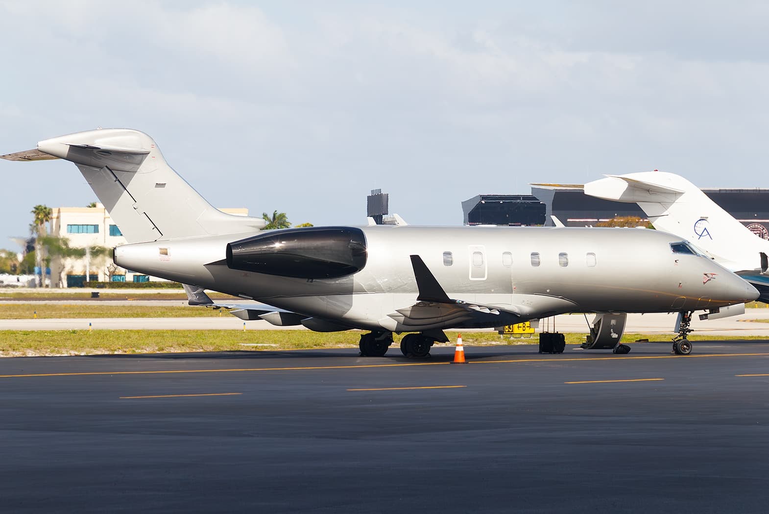 Wed, Nov 11in 8 daysRochesterKROC · Greater Rochester International AirportBedfordKBED · Laurence G Hanscom FieldChallenger 3009—$7,91011NovRochester → BedfordKROC → KBED · in 8 daysChallenger 300 · 9 seats$7,910
- Sun, Nov 22in 19 daysRochesterKROC · Greater Rochester International AirportOrlandoKORL · Orlando Executive AirportCessna Citation Excel 560XLS9—On request22NovRochester → OrlandoKROC → KORL · in 19 daysCessna Citation Excel 560XLS · 9 seatsOn request
- Tue, Nov 24in 21 daysRochesterKROC · Frederick Douglass Greater Rochester International AirportOrlandoKORL · Orlando Executive AirportCessna Citation XLS+8—$42,79024NovRochester → OrlandoKROC → KORL · in 21 daysCessna Citation XLS+ · 8 seats$42,790
 Tue, Nov 24in 21 daysRochesterKROC · Greater Rochester International AirportOrlandoKMCO · Orlando International AirportCessna Citation XLS12h 48m$46,04624NovRochester → OrlandoKROC → KMCO · in 21 daysCessna Citation XLS · 1 seat · 2h 48m$46,046
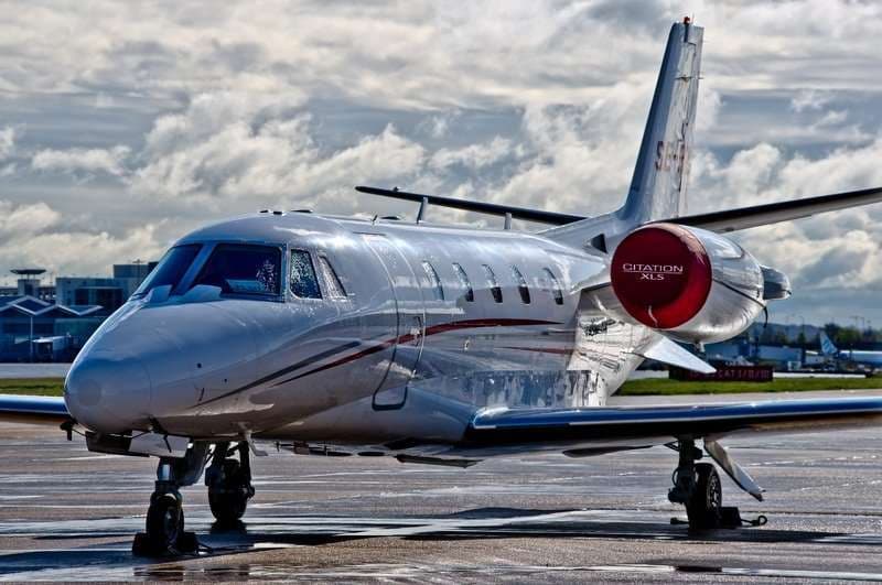 Tue, Nov 24in 21 daysRochesterKROC · Greater Rochester International AirportOrlandoKMCO · Orlando International AirportCitation XLS8—$38,64624NovRochester → OrlandoKROC → KMCO · in 21 daysCitation XLS · 8 seats$38,646
 Fri, Jan 22in 80 daysRochesterKROC · Greater Rochester International AirportFort LauderdaleKFXE · Fort Lauderdale Executive AirportBombardier Challenger 30012h 36m$33,49522JanRochester → Fort LauderdaleKROC → KFXE · in 80 daysBombardier Challenger 300 · 1 seat · 2h 36m$33,495
 KROC · Greater Rochester International Airport
* Total price incl. 10% service fee, converted to your selected currency. Price subject to operator confirmation.
Empty legs to KROC
12 arrivals available
- Wed, Nov 4TomorrowMyrtle BeachKMYR · Myrtle Beach International AirportRochesterKROC · Greater Rochester International AirportChallenger 3009—$16,8764NovMyrtle Beach → RochesterKMYR → KROC · TomorrowChallenger 300 · 9 seats$16,876
- Wed, Nov 25in 22 daysGreen BayKGRB · Austin Straubel International AirportRochesterKROC · Frederick Douglass Greater Rochester International AirportCessna CitationJet5—$9,13025NovGreen Bay → RochesterKGRB → KROC · in 22 daysCessna CitationJet · 5 seats$9,130
- Wed, Nov 25in 22 daysChicagoKORD · Chicago O'Hare International AirportRochesterKROC · Frederick Douglass Greater Rochester International AirportCessna CitationJet5—$9,02025NovChicago → RochesterKORD → KROC · in 22 daysCessna CitationJet · 5 seats$9,020
- Wed, Nov 25in 22 daysColumbusKCMH · John Glenn Columbus International AirportRochesterKROC · Greater Rochester International AirportHawker 9008—$16,83025NovColumbus → RochesterKCMH → KROC · in 22 daysHawker 900 · 8 seats$16,830
- Sat, Nov 28in 25 daysChicagoKDPA · Dupage AirportRochesterKROC · Greater Rochester International AirportChallenger 3009—$19,80028NovChicago → RochesterKDPA → KROC · in 25 daysChallenger 300 · 9 seats$19,800
- Sun, Nov 29in 26 daysChicago/West ChicagoKDPA · Dupage AirportRochesterKROC · Greater Rochester International AirportBombardier Challenger 30011h 18m$27,72029NovChicago/West Chicago → RochesterKDPA → KROC · in 26 daysBombardier Challenger 300 · 1 seat · 1h 18m$27,720
- Mon, Nov 30in 27 daysChicagoKDPA · Dupage AirportRochesterKROC · Greater Rochester International AirportChallenger 3009—$13,05330NovChicago → RochesterKDPA → KROC · in 27 daysChallenger 300 · 9 seats$13,053
- Tue, Dec 8in 35 daysMinneapolisKMIC · Crystal AirportRochesterKROC · Frederick Douglass Greater Rochester International AirportCessna Citation XLS8—$15,6208DecMinneapolis → RochesterKMIC → KROC · in 35 daysCessna Citation XLS · 8 seats$15,620
- Tue, Dec 8in 35 daysMinneapolisKMSP · Minneapolis-Saint Paul International Airport / Wold-Chamberlain FieldRochesterKROC · Frederick Douglass Greater Rochester International AirportBeechcraft Hawker 900XP8—$15,4008DecMinneapolis → RochesterKMSP → KROC · in 35 daysBeechcraft Hawker 900XP · 8 seats$15,400
* Total price incl. 10% service fee, converted to your selected currency. Price subject to operator confirmation.
Map: Rochester Airport
View the location of Rochester – ROC/KROC. Zoom in to explore the area around the airport.
About the airport
Greater Rochester International Airport (ROC/KROC) is the key private jet gateway for Rochester. PrivJet gives you instant access to charter flights and empty legs: fast, discreet and globally connected.
KROC airport FAQ
Are there any restrictions at Rochester airport (KROC) today?
There are currently 13 valid NOTAMs for Rochester (KROC). Affected: Obstacle: out of service; Other: out of service; Instrument approach procedure; Instrument approach procedure: changed. 1 more NOTAM starts in the coming days. For information only, not for flight planning or operational use. Always rely on an official pre-flight briefing. This list may be incomplete or out of date.
How long are the runways at Rochester airport (KROC)?
Rochester (KROC) has 3 runways: runway 04/22 with 2,439 m (8,001 ft), asphalt, runway 10/28 with 1,951 m (6,402 ft), asphalt and runway 07/25 with 1,219 m (4,000 ft), asphalt. The longest is 2,439 m.
What are the radio frequencies at Rochester airport (KROC)?
Frequencies at KROC: Tower 118.3 MHz, Ground 121.7 MHz and ATIS 124.825 MHz. For information only. Always rely on the published AIP.
What are the airport codes of Greater Rochester International Airport?
The ICAO code is KROC and the IATA code is ROC. ICAO codes are used by air traffic control and pilots, e.g. in flight plans; IATA codes appear on tickets and baggage tags.
What is the elevation of KROC airport?
Greater Rochester International Airport sits at 559 ft (170 m) above sea level. Local time zone: America/New York.
Can I fly to KROC by private jet?
Whether a private jet can operate into Greater Rochester International Airport depends on runway length, opening hours, customs and immigration rules as well as slot and handling availability, among other things. PrivJet checks this with the operating carrier for every request.
Are there empty legs from or to KROC?
There are currently 6 empty legs departing from and 12 arriving at Greater Rochester International Airport. Empty legs are repositioning flights at heavily reduced prices; the list is updated several times a day.