Salem McNary Field Airport (KSLE / SLE)
Empty legs and charters from Salem
KSLE airport at a glance
- ICAO code
- KSLE
- IATA code
- SLE
- City
- Salem
- Region
- Oregon
- Country
- United States
- Elevation
- 214 ft (65 m)
- Time zone
- America/Los Angeles (UTC-8)
- Coordinates
- 44.9095° N, 123.0030° W
- Empty legs from
- 24
- Empty legs to
- 21
Weather & airport info KSLE
Current weather
Good visual conditions (VFR)observed 03 Nov, 23:56 UTC- Wind
- 8 kt (15 km/h) from north (360°)
- Visibility
- 10 km or more
- Clouds
- no significant clouds
- Temperature
- 16 °C (dew point 7 °C)
- Pressure (QNH)
- 1,017 hPa
Original weather report (METAR)
METAR KSLE 032356Z 36008KT 10SM CLR 16/07 A3003 RMK AO2 SLP170 T01560067 10167 20100 53009
Forecast (TAF)
- 04 Nov, 00:00–13:00 UTC5 kt (9 km/h) from north-northeast (20°) · visibility 10 km or more · broken clouds at 25,000 ft
- 04 Nov, 13:00–14:00 UTCfrom5 kt (9 km/h) from variable directions · visibility 6 km · Mist · broken clouds at 3,000 ft
- 04 Nov, 14:00–16:00 UTCfrom3 kt (6 km/h) from variable directions · visibility 1.6 km · Mist · broken clouds at 1,000 ft
- 04 Nov, 16:00–17:00 UTCfrom5 kt (9 km/h) from variable directions · visibility 5 km · Mist · broken clouds at 2,000 ft
- 04 Nov, 17:00–00:00 UTCfrom5 kt (9 km/h) from south (180°) · visibility 10 km or more · scattered clouds at 15,000 ft
Original forecast (TAF)
TAF KSLE 032335Z 0400/0424 02005KT P6SM BKN250 FM041300 VRB05KT 4SM BR BKN030 FM041400 VRB03KT 1SM BR BKN010 FM041600 VRB05KT 3SM BR BKN020 FM041700 18005KT P6SM SCT150
Airport
- Elevation
- 214 ft (65 m)
- Sunrise / Sunset
- 06:54 / 16:56 local time
Runways
| Runway | Length | Surface | Lighted |
|---|---|---|---|
| 13/31 | 1,771 m (5,811 ft) | asphalt | yes |
| 16/34 | 1,569 m (5,146 ft) | asphalt | yes |
Radio frequencies
- ATIS: 124.55
- CTAF: 119.1
- Ground: 121.9
- Tower: 119.1
- UNICOM: 122.95
For information only, not for flight planning. Weather can change quickly; always rely on official reports. Sources: aviationweather.gov (NOAA), OurAirports.
Airport map KSLE
Full screen →Runways white, taxiways yellow with designators, closed taxiways and runways per NOTAM in red.
Official charts (FAA)
Cycle 2611, valid until 0901Z 11/26/26
Airport diagram (FAA)
Airport diagram (1)
Instrument approaches (5)
Departure procedures (1)
Minimums (2)
LAHSO (1)
For information only, not for navigation. Always use current official charts and NOTAMs.
Current NOTAMs for KSLE(4)
NOTAMs (Notices to Air Missions) announce short-term changes at an airport: closed runways or taxiways, unserviceable approach aids, obstacles, airspace restrictions.
- Out of serviceObstacle11/002· until 01 Feb, 16:52 UTC
Obstacle light on tower (ASR 1035279) (1.3 NM northeast of SLE) 352.0 ft above sea level (132.9 ft above ground) out of service
Show original text
OBST TOWER LGT (ASR 1035279) 445538.60N1225904.90W (1.3NM NE SLE) 352.0FT (132.9FT AGL) U/S
- ClosedApron: closedA0332/26· until 11 Dec, 23:00 UTC
The apron for air carrier aircraft (Air Carrier Ramp) is closed.
Show original text
APRON AIR CARRIER RAMP CLSD
A0332/26 NOTAMN
Q) KZSE/QMNLC////000/999/4454N12300W005
A) KSLE
B) 2610292055
C) 2612112300
E) APRON AIR CARRIER RAMP CLSD
- Out of serviceProcedure6915/26· until 14 May, 17:54 UTC
Standard departure (SID) MCNARY FLD, SALEM, or. SALEM FOUR DEPARTURE... LOST COMMUNICATIONS PROCEDURE: TAKEOFF runway 31 and 34 not available except for aircraft equipped with SUITABLE RNAV (area navigation) SYSTEM with GPS, UBG VOR beacon out of service. 2 Oct 17:54 UTC -2705141754EST
Show original text
SID MCNARY FLD, SALEM, OR. SALEM FOUR DEPARTURE... LOST COMMUNICATIONS PROCEDURE: TAKEOFF RUNWAY 31 AND 34 NA EXCEPT FOR AIRCRAFT EQUIPPED WITH SUITABLE RNAV SYSTEM WITH GPS, UBG VOR OUT OF SERVICE. 2610021754-2705141754EST
Q) KZSE/undefined/NBO/A/000/999/4454N12300W005
A) KSLE
B) 2504292126
C) 2512092126EST
E) SLE MCNARY FLD, SALEM, OR.
SALEM FOUR DEPARTURE...
LOST COMMUNICATIONS PROCEDURE: TAKEOFF RUNWAY 31 AND 34 NA EXCEPT FOR AIRCRAFT EQUIPPED WITH SUITABLE RNAV SYSTEM WITH GPS,
UBG VOR U/S.
- Out of serviceStandard instrument departure: changedA0314/26· until 14 May, 17:54 UTC
The lost communications procedures for the Salem Four standard departure route (SID) from runways 31 and 34 are not available, except for aircraft equipped with a suitable RNAV system with GPS, as the UBG VOR radio beacon is out of service.
Show original text
SID MCNARY FLD, SALEM, OR. SALEM FOUR DEPARTURE... LOST COMMUNICATIONS PROCEDURE: TAKEOFF RUNWAY 31 AND 34 NA EXCEPT FOR AIRCRAFT EQUIPPED WITH SUITABLE RNAV SYSTEM WITH GPS, UBG VOR OUT OF SERVICE.
A0314/26 NOTAMN
Q) KZSE/QPDCH/I/NBO/A/000/999/4454N12300W005
A) KSLE
B) 2610021754
C) 2705141754
E) SID MCNARY FLD, SALEM, OR. SALEM FOUR DEPARTURE... LOST COMMUNICATIONS PROCEDURE: TAKEOFF RUNWAY 31 AND 34 NA EXCEPT FOR AIRCRAFT EQUIPPED WITH SUITABLE RNAV SYSTEM WITH GPS, UBG VOR OUT OF SERVICE.
For information only, not for flight planning or operational use. Always rely on an official pre-flight briefing. This list may be incomplete or out of date. Explanations and expanded abbreviations are generated automatically. The original text is authoritative. Source: FAA NOTAM Management Service (SWIM).
Private jet traffic in McNary Field (last 30 days)
- Arrivals
- 99
- Departures
- 92
- Different jets
- 55
Most frequent origins: Rogue Valley International Medford Airport (6), Boise Air Terminal/Gowen field (5), Henderson Executive Airport (4), Renton Municipal Airport (4), Mahlon Sweet Field (3).
Most frequent destinations: Roberts Field (6), Rogue Valley International Medford Airport (6), Henderson Executive Airport (6), Renton Municipal Airport (4), Mahlon Sweet Field (3).
Most common aircraft types: Pilatus PC-12 (26), Cessna Citation II/Bravo (24), Beechcraft King Air 200/250 (18), Cessna Citation CJ2 (14), Beechcraft King Air 90 (10).
Monday is the busiest day.
Our own analysis of public ADS-B signals from business jets. Not every flight is received, and jets with a removal request are excluded.
Empty legs from KSLE
24 departures available
- Wed, Nov 414:00SalemKSLE · Salem-Willamette Valley Airport/McNary FieldPortlandKPDX · Portland International AirportCessna Citation XLS+8—$3,9604NovSalem → PortlandKSLE → KPDX · 14:00Cessna Citation XLS+ · 8 seats$3,960
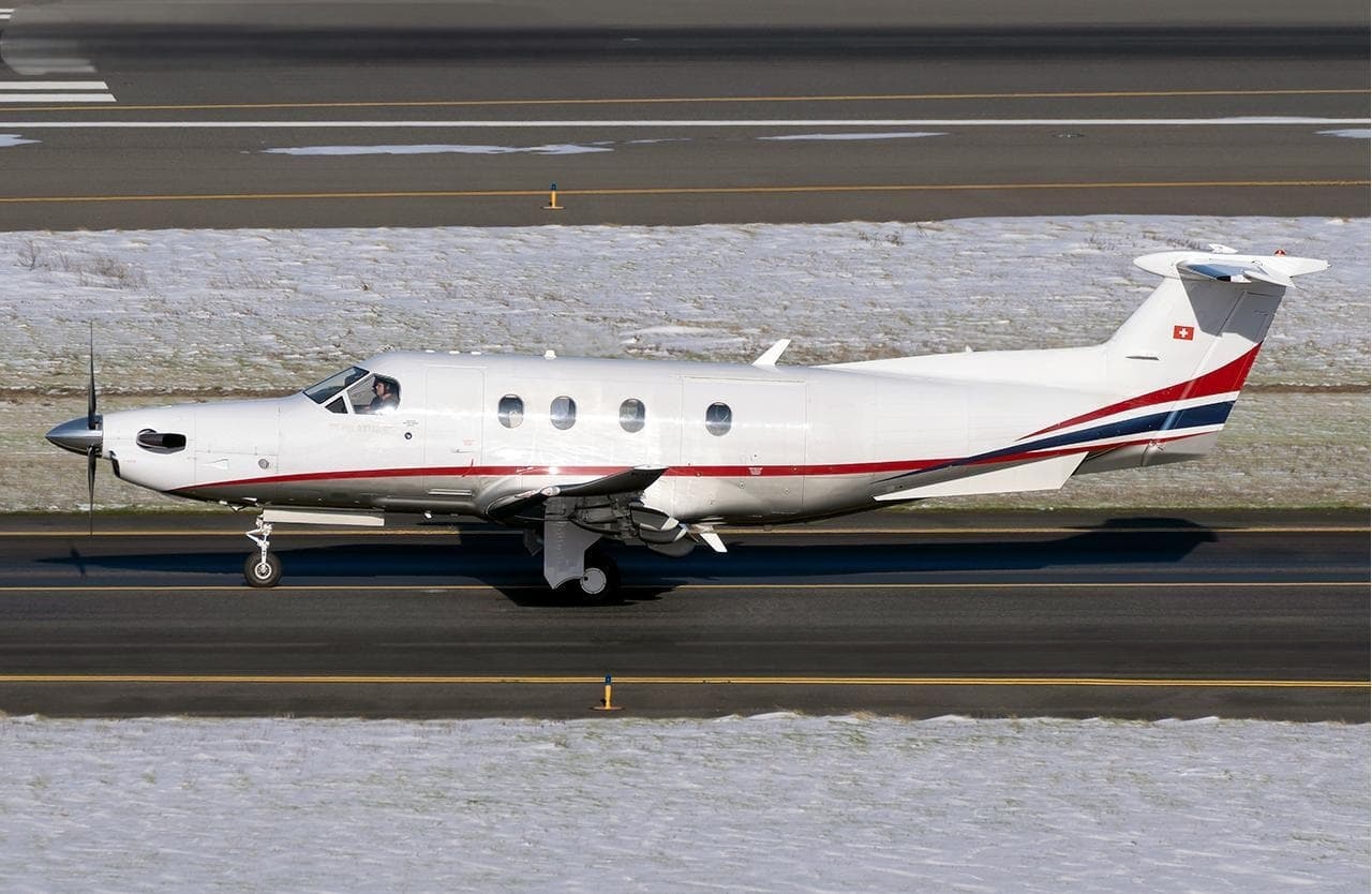 Thu, Nov 19in 15 daysSalemKSLE · McNary FieldBoiseKBOI · Boise Air Terminal/Gowen fieldPilatus PC-129—On request19NovSalem → BoiseKSLE → KBOI · in 15 daysPilatus PC-12 · 9 seatsOn request
- Fri, Nov 20in 16 daysSalemKSLE · McNary FieldBoiseKBOI · Boise Air Terminal/Gowen fieldPilatus PC-12 NG81h 24mOn request20NovSalem → BoiseKSLE → KBOI · in 16 daysPilatus PC-12 NG · 8 seats · 1h 24mOn request
 Fri, Nov 2009:21SalemKSLE · Salem-Willamette Valley Airport/McNary FieldBoiseKBOI · Boise Air Terminal/Gowen FieldPilatus PC 129—$2,68420NovSalem → BoiseKSLE → KBOI · 09:21Pilatus PC 12 · 9 seats$2,684
- Wed, Nov 2501:27SalemKSLE · McNary FldNapaKAPC · Napa CountyCessna Citation M26—On request25NovSalem → NapaKSLE → KAPC · 01:27Cessna Citation M2 · 6 seatsOn request
- Sat, Jan 1622:21SalemKSLE · McNary FieldBoiseKBOI · Boise Air Terminal/Gowen fieldPilatus PC 1211h 42mOn request16JanSalem → BoiseKSLE → KBOI · 22:21Pilatus PC 12 · 1 seat · 1h 42mOn request
- Sun, Jan 1703:21SalemKSLE · McNary FldBoiseKBOI · Gowen FieldPilatus PC 129—On request17JanSalem → BoiseKSLE → KBOI · 03:21Pilatus PC 12 · 9 seatsOn request
- Tue, Feb 2in 90 daysSalemKSLE · McNary FieldBoiseKBOI · Boise Air Terminal/Gowen fieldPilatus PC-12 NG81h 24mOn request2FebSalem → BoiseKSLE → KBOI · in 90 daysPilatus PC-12 NG · 8 seats · 1h 24mOn request
- Thu, Mar 422:21SalemKSLE · McNary FieldBoiseKBOI · Boise Air Terminal/Gowen fieldPilatus PC 1211h 42mOn request4MarSalem → BoiseKSLE → KBOI · 22:21Pilatus PC 12 · 1 seat · 1h 42mOn request
 KSLE · Salem-Willamette Valley Airport/McNary Field
* Total price incl. 10% service fee, converted to your selected currency. Price subject to operator confirmation.
Empty legs to KSLE
21 arrivals available
- Wed, Nov 4TodayBoiseKBOI · Boise Air Terminal/Gowen fieldSalemKSLE · McNary FieldPilatus PC-129—$5,7354NovBoise → SalemKBOI → KSLE · TodayPilatus PC-12 · 9 seats$5,735
- Wed, Nov 4TodayBoiseKBOI · Boise Air Terminal/Gowen FieldSalemKSLE · Salem-Willamette Valley Airport/McNary FieldPilatus PC-12/47 NG8—$6,9304NovBoise → SalemKBOI → KSLE · TodayPilatus PC-12/47 NG · 8 seats$6,930
- Thu, Nov 508:51BoiseKBOI · Boise Air Terminal/Gowen FieldSalemKSLE · Salem-Willamette Valley Airport/McNary FieldPilatus PC-128—$4,0705NovBoise → SalemKBOI → KSLE · 08:51Pilatus PC-12 · 8 seats$4,070
- Thu, Nov 5TomorrowBoiseKBOI · Boise Air Terminal/Gowen fieldSalemKSLE · McNary FieldPilatus PC-12 NG81h 24mOn request5NovBoise → SalemKBOI → KSLE · TomorrowPilatus PC-12 NG · 8 seats · 1h 24mOn request
- Fri, Nov 615:00PortlandKPDX · Portland International AirportSalemKSLE · Salem-Willamette Valley Airport/McNary FieldCessna Citation XLS+8—$8,5806NovPortland → SalemKPDX → KSLE · 15:00Cessna Citation XLS+ · 8 seats$8,580
- Mon, Nov 16in 12 daysVan NuysKVNY · Van Nuys AirportSalemKSLE · McNary FieldEmbraer Legacy 650E13—$25,41016NovVan Nuys → SalemKVNY → KSLE · in 12 daysEmbraer Legacy 650E · 13 seats$25,410
- Mon, Nov 16in 12 daysVan NuysKVNY · Van Nuys AirportSalemKSLE · McNary FieldHawker 9008—$11,88016NovVan Nuys → SalemKVNY → KSLE · in 12 daysHawker 900 · 8 seats$11,880
 Tue, Nov 17in 13 daysLas VegasKLAS · Harry Reid International AirportSalemKSLE · McNary FieldLearjet 608—On request17NovLas Vegas → SalemKLAS → KSLE · in 13 daysLearjet 60 · 8 seatsOn request
- Tue, Nov 1706:20Las VegasKLAS · Harry Reid International AirportSalemKSLE · Salem-Willamette Valley Airport/McNary FieldBombardier Learjet 60XR7—$13,97017NovLas Vegas → SalemKLAS → KSLE · 06:20Bombardier Learjet 60XR · 7 seats$13,970
* Total price incl. 10% service fee, converted to your selected currency. Price subject to operator confirmation.
Map: Salem Airport
View the location of Salem – SLE/KSLE. Zoom in to explore the area around the airport.
About the airport
McNary Field (SLE/KSLE) is the key private jet gateway for Salem. PrivJet gives you instant access to charter flights and empty legs: fast, discreet and globally connected.
KSLE airport FAQ
Are there any restrictions at Salem airport (KSLE) today?
There are currently 4 valid NOTAMs for Salem (KSLE). Affected: Apron: closed; Obstacle: out of service; Procedure: out of service; Standard instrument departure: changed. For information only, not for flight planning or operational use. Always rely on an official pre-flight briefing. This list may be incomplete or out of date.
What is the weather at Salem airport (KSLE)?
According to the latest weather report for KSLE (METAR, 03 Nov, 23:56 UTC): Good visual conditions (VFR). Wind 8 kt (15 km/h) from north (360°), visibility 10 km or more, temperature 16 °C (dew point 7 °C). For information only, not for flight planning. Weather can change quickly; always rely on official reports.
How long are the runways at Salem airport (KSLE)?
Salem (KSLE) has 2 runways: runway 13/31 with 1,771 m (5,811 ft), asphalt and runway 16/34 with 1,569 m (5,146 ft), asphalt. The longest is 1,771 m.
What are the radio frequencies at Salem airport (KSLE)?
Frequencies at KSLE: Tower 119.1 MHz, Ground 121.9 MHz and ATIS 124.55 MHz. For information only. Always rely on the published AIP.
What are the airport codes of McNary Field?
The ICAO code is KSLE and the IATA code is SLE. ICAO codes are used by air traffic control and pilots, e.g. in flight plans; IATA codes appear on tickets and baggage tags.
What is the elevation of KSLE airport?
McNary Field sits at 214 ft (65 m) above sea level. Local time zone: America/Los Angeles.
Can I fly to KSLE by private jet?
Whether a private jet can operate into McNary Field depends on runway length, opening hours, customs and immigration rules as well as slot and handling availability, among other things. PrivJet checks this with the operating carrier for every request.
Are there empty legs from or to KSLE?
There are currently 24 empty legs departing from and 21 arriving at McNary Field. Empty legs are repositioning flights at heavily reduced prices; the list is updated several times a day.