Syracuse Hancock Airport (KSYR / SYR)
Empty legs and charters from Syracuse
KSYR airport at a glance
- ICAO code
- KSYR
- IATA code
- SYR
- City
- Syracuse
- Region
- New York
- Country
- United States
- Elevation
- 421 ft (128 m)
- Time zone
- America/New York (UTC-5)
- Coordinates
- 43.1112° N, 76.1063° W
- Empty legs from
- 6
- Empty legs to
- 3
Weather & airport info KSYR
Current weather
No current weather report is available for this airport.
Airport
- Elevation
- 421 ft (128 m)
- Sunrise / Sunset
- 06:41 / 16:54 local time
Runways
| Runway | Length | Surface | Lighted |
|---|---|---|---|
| 10/28 | 2,747 m (9,013 ft) | asphalt | yes |
| 15/33 | 2,286 m (7,499 ft) | asphalt | yes |
Radio frequencies
- ATIS: 132.05
- Clearance: 125.05
- Ground: 121.7
- Tower: 120.3
- UNICOM: 122.95
For information only, not for flight planning. Weather can change quickly; always rely on official reports. Sources: aviationweather.gov (NOAA), OurAirports.
Airport map KSYR
Full screen →Runways white, taxiways yellow with designators, closed taxiways and runways per NOTAM in red.
Closed per NOTAM: TWY B* (* partly closed)
Official charts (FAA)
Cycle 2611, valid until 0901Z 11/26/26
Airport diagram (FAA)
Airport diagram (1)
Instrument approaches (11)
Departure procedures (1)
Minimums (2)
Hot spots (1)
For information only, not for navigation. Always use current official charts and NOTAMs.
Current NOTAMs for KSYR(18)
NOTAMs (Notices to Air Missions) announce short-term changes at an airport: closed runways or taxiways, unserviceable approach aids, obstacles, airspace restrictions.
- Out of serviceTerminal area surveillance radar: unserviceableA2767/26· from 05 Nov, 12:00 UTC · until 05 Nov, 23:00 UTC
Service: terminal and secondary radar out of service
Show original text
SVC TAR/SSR U/S
A2767/26 NOTAMN
Q) KZBW/QCTAS////000/999/4306N07606W005
A) KSYR
B) 2611051200
C) 2611052300
E) SVC TAR/SSR U/S
- Out of serviceAerodrome: not availableA2768/26· from 05 Nov, 12:00 UTC · until 05 Nov, 23:00 UTC
Service: MBST/WS DETECTION SYSTEM not available
Show original text
SVC MBST/WS DETECTION SYSTEM NOT AVBL
A2768/26 NOTAMN
Q) KZBW/QFMAU////000/999/4306N07606W005
A) KSYR
B) 2611051200
C) 2611052300
E) SVC MBST/WS DETECTION SYSTEM NOT AVBL
- Out of serviceTerminal area surveillance radar: unserviceableA2765/26· from 04 Nov, 13:00 UTC · until 04 Nov, 23:00 UTC
Service: terminal and secondary radar out of service
Show original text
SVC TAR/SSR U/S
A2765/26 NOTAMN
Q) KZBW/QCTAS////000/999/4306N07606W005
A) KSYR
B) 2611041300
C) 2611042300
E) SVC TAR/SSR U/S
- Out of serviceAerodrome: not availableA2766/26· from 04 Nov, 13:00 UTC · until 04 Nov, 23:00 UTC
Service: MBST/WS DETECTION SYSTEM not available
Show original text
SVC MBST/WS DETECTION SYSTEM NOT AVBL
A2766/26 NOTAMN
Q) KZBW/QFMAU////000/999/4306N07606W005
A) KSYR
B) 2611041300
C) 2611042300
E) SVC MBST/WS DETECTION SYSTEM NOT AVBL
- Out of serviceObstacle10/153· until 31 Dec, 23:59 UTC
A stack light (OBST STACK LGT) 5.5 nautical miles south of Syracuse Hancock International Airport is out of service (U/S). The top of the stack is 274 feet above ground (AGL).
Show original text
OBST STACK LGT (ASN 1991-AEA-0329-OE) 430016N0760654W (5.5NM S SYR) UNKNOWN (274FT AGL) U/S
- ClosedTaxiway: closedA2745/26· permanent
Taxiway B is closed between runway 15/33 and taxiway M. This may lead to changes in taxiing at the airport.
Show original text
TWY B BTN RWY 15/33 AND TWY M CLSD
A2745/26 NOTAMN
Q) KZBW/QMXLC////000/999/4306N07606W005
A) KSYR
B) 2610281924
C) PERM
E) TWY B BTN RWY 15/33 AND TWY M CLSD
- Out of serviceILS glide path: unserviceable10/141· until 11 Nov, 23:59 UTC
The instrument landing system (ILS) for runway 10, which guides aircraft to the runway in poor visibility, is out of service.
Show original text
SYR NAV ILS RWY 10 GP U/S
A2726/26 NOTAMN
Q) KZBW/QIGAS////000/999/4306N07606W005
A) KSYR
B) 2610272232
C) 2611112359
E) SYR NAV ILS RWY 10 GP U/S
- Out of serviceILS glide path: unserviceableA2726/26· until 11 Nov, 23:59 UTC
The instrument landing system (ILS) for runway 10, which guides aircraft to the runway in poor visibility, is out of service.
Show original text
SYR NAV ILS RWY 10 GP U/S
A2726/26 NOTAMN Q) KZBW/QIGAS////000/999/4306N07606W005 A) KSYR B) 2610272232 C) 2611112359 E) SYR NAV ILS RWY 10 GP U/S
10 more NOTAMs
- ClosedTaxiway: closed10/123· until 30 Nov, 23:00 UTC
Taxiway B between runway 15/33 and taxiway M is closed. This may lead to longer taxiing times.
Show original text
TWY B BTN RWY 15/33 AND TWY M CLSD
A2692/26 NOTAMN Q) KZBW/QMXLC////000/999/4306N07606W005 A) KSYR B) 2610261221 C) 2611302300 E) TWY B BTN RWY 15/33 AND TWY M CLSD
- Out of serviceObstacle10/091· until 19 Nov, 23:59 UTC
The lighting of an obstacle tower 4.8 nautical miles south-southwest of Syracuse Hancock Airport is out of service. Its top is 948.2 feet above sea level, 292.0 feet above ground.
Show original text
OBST TOWER LGT (ASR 1008406) 430201.00N0760752.00W (4.8NM SSW SYR) 948.2FT (292.0FT AGL) U/S
- ClosedTaxiway: closed10/086· until 01 Dec, 16:00 UTC
Taxiway B between taxiway T and taxiway A closed
Show original text
TWY B BTN TWY T AND TWY A CLSD
A2648/26 NOTAMN
Q) KZBW/QMXLC////000/999/4306N07606W005
A) KSYR
B) 2610191112
C) 2612011600
E) TWY B BTN TWY T AND TWY A CLSD
- ClosedTaxiway: closedA2648/26· until 01 Dec, 16:00 UTC
Taxiway B between Taxiway T and Taxiway A at Syracuse Hancock International Airport is closed.
Show original text
TWY B BTN TWY T AND TWY A CLSD
A2648/26 NOTAMN Q) KZBW/QMXLC////000/999/4306N07606W005 A) KSYR B) 2610191112 C) 2612011600 E) TWY B BTN TWY T AND TWY A CLSD
- Out of serviceObstacle10/069· until 14 Nov, 23:00 UTC
The lighting on a tower obstacle 9.7 nautical miles east-southeast of the airport is out of service. Its top is 1456.0 ft above sea level, 245.1 ft above ground.
Show original text
OBST TOWER LGT (ASR 1002334) 430116.40N0755508.90W (9.7NM ESE SYR) 1456.0FT (245.1FT AGL) U/S
- Out of serviceVASIS: unserviceableA2503/26· until 23 Dec, 23:59 UTC
The VASI (Visual Approach Slope Indicator) for runway 10, an approach aid that shows pilots the correct altitude, is out of service.
Show original text
RWY 10 VASI U/S
A2503/26 NOTAMN
Q) KZBW/QLVAS////000/999/4306N07606W005
A) KSYR
B) 2609241731
C) 2612232359
E) RWY 10 VASI U/S
- NoticeAirspace10/156· until 29 Jan, 23:59 UTC
Airspace for unmanned aircraft systems (UAS) is restricted within an area defined as a 13 nautical mile radius of Syracuse Hancock Intl from the surface to 17999 ft above ground.
Show original text
AIRSPACE UAS WI AN AREA DEFINED AS 13NM RADIUS OF SYR SFC-17999FT
- NoticeInstrument approach procedure3580/26· until 10 Jun, 10:29 UTC (estimated)
A temporary crane with its top 851 feet above sea level is located 1.97 nautical miles south of Syracuse Hancock International Airport. This may affect the minimum visibility for various approach procedures.
Show original text
IAP SYRACUSE HANCOCK INTL, SYRACUSE, NY. ILS OR LOC RWY 28, AMDT 35... RNAV (GPS) RWY 15, AMDT 2... RNAV (GPS) RWY 33, AMDT 2... RNAV (GPS) Z RWY 10, AMDT 3A... RNAV (GPS) Z RWY 28, AMDT 2D... TACAN RWY 33, AMDT 1... CIRCLING MDA 1160/HAA 739 CAT B/C. VISIBILITY CAT C 2. TEMPORARY CRANE 851FT MSL 1.97 NM SOUTH OF SYR AIRPORT (2023-AEA-11616-OE). 2610291029-2706101029EST
Q) KZBW/QPIXX/I/NBO/A/000/999/4306N07606W005
A) KSYR
B) 2610261717
C) 2706071716EST
E) SYR SYRACUSE HANCOCK INTL, SYRACUSE, NY.
ILS OR LOC RWY 28, AMDT 35...
RNAV (GPS) RWY 15, AMDT 2...
RNAV (GPS) RWY 33, AMDT 2...
RNAV (GPS) Z RWY 10, AMDT 3A...
RNAV (GPS) Z RWY 28, AMDT 2D...
TACAN RWY 33, AMDT 1...
CIRCLING MDA 1160/HAA 739 CAT B/C. VISIBILITY CAT C 2. TEMPORARY CRANE 851FT MSL 1.97 NM SOUTH OF SYR AIRPORT (2023-AEA-11616-OE).
- NoticeInstrument approach procedure: changedA2748/26· until 10 Jun, 10:29 UTC
A temporary crane with its top 851 feet above sea level is located 1.97 nautical miles south of Syracuse Hancock International Airport. This may affect the minimum visibility for various approach procedures.
Show original text
IAP SYRACUSE HANCOCK INTL, SYRACUSE, NY. ILS OR LOC RWY 28, AMDT 35... RNAV (GPS) RWY 15, AMDT 2... RNAV (GPS) RWY 33, AMDT 2... RNAV (GPS) Z RWY 10, AMDT 3A... RNAV (GPS) Z RWY 28, AMDT 2D... TACAN RWY 33, AMDT 1... CIRCLING MDA 1160/HAA 739 CAT B/C. VISIBILITY CAT C 2. TEMPORARY CRANE 851FT MSL 1.97 NM SOUTH OF SYR AIRPORT (2023-AEA-11616-OE).
A2748/26 NOTAMN
Q) KZBW/QPICH/I/NBO/A/000/999/4306N07606W005
A) KSYR
B) 2610291029
C) 2706101029
E) IAP SYRACUSE HANCOCK INTL, SYRACUSE, NY. ILS OR LOC RWY 28, AMDT 35... RNAV (GPS) RWY 15, AMDT 2... RNAV (GPS) RWY 33, AMDT 2... RNAV (GPS) Z RWY 10, AMDT 3A... RNAV (GPS) Z RWY 28, AMDT 2D... TACAN RWY 33, AMDT 1... CIRCLING MDA 1160/HAA 739 CAT B/C. VISIBILITY CAT C 2. TEMPORARY CRANE 851FT MSL 1.97 NM SOUTH OF SYR AIRPORT (2023-AEA-11616-OE).
- NoticeObstacle09/083· until 31 Dec, 23:59 UTC
A cooling tower near Syracuse Hancock International Airport is an obstacle to air traffic; its top is 806 ft above sea level (546 ft above ground) and it is not lit.
Show original text
OBST COOLING TOWER (ASN UNKNOWN) 433130N0762400W (10NM N FZY) 806FT (546FT AGL) NOT LGTD
For information only, not for flight planning or operational use. Always rely on an official pre-flight briefing. This list may be incomplete or out of date. Explanations and expanded abbreviations are generated automatically. The original text is authoritative. Source: FAA NOTAM Management Service (SWIM).
Private jet traffic in Syracuse Hancock International Airport (last 30 days)
- Arrivals
- 339
- Departures
- 293
- Different jets
- 217
Most frequent origins: Teterboro Airport (24), Reading Regional Carl A Spaatz Field (17), Greater Rochester International Airport (10), Buffalo Niagara International Airport (9), Laurence G Hanscom Field (8).
Most frequent destinations: Greater Rochester International Airport (22), Teterboro Airport (19), Laurence G Hanscom Field (11), Westchester County Airport (8), Buffalo Niagara International Airport (8).
Most common aircraft types: Pilatus PC-12 (98), Learjet 60 (51), Embraer Phenom 300 (41), Cessna Citation Excel/XLS (32), Cessna Citation Mustang (31).
Our own analysis of public ADS-B signals from business jets. Not every flight is received, and jets with a removal request are excluded.
Charter operators based here
Operators with a base at this airport.
- Altius AviationLight jet, Midsize jet, Super midsize jet
Empty legs from KSYR
6 departures available
- Tue, Nov 319:06SyracuseKSYR · Syracuse Hancock International AirportHarrisburgKCXY · Capital City AirportCessna Citation CJ26—$4,2903NovSyracuse → HarrisburgKSYR → KCXY · 19:06Cessna Citation CJ2 · 6 seats$4,290
- Tue, Nov 3TodaySyracuseKSYR · Syracuse Hancock International AirportLeesburgKJYO · Leesburg Executive AirportChallenger 30010—$9,4603NovSyracuse → LeesburgKSYR → KJYO · TodayChallenger 300 · 10 seats$9,460
- Wed, Nov 414:54SyracuseKSYR · Syracuse Hancock International AirportErieKERI · Erie International Tom Ridge FieldCessna Citation CJ26—$4,6204NovSyracuse → ErieKSYR → KERI · 14:54Cessna Citation CJ2 · 6 seats$4,620
- Thu, Nov 5in 2 daysSyracuseKSYR · Syracuse Hancock International AirportIndianapolisKTYQ · Indianapolis Executive AirportCessna Citation Excel8—$10,0105NovSyracuse → IndianapolisKSYR → KTYQ · in 2 daysCessna Citation Excel · 8 seats$10,010
- Wed, Nov 1106:06SyracuseKSYR · Syracuse Hancock International AirportBoca RatonKBCT · Boca Raton AirportCessna Citation CJ26—$23,43011NovSyracuse → Boca RatonKSYR → KBCT · 06:06Cessna Citation CJ2 · 6 seats$23,430
- Wed, Nov 1105:00SyracuseKSYR · Syracuse Hancock International AirportHarrisburgKCXY · Capital City AirportCessna Citation CJ26—$6,82011NovSyracuse → HarrisburgKSYR → KCXY · 05:00Cessna Citation CJ2 · 6 seats$6,820
 KSYR · Syracuse Hancock International Airport
* Total price incl. 10% service fee, converted to your selected currency. Price subject to operator confirmation.
Empty legs to KSYR
3 arrivals available
- Thu, Nov 5in 2 daysTeterboroKTEB · Teterboro AirportSyracuseKSYR · Syracuse Hancock International AirportCessna Citation CJ26—$10,0105NovTeterboro → SyracuseKTEB → KSYR · in 2 daysCessna Citation CJ2 · 6 seats$10,010
- Tue, Nov 17in 14 daysDullesKIAD · Washington Dulles International AirportSyracuseKSYR · Syracuse Hancock International AirportCessna Citation Excel 560XLS9—On request17NovDulles → SyracuseKIAD → KSYR · in 14 daysCessna Citation Excel 560XLS · 9 seatsOn request
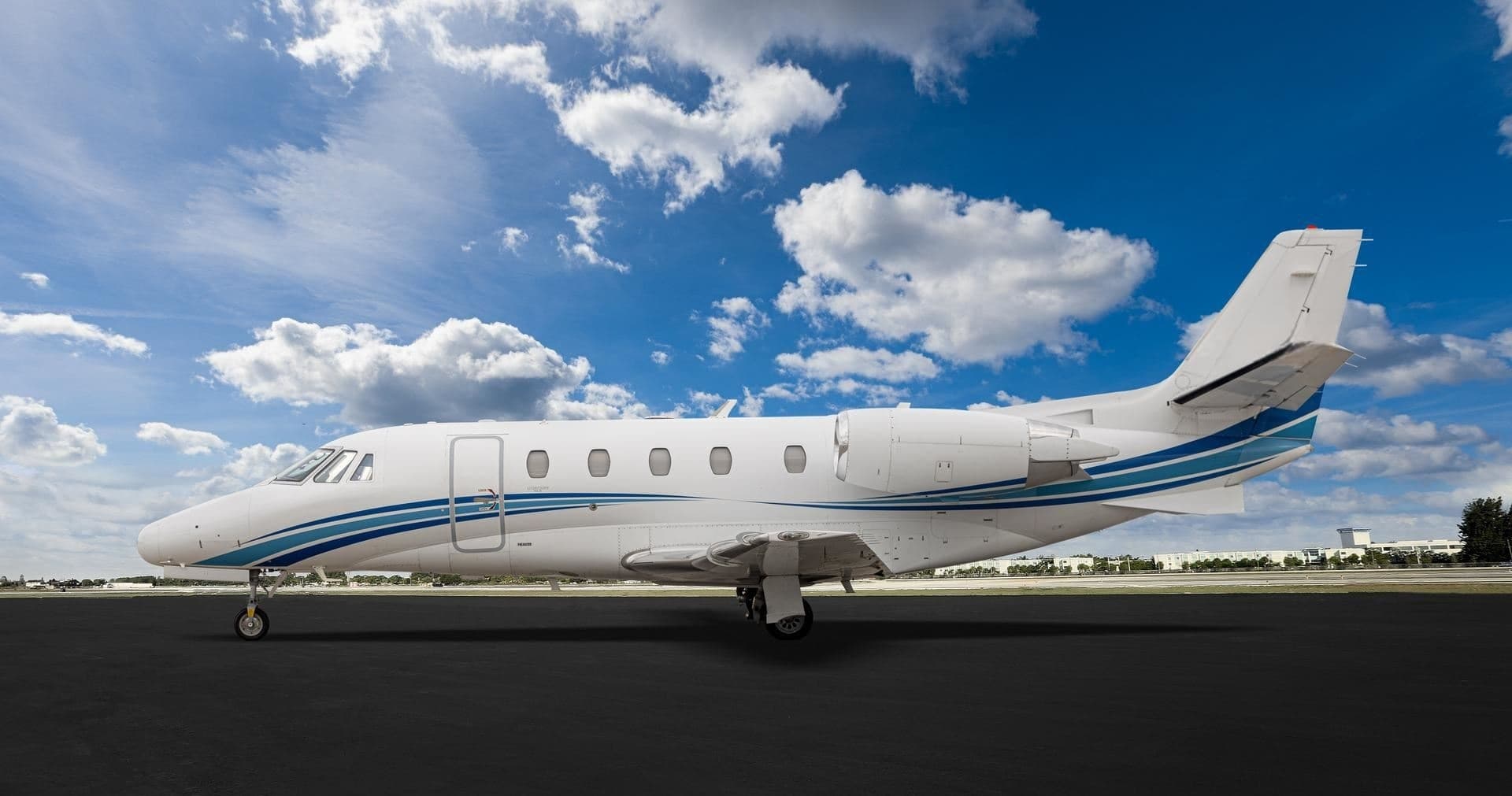 Thu, Nov 19in 16 daysWashingtonKIAD · Washington Dulles International AirportSyracuseKSYR · Syracuse Hancock International AirportCitation XLS9—$7,97619NovWashington → SyracuseKIAD → KSYR · in 16 daysCitation XLS · 9 seats$7,976
* Total price incl. 10% service fee, converted to your selected currency. Price subject to operator confirmation.
Map: Syracuse Airport
View the location of Syracuse – SYR/KSYR. Zoom in to explore the area around the airport.
About the airport
Syracuse Hancock International Airport (SYR/KSYR) is the key private jet gateway for Syracuse. PrivJet gives you instant access to charter flights and empty legs: fast, discreet and globally connected.
KSYR airport FAQ
Are there any restrictions at Syracuse airport (KSYR) today?
There are currently 14 valid NOTAMs for Syracuse (KSYR). Affected: Taxiway: closed; Obstacle: out of service; ILS glide path: unserviceable; VASIS: unserviceable. 4 more NOTAMs start in the coming days. For information only, not for flight planning or operational use. Always rely on an official pre-flight briefing. This list may be incomplete or out of date.
How long are the runways at Syracuse airport (KSYR)?
Syracuse (KSYR) has 2 runways: runway 10/28 with 2,747 m (9,013 ft), asphalt and runway 15/33 with 2,286 m (7,499 ft), asphalt. The longest is 2,747 m.
What are the radio frequencies at Syracuse airport (KSYR)?
Frequencies at KSYR: Tower 120.3 MHz, Ground 121.7 MHz and ATIS 132.05 MHz. For information only. Always rely on the published AIP.
What are the airport codes of Syracuse Hancock International Airport?
The ICAO code is KSYR and the IATA code is SYR. ICAO codes are used by air traffic control and pilots, e.g. in flight plans; IATA codes appear on tickets and baggage tags.
What is the elevation of KSYR airport?
Syracuse Hancock International Airport sits at 421 ft (128 m) above sea level. Local time zone: America/New York.
Can I fly to KSYR by private jet?
Whether a private jet can operate into Syracuse Hancock International Airport depends on runway length, opening hours, customs and immigration rules as well as slot and handling availability, among other things. PrivJet checks this with the operating carrier for every request.
Are there empty legs from or to KSYR?
There are currently 6 empty legs departing from and 3 arriving at Syracuse Hancock International Airport. Empty legs are repositioning flights at heavily reduced prices; the list is updated several times a day.