Tampa Airport (KTPA / TPA)
Empty legs and charters from Tampa
KTPA airport at a glance
- ICAO code
- KTPA
- IATA code
- TPA
- City
- Tampa
- Region
- Florida
- Country
- United States
- Elevation
- 26 ft (8 m)
- Time zone
- America/New York (UTC-5)
- Coordinates
- 27.9755° N, 82.5332° W
- Empty legs from
- 88
- Empty legs to
- 69
Private jet terminal & FBOs at Tampa
- Signature Aviation TPA2450 N Westshore Boulevard, Tampa, FL 33607
- Sheltair Tampa4751 Jim Walter Blvd., Tampa, FL 33607
Weather & airport info KTPA
Current weather
Good visual conditions (VFR)observed 04 Nov, 04:53 UTC- Wind
- 6 kt (11 km/h) from east (80°)
- Visibility
- 10 km or more
- Clouds
- few clouds at 5,000 ft
- Temperature
- 24 °C (dew point 22 °C)
- Pressure (QNH)
- 1,016 hPa
Original weather report (METAR)
METAR KTPA 040453Z 08006KT 10SM FEW050 24/22 A3000 RMK AO2 SLP158 T02440217 403060217
Forecast (TAF)
- 04 Nov, 06:00–15:00 UTC6 kt (11 km/h) from east (100°) · visibility 10 km or more · few clouds at 5,000 ft, scattered clouds at 20,000 ft
- 04 Nov, 15:00–19:00 UTCfrom7 kt (13 km/h) from southeast (130°) · visibility 10 km or more · scattered clouds at 2,000 ft, scattered clouds at 25,000 ft
- 04 Nov, 19:00–01:00 UTCfrom6 kt (11 km/h) from south (170°) · visibility 10 km or more · scattered clouds at 4,000 ft, broken clouds at 25,000 ft
- 04 Nov, 21:00–23:00 UTCpossible, 30 % probabilityvisibility 5 km · Rain showers · scattered clouds at 2,000 ft, broken clouds at 3,500 ft, broken clouds at 25,000 ft
- 05 Nov, 01:00–12:00 UTCfrom3 kt (6 km/h) from variable directions · visibility 10 km or more · scattered clouds at 2,000 ft, broken clouds at 4,000 ft
Original forecast (TAF)
TAF KTPA 040522Z 0406/0512 10006KT P6SM FEW050 SCT200 FM041500 13007KT P6SM SCT020 SCT250 FM041900 17006KT P6SM SCT040 BKN250 PROB30 0421/0423 3SM SHRA SCT020 BKN035 BKN250 FM050100 VRB03KT P6SM SCT020 BKN040
Airport
- Elevation
- 26 ft (8 m)
- Sunrise / Sunset
- 06:43 / 17:44 local time
Runways
| Runway | Length | Surface | Lighted |
|---|---|---|---|
| 19R/01L | 3,353 m (11,002 ft) | concrete | yes |
| 19L/01R | 2,530 m (8,300 ft) | asphalt/concrete | yes |
| 10/28 | 2,133 m (6,999 ft) | asphalt/concrete | yes |
Radio frequencies
- ATIS: 126.45
- Clearance: 133.6
- Ground: 121.7
- Tower: 119.5
- UNICOM: 122.95
For information only, not for flight planning. Weather can change quickly; always rely on official reports. Sources: aviationweather.gov (NOAA), OurAirports.
Airport map KTPA
Full screen →Runways white, taxiways yellow with designators, closed taxiways and runways per NOTAM in red.
Closed per NOTAM: TWY J* (* partly closed)
Official charts (FAA)
Cycle 2611, valid until 0901Z 11/26/26
Airport diagram (FAA)
Airport diagram (1)
Instrument approaches (16)
- ILS OR LOC RWY 01L
- ILS OR LOC RWY 19L
- ILS OR LOC RWY 19R
- ILS RWY 01L (SA CAT I)
- ILS RWY 19L (SA CAT I)
- ILS RWY 19L (CAT II)
- ILS RWY 01L (CAT II - III)
- RNAV (RNP) Z RWY 01L
- RNAV (RNP) Z RWY 01R
- RNAV (GPS) RWY 10
- RNAV (GPS) RWY 19L
- RNAV (GPS) RWY 19R
- RNAV (GPS) RWY 28
- RNAV (GPS) Y RWY 01L
- RNAV (GPS) Y RWY 01R
- LOC RWY 01R
Departure procedures (10)
Minimums (2)
LAHSO (1)
For information only, not for navigation. Always use current official charts and NOTAMs.
Current NOTAMs for KTPA(23)
NOTAMs (Notices to Air Missions) announce short-term changes at an airport: closed runways or taxiways, unserviceable approach aids, obstacles, airspace restrictions.
- Out of serviceLanding direction indicator: unserviceableA3663/26· from 04 Nov, 13:00 UTC · until 04 Nov, 18:30 UTC
All Runway Visual Range (RVR) measurements at the airport are out of service. RVR measures the visibility on the runway.
Show original text
AD AP RVR ALL U/S
A3663/26 NOTAMN
Q) KZMA/QFTAS////000/999/2758N08231W005
A) KTPA
B) 2611041300
C) 2611041830
E) AD AP RVR ALL U/S
- ClosedTaxiway: closedA3667/26· until 05 Nov, 08:00 UTC
Taxiway J between taxiway L and runway 01R/19L, taxiway C between taxiway G1 and taxiway N closed
Show original text
TWY J BTN TWY L AND RWY 01R/19L, TWY C BTN TWY G1 AND TWY N CLSD
A3667/26 NOTAMN
Q) KZMA/QMXLC////000/999/2758N08231W005
A) KTPA
B) 2611040537
C) 2611050800
E) TWY J BTN TWY L AND RWY 01R/19L, TWY C BTN TWY G1 AND TWY N CLSD
- ClosedApron: closedA3612/26· permanent
Taxiway F between taxiway F2 and taxiway R, and taxiway R between taxiway F and taxiway R3 are closed. This affects aircraft movement at the airport.
Show original text
APRON TXL F BTN TWY F2 AND TXL R, TXL R BTN TXL F AND TWY R3 CLSD
A3612/26 NOTAMN
Q) KZMA/QMNLC////000/999/2758N08231W005
A) KTPA
B) 2611010300
C) PERM
E) APRON TXL F BTN TWY F2 AND TXL R, TXL R BTN TXL F AND TWY R3 CLSD
- Out of serviceObstacle10/237· until 30 Nov, 23:59 UTC
A bridge light near the airport is out of service. Its top is 3 ft above ground.
Show original text
OBST BRIDGE LGT (ASN UNKNOWN) 275910N0823205W (.6NM N TPA) UNKNOWN (3FT AGL) U/S
- Out of serviceObstacle lights: unserviceableA3569/26· until 11 Dec, 03:18 UTC
A tower light 2.9 nautical miles northeast of the airport is out of service. Its top is 276 ft above sea level, 233 ft above ground.
Show original text
TOWER LGT (ASR 1040048) 280044.00N0822953.00W (2.9NM NE TPA) 276FT (233FT AGL) U/S
A3569/26 NOTAMN
Q) KZMA/QOLAS/IV/M/AE/000/999/2800N08229W001
A) KTPA
B) 2610262118
C) 2612110318
E) TOWER LGT (ASR 1040048) 280044.00N0822953.00W (2.9NM NE TPA) 276FT (233FT AGL) U/S
- Out of servicePAPI: unserviceable10/189· until 06 Nov, 20:00 UTC
The PAPI (Precision Approach Path Indicator) for runway 19L is out of service. The PAPI helps pilots maintain the correct glide path to the runway.
Show original text
RWY 19L PAPI U/S
A3559/26 NOTAMN
Q) KZMA/QLPAS////000/999/2758N08231W005
A) KTPA
B) 2610251542
C) 2611062000
E) RWY 19L PAPI U/S
- Out of servicePAPI: unserviceableA3559/26· until 06 Nov, 20:00 UTC
The PAPI (Precision Approach Path Indicator) for runway 19L is out of service. The PAPI helps pilots maintain the correct glide path to the runway.
Show original text
RWY 19L PAPI U/S
A3559/26 NOTAMN Q) KZMA/QLPAS////000/999/2758N08231W005 A) KTPA B) 2610251542 C) 2611062000 E) RWY 19L PAPI U/S
- Out of serviceObstacle lights: unserviceableA3508/26· until 03 Dec, 12:04 UTC
Tower light (ASR 1040049) (2.9 NM northeast of TPA) 276 ft above sea level (233 ft above ground) out of service
Show original text
TOWER LGT (ASR 1040049) 280041.00N0822952.00W (2.9NM NE TPA) 276FT (233FT AGL) U/S
A3508/26 NOTAMN
Q) KZMA/QOLAS/IV/M/AE/000/999/2800N08229W001
A) KTPA
B) 2610191204
C) 2612031204
E) TOWER LGT (ASR 1040049) 280041.00N0822952.00W (2.9NM NE TPA) 276FT (233FT AGL) U/S
15 more NOTAMs
- Out of serviceILS category II: not availableA3664/26· from 04 Nov, 13:00 UTC · until 04 Nov, 18:30 UTC
The instrument landing system (ILS) for runway 19L is not available for Category II approaches. The ILS guides aircraft to the runway in poor visibility.
Show original text
TPA NAV ILS RWY 19L CAT II NA
A3664/26 NOTAMN
Q) KZMA/QITAU////000/999/2758N08231W005
A) KTPA
B) 2611041300
C) 2611041830
E) TPA NAV ILS RWY 19L CAT II NA
- Out of serviceILS category II: not availableA3665/26· from 04 Nov, 13:00 UTC · until 04 Nov, 18:30 UTC
The Category II Instrument Landing System (ILS) for runway 01R is not available. The ILS guides aircraft to the runway in poor visibility.
Show original text
TPA NAV ILS RWY 01R CAT II NA
A3665/26 NOTAMN
Q) KZMA/QITAU////000/999/2758N08231W005
A) KTPA
B) 2611041300
C) 2611041830
E) TPA NAV ILS RWY 01R CAT II NA
- NoticeObstacle10/224· until 26 Apr, 21:00 UTC
An obstacle, a crane, is located 1.5 nautical miles northeast of Tampa International Airport. Its top is 128 feet above sea level, 100 feet above ground, and it is flagged.
Show original text
OBST CRANE (ASN 2026-ASO-19987-OE) 275941N0823052W (1.5NM NE TPA) 128FT (100FT AGL) FLAGGED
- NoticeTaxiway10/230· until 27 Nov, 22:00 UTC
The centerline markings for taxiway C5 on the south side between runway 01R/19L and taxiway C are not standard.
Show original text
TWY C5 CL MARKINGS BTN RWY 01R/19L AND TWY C SOUTH SIDE NOT STD
- NoticeInstrument approach procedure3838/26· until 15 Jan, 18:58 UTC (estimated)
A temporary crane is located 1.2 nautical miles south of runway 1L at Tampa International Airport. Its top is 171 ft above mean sea level.
Show original text
IAP TAMPA INTL, TAMPA, FL. RNAV (RNP) Z RWY 1L, ORIG... RNP 0.30 DA 465/HAT 454 ALL CATS, VIS ALL CATS RVR 4500. TEMPORARY CRANE 171 MSL 1.2NM S OF RWY 1L ( 2026-ASO-7496-OE). 2610291858-2701151858EST
Q) KZJX/QPIXX/I/NBO/A/000/999/2758N08231W005
A) KTPA
B) 2610291857
C) 2706101857EST
E) TPA TAMPA INTL, TAMPA, FL.
RNAV (RNP) Z RWY 1L, ORIG...
RNP 0.30 DA 465/HAT 454 ALL CATS, VIS ALL CATS RVR 4500.  TEMPORARY CRANE 171 MSL 1.2NM S OF RWY 1L ( 2026-ASO-7496-OE).
- NoticeInstrument approach procedure: changedA3595/26· until 15 Jan, 18:58 UTC
A temporary crane is located 1.2 nautical miles south of runway 1L at Tampa International Airport. Its top is 171 ft above mean sea level.
Show original text
IAP TAMPA INTL, TAMPA, FL. RNAV (RNP) Z RWY 1L, ORIG... RNP 0.30 DA 465/HAT 454 ALL CATS, VIS ALL CATS RVR 4500. TEMPORARY CRANE 171 MSL 1.2NM S OF RWY 1L ( 2026-ASO-7496-OE).
A3595/26 NOTAMN
Q) KZMA/QPICH/I/NBO/A/000/999/2758N08231W005
A) KTPA
B) 2610291858
C) 2701151858
E) IAP TAMPA INTL, TAMPA, FL. RNAV (RNP) Z RWY 1L, ORIG... RNP 0.30 DA 465/HAT 454 ALL CATS, VIS ALL CATS RVR 4500. TEMPORARY CRANE 171 MSL 1.2NM S OF RWY 1L ( 2026-ASO-7496-OE).
- NoticeRunway10/212· until 30 Nov, 04:00 UTC
The holding position markings for runway 19L at runway 10/28 are obscured.
Show original text
RWY 19L HLDG PSN MARKINGS AT RWY 10/28 OBSC
- NoticeRunway10/211· until 30 Nov, 04:00 UTC
The holding position markings for runway 01R at runway 10/28 are obscured.
Show original text
RWY 01R HLDG PSN MARKINGS AT RWY 10/28 OBSC
- NoticeDaylight markings10/203· until 30 Nov, 19:00 UTC
The runway 01L threshold markings are not standard. This might affect orientation during approach.
Show original text
RWY 01L THR MARKINGS NOT STD
10/203 NOTAMN
Q) KZJX/QMMXX/V/M/A/000/999/2758N08231W005
A) KTPA
B) 2610271958
C) 2611301900

E) RWY 01L THR MARKINGS NOT STD
- NoticeRunway10/202· until 30 Nov, 19:00 UTC
The runway 19R lead off centerline markings at taxiway W3 are obscured. This may affect guidance when exiting the runway.
Show original text
RWY 19R LEAD OFF CL MARKINGS AT TWY W3 OBSC
- Out of serviceOther664/26· until 01 Jun, 13:56 UTC (estimated)
The RNAV visual runway 01L, original and original-A procedures are not available. This means these specific approach procedures cannot be used.
Show original text
SPECIAL TAMPA INTL, TAMPA, FL. RNAV VISUAL RWY 01L, ORIG ... RNAV VISUAL RWY 01L, ORIG-A ... PROCEDURE NA 2610201356-2706011356EST
Q) KZJX/QXXXX/I/NBO/A/000/999/2758N08231W025
A) KTPA
B) 2610201356
C) 2706011356EST
E) SPECIAL TAMPA INTL, TAMPA, FL.
RNAV VISUAL RWY 01L, ORIG ...
RNAV VISUAL RWY 01L, ORIG-A ...
PROCEDURE NA
- Out of serviceOtherA3518/26· until 01 Jun, 13:56 UTC
The RNAV visual runway 01L, original and original-A procedures are not available. This means these specific approach procedures cannot be used.
Show original text
SPECIAL TAMPA INTL, TAMPA, FL. RNAV VISUAL RWY 01L, ORIG ... RNAV VISUAL RWY 01L, ORIG-A ... PROCEDURE NA
A3518/26 NOTAMN
Q) KZMA/QXXXX////000/999/2758N08231W005
A) KTPA
B) 2610201356
C) 2706011356
E) SPECIAL TAMPA INTL, TAMPA, FL. RNAV VISUAL RWY 01L, ORIG ... RNAV VISUAL RWY 01L, ORIG-A ... PROCEDURE NA
- NoticeObstacle: erectedA3459/26· until 25 Dec, 22:30 UTC
A crane, whose owner is unknown, is located 0.5 nautical miles northwest of Tampa airport. Its top is 116 feet above sea level, 90 feet above ground, and it is flagged.
Show original text
OBST CRANE (ASN UNKNOWN) 275856N0823215W (.5NM NW TPA) 116FT (90FT AGL) FLAGGED
A3459/26 NOTAMN
Q) KZMA/QOBCE/IV/M/AE/000/999/2758N08231W005
A) KTPA
B) 2610191100
C) 2612252230
D) DLY 1100-2230
E) OBST CRANE (ASN UNKNOWN) 275856N0823215W (.5NM NW TPA)
 116FT (90FT AGL) FLAGGED
Hours: DLY 1100-2230
- NoticeDaylight markings10/135· until 16 Nov, 19:00 UTC
The lead-off centerline markings for runway 19R at taxiway W2 are obscured.
Show original text
RWY 19R LEAD OFF CL MARKINGS AT TWY W2 OBSC
10/135 NOTAMN
Q) KZJX/QMMXX/V/M/A/000/999/2758N08231W005
A) KTPA
B) 2610161719
C) 2611161900

E) RWY 19R LEAD OFF CL MARKINGS AT TWY W2 OBSC
- NoticeObstacle: erectedA3433/26· until 07 Dec, 22:00 UTC
An obstacle, a crane, is located near the airport (1.7 nautical miles southeast of Tampa International). Its top is 159 feet above sea level, 125 feet above ground, and it is flagged and lighted.
Show original text
OBST CRANE (ASN UNKNOWN) 275751N0823016W (1.7NM SE TPA) 159FT (125FT AGL) FLAGGED AND LGTD
A3433/26 NOTAMN
Q) KZMA/QOBCE/IV/M/AE/000/999/2758N08231W005
A) KTPA
B) 2610131100
C) 2612072200
D) DLY 1100-2200
E) OBST CRANE (ASN UNKNOWN) 275751N0823016W (1.7NM SE TPA)
 159FT (125FT AGL) FLAGGED AND LGTD
Hours: DLY 1100-2200
For information only, not for flight planning or operational use. Always rely on an official pre-flight briefing. This list may be incomplete or out of date. Explanations and expanded abbreviations are generated automatically. The original text is authoritative. Source: FAA NOTAM Management Service (SWIM).
Private jet traffic in Tampa International Airport (last 30 days)
- Arrivals
- 1,729
- Departures
- 1,673
- Different jets
- 1,043
Most frequent origins: Miami-Opa Locka Executive Airport (113), Fort Lauderdale Hollywood International Airport (65), Palm Beach International Airport (45), Orlando Executive Airport (35), DeKalb Peachtree Airport (35).
Most frequent destinations: Miami-Opa Locka Executive Airport (129), Fort Lauderdale Hollywood International Airport (60), Palm Beach International Airport (44), Teterboro Airport (40), DeKalb Peachtree Airport (35).
Most common aircraft types: Pilatus PC-12 (374), Embraer Phenom 300 (269), Cessna Citation Latitude (166), Cessna Citation CJ2 (161), Bombardier Challenger 350/3500 (126).
Tuesday is the busiest day.
Our own analysis of public ADS-B signals from business jets. Not every flight is received, and jets with a removal request are excluded.
Charter operators based here
Operators with a base at this airport.
- Fly AllianceOrlando Executive (KORL) · Light jet, Midsize jet, Super midsize jet
- Elite AirSt Petersburg (St Pete-Clearwater International) (KPIE) · Turboprop, Light jet, Midsize jet
- M & N AviationDenver (Centennial) (KAPA) · Midsize jet, Super midsize jet
- FlyCarolinaCharlotte Douglas International (KCLT) · Turboprop, Light jet, Midsize jet
- FlyUSATurboprop, Light jet, Midsize jet
- Gold Aviation ServicesFort Lauderdale/Hollywood International (KFLL) · Light jet, Super midsize jet
- Aitheras Aviation GroupCleveland (Burke Lakefront) (KBKL) · Light jet, Midsize jet, Super midsize jet
- Skyway Aviation ServicesLight jet, Midsize jet
- ExecuJet Charter ServiceTurboprop, Light jet, Super midsize jet
- Odyssey AirwaysTurboprop, Light jet
- Orchid Island AviationMiami (Dade Collier) (KTNT) · Turboprop, Midsize jet
- Will Smith AviationLight jet
Empty legs from KTPA
88 departures available
 Wed, Nov 4TodayTampaKTPA · Tampa International AirportNew YorkKTEB · Teterboro AirportFalcon 509—On request4NovTampa → New YorkKTPA → KTEB · TodayFalcon 50 · 9 seatsOn request
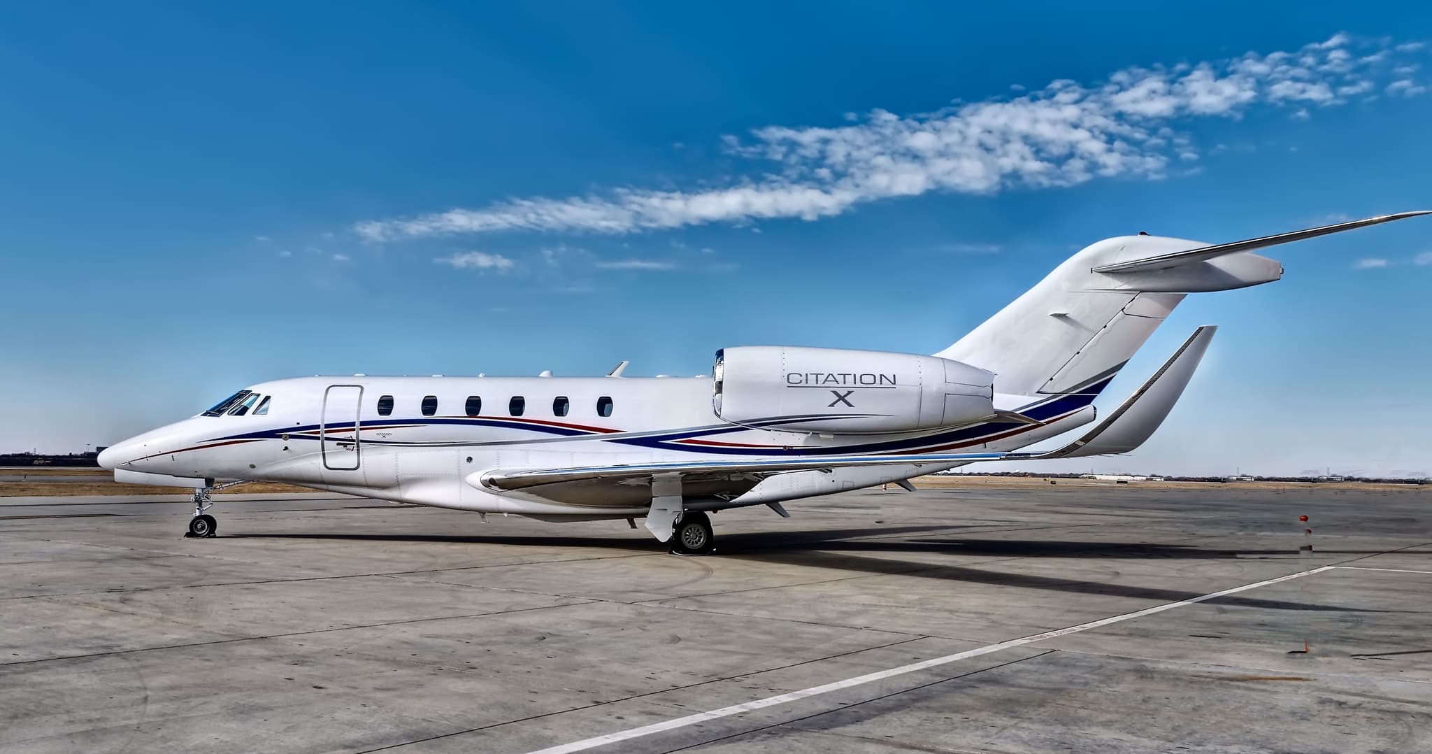 Wed, Nov 4TodayTampaKTPA · Tampa International AirportAtlantaKPDK · DeKalb Peachtree AirportCitation X8—$11,8664NovTampa → AtlantaKTPA → KPDK · TodayCitation X · 8 seats$11,866
 Wed, Nov 421:01TampaKTPA · Tampa International AirportTeterboroKTEB · Teterboro AirportCessna Citation Bravo12h 54mOn request4NovTampa → TeterboroKTPA → KTEB · 21:01Cessna Citation Bravo · 1 seat · 2h 54mOn request
- Wed, Nov 421:12TampaKTPA · Tampa IntlWest Palm BeachKDJT · President Donald J. Trump International AirportCessna Citation Excel8—On request4NovTampa → West Palm BeachKTPA → KDJT · 21:12Cessna Citation Excel · 8 seatsOn request
- Wed, Nov 4TodayTampaKTPA · Tampa International AirportMerritt IslandKCOI · Merritt Island AirportPilatus PC-12 NG648mOn request4NovTampa → Merritt IslandKTPA → KCOI · TodayPilatus PC-12 NG · 6 seats · 48mOn request
- Wed, Nov 4TodayTampaKTPA · Tampa International AirportDeLandKDED · DeLand Municipal AirportCitation X12—$9,4604NovTampa → DeLandKTPA → KDED · TodayCitation X · 12 seats$9,460
- Wed, Nov 4TodayTampaKTPA · Tampa International AirportTeterboroKTEB · Teterboro AirportCitation X12—$11,8254NovTampa → TeterboroKTPA → KTEB · TodayCitation X · 12 seats$11,825
 Thu, Nov 5TomorrowTampaKTPA · Tampa International AirportNew YorkKTEB · Teterboro AirportCitation Bravo7—On request5NovTampa → New YorkKTPA → KTEB · TomorrowCitation Bravo · 7 seatsOn request
- Thu, Nov 5TomorrowTampaKTPA · Tampa IntlWest Palm BeachKDJT · President Donald J. Trump International AirportCessna Citation Latitude—53mOn request5NovTampa → West Palm BeachKTPA → KDJT · TomorrowCessna Citation Latitude · 53mOn request
 KTPA · Tampa International Airport
* Total price incl. 10% service fee, converted to your selected currency. Price subject to operator confirmation.
Empty legs to KTPA
69 arrivals available
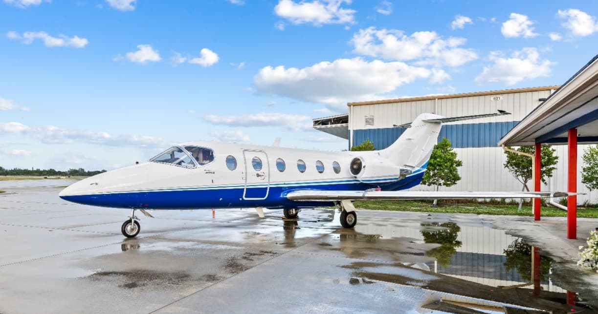 Wed, Nov 4TodayMiamiKOPF · Miami-Opa Locka Executive AirportTampaKTPA · Tampa International AirportHawker 400XP7—$4,4554NovMiami → TampaKOPF → KTPA · TodayHawker 400XP · 7 seats$4,455
 Wed, Nov 410:44Fort LauderdaleKFLL · Fort Lauderdale Hollywood International AirportTampaKTPA · Tampa International AirportEmbraer Phenom 300148m$4,8404NovFort Lauderdale → TampaKFLL → KTPA · 10:44Embraer Phenom 300 · 1 seat · 48m$4,840
- Wed, Nov 415:39DallasKDFW · Dallas - Fort Worth IntlTampaKTPA · Tampa IntlBombardier Learjet 608—$20,7224NovDallas → TampaKDFW → KTPA · 15:39Bombardier Learjet 60 · 8 seats$20,722
- Wed, Nov 417:12Fort LauderdaleKFLL · Hollywood IntlTampaKTPA · Tampa IntlBombardier Learjet 607—$7,2604NovFort Lauderdale → TampaKFLL → KTPA · 17:12Bombardier Learjet 60 · 7 seats$7,260
- Wed, Nov 416:12HoustonKHOU · William P HobbyTampaKTPA · Tampa IntlBombardier Learjet 608—$17,6974NovHouston → TampaKHOU → KTPA · 16:12Bombardier Learjet 60 · 8 seats$17,697
- Wed, Nov 414:54El PasoKELP · El Paso IntlTampaKTPA · Tampa IntlBombardier Learjet 608—$29,4944NovEl Paso → TampaKELP → KTPA · 14:54Bombardier Learjet 60 · 8 seats$29,494
- Wed, Nov 418:12Boca RatonKBCTTampaKTPA · Tampa IntlBombardier Learjet 607—$6,3534NovBoca Raton → TampaKBCT → KTPA · 18:12Bombardier Learjet 60 · 7 seats$6,353
- Wed, Nov 418:18NaplesKAPFTampaKTPA · Tampa IntlBombardier Learjet 607—$5,4454NovNaples → TampaKAPF → KTPA · 18:18Bombardier Learjet 60 · 7 seats$5,445
- Wed, Nov 4TodayWest Palm BeachKPBI · Palm Beach International AirportTampaKTPA · Tampa International AirportPilatus PC-12 NG61hOn request4NovWest Palm Beach → TampaKPBI → KTPA · TodayPilatus PC-12 NG · 6 seats · 1hOn request
* Total price incl. 10% service fee, converted to your selected currency. Price subject to operator confirmation.
Map: Tampa Airport
View the location of Tampa – TPA/KTPA. Zoom in to explore the area around the airport.
About the airport
Tampa International Airport (TPA/KTPA) is the key private jet gateway for Tampa. PrivJet gives you instant access to charter flights and empty legs: fast, discreet and globally connected.
KTPA airport FAQ
Are there any restrictions at Tampa airport (KTPA) today?
There are currently 20 valid NOTAMs for Tampa (KTPA). Affected: Taxiway: closed; Apron: closed; Obstacle: out of service; Obstacle lights: unserviceable and 2 more. 3 more NOTAMs start in the coming days. For information only, not for flight planning or operational use. Always rely on an official pre-flight briefing. This list may be incomplete or out of date.
What is the weather at Tampa airport (KTPA)?
According to the latest weather report for KTPA (METAR, 04 Nov, 04:53 UTC): Good visual conditions (VFR). Wind 6 kt (11 km/h) from east (80°), visibility 10 km or more, temperature 24 °C (dew point 22 °C). For information only, not for flight planning. Weather can change quickly; always rely on official reports.
How long are the runways at Tampa airport (KTPA)?
Tampa (KTPA) has 3 runways: runway 19R/01L with 3,353 m (11,002 ft), concrete, runway 19L/01R with 2,530 m (8,300 ft), asphalt/concrete and runway 10/28 with 2,133 m (6,999 ft), asphalt/concrete. The longest is 3,353 m.
What are the radio frequencies at Tampa airport (KTPA)?
Frequencies at KTPA: Tower 119.5 MHz, Ground 121.7 MHz and ATIS 126.45 MHz. For information only. Always rely on the published AIP.
What are the airport codes of Tampa International Airport?
The ICAO code is KTPA and the IATA code is TPA. ICAO codes are used by air traffic control and pilots, e.g. in flight plans; IATA codes appear on tickets and baggage tags.
What is the elevation of KTPA airport?
Tampa International Airport sits at 26 ft (8 m) above sea level. Local time zone: America/New York.
Where do private jets land at Tampa?
KTPA has 2 private jet terminals or FBOs: Signature Aviation TPA and Sheltair Tampa. Your flight confirmation says which one your operator uses.
Can I fly to KTPA by private jet?
Whether a private jet can operate into Tampa International Airport depends on runway length, opening hours, customs and immigration rules as well as slot and handling availability, among other things. PrivJet checks this with the operating carrier for every request.
Are there empty legs from or to KTPA?
There are currently 88 empty legs departing from and 69 arriving at Tampa International Airport. Empty legs are repositioning flights at heavily reduced prices; the list is updated several times a day.