Knoxville McGhee Tyson Airport (KTYS / TYS)
Empty legs and charters from Knoxville
KTYS airport at a glance
- ICAO code
- KTYS
- IATA code
- TYS
- City
- Knoxville
- Region
- Tennessee
- Country
- United States
- Elevation
- 981 ft (299 m)
- Time zone
- America/New York (UTC-5)
- Coordinates
- 35.8110° N, 83.9940° W
- Empty legs from
- 53
- Empty legs to
- 51
Private jet terminal & FBOs at Knoxville McGhee Tyson
- Signature Aviation TYS2343 W General Aviation Drive, Alcoa, TN 37701
Weather & airport info KTYS
Current weather
Good visual conditions (VFR)observed 03 Nov, 05:53 UTC- Wind
- Calm
- Visibility
- 10 km or more
- Clouds
- no significant clouds
- Temperature
- 12 °C (dew point 11 °C)
- Pressure (QNH)
- 1,023 hPa
Original weather report (METAR)
METAR KTYS 030553Z 00000KT 10SM CLR 12/11 A3021 RMK AO2 SLP225 T01220111 10189 20117 58004 $
Forecast (TAF)
- 03 Nov, 06:00–06:00 UTC4 kt (7 km/h) from variable directions · visibility 10 km or more · few clouds at 5,000 ft, scattered clouds at 10,000 ft
Original forecast (TAF)
TAF KTYS 030530Z 0306/0406 VRB04KT P6SM FEW050 SCT100
Airport
- Elevation
- 981 ft (299 m)
- Sunrise / Sunset
- 07:00 / 17:38 local time
Runways
| Runway | Length | Surface | Lighted |
|---|---|---|---|
| 05L/23R | 3,048 m (10,000 ft) | concrete | yes |
| 05R/23L | 2,743 m (9,000 ft) | asphalt | yes |
Radio frequencies
- ATIS: 128.35
- Clearance: 121.65
- Ground: 121.9
- Tower: 121.2
- UNICOM: 122.95
For information only, not for flight planning. Weather can change quickly; always rely on official reports. Sources: aviationweather.gov (NOAA), OurAirports.
Airport map KTYS
Full screen →Runways white, taxiways yellow with designators, closed taxiways and runways per NOTAM in red.
Closed per NOTAM: RWY 5R/23L, TWY A1*, TWY A2*, TWY A3*, TWY A7*, TWY A8*, TWY A* (* partly closed)
Official charts (FAA)
Cycle 2611, valid until 0901Z 11/26/26
Airport diagram (FAA)
Airport diagram (1)
Instrument approaches (16)
Departure procedures (1)
Minimums (2)
Hot spots (1)
For information only, not for navigation. Always use current official charts and NOTAMs.
Current NOTAMs for KTYS(26)
NOTAMs (Notices to Air Missions) announce short-term changes at an airport: closed runways or taxiways, unserviceable approach aids, obstacles, airspace restrictions.
- ClosedRunway: closedA1961/26· until 01 Dec, 23:59 UTC
Runway 05R/23L is closed.
Show original text
RWY 05R/23L CLSD
A1961/26 NOTAMN
Q) KZTL/QMRLC////000/999/3548N08359W005
A) KTYS
B) 2610300819
C) 2612012359
E) RWY 05R/23L CLSD
- Out of serviceILS: unserviceableA1968/26· from 04 Nov, 05:00 UTC · until 04 Nov, 06:30 UTC
The instrument landing system (ILS) for runway 23R is out of service. The ILS helps aircraft find their way to the runway in poor visibility.
Show original text
TYS NAV ILS RWY 23R U/S
A1968/26 NOTAMN
Q) KZTL/QICAS////000/999/3548N08359W005
A) KTYS
B) 2611040500
C) 2611040630
E) TYS NAV ILS RWY 23R U/S
- Out of serviceILS: unserviceableA1980/26· until 19 Nov, 23:59 UTC
TYS navigation: ILS (instrument landing system) runway 23L out of service
Show original text
TYS NAV ILS RWY 23L U/S
A1980/26 NOTAMN
Q) KZTL/QICAS////000/999/3548N08359W005
A) KTYS
B) 2611021117
C) 2611192359
E) TYS NAV ILS RWY 23L U/S
- Out of serviceOtherA1965/26· until 30 Nov, 23:59 UTC
All taxiway A lights are out of service, except for the medium intensity lights on the taxiway connectors.
Show original text
TWY A LGT ALL U/S EXC MEDIUM INTST ON CONS
A1965/26 NOTAMN
Q) KZTL/QXXXX////000/999/3548N08359W005
A) KTYS
B) 2610310422
C) 2611302359
E) TWY A LGT ALL U/S EXC MEDIUM INTST ON CONS
- Out of serviceTaxiway edge lightsA1959/26· until 30 Dec, 21:00 UTC
The taxiway B lighting at McGhee Tyson Airport is out of service, except for medium intensity on request.
Show original text
TWY B LGT U/S EXC MEDIUM INTST ON CONS
A1959/26 NOTAMN
Q) KZTL/QLYXX////000/999/3548N08359W005
A) KTYS
B) 2610291910
C) 2612302100
E) TWY B LGT U/S EXC MEDIUM INTST ON CONS
- ClosedTaxiway: closedA1957/26· until 30 Dec, 23:30 UTC
Taxiways A1, A2, A3, A7, A8, and taxiway A between taxiway A1 and taxiway C at McGhee Tyson Airport are closed.
Show original text
TWY A1, A2, A3, A7, A8, TWY A BTN TWY A1 AND TWY C CLSD
A1957/26 NOTAMN
Q) KZTL/QMXLC////000/999/3548N08359W005
A) KTYS
B) 2610291842
C) 2612302330
E) TWY A1, A2, A3, A7, A8, TWY A BTN TWY A1 AND TWY C CLSD
- ClosedTaxiway: closed10/091· until 06 Nov, 22:00 UTC
Taxiway A between taxiway R3 and taxiway A9 is closed, except for aircraft with a wingspan less than 118 ft.
Show original text
TWY A BTN TWY R3 AND TWY A9 CLSD EXC ACFT WINGSPAN LESS THAN 118FT
A1904/26 NOTAMN Q) KZTL/QMXLC////000/999/3548N08359W005 A) KTYS B) 2610191539 C) 2611062200 E) TWY A BTN TWY R3 AND TWY A9 CLSD EXC ACFT WINGSPAN LESS THAN 118FT
- Out of serviceObstacle10/082· until 15 Feb, 19:02 UTC
A tower with its top 1235.9 feet above sea level (235.9 feet above ground) is located 13.0 nautical miles west of the airport. The tower lighting is out of service.
Show original text
OBST TOWER LGT (ASR 1034997) 354846.00N0841538.70W (13.0NM W TYS) 1235.9FT (235.9FT AGL) U/S
18 more NOTAMs
- Out of serviceObstacle lights: unserviceable10/046· until 10 Jan, 04:00 UTC
A tower obstacle light 13.2 nautical miles northwest of the airport is out of service. Its top is 1344.2 ft above sea level, 286.1 ft above ground.
Show original text
OBST TOWER LGT (ASR 1043648) 355825.70N0841044.30W (13.2NM NW TYS) 1344.2FT (286.1FT AGL) U/S
10/046 NOTAMN<br/>
<b>Q) </b>KZTL/QOLAS/IV/M/E/000/014/3548N08359W005<br/>
<b>A) </b>KTYS<br/>
<b>B) </b>2610121606<br/>
<b>C) </b>2701100400<br/>
<b>E) </b> TOWER LGT (ASR 1043648) 355825.70N0841044.30W (13.2NM NW TYS) 1344.2FT (286.1FT AGL) U/S<br/>
- Out of serviceObstacle10/010· until 31 Jan, 16:55 UTC
An obstacle tower light (ASR 1043007) 10.8 nautical miles south-southeast of the airport is out of service; its top is 2877.0 ft above sea level, 379.9 ft above ground.
Show original text
OBST TOWER LGT (ASR 1043007) 353812.10N0835604.50W (10.8NM SSE TYS) 2877.0FT (379.9FT AGL) U/S
- Out of serviceServices09/120· until 10 Nov, 23:59 UTC (estimated)
The remote transmitter/receiver on frequency 132.8 is not available.
Show original text
COM REMOTE TRANS/REC 132.8 NOT AVBL
- ClosedApron: closedM0004/26· until 18 Dec, 21:00 UTC
AIR NTL GUARD LOWER ramp closed lighted and BARRICADED
Show original text
AIR NTL GUARD LOWER RAMP CLSD LGTD AND BARRICADED
M0004/26 NOTAMN
Q) ZTL/QMNLC/IV/NBO/A/000/999/3548N08359W005
A) KTYS
B) 2609291552
C) 2612182100
E)
AIR NTL GUARD LOWER RAMP CLSD LGTD AND BARRICADED
- NoticeAirspace11/010· from 03 Nov, 13:00 UTC · until 06 Nov, 22:00 UTC
Airspace for unmanned aircraft systems (UAS) is restricted daily from surface to 400 feet above ground level within a 4.2 nautical mile radius of 16 nautical miles northwest of TYS.
Show original text
AIRSPACE UAS WI AN AREA DEFINED AS 4.2NM RADIUS OF 355549N0841838W (16NM NW TYS) SFC-400FT AGL DLY 1300-2200
- NoticeAirspace11/009· until 27 Nov, 22:00 UTC
The airspace within a 3.5 nautical mile radius of VXV275021 is restricted for unmanned aircraft systems (drones) up to 1199 feet above ground.
Show original text
AIRSPACE UAS WI AN AREA DEFINED AS 3.5NM RADIUS OF VXV275021 SFC-1199FT AGL MON-FRI 1300-2200
- NoticeAirspace10/140· until 06 Nov, 22:00 UTC
Airspace drones (UAS) within an area defined as 3 NM radius of a defined point (15.3 NM west-northwest of TYS) surface- 400 ft above ground daily 1200-2200
Show original text
AIRSPACE UAS WI AN AREA DEFINED AS 3NM RADIUS OF 355522N0841739W (15.3NM WNW TYS) SFC-400FT AGL DLY 1200-2200
- NoticeRunway10/135· until 01 Jan, 21:00 UTC
The centerline markings on the northeast side of runway 05L/23R are obscured.
Show original text
RWY 05L/23R CL MARKINGS NE SIDE OBSC
- NoticeTaxiway10/133· until 30 Dec, 21:00 UTC
The taxiway centerline markings on taxiway S are not standard. This might affect guidance on the taxiway.
Show original text
TWY S CL MARKINGS NOT STD
- NoticeInstrument approach procedure2694/26· until 20 Nov, 14:51 UTC (estimated)
For the RNAV (GPS) approach to runway 23L, AMDT 2A, there are temporary cranes up to 1190 feet above mean sea level, starting 3579 feet south of runway 23L. The decision altitude for LPV (LPV DA) is 1237 feet above mean sea level and the height above threshold (HAT) is 272 feet for all aircraft categories. The visibility (VIS) is 4500 feet for all aircraft categories.
Show original text
IAP MC GHEE TYSON, KNOXVILLE, TN. RNAV (GPS) RWY 23L, AMDT 2A... LPV DA 1237/HAT 272 ALL CATS. VIS RVR 4500 ALL CATS. TEMPORARY CRANES, UP TO 1190 MSL, BEGINNING 3579FT SOUTH OF RWY 23L (2023-ASO-12096 THRU 12100-NRA). 2610271451-2611201451EST
Q) KZTL/QPIXX/I/NBO/A/000/999/3548N08359W005
A) KTYS
B) 2610271451
C) 2611201451EST
E) TYS MC GHEE TYSON, KNOXVILLE, TN.
RNAV (GPS) RWY 23L, AMDT 2A...
LPV DA 1237/HAT 272 ALL CATS. VIS RVR 4500 ALL CATS.
TEMPORARY CRANES, UP TO 1190 MSL, BEGINNING 3579FT SOUTH OF RWY 23L (2023-ASO-12096 THRU 12100-NRA).
- NoticeInstrument approach procedure: changedA1942/26· until 20 Nov, 14:51 UTC
For the RNAV (GPS) approach to runway 23L, AMDT 2A, there are temporary cranes up to 1190 feet above mean sea level, starting 3579 feet south of runway 23L. The decision altitude for LPV (LPV DA) is 1237 feet above mean sea level and the height above threshold (HAT) is 272 feet for all aircraft categories. The visibility (VIS) is 4500 feet for all aircraft categories.
Show original text
IAP MC GHEE TYSON, KNOXVILLE, TN. RNAV (GPS) RWY 23L, AMDT 2A... LPV DA 1237/HAT 272 ALL CATS. VIS RVR 4500 ALL CATS. TEMPORARY CRANES, UP TO 1190 MSL, BEGINNING 3579FT SOUTH OF RWY 23L (2023-ASO-12096 THRU 12100-NRA).
A1942/26 NOTAMN
Q) KZTL/QPICH/I/NBO/A/000/999/3548N08359W005
A) KTYS
B) 2610271451
C) 2611201451
E) IAP MC GHEE TYSON, KNOXVILLE, TN. RNAV (GPS) RWY 23L, AMDT 2A... LPV DA 1237/HAT 272 ALL CATS. VIS RVR 4500 ALL CATS. TEMPORARY CRANES, UP TO 1190 MSL, BEGINNING 3579FT SOUTH OF RWY 23L (2023-ASO-12096 THRU 12100-NRA).
- NoticeAirspace10/035· until 09 Jan, 23:59 UTC
Airspace is closed to unmanned aircraft systems (UAS) within an area defined as a 3 nautical mile radius of 355752.20N0835520.10W (2.4 nautical miles west of DKX) from the surface to 200 feet above ground.
Show original text
AIRSPACE UAS WI AN AREA DEFINED AS 3NM RADIUS OF 355752.20N0835520.10W (2.4NM W DKX) SFC-200FT AGL
- NoticeAirspace10/036· until 09 Nov, 23:59 UTC
In the airspace within a 3 nautical mile radius, 2.4 nautical miles west of DKX, from the surface to 200 feet above ground, there are unmanned aircraft systems (drones).
Show original text
AIRSPACE UAS WI AN AREA DEFINED AS 3NM RADIUS OF 355752.20N0835520.10W (2.4NM W DKX) SFC-200FT AGL
- NoticeAirspace10/037· until 09 Nov, 23:59 UTC
In the airspace within a 3 nautical mile radius, 3.5 nautical miles northeast of DKX, from the surface to 200 feet above ground, there are unmanned aircraft systems (drones).
Show original text
AIRSPACE UAS WI AN AREA DEFINED AS 3NM RADIUS OF 360044.80N0835006.30W (3.5NM NE DKX) SFC-200FT AGL
- NoticeAirspace10/038· until 09 Nov, 23:59 UTC
Airspace drones (UAS) within an area defined as 3 NM radius of a defined point (4.3 NM west of DKX) surface- 200 ft above ground
Show original text
AIRSPACE UAS WI AN AREA DEFINED AS 3NM RADIUS OF 355740N0835743.40W (4.3NM W DKX) SFC-200FT AGL
- NoticeAirspace10/039· until 09 Nov, 23:59 UTC
In the airspace within a 3 nautical mile radius, 2.7 nautical miles southwest of DKX, from the surface to 200 feet above ground, there are unmanned aircraft systems (drones).
Show original text
AIRSPACE UAS WI AN AREA DEFINED AS 3NM RADIUS OF 355603.70N0835456.40W (2.7NM SW DKX) SFC-200FT AGL
- NoticeRunway09/081· until 27 Nov, 21:00 UTC
The lead-off centerline markings from runway 05L to taxiway B6 and taxiway G4 are obscured.
Show original text
RWY 05L LEAD OFF CL MARKINGS AT TWY B6 AND TWY G4 OBSC
- NoticeRunway09/080· until 27 Nov, 21:00 UTC
The lead-off centerline markings from runway 23R to taxiway B2 and taxiway G3 are obscured.
Show original text
RWY 23R LEAD OFF CL MARKINGS AT TWY B2 AND TWY G3 OBSC
For information only, not for flight planning or operational use. Always rely on an official pre-flight briefing. This list may be incomplete or out of date. Explanations and expanded abbreviations are generated automatically. The original text is authoritative. Source: FAA NOTAM Management Service (SWIM).
Private jet traffic in McGhee Tyson Airport (last 30 days)
- Arrivals
- 1,360
- Departures
- 845
- Different jets
- 842
Most frequent origins: Nashville International Airport (45), Teterboro Airport (39), DeKalb Peachtree Airport (27), Lovell Field (27), John C Tune Airport (26).
Most frequent destinations: Birmingham-Shuttlesworth International Airport (32), Nashville International Airport (31), Teterboro Airport (20), Lovell Field (18), Memphis International Airport (18).
Most common aircraft types: Cirrus Vision Jet (274), Embraer Phenom 300 (221), Cessna Citation Excel/XLS (177), Pilatus PC-12 (140), Beechcraft King Air 200/250 (119).
Sunday is the busiest day.
Our own analysis of public ADS-B signals from business jets. Not every flight is received, and jets with a removal request are excluded.
Charter operators based here
Operators with a base at this airport.
- JetRight Air ManagementNashville International (KBNA) · Light jet, Super midsize jet
- Flight ChoiceTurboprop, Piston aircraft
Empty legs from KTYS
53 departures available
- Tue, Nov 3TodayKnoxvilleKTYS · Mc Ghee TysonFort LauderdaleKFLL · Ft Lauderdale Hollywood IntlEmbraer Legacy 500—2h 9m$20,0863NovKnoxville → Fort LauderdaleKTYS → KFLL · TodayEmbraer Legacy 500 · 2h 9m$20,086
 Tue, Nov 318:15KnoxvilleKTYS · McGhee Tyson AirportNashvilleKBNA · Nashville International AirportEmbraer Praetor 600130m$18,2603NovKnoxville → NashvilleKTYS → KBNA · 18:15Embraer Praetor 600 · 1 seat · 30m$18,260
- Tue, Nov 322:45KnoxvilleKTYS · McGhee TysonFort LauderdaleKFLL · Hollywood IntlEmbraer Praetor 6009—$25,1083NovKnoxville → Fort LauderdaleKTYS → KFLL · 22:45Embraer Praetor 600 · 9 seats$25,108
 Tue, Nov 3TodayKnoxvilleKTYS · McGhee Tyson AirportOrlandoKORL · Orlando Executive AirportBeechcraft King Air 2507—$6,5933NovKnoxville → OrlandoKTYS → KORL · TodayBeechcraft King Air 250 · 7 seats$6,593
- Wed, Nov 4TomorrowAlcoaKTYS · McGhee Tyson AirportNashvilleKBNA · Nashville International AirportEmbraer Praetor 60010—$21,5604NovAlcoa → NashvilleKTYS → KBNA · TomorrowEmbraer Praetor 600 · 10 seats$21,560
- Wed, Nov 421:00AlcoaKTYS · McGhee Tyson AirportSwainsboroKSBO · Emanuel County AirportCessna CitationJet5—$3,3004NovAlcoa → SwainsboroKTYS → KSBO · 21:00Cessna CitationJet · 5 seats$3,300
- Thu, Nov 5in 2 daysKnoxvilleKTYS · McGhee Tyson AirportHarlanKHNR · Harlan Municipal AirportHawker 9008—$11,6605NovKnoxville → HarlanKTYS → KHNR · in 2 daysHawker 900 · 8 seats$11,660
- Thu, Nov 5in 2 daysKnoxvilleKTYS · McGhee Tyson AirportChicagoKORD · Chicago O'Hare International AirportBombardier Challenger 30091h 30m€5,9145NovKnoxville → ChicagoKTYS → KORD · in 2 daysBombardier Challenger 300 · 9 seats · 1h 30m€5,914
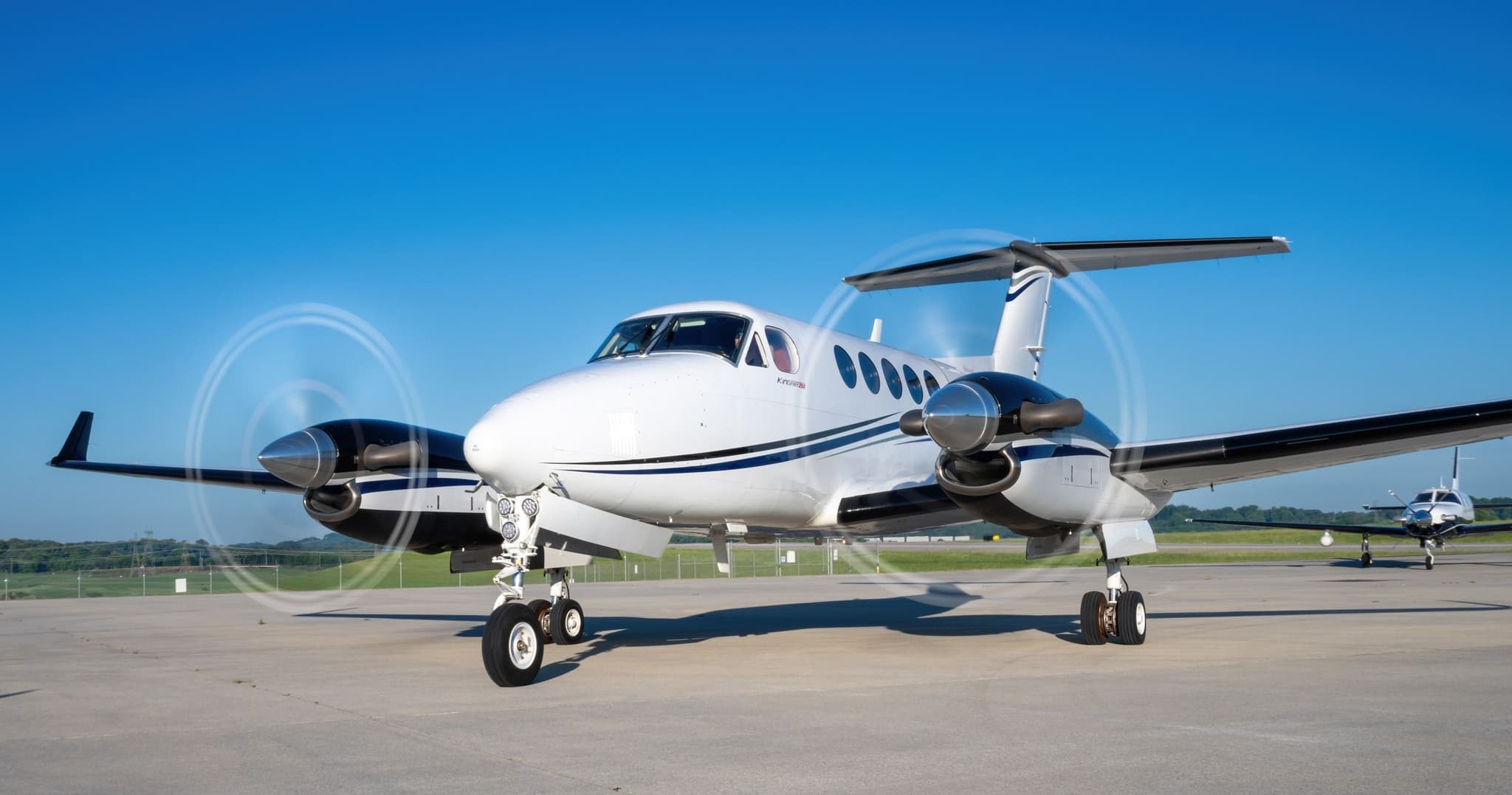 Sun, Nov 8in 5 daysKnoxvilleKTYS · McGhee Tyson AirportChicagoKPWK · Chicago Executive AirportKing Air 200GT8—$4,3678NovKnoxville → ChicagoKTYS → KPWK · in 5 daysKing Air 200GT · 8 seats$4,367
 KTYS · Mc Ghee Tyson
* Total price incl. 10% service fee, converted to your selected currency. Price subject to operator confirmation.
Empty legs to KTYS
51 arrivals available
- Tue, Nov 3TodayLexingtonKLEX · Blue Grass AirportKnoxvilleKTYS · McGhee Tyson AirportBombardier Learjet 60——On request3NovLexington → KnoxvilleKLEX → KTYS · TodayBombardier Learjet 60On request
- Wed, Nov 412:30SwainsboroKSBO · Emanuel County AirportAlcoaKTYS · McGhee Tyson AirportCessna CitationJet5—$4,8404NovSwainsboro → AlcoaKSBO → KTYS · 12:30Cessna CitationJet · 5 seats$4,840
- Thu, Nov 5in 2 daysChicagoKPWK · Chicago Executive AirportKnoxvilleKTYS · McGhee Tyson AirportKing Air 200GT8—$4,3675NovChicago → KnoxvilleKPWK → KTYS · in 2 daysKing Air 200GT · 8 seats$4,367
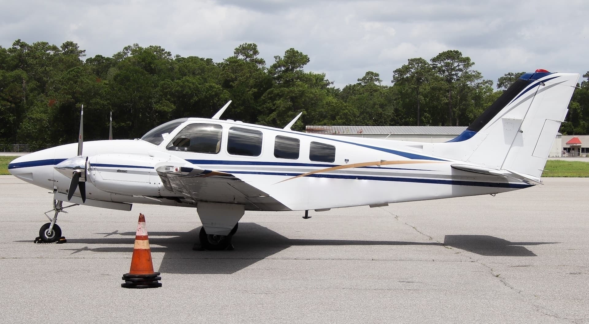 Thu, Nov 5in 2 daysNorth CharlestonKCHS · Charleston Air Force Base-International AirportKnoxvilleKTYS · McGhee Tyson AirportBeech 58 Baron5—$3,1905NovNorth Charleston → KnoxvilleKCHS → KTYS · in 2 daysBeech 58 Baron · 5 seats$3,190
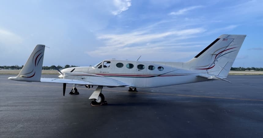 Thu, Nov 5in 2 daysMiamiKOPF · Miami-Opa Locka Executive AirportKnoxvilleKTYS · McGhee Tyson AirportCessna 4147—On request5NovMiami → KnoxvilleKOPF → KTYS · in 2 daysCessna 414 · 7 seatsOn request
- Thu, Nov 5in 2 daysChicagoKIGQ · Lansing Municipal AirportKnoxvilleKTYS · McGhee Tyson AirportBeechcraft King Air 2508—On request5NovChicago → KnoxvilleKIGQ → KTYS · in 2 daysBeechcraft King Air 250 · 8 seatsOn request
- Thu, Nov 5in 2 daysCharlestonK09M · Charleston Municipal AirportKnoxvilleKTYS · McGhee Tyson AirportHawker 9008—$14,0805NovCharleston → KnoxvilleK09M → KTYS · in 2 daysHawker 900 · 8 seats$14,080
- Thu, Nov 5in 2 daysChicago/Prospect Heights/WheelingKPWK · Chicago Executive AirportKnoxvilleKTYS · McGhee Tyson AirportEmbraer Phenom 300E7—$6,9305NovChicago/Prospect Heights/Wheeling → KnoxvilleKPWK → KTYS · in 2 daysEmbraer Phenom 300E · 7 seats$6,930
- Thu, Nov 510:21Vero BeachKVRB · Vero Beach Regional AirportAlcoaKTYS · McGhee Tyson AirportCessna Citation CJ3+7—$11,3305NovVero Beach → AlcoaKVRB → KTYS · 10:21Cessna Citation CJ3+ · 7 seats$11,330
* Total price incl. 10% service fee, converted to your selected currency. Price subject to operator confirmation.
Map: Knoxville Airport
View the location of Knoxville – TYS/KTYS. Zoom in to explore the area around the airport.
About the airport
McGhee Tyson Airport (TYS/KTYS) is the key private jet gateway for Knoxville. PrivJet gives you instant access to charter flights and empty legs: fast, discreet and globally connected.
KTYS airport FAQ
Are there any restrictions at Knoxville airport (KTYS) today?
There are currently 24 valid NOTAMs for Knoxville (KTYS). According to NOTAM, at least one runway or the aerodrome itself is closed. Affected: Runway: closed; Taxiway: closed; Apron: closed; ILS: unserviceable and 5 more. 2 more NOTAMs start in the coming days. For information only, not for flight planning or operational use. Always rely on an official pre-flight briefing. This list may be incomplete or out of date.
What is the weather at Knoxville airport (KTYS)?
According to the latest weather report for KTYS (METAR, 03 Nov, 05:53 UTC): Good visual conditions (VFR). Wind Calm, visibility 10 km or more, temperature 12 °C (dew point 11 °C). For information only, not for flight planning. Weather can change quickly; always rely on official reports.
How long are the runways at Knoxville airport (KTYS)?
Knoxville (KTYS) has 2 runways: runway 05L/23R with 3,048 m (10,000 ft), concrete and runway 05R/23L with 2,743 m (9,000 ft), asphalt. The longest is 3,048 m.
What are the radio frequencies at Knoxville airport (KTYS)?
Frequencies at KTYS: Tower 121.2 MHz, Ground 121.9 MHz and ATIS 128.35 MHz. For information only. Always rely on the published AIP.
What are the airport codes of McGhee Tyson Airport?
The ICAO code is KTYS and the IATA code is TYS. ICAO codes are used by air traffic control and pilots, e.g. in flight plans; IATA codes appear on tickets and baggage tags.
What is the elevation of KTYS airport?
McGhee Tyson Airport sits at 981 ft (299 m) above sea level. Local time zone: America/New York.
Where do private jets land at Knoxville McGhee Tyson?
Private jet passengers at KTYS are handled through Signature Aviation TYS (2343 W General Aviation Drive, Alcoa, TN 37701). The operator confirms the exact meeting point with your flight confirmation.
Can I fly to KTYS by private jet?
Whether a private jet can operate into McGhee Tyson Airport depends on runway length, opening hours, customs and immigration rules as well as slot and handling availability, among other things. PrivJet checks this with the operating carrier for every request.
Are there empty legs from or to KTYS?
There are currently 53 empty legs departing from and 51 arriving at McGhee Tyson Airport. Empty legs are repositioning flights at heavily reduced prices; the list is updated several times a day.