Vero Beach Airport (KVRB / VRB)
Empty legs and charters from Vero Beach
KVRB airport at a glance
- ICAO code
- KVRB
- IATA code
- VRB
- City
- Vero Beach
- Region
- Florida
- Country
- United States
- Elevation
- 24 ft (7 m)
- Time zone
- America/New York (UTC-5)
- Coordinates
- 27.6556° N, 80.4179° W
- Empty legs from
- 28
- Empty legs to
- 16
Weather & airport info KVRB
Current weather
Good visual conditions (VFR)observed 03 Nov, 21:53 UTC- Wind
- 10 kt (19 km/h) from east-southeast (120°)
- Visibility
- 10 km or more
- Clouds
- overcast at 5,500 ft
- Temperature
- 24 °C (dew point 22 °C)
- Pressure (QNH)
- 1,016 hPa
Original weather report (METAR)
METAR KVRB 032153Z 12010KT 7SM OVC055 24/22 A3001 RMK AO2 RAB2054E03 SLP161 P0000 T02440222
Forecast (TAF)
- 03 Nov, 20:00–00:00 UTC14 kt (26 km/h) from east-southeast (120°), gusts up to 22 kt · visibility 10 km or more · Showers in the vicinity · scattered clouds at 3,000 ft, broken clouds at 10,000 ft
- 04 Nov, 00:00–14:00 UTCfrom10 kt (19 km/h) from east (90°) · visibility 10 km or more · scattered clouds at 2,500 ft, scattered clouds at 10,000 ft
- 04 Nov, 14:00–18:00 UTCfrom10 kt (19 km/h) from east (100°) · visibility 10 km or more · Showers in the vicinity · scattered clouds at 3,000 ft, scattered clouds at 12,000 ft
Original forecast (TAF)
TAF KVRB 032000Z 0320/0418 12014G22KT P6SM VCSH SCT030 BKN100 TEMPO 0320/0321 3SM SHRA BKN020 FM040000 09010KT P6SM SCT025 SCT100 FM041400 10010KT P6SM VCSH SCT030 SCT120
Airport
- Elevation
- 24 ft (7 m)
- Sunrise / Sunset
- 06:33 / 17:36 local time
Runways
| Runway | Length | Surface | Lighted |
|---|---|---|---|
| 12R/30L | 2,229 m (7,314 ft) | asphalt | yes |
| 04/22 | 1,516 m (4,974 ft) | asphalt | yes |
| 12L/30R | 1,068 m (3,505 ft) | asphalt | yes |
Radio frequencies
- ATIS: 120.575
- Clearance: 134.975
- CTAF: 126.3
- Ground: 127.45
- Tower: 126.3
- UNICOM: 122.95
For information only, not for flight planning. Weather can change quickly; always rely on official reports. Sources: aviationweather.gov (NOAA), OurAirports.
Airport map KVRB
Full screen →Runways white, taxiways yellow with designators, closed taxiways and runways per NOTAM in red.
Official charts (FAA)
Cycle 2611, valid until 0901Z 11/26/26
Airport diagram (FAA)
Airport diagram (1)
Instrument approaches (4)
Minimums (2)
Hot spots (1)
LAHSO (1)
For information only, not for navigation. Always use current official charts and NOTAMs.
Current NOTAMs for KVRB(11)
NOTAMs (Notices to Air Missions) announce short-term changes at an airport: closed runways or taxiways, unserviceable approach aids, obstacles, airspace restrictions.
- Out of serviceLanding direction indicator: unserviceableA0352/26· from 04 Nov, 14:00 UTC · until 04 Nov, 19:30 UTC
The Terminal Area Radar (TAR) and Secondary Surveillance Radar (SSR) are out of service. These radar systems are used for air traffic monitoring.
Show original text
SVC TAR/SSR U/S
A0352/26 NOTAMN
Q) KZMA/QFTAS////000/999/2739N08025W005
A) KVRB
B) 2611041400
C) 2611041930
E) SVC TAR/SSR U/S
- ClosedApron: closedA0345/26· until 04 Nov, 21:00 UTC
The west entrance to the west Corporate Air Ramp on the apron is closed due to flooding.
Show original text
APRON WEST CORPORATE AIR RAMP WEST ENTRANCE CLSD DUE TO FLOODING
A0345/26 NOTAMN
Q) KZMA/QMNLC////000/999/2739N08025W005
A) KVRB
B) 2611022123
C) 2611042100
E) APRON WEST CORPORATE AIR RAMP WEST ENTRANCE CLSD DUE TO FLOODING
- Out of serviceRunway end identifier lights: unserviceableA0343/26· until 09 Nov, 20:00 UTC
The runway end identification lights for runway 30L are out of service. These lights mark the end of the runway.
Show original text
RWY 30L RWY END ID LGT U/S
A0343/26 NOTAMN
Q) KZMA/QLIAS////000/999/2739N08025W005
A) KVRB
B) 2611021504
C) 2611092000
E) RWY 30L RWY END ID LGT U/S
- Out of serviceRunway end identifier lights: unserviceableA0339/26· until 30 Nov, 21:00 UTC
The runway end identification lighting for runway 12R at Vero Beach Regional Airport is out of service.
Show original text
RWY 12R RWY END ID LGT U/S
A0339/26 NOTAMN
Q) KZMA/QLIAS////000/999/2739N08025W005
A) KVRB
B) 2610301332
C) 2611302100
E) RWY 12R RWY END ID LGT U/S
- Out of serviceRunway end identifier lights: unserviceableA0340/26· until 30 Nov, 21:00 UTC
The runway end identification lighting for runway 04 at Vero Beach Regional Airport is out of service.
Show original text
RWY 04 RWY END ID LGT U/S
A0340/26 NOTAMN
Q) KZMA/QLIAS////000/999/2739N08025W005
A) KVRB
B) 2610301332
C) 2611302100
E) RWY 04 RWY END ID LGT U/S
- Out of serviceRunway end identifier lights: unserviceableA0341/26· until 30 Nov, 21:00 UTC
The runway end identification lighting for runway 22 at Vero Beach Regional Airport is out of service.
Show original text
RWY 22 RWY END ID LGT U/S
A0341/26 NOTAMN
Q) KZMA/QLIAS////000/999/2739N08025W005
A) KVRB
B) 2610301332
C) 2611302100
E) RWY 22 RWY END ID LGT U/S
- Out of serviceObstacle10/006· until 31 Dec, 00:43 UTC
An obstacle (OBST) near the airport, a tower with identifier ASR 1307384, is out of service. Its top is 226 ft above sea level, 225 ft above ground.
Show original text
OBST TOWER LGT (ASR 1307384) 273801.98N0802252.82W (2.3NM ESE VRB) 226FT (225FT AGL) U/S
- NoticeRunwayA0348/26· until 04 Nov, 21:00 UTC
The safety area for runway 04/22 is not standard due to temporary standing water.
Show original text
RWY 04/22 SAFETY AREA NOT STD TEMPORARY STANDING WATER
A0348/26 NOTAMN
Q) KZMA/QMRXX////000/999/2739N08025W005
A) KVRB
B) 2611022138
C) 2611042100
E) RWY 04/22 SAFETY AREA NOT STD TEMPORARY STANDING WATER
3 more NOTAMs
- NoticeRunwayA0347/26· until 04 Nov, 21:00 UTC
The runway 12L/30R safety area is not standard due to temporary standing water.
Show original text
RWY 12L/30R SAFETY AREA NOT STD TEMPORARY STANDING WATER
A0347/26 NOTAMN
Q) KZMA/QMRXX////000/999/2739N08025W005
A) KVRB
B) 2611022137
C) 2611042100
E) RWY 12L/30R SAFETY AREA NOT STD TEMPORARY STANDING WATER
- NoticeRunwayA0346/26· until 04 Nov, 21:00 UTC
The safety area of runway 12R/30L is not standard due to temporary standing water.
Show original text
RWY 12R/30L SAFETY AREA NOT STD TEMPORARY STANDING WATER
A0346/26 NOTAMN
Q) KZMA/QMRXX////000/999/2739N08025W005
A) KVRB
B) 2611022136
C) 2611042100
E) RWY 12R/30L SAFETY AREA NOT STD TEMPORARY STANDING WATER
- NoticeThreshold lights: changedA0336/26· until 30 Nov, 21:00 UTC
The runway threshold lighting for runway 12L at Vero Beach Regional Airport is not standard.
Show original text
RWY 12L RTHL NOT STD
A0336/26 NOTAMN
Q) KZMA/QLTCH////000/999/2739N08025W005
A) KVRB
B) 2610301329
C) 2611302100
E) RWY 12L RTHL NOT STD
For information only, not for flight planning or operational use. Always rely on an official pre-flight briefing. This list may be incomplete or out of date. Explanations and expanded abbreviations are generated automatically. The original text is authoritative. Source: FAA NOTAM Management Service (SWIM).
Private jet traffic in Vero Beach Municipal Airport (last 30 days)
- Arrivals
- 519
- Departures
- 332
- Different jets
- 429
Most frequent origins: Teterboro Airport (13), Westchester County Airport (13), Witham Field (13), Morristown Municipal Airport (11), Laurence G Hanscom Field (10).
Most frequent destinations: Palm Beach International Airport (9), Teterboro Airport (8), Fort Lauderdale Executive Airport (7), Sarasota Bradenton International Airport (7), Fort Lauderdale Hollywood International Airport (6).
Most common aircraft types: Embraer Phenom 300 (113), Cessna Citation Excel/XLS (64), Cessna Citation CJ3 (63), Cessna Citation Latitude (59), Piper M500/M600 (57).
Our own analysis of public ADS-B signals from business jets. Not every flight is received, and jets with a removal request are excluded.
Charter operators based here
Operators with a base at this airport.
- Solairus AviationVan Nuys (KVNY) · Turboprop, Light jet, Midsize jet
- Skydance AirRapid City Regional (KRAP) · Light jet
- Marcare AviationSan Luis Obispo (San Luis County Regional) (KSBP) · Turboprop, Piston aircraft
- Paris AirPiston aircraft
- Sun AviationLight jet
Empty legs from KVRB
28 departures available
 Wed, Nov 4TomorrowVero Beach SouthKVRB · Vero Beach Municipal AirportNorth CharlestonKCHS · Charleston Air Force Base-International AirportKing Air 3509—$7,9104NovVero Beach South → North CharlestonKVRB → KCHS · TomorrowKing Air 350 · 9 seats$7,910
- Wed, Nov 4TomorrowVero BeachKVRB · Vero Beach Municipal AirportDiavikCDK2 · Diavik AirportPilatus PC-12/47 NG——On request4NovVero Beach → DiavikKVRB → CDK2 · TomorrowPilatus PC-12/47 NGOn request
- Wed, Nov 4TomorrowVero BeachKVRB · Vero Beach Regional AirportDeLandKDED · DeLand Municipal AirportCitation X8—$9,4604NovVero Beach → DeLandKVRB → KDED · TomorrowCitation X · 8 seats$9,460
- Thu, Nov 510:21Vero BeachKVRB · Vero Beach Regional AirportAlcoaKTYS · McGhee Tyson AirportCessna Citation CJ3+7—$11,3305NovVero Beach → AlcoaKVRB → KTYS · 10:21Cessna Citation CJ3+ · 7 seats$11,330
- Thu, Nov 5in 2 daysVero BeachKVRB · Vero Beach Regional AirportCharlestonKCHS · Charleston International AirportBeechcraft King Air 3509—$9,0205NovVero Beach → CharlestonKVRB → KCHS · in 2 daysBeechcraft King Air 350 · 9 seats$9,020
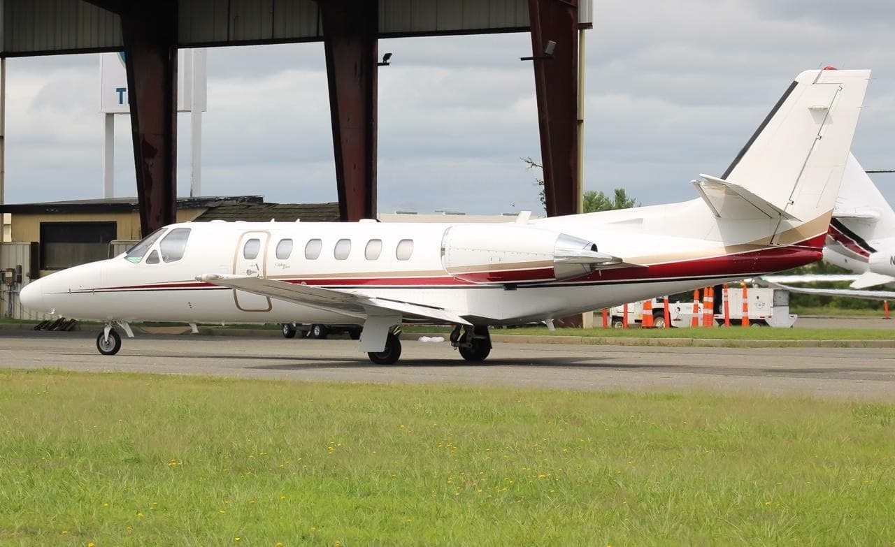 Sat, Nov 7in 4 daysVero Beach SouthKVRB · Vero Beach Municipal AirportPanama CityKECP · Northwest Florida Beaches International AirportCitation Bravo8—On request7NovVero Beach South → Panama CityKVRB → KECP · in 4 daysCitation Bravo · 8 seatsOn request
- Sun, Nov 820:00Vero BeachKVRB · Vero Beach RegionalCorneliaKAJR · Habersham County AirportCessna Citation Bravo8—On request8NovVero Beach → CorneliaKVRB → KAJR · 20:00Cessna Citation Bravo · 8 seatsOn request
- Sun, Nov 801:00Vero BeachKVRB · Vero Beach RegionalAuburnKAUO · Auburn University RgnlCessna Citation Bravo8—On request8NovVero Beach → AuburnKVRB → KAUO · 01:00Cessna Citation Bravo · 8 seatsOn request
- Sun, Nov 801:00Vero BeachKVRB · Vero Beach RegionalPanama CityKECP · Northwest Florida BeachesCessna Citation Bravo8—On request8NovVero Beach → Panama CityKVRB → KECP · 01:00Cessna Citation Bravo · 8 seatsOn request
 KVRB · Vero Beach Municipal Airport
 CDK2 · Diavik Airport
* Total price incl. 10% service fee, converted to your selected currency. Price subject to operator confirmation.
Empty legs to KVRB
16 arrivals available
- Mon, Nov 911:33AlcoaKTYS · McGhee Tyson AirportVero BeachKVRB · Vero Beach Regional AirportCessna Citation CJ3+7—$17,9309NovAlcoa → Vero BeachKTYS → KVRB · 11:33Cessna Citation CJ3+ · 7 seats$17,930
 Tue, Nov 10in 7 daysNorth EleutheraMYEH · North Eleuthera AirportVero Beach SouthKVRB · Vero Beach Municipal AirportHawker 400XP7—$4,45510NovNorth Eleuthera → Vero Beach SouthMYEH → KVRB · in 7 daysHawker 400XP · 7 seats$4,455
- Tue, Nov 10in 7 daysNorth EleutheraMYEH · North Eleuthera AirportVero BeachKVRB · Vero Beach Municipal AirportBeechcraft Beechjet 400A754mOn request10NovNorth Eleuthera → Vero BeachMYEH → KVRB · in 7 daysBeechcraft Beechjet 400A · 7 seats · 54mOn request
- Thu, Nov 12in 9 daysFort MyersKRSW · Southwest Florida International AirportVero BeachKVRB · Vero Beach Municipal AirportEmbraer Phenom 300E7—$4,51012NovFort Myers → Vero BeachKRSW → KVRB · in 9 daysEmbraer Phenom 300E · 7 seats$4,510
- Thu, Nov 12in 9 daysFort MyersKFMY · Page FieldVero BeachKVRB · Vero Beach RegionalMidsize Jet6—On request12NovFort Myers → Vero BeachKFMY → KVRB · in 9 daysMidsize Jet · 6 seatsOn request
- Thu, Nov 1218:24Fort MyersKFMY · Page FieldVero BeachKVRB · Vero Beach RegionalBombardier Learjet 607—$4,53812NovFort Myers → Vero BeachKFMY → KVRB · 18:24Bombardier Learjet 60 · 7 seats$4,538
 Thu, Nov 12in 9 daysFort MyersKFMY · Page FieldVero BeachKVRB · Vero Beach Municipal AirportLear 607—$5,03312NovFort Myers → Vero BeachKFMY → KVRB · in 9 daysLear 60 · 7 seats$5,033
- Fri, Nov 1312:00Boca RatonKBCT · Boca Raton AirportVero BeachKVRB · Vero Beach Regional AirportBombardier Learjet 607—$10,56013NovBoca Raton → Vero BeachKBCT → KVRB · 12:00Bombardier Learjet 60 · 7 seats$10,560
- Sat, Nov 21in 18 daysLakelandKLAL · Lakeland Linder Regional AirportVero BeachKVRB · Vero Beach Municipal AirportCessna Citation XLS936mOn request21NovLakeland → Vero BeachKLAL → KVRB · in 18 daysCessna Citation XLS · 9 seats · 36mOn request
 MYEH · North Eleuthera Airport
* Total price incl. 10% service fee, converted to your selected currency. Price subject to operator confirmation.
Map: Vero Beach Airport
View the location of Vero Beach – VRB/KVRB. Zoom in to explore the area around the airport.
About the airport
Vero Beach Municipal Airport (VRB/KVRB) is the key private jet gateway for Vero Beach. PrivJet gives you instant access to charter flights and empty legs: fast, discreet and globally connected.
KVRB airport FAQ
Are there any restrictions at Vero Beach airport (KVRB) today?
There are currently 10 valid NOTAMs for Vero Beach (KVRB). Affected: Apron: closed; Runway end identifier lights: unserviceable; Obstacle: out of service. 1 more NOTAM starts in the coming days. For information only, not for flight planning or operational use. Always rely on an official pre-flight briefing. This list may be incomplete or out of date.
What is the weather at Vero Beach airport (KVRB)?
According to the latest weather report for KVRB (METAR, 03 Nov, 21:53 UTC): Good visual conditions (VFR). Wind 10 kt (19 km/h) from east-southeast (120°), visibility 10 km or more, temperature 24 °C (dew point 22 °C). For information only, not for flight planning. Weather can change quickly; always rely on official reports.
How long are the runways at Vero Beach airport (KVRB)?
Vero Beach (KVRB) has 3 runways: runway 12R/30L with 2,229 m (7,314 ft), asphalt, runway 04/22 with 1,516 m (4,974 ft), asphalt and runway 12L/30R with 1,068 m (3,505 ft), asphalt. The longest is 2,229 m.
What are the radio frequencies at Vero Beach airport (KVRB)?
Frequencies at KVRB: Tower 126.3 MHz, Ground 127.45 MHz and ATIS 120.575 MHz. For information only. Always rely on the published AIP.
What are the airport codes of Vero Beach Municipal Airport?
The ICAO code is KVRB and the IATA code is VRB. ICAO codes are used by air traffic control and pilots, e.g. in flight plans; IATA codes appear on tickets and baggage tags.
What is the elevation of KVRB airport?
Vero Beach Municipal Airport sits at 24 ft (7 m) above sea level. Local time zone: America/New York.
Can I fly to KVRB by private jet?
Whether a private jet can operate into Vero Beach Municipal Airport depends on runway length, opening hours, customs and immigration rules as well as slot and handling availability, among other things. PrivJet checks this with the operating carrier for every request.
Are there empty legs from or to KVRB?
There are currently 28 empty legs departing from and 16 arriving at Vero Beach Municipal Airport. Empty legs are repositioning flights at heavily reduced prices; the list is updated several times a day.