Dinard-Pleurtuit-Saint-Malo Airport (LFRD / DNR)
Empty legs and charters from Dinard/Pleurtuit/Saint Malo
LFRD airport at a glance
- ICAO code
- LFRD
- IATA code
- DNR
- City
- Dinard
- Region
- Brittany
- Country
- France
- Elevation
- 219 ft (67 m)
- Time zone
- Europe/Paris (UTC+1)
- Coordinates
- 48.5877° N, 2.0800° W
- Empty legs from
- 2
- Empty legs to
- 2
Weather & airport info LFRD
Current weather
Good visual conditions (VFR)observed 03 Nov, 03:30 UTC- Wind
- 9 kt (17 km/h) from northeast (40°)
- Visibility
- 10 km or more
- Clouds
- broken clouds at 3,500 ft, broken clouds at 4,100 ft, overcast at 4,700 ft
- Temperature
- 11 °C (dew point 8 °C)
- Pressure (QNH)
- 1,029 hPa
Original weather report (METAR)
METAR LFRD 030330Z AUTO 04009KT 9999 BKN035 BKN041 OVC047 11/08 Q1029 TEMPO 4000 -SHRA BKN012 SCT020TCU
Forecast (TAF)
- 03 Nov, 00:00–00:00 UTC10 kt (19 km/h) from northeast (40°), gusts up to 24 kt · visibility 10 km or more · few clouds at 1,500 ft, scattered clouds at 4,500 ft
- 03 Nov, 00:00–10:00 UTCtemporarilyvisibility 4 km · Light rain showers · broken clouds at 1,200 ft, scattered clouds at 2,000 ft
- 03 Nov, 00:00–08:00 UTCtemporarily, 30 % probabilitybroken clouds at 600 ft
- 03 Nov, 10:00–16:00 UTCtemporarily15 kt (28 km/h) from northeast (40°), gusts up to 25 kt
Original forecast (TAF)
TAF LFRD 022300Z 0300/0324 04010G24KT 9999 FEW015 SCT045 TEMPO 0300/0310 4000 -SHRA BKN012 SCT020TCU PROB30 TEMPO 0300/0308 BKN006 TEMPO 0310/0316 04015G25KT
Airport
- Elevation
- 219 ft (67 m)
- Sunrise / Sunset
- 07:57 / 17:46 local time
Runways
| Runway | Length | Surface | Lighted |
|---|---|---|---|
| 17/35 | 2,200 m (7,218 ft) | asphalt | yes |
| 12/30 | 1,435 m (4,708 ft) | asphalt | no |
Radio frequencies
- ATIS: 124.575
- Tower: 120.15
For information only, not for flight planning. Weather can change quickly; always rely on official reports. Sources: aviationweather.gov (NOAA), OurAirports.
Airport map LFRD
Full screen →Runways white, taxiways yellow with designators, closed taxiways and runways per NOTAM in red.
Official charts
Aerodrome, approach and ground charts are published by the national air navigation service in its AIP:
SIA France →For information only, not for navigation. Always use current official charts and NOTAMs.
Current NOTAMs for LFRD(4)
NOTAMs (Notices to Air Missions) announce short-term changes at an airport: closed runways or taxiways, unserviceable approach aids, obstacles, airspace restrictions.
- Out of serviceFuel: limited toB5253/26· until 10 Nov, 17:00 UTC
AVGAS 100LL fuel is not available. This means aircraft requiring this fuel cannot refuel at the airport.
Show original text
AVGAS 100LL NOT AVBL
B5253/26 NOTAMR B5204/26
 Q) LFRR/QFULT/IV/NBO/A /000/999/4835N00205W005
 A) LFRD B) 2611021523 C) 2611101700
 E) AVGAS 100LL NOT AVBL
- NoticeAerodrome: limited toB5045/26· until 15 Nov, 16:00 UTC
Instrument flight rules (IFR) and visual flight rules (VFR) trainings are prohibited during the activation of the 'Route du Rhum' temporary restricted area.
Show original text
IFR AND VFR TRAININGS PROHIBITED DURING 'ROUTE DU RHUM' TEMPO RESTRICTED AREA ACT.
B5045/26 NOTAMN
 Q) LFRR/QFALT/IV/NBO/A /000/999/4835N00205W005
 A) LFRD B) 2610300730 C) 2611151600
 E) IFR AND VFR TRAININGS PROHIBITED DURING 'ROUTE DU RHUM' TEMPO
 RESTRICTED AREA ACT.
- NoticeTemporary restricted areaR3028/26· until 15 Nov, 16:00 UTC
TRIGGER NOTAM - AIP SUP 225/26. CREATION of A TEMPORARY restricted area ('ZRT') in DINARD CTR 1 and RENNES TMA 4 for the START of the 2026 EDITION of the 'ROUTE DU RHUM' TRANSATLANTIC SAILING RACE. THIS AIP SUP is available at WWW.SIA.AVIATION-CIVILE.GOUV.FR
Show original text
TRIGGER NOTAM - AIP SUP 225/26. CREATION OF A TEMPORARY RESTRICTED AREA ('ZRT') IN DINARD CTR 1 AND RENNES TMA 4 FOR THE START OF THE 2026 EDITION OF THE 'ROUTE DU RHUM' TRANSATLANTIC SAILING RACE. THIS AIP SUP IS AVBL AT WWW.SIA.AVIATION-CIVILE.GOUV.FR
R3028/26 NOTAMN Q) LFRR/QRTTT/IV/BO /AW/000/045/4835N00205W020 A) LFRD B) 2610300730 C) 2611151600 E) TRIGGER NOTAM - AIP SUP 225/26. CREATION OF A TEMPORARY RESTRICTED AREA ('ZRT') IN DINARD CTR 1 AND RENNES TMA 4 FOR THE START OF THE 2026 EDITION OF THE 'ROUTE DU RHUM' TRANSATLANTIC SAILING RACE. THIS AIP SUP IS AVBL AT WWW.SIA.AVIATION-CIVILE.GOUV.FR F) SFC G) 4500FT AMSL - NoticeFuel: hours of service are nowB5133/26· until 26 Jan, 23:59 UTC
JET A1 fueling hours of operation are Monday to Friday from 05:00 to 11:00 and 12:30 to 20:00. Outside these scheduled times, 2 hours prior permission required (PPR) is needed. On Saturday, Sunday, November 11, December 25, and January 01, 1 hour prior permission required is needed. Telephone: +33 299 827 348.
Show original text
JET A1 FUELING HOURS OF OPS: MON-FRI 0500-1100 1230-2000, OUTSIDE THESE SKED, UPON 2HR PPR. SAT, SUN AND NOV 11, DEC 25, JAN 01 : UPON 1HR PPR . TEL : +33 299 827 348
B5133/26 NOTAMR B5132/26
 Q) LFRR/QFUAH/IV/BO /A /000/999/4835N00205W005
 A) LFRD B) 2610270711 C) 2701262359
 E) JET A1 FUELING HOURS OF OPS:
 MON-FRI 0500-1100 1230-2000, OUTSIDE THESE SKED, UPON 2HR PPR.
 SAT, SUN AND NOV 11, DEC 25, JAN 01 : UPON 1HR PPR .
 TEL : +33 299 827 348
For information only, not for flight planning or operational use. Always rely on an official pre-flight briefing. This list may be incomplete or out of date. Explanations and expanded abbreviations are generated automatically. The original text is authoritative. Source: FAA NOTAM Management Service (SWIM).
Private jet traffic in Dinard-Pleurtuit-Saint-Malo Airport (last 30 days)
- Arrivals
- 34
- Departures
- 22
- Different jets
- 29
Most frequent origins: Paris-Le Bourget Airport (4).
Most common aircraft types: Pilatus PC-12 (9), Embraer Phenom 300 (9), Cessna Citation Mustang (8), Piper M500/M600 (5), Cessna Citation Excel/XLS (4).
Sunday is the busiest day.
Our own analysis of public ADS-B signals from business jets. Not every flight is received, and jets with a removal request are excluded.
Charter operators based here
Operators with a base at this airport.
- Heliberte HJSLa Rochelle (Ile de Re) (LFBH) · Helicopter
Empty legs from LFRD
2 departures available
 Fri, Nov 13in 10 daysDinardLFRD · Dinard-Pleurtuit-Saint-Malo AirportKortrijkEBKT · Wevelgem AirportCitation CJ48—€4,29013NovDinard → KortrijkLFRD → EBKT · in 10 daysCitation CJ4 · 8 seats€4,290
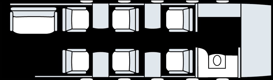 Fri, Nov 1316:00Dinard/Pleurtuit/Saint-MaloLFRD · Dinard-Pleurtuit-Saint-Malo AirportWevelgemEBKT · Wevelgem AirportCessna Citation CJ4 Gen 29—€4,29013NovDinard/Pleurtuit/Saint-Malo → WevelgemLFRD → EBKT · 16:00Cessna Citation CJ4 Gen 2 · 9 seats€4,290
 LFRD · Dinard-Pleurtuit-Saint-Malo Airport
 EBKT · Wevelgem Airport
* Total price incl. 10% service fee, converted to your selected currency. Price subject to operator confirmation.
Empty legs to LFRD
2 arrivals available
 Thu, Nov 19in 16 daysKortrijkEBKT · Wevelgem AirportDinardLFRD · Dinard-Pleurtuit-Saint-Malo AirportCitation CJ48—€4,29019NovKortrijk → DinardEBKT → LFRD · in 16 daysCitation CJ4 · 8 seats€4,290
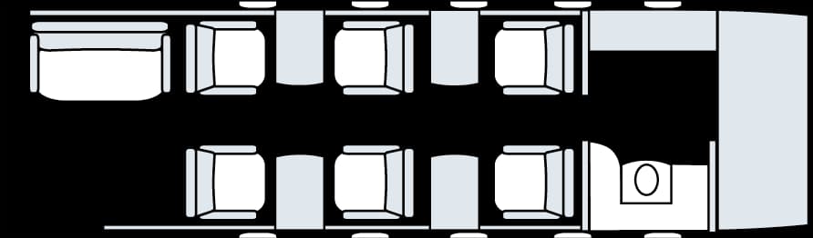 Thu, Nov 1907:00WevelgemEBKT · Wevelgem AirportDinard/Pleurtuit/Saint-MaloLFRD · Dinard-Pleurtuit-Saint-Malo AirportCessna Citation CJ4 Gen 29—€4,29019NovWevelgem → Dinard/Pleurtuit/Saint-MaloEBKT → LFRD · 07:00Cessna Citation CJ4 Gen 2 · 9 seats€4,290
* Total price incl. 10% service fee, converted to your selected currency. Price subject to operator confirmation.
Map: Dinard/Pleurtuit/Saint Malo Airport
View the location of Dinard/Pleurtuit/Saint Malo – DNR/LFRD. Zoom in to explore the area around the airport.
About the airport
Dinard-Pleurtuit-Saint-Malo Airport (DNR/LFRD) is the key private jet gateway for Dinard/Pleurtuit/Saint Malo. PrivJet gives you instant access to charter flights and empty legs: fast, discreet and globally connected.
LFRD airport FAQ
Are there any restrictions at Dinard airport (LFRD) today?
There are currently 4 valid NOTAMs for Dinard (LFRD). Affected: Fuel: limited to. For information only, not for flight planning or operational use. Always rely on an official pre-flight briefing. This list may be incomplete or out of date.
What is the weather at Dinard airport (LFRD)?
According to the latest weather report for LFRD (METAR, 03 Nov, 03:30 UTC): Good visual conditions (VFR). Wind 9 kt (17 km/h) from northeast (40°), visibility 10 km or more, temperature 11 °C (dew point 8 °C). For information only, not for flight planning. Weather can change quickly; always rely on official reports.
How long are the runways at Dinard airport (LFRD)?
Dinard (LFRD) has 2 runways: runway 17/35 with 2,200 m (7,218 ft), asphalt and runway 12/30 with 1,435 m (4,708 ft), asphalt. The longest is 2,200 m.
What are the radio frequencies at Dinard airport (LFRD)?
Frequencies at LFRD: Tower 120.15 MHz and ATIS 124.575 MHz. For information only. Always rely on the published AIP.
What are the airport codes of Dinard-Pleurtuit-Saint-Malo Airport?
The ICAO code is LFRD and the IATA code is DNR. ICAO codes are used by air traffic control and pilots, e.g. in flight plans; IATA codes appear on tickets and baggage tags.
What is the elevation of LFRD airport?
Dinard-Pleurtuit-Saint-Malo Airport sits at 219 ft (67 m) above sea level. Local time zone: Europe/Paris.
Can I fly to LFRD by private jet?
Whether a private jet can operate into Dinard-Pleurtuit-Saint-Malo Airport depends on runway length, opening hours, customs and immigration rules as well as slot and handling availability, among other things. PrivJet checks this with the operating carrier for every request.
Are there empty legs from or to LFRD?
There are currently 2 empty legs departing from and 2 arriving at Dinard-Pleurtuit-Saint-Malo Airport. Empty legs are repositioning flights at heavily reduced prices; the list is updated several times a day.