Bale EuroAirport Basel-Mulhouse-Freiburg Airport (LFSB / BSL)
Empty legs and charters from Bale/Mulhouse
LFSB airport at a glance
- ICAO code
- LFSB
- IATA code
- BSL
- City
- Bale
- Region
- Grand Est
- Country
- France
- Elevation
- 885 ft (270 m)
- Time zone
- Europe/Paris (UTC+1)
- Coordinates
- 47.5896° N, 7.5299° E
- Empty legs from
- 7
- Empty legs to
- 5
Weather & airport info LFSB
Current weather
Good visual conditions (VFR)observed 03 Nov, 00:00 UTC- Wind
- 6 kt (11 km/h) from north (10°)
- Visibility
- 10 km or more
- Clouds
- overcast at 3,700 ft
- Temperature
- 7 °C (dew point 2 °C)
- Pressure (QNH)
- 1,024 hPa
Original weather report (METAR)
METAR LFSB 030000Z AUTO 01006KT 9999 OVC037 07/02 Q1024 NOSIG
Forecast (TAF)
- 03 Nov, 00:00–00:00 UTC5 kt (9 km/h) from north (350°) · visibility 10 km or more · broken clouds at 3,500 ft
- 03 Nov, 03:00–09:00 UTCtemporarily, 40 % probabilityvisibility 3 km · Mist · overcast at 300 ft
- 03 Nov, 04:00–08:00 UTCpossible, 30 % probabilityvisibility 0.5 km · Fog
Original forecast (TAF)
TAF LFSB 022300Z 0300/0324 35005KT 9999 BKN035 PROB40 TEMPO 0303/0309 3000 BR OVC003 PROB30 0304/0308 0500 FG VV///
Airport
- Elevation
- 885 ft (270 m)
- Sunrise / Sunset
- 07:16 / 17:10 local time
Runways
| Runway | Length | Surface | Lighted |
|---|---|---|---|
| 15/33 | 3,900 m (12,795 ft) | concrete | yes |
| 07/25 | 1,715 m (5,626 ft) | concrete | yes |
Radio frequencies
- ATIS: 127.875
- Ground: 121.6
- Tower: 118.3
For information only, not for flight planning. Weather can change quickly; always rely on official reports. Sources: aviationweather.gov (NOAA), OurAirports.
Airport map LFSB
Full screen →Runways white, taxiways yellow with designators, closed taxiways and runways per NOTAM in red.
Closed per NOTAM: RWY 25, RWY 7, TWY J
Official charts
Aerodrome, approach and ground charts are published by the national air navigation service in its AIP:
SIA France →For information only, not for navigation. Always use current official charts and NOTAMs.
Current NOTAMs for LFSB(13)
NOTAMs (Notices to Air Missions) announce short-term changes at an airport: closed runways or taxiways, unserviceable approach aids, obstacles, airspace restrictions.
- ClosedRunway: closedA7238/26· from 05 Nov, 23:00 UTC · until 07 Nov, 04:00 UTC
Runway 15/33 is closed.
Show original text
RWY 15/33 CLOSED.
A7238/26 NOTAMN
 Q) LFEE/QMRLC/IV/NBO/A /000/999/4735N00732E005
 A) LFSB B) 2611052300 C) 2611070400
 D) 2300-0400
 E) RWY 15/33 CLOSED.
Hours: 2300-0400
- ClosedRunway: closedA7161/26· until 07 Nov, 04:00 UTC
Runway 25 at Basel-Mulhouse Airport is closed. However, taxiing is authorized.
Show original text
RWY 25 CLSD, TAXIING AUTHORISED.
A7161/26 NOTAMN
 Q) LFEE/QMRLC/IV/NBO/A /000/999/4735N00732E005
 A) LFSB B) 2611022130 C) 2611070400
 D) 2130-0400
 E) RWY 25 CLSD, TAXIING AUTHORISED.
Hours: 2130-0400
- ClosedRunway: closedA7166/26· until 13 Nov, 17:00 UTC
Runway 25 is closed, but taxiing is authorized.
Show original text
RWY 25 CLSD, TAXIING AUTHORISED.
A7166/26 NOTAMR A7145/26
 Q) LFEE/QMRLC/IV/NBO/A /000/999/4735N00732E005
 A) LFSB B) 2610261358 C) 2611131700
 D) MON-FRI 0600-1700
 E) RWY 25 CLSD, TAXIING AUTHORISED.
Hours: MON-FRI 0600-1700
- ClosedRunway: closedA7081/26· until 25 Jan, 23:59 UTC
Runway 07 is closed.
Show original text
RWY 07 CLSD.
A7081/26 NOTAMN
 Q) LFEE/QMRLC/IV/NBO/A /000/999/4735N00732E005
 A) LFSB B) 2610260000 C) 2701252359
 E) RWY 07 CLSD.
- ClosedTaxiway: closedA7162/26· until 07 Nov, 04:00 UTC
Taxiway J at Basel-Mulhouse Airport is closed.
Show original text
TWY J CLSD.
A7162/26 NOTAMN
 Q) LFEE/QMXLC/IV/BO /A /000/999/4735N00732E005
 A) LFSB B) 2611022130 C) 2611070400
 D) 2130-0400
 E) TWY J CLSD.
Hours: 2130-0400
- Out of serviceILSA7194/26· until 30 Apr, 15:00 UTC
The Instrument Landing System (ILS) 'MH' for runway 15 is out of service if visibility is greater than 1500 meters and the ceiling is higher than 400 feet. The ILS guides aircraft to the runway in poor visibility.
Show original text
ILS 'MH' RWY 15 U/S IF VIS GREATER THAN 1500M AND CEILING HIGHER THAN 400FT.
A7194/26 NOTAMN
 Q) LFEE/QICXX/I /NBO/A /000/999/4735N00732E005
 A) LFSB B) 2610281600 C) 2704301500
 E) ILS 'MH' RWY 15 U/S IF VIS GREATER THAN 1500M AND CEILING HIGHER
 THAN 400FT.
- Out of serviceInstrument approach procedure: not availableA7197/26· until 30 Apr, 15:00 UTC
The approach procedures ILS Z and LOC Z for runway 33 are not available. Aircraft cannot use these specific approach procedures.
Show original text
APCH PROC ILS Z AND LOC Z RWY 33 NOT AVBL AIP REF : AD2 LFSB IAC RWY 33 FNA ILS Z CAT 1 LOC Z
A7197/26 NOTAMN
 Q) LFEE/QPIAU/I /NBO/A /000/999/4735N00732E005
 A) LFSB B) 2610281600 C) 2704301500
 E) APCH PROC ILS Z AND LOC Z RWY 33 NOT AVBL
 AIP REF : AD2 LFSB IAC RWY 33 FNA ILS Z CAT 1 LOC Z
- NoticeObstacle: erectedP4047/26· until 02 May, 15:30 UTC
A fixed crane is located near the airport, 0.91 nautical miles from the airport reference point LFSB. Its top is 1030 feet above sea level, 171 feet high, and it is lit day and night.
Show original text
FIXED CRANE NEARBY AD - RDL 354/0.91NM ARP LFSB - PSN : 473618.76N 0073140.76E - HEIGHT 171FT - ELEV 1 030FT - LIGHTING: NIGHT AND DAY
P4047/26 NOTAMN
 Q) LFEE/QOBCE/IV/M  /AE/000/011/4736N00732E001
 A) LFSB B) 2611020630 C) 2705021530
 E) FIXED CRANE NEARBY AD
 - RDL 354/0.91NM ARP LFSB
 - PSN : 473618.76N 0073140.76E
 - HEIGHT 171FT
 - ELEV 1 030FT
 - LIGHTING: NIGHT AND DAY
5 more NOTAMs
- NoticeInstrument approach procedureA6206/26· until 29 Oct, 23:59 UTC
This NOTAM refers to an Aeronautical Information Publication Supplement (AIP SUP 218/26). It concerns the evaluation of the optional initial approach fix 'ZONPE' for runway 15. The supplement is available online.
Show original text
TRIGGER NOTAM - AIRAC AIP SUP 218/26. EVALUATION OF OPTIONAL IAF 'ZONPE' RWY 15 THIS AIP SUP IS AVBL AT WWW.SIA.AVIATION-CIVILE.GOUV.FR
A6206/26 NOTAMN
 Q) LFEE/QPITT/I /BO /A /000/999/4735N00732E005
 A) LFSB B) 2610290000 C) 2710292359
 E) TRIGGER NOTAM - AIRAC AIP SUP 218/26.
 EVALUATION OF OPTIONAL IAF 'ZONPE' RWY 15
 THIS AIP SUP IS AVBL AT WWW.SIA.AVIATION-CIVILE.GOUV.FR
- NoticeObstacle: erectedP3896/26· until 06 Nov, 17:00 UTC
A mobile crane is located at 'Hegenheim', 1.24 nautical miles on radial 186 from the airport reference point. Its top is 148 feet above ground (1047 feet above mean sea level) and it is lit for night and day.
Show original text
MOBILE CRANE AT 'HEGENHEIM' - RDL186/1.24NM LFSB ARP: - PSN: 473410.166N 0073132.55E - HGT: 148FT - ELEV: 1047FT - LGT: NGT AND DAY
P3896/26 NOTAMN
 Q) LFEE/QOBCE/IV/M  /A /000/999/4735N00732E005
 A) LFSB B) 2610260500 C) 2611061700
 D) 0500-1700
 E) MOBILE CRANE AT 'HEGENHEIM' - RDL186/1.24NM LFSB ARP:
 - PSN: 473410.166N 0073132.55E
 - HGT: 148FT
 - ELEV: 1047FT
 - LGT: NGT AND DAY
Hours: 0500-1700
- NoticeMissed approach procedure: changedA6575/26· until 30 Apr, 15:00 UTC
MISSED approach PROC runway 15 changed: CLIMB STRAIGHT AHEAD to 4000 (3136) maximum at 2.3 NM AFTER MH TURN RIGHT DCT ALTIK (maximum IAS 200 kt) CLIMBING to 5500 (4636) maximum and FOLLOW air traffic control INSTRUCTIONS. see aerodrome 2 LFSB IAC runway 15 ILS (instrument landing system) Y category123 localizer Y VOR beacon Y MINIMA aerodrome 2 LFSB IAC runway 15 ILS (instrument landing system) Y category123 localizer Y VOR beacon Y aerodrome 2 LFSB IAC runway 15 FNA ILS (instrument landing system) Z category123 localizer Z VOR beacon Z MINIMA aerodrome 2 LFSB IAC runway 15 FNA ILS (instrument landing system) Z category123 localizer Z VOR beacon Z.
Show original text
MISSED APCH PROC RWY 15 CHANGED : CLIMB STRAIGHT AHEAD TO 4000 (3136) MAX AT 2.3NM AFTER MH TURN RIGHT DCT ALTIK (MAX IAS 200KT) CLIMBING TO 5500 (4636) MAX AND FOLLOW ATC INSTRUCTIONS. REF AD 2 LFSB IAC RWY 15 ILS Y CAT123 LOC Y VOR Y MINIMA AD 2 LFSB IAC RWY 15 ILS Y CAT123 LOC Y VOR Y AD 2 LFSB IAC RWY 15 FNA ILS Z CAT123 LOC Z VOR Z MINIMA AD 2 LFSB IAC RWY 15 FNA ILS Z CAT123 LOC Z VOR Z.
A6575/26 NOTAMR A5974/26 Q) LFEE/QPUCH/I /BO /A /000/999/4735N00732E005 A) LFSB B) 2610080712 C) 2704301500 E) MISSED APCH PROC RWY 15 CHANGED : CLIMB STRAIGHT AHEAD TO 4000 (3136) MAX AT 2.3NM AFTER MH TURN RIGHT DCT ALTIK (MAX IAS 200KT) CLIMBING TO 5500 (4636) MAX AND FOLLOW ATC INSTRUCTIONS. REF AD 2 LFSB IAC RWY 15 ILS Y CAT123 LOC Y VOR Y MINIMA AD 2 LFSB IAC RWY 15 ILS Y CAT123 LOC Y VOR Y AD 2 LFSB IAC RWY 15 FNA ILS Z CAT123 LOC Z VOR Z MINIMA AD 2 LFSB IAC RWY 15 FNA ILS Z CAT123 LOC Z VOR Z. - NoticeStandard instrument departureA6350/26· until 07 Jul, 23:59 UTC
This trigger NOTAM refers to a modified AIP SUP 143/26 concerning the evaluation of two RNP Standard Departure Routes (SID) and a PINS departure from Basel-Mulhouse airport to LFN Jura Suisse. These procedures are exclusively reserved for Swiss Air Guard helicopters (REGA).
Show original text
TRIGGER NOTAM - AIP SUP 143/26 MODIFIED. EVALUATION OF TWO RNP SID AND A PINS DEPARTURE FROM 'BASEL-MULHOUSE' TO 'LFN JURA SUISSE'. THESE PROCEDURES ARE EXCLUSIVELY RESERVED FOR SWISS AIR GUARD HELICOPTERS ('REGA'). -------------------------------------------------------------------- NEW DATES OF VALIDITY : FM 29 OCT 2026 0000 TO 07 JUL 2027 2359. ------------------------------------------------------------------- THIS AIP SUP IS AVBL AT WWW.SIA.AVIATION-CIVILE.GOUV.FR
A6350/26 NOTAMR A5179/26 Q) LFEE/QPDTT/I /BO /A /000/999/4735N00732E005 A) LFSB B) 2609300715 C) 2707072359 E) TRIGGER NOTAM - AIP SUP 143/26 MODIFIED. EVALUATION OF TWO RNP SID AND A PINS DEPARTURE FROM 'BASEL-MULHOUSE' TO 'LFN JURA SUISSE'. THESE PROCEDURES ARE EXCLUSIVELY RESERVED FOR SWISS AIR GUARD HELICOPTERS ('REGA'). -------------------------------------------------------------------- NEW DATES OF VALIDITY : FM 29 OCT 2026 0000 TO 07 JUL 2027 2359. ------------------------------------------------------------------- THIS AIP SUP IS AVBL AT WWW.SIA.AVIATION-CIVILE.GOUV.FR - NoticeObstacle: erectedP3504/26· until 06 Nov, 18:00 UTC
A fixed crane is operating in Hegenheim, 1.23 nautical miles from the airport. Its top is 1011 ft above sea level, 112 ft above ground, and it is lit day and night.
Show original text
OBST : FIXED CRANE OPR AT HEGENHEIM RDL186/1.23NM ARP LFSB PSN : 473410.588N 0073132.743E - HGT 112FT - ELEV : 1011FT LGT : DAY AND NGT.
P3504/26 NOTAMN
 Q) LFEE/QOBCE/IV/M  /A /000/999/4735N00732E005
 A) LFSB B) 2609251600 C) 2611061800
 E) OBST : FIXED CRANE OPR AT HEGENHEIM
 RDL186/1.23NM ARP LFSB
 PSN : 473410.588N 0073132.743E
 - HGT 112FT
 - ELEV : 1011FT
 LGT : DAY AND NGT.
For information only, not for flight planning or operational use. Always rely on an official pre-flight briefing. This list may be incomplete or out of date. Explanations and expanded abbreviations are generated automatically. The original text is authoritative. Source: FAA NOTAM Management Service (SWIM).
Private jet traffic in EuroAirport Basel-Mulhouse-Freiburg Airport (last 30 days)
- Arrivals
- 208
- Departures
- 193
- Different jets
- 174
Most frequent origins: Zurich Airport (8), Paris-Le Bourget Airport (7), Farnborough Airport (5), Geneva Cointrin International Airport (4), Nice-Cote d'Azur Airport (4).
Most frequent destinations: Paris-Le Bourget Airport (17), Linate Airport (7), Berlin Brandenburg Airport (6), Nice-Cote d'Azur Airport (6), Zurich Airport (6).
Most common aircraft types: Pilatus PC-12 (44), Cessna Citation Latitude (31), Bombardier Challenger 600/650 (26), Pilatus PC-24 (23), Dassault Falcon 8X (21).
Sunday is the busiest day.
Our own analysis of public ADS-B signals from business jets. Not every flight is received, and jets with a removal request are excluded.
Charter operators based here
Operators with a base at this airport.
- Heron AviationHamburg (EDDH) · Turboprop, Light jet, Midsize jet
- Haute AviationZurich (LSZH) · Turboprop, Light jet, Super midsize jet
- Zimex AviationTurboprop
- Premium JetSuper midsize jet, Heavy jet
- Airport HelicopterLucerne (Beromunster) (LSZO) · Helicopter
- Nomad AviationBahrain International (OBBI) · Heavy jet
- HelitransHelicopter
Empty legs from LFSB
7 departures available
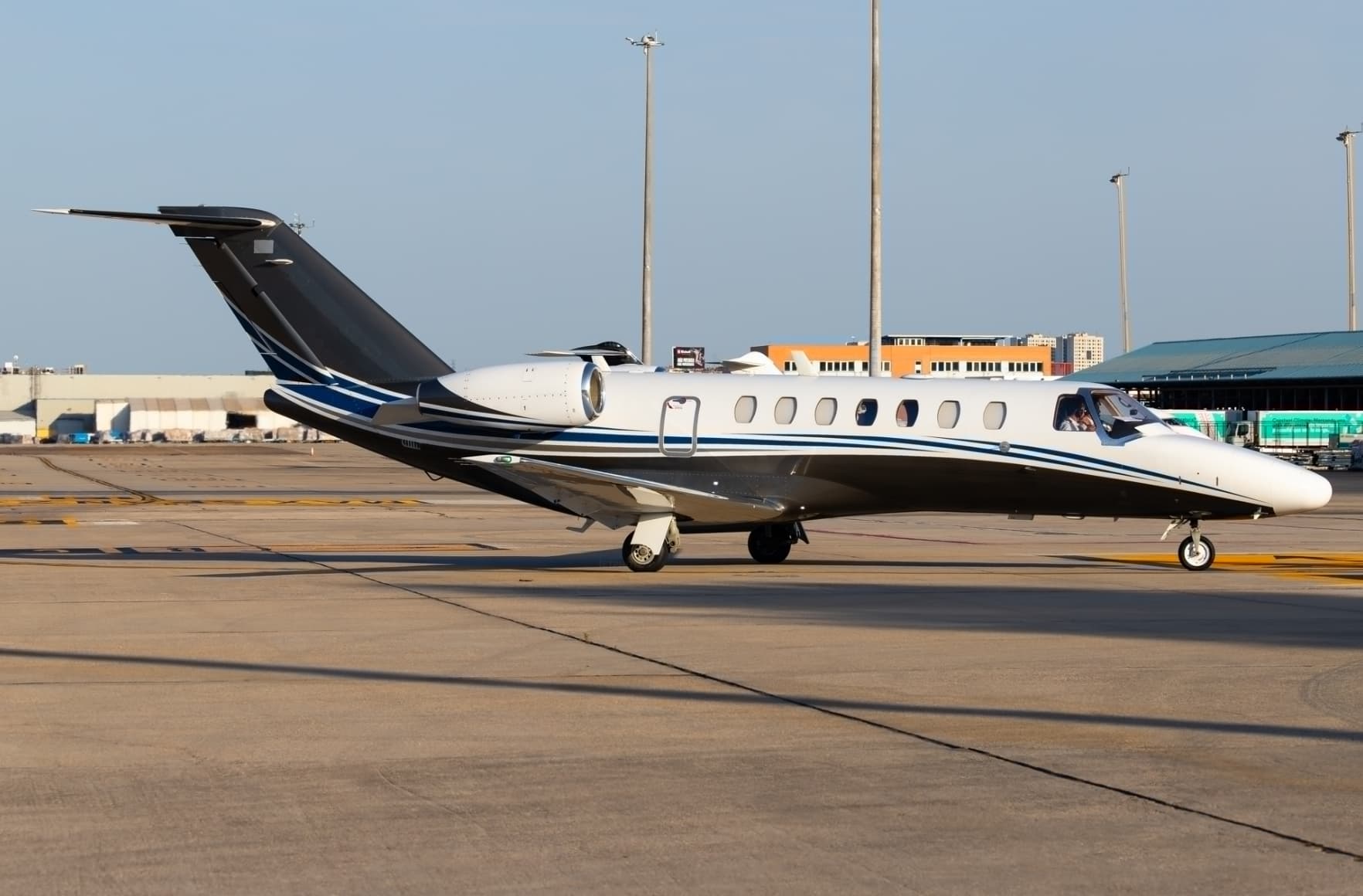 Thu, Nov 12in 9 daysBaselLFSB · EuroAirport Basel-Mulhouse-Freiburg AirportLe CastelletLFMQ · Le Castellet AirportCitation CJ38—On request12NovBasel → Le CastelletLFSB → LFMQ · in 9 daysCitation CJ3 · 8 seatsOn request
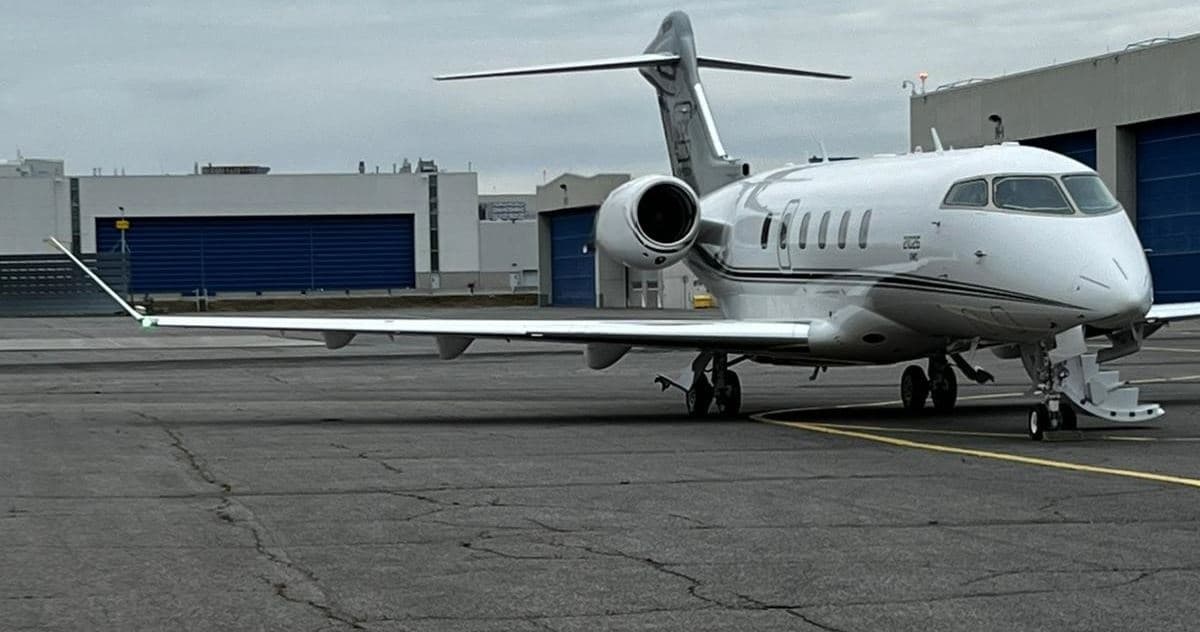 Mon, Nov 16in 13 daysBaselLFSB · EuroAirport Basel-Mulhouse-Freiburg AirportKlagenfurt Am WortherseeLOWK · Klagenfurt AirportChallenger 35008—$18,59016NovBasel → Klagenfurt Am WortherseeLFSB → LOWK · in 13 daysChallenger 3500 · 8 seats$18,590
 Wed, Nov 18in 15 daysBaselLFSB · EuroAirport Basel-Mulhouse-Freiburg AirportPonta DelgadaLPPD · Joao Paulo II AirportGlobal Express XRS13—$53,49918NovBasel → Ponta DelgadaLFSB → LPPD · in 15 daysGlobal Express XRS · 13 seats$53,499
 Thu, Nov 19in 16 daysSaint-LouisLFSB · EuroAirport Basel-Mulhouse-FreiburgKlagenfurt am WörtherseeLOWK · Klagenfurt AirportBombardier Challenger 35008—$8,75419NovSaint-Louis → Klagenfurt am WörtherseeLFSB → LOWK · in 16 daysBombardier Challenger 3500 · 8 seats$8,754
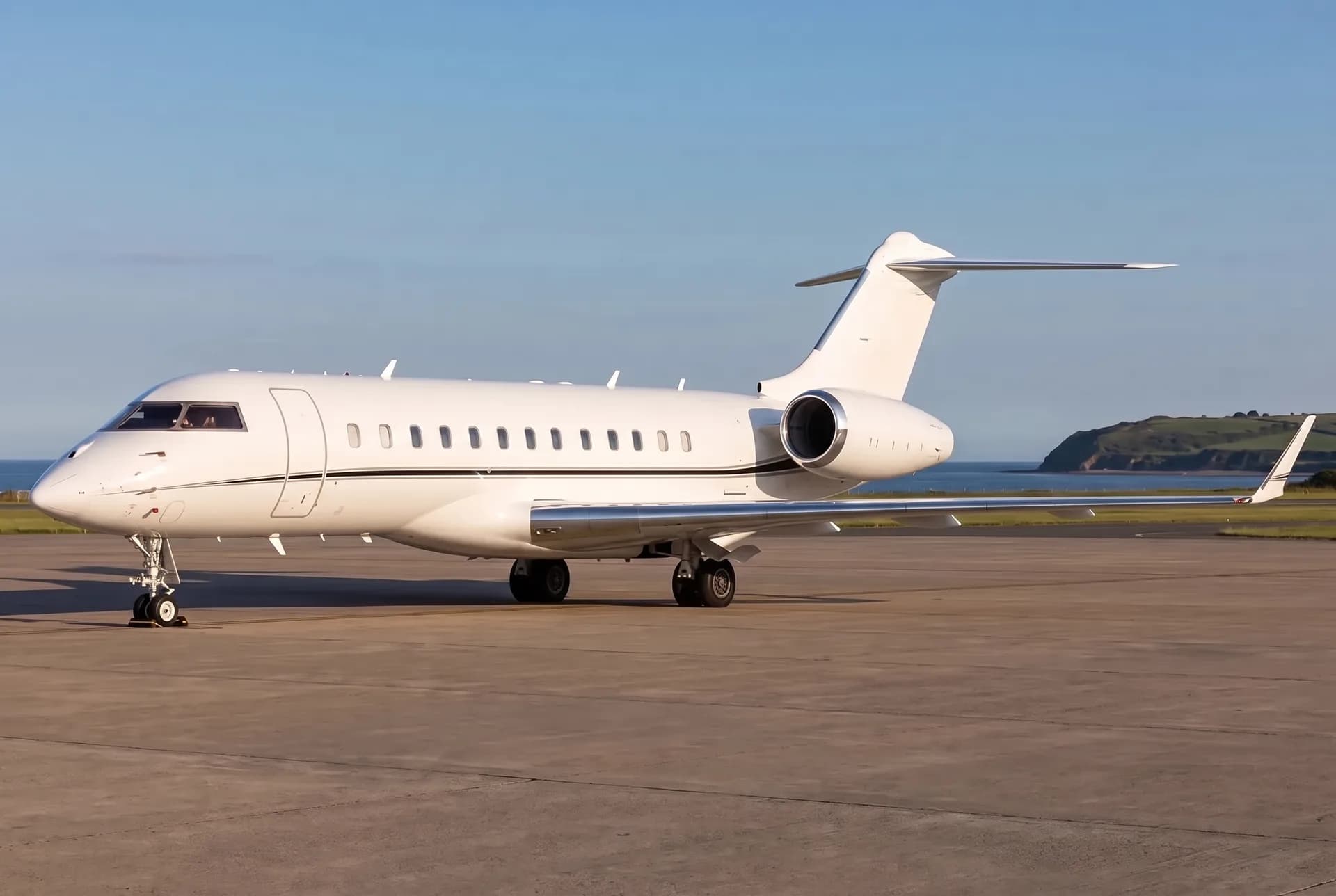 Sat, Nov 2107:50Saint-LouisLFSB · EuroAirport Basel-Mulhouse-FreiburgPonta DelgadaLPPD · João Paulo II AirportBombardier Global Express XRS13—$103,74321NovSaint-Louis → Ponta DelgadaLFSB → LPPD · 07:50Bombardier Global Express XRS · 13 seats$103,743
- Mon, Dec 713:15MulhouseLFSB · EuroAirport Basel Mulhouse FreiburgStuttgartEDDSCessna Citation CJ3+—49mOn request7DecMulhouse → StuttgartLFSB → EDDS · 13:15Cessna Citation CJ3+ · 49mOn request
- Sat, Dec 1912:15Saint-LouisLFSB · EuroAirport Basel-Mulhouse-FreiburgLa Seu d'Urgell Pyrenees and AndorraLESU · Pirineus - la Seu d'Urgel AirportCessna Citation Mustang4—$9,35019DecSaint-Louis → La Seu d'Urgell Pyrenees and AndorraLFSB → LESU · 12:15Cessna Citation Mustang · 4 seats$9,350
 LFSB · EuroAirport Basel-Mulhouse-Freiburg Airport
 LOWK · Klagenfurt Airport
 LPPD · Joao Paulo II Airport
 EDDS
 LESU · Pirineus - la Seu d'Urgel Airport
* Total price incl. 10% service fee, converted to your selected currency. Price subject to operator confirmation.
Empty legs to LFSB
5 arrivals available
- Sat, Nov 7in 4 daysAntwerpEBAW · Antwerp International Airport (Deurne)Bale/MulhouseLFSB · EuroAirport Basel-Mulhouse-Freiburg AirportDassault Falcon 900——On request7NovAntwerp → Bale/MulhouseEBAW → LFSB · in 4 daysDassault Falcon 900On request
- Mon, Nov 16in 13 daysZurichLSZH · Zurich AirportSaint-LouisLFSB · EuroAirport Basel-Mulhouse-FreiburgBombardier Global Express XRS13—$11,00016NovZurich → Saint-LouisLSZH → LFSB · in 13 daysBombardier Global Express XRS · 13 seats$11,000
- Tue, Nov 1711:00ZurichLSZH · Zürich AirportSaint-LouisLFSB · EuroAirport Basel-Mulhouse-FreiburgBombardier Global Express XRS13—$22,53217NovZurich → Saint-LouisLSZH → LFSB · 11:00Bombardier Global Express XRS · 13 seats$22,532
 Wed, Nov 18in 15 daysGenevaLSGG · Geneva Cointrin International AirportBaselLFSB · EuroAirport Basel-Mulhouse-Freiburg AirportCitation CJ2+7—$3,98818NovGeneva → BaselLSGG → LFSB · in 15 daysCitation CJ2+ · 7 seats$3,988
- Sat, Dec 508:45StuttgartEDDSMulhouseLFSB · EuroAirport Basel Mulhouse FreiburgCessna Citation CJ3+—49mOn request5DecStuttgart → MulhouseEDDS → LFSB · 08:45Cessna Citation CJ3+ · 49mOn request
 EBAW · Antwerp International Airport (Deurne)
 LSZH · Zurich Airport
* Total price incl. 10% service fee, converted to your selected currency. Price subject to operator confirmation.
Map: Bale/Mulhouse Airport
View the location of Bale/Mulhouse – BSL/LFSB. Zoom in to explore the area around the airport.
About the airport
EuroAirport Basel-Mulhouse-Freiburg Airport (BSL/LFSB) is the key private jet gateway for Bale/Mulhouse. PrivJet gives you instant access to charter flights and empty legs: fast, discreet and globally connected.
LFSB airport FAQ
Are there any restrictions at Bale airport (LFSB) today?
There are currently 12 valid NOTAMs for Bale (LFSB). According to NOTAM, at least one runway or the aerodrome itself is closed. Affected: Runway: closed; Taxiway: closed; ILS; Instrument approach procedure: not available. 1 more NOTAM starts in the coming days. For information only, not for flight planning or operational use. Always rely on an official pre-flight briefing. This list may be incomplete or out of date.
What is the weather at Bale airport (LFSB)?
According to the latest weather report for LFSB (METAR, 03 Nov, 00:00 UTC): Good visual conditions (VFR). Wind 6 kt (11 km/h) from north (10°), visibility 10 km or more, temperature 7 °C (dew point 2 °C). For information only, not for flight planning. Weather can change quickly; always rely on official reports.
How long are the runways at Bale airport (LFSB)?
Bale (LFSB) has 2 runways: runway 15/33 with 3,900 m (12,795 ft), concrete and runway 07/25 with 1,715 m (5,626 ft), concrete. The longest is 3,900 m.
What are the radio frequencies at Bale airport (LFSB)?
Frequencies at LFSB: Tower 118.3 MHz, Ground 121.6 MHz and ATIS 127.875 MHz. For information only. Always rely on the published AIP.
What are the airport codes of EuroAirport Basel-Mulhouse-Freiburg Airport?
The ICAO code is LFSB and the IATA code is BSL. ICAO codes are used by air traffic control and pilots, e.g. in flight plans; IATA codes appear on tickets and baggage tags.
What is the elevation of LFSB airport?
EuroAirport Basel-Mulhouse-Freiburg Airport sits at 885 ft (270 m) above sea level. Local time zone: Europe/Paris.
Can I fly to LFSB by private jet?
Whether a private jet can operate into EuroAirport Basel-Mulhouse-Freiburg Airport depends on runway length, opening hours, customs and immigration rules as well as slot and handling availability, among other things. PrivJet checks this with the operating carrier for every request.
Are there empty legs from or to LFSB?
There are currently 7 empty legs departing from and 5 arriving at EuroAirport Basel-Mulhouse-Freiburg Airport. Empty legs are repositioning flights at heavily reduced prices; the list is updated several times a day.