Graz Airport (LOWG / GRZ)
Empty legs and charters from Graz
LOWG airport at a glance
- ICAO code
- LOWG
- IATA code
- GRZ
- City
- Graz
- Region
- Styria
- Country
- Austria
- Elevation
- 1,115 ft (340 m)
- Time zone
- Europe/Vienna (UTC+1)
- Coordinates
- 46.9911° N, 15.4396° E
- Empty legs from
- 6
- Empty legs to
- 6
Weather & airport info LOWG
Current weather
Good visual conditions (VFR)observed 03 Nov, 00:50 UTC- Wind
- 3 kt (6 km/h) from south-southwest (200°)
- Visibility
- 10 km or more
- Clouds
- few clouds at 4,200 ft, overcast at 4,400 ft
- Temperature
- 6 °C (dew point 3 °C)
- Pressure (QNH)
- 1,023 hPa
Original weather report (METAR)
METAR LOWG 030050Z AUTO 20003KT 9999 FEW042 OVC044 06/03 Q1023
Forecast (TAF)
- 03 Nov, 00:00–00:00 UTC3 kt (6 km/h) from variable directions · visibility 10 km or more · few clouds at 1,000 ft, broken clouds at 3,000 ft
- 03 Nov, 00:00–02:00 UTCtemporarilyLight rain
- 03 Nov, 02:00–11:00 UTCtemporarily, 40 % probabilityvisibility 3 km · Light rain, light drizzle, mist · scattered clouds at 200 ft, broken clouds at 400 ft
- 03 Nov, 18:00–00:00 UTCtemporarilyLight rain
Original forecast (TAF)
TAF LOWG 022315Z 0300/0324 VRB03KT 9999 FEW010 BKN030 TX06/0311Z TN04/0305Z TEMPO 0300/0302 -RA PROB40 TEMPO 0302/0311 3000 -RADZ BR SCT002 BKN004 TEMPO 0318/0324 -RA
Airport
- Elevation
- 1,115 ft (340 m)
- Sunrise / Sunset
- 06:43 / 16:40 local time
Runways
| Runway | Length | Surface | Lighted |
|---|---|---|---|
| 16C/34C | 3,000 m (9,842 ft) | asphalt | yes |
| 16R/34L | 760 m (2,493 ft) | grass | no |
| 16L/34R | 640 m (2,100 ft) | grass | no |
Radio frequencies
- Approach: 119.3
- ATIS: 126.125
- Tower: 118.2
For information only, not for flight planning. Weather can change quickly; always rely on official reports. Sources: aviationweather.gov (NOAA), OurAirports.
Airport map LOWG
Full screen →Runways white, taxiways yellow with designators, closed taxiways and runways per NOTAM in red.
Official charts
Aerodrome, approach and ground charts are published by the national air navigation service in its AIP:
Austro Control eAIP →For information only, not for navigation. Always use current official charts and NOTAMs.
Current NOTAMs for LOWG(2)
NOTAMs (Notices to Air Missions) announce short-term changes at an airport: closed runways or taxiways, unserviceable approach aids, obstacles, airspace restrictions.
- Out of serviceILS glide path: unserviceableA2694/26· from 05 Nov, 12:00 UTC · until 05 Nov, 13:00 UTC
The Instrument Landing System (ILS) Glide Path (GP) OEG for runway 34C, frequency 330.800 MHz, is out of service. The ILS guides aircraft to the runway in poor visibility.
Show original text
ILS GP OEG RWY 34C 330.800MHZ U/S
A2694/26 NOTAMN
 Q) LOVV/QIGAS/I /NBO/A /000/999/4700N01526E005
 A) LOWG B) 2611051200 C) 2611051300
 E) ILS GP OEG RWY 34C 330.800MHZ U/S
- NoticeInstrument approach procedureA2914/26· until 26 Jan, 23:59 UTC (estimated)
The minimum altitudes for LPV (Localizer Performance with Vertical Guidance) approaches on runways 16C and 34C are raised to the higher LNAV/VNAV (Lateral Navigation/Vertical Navigation) minimums. This affects precision approaches that guide aircraft to the runway in poor visibility.
Show original text
LPV MINIMA SHALL BE RAISED TO THE RESPECTIVE LNAV/VNAV MINIMA. RNP RWY 16C, REF AIP AUSTRIA, LOWG AD 2 MAP 13-2-1 RNP RWY 34C, REF AIP AUSTRIA, LOWG AD 2 MAP 13-2-2 NOTE: DUE TO ICAO ELECTRONIC BULLETIN 2026/13
A2914/26 NOTAMR A1999/26
 Q) LOVV/QPIXX/I /NBO/A /000/999/4700N01526E005
 A) LOWG B) 2611020855 C) 2701262359EST
 E) LPV MINIMA SHALL BE RAISED TO THE RESPECTIVE LNAV/VNAV MINIMA.
 RNP RWY 16C, REF AIP AUSTRIA, LOWG AD 2 MAP 13-2-1
 RNP RWY 34C, REF AIP AUSTRIA, LOWG AD 2 MAP 13-2-2
 NOTE: DUE TO ICAO ELECTRONIC BULLETIN 2026/13
For information only, not for flight planning or operational use. Always rely on an official pre-flight briefing. This list may be incomplete or out of date. Explanations and expanded abbreviations are generated automatically. The original text is authoritative. Source: FAA NOTAM Management Service (SWIM).
Private jet traffic in Graz Airport (last 30 days)
- Arrivals
- 105
- Departures
- 86
- Different jets
- 54
Most frequent origins: Salzburg Airport (6), Vienna International Airport (5), Hamburg Airport (3), Barcelona International Airport (3), Zurich Airport (3).
Most frequent destinations: Vienna International Airport (7), Salzburg Airport (5), Belgrade Nikola Tesla Airport (3), Augsburg Airport (3).
Most common aircraft types: Pilatus PC-12 (19), Bombardier Global 5000/5500 (18), Cessna Citation Excel/XLS (18), Embraer Phenom 300 (16), Bombardier Global 6000/6500 (15).
Sunday is the busiest day.
Our own analysis of public ADS-B signals from business jets. Not every flight is received, and jets with a removal request are excluded.
Charter operators based here
Operators with a base at this airport.
- Avcon JetVienna (Schwechat) (LOWW) · Light jet, Midsize jet, Super midsize jet
- Sparfell LuftfahrtVienna (Schwechat) (LOWW) · Light jet, Super midsize jet, Heavy jet
- SalzburgJetAviationVienna (Schwechat) (LOWW) · Turboprop, Light jet, Midsize jet
- Heli-LineHelicopter
Empty legs from LOWG
6 departures available
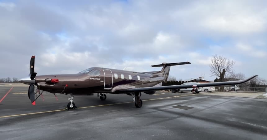 Tue, Nov 3TodayGrazLOWG · Graz AirportPragueLKPR · Vaclav Havel AirportPilatus PC-126—$4,4183NovGraz → PragueLOWG → LKPR · TodayPilatus PC-12 · 6 seats$4,418
- Tue, Nov 3TodayGrazLOWG · Graz AirportPragueLKPR · Vaclav Havel AirportPilatus PC-12 PRO8—€4,4003NovGraz → PragueLOWG → LKPR · TodayPilatus PC-12 PRO · 8 seats€4,400
- Thu, Nov 5in 2 daysFeldkirchen bei GrazLOWG · Graz AirportBelgradeLYBE · Belgrade Nikola Tesla AirportCessna Citation XLS Gen28—$8,6905NovFeldkirchen bei Graz → BelgradeLOWG → LYBE · in 2 daysCessna Citation XLS Gen2 · 8 seats$8,690
- Thu, Nov 513:15GrazLOWG · Graz InternationalBelgradeLYBE · Belgrade/Beograd Nikola TeslaCitation XLS9—€6,7775NovGraz → BelgradeLOWG → LYBE · 13:15Citation XLS · 9 seats€6,777
 Sat, Nov 7in 4 daysGrazLOWG · Graz AirportGenevaLSGG · Geneva Cointrin International AirportPilatus PC-248—On request7NovGraz → GenevaLOWG → LSGG · in 4 daysPilatus PC-24 · 8 seatsOn request
- Wed, Dec 1617:10GrazLOWGViennaLOWW · SchwechatChallenger 350—44mOn request16DecGraz → ViennaLOWG → LOWW · 17:10Challenger 350 · 44mOn request
 LOWG · Graz Airport
 LKPR · Vaclav Havel Airport
 LYBE · Belgrade Nikola Tesla Airport
 LSGG · Geneva Cointrin International Airport
* Total price incl. 10% service fee, converted to your selected currency. Price subject to operator confirmation.
Empty legs to LOWG
6 arrivals available
- Tue, Nov 3TodayAltenrheinLSZR · St Gallen Altenrhein AirportGrazLOWG · Graz AirportCessna Citation XLS71h 4m€3,2033NovAltenrhein → GrazLSZR → LOWG · TodayCessna Citation XLS · 7 seats · 1h 4m€3,203
- Wed, Nov 4TomorrowBelgradeLYBE · Belgrade Nikola Tesla AirportFeldkirchen bei GrazLOWG · Graz AirportCessna Citation XLS Gen28—$9,3504NovBelgrade → Feldkirchen bei GrazLYBE → LOWG · TomorrowCessna Citation XLS Gen2 · 8 seats$9,350
- Wed, Nov 403:45BelgradeLYBE · Belgrade/Beograd Nikola TeslaGrazLOWG · Graz InternationalCitation XLS9—€7,3324NovBelgrade → GrazLYBE → LOWG · 03:45Citation XLS · 9 seats€7,332
- Thu, Nov 5in 2 daysBelgradeLYBE · Belgrade Nikola Tesla AirportFeldkirchen bei GrazLOWG · Graz AirportCessna Citation XLS Gen28—$9,3505NovBelgrade → Feldkirchen bei GrazLYBE → LOWG · in 2 daysCessna Citation XLS Gen2 · 8 seats$9,350
- Thu, Nov 503:45BelgradeLYBE · Belgrade/Beograd Nikola TeslaGrazLOWG · Graz InternationalCitation XLS9—€7,3325NovBelgrade → GrazLYBE → LOWG · 03:45Citation XLS · 9 seats€7,332
- Sun, Dec 1303:01ViennaLOWW · SchwechatGrazLOWGChallenger 350—44mOn request13DecVienna → GrazLOWW → LOWG · 03:01Challenger 350 · 44mOn request
* Total price incl. 10% service fee, converted to your selected currency. Price subject to operator confirmation.
Map: Graz Airport
View the location of Graz – GRZ/LOWG. Zoom in to explore the area around the airport.
About the airport
Graz Airport (GRZ/LOWG) is the key private jet gateway for Graz. PrivJet gives you instant access to charter flights and empty legs: fast, discreet and globally connected.
LOWG airport FAQ
Are there any restrictions at Graz airport (LOWG) today?
There is currently 1 valid NOTAM for Graz (LOWG). 1 more NOTAM starts in the coming days. For information only, not for flight planning or operational use. Always rely on an official pre-flight briefing. This list may be incomplete or out of date.
What is the weather at Graz airport (LOWG)?
According to the latest weather report for LOWG (METAR, 03 Nov, 00:50 UTC): Good visual conditions (VFR). Wind 3 kt (6 km/h) from south-southwest (200°), visibility 10 km or more, temperature 6 °C (dew point 3 °C). For information only, not for flight planning. Weather can change quickly; always rely on official reports.
How long are the runways at Graz airport (LOWG)?
Graz (LOWG) has 3 runways: runway 16C/34C with 3,000 m (9,842 ft), asphalt, runway 16R/34L with 760 m (2,493 ft), grass and runway 16L/34R with 640 m (2,100 ft), grass. The longest is 3,000 m.
What are the radio frequencies at Graz airport (LOWG)?
Frequencies at LOWG: Tower 118.2 MHz and ATIS 126.125 MHz. For information only. Always rely on the published AIP.
What are the airport codes of Graz Airport?
The ICAO code is LOWG and the IATA code is GRZ. ICAO codes are used by air traffic control and pilots, e.g. in flight plans; IATA codes appear on tickets and baggage tags.
What is the elevation of LOWG airport?
Graz Airport sits at 1,115 ft (340 m) above sea level. Local time zone: Europe/Vienna.
Can I fly to LOWG by private jet?
Whether a private jet can operate into Graz Airport depends on runway length, opening hours, customs and immigration rules as well as slot and handling availability, among other things. PrivJet checks this with the operating carrier for every request.
Are there empty legs from or to LOWG?
There are currently 6 empty legs departing from and 6 arriving at Graz Airport. Empty legs are repositioning flights at heavily reduced prices; the list is updated several times a day.