Linz Airport (LOWL / LNZ)
Empty legs and charters from Linz
LOWL airport at a glance
- ICAO code
- LOWL
- IATA code
- LNZ
- City
- Linz
- Region
- Upper Austria
- Country
- Austria
- Elevation
- 978 ft (298 m)
- Time zone
- Europe/Vienna (UTC+1)
- Coordinates
- 48.2332° N, 14.1875° E
- Empty legs from
- 9
- Empty legs to
- 9
Weather & airport info LOWL
Current weather
No current weather report is available for this airport.
Airport
- Elevation
- 980 ft (299 m)
- Sunrise / Sunset
- 06:52 / 16:40 local time
Runways
| Runway | Length | Surface | Lighted |
|---|---|---|---|
| 08/26 | 3,000 m (9,843 ft) | asphalt | yes |
| 08E/26E | 660 m (2,165 ft) | grass | no |
Radio frequencies
- Approach: 129.62
- ATIS: 128.12
- Tower: 118.8
For information only, not for flight planning. Weather can change quickly; always rely on official reports. Sources: aviationweather.gov (NOAA), OurAirports.
Airport map LOWL
Full screen →Runways white, taxiways yellow with designators, closed taxiways and runways per NOTAM in red.
Official charts
Aerodrome, approach and ground charts are published by the national air navigation service in its AIP:
Austro Control eAIP →For information only, not for navigation. Always use current official charts and NOTAMs.
Current NOTAMs for LOWL(8)
NOTAMs (Notices to Air Missions) announce short-term changes at an airport: closed runways or taxiways, unserviceable approach aids, obstacles, airspace restrictions.
- Out of serviceILS glide path: unserviceableA2778/26· from 05 Nov, 07:00 UTC · until 05 Nov, 11:00 UTC
The glideslope (GP) of the instrument landing system (ILS) for runway 26 with frequency 332.000 MHz is out of service. The ILS guides aircraft to the runway in poor visibility.
Show original text
ILS GP RWY 26 332.000MHZ U/S
A2778/26 NOTAMN
 Q) LOVV/QIGAS/I /NBO/A /000/999/4814N01412E005
 A) LOWL B) 2611050700 C) 2611051100
 E) ILS GP RWY 26 332.000MHZ U/S
- Out of serviceILS localizer: unserviceableA2779/26· from 05 Nov, 07:00 UTC · until 05 Nov, 11:00 UTC
The localizer (LOC) of the instrument landing system (ILS) for runway 26 with frequency 109.300 MHz is out of service. The ILS guides aircraft to the runway in poor visibility.
Show original text
ILS LOC RWY 26 OEL 109.300MHZ U/S
A2779/26 NOTAMN
 Q) LOVV/QILAS/I /NBO/A /000/999/4814N01411E005
 A) LOWL B) 2611050700 C) 2611051100
 E) ILS LOC RWY 26 OEL 109.300MHZ U/S
- Out of serviceAir/ground facility: unserviceableA2928/26· until 06 Nov, 06:00 UTC
The alternate radar frequency 129.625 MHz in Linz is out of service. This affects communication with air traffic control.
Show original text
LINZ RADAR ALTERNATE FREQ 129.625MHZ U/S.
A2928/26 NOTAMN
 Q) LOVV/QCAAS/IV/BO /AE/000/165/4814N01411E005
 A) LOWL B) 2611030848 C) 2611060600
 E) LINZ RADAR ALTERNATE FREQ 129.625MHZ U/S.
- NoticeObstacle: erectedA2929/26· from 05 Nov, 05:00 UTC · until 05 Nov, 17:00 UTC
A mobile crane has been erected at Pasching Pluscity. Its top is 320 meters above sea level, 45 meters above ground. The obstacle is marked day and night.
Show original text
MOBILE CRANE ERECTED AT PASCHING PLUSCITY PSN: 481441N 0141415E MAX HEIGHT ABOVE GND 45M/148FT ELEVATION 320M/1050FT OBST DAY AND NIGHT MARKED
A2929/26 NOTAMN
 Q) LOVV/QOBCE/IV/M  /AE/000/011/4815N01414E001
 A) LOWL B) 2611050500 C) 2611051700
 E) MOBILE CRANE ERECTED AT PASCHING PLUSCITY
 PSN: 481441N 0141415E
 MAX HEIGHT ABOVE GND 45M/148FT
 ELEVATION 320M/1050FT
 OBST DAY AND NIGHT MARKED
- NoticeInstrument approach procedureA2919/26· until 26 Jan, 23:59 UTC (estimated)
The LPV minima for approaches to runways 08 and 26 at Linz airport must be raised to the respective LNAV/VNAV minima. This affects the RNP approach procedures.
Show original text
LPV MINIMA SHALL BE RAISED TO THE RESPECTIVE LNAV/VNAV MINIMA. RNP RWY 08, REF AIP AUSTRIA, LOWL AD 2 MAP 13-2-1 RNP RWY 26, REF AIP AUSTRIA, LOWL AD 2 MAP 13-2-2 NOTE: DUE TO ICAO ELECTRONIC BULLETIN 2026/13
A2919/26 NOTAMR A2004/26
 Q) LOVV/QPIXX/I /NBO/A /000/999/4814N01411E005
 A) LOWL B) 2611020858 C) 2701262359EST
 E) LPV MINIMA SHALL BE RAISED TO THE RESPECTIVE LNAV/VNAV MINIMA.
 RNP RWY 08, REF AIP AUSTRIA, LOWL AD 2 MAP 13-2-1
 RNP RWY 26, REF AIP AUSTRIA, LOWL AD 2 MAP 13-2-2
 NOTE: DUE TO ICAO ELECTRONIC BULLETIN 2026/13
- NoticeObstacle: erectedA2836/26· until 14 Jan, 12:00 UTC
A crane has been erected at Hoersching. Its top is 323 meters above sea level, 26 meters above ground. The obstacle is marked day and night.
Show original text
CRANE ERECTED AT HOERSCHING PSN:481314N 0141060E MAX HEIGHT 26M/86FT AGL ELEVATION 323M/1160FT MSL OBST DAY AND NIGHT MARKED
A2836/26 NOTAMN
 Q) LOVV/QOBCE/IV/M  /AE/000/012/4813N01411E001
 A) LOWL B) 2610221030 C) 2701141200
 E) CRANE ERECTED AT HOERSCHING
 PSN:481314N 0141060E
 MAX HEIGHT 26M/86FT AGL
 ELEVATION 323M/1160FT MSL
 OBST DAY AND NIGHT MARKED
- NoticeRunway: installedA2772/26· until 23 Dec, 23:00 UTC
The declared distances for takeoff and landing on runways 08 and 26 at Linz Airport are deviating from standard values.
Show original text
DEVIATING TO LOWL AD2.13 DECLARED DISTANCES RWY 08 TORA 3000 (TWY G 2176 TWY Z 1448) TODA 3060 (TWY G 2236 TWY Z 1508) ASDA 3000 (TWY G 2176 TWY Z 1448) LDA 2749 RWY 26 TORA 3000 (TWY F 2315 TWY Z 1563) TODA 3000 (TWY F 2315 TWY Z 1563) ASDA 3000 (TWY F 2315 TWY Z 1563) LDA 2849
A2772/26 NOTAMN
 Q) LOVV/QMRCS/IV/BO /A /000/999/4814N01411E005
 A) LOWL B) 2610151105 C) 2612232300
 E) DEVIATING TO LOWL AD2.13 DECLARED DISTANCES
 RWY 08 TORA 3000 (TWY G 2176 TWY Z 1448) TODA 3060 (TWY G 2236 TWY Z
 1508) ASDA 3000 (TWY G 2176 TWY Z 1448) LDA 2749
 RWY 26 TORA 3000 (TWY F 2315 TWY Z 1563) TODA 3000 (TWY F 2315 TWY Z
 1563) ASDA 3000 (TWY F 2315 TWY Z 1563) LDA 2849
- NoticeObstacle: erectedA2624/26· until 30 Nov, 15:00 UTC
A crane has been erected at Pasching; its top is 329 meters above sea level, 31 meters above ground. The obstacle is marked day and night.
Show original text
CRANE ERECTED AT PASCHING PSN: 481318N 0141057E MAX HGT ABOVE GND: 31M/102FT AGL ELEV: 329M/1080FT AMSL OBST DAY AND NIGHT MARKED
A2624/26 NOTAMN
 Q) LOVV/QOBCE/IV/M  /AE/000/010/4813N01411E001
 A) LOWL B) 2610011500 C) 2611301500
 E) CRANE ERECTED AT PASCHING
 PSN: 481318N 0141057E
 MAX HGT ABOVE GND: 31M/102FT AGL
 ELEV: 329M/1080FT  AMSL
 OBST DAY AND NIGHT MARKED
For information only, not for flight planning or operational use. Always rely on an official pre-flight briefing. This list may be incomplete or out of date. Explanations and expanded abbreviations are generated automatically. The original text is authoritative. Source: FAA NOTAM Management Service (SWIM).
Private jet traffic in Linz Airport (last 30 days)
- Arrivals
- 92
- Departures
- 87
- Different jets
- 50
Most frequent origins: Salzburg Airport (5), Vienna International Airport (5), Venezia / Tessera - Marco Polo Airport (3).
Most frequent destinations: Vienna International Airport (7), Salzburg Airport (5), Schwabisch Hall-Weckrieden Airport (4), Palma De Mallorca Airport (3), Berlin Brandenburg Airport (3).
Most common aircraft types: Cessna Citation Excel/XLS (50), Cessna Citation Mustang (32), Pilatus PC-12 (17), Gulfstream G550/GV (13), Cessna Citation CJ3 (11).
Friday is the busiest day.
Our own analysis of public ADS-B signals from business jets. Not every flight is received, and jets with a removal request are excluded.
Charter operators based here
Operators with a base at this airport.
- GlobeAirLight jet
- SalzburgJetAviationVienna (Schwechat) (LOWW) · Turboprop, Light jet, Midsize jet
- Jet Fly AirlineSalzburg (W. A. Mozart) (LOWS) · Light jet, Midsize jet
- SkyemotionHeavy jet
Empty legs from LOWL
9 departures available
- Fri, Nov 618:50LinzLOWL · Linz-Horsching Airport / Vogler Air BaseKlagenfurt am WortherseeLOWK · Klagenfurt AirportBombardier Challenger 35009—$7,1506NovLinz → Klagenfurt am WortherseeLOWL → LOWK · 18:50Bombardier Challenger 3500 · 9 seats$7,150
 Sat, Nov 7in 3 daysLinz-land DistrictLOWL · Linz AirportWinningenEDRK · Koblenz-Winningen AirportPilatus PC-247—€8,0337NovLinz-land District → WinningenLOWL → EDRK · in 3 daysPilatus PC-24 · 7 seats€8,033
 Sat, Nov 7in 3 daysLinz-land DistrictLOWL · Linz AirportInnsbruckLOWI · Innsbruck AirportCitation Mustang4—On request7NovLinz-land District → InnsbruckLOWL → LOWI · in 3 daysCitation Mustang · 4 seatsOn request
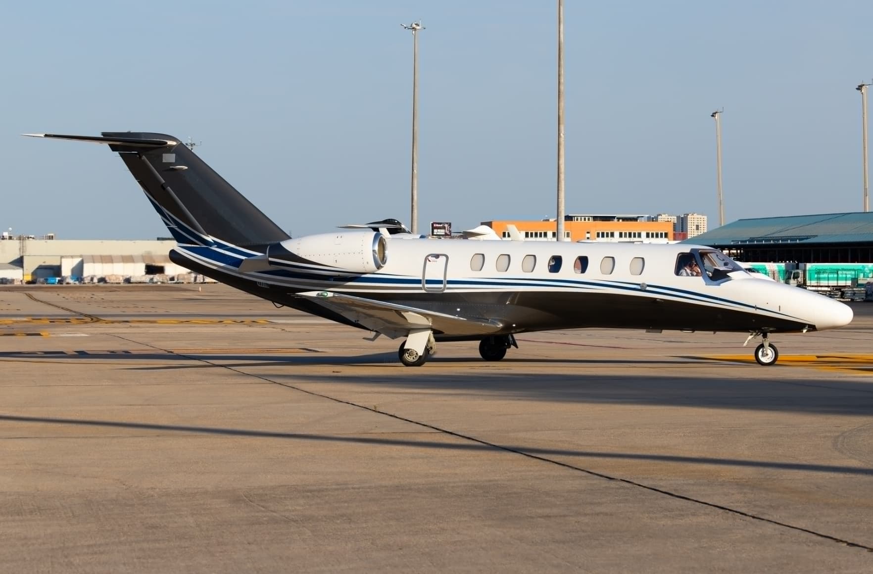 Sun, Nov 15in 11 daysLinz-land DistrictLOWL · Linz AirportGironaLEGE · Girona AirportCitation CJ38—On request15NovLinz-land District → GironaLOWL → LEGE · in 11 daysCitation CJ3 · 8 seatsOn request
- Mon, Nov 16in 12 daysLinzLOWL · Linz AirportNorwichEGSH · Norwich International AirportCitation Mustang4—On request16NovLinz → NorwichLOWL → EGSH · in 12 daysCitation Mustang · 4 seatsOn request
- Wed, Nov 18in 14 daysLinz-land DistrictLOWL · Linz AirportLublinEPLB · Lublin AirportPilatus PC-247—$9,38618NovLinz-land District → LublinLOWL → EPLB · in 14 daysPilatus PC-24 · 7 seats$9,386
- Wed, Nov 18in 14 daysLinzLOWL · Linz AirportGironaLEGE · Girona AirportCitation CJ37—On request18NovLinz → GironaLOWL → LEGE · in 14 daysCitation CJ3 · 7 seatsOn request
- Thu, Nov 19in 15 daysLinz-land DistrictLOWL · Linz AirportCologneEDDK · Cologne Bonn AirportPilatus PC-247—€9,32119NovLinz-land District → CologneLOWL → EDDK · in 15 daysPilatus PC-24 · 7 seats€9,321
 Mon, Nov 23in 19 daysLinz-land DistrictLOWL · Linz AirportAltenrheinLSZR · St Gallen Altenrhein AirportCitation Mustang4—On request23NovLinz-land District → AltenrheinLOWL → LSZR · in 19 daysCitation Mustang · 4 seatsOn request
 LOWL · Linz-Horsching Airport / Vogler Air Base
 EDRK · Koblenz-Winningen Airport
 LEGE · Girona Airport
 EGSH · Norwich International Airport
 EPLB · Lublin Airport
 LSZR · St Gallen Altenrhein Airport
* Total price incl. 10% service fee, converted to your selected currency. Price subject to operator confirmation.
Empty legs to LOWL
9 arrivals available
- Thu, Nov 511:36BydgoszczEPBYLinzLOWLCessna Citation Mustang41h 21m€1,4195NovBydgoszcz → LinzEPBY → LOWL · 11:36Cessna Citation Mustang · 4 seats · 1h 21m€1,419
- Mon, Nov 1610:00SalzburgLOWS · Salzburg AirportLinzLOWL · Linz-Horsching Airport / Vogler Air BasePilatus PC-128—$2,75016NovSalzburg → LinzLOWS → LOWL · 10:00Pilatus PC-12 · 8 seats$2,750
- Tue, Nov 1715:00BrnoLKTB · Brno-Turany AirportLinzLOWL · Linz AirportHawker Beechjet 4008—On request17NovBrno → LinzLKTB → LOWL · 15:00Hawker Beechjet 400 · 8 seatsOn request
- Wed, Nov 18in 14 daysCologneEDDK · Cologne Bonn AirportLinz-land DistrictLOWL · Linz AirportPilatus PC-247—€8,21718NovCologne → Linz-land DistrictEDDK → LOWL · in 14 daysPilatus PC-24 · 7 seats€8,217
 Wed, Nov 1811:00SalzburgLOWS · Salzburg AirportLinzLOWL · Linz-Hörsching Airport / Vogler Air BasePC-128—$2,27018NovSalzburg → LinzLOWS → LOWL · 11:00PC-12 · 8 seats$2,270
- Thu, Nov 19in 15 daysLublinEPLB · Lublin AirportLinz-land DistrictLOWL · Linz AirportPilatus PC-247—€9,38219NovLublin → Linz-land DistrictEPLB → LOWL · in 15 daysPilatus PC-24 · 7 seats€9,382
- Sun, Nov 22in 18 daysViennaLOWW · Vienna International AirportLinz-land DistrictLOWL · Linz AirportCitation Mustang4—On request22NovVienna → Linz-land DistrictLOWW → LOWL · in 18 daysCitation Mustang · 4 seatsOn request
- Sun, Dec 1315:15ColumbiaKCOU · Columbia Regional AirportLinzLOWL · Linz-Horsching Airport / Vogler Air BaseBombardier Global Express XRS13—$187,00013DecColumbia → LinzKCOU → LOWL · 15:15Bombardier Global Express XRS · 13 seats$187,000
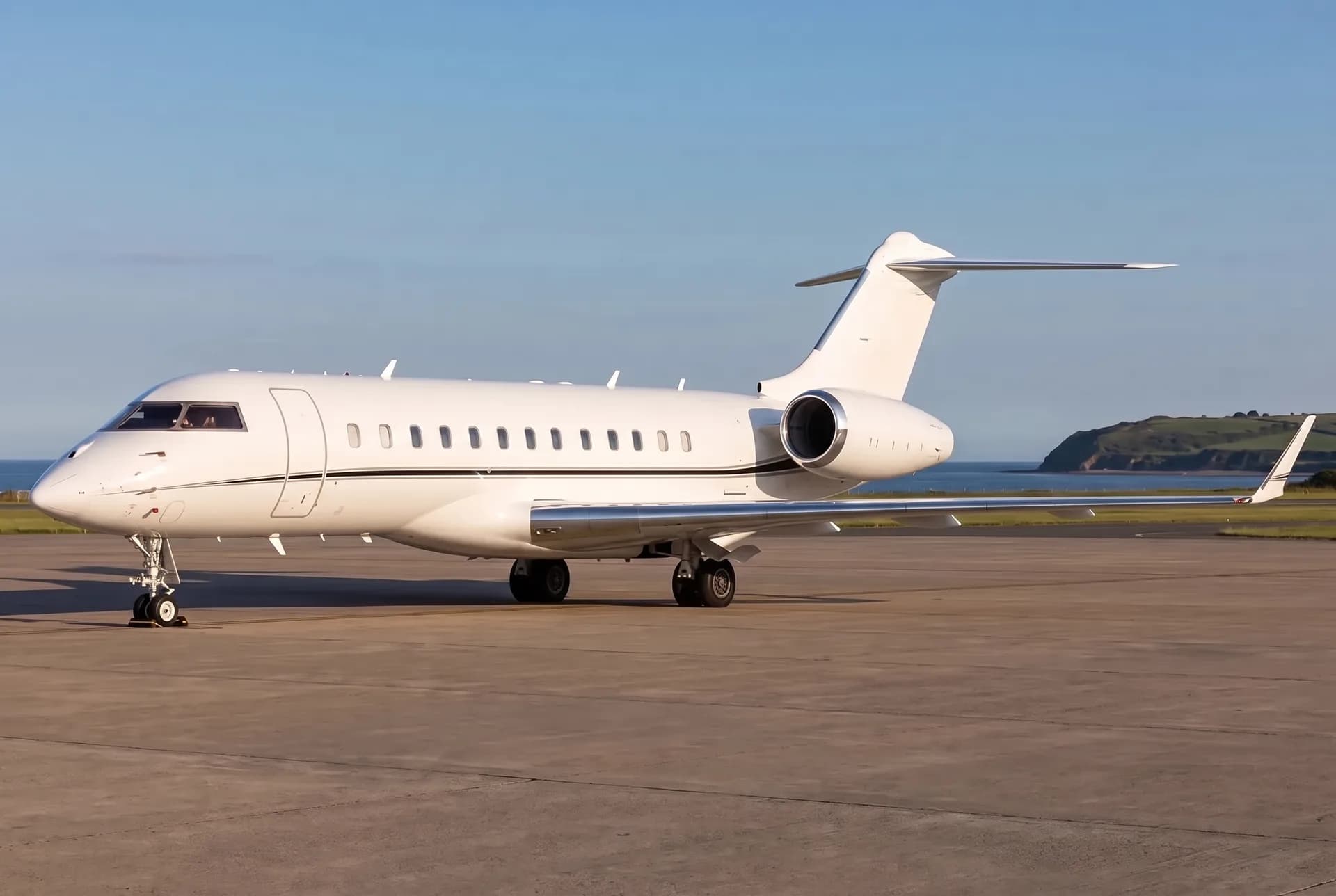 Tue, Dec 1520:15ColumbiaKCOU · Columbia Regional AirportLinzLOWL · Linz-Hörsching Airport / Vogler Air BaseBombardier Global Express XRS13—$135,92615DecColumbia → LinzKCOU → LOWL · 20:15Bombardier Global Express XRS · 13 seats$135,926
 LKTB · Brno-Turany Airport
 KCOU · Columbia Regional Airport
* Total price incl. 10% service fee, converted to your selected currency. Price subject to operator confirmation.
Map: Linz Airport
View the location of Linz – LNZ/LOWL. Zoom in to explore the area around the airport.
About the airport
Linz Airport (LNZ/LOWL) is the key private jet gateway for Linz. PrivJet gives you instant access to charter flights and empty legs: fast, discreet and globally connected.
LOWL airport FAQ
Are there any restrictions at Linz airport (LOWL) today?
There are currently 5 valid NOTAMs for Linz (LOWL). Affected: Air/ground facility: unserviceable. 3 more NOTAMs start in the coming days. For information only, not for flight planning or operational use. Always rely on an official pre-flight briefing. This list may be incomplete or out of date.
How long are the runways at Linz airport (LOWL)?
Linz (LOWL) has 2 runways: runway 08/26 with 3,000 m (9,843 ft), asphalt and runway 08E/26E with 660 m (2,165 ft), grass. The longest is 3,000 m.
What are the radio frequencies at Linz airport (LOWL)?
Frequencies at LOWL: Tower 118.8 MHz and ATIS 128.12 MHz. For information only. Always rely on the published AIP.
What are the airport codes of Linz Airport?
The ICAO code is LOWL and the IATA code is LNZ. ICAO codes are used by air traffic control and pilots, e.g. in flight plans; IATA codes appear on tickets and baggage tags.
What is the elevation of LOWL airport?
Linz Airport sits at 978 ft (298 m) above sea level. Local time zone: Europe/Vienna.
Can I fly to LOWL by private jet?
Whether a private jet can operate into Linz Airport depends on runway length, opening hours, customs and immigration rules as well as slot and handling availability, among other things. PrivJet checks this with the operating carrier for every request.
Are there empty legs from or to LOWL?
There are currently 9 empty legs departing from and 9 arriving at Linz Airport. Empty legs are repositioning flights at heavily reduced prices; the list is updated several times a day.