Beja Airport (LPBJ / BYJ)
Empty legs and charters from Beja
LPBJ airport at a glance
- ICAO code
- LPBJ
- IATA code
- BYJ
- City
- Beja
- Region
- Beja
- Country
- Portugal
- Elevation
- 636 ft (194 m)
- Time zone
- Europe/Lisbon (UTC±0)
- Coordinates
- 38.0789° N, 7.9324° W
- Empty legs from
- 0
- Empty legs to
- 2
Weather & airport info LPBJ
Current weather
No current weather report is available for this airport.
Airport
- Elevation
- 636 ft (194 m)
- Sunrise / Sunset
- 06:59 / 17:31 local time
Runways
| Runway | Length | Surface | Lighted |
|---|---|---|---|
| 01L/19R | 3,450 m (11,319 ft) | concrete | yes |
| 01R/19L | 2,951 m (9,682 ft) | concrete | no |
Radio frequencies
- Approach: 130.1
- Ground: 23.4
- Tower: 130.4
For information only, not for flight planning. Weather can change quickly; always rely on official reports. Sources: aviationweather.gov (NOAA), OurAirports.
Airport map LPBJ
Full screen →Runways white, taxiways yellow with designators, closed taxiways and runways per NOTAM in red.
Official charts
Aerodrome, approach and ground charts are published by the national air navigation service in its AIP:
NAV Portugal AIS →For information only, not for navigation. Always use current official charts and NOTAMs.
Current NOTAMs for LPBJ(18)
NOTAMs (Notices to Air Missions) announce short-term changes at an airport: closed runways or taxiways, unserviceable approach aids, obstacles, airspace restrictions.
- Out of serviceApproach lightingM1923/26· until 13 Nov, 00:00 UTC
The approach lighting system for runway 01L is out of service. Approach lighting helps pilots find the runway in poor visibility.
Show original text
TRIGGER NOTAM - NON AIRAC MIL AIP SUP 28/26 WEF 30OCT2026. APCH LIGHTING SYSTEM RWY 01L UNSERVICEABLE.
M1923/26 NOTAMN
 Q)LPPC/QLATT/IV/BO/A/000/999/3805N00756W005
 A)LPBJ B)2610301553 C)2611130000
 E)TRIGGER NOTAM - NON AIRAC MIL AIP SUP 28/26 WEF 30OCT2026. APCH
 LIGHTING SYSTEM RWY 01L UNSERVICEABLE.
- NoticeUnmanned aircraft: will take placeM1913/26· from 07 Nov, 07:04 UTC · until 15 Nov, 17:20 UTC
Unmanned aircraft activity will take place within a 400-meter radius centered at the specified point near the airport.
Show original text
UNMANNED AIRCRAFT ACTIVITY WILL TAKE PLACE RADIUS 400M CENTERED AT 380844N 0074533W.
M1913/26 NOTAMN
 Q)LPPC/QWULW/IV/BO/AW/000/001/3809N00746W001
 A)LPBJ B)2611070704 C)2611151720
 D)DAILY SR-SS
 E)UNMANNED AIRCRAFT ACTIVITY WILL TAKE PLACE RADIUS 400M CENTERED AT
 380844N 0074533W.
 F)GND G)30M AGL
Hours: DAILY SR-SS
- NoticeAirspace reservation: will take placeA6294/26· from 06 Nov, 07:03 UTC · until 06 Nov, 17:28 UTC
An airspace reservation for parachutists will take place within a 5 nautical mile radius centered on Beja Airport. Activity is subject to coordination with Beja Approach control.
Show original text
AIRSPACE RESERVATION FOR PJE WILL TAKE PLACE WI 5NM RADIUS CENTERED ON 380444N 0075557W (LPBJ). ACTIVITY SUBJECT TO COORDINATION WITH BEJA APP.
A6294/26 NOTAMN
 Q) LPPC/QRALW/IV/NBO/AW/000/150/3805N00756W005
 A) LPBJ B) 2611060703 C) 2611061728
 E) AIRSPACE RESERVATION FOR PJE WILL TAKE PLACE WI 5NM RADIUS
 CENTERED ON 380444N 0075557W (LPBJ).
 ACTIVITY SUBJECT TO COORDINATION WITH BEJA APP.
 F) GND G) FL150
- NoticeUnmanned aircraft: will take placeA6213/26· from 03 Nov, 07:00 UTC · until 03 Nov, 17:31 UTC
Unmanned aircraft activity will take place within a 60 m radius centered at 375951N 0075658W.
Show original text
UNMANNED ACFT ACTIVITY WILL TAKE PLACE RADIUS 60M CENTERED AT 375951N 0075658W.
A6213/26 NOTAMN
 Q) LPPC/QWULW/IV/BO /AW/000/007/3800N00757W001
 A) LPBJ B) 2611030700 C) 2611031731
 E) UNMANNED ACFT ACTIVITY WILL TAKE PLACE RADIUS 60M CENTERED AT
 375951N 0075658W.
 F) GND G) 15M AGL
- NoticeUnmanned aircraft: will take placeM1898/26· from 03 Nov, 07:00 UTC · until 03 Nov, 17:31 UTC
Unmanned aircraft activity will take place within a 60 m radius centered at 375951N 0075658W.
Show original text
UNMANNED AIRCRAFT ACTIVITY WILL TAKE PLACE RADIUS 60M CENTERED AT 375951N 0075658W.
M1898/26 NOTAMN
 Q)LPPC/QWULW/IV/BO/AW/000/001/3800N00757W001
 A)LPBJ B)2611030700 C)2611031731
 E)UNMANNED AIRCRAFT ACTIVITY WILL TAKE PLACE RADIUS 60M CENTERED AT
 375951N 0075658W.
 F)GND G)15M AGL
- NoticeUnmanned aircraft: will take placeM1899/26· from 03 Nov, 07:00 UTC · until 28 Nov, 17:13 UTC
Unmanned aircraft activity will take place within a 200-meter radius of the specified position.
Show original text
UNMANNED AIRCRAFT ACTIVITY WILL TAKE PLACE RADIUS 200M CENTERED AT 380007N 0074953W.
M1899/26 NOTAMN
 Q)LPPC/QWULW/IV/BO/AW/000/001/3800N00750W001
 A)LPBJ B)2611030700 C)2611281713
 D)DAILY SR-SS
 E)UNMANNED AIRCRAFT ACTIVITY WILL TAKE PLACE RADIUS 200M CENTERED AT
 380007N 0074953W.
 F)GND G)15M AGL
Hours: DAILY SR-SS
- NoticeUnmanned aircraft: will take placeM1906/26· from 03 Nov, 07:00 UTC · until 28 Nov, 17:13 UTC
Unmanned aircraft activity will take place within a 200 m radius centered at 380007N 0074953W.
Show original text
UNMANNED AIRCRAFT ACTIVITY WILL TAKE PLACE RADIUS 200M CENTERED AT 380007N 0074953W.
M1906/26 NOTAMN
 Q)LPPC/QWULW/IV/BO/AW/000/001/3800N00750W001
 A)LPBJ B)2611030700 C)2611281713
 D)DAILY SR-SS
 E)UNMANNED AIRCRAFT ACTIVITY WILL TAKE PLACE RADIUS 200M CENTERED AT
 380007N 0074953W.
 F)GND G)30M AGL
Hours: DAILY SR-SS
- NoticeUnmanned aircraft: will take placeM1912/26· from 03 Nov, 07:00 UTC · until 04 Nov, 17:29 UTC
Unmanned aircraft activity will take place within a 70-meter radius centered at the specified position near Beja airport.
Show original text
UNMANNED AIRCRAFT ACTIVITY WILL TAKE PLACE RADIUS 70M CENTERED AT 381013N 0074829W.
M1912/26 NOTAMN
 Q)LPPC/QWULW/IV/BO/AW/000/001/3810N00748W001
 A)LPBJ B)2611030700 C)2611041729
 D)DAILY SR-SS
 E)UNMANNED AIRCRAFT ACTIVITY WILL TAKE PLACE RADIUS 70M CENTERED AT
 381013N 0074829W.
 F)GND G)30M AGL
Hours: DAILY SR-SS
10 more NOTAMs
- NoticeUnmanned aircraft: will take placeA6218/26· from 03 Nov, 06:59 UTC · until 28 Nov, 17:13 UTC
Unmanned aircraft (drone) activity will take place within a 200-meter radius of the specified location. This may affect flight operations in that area.
Show original text
UNMANNED ACFT ACTIVITY WILL TAKE PLACE RADIUS 200M CENTERED AT 380007N 0074953W.
A6218/26 NOTAMN
 Q) LPPC/QWULW/IV/BO /AW/000/007/3800N00750W001
 A) LPBJ B) 2611030659 C) 2611281713
 D) DAILY SR-SS
 E) UNMANNED ACFT ACTIVITY WILL TAKE PLACE RADIUS 200M CENTERED AT
 380007N 0074953W.
 F) GND G) 30M AGL
Hours: DAILY SR-SS
- NoticeUnmanned aircraft: will take placeM1900/26· until 06 Nov, 14:00 UTC
Unmanned aircraft will operate in an area defined by the specified coordinates.
Show original text
UNMANNED AIRCRAFT WILL TAKE PLACE ON AREA DEFINED BY THE FOLLOWING COORDINATES: 380735N 0074821W - 380729N 0074843W - 380709N 0074828W - 380718N 0074805W - 380735N 0074821W.
M1900/26 NOTAMN
 Q)LPPC/QWULW/IV/BO/AW/000/001/3807N00748W001
 A)LPBJ B)2611020900 C)2611061400
 D)DAILY SR-SS
 E)UNMANNED AIRCRAFT WILL TAKE PLACE ON AREA DEFINED BY THE FOLLOWING
 COORDINATES: 380735N 0074821W - 380729N 0074843W - 380709N 0074828W -
 380718N 0074805W - 380735N 0074821W.
 F)GND G)30M AGL
Hours: DAILY SR-SS
- NoticeUnmanned aircraft: will take placeM1901/26· until 30 Nov, 17:12 UTC
Unmanned aircraft activity will take place within a 1000-meter radius of the specified position.
Show original text
UNMANNED AIRCRAFT ACTIVITY WILL TAKE PLACE RADIUS 1000M CENTERED AT 380711N 0073829W.
M1901/26 NOTAMN
 Q)LPPC/QWULW/IV/BO/AW/000/001/3807N00738W001
 A)LPBJ B)2611010657 C)2611301712
 D)DAILY SR-SS
 E)
 UNMANNED AIRCRAFT ACTIVITY WILL TAKE PLACE RADIUS 1000M CENTERED AT
 380711N 0073829W.
 F)GND G)15M AGL
Hours: DAILY SR-SS
- NoticeUnmanned aircraft: will take placeM1904/26· until 30 Nov, 17:12 UTC
Unmanned aircraft activity will take place within a 1000-meter radius of the specified position.
Show original text
UNMANNED AIRCRAFT ACTIVITY WILL TAKE PLACE RADIUS 1000M CENTERED AT 380711N 0073829W.
M1904/26 NOTAMN
 Q)LPPC/QWULW/IV/BO/AW/000/001/3807N00738W001
 A)LPBJ B)2611010657 C)2611301712
 D)DAILY SR-SS
 E)
 UNMANNED AIRCRAFT ACTIVITY WILL TAKE PLACE RADIUS 1000M CENTERED AT
 380711N 0073829W.
 F)GND G)30M AGL
Hours: DAILY SR-SS
- NoticeObstacleM1918/26· until 30 Jan, 17:15 UTC
There are unmarked concrete obstacles on the left side of the threshold of runway 01R, between 23 and 55 meters from the centerline.
Show original text
CONCRETE OBSTACLES ON THE LEFT SIDE OF THRESHOLD RWY 01R, BETWEEN 23 AND 55 METERS FROM THE CENTERLINE. OBSTACLES ARE NOT MARKED.
M1918/26 NOTAMN
 Q)LPPC/QOBXX/IV/M/AE/000/999/3805N00756W005
 A)LPBJ B)2610301055 C)2701301715
 E)CONCRETE OBSTACLES ON THE LEFT SIDE OF THRESHOLD RWY 01R, BETWEEN
 23 AND 55 METERS FROM THE CENTERLINE. OBSTACLES ARE NOT MARKED.
- NoticeObstacleM1917/26· until 30 Jan, 17:15 UTC
There are unmarked concrete obstacles on the right side of the threshold of runway 01R, between 23 and 55 meters from the centerline.
Show original text
CONCRETE OBSTACLES ON THE RIGHT SIDE OF THRESHOLD RWY 01R, BETWEEN 23 AND 55 METERS FROM THE CENTERLINE.OBSTACLES ARE NOT MARKED.
M1917/26 NOTAMN
 Q)LPPC/QOBXX/IV/M/AE/000/999/3805N00756W005
 A)LPBJ B)2610301054 C)2701301715
 E)CONCRETE OBSTACLES ON THE RIGHT SIDE OF THRESHOLD RWY 01R, BETWEEN
 23 AND 55 METERS FROM THE CENTERLINE.OBSTACLES ARE NOT MARKED.
- NoticeObstacleM1915/26· until 30 Jan, 17:15 UTC
There are unmarked concrete obstacles on the left side of the threshold of runway 19L, between 23 and 55 meters from the centerline.
Show original text
CONCRETE OBSTACLES ON THE LEFT SIDE OF THRESHOLD RWY 19L, BETWEEN 23 AND 55 METERS FROM THE CENTERLINE. OBSTACLES ARE NOT MARKED.
M1915/26 NOTAMN
 Q)LPPC/QOBXX/IV/M/AE/000/999/3805N00756W005
 A)LPBJ B)2610301030 C)2701301715
 E)CONCRETE OBSTACLES ON THE LEFT SIDE OF THRESHOLD RWY 19L, BETWEEN
 23 AND 55 METERS FROM THE CENTERLINE. OBSTACLES ARE NOT MARKED.
- NoticeObstacleM1916/26· until 30 Jan, 17:15 UTC
There are unmarked concrete obstacles on the right side of the threshold of runway 19L, between 23 and 55 meters from the centerline.
Show original text
CONCRETE OBSTACLES ON THE RIGHT SIDE OF THRESHOLD RWY 19L, BETWEEN 23 AND 55 METERS FROM THE CENTERLINE. OBSTACLES ARE NOT MARKED.
M1916/26 NOTAMN
 Q)LPPC/QOBXX/IV/M/AE/000/999/3805N00756W005
 A)LPBJ B)2610301030 C)2701301715
 E)CONCRETE OBSTACLES ON THE RIGHT SIDE OF THRESHOLD RWY 19L, BETWEEN
 23 AND 55 METERS FROM THE CENTERLINE. OBSTACLES ARE NOT MARKED.
- NoticeTaxiway: limited toA5770/26· until 31 Dec, 17:15 UTC
Taxiway H is limited to conventional aircraft and aircraft based therein due to degraded pavement.
Show original text
TWY H LIMITED TO CONVENTIONAL ACFT AND ACFT BASED THEREIN DUE TO DEGRADED PAVEMENT.
A5770/26 NOTAMN
 Q) LPPC/QMXLT/IV/M  /A /000/999/3805N00756W005
 A) LPBJ B) 2610021107 C) 2612311715
 E) TWY H LIMITED TO CONVENTIONAL ACFT AND ACFT BASED THEREIN DUE TO
 DEGRADED PAVEMENT.
- NoticeTaxiway: limited toM1715/26· until 31 Dec, 17:15 UTC
Taxiway H is limited to conventional aircraft and aircraft based therein due to degraded pavement.
Show original text
TWY H LIMITED TO CONVENTIONAL AIRCRAFT AND AIRCRAFT BASED THEREIN DUE TO DEGRADED PAVEMENT.
M1715/26 NOTAMR M1184/26
 Q)LPPC/QMXLT/IV/M/A/000/999/3805N00756W005
 A)LPBJ B)2610021001 C)2612311715
 E) TWY H LIMITED TO CONVENTIONAL AIRCRAFT AND AIRCRAFT BASED
 THEREIN DUE TO DEGRADED PAVEMENT.
For information only, not for flight planning or operational use. Always rely on an official pre-flight briefing. This list may be incomplete or out of date. Explanations and expanded abbreviations are generated automatically. The original text is authoritative. Source: FAA NOTAM Management Service (SWIM).
Private jet traffic in Beja International Airport (last 30 days)
- Arrivals
- 45
- Departures
- 13
- Different jets
- 37
Most frequent origins: Farnborough Airport (5), Cologne Bonn Airport (3).
Most common aircraft types: Embraer Phenom 300 (13), Bombardier Challenger 350/3500 (10), Bombardier Global 6000/6500 (7), Cessna Citation Excel/XLS (6), Cessna Citation CJ2 (4).
Friday is the busiest day.
Our own analysis of public ADS-B signals from business jets. Not every flight is received, and jets with a removal request are excluded.
Charter operators based here
Operators with a base at this airport.
- Hi FlyHeavy jet
Empty legs from LPBJ
0 departures available
No empty legs are currently available departing from this airport.
Request tailored flightEmpty legs to LPBJ
2 arrivals available
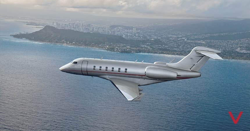 Fri, Nov 6in 3 daysPortoLPPR · Francisco de Sa Carneiro AirportBejaLPBJ · Beja International AirportChallenger 3508—On request6NovPorto → BejaLPPR → LPBJ · in 3 daysChallenger 350 · 8 seatsOn request
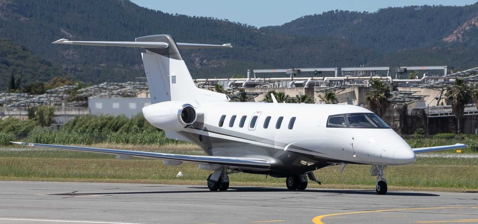 Wed, Nov 11in 8 daysAntwerpEBAW · Antwerp International Airport (Deurne)BejaLPBJ · Beja International AirportPilatus PC-248—$15,76711NovAntwerp → BejaEBAW → LPBJ · in 8 daysPilatus PC-24 · 8 seats$15,767
 LPPR · Francisco de Sa Carneiro Airport
 EBAW · Antwerp International Airport (Deurne)
* Total price incl. 10% service fee, converted to your selected currency. Price subject to operator confirmation.
Map: Beja Airport
View the location of Beja – BYJ/LPBJ. Zoom in to explore the area around the airport.
About the airport
Beja International Airport (BYJ/LPBJ) is the key private jet gateway for Beja. PrivJet gives you instant access to charter flights and empty legs: fast, discreet and globally connected.
LPBJ airport FAQ
Are there any restrictions at Beja airport (LPBJ) today?
There are currently 10 valid NOTAMs for Beja (LPBJ). Affected: Approach lighting. 8 more NOTAMs start in the coming days. For information only, not for flight planning or operational use. Always rely on an official pre-flight briefing. This list may be incomplete or out of date.
How long are the runways at Beja airport (LPBJ)?
Beja (LPBJ) has 2 runways: runway 01L/19R with 3,450 m (11,319 ft), concrete and runway 01R/19L with 2,951 m (9,682 ft), concrete. The longest is 3,450 m.
What are the radio frequencies at Beja airport (LPBJ)?
Frequencies at LPBJ: Tower 130.4 MHz and Ground 23.4 MHz. For information only. Always rely on the published AIP.
What are the airport codes of Beja International Airport?
The ICAO code is LPBJ and the IATA code is BYJ. ICAO codes are used by air traffic control and pilots, e.g. in flight plans; IATA codes appear on tickets and baggage tags.
What is the elevation of LPBJ airport?
Beja International Airport sits at 636 ft (194 m) above sea level. Local time zone: Europe/Lisbon.
Can I fly to LPBJ by private jet?
Whether a private jet can operate into Beja International Airport depends on runway length, opening hours, customs and immigration rules as well as slot and handling availability, among other things. PrivJet checks this with the operating carrier for every request.
Are there empty legs from or to LPBJ?
There are currently 0 empty legs departing from and 2 arriving at Beja International Airport. Empty legs are repositioning flights at heavily reduced prices; the list is updated several times a day.