Izmir Adnan Menderes Airport (LTBJ / ADB)
Empty legs and charters from Izmir
LTBJ airport at a glance
- ICAO code
- LTBJ
- IATA code
- ADB
- City
- Izmir
- Region
- Izmir
- Country
- Türkiye
- Elevation
- 412 ft (126 m)
- Time zone
- Europe/Istanbul (UTC+3)
- Coordinates
- 38.2924° N, 27.1570° E
- Empty legs from
- 0
- Empty legs to
- 2
Weather & airport info LTBJ
Current weather
Poor visibility, instrument conditions (IFR)observed 03 Nov, 09:50 UTC- Wind
- 6 kt (11 km/h) from south (180°)
- Visibility
- 4 km
- Weather
- Rain showers
- Clouds
- few clouds at 2,000 ft, scattered clouds at 3,000 ft, broken clouds at 10,000 ft
- Temperature
- 16 °C (dew point 16 °C)
- Pressure (QNH)
- 1,013 hPa
Original weather report (METAR)
METAR LTBJ 030950Z 18006KT 140V220 4000 SHRA FEW020CB SCT030 BKN100 16/16 Q1013 TEMPO TSRA RMK RWY16 18008KT
Forecast (TAF)
- 03 Nov, 06:00–06:00 UTC2 kt (4 km/h) from variable directions · visibility 7 km · Light rain showers · scattered clouds at 3,000 ft, broken clouds at 10,000 ft
- 03 Nov, 08:00–12:00 UTCtemporarily15 kt (28 km/h) from variable directions, gusts up to 25 kt · visibility 4 km · Thunderstorm with rain · scattered clouds at 1,500 ft, broken clouds at 2,500 ft
- 03 Nov, 12:00–15:00 UTCtemporarilyvisibility 4 km · Thunderstorm with rain · scattered clouds at 1,500 ft, broken clouds at 2,500 ft
- 03 Nov, 21:00–00:00 UTCtemporarily12 kt (22 km/h) from south-southeast (160°) · visibility 4 km · Thunderstorm with rain · scattered clouds at 1,500 ft, broken clouds at 2,500 ft
Original forecast (TAF)
TAF LTBJ 030440Z 0306/0406 VRB02KT 7000 -SHRA SCT030 BKN100 TEMPO 0308/0312 VRB15G25KT 4000 TSRA SCT015CB BKN025 TEMPO 0312/0315 4000 TSRA SCT015CB BKN025 TEMPO 0321/0324 16012KT 4000 TSRA SCT015CB BKN025
Airport
- Elevation
- 412 ft (126 m)
- Sunrise / Sunset
- 07:39 / 18:10 local time
Runways
| Runway | Length | Surface | Lighted |
|---|---|---|---|
| 16L/34R | 3,240 m (10,630 ft) | asphalt | yes |
| 16R/34L | 3,240 m (10,630 ft) | concrete | yes |
Radio frequencies
- Approach: 119.5
- Approach: 134.2
- ATIS: 129.2
- Ground: 121.9
- Tower: 118.1
For information only, not for flight planning. Weather can change quickly; always rely on official reports. Sources: aviationweather.gov (NOAA), OurAirports.
Airport map LTBJ
Full screen →Runways white, taxiways yellow with designators, closed taxiways and runways per NOTAM in red.
Closed per NOTAM: RWY 16L/34R, TWY J, TWY K, TWY L, TWY M, TWY P, TWY R, TWY H
Official charts
Aerodrome, approach and ground charts are published by the national air navigation service in its AIP:
DHMİ AIP Türkiye →For information only, not for navigation. Always use current official charts and NOTAMs.
Current NOTAMs for LTBJ(11)
NOTAMs (Notices to Air Missions) announce short-term changes at an airport: closed runways or taxiways, unserviceable approach aids, obstacles, airspace restrictions.
- ClosedRunway: closedB3982/26· until 30 Dec, 16:00 UTC (estimated)
Runway 16L/34R is closed to take-off and landing traffic due to construction. Taxiway H-R, which enables transition to threshold 34R and the military side, is also closed. Traffic using the military area will be parked in a suitable area on apron 3. During this time, runway 16R/34L shall be used for take-off and landing traffic.
Show original text
RWY 16L/34R CLSD TO TKOF/LDG TFC DUE TO CONST. NOTE 1: TWY H-R LINE ENABLING TRANSITION THR 34R TO MIL SIDE IS CLSD NOTE 2: SINCE THR 34R AND TWY H-R LINE CLSD, TFC THAT USE MIL AREA WILL BE PARKED IN A SUITABLE AREA IN APRON 3. DURING THE DATES AND TIMES SPECIFIED UNDER REF AIP LTBJ AD 2.12 RUNWAY PHYSICAL CHARACTERISTICS REMARK 14, RWY 16R/34L SHALL BE USED FOR TKOF/LDG TFC.
B3982/26 NOTAMR B3262/26
 Q) LTBB/QMRLC/IV/NBO/A /000/999/3817N02709E005
 A) LTBJ B) 2610061604 C) 2612301600EST
 E) RWY 16L/34R CLSD TO TKOF/LDG TFC DUE TO CONST.

 NOTE 1: TWY H-R LINE ENABLING TRANSITION THR 34R TO MIL SIDE IS CLSD
 NOTE 2: SINCE THR 34R AND TWY H-R LINE CLSD, TFC THAT USE MIL AREA
 WILL BE PARKED IN A SUITABLE AREA IN APRON 3.

 DURING THE DATES AND TIMES SPECIFIED UNDER REF AIP LTBJ AD 2.12
 RUNWAY PHYSICAL CHARACTERISTICS REMARK 14, RWY 16R/34L SHALL BE USED
 FOR TKOF/LDG TFC.
- Out of serviceVOR/DME: unserviceableB4306/26· until 25 Dec, 17:00 UTC
The VOR/DME IMR 113.7MHZ/CH84X, a navigation system, is out of service due to a device change.
Show original text
VOR/DME IMR 113.7MHZ/CH84X U/S DUE TO DEVICE CHANGE.
B4306/26 NOTAMN
 Q) LTBB/QNMAS/IV/BO /AE/000/999/3819N02700E025
 A) LTBJ B) 2610270700 C) 2612251700
 E) VOR/DME IMR 113.7MHZ/CH84X U/S DUE TO DEVICE CHANGE.
- ClosedTaxiway: closedB3981/26· until 30 Dec, 16:00 UTC (estimated)
Taxiways J, K, L, M, N, P, R and H are closed to traffic due to construction work on runway 16L/34R.
Show original text
TWYS J, K, L, M, N, P, R AND H CLSD TO TFC. -DUE TO CONST ON RWY 16L/34R-
B3981/26 NOTAMR B3263/26
 Q) LTBB/QMXLC/IV/BO /A /000/999/3817N02709E005
 A) LTBJ B) 2610061610 C) 2612301600EST
 E) TWYS J, K, L, M, N, P, R AND H CLSD TO TFC.
 -DUE TO CONST ON RWY 16L/34R-
- ClosedAircraft stand: limited toB3978/26· until 30 Dec, 16:00 UTC
Parking areas 65, 66, 67, and 68 at Izmir/Adnan Menderes Airport are available only for military and police flights. Parking areas 61, 62, 63, and 64 are closed for civil, exercise, air display, and general aviation aircraft staying overnight for more than 5 days. This is due to construction work, which has closed taxiways H and R.
Show original text
PARKING AREAS 65, 66, 67 AND 68 AVAILABLE ONLY MILITARY AND POLICE FLIGHTS. PARKING AREAS 61, 62, 63 AND 64 CLSD FOR CIVIL, EXERCISE, AIR DISPLAY AND GENERAL AVIATION ACFT USING OVERNIGHT MORE THAN 5 DAYS. UTILIZATION PROCEDURES MUST BE FOLLOWED DUE TO ACFT TIE-DOWN EQUIPMENTS ONLY AVBL AT PARKING AREAS 61, 62, 63, 64, 65, 66, 67 AND 68. -DUE TO TWYS H/R CLSD WI CONST WORKS AREA-
B3978/26 NOTAMN
 Q) LTBB/QMPLT/IV/M  /A /000/999/3817N02709E005
 A) LTBJ B) 2610061125 C) 2612301600
 E) PARKING AREAS 65, 66, 67 AND 68 AVAILABLE ONLY MILITARY AND
 POLICE FLIGHTS.
 PARKING AREAS 61, 62, 63 AND 64 CLSD FOR CIVIL, EXERCISE,  AIR
 DISPLAY AND GENERAL AVIATION ACFT USING OVERNIGHT MORE THAN 5 DAYS.
 UTILIZATION PROCEDURES MUST BE FOLLOWED DUE TO ACFT TIE-DOWN
 EQUIPMENTS ONLY AVBL AT PARKING AREAS 61, 62, 63, 64, 65, 66, 67 AND
 68.
 -DUE TO TWYS H/R CLSD WI CONST WORKS AREA-
- Out of serviceWind indicator: unserviceableB3862/26· until 25 Dec, 14:00 UTC (estimated)
WIND SOCK in STRIP area out of service between taxiway A and taxiway B at the FOLLOWING COORDINATES: WIND SOCK COORDINATES:
Show original text
WIND SOCK IN STRIP AREA U/S BTN TWY A AND TWY B AT THE FOLLOWING COORDINATES: WIND SOCK COORDINATES: 381648.76N0270924.80E 381648.64N0270924.18E 381648.26N0270924.96E 381648.16N0270924.34E
B3862/26 NOTAMR B2658/26
 Q) LTBB/QFWAS/V /M  /A /000/999/3817N02709E005
 A) LTBJ B) 2609281320 C) 2612251400EST
 E) WIND SOCK IN STRIP AREA U/S BTN TWY A AND TWY B AT THE FOLLOWING
 COORDINATES:

 WIND SOCK COORDINATES:
 381648.76N0270924.80E
 381648.64N0270924.18E
 381648.26N0270924.96E
 381648.16N0270924.34E
- NoticeTaxiway: limited toD2517/26· until 29 Jan, 05:43 UTC (estimated)
Transitions from the main and emergency runway to the military area shall be made only from taxiway R. This is due to the deteriorated asphalt surface on the military taxiway connecting the runway to the military area.
Show original text
TRANSITIONS FROM MAIN AND EMERGENCY RUNWAY TO MILITARY AREA SHALL BE MADE ONLY FROM TWY R. DUE TO DETERIORATED ASPHALT SURFACE ON THE MIL TWY CONNECTING THE RWY TO MIL AREA.
D2517/26 NOTAMR D1725/26
 Q) LTBB/QMXLT/IV/M  /A /000/999/3817N02709E005
 A) LTBJ B) 2610300850 C) 2701290543EST
 E) TRANSITIONS FROM MAIN AND EMERGENCY RUNWAY TO MILITARY AREA SHALL
 BE MADE ONLY FROM TWY R. DUE TO DETERIORATED ASPHALT SURFACE ON THE
 MIL TWY CONNECTING THE RWY TO MIL AREA.
- NoticeObstacle: erectedB4356/26· until 30 Nov, 16:00 UTC
Eleven mobile construction machines are 75 meters east of the runway 16R/34L centerline in the strip area. Their top is 125 meters above sea level, 6 meters high. The machines have obstacle markings and red obstacle lights.
Show original text
ELEVEN(11) MOBILE CONST MACHINES 75M EAST OF RWY 16R/34L CENTERLINE IN THE STRIP AREA. COORDINATES: 381654.10N0270932.27E 381820.25N0270906.44E 381820.46N0270909.08E 381655.36N0270934.76E ELEV: 119 M HGT : 6 M ELEV AT TOP: 125 M THE SPECIFIED MACHINES HAVE OBST MARKINGS AND RED OBST LGTS
B4356/26 NOTAMR B3979/26 Q) LTBB/QOBCE/IV/M /AE/000/005/3817N02709E005 A) LTBJ B) 2610300829 C) 2611301600 E) ELEVEN(11) MOBILE CONST MACHINES 75M EAST OF RWY 16R/34L CENTERLINE IN THE STRIP AREA. COORDINATES: 381654.10N0270932.27E 381820.25N0270906.44E 381820.46N0270909.08E 381655.36N0270934.76E ELEV: 119 M HGT : 6 M ELEV AT TOP: 125 M THE SPECIFIED MACHINES HAVE OBST MARKINGS AND RED OBST LGTS - NoticeFuelB4355/26· until 27 Jan, 16:00 UTC (estimated)
Fuel available with fuel TRUCKS between parking AREAS 43-68 at apron 3. FUELLING USING HYDRANT SYSTEM at parking AREAS 35,36,37,38,39,40,41 and 42 available only from the RIGHT WING.
Show original text
FUEL AVBL WITH FUEL TRUCKS BTN PARKING AREAS 43-68 AT APRON 3. FUELLING USING HYDRANT SYSTEM AT PARKING AREAS 35,36,37,38,39,40,41 AND 42 AVBL ONLY FROM THE RIGHT WING.
B4355/26 NOTAMN
 Q) LTBB/QFUXX/IV/NBO/A /000/999/3817N02709E005
 A) LTBJ B) 2610300824 C) 2701271600EST
 E) FUEL AVBL WITH FUEL TRUCKS BTN PARKING AREAS 43-68 AT APRON 3.
 FUELLING USING HYDRANT SYSTEM AT PARKING AREAS 35,36,37,38,39,40,41
 AND 42 AVBL ONLY FROM THE RIGHT WING.
3 more NOTAMs
- NoticeObstacle: erectedB4353/26· until 06 Nov, 16:00 UTC
Two mobile vehicles 5 meters high are present as an obstacle. They are located within the RESA north of runway 16R, 160 meters from threshold 16R. Their top is 124 meters above sea level and they have red obstacle lights.
Show original text
5 METERS HEIGHT TWO MOBILE VEHICLES PRESENCE WITH FOLLOWING PROPERTIES: -WITHIN RESA LOCATED NORTH OF RWY 16R -160M DISTANCE TO THR 16R -ELEVATION AT TOP: 124M -OBSTACLE LIGHTS: RED
B4353/26 NOTAMN
 Q) LTBB/QOBCE/IV/M  /AE/000/999/3817N02709E005
 A) LTBJ B) 2610300658 C) 2611061600
 E) 5 METERS HEIGHT TWO MOBILE VEHICLES PRESENCE WITH FOLLOWING
 PROPERTIES:
 -WITHIN RESA LOCATED NORTH OF RWY 16R
 -160M DISTANCE TO THR 16R
 -ELEVATION AT TOP: 124M
 -OBSTACLE LIGHTS: RED
- NoticeTACAND2197/26· until 23 Dec, 16:00 UTC
The TACAN system MEN on channel 98X is unreliable. TACAN is a navigation system that helps aircraft determine their position and direction.
Show original text
TACAN MEN CH98X UNRELIABLE.
D2197/26 NOTAMR D2151/26
 Q) LTBB/QNNXX/IV/BO /A /000/999/3818N02709E005
 A) LTBJ B) 2609251233 C) 2612231600
 E) TACAN MEN CH98X UNRELIABLE.
- NoticeTACAN: hours of service are nowD2198/26· until 23 Dec, 16:00 UTC
The MEN TACAN navigation system (channel 98X) is only operational from 06:30 to 14:30. On Saturdays, Sundays, and holidays, prior permission required (PPR) two hours in advance.
Show original text
MEN TACAN CH98X HOURS OF OPS/SERVICE: OPERATIONAL HOURS: 0630-1430 SAT SUN AND HOLIDAYS PPR 2 HOURS.
D2198/26 NOTAMR D1482/26
 Q) LTBB/QNNAH/IV/BO /A /000/999/3818N02709E005
 A) LTBJ B) 2609251230 C) 2612231600
 E) MEN TACAN CH98X HOURS OF OPS/SERVICE:
 OPERATIONAL HOURS: 0630-1430
 SAT SUN AND HOLIDAYS PPR 2 HOURS.
For information only, not for flight planning or operational use. Always rely on an official pre-flight briefing. This list may be incomplete or out of date. Explanations and expanded abbreviations are generated automatically. The original text is authoritative. Source: FAA NOTAM Management Service (SWIM).
Charter operators based here
Operators with a base at this airport.
- ArkasairSuper midsize jet
Empty legs from LTBJ
0 departures available
No empty legs are currently available departing from this airport.
Request tailored flightEmpty legs to LTBJ
2 arrivals available
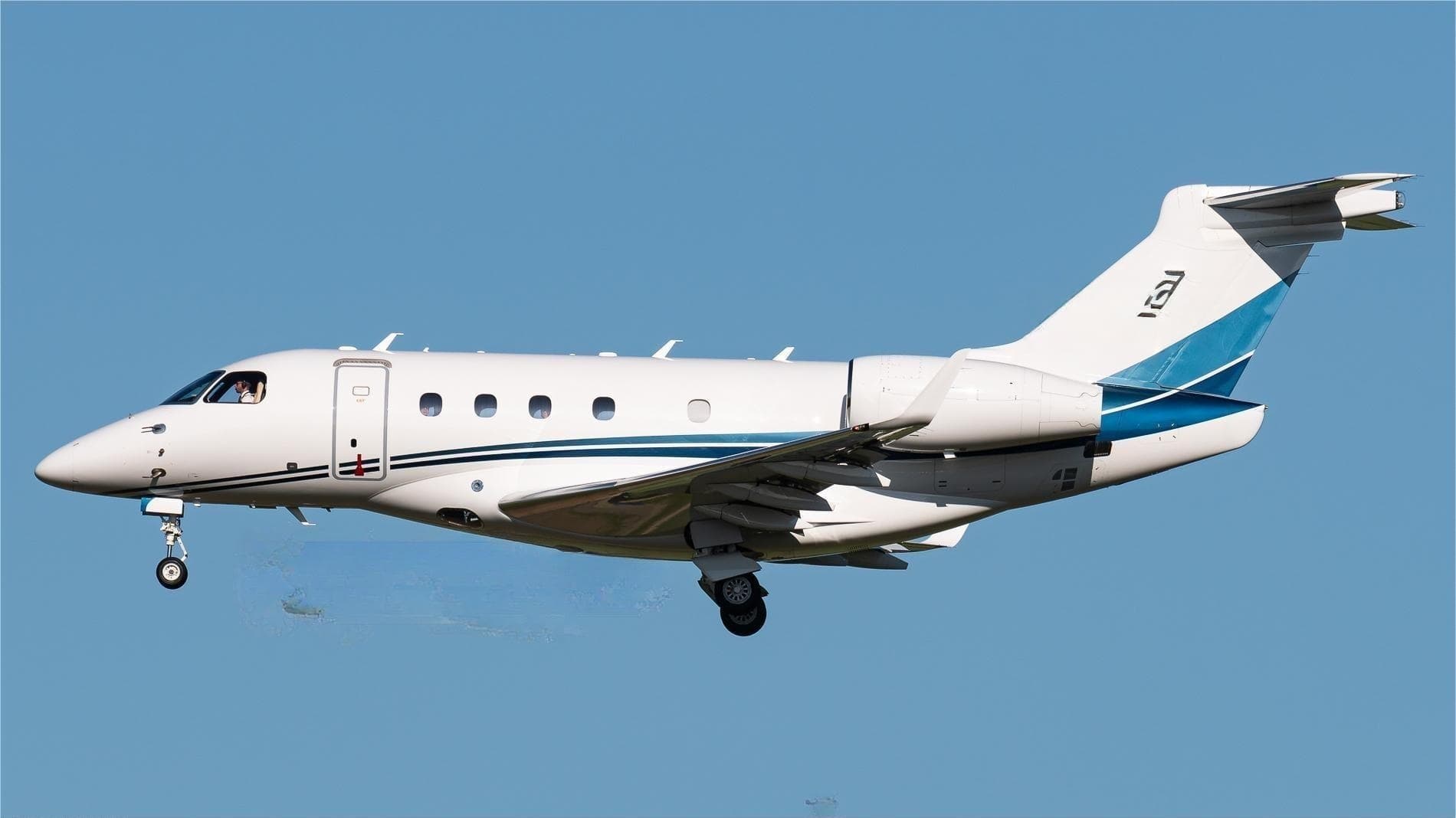 Tue, Nov 3TodayBrusselsEBBR · Brussels AirportIzmirLTBJ · Adnan Menderes International AirportLegacy 4508—On request3NovBrussels → IzmirEBBR → LTBJ · TodayLegacy 450 · 8 seatsOn request
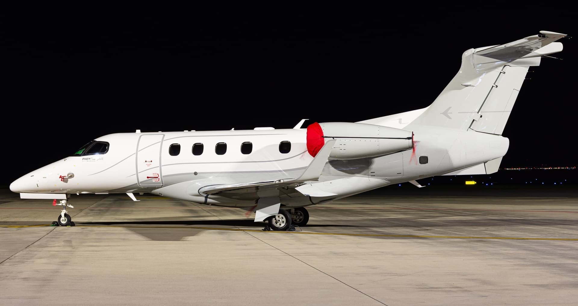 Mon, Nov 16in 13 daysCiudad RealLEIZ · La Perdiz - Torre De Juan Abad AirportIzmirLTBJ · Adnan Menderes International AirportPhenom 3009—On request16NovCiudad Real → IzmirLEIZ → LTBJ · in 13 daysPhenom 300 · 9 seatsOn request
 EBBR · Brussels Airport
 LTBJ · Adnan Menderes International Airport
 LEIZ · La Perdiz - Torre De Juan Abad Airport
* Total price incl. 10% service fee, converted to your selected currency. Price subject to operator confirmation.
Map: Izmir Airport
View the location of Izmir – ADB/LTBJ. Zoom in to explore the area around the airport.
About the airport
Adnan Menderes International Airport (ADB/LTBJ) is the key private jet gateway for Izmir. PrivJet gives you instant access to charter flights and empty legs: fast, discreet and globally connected.
LTBJ airport FAQ
Are there any restrictions at Izmir airport (LTBJ) today?
There are currently 11 valid NOTAMs for Izmir (LTBJ). According to NOTAM, at least one runway or the aerodrome itself is closed. Affected: Runway: closed; Taxiway: closed; Aircraft stand: limited to; VOR/DME: unserviceable and 1 more. For information only, not for flight planning or operational use. Always rely on an official pre-flight briefing. This list may be incomplete or out of date.
What is the weather at Izmir airport (LTBJ)?
According to the latest weather report for LTBJ (METAR, 03 Nov, 09:50 UTC): Poor visibility, instrument conditions (IFR). Wind 6 kt (11 km/h) from south (180°), visibility 4 km, temperature 16 °C (dew point 16 °C). Rain showers. For information only, not for flight planning. Weather can change quickly; always rely on official reports.
How long are the runways at Izmir airport (LTBJ)?
Izmir (LTBJ) has 2 runways: runway 16L/34R with 3,240 m (10,630 ft), asphalt and runway 16R/34L with 3,240 m (10,630 ft), concrete. The longest is 3,240 m.
What are the radio frequencies at Izmir airport (LTBJ)?
Frequencies at LTBJ: Tower 118.1 MHz, Ground 121.9 MHz and ATIS 129.2 MHz. For information only. Always rely on the published AIP.
What are the airport codes of Adnan Menderes International Airport?
The ICAO code is LTBJ and the IATA code is ADB. ICAO codes are used by air traffic control and pilots, e.g. in flight plans; IATA codes appear on tickets and baggage tags.
What is the elevation of LTBJ airport?
Adnan Menderes International Airport sits at 412 ft (126 m) above sea level. Local time zone: Europe/Istanbul.
Can I fly to LTBJ by private jet?
Whether a private jet can operate into Adnan Menderes International Airport depends on runway length, opening hours, customs and immigration rules as well as slot and handling availability, among other things. PrivJet checks this with the operating carrier for every request.
Are there empty legs from or to LTBJ?
There are currently 0 empty legs departing from and 2 arriving at Adnan Menderes International Airport. Empty legs are repositioning flights at heavily reduced prices; the list is updated several times a day.