Puerto Vallarta Licenciado Gustavo Diaz Ordaz Airport (MMPR / PVR)
Empty legs and charters from Puerto Vallarta
MMPR airport at a glance
- ICAO code
- MMPR
- IATA code
- PVR
- City
- Puerto Vallarta
- Region
- Jalisco
- Country
- Mexico
- Elevation
- 23 ft (7 m)
- Time zone
- America/Bahia Banderas (UTC-6)
- Coordinates
- 20.6801° N, 105.2540° W
- Empty legs from
- 20
- Empty legs to
- 23
Weather & airport info MMPR
Current weather
Good visual conditions (VFR)observed 03 Nov, 04:41 UTC- Wind
- 2 kt (4 km/h) from northeast (50°)
- Visibility
- 10 km or more
- Clouds
- no significant clouds
- Temperature
- 26 °C (dew point 24 °C)
- Pressure (QNH)
- 1,012 hPa
Original weather report (METAR)
METAR MMPR 030441Z 05002KT 8SM SKC 26/24 A2989 RMK HZY
Forecast (TAF)
- 03 Nov, 06:00–13:00 UTCCalm · visibility 10 km or more · scattered clouds at 3,000 ft, scattered clouds at 25,000 ft
- 03 Nov, 13:00–19:00 UTCfrom6 kt (11 km/h) from east (90°) · visibility 10 km or more · no significant clouds
- 03 Nov, 19:00–04:00 UTCfrom10 kt (19 km/h) from west-northwest (300°) · visibility 10 km or more · scattered clouds at 3,000 ft
- 04 Nov, 04:00–06:00 UTCfrom5 kt (9 km/h) from north (360°) · visibility 10 km or more · broken clouds at 4,000 ft
Original forecast (TAF)
TAF MMPR 030524Z 0306/0406 00000KT P6SM SCT030 SCT250 TX31/0318Z TN25/0312Z FM031300 09006KT P6SM SKC FM031900 30010KT P6SM SCT030 FM040400 36005KT P6SM BKN040
Airport
- Elevation
- 23 ft (7 m)
- Sunrise / Sunset
- 07:04 / 18:24 local time
Runways
| Runway | Length | Surface | Lighted |
|---|---|---|---|
| 04/22 | 3,100 m (10,171 ft) | asphalt | yes |
Radio frequencies
- Approach: 121.3
- ATIS: 127.5
- Tower: 118.5
For information only, not for flight planning. Weather can change quickly; always rely on official reports. Sources: aviationweather.gov (NOAA), OurAirports.
Airport map MMPR
Full screen →Runways white, taxiways yellow with designators, closed taxiways and runways per NOTAM in red.
Closed per NOTAM: RWY 4/22
Official charts
Aerodrome, approach and ground charts are published by the national air navigation service in its AIP:
EUROCONTROL: nationale AIS-Websites →For information only, not for navigation. Always use current official charts and NOTAMs.
Current NOTAMs for MMPR(3)
NOTAMs (Notices to Air Missions) announce short-term changes at an airport: closed runways or taxiways, unserviceable approach aids, obstacles, airspace restrictions.
- ClosedRunway: closedB3818/26· until 12 Nov, 13:15 UTC
Runway 04/22 is closed. This means aircraft cannot use this runway at the moment.
Show original text
RWY 04/22 CLSD
B3818/26 NOTAMR B3677/26

 Q) MMFR/QMRLC/IV/NBO/A/000/999/2041N10515W002

 A) MMPR

 B) 2611010800

 C) 2611121315

 D) 01 0800-1200, 12 1215-1315

 E) RWY 04/22 CLSD
Hours: 01 0800-1200, 12 1215-1315
- NoticeObstacle: erectedB3867/26· from 03 Nov, 14:00 UTC · until 04 Nov, 23:59 UTC
A building structure (BST) 50 meters high is an obstacle near runway 22, 371.85 meters from the runway centerline.
Show original text
BST 50M HGT GEOGRAPHIC SITUATION: 204103.61N 1051434.99W - 204102.83N 1051435.21W - 204102.19N 1051433.94W - 204101.91N 1051434.34W 371.85M FM THE CENTERLINE RWY 22
B3867/26 NOTAMN Q) MMFR/QOBCE/IV/M/AE/000/999/2041N10515W002 A) MMPR B) 2611031400 C) 2611042359 E) BST 50M HGT GEOGRAPHIC SITUATION: 204103.61N 1051434.99W - 204102.83N 1051435.21W - 204102.19N 1051433.94W - 204101.91N 1051434.34W 371.85M FM THE CENTERLINE RWY 22 - NoticeOtherB2623/26· until 31 Dec, 23:00 UTC
Clearance Delivery is operating on frequency 121.9 MHz.
Show original text
CLEARANCE DELIVERY OPR IN FREQ 121.9MHZ
B2623/26 NOTAMN

 Q) MMFR/QXXXX////000/999/2041N10515W005

 A) MMPR

 B) 2610081600

 C) 2612312300

 D) DLY 1600-2300

 E) CLEARANCE DELIVERY OPR IN FREQ 121.9MHZ
Hours: DLY 1600-2300
For information only, not for flight planning or operational use. Always rely on an official pre-flight briefing. This list may be incomplete or out of date. Explanations and expanded abbreviations are generated automatically. The original text is authoritative. Source: FAA NOTAM Management Service (SWIM).
Private jet traffic in Licenciado Gustavo Diaz Ordaz International Airport (last 30 days)
- Arrivals
- 204
- Departures
- 162
- Different jets
- 165
Most frequent origins: Del Norte International Airport (11), General Mariano Escobedo International Airport (8), Van Nuys Airport (4), William P Hobby Airport (3).
Most frequent destinations: Del Norte International Airport (8), Tucson International Airport (6), Los Angeles International Airport (4), William P Hobby Airport (4), Brown Field Municipal Airport (4).
Most common aircraft types: Hawker 800/900 (42), Pilatus PC-12 (35), Cessna Citation Latitude (25), Cessna Citation CJ3 (23), Embraer Phenom 300 (23).
Friday is the busiest day.
Our own analysis of public ADS-B signals from business jets. Not every flight is received, and jets with a removal request are excluded.
Empty legs from MMPR
20 departures available
- Wed, Nov 1114:10Puerto VallartaMMPR · Puerto Vallarta International AirportVan NuysKVNY · Van Nuys AirportGulfstream G55014—$58,30011NovPuerto Vallarta → Van NuysMMPR → KVNY · 14:10Gulfstream G550 · 14 seats$58,300
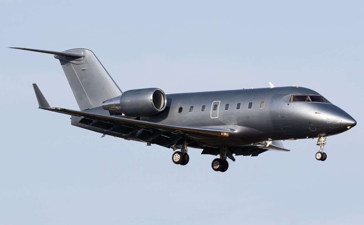 Mon, Nov 16in 13 daysPuerto VallartaMMPR · Licenciado Gustavo Diaz Ordaz International AirportEverettKPAE · Snohomish County (Paine Field) AirportChallenger 60412—On request16NovPuerto Vallarta → EverettMMPR → KPAE · in 13 daysChallenger 604 · 12 seatsOn request
 Mon, Nov 2319:17Puerto VallartaMMPR · Licenciado Gustavo Diaz Ordaz International AirportFort WorthKFTW · Fort Worth Meacham International AirportBombardier Challenger 60412h 12m$20,69823NovPuerto Vallarta → Fort WorthMMPR → KFTW · 19:17Bombardier Challenger 604 · 1 seat · 2h 12m$20,698
- Mon, Nov 23in 20 daysPuerto VallartaMMPR · Puerto Vallarta International AirportDallasKDAL · Dallas Love FieldBombardier Challenger 60410—$19,86623NovPuerto Vallarta → DallasMMPR → KDAL · in 20 daysBombardier Challenger 604 · 10 seats$19,866
- Tue, Nov 2400:12Puerto VallartaMMPR · Lic. Gustavo Ordaz IntlDallasKDAL · Dallas Love FieldBombardier Challenger 60410—$25,41024NovPuerto Vallarta → DallasMMPR → KDAL · 00:12Bombardier Challenger 604 · 10 seats$25,410
- Tue, Nov 2400:17Puerto VallartaMMPR · Lic. Gustavo Ordaz IntlFort WorthKFTW · Fort Worth Meacham IntlBombardier Challenger 60410—$25,41024NovPuerto Vallarta → Fort WorthMMPR → KFTW · 00:17Bombardier Challenger 604 · 10 seats$25,410
- Sat, Dec 19in 46 daysPuerto VallartaMMPR · Licenciado Gustavo Diaz Ordaz International AirportDallasKDAL · Dallas Love FieldDassault Falcon 900C122h 18mOn request19DecPuerto Vallarta → DallasMMPR → KDAL · in 46 daysDassault Falcon 900C · 12 seats · 2h 18mOn request
- Sun, Dec 20in 47 daysPuerto VallartaMMPR · Licenciado Gustavo Diaz Ordaz International AirportCarlsbadKCRQ · Mc Clellan-Palomar AirportBombardier Challenger 601——On request20DecPuerto Vallarta → CarlsbadMMPR → KCRQ · in 47 daysBombardier Challenger 601On request
- Sun, Dec 2000:06Puerto VallartaMMPR · Lic. Gustavo Ordaz IntlLondonCYXUGulfstream G2009—On request20DecPuerto Vallarta → LondonMMPR → CYXU · 00:06Gulfstream G200 · 9 seatsOn request
 MMPR · Puerto Vallarta International Airport
 KVNY · Van Nuys Airport
 CYXU
* Total price incl. 10% service fee, converted to your selected currency. Price subject to operator confirmation.
Empty legs to MMPR
23 arrivals available
- Tue, Nov 3TodayNashvilleKBNA · Nashville IntlPuerto VallartaMMPR · Lic Gustavo Diaz Ordaz IntlCessna Citation Latitude—3h 45mOn request3NovNashville → Puerto VallartaKBNA → MMPR · TodayCessna Citation Latitude · 3h 45mOn request
 Tue, Nov 310:18PhoenixKPHX · Phoenix Sky Harbor International AirportPuerto VallartaMMPR · Licenciado Gustavo Diaz Ordaz International AirportCessna Citation Latitude12hOn request3NovPhoenix → Puerto VallartaKPHX → MMPR · 10:18Cessna Citation Latitude · 1 seat · 2hOn request
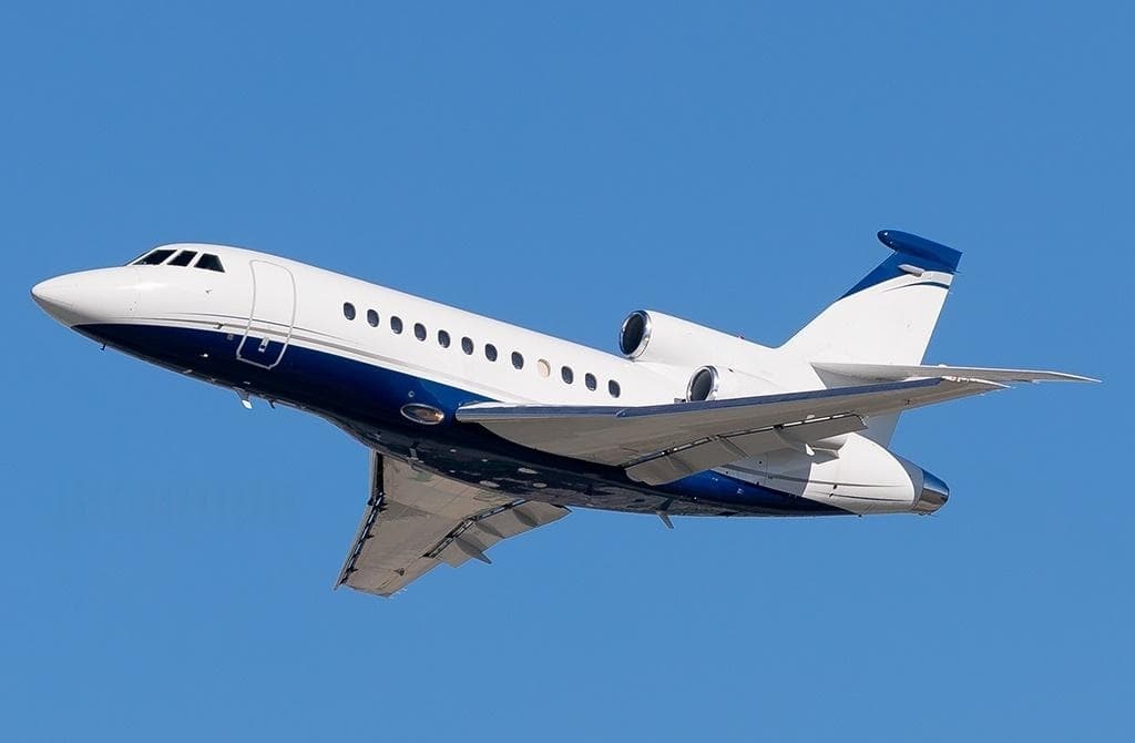 Sun, Nov 8in 5 daysPunta CanaMDPC · Punta Cana International AirportPuerto VallartaMMPR · Licenciado Gustavo Diaz Ordaz International AirportFalcon 900B12—$58,6308NovPunta Cana → Puerto VallartaMDPC → MMPR · in 5 daysFalcon 900B · 12 seats$58,630
- Sun, Nov 811:29Las VegasKLAS · Harry Reid IntlPuerto VallartaMMPR · Lic. Gustavo Ordaz IntlBombardier Learjet 608—On request8NovLas Vegas → Puerto VallartaKLAS → MMPR · 11:29Bombardier Learjet 60 · 8 seatsOn request
- Wed, Nov 11in 8 daysDallasKADS · Addison AirportPuerto VallartaMMPR · Licenciado Gustavo Diaz Ordaz International AirportCessna Citation XLS82h 50mOn request11NovDallas → Puerto VallartaKADS → MMPR · in 8 daysCessna Citation XLS · 8 seats · 2h 50mOn request
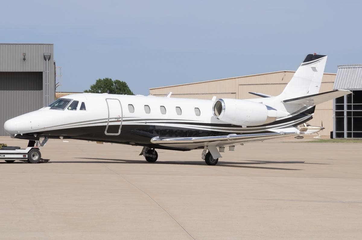 Thu, Nov 12in 9 daysDallasKADS · Addison AirportPuerto VallartaMMPR · Licenciado Gustavo Diaz Ordaz International AirportCitation XLS9—On request12NovDallas → Puerto VallartaKADS → MMPR · in 9 daysCitation XLS · 9 seatsOn request
 Fri, Nov 1320:00DallasKADS · Addison AirportPuerto VallartaMMPR · Licenciado Gustavo Diaz Ordaz International AirportCessna Citation XLS12h 24mOn request13NovDallas → Puerto VallartaKADS → MMPR · 20:00Cessna Citation XLS · 1 seat · 2h 24mOn request
- Sat, Nov 1415:10DallasKADS · AddisonPuerto VallartaMMPR · Lic. Gustavo Ordaz IntlCessna Citation XLS8—On request14NovDallas → Puerto VallartaKADS → MMPR · 15:10Cessna Citation XLS · 8 seatsOn request
- Sat, Nov 2816:30Fort WorthKFTW · Fort Worth Meacham International AirportPuerto VallartaMMPR · Licenciado Gustavo Diaz Ordaz International AirportBombardier Challenger 60412h 18m$20,69828NovFort Worth → Puerto VallartaKFTW → MMPR · 16:30Bombardier Challenger 604 · 1 seat · 2h 18m$20,698
 MDPC · Punta Cana International Airport
* Total price incl. 10% service fee, converted to your selected currency. Price subject to operator confirmation.
Map: Puerto Vallarta Airport
View the location of Puerto Vallarta – PVR/MMPR. Zoom in to explore the area around the airport.
About the airport
Licenciado Gustavo Diaz Ordaz International Airport (PVR/MMPR) is the key private jet gateway for Puerto Vallarta. PrivJet gives you instant access to charter flights and empty legs: fast, discreet and globally connected.
MMPR airport FAQ
Are there any restrictions at Puerto Vallarta airport (MMPR) today?
There are currently 2 valid NOTAMs for Puerto Vallarta (MMPR). According to NOTAM, at least one runway or the aerodrome itself is closed. Affected: Runway: closed. 1 more NOTAM starts in the coming days. For information only, not for flight planning or operational use. Always rely on an official pre-flight briefing. This list may be incomplete or out of date.
What is the weather at Puerto Vallarta airport (MMPR)?
According to the latest weather report for MMPR (METAR, 03 Nov, 04:41 UTC): Good visual conditions (VFR). Wind 2 kt (4 km/h) from northeast (50°), visibility 10 km or more, temperature 26 °C (dew point 24 °C). For information only, not for flight planning. Weather can change quickly; always rely on official reports.
How long are the runways at Puerto Vallarta airport (MMPR)?
Puerto Vallarta (MMPR) has one runway: runway 04/22 with 3,100 m (10,171 ft), asphalt.
What are the radio frequencies at Puerto Vallarta airport (MMPR)?
Frequencies at MMPR: Tower 118.5 MHz and ATIS 127.5 MHz. For information only. Always rely on the published AIP.
What are the airport codes of Licenciado Gustavo Diaz Ordaz International Airport?
The ICAO code is MMPR and the IATA code is PVR. ICAO codes are used by air traffic control and pilots, e.g. in flight plans; IATA codes appear on tickets and baggage tags.
What is the elevation of MMPR airport?
Licenciado Gustavo Diaz Ordaz International Airport sits at 23 ft (7 m) above sea level. Local time zone: America/Bahia Banderas.
Can I fly to MMPR by private jet?
Whether a private jet can operate into Licenciado Gustavo Diaz Ordaz International Airport depends on runway length, opening hours, customs and immigration rules as well as slot and handling availability, among other things. PrivJet checks this with the operating carrier for every request.
Are there empty legs from or to MMPR?
There are currently 20 empty legs departing from and 23 arriving at Licenciado Gustavo Diaz Ordaz International Airport. Empty legs are repositioning flights at heavily reduced prices; the list is updated several times a day.