Toluca Licenciado Adolfo Lopez Mateos Airport (MMTO / TLC)
Empty legs and charters from Toluca
MMTO airport at a glance
- ICAO code
- MMTO
- IATA code
- TLC
- City
- Toluca
- Region
- Mexico
- Country
- Mexico
- Elevation
- 8,466 ft (2,580 m)
- Time zone
- America/Mexico City (UTC-6)
- Coordinates
- 19.3371° N, 99.5660° W
- Empty legs from
- 2
- Empty legs to
- 4
Weather & airport info MMTO
Current weather
Good visual conditions (VFR)observed 03 Nov, 09:40 UTC- Wind
- Calm
- Visibility
- 10 km or more
- Clouds
- no significant clouds
- Temperature
- 5 °C (dew point 4 °C)
- Pressure (QNH)
- 1,028 hPa
Original weather report (METAR)
METAR MMTO 030940Z 00000KT 8SM SKC 05/04 A3036
Forecast (TAF)
- 03 Nov, 10:00–15:00 UTCbecomingCalm · visibility 5 km · Mist · scattered clouds at 1,000 ft
- 03 Nov, 11:00–15:00 UTCtemporarilyvisibility 0.8 km · Fog · sky obscured, vertical visibility 20000 ft
- 03 Nov, 15:00–16:00 UTCfromCalm · visibility 3 km · Mist · broken clouds at 500 ft
- 03 Nov, 16:00–17:00 UTCfromCalm · visibility 5 km · Haze · scattered clouds at 1,000 ft
- 03 Nov, 17:00–04:00 UTCfrom8 kt (15 km/h) from north-northwest (330°) · visibility 10 km or more · no significant clouds
Original forecast (TAF)
TAF COR MMTO 030605Z 0306/0406 00000KT 6SM HZ SKC TX22/0321Z TN08/0312Z BECMG 0310/0311 00000KT 3SM BR SCT010 TEMPO 0311/0315 1/2SM FG VV002 FM031500 00000KT 2SM BR BKN005 FM031600 00000KT 3SM HZ SCT010 FM031700 33008KT P6SM SKC FM040400 00000KT 6SM HZ SKC
Airport
- Elevation
- 8,466 ft (2,580 m)
- Sunrise / Sunset
- 06:39 / 18:03 local time
Runways
| Runway | Length | Surface | Lighted |
|---|---|---|---|
| 15/33 | 4,200 m (13,780 ft) | asphalt | yes |
Radio frequencies
- Approach: 128.9
- ATIS: 127.8
- Tower: 118
For information only, not for flight planning. Weather can change quickly; always rely on official reports. Sources: aviationweather.gov (NOAA), OurAirports.
Airport map MMTO
Full screen →Runways white, taxiways yellow with designators, closed taxiways and runways per NOTAM in red.
Closed per NOTAM: TWY C
Official charts
Aerodrome, approach and ground charts are published by the national air navigation service in its AIP:
EUROCONTROL: nationale AIS-Websites →For information only, not for navigation. Always use current official charts and NOTAMs.
Current NOTAMs for MMTO(4)
NOTAMs (Notices to Air Missions) announce short-term changes at an airport: closed runways or taxiways, unserviceable approach aids, obstacles, airspace restrictions.
- ClosedRunway: closedB3723/26· from 04 Nov, 18:30 UTC · until 27 Nov, 19:30 UTC
Runway 15/33 at Toluca airport is closed.
Show original text
RWY 15/33 CLSD
B3723/26 NOTAMN

 Q) MMFR/QMRLC/IV/NBO/A/000/999/1920N09934W002

 A) MMTO

 B) 2611041830

 C) 2611271930

 D) 4 5 6 9 11 12 18 20 23 25 27 1830-1930

 E) RWY 15/33 CLSD
Hours: 4 5 6 9 11 12 18 20 23 25 27 1830-1930
- ClosedTaxiway: closedB3885/26· until 03 Nov, 20:00 UTC
Taxiway C is closed. Aircraft cannot use this part of the taxiway system.
Show original text
TWY C CLSD
B3885/26 NOTAMN

 Q) MMFR/QMXLC/IV/M/A/000/999/1920N09934W002

 A) MMTO

 B) 2611030100

 C) 2611032000

 E) TWY C CLSD
- ClosedAircraft stand: closedB3419/26· until 29 Nov, 00:00 UTC
Aircraft stand 5 on the commercial aviation apron is closed.
Show original text
ACFT STAND 5 COMMERCIAL AVIATION APN CLSD
B3419/26 NOTAMR B3316/26

 Q) MMFR/QMPLC/IV/BO/A/000/999/1920N09934W002

 A) MMTO

 B) 2610261400

 C) 2611290000

 E) ACFT STAND 5 COMMERCIAL AVIATION APN CLSD
- NoticeAircraft stand: limited toA9583/26· until 29 Nov, 00:00 UTC
Aircraft stands 4 and 6 on the commercial aviation apron are only for aircraft with a towbar.
Show original text
ACFT STANDS 4 AND 6 COMMERCIAL AVIATION APN ONLY FOR ACFT WITH TOW
A9583/26 NOTAMN

 Q) MMFR/QMPLT/IV/M/A/000/999/1920N09934W002

 A) MMTO

 B) 2610262027

 C) 2611290000

 E) ACFT STANDS 4 AND 6 COMMERCIAL AVIATION APN ONLY FOR ACFT WITH TOW
For information only, not for flight planning or operational use. Always rely on an official pre-flight briefing. This list may be incomplete or out of date. Explanations and expanded abbreviations are generated automatically. The original text is authoritative. Source: FAA NOTAM Management Service (SWIM).
Charter operators based here
Operators with a base at this airport.
- Transportes Aereos PegasoCiudad del Carmen International (MMCE) · Light jet, Helicopter
- Aerolineas EjecutivasLight jet, Super midsize jet, Helicopter
- Fly AcrossLight jet, Midsize jet, Super midsize jet
- JetsTimeMidsize jet, Heavy jet
- FlyMexLight jet, Midsize jet, Super midsize jet
- Patriot AviationLight jet, Midsize jet, Super midsize jet
- Performance AirTurboprop, Light jet, Midsize jet
- Aero J.L.Light jet, Midsize jet, Heavy jet
- AvemexTurboprop, Light jet, Midsize jet
- Servicios Aereos EstrellaTurboprop, Light jet, Midsize jet
- ARE Wings / Book a JetLight jet, Super midsize jet, Heavy jet
- AerovicsLight jet, Heavy jet
- ND AerotaxisTurboprop, Light jet, Super midsize jet
- Skyjets & SupportLight jet, Midsize jet
- Eurus AviationSuper midsize jet
- Fly Business AviationMidsize jet, Super midsize jet
- HeliejecutivoMidsize jet, Super midsize jet, Helicopter
- JetLifeLight jet, Super midsize jet, Helicopter
- Aerotransportes EmpresarialesSuper midsize jet, Heavy jet
- Comfort Jet ServicesMidsize jet
- Commander MexicanaHeavy jet, Helicopter
- Corporacion Aero AngelesHeavy jet
- JetproLight jet
- Potosina del AireMonterrey (Del Norte Intl) (MMAN) · Light jet
- STAMMexico City (Benito Juarez Intl) (MMMX) · Super midsize jet, Helicopter
- Taxi Aereo de MexicoMidsize jet, Super midsize jet
- Transportes La PazTurboprop, Super midsize jet
- Aeromundo EjecutivoHeavy jet
- Airmex (Mexico Transportes Aereos)Heavy jet
- Comercial AereaHeavy jet
Empty legs from MMTO
2 departures available
 Sat, Nov 14in 11 daysMexico CityMMTO · Licenciado Adolfo Lopez Mateos International AirportHoustonKHOU · William P Hobby AirportChallenger 6049—$20,97314NovMexico City → HoustonMMTO → KHOU · in 11 daysChallenger 604 · 9 seats$20,973
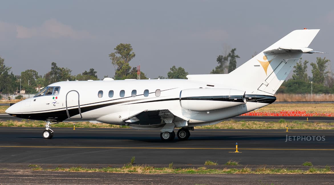 Mon, Nov 16in 13 daysMexico CityMMTO · Licenciado Adolfo Lopez Mateos International AirportManzanilloMMZO · Playa De Oro International AirportHawker 800XP8—$3,06616NovMexico City → ManzanilloMMTO → MMZO · in 13 daysHawker 800XP · 8 seats$3,066
 MMTO · Licenciado Adolfo Lopez Mateos International Airport
 KHOU · William P Hobby Airport
* Total price incl. 10% service fee, converted to your selected currency. Price subject to operator confirmation.
Empty legs to MMTO
4 arrivals available
- Fri, Nov 6in 3 daysSanta AnaKSNA · John Wayne Airport-Orange County AirportTolucaMMTO · Licenciado Adolfo Lopez Mateos International AirportBombardier Inc Challenger 85015—$25,9556NovSanta Ana → TolucaKSNA → MMTO · in 3 daysBombardier Inc Challenger 850 · 15 seats$25,955
- Fri, Nov 6in 3 daysLas VegasKLAS · Harry Reid International AirportTolucaMMTO · Licenciado Adolfo Lopez Mateos International AirportChallenger 85012—On request6NovLas Vegas → TolucaKLAS → MMTO · in 3 daysChallenger 850 · 12 seatsOn request
 Mon, Nov 16in 13 daysMiamiKOPF · Miami-Opa Locka Executive AirportMexico CityMMTO · Licenciado Adolfo Lopez Mateos International AirportGulfstream G45014—On request16NovMiami → Mexico CityKOPF → MMTO · in 13 daysGulfstream G450 · 14 seatsOn request
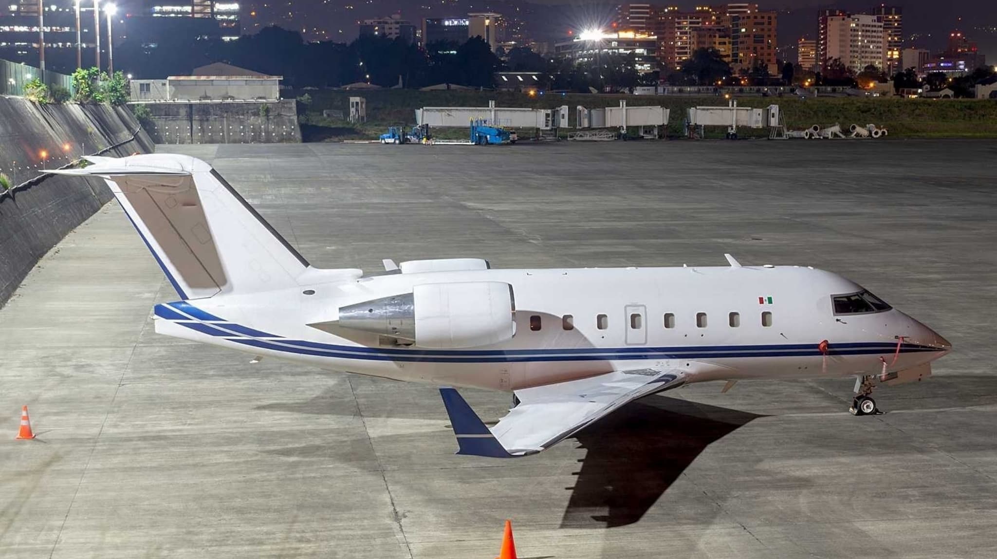 Fri, Nov 20in 17 daysSint MaartenTNCM · Princess Juliana International AirportMexico CityMMTO · Licenciado Adolfo Lopez Mateos International AirportChallenger 60110—On request20NovSint Maarten → Mexico CityTNCM → MMTO · in 17 daysChallenger 601 · 10 seatsOn request
 TNCM · Princess Juliana International Airport
* Total price incl. 10% service fee, converted to your selected currency. Price subject to operator confirmation.
Map: Toluca Airport
View the location of Toluca – TLC/MMTO. Zoom in to explore the area around the airport.
About the airport
Licenciado Adolfo Lopez Mateos International Airport (TLC/MMTO) is the key private jet gateway for Toluca. PrivJet gives you instant access to charter flights and empty legs: fast, discreet and globally connected.
MMTO airport FAQ
Are there any restrictions at Toluca airport (MMTO) today?
There are currently 3 valid NOTAMs for Toluca (MMTO). Affected: Taxiway: closed; Aircraft stand: closed. 1 more NOTAM starts in the coming days. For information only, not for flight planning or operational use. Always rely on an official pre-flight briefing. This list may be incomplete or out of date.
What is the weather at Toluca airport (MMTO)?
According to the latest weather report for MMTO (METAR, 03 Nov, 09:40 UTC): Good visual conditions (VFR). Wind Calm, visibility 10 km or more, temperature 5 °C (dew point 4 °C). For information only, not for flight planning. Weather can change quickly; always rely on official reports.
How long are the runways at Toluca airport (MMTO)?
Toluca (MMTO) has one runway: runway 15/33 with 4,200 m (13,780 ft), asphalt.
What are the radio frequencies at Toluca airport (MMTO)?
Frequencies at MMTO: Tower 118 MHz and ATIS 127.8 MHz. For information only. Always rely on the published AIP.
What are the airport codes of Licenciado Adolfo Lopez Mateos International Airport?
The ICAO code is MMTO and the IATA code is TLC. ICAO codes are used by air traffic control and pilots, e.g. in flight plans; IATA codes appear on tickets and baggage tags.
What is the elevation of MMTO airport?
Licenciado Adolfo Lopez Mateos International Airport sits at 8,466 ft (2,580 m) above sea level. Local time zone: America/Mexico City.
Can I fly to MMTO by private jet?
Whether a private jet can operate into Licenciado Adolfo Lopez Mateos International Airport depends on runway length, opening hours, customs and immigration rules as well as slot and handling availability, among other things. PrivJet checks this with the operating carrier for every request.
Are there empty legs from or to MMTO?
There are currently 2 empty legs departing from and 4 arriving at Licenciado Adolfo Lopez Mateos International Airport. Empty legs are repositioning flights at heavily reduced prices; the list is updated several times a day.