Honolulu Airport (PHNL / HNL)
Empty legs and charters from Honolulu
PHNL airport at a glance
- ICAO code
- PHNL
- IATA code
- HNL
- City
- Honolulu
- Region
- Hawaii
- Country
- United States
- Elevation
- 13 ft (4 m)
- Time zone
- Pacific/Honolulu (UTC-10)
- Coordinates
- 21.3187° N, 157.9220° W
- Empty legs from
- 6
- Empty legs to
- 3
Weather & airport info PHNL
Current weather
Good visual conditions (VFR)observed 03 Nov, 10:53 UTC- Wind
- 14 kt (26 km/h) from northeast (50°), gusts up to 22 kt
- Visibility
- 10 km or more
- Clouds
- few clouds at 2,500 ft, broken clouds at 4,000 ft
- Temperature
- 24 °C (dew point 18 °C)
- Pressure (QNH)
- 1,019 hPa
Original weather report (METAR)
METAR PHNL 031053Z 05014G22KT 10SM FEW025 BKN040 24/18 A3010 RMK AO2 RAB17E48 SLP191 P0000 T02440183 $
Forecast (TAF)
- 03 Nov, 12:00–19:00 UTC13 kt (24 km/h) from northeast (50°) · visibility 10 km or more · few clouds at 2,500 ft, few clouds at 3,500 ft
- 03 Nov, 19:00–18:00 UTCfrom15 kt (28 km/h) from east-northeast (70°), gusts up to 25 kt · visibility 10 km or more · few clouds at 3,000 ft, scattered clouds at 5,000 ft
Original forecast (TAF)
TAF PHNL 031122Z 0312/0418 05013KT P6SM FEW025 FEW035 FM031900 07015G25KT P6SM FEW030 SCT050
Airport
- Elevation
- 13 ft (4 m)
- Sunrise / Sunset
- 06:35 / 17:54 local time
Runways
| Runway | Length | Surface | Lighted |
|---|---|---|---|
| 08L/26R | 3,767 m (12,360 ft) | asphalt | no |
| 08R/26L | 3,658 m (12,000 ft) | asphalt | no |
| 04R/22L | 2,744 m (9,002 ft) | asphalt | no |
| 04L/22R | 2,120 m (6,955 ft) | asphalt | no |
| 08W/26W | 1,551 m (5,090 ft) | water | no |
| 04W/22W | 914 m (3,000 ft) | water | no |
Radio frequencies
- ATIS: 127.9
- Ground: 121.9
- Tower: 118.1
For information only, not for flight planning. Weather can change quickly; always rely on official reports. Sources: aviationweather.gov (NOAA), OurAirports.
Airport map PHNL
Full screen →Runways white, taxiways yellow with designators, closed taxiways and runways per NOTAM in red.
Closed per NOTAM: RWY 4L/22R, RWY 26R, RWY 8L/26R, RWY 8L, TWY A*, TWY K*, TWY C*, TWY Y*, TWY H* (* partly closed)
Official charts (FAA)
Cycle 2611, valid until 0901Z 11/26/26
Airport diagram (FAA)
Airport diagram (1)
Instrument approaches (19)
- ILS RWY 08L
- ILS Y RWY 04R
- ILS Z RWY 04R
- RNAV (RNP) RWY 26L
- RNAV (RNP) Z RWY 04R
- RNAV (RNP) Z RWY 08L
- RNAV (GPS) RWY 04L
- RNAV (GPS) RWY 08R
- RNAV (GPS) Y RWY 04R
- RNAV (GPS) Y RWY 08L
- LOC RWY 04R
- LOC RWY 08L
- LDA RWY 26L
- VOR OR TACAN RWY 04R
- VOR OR TACAN RWY 08R
- VOR OR TACAN-A
- VOR OR TACAN-B
- KAHE POWER PLANT VISUAL RWY 22L
- WAIALAE GOLF COURSE VISUAL RWY 22L
Departure procedures (13)
Obstacle departure procedures (2)
Hot spots (1)
LAHSO (1)
For information only, not for navigation. Always use current official charts and NOTAMs.
Current NOTAMs for PHNL(60)
NOTAMs (Notices to Air Missions) announce short-term changes at an airport: closed runways or taxiways, unserviceable approach aids, obstacles, airspace restrictions.
- ClosedRunway: closedA4878/26· from 06 Nov, 08:00 UTC · until 06 Nov, 18:00 UTC
Runway 04R/22L at Daniel K. Inouye International Airport is closed.
Show original text
RWY 04R/22L CLSD
A4878/26 NOTAMN
Q) PHZH/QMRLC////000/999/2119N15755W005
A) PHNL
B) 2611060800
C) 2611061800
E) RWY 04R/22L CLSD
- ClosedRunway: closedA4939/26· from 06 Nov, 01:00 UTC · until 06 Nov, 07:59 UTC
Runway 08L/26R is closed.
Show original text
RWY 08L/26R CLSD
A4939/26 NOTAMN
Q) PHZH/QMRLC////000/999/2119N15755W005
A) PHNL
B) 2611060100
C) 2611060759
E) RWY 08L/26R CLSD
- ClosedRunway: closedA4873/26· from 05 Nov, 08:00 UTC · until 05 Nov, 18:00 UTC
Runway 04R/22L at Daniel K. Inouye International Airport is closed. This may affect which runways are used for takeoffs and landings.
Show original text
RWY 04R/22L CLSD
A4873/26 NOTAMN
Q) PHZH/QMRLC////000/999/2119N15755W005
A) PHNL
B) 2611050800
C) 2611051800
E) RWY 04R/22L CLSD
- ClosedRunway: closedA4866/26· from 04 Nov, 08:00 UTC · until 04 Nov, 18:00 UTC
Runway 04R/22L at Daniel K Inouye airport is closed. This means aircraft cannot use this runway at the moment.
Show original text
RWY 04R/22L CLSD
A4866/26 NOTAMN
Q) PHZH/QMRLC////000/999/2119N15755W005
A) PHNL
B) 2611040800
C) 2611041800
E) RWY 04R/22L CLSD
- ClosedRunway: closedA4860/26· until 03 Nov, 18:00 UTC
Runway 04L/22R is closed. This means aircraft cannot use this runway at the moment.
Show original text
RWY 04L/22R CLSD
A4860/26 NOTAMN
Q) PHZH/QMRLC////000/999/2119N15755W005
A) PHNL
B) 2611030800
C) 2611031800
E) RWY 04L/22R CLSD
- ClosedRunway: closedA4845/26· until 09 Nov, 18:00 UTC
Runway 26R is closed to turbojet aircraft. This means that these aircraft cannot use this runway.
Show original text
RWY 26R CLSD TO TURBOJET
A4845/26 NOTAMN
Q) PHZH/QMRLC////000/999/2119N15755W005
A) PHNL
B) 2610291734
C) 2611091800
E) RWY 26R CLSD TO TURBOJET
- ClosedRunway: closedA4843/26· until 09 Nov, 18:00 UTC
Runway 26R is closed for takeoffs, except for aircraft with a wingspan less than 79 feet.
Show original text
RWY 26R CLSD TO TKOF EXC ACFT WINGSPAN LESS THAN 79FT
A4843/26 NOTAMN
Q) PHZH/QMRLC////000/999/2119N15755W005
A) PHNL
B) 2610291731
C) 2611091800
E) RWY 26R CLSD TO TKOF EXC ACFT WINGSPAN LESS THAN 79FT
- ClosedRunway: closedA4841/26· until 09 Nov, 18:00 UTC
Runway 26R closed to LDG
Show original text
RWY 26R CLSD TO LDG
A4841/26 NOTAMN
Q) PHZH/QMRLC////000/999/2119N15755W005
A) PHNL
B) 2610291729
C) 2611091800
E) RWY 26R CLSD TO LDG
52 more NOTAMs
- ClosedRunway: closedA4840/26· until 09 Nov, 18:00 UTC
The east 5360 feet of runway 08L/26R are closed. The declared distances for runway 8L and 26R are as stated.
Show original text
RWY 08L/26R E 5360FT CLSD. DECLARED DIST: RWY 8L TORA 7000FT TODA 7000FT ASDA 7000FT LDA 7000FT. RWY 26R TORA 7000FT TODA 7000FT ASDA 7000FT LDA 0FT.
A4840/26 NOTAMN
Q) PHZH/QMRLC////000/999/2119N15755W005
A) PHNL
B) 2610291728
C) 2611091800
E) RWY 08L/26R E 5360FT CLSD. DECLARED DIST: RWY 8L TORA 7000FT TODA 7000FT
 ASDA 7000FT LDA 7000FT. RWY 26R TORA 7000FT TODA 7000FT ASDA 7000FT LDA 0FT.
- ClosedTaxiway: closedA4865/26· from 06 Nov, 08:00 UTC · until 06 Nov, 16:00 UTC
Taxiway A between Taxiway W and Taxiway K at Daniel K. Inouye International Airport is closed.
Show original text
TWY A BTN TWY W AND TWY K CLSD
A4865/26 NOTAMN
Q) PHZH/QMXLC////000/999/2119N15755W005
A) PHNL
B) 2611060800
C) 2611061600
E) TWY A BTN TWY W AND TWY K CLSD
- Out of serviceRunwayA4872/26· from 06 Nov, 08:00 UTC · until 06 Nov, 14:00 UTC
The BAK-12 arresting system on runway 04R at Daniel K. Inouye International Airport is out of service. This system is used to stop aircraft on the runway in an emergency.
Show original text
RWY 04R BAK-12 ARST SYSTEM U/S
A4872/26 NOTAMN
Q) PHZH/QMRXX////000/999/2119N15755W005
A) PHNL
B) 2611060800
C) 2611061400
E) RWY 04R BAK-12 ARST SYSTEM U/S
- ClosedTaxiway: closedA4879/26· from 06 Nov, 08:00 UTC · until 06 Nov, 18:00 UTC
Taxiway C between the approach end of Runway 04R and Taxiway RT at Daniel K. Inouye International Airport is closed.
Show original text
TWY C BTN APCH END RWY 04R AND TWY RT CLSD
A4879/26 NOTAMN
Q) PHZH/QMXLC////000/999/2119N15755W005
A) PHNL
B) 2611060800
C) 2611061800
E) TWY C BTN APCH END RWY 04R AND TWY RT CLSD
- ClosedTaxiway: closedA4880/26· from 06 Nov, 08:00 UTC · until 06 Nov, 18:00 UTC
Taxiway K between runway 04R/22L and runway 04L/22R closed
Show original text
TWY K BTN RWY 04R/22L AND RWY 04L/22R CLSD
A4880/26 NOTAMN
Q) PHZH/QMXLC////000/999/2119N15755W005
A) PHNL
B) 2611060800
C) 2611061800
E) TWY K BTN RWY 04R/22L AND RWY 04L/22R CLSD
- ClosedTaxiway: closedA4881/26· from 06 Nov, 08:00 UTC · until 06 Nov, 18:00 UTC
Taxiway P between Taxiway C and Runway 04R/22L at Daniel K. Inouye International Airport is closed.
Show original text
TWY P BTN TWY C AND RWY 04R/22L CLSD
A4881/26 NOTAMN
Q) PHZH/QMXLC////000/999/2119N15755W005
A) PHNL
B) 2611060800
C) 2611061800
E) TWY P BTN TWY C AND RWY 04R/22L CLSD
- ClosedTaxiway: closedA4882/26· from 06 Nov, 08:00 UTC · until 06 Nov, 18:00 UTC
Taxiway C between the approach end of Runway 22R and Taxiway Number 1 at Daniel K. Inouye International Airport is closed.
Show original text
TWY C BTN APCH END RWY 22R AND TXL NUMBER 1 CLSD
A4882/26 NOTAMN
Q) PHZH/QMXLC////000/999/2119N15755W005
A) PHNL
B) 2611060800
C) 2611061800
E) TWY C BTN APCH END RWY 22R AND TXL NUMBER 1 CLSD
- Out of serviceILS: unserviceableA4934/26· from 06 Nov, 08:00 UTC · until 06 Nov, 18:00 UTC
The Instrument Landing System (ILS) for runway 08L at Daniel K. Inouye International Airport is out of service. The ILS guides aircraft to the runway in poor visibility.
Show original text
HNL NAV ILS RWY 08L U/S
A4934/26 NOTAMN
Q) PHZH/QICAS////000/999/2119N15755W005
A) PHNL
B) 2611060800
C) 2611061800
E) HNL NAV ILS RWY 08L U/S
- Out of serviceILS: unserviceableA4935/26· from 06 Nov, 08:00 UTC · until 06 Nov, 18:00 UTC
The Instrument Landing System (ILS) for runway 04R at Daniel K. Inouye International Airport is out of service. The ILS guides aircraft to the runway in poor visibility.
Show original text
HNL NAV ILS RWY 04R U/S
A4935/26 NOTAMN
Q) PHZH/QICAS////000/999/2119N15755W005
A) PHNL
B) 2611060800
C) 2611061800
E) HNL NAV ILS RWY 04R U/S
- Out of serviceApproach lighting: unserviceableA4936/26· from 06 Nov, 08:00 UTC · until 06 Nov, 18:00 UTC
The Approach Lighting System (ALS) for runway 04R at Daniel K. Inouye International Airport is out of service.
Show original text
RWY 04R ALS U/S
A4936/26 NOTAMN
Q) PHZH/QLAAS////000/999/2119N15755W005
A) PHNL
B) 2611060800
C) 2611061800
E) RWY 04R ALS U/S
- Out of servicePAPI: unserviceableA4937/26· from 06 Nov, 08:00 UTC · until 06 Nov, 18:00 UTC
The Precision Approach Path Indicator (PAPI) system for runway 04R at Daniel K. Inouye International Airport is out of service.
Show original text
RWY 04R PAPI U/S
A4937/26 NOTAMN
Q) PHZH/QLPAS////000/999/2119N15755W005
A) PHNL
B) 2611060800
C) 2611061800
E) RWY 04R PAPI U/S
- Out of servicePAPI: unserviceableA4938/26· from 06 Nov, 08:00 UTC · until 06 Nov, 18:00 UTC
The Precision Approach Path Indicator (PAPI) system for runway 22L at Daniel K. Inouye International Airport is out of service.
Show original text
RWY 22L PAPI U/S
A4938/26 NOTAMN
Q) PHZH/QLPAS////000/999/2119N15755W005
A) PHNL
B) 2611060800
C) 2611061800
E) RWY 22L PAPI U/S
- Out of serviceRunway end identifier lights: unserviceableA4940/26· from 06 Nov, 08:00 UTC · until 06 Nov, 18:00 UTC
The Runway End Identification Lights (RWY END ID LGT) for runway 22L at Daniel K. Inouye International Airport are out of service.
Show original text
RWY 22L RWY END ID LGT U/S
A4940/26 NOTAMN
Q) PHZH/QLIAS////000/999/2119N15755W005
A) PHNL
B) 2611060800
C) 2611061800
E) RWY 22L RWY END ID LGT U/S
- Out of serviceILS: unserviceableA4931/26· from 06 Nov, 01:00 UTC · until 06 Nov, 07:59 UTC
The instrument landing system (ILS) for runway 08L is out of service. The ILS guides aircraft to the runway in poor visibility.
Show original text
HNL NAV ILS RWY 08L U/S
A4931/26 NOTAMN
Q) PHZH/QICAS////000/999/2119N15755W005
A) PHNL
B) 2611060100
C) 2611060759
E) HNL NAV ILS RWY 08L U/S
- Out of serviceApproach lighting: unserviceableA4932/26· from 06 Nov, 01:00 UTC · until 06 Nov, 07:59 UTC
The approach lighting system (ALS) for runway 08L is out of service. The ALS helps pilots with orientation during approach.
Show original text
RWY 08L ALS U/S
A4932/26 NOTAMN
Q) PHZH/QLAAS////000/999/2119N15755W005
A) PHNL
B) 2611060100
C) 2611060759
E) RWY 08L ALS U/S
- Out of servicePAPI: unserviceableA4933/26· from 06 Nov, 01:00 UTC · until 06 Nov, 07:59 UTC
The precision approach path indicator (PAPI) for runway 08L is out of service. The PAPI helps pilots maintain the correct glide path for landing.
Show original text
RWY 08L PAPI U/S
A4933/26 NOTAMN
Q) PHZH/QLPAS////000/999/2119N15755W005
A) PHNL
B) 2611060100
C) 2611060759
E) RWY 08L PAPI U/S
- Out of serviceWind indicator: not availableA4941/26· from 05 Nov, 17:00 UTC · until 05 Nov, 21:00 UTC
The microburst and wind shear detection system is not available at Daniel K. Inouye International Airport. Microbursts are sudden, strong downdrafts that can be hazardous.
Show original text
SVC MBST/WS DETECTION SYSTEM NOT AVBL
A4941/26 NOTAMN
Q) PHZH/QFWAU////000/999/2119N15755W005
A) PHNL
B) 2611051700
C) 2611052100
E) SVC MBST/WS DETECTION SYSTEM NOT AVBL
- ClosedTaxiway: closedA4864/26· from 05 Nov, 08:00 UTC · until 05 Nov, 16:00 UTC
Taxiway A between Taxiway W and Taxiway K at Daniel K. Inouye International Airport is closed.
Show original text
TWY A BTN TWY W AND TWY K CLSD
A4864/26 NOTAMN
Q) PHZH/QMXLC////000/999/2119N15755W005
A) PHNL
B) 2611050800
C) 2611051600
E) TWY A BTN TWY W AND TWY K CLSD
- ClosedTaxiway: closedA4874/26· from 05 Nov, 08:00 UTC · until 05 Nov, 18:00 UTC
Taxiway C between the approach end of Runway 04R and Taxiway RT at Daniel K. Inouye International Airport is closed.
Show original text
TWY C BTN APCH END RWY 04R AND TWY RT CLSD
A4874/26 NOTAMN
Q) PHZH/QMXLC////000/999/2119N15755W005
A) PHNL
B) 2611050800
C) 2611051800
E) TWY C BTN APCH END RWY 04R AND TWY RT CLSD
- ClosedTaxiway: closedA4875/26· from 05 Nov, 08:00 UTC · until 05 Nov, 18:00 UTC
Taxiway K between Runway 04R/22L and Runway 04L/22R at Daniel K. Inouye International Airport is closed.
Show original text
TWY K BTN RWY 04R/22L AND RWY 04L/22R CLSD
A4875/26 NOTAMN
Q) PHZH/QMXLC////000/999/2119N15755W005
A) PHNL
B) 2611050800
C) 2611051800
E) TWY K BTN RWY 04R/22L AND RWY 04L/22R CLSD
- ClosedTaxiway: closedA4876/26· from 05 Nov, 08:00 UTC · until 05 Nov, 18:00 UTC
Taxiway P between Runway 04R/22L and Taxiway C at Daniel K. Inouye International Airport is closed.
Show original text
TWY P BTN RWY 04R/22L AND TWY C CLSD
A4876/26 NOTAMN
Q) PHZH/QMXLC////000/999/2119N15755W005
A) PHNL
B) 2611050800
C) 2611051800
E) TWY P BTN RWY 04R/22L AND TWY C CLSD
- ClosedTaxiway: closedA4877/26· from 05 Nov, 08:00 UTC · until 05 Nov, 18:00 UTC
Taxiway C between approach END runway 22R and taxilane NUMBER 1 closed
Show original text
TWY C BTN APCH END RWY 22R AND TXL NUMBER 1 CLSD
A4877/26 NOTAMN
Q) PHZH/QMXLC////000/999/2119N15755W005
A) PHNL
B) 2611050800
C) 2611051800
E) TWY C BTN APCH END RWY 22R AND TXL NUMBER 1 CLSD
- Out of serviceILS: unserviceableA4909/26· from 05 Nov, 08:00 UTC · until 05 Nov, 18:00 UTC
The Instrument Landing System (ILS) for runway 08L at Daniel K. Inouye International Airport is out of service. The ILS guides aircraft to the runway in poor visibility.
Show original text
HNL NAV ILS RWY 08L U/S
A4909/26 NOTAMN
Q) PHZH/QICAS////000/999/2119N15755W005
A) PHNL
B) 2611050800
C) 2611051800
E) HNL NAV ILS RWY 08L U/S
- Out of serviceApproach lighting: unserviceableA4912/26· from 05 Nov, 08:00 UTC · until 05 Nov, 18:00 UTC
The approach lighting system (ALS) for runway 04R is out of service. The ALS helps pilots with orientation during approach, especially in poor visibility.
Show original text
RWY 04R ALS U/S
A4912/26 NOTAMN
Q) PHZH/QLAAS////000/999/2119N15755W005
A) PHNL
B) 2611050800
C) 2611051800
E) RWY 04R ALS U/S
- Out of serviceILS: unserviceableA4913/26· from 05 Nov, 08:00 UTC · until 05 Nov, 18:00 UTC
The Instrument Landing System (ILS) for runway 04R at Daniel K. Inouye International Airport is out of service. The ILS guides aircraft to the runway in poor visibility.
Show original text
HNL NAV ILS RWY 04R U/S
A4913/26 NOTAMN
Q) PHZH/QICAS////000/999/2119N15755W005
A) PHNL
B) 2611050800
C) 2611051800
E) HNL NAV ILS RWY 04R U/S
- Out of servicePAPI: unserviceableA4914/26· from 05 Nov, 08:00 UTC · until 05 Nov, 18:00 UTC
The Precision Approach Path Indicator (PAPI) for runway 04R is out of service. The PAPI helps pilots maintain the correct glide path for landing.
Show original text
RWY 04R PAPI U/S
A4914/26 NOTAMN
Q) PHZH/QLPAS////000/999/2119N15755W005
A) PHNL
B) 2611050800
C) 2611051800
E) RWY 04R PAPI U/S
- Out of servicePAPI: unserviceableA4915/26· from 05 Nov, 08:00 UTC · until 05 Nov, 18:00 UTC
The Precision Approach Path Indicator (PAPI) for runway 22L is out of service. The PAPI helps pilots maintain the correct glide path for landing.
Show original text
RWY 22L PAPI U/S
A4915/26 NOTAMN
Q) PHZH/QLPAS////000/999/2119N15755W005
A) PHNL
B) 2611050800
C) 2611051800
E) RWY 22L PAPI U/S
- Out of serviceRunway end identifier lights: unserviceableA4916/26· from 05 Nov, 08:00 UTC · until 05 Nov, 18:00 UTC
The runway end identification lights (RWY END ID LGT) for runway 22L are out of service.
Show original text
RWY 22L RWY END ID LGT U/S
A4916/26 NOTAMN
Q) PHZH/QLIAS////000/999/2119N15755W005
A) PHNL
B) 2611050800
C) 2611051800
E) RWY 22L RWY END ID LGT U/S
- ClosedTaxiway: closedA4863/26· from 04 Nov, 08:00 UTC · until 04 Nov, 16:00 UTC
Taxiway A between taxiway W and taxiway K is closed. Aircraft cannot use this section of the taxiway.
Show original text
TWY A BTN TWY W AND TWY K CLSD
A4863/26 NOTAMN
Q) PHZH/QMXLC////000/999/2119N15755W005
A) PHNL
B) 2611040800
C) 2611041600
E) TWY A BTN TWY W AND TWY K CLSD
- ClosedTaxiway: closedA4867/26· from 04 Nov, 08:00 UTC · until 04 Nov, 18:00 UTC
Taxiway P between taxiway C and runway 04R/22L is closed. Aircraft cannot use this section of the taxiway.
Show original text
TWY P BTN TWY C AND RWY 04R/22L CLSD
A4867/26 NOTAMN
Q) PHZH/QMXLC////000/999/2119N15755W005
A) PHNL
B) 2611040800
C) 2611041800
E) TWY P BTN TWY C AND RWY 04R/22L CLSD
- ClosedTaxiway: closedA4868/26· from 04 Nov, 08:00 UTC · until 04 Nov, 18:00 UTC
Taxiway C between the approach end of runway 04R and taxiway RT is closed. Aircraft cannot use this section of the taxiway.
Show original text
TWY C BTN APCH END RWY 04R AND TWY RT CLSD
A4868/26 NOTAMN
Q) PHZH/QMXLC////000/999/2119N15755W005
A) PHNL
B) 2611040800
C) 2611041800
E) TWY C BTN APCH END RWY 04R AND TWY RT CLSD
- ClosedTaxiway: closedA4869/26· from 04 Nov, 08:00 UTC · until 04 Nov, 18:00 UTC
Taxiway K between runway 04R/22L and runway 04L/22R is closed. Aircraft cannot use this section of the taxiway.
Show original text
TWY K BTN RWY 04R/22L AND RWY 04L/22R CLSD
A4869/26 NOTAMN
Q) PHZH/QMXLC////000/999/2119N15755W005
A) PHNL
B) 2611040800
C) 2611041800
E) TWY K BTN RWY 04R/22L AND RWY 04L/22R CLSD
- ClosedTaxiway: closedA4870/26· from 04 Nov, 08:00 UTC · until 04 Nov, 18:00 UTC
Taxiway C between the approach end of runway 22R and taxiway line number 1 is closed. Aircraft cannot use this section of the taxiway.
Show original text
TWY C BTN APCH END RWY 22R AND TXL NUMBER 1 CLSD
A4870/26 NOTAMN
Q) PHZH/QMXLC////000/999/2119N15755W005
A) PHNL
B) 2611040800
C) 2611041800
E) TWY C BTN APCH END RWY 22R AND TXL NUMBER 1 CLSD
- Out of serviceILS: unserviceableA4897/26· from 04 Nov, 08:00 UTC · until 04 Nov, 18:00 UTC
The instrument landing system (ILS) for runway 08L is out of service. The ILS guides aircraft to the runway in poor visibility.
Show original text
HNL NAV ILS RWY 08L U/S
A4897/26 NOTAMN
Q) PHZH/QICAS////000/999/2119N15755W005
A) PHNL
B) 2611040800
C) 2611041800
E) HNL NAV ILS RWY 08L U/S
- Out of serviceILS: unserviceableA4898/26· from 04 Nov, 08:00 UTC · until 04 Nov, 18:00 UTC
The instrument landing system (ILS) for runway 04R is out of service. The ILS guides aircraft precisely to the runway in poor visibility.
Show original text
HNL NAV ILS RWY 04R U/S
A4898/26 NOTAMN
Q) PHZH/QICAS////000/999/2119N15755W005
A) PHNL
B) 2611040800
C) 2611041800
E) HNL NAV ILS RWY 04R U/S
- Out of serviceApproach lighting: unserviceableA4899/26· from 04 Nov, 08:00 UTC · until 04 Nov, 18:00 UTC
The approach lighting system (ALS) for runway 04R is out of service. Approach lighting helps pilots find the runway in poor visibility.
Show original text
RWY 04R ALS U/S
A4899/26 NOTAMN
Q) PHZH/QLAAS////000/999/2119N15755W005
A) PHNL
B) 2611040800
C) 2611041800
E) RWY 04R ALS U/S
- Out of servicePAPI: unserviceableA4900/26· from 04 Nov, 08:00 UTC · until 04 Nov, 18:00 UTC
The PAPI (Precision Approach Path Indicator) for runway 04R is out of service. The PAPI is a visual aid that helps pilots maintain the correct altitude during approach.
Show original text
RWY 04R PAPI U/S
A4900/26 NOTAMN
Q) PHZH/QLPAS////000/999/2119N15755W005
A) PHNL
B) 2611040800
C) 2611041800
E) RWY 04R PAPI U/S
- Out of servicePAPI: unserviceableA4901/26· from 04 Nov, 08:00 UTC · until 04 Nov, 18:00 UTC
The PAPI (Precision Approach Path Indicator) for runway 22L is out of service. The PAPI is a system that visually guides pilots to the correct glide path for landing.
Show original text
RWY 22L PAPI U/S
A4901/26 NOTAMN
Q) PHZH/QLPAS////000/999/2119N15755W005
A) PHNL
B) 2611040800
C) 2611041800
E) RWY 22L PAPI U/S
- Out of serviceRunway end identifier lights: unserviceableA4902/26· from 04 Nov, 08:00 UTC · until 04 Nov, 18:00 UTC
The runway end identification lights for runway 22L are out of service. These lights help pilots identify the end of the runway in darkness or poor visibility.
Show original text
RWY 22L RWY END ID LGT U/S
A4902/26 NOTAMN
Q) PHZH/QLIAS////000/999/2119N15755W005
A) PHNL
B) 2611040800
C) 2611041800
E) RWY 22L RWY END ID LGT U/S
- ClosedApron: closedA4849/26· from 04 Nov, 06:00 UTC · until 04 Nov, 16:00 UTC
The apron entrance to the South Ramp T Hangar is closed.
Show original text
APRON SOUTH RAMP T HANGAR APN ENTRANCE CLSD
A4849/26 NOTAMN
Q) PHZH/QMNLC////000/999/2119N15755W005
A) PHNL
B) 2611040600
C) 2611041600
E) APRON SOUTH RAMP T HANGAR APN ENTRANCE CLSD
- Out of serviceTACAN: unserviceableA4859/26· from 03 Nov, 18:00 UTC · until 03 Nov, 23:55 UTC
The tactical air navigation (TACAN) system is out of service. TACAN is a navigation system that helps military aircraft determine their position.
Show original text
CKH NAV TACAN U/S
A4859/26 NOTAMN Q) PHZH/QNNAS////000/999/2115N15742W005 A) PHNL B) 2611031800 C) 2611032355 E) CKH NAV TACAN U/S
- Out of serviceILS: unserviceableA4930/26· from 03 Nov, 17:00 UTC · until 03 Nov, 21:00 UTC
The instrument landing system (ILS) for runway 04R at Daniel K. Inouye International airport is out of service. The ILS guides aircraft to the runway in poor visibility.
Show original text
HNL NAV ILS RWY 04R U/S
A4930/26 NOTAMN
Q) PHZH/QICAS////000/999/2119N15755W005
A) PHNL
B) 2611031700
C) 2611032100
E) HNL NAV ILS RWY 04R U/S
- ClosedTaxiway: closedA4851/26· until 03 Nov, 16:00 UTC
Taxiway W is closed between taxiway A and taxiway Z.
Show original text
TWY W BTN TWY A AND TWY Z CLSD
A4851/26 NOTAMN
Q) PHZH/QMXLC////000/999/2119N15755W005
A) PHNL
B) 2611030800
C) 2611031600
E) TWY W BTN TWY A AND TWY Z CLSD
- ClosedTaxiway: closedA4852/26· until 03 Nov, 16:00 UTC
Taxiway A between approach END runway 22R and taxiway K closed
Show original text
TWY A BTN APCH END RWY 22R AND TWY K CLSD
A4852/26 NOTAMN
Q) PHZH/QMXLC////000/999/2119N15755W005
A) PHNL
B) 2611030800
C) 2611031600
E) TWY A BTN APCH END RWY 22R AND TWY K CLSD
- ClosedTaxiway: closedA4861/26· until 03 Nov, 18:00 UTC
Taxiway K between runway 04R/22L and taxiway A is closed. Aircraft cannot use this section of the taxiway.
Show original text
TWY K BTN RWY 04R/22L AND TWY A CLSD
A4861/26 NOTAMN
Q) PHZH/QMXLC////000/999/2119N15755W005
A) PHNL
B) 2611030800
C) 2611031800
E) TWY K BTN RWY 04R/22L AND TWY A CLSD
- ClosedTaxiway: closedA4862/26· until 03 Nov, 16:00 UTC
Taxiway C between the approach end of runway 22L and the approach end of runway 22R is closed. Aircraft cannot use this section of the taxiway.
Show original text
TWY C BTN APCH END RWY 22L AND APCH END RWY 22R CLSD
A4862/26 NOTAMN
Q) PHZH/QMXLC////000/999/2119N15755W005
A) PHNL
B) 2611030800
C) 2611031600
E) TWY C BTN APCH END RWY 22L AND APCH END RWY 22R CLSD
- Out of serviceILS: unserviceableA4893/26· until 03 Nov, 18:00 UTC
The instrument landing system (ILS) for runway 08L is out of service. The ILS guides aircraft to the runway in poor visibility.
Show original text
HNL NAV ILS RWY 08L U/S
A4893/26 NOTAMN
Q) PHZH/QICAS////000/999/2119N15755W005
A) PHNL
B) 2611030800
C) 2611031800
E) HNL NAV ILS RWY 08L U/S
- Out of serviceRunway end identifier lights: unserviceableA4894/26· until 03 Nov, 18:00 UTC
The runway end identification lights (RWY End ID LGT) for runway 22R are out of service. These lights help pilots identify the end of the runway.
Show original text
RWY 22R RWY END ID LGT U/S
A4894/26 NOTAMN
Q) PHZH/QLIAS////000/999/2119N15755W005
A) PHNL
B) 2611030800
C) 2611031800
E) RWY 22R RWY END ID LGT U/S
- Out of servicePAPI: unserviceableA4895/26· until 03 Nov, 18:00 UTC
The PAPI (Precision Approach Path Indicator) for runway 04L is out of service. The PAPI helps pilots find the correct glide path for landing.
Show original text
RWY 04L PAPI U/S
A4895/26 NOTAMN
Q) PHZH/QLPAS////000/999/2119N15755W005
A) PHNL
B) 2611030800
C) 2611031800
E) RWY 04L PAPI U/S
- Out of serviceRunway end identifier lights: unserviceableA4896/26· until 03 Nov, 18:00 UTC
The runway end identification lights for runway 04L are out of service. These lights mark the end of the runway.
Show original text
RWY 04L RWY END ID LGT U/S
A4896/26 NOTAMN
Q) PHZH/QLIAS////000/999/2119N15755W005
A) PHNL
B) 2611030800
C) 2611031800
E) RWY 04L RWY END ID LGT U/S
- ClosedApron: closedA4848/26· until 03 Nov, 16:00 UTC
Apron south ramp T HANGER apron ENTRANCE closed
Show original text
APRON SOUTH RAMP T HANGER APN ENTRANCE CLSD
A4848/26 NOTAMN
Q) PHZH/QMNLC////000/999/2119N15755W005
A) PHNL
B) 2611030600
C) 2611031600
E) APRON SOUTH RAMP T HANGER APN ENTRANCE CLSD
- ClosedOtherM0445/26· until 01 Jan, 16:00 UTC
Hickam Air Force Base Ramp 23 Row is closed due to men and equipment working.
Show original text
HICKAM AIR FORCE BASE RAMP 23 ROW CLOSED DUE TO MEN AND EQUIPMENT WORKING.
M0445/26 NOTAMN
Q) ZHN/QXXXX/IV/NBO/A/000/999/2119N15755W005
A) PHNL
B) 2611021600
C) 2701011600
E) HICKAM AIR FORCE BASE RAMP 23 ROW CLOSED DUE TO MEN AND EQUIPMENT WORKING.
For information only, not for flight planning or operational use. Always rely on an official pre-flight briefing. This list may be incomplete or out of date. Explanations and expanded abbreviations are generated automatically. The original text is authoritative. Source: FAA NOTAM Management Service (SWIM).
Private jet traffic in Honolulu International Airport (last 30 days)
- Arrivals
- 762
- Departures
- 688
- Different jets
- 147
Most frequent origins: Lanai Airport (107), Kona International At Keahole Airport (61), Kalaeloa (John Rodgers Field) Airport (20), Lihue Airport (18), Wheeler Army Airfield (7).
Most frequent destinations: Lanai Airport (174), Kahului Airport (63), Lihue Airport (35), Waimea Kohala Airport (33), Kona International At Keahole Airport (30).
Most common aircraft types: Beechcraft King Air 90 (516), Pilatus PC-12 (479), Bombardier Challenger 600/650 (53), Bombardier Global 6000/6500 (47), Gulfstream G550/GV (39).
Sunday is the busiest day.
Our own analysis of public ADS-B signals from business jets. Not every flight is received, and jets with a removal request are excluded.
Charter operators based here
Operators with a base at this airport.
- Mokulele AirlinesTurboprop
- Lāna‘i AirTurboprop
- PrismJetScottsdale (KSDL) · Light jet, Super midsize jet, Heavy jet
- Emergency AirliftKlamath Falls (Crater Lake-Klamath Regional) (KLMT) · Super midsize jet
- Mid-Pacific JetsLight jet, Super midsize jet
- Pacific Air ChartersPiston aircraft
- George's Aviation ServicesPiston aircraft
- Magnum HelicoptersHelicopter
- Resort AirPiston aircraft
- Royal Pacific AirTurboprop
- Guardian Flight (UT)Anchorage (Ted Stevens International) (PANC) · Turboprop, Light jet
- Transair & Interisland AirwaysTurboprop
- Kamaka AirTurboprop
- Hawaii Life Flight CorporationTurboprop, Helicopter
Empty legs from PHNL
6 departures available
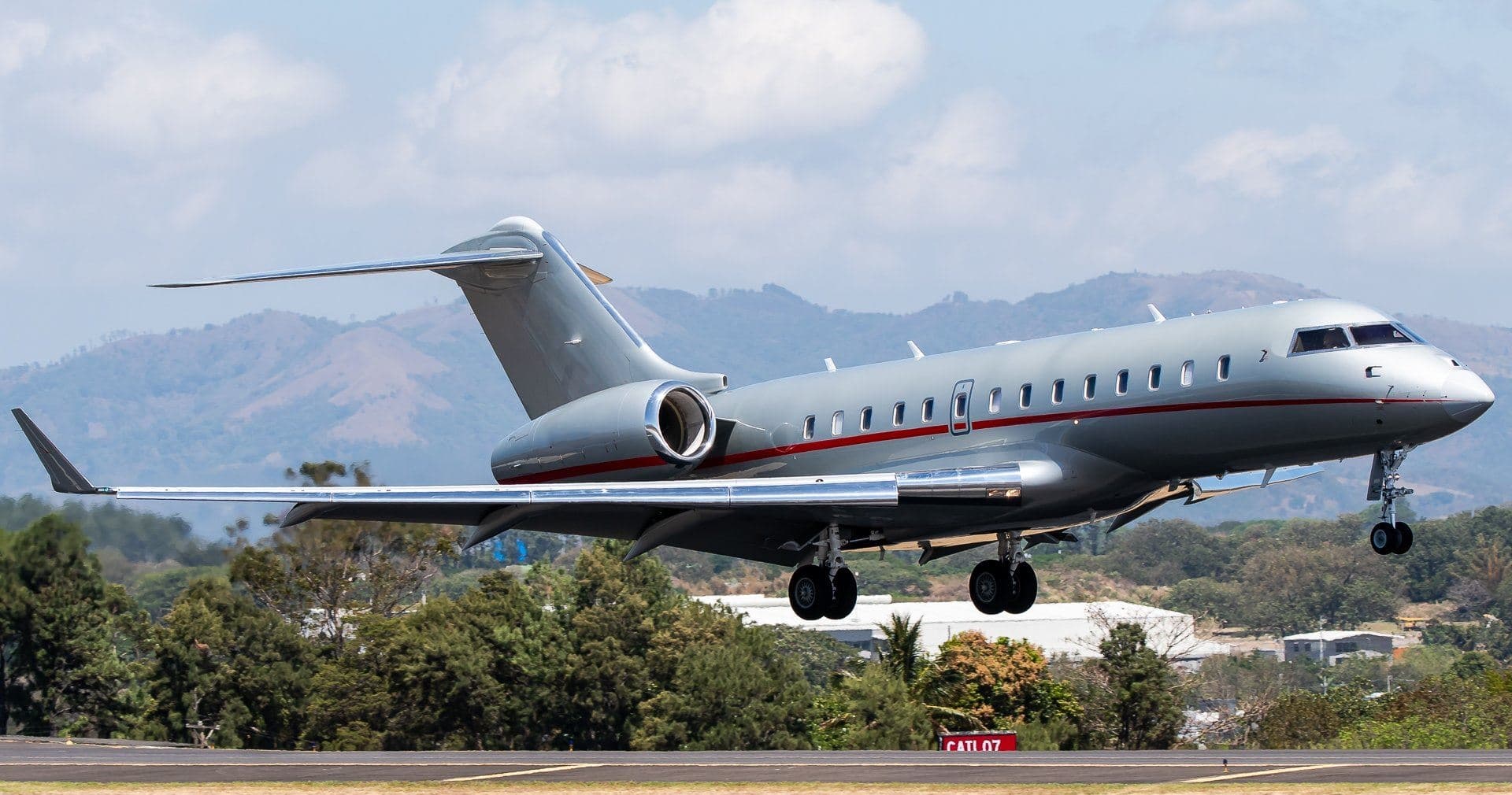 Wed, Nov 4TomorrowHonoluluPHNL · Honolulu International AirportLos AngelesKLAX · Los Angeles International AirportGlobal 500012—On request4NovHonolulu → Los AngelesPHNL → KLAX · TomorrowGlobal 5000 · 12 seatsOn request
- Sun, Nov 15in 12 daysHonoluluPHNL · Honolulu International AirportDallasKDAL · Dallas Love FieldGulfstream G-65011—On request15NovHonolulu → DallasPHNL → KDAL · in 12 daysGulfstream G-650 · 11 seatsOn request
- Tue, Dec 1in 28 daysHonoluluPHNL · Honolulu International AirportKahuluiPHOG · Kahului AirportBombardier Challenger 601——On request1DecHonolulu → KahuluiPHNL → PHOG · in 28 daysBombardier Challenger 601On request
- Tue, Dec 22in 49 daysHonoluluPHNL · Honolulu International AirportLas VegasKHND · Henderson Executive AirportCessna Citation Longitude——On request22DecHonolulu → Las VegasPHNL → KHND · in 49 daysCessna Citation LongitudeOn request
 Tue, Dec 2212:01HonoluluPHNL · Honolulu International AirportLas VegasKLAS · Harry Reid International AirportCessna Citation Longitude14h 36mOn request22DecHonolulu → Las VegasPHNL → KLAS · 12:01Cessna Citation Longitude · 1 seat · 4h 36mOn request
- Sun, Jul 11in 250 daysHonoluluPHNL · Honolulu International AirportKailua/KonaPHKO · Kona International At Keahole AirportDassault Falcon 2000LX1042mOn request11JulHonolulu → Kailua/KonaPHNL → PHKO · in 250 daysDassault Falcon 2000LX · 10 seats · 42mOn request
 PHNL · Honolulu International Airport
* Total price incl. 10% service fee, converted to your selected currency. Price subject to operator confirmation.
Empty legs to PHNL
3 arrivals available
- Sat, Nov 712:01Palm SpringsKPSP · Palm Springs International AirportHonoluluPHNL · Daniel K Inouye International AirportGulfstream G55014—$30,2507NovPalm Springs → HonoluluKPSP → PHNL · 12:01Gulfstream G550 · 14 seats$30,250
- Sat, Nov 7in 4 daysLas VegasKLAS · Harry Reid International AirportHonoluluPHNL · Honolulu International AirportBombardier Challenger 350105h 49m€22,9367NovLas Vegas → HonoluluKLAS → PHNL · in 4 daysBombardier Challenger 350 · 10 seats · 5h 49m€22,936
- Fri, Jan 22in 80 daysCarlsbadKCRQ · Mc Clellan-Palomar AirportHonoluluPHNL · Honolulu International AirportBombardier Challenger 601——On request22JanCarlsbad → HonoluluKCRQ → PHNL · in 80 daysBombardier Challenger 601On request
* Total price incl. 10% service fee, converted to your selected currency. Price subject to operator confirmation.
Map: Honolulu Airport
View the location of Honolulu – HNL/PHNL. Zoom in to explore the area around the airport.
About the airport
Honolulu International Airport (HNL/PHNL) is the key private jet gateway for Honolulu. PrivJet gives you instant access to charter flights and empty legs: fast, discreet and globally connected.
PHNL airport FAQ
Are there any restrictions at Honolulu airport (PHNL) today?
There are currently 54 valid NOTAMs for Honolulu (PHNL). According to NOTAM, at least one runway or the aerodrome itself is closed. Affected: Runway: closed; Taxiway: closed; Apron: closed; Other: closed and 10 more. 46 more NOTAMs start in the coming days. For information only, not for flight planning or operational use. Always rely on an official pre-flight briefing. This list may be incomplete or out of date.
What is the weather at Honolulu airport (PHNL)?
According to the latest weather report for PHNL (METAR, 03 Nov, 10:53 UTC): Good visual conditions (VFR). Wind 14 kt (26 km/h) from northeast (50°), gusts up to 22 kt, visibility 10 km or more, temperature 24 °C (dew point 18 °C). For information only, not for flight planning. Weather can change quickly; always rely on official reports.
How long are the runways at Honolulu airport (PHNL)?
Honolulu (PHNL) has 6 runways: runway 08L/26R with 3,767 m (12,360 ft), asphalt, runway 08R/26L with 3,658 m (12,000 ft), asphalt, runway 04R/22L with 2,744 m (9,002 ft), asphalt, runway 04L/22R with 2,120 m (6,955 ft), asphalt, runway 08W/26W with 1,551 m (5,090 ft), water and runway 04W/22W with 914 m (3,000 ft), water. The longest is 3,767 m.
What are the radio frequencies at Honolulu airport (PHNL)?
Frequencies at PHNL: Tower 118.1 MHz, Ground 121.9 MHz and ATIS 127.9 MHz. For information only. Always rely on the published AIP.
What are the airport codes of Honolulu International Airport?
The ICAO code is PHNL and the IATA code is HNL. ICAO codes are used by air traffic control and pilots, e.g. in flight plans; IATA codes appear on tickets and baggage tags.
What is the elevation of PHNL airport?
Honolulu International Airport sits at 13 ft (4 m) above sea level. Local time zone: Pacific/Honolulu.
Can I fly to PHNL by private jet?
Whether a private jet can operate into Honolulu International Airport depends on runway length, opening hours, customs and immigration rules as well as slot and handling availability, among other things. PrivJet checks this with the operating carrier for every request.
Are there empty legs from or to PHNL?
There are currently 6 empty legs departing from and 3 arriving at Honolulu International Airport. Empty legs are repositioning flights at heavily reduced prices; the list is updated several times a day.