San Juan Luis Munoz Marin Airport (TJSJ / SJU)
Empty legs and charters from San Juan
TJSJ airport at a glance
- ICAO code
- TJSJ
- IATA code
- SJU
- City
- San Juan
- Region
- Carolina
- Country
- Puerto Rico
- Elevation
- 9 ft (3 m)
- Time zone
- America/Puerto Rico (UTC-4)
- Coordinates
- 18.4394° N, 66.0018° W
- Empty legs from
- 32
- Empty legs to
- 17
Weather & airport info TJSJ
Current weather
Good visual conditions (VFR)observed 03 Nov, 07:56 UTC- Wind
- 3 kt (6 km/h) from south (180°)
- Visibility
- 10 km or more
- Clouds
- few clouds at 3,600 ft
- Temperature
- 27 °C (dew point 24 °C)
- Pressure (QNH)
- 1,013 hPa
Original weather report (METAR)
METAR TJSJ 030756Z 18003KT 10SM FEW036 27/24 A2991 RMK AO2 SLP129 T02670244 $
Forecast (TAF)
- 03 Nov, 06:00–13:00 UTC3 kt (6 km/h) from south-southeast (150°) · visibility 10 km or more · few clouds at 3,000 ft
- 03 Nov, 13:00–18:00 UTCfrom11 kt (20 km/h) from east-southeast (110°) · visibility 10 km or more · Showers in the vicinity · few clouds at 3,000 ft, scattered clouds at 5,000 ft
- 03 Nov, 18:00–23:50 UTCfrom11 kt (20 km/h) from east (100°), gusts up to 20 kt · visibility 10 km or more · Thunderstorm in the vicinity · scattered clouds at 3,000 ft, scattered clouds at 5,000 ft
- 03 Nov, 23:50–05:00 UTCfrom6 kt (11 km/h) from east-southeast (120°) · visibility 10 km or more · few clouds at 3,000 ft
- 04 Nov, 05:00–06:00 UTCfrom2 kt (4 km/h) from south-southeast (150°) · visibility 10 km or more · scattered clouds at 5,000 ft
Original forecast (TAF)
TAF TJSJ 030520Z 0306/0406 15003KT P6SM FEW030 FM031300 11011KT P6SM VCSH FEW030 SCT050 FM031800 10011G20KT P6SM VCTS SCT030CB SCT050 FM032350 12006KT P6SM FEW030 FM040500 15002KT P6SM SCT050
Airport
- Elevation
- 9 ft (3 m)
- Sunrise / Sunset
- 06:24 / 17:50 local time
Runways
| Runway | Length | Surface | Lighted |
|---|---|---|---|
| 08/26 | 3,049 m (10,002 ft) | asphalt | yes |
| 10/28 | 2,443 m (8,016 ft) | concrete | yes |
Radio frequencies
- Approach: 119.4
- ATIS: 125.8
- Clearance: 126.4
- Ground: 121.9
- Tower: 132.05
- UNICOM: 123
For information only, not for flight planning. Weather can change quickly; always rely on official reports. Sources: aviationweather.gov (NOAA), OurAirports.
Airport map TJSJ
Full screen →Runways white, taxiways yellow with designators, closed taxiways and runways per NOTAM in red.
Official charts (FAA)
Cycle 2611, valid until 0901Z 11/26/26
Airport diagram (FAA)
Airport diagram (1)
Instrument approaches (12)
Departure procedures (8)
Minimums (2)
Hot spots (1)
For information only, not for navigation. Always use current official charts and NOTAMs.
Current NOTAMs for TJSJ(17)
NOTAMs (Notices to Air Missions) announce short-term changes at an airport: closed runways or taxiways, unserviceable approach aids, obstacles, airspace restrictions.
- Out of serviceILS: unserviceableA2370/26· from 05 Nov, 12:00 UTC · until 05 Nov, 20:00 UTC
The instrument landing system (ILS) for runway 08 is out of service. The ILS guides aircraft to the runway in poor visibility.
Show original text
SJU NAV ILS RWY 08 U/S
A2370/26 NOTAMN
Q) TJZS/QICAS////000/999/1826N06600W005
A) TJSJ
B) 2611051200
C) 2611052000
E) SJU NAV ILS RWY 08 U/S
- Out of serviceILS: unserviceableA2369/26· from 04 Nov, 12:00 UTC · until 04 Nov, 20:00 UTC
The instrument landing system (ILS) for runway 08 is out of service. The ILS guides aircraft to the runway in poor visibility.
Show original text
SJU NAV ILS RWY 08 U/S
A2369/26 NOTAMN
Q) TJZS/QICAS////000/999/1826N06600W005
A) TJSJ
B) 2611041200
C) 2611042000
E) SJU NAV ILS RWY 08 U/S
- Out of serviceObstacle10/269· until 28 Jan, 04:00 UTC
A tower light near Luis Munoz Marin International airport (5.2 nautical miles south) is out of service. The obstacle's top is 592.8 ft above sea level, 211.9 ft above ground.
Show original text
OBST TOWER LGT (ASR 1205948) 182105.50N0660003.50W (5.2NM S SJU) 592.8FT (211.9FT AGL) U/S
- Out of serviceObstacle lights: unserviceableA2366/26· until 11 Dec, 00:57 UTC
A tower light 7.2 nautical miles south of the airport is out of service. Its top is 883 feet above sea level, 275 feet above ground.
Show original text
TOWER LGT (ASR 1011209) 181923.30N0660156.10W (7.2NM S SJU) 883FT (275FT AGL) U/S
A2366/26 NOTAMN
Q) TJZS/QOLAS/IV/M/E/000/999/1819N06601W001
A) TJSJ
B) 2610261857
C) 2612110057
E) TOWER LGT (ASR 1011209) 181923.30N0660156.10W (7.2NM S SJU) 883FT (275FT AGL) U/S
- Out of serviceObstacle lights: unserviceableA2364/26· until 09 Dec, 23:23 UTC
The tower light (ASR 1301304) near the airport is out of service. Its top is 225 ft above sea level, 203 ft above ground.
Show original text
TOWER LGT (ASR 1301304) 182427.10N0655845.70W (2.3NM SE SJU) 225FT (203FT AGL) U/S
A2364/26 NOTAMN
Q) TJZS/QOLAS/IV/M/AE/000/999/1824N06558W001
A) TJSJ
B) 2610252323
C) 2612092323
E) TOWER LGT (ASR 1301304) 182427.10N0655845.70W (2.3NM SE SJU) 225FT (203FT AGL) U/S
- Out of serviceObstacle10/218· until 06 Nov, 07:09 UTC
An obstacle tower light (ASR 1064596) approximately 5.1 nautical miles southeast of the airport is out of service. Its top is 292.0 feet above sea level, 228.0 feet above ground.
Show original text
OBST TOWER LGT (ASR 1064596) 182143.10N0655717.50W (5.1NM SSE SJU) 292.0FT (228.0FT AGL) U/S
- Out of serviceVORTAC: unserviceableA2205/26· until 27 Nov, 20:00 UTC
The SJU VORTAC navigation system is out of service. VORTAC is a navigation system that provides aircraft with bearing and distance information to the airport.
Show original text
SJU NAV VORTAC U/S
A2205/26 NOTAMN
Q) TJZS/QNTAS////000/999/1826N06600W005
A) TJSJ
B) 2610072345
C) 2611272000
E) SJU NAV VORTAC U/S
- Out of serviceObstacle10/061· until 07 Nov, 23:59 UTC
Obstacle light on tower (ASR 1214932) (0.9 NM west-northwest of SJU) 165.0 ft above sea level (156.2 ft above ground) out of service
Show original text
OBST TOWER LGT (ASR 1214932) 182636.70N0660105.00W (0.9NM WNW SJU) 165.0FT (156.2FT AGL) U/S
9 more NOTAMs
- Out of serviceILS outer marker: unserviceableA2126/26· until 24 Sept, 20:00 UTC
The instrument landing system (ILS) for runway 08, specifically the PATTY LOM outer marker, is out of service. The ILS guides aircraft to the runway in poor visibility.
Show original text
NAV ILS RWY 08 PATTY LOM U/S
A2126/26 NOTAMN
Q) TJZS/QIOAS////000/999/1826N06600W005
A) TJSJ
B) 2609251522
C) 2709242000
E) NAV ILS RWY 08 PATTY LOM U/S
- NoticeTaxiway: work in progressA2381/26· until 06 Nov, 21:00 UTC
Taxiway H work in progress MAINTENANCE
Show original text
TWY H WIP MAINTENANCE
A2381/26 NOTAMN
Q) TJZS/QMXHW////000/999/1826N06600W005
A) TJSJ
B) 2611021100
C) 2611062100
E) TWY H WIP MAINTENANCE
- NoticeDaylight markings10/272· until 30 Nov, 21:00 UTC
The runway 10/28 centerline markings are obscured. This may affect guidance on the runway.
Show original text
RWY 10/28 CL MARKINGS OBSC
10/272 NOTAMN
Q) TJZS/QMMXX/V/M/A/000/999/1826N06600W005
A) TJSJ
B) 2610301258
C) 2611302100

E) RWY 10/28 CL MARKINGS OBSC
- NoticeRunway10/271· until 30 Nov, 21:00 UTC
The center line markings for runway 08/26 are obscured.
Show original text
RWY 08/26 CL MARKINGS OBSC
- NoticeTaxiway10/081· until 11 Nov, 21:00 UTC
Taxiway N3 edge markings between taxiway M and taxiway L are not marked. This means the boundaries of this section of the taxiway are not clearly visible.
Show original text
TWY N3 EDGE MARKINGS BTN TWY M AND TWY L NOT MARKED
- NoticeOther5979/26· until 28 Sept, 20:22 UTC (estimated)
If the approach lighting system (ALS) for runway 8 is out of service, the visibility for certain aircraft categories must be increased to 1 5/8 SM. Helicopters are not authorized to reduce visibility below 3/4 SM on runway 8.
Show original text
IAP LUIS MUNOZ MARIN INTL, SAN JUAN, PR. VOR OR TACAN RWY 8, AMDT 1A ... S-8 MDA 580/HAT 571 ALL CATS, CAT C VIS 1 1/4. CHANGE FOR INOPERATIVE MALSR NOTE TO READ: FOR INOPERATIVE ALS, INCREASE S-8 CAT C/D/E VISIBILITY TO 1 5/8 SM. NOTE: RWY 8 HELICOPTER VISIBILITY REDUCTION BELOW 3/4 SM NOT AUTHORIZED. 2609282022-2809282022EST
Q) TJZS/QXXXX/I/NBO/A/000/999/1826N06600W025
A) TJSJ
B) 2609282022
C) 2705102022EST
E) IAP LUIS MUNOZ MARIN INTL, SAN JUAN, PR.
VOR OR TACAN RWY 8, AMDT 1A ...
S-8 MDA 580/HAT 571 ALL CATS, CAT C VIS 1 1/4. CHANGE FOR INOPERATIVE MALSR NOTE TO READ: FOR INOPERATIVE ALS, INCREASE S-8 CAT C/D/E VISIBILITY TO 1 5/8 SM. NOTE: RWY 8 HELICOPTER VISIBILITY REDUCTION BELOW 3/4 SM NOT AUTHORIZED.
- NoticeInstrument approach procedure: changedA2143/26· until 28 Sept, 20:22 UTC
If the approach lighting system (ALS) for runway 8 is out of service, the visibility for certain aircraft categories must be increased to 1 5/8 SM. Helicopters are not authorized to reduce visibility below 3/4 SM on runway 8.
Show original text
IAP LUIS MUNOZ MARIN INTL, SAN JUAN, PR. VOR OR TACAN RWY 8, AMDT 1A ... S-8 MDA 580/HAT 571 ALL CATS, CAT C VIS 1 1/4. CHANGE FOR INOPERATIVE MALSR NOTE TO READ: FOR INOPERATIVE ALS, INCREASE S-8 CAT C/D/E VISIBILITY TO 1 5/8 SM. NOTE: RWY 8 HELICOPTER VISIBILITY REDUCTION BELOW 3/4 SM NOT AUTHORIZED.
A2143/26 NOTAMN
Q) TJZS/QPICH/I/NBO/A/000/999/1826N06600W005
A) TJSJ
B) 2609282022
C) 2809282022
E) IAP LUIS MUNOZ MARIN INTL, SAN JUAN, PR. VOR OR TACAN RWY 8, AMDT 1A ... S-8 MDA 580/HAT 571 ALL CATS, CAT C VIS 1 1/4. CHANGE FOR INOPERATIVE MALSR NOTE TO READ: FOR INOPERATIVE ALS, INCREASE S-8 CAT C/D/E VISIBILITY TO 1 5/8 SM. NOTE: RWY 8 HELICOPTER VISIBILITY REDUCTION BELOW 3/4 SM NOT AUTHORIZED.
- NoticeOther5366/26· until 24 Sept, 16:00 UTC (estimated)
For the NDB approach procedure runway 8, helicopter visibility reduction below 3/4 statute mile is not authorized.
Show original text
IAP LUIS MUNOZ MARIN INTL, SAN JUAN, PR. NDB RWY 8, AMDT 8A ... S-8 MDA 640/HAT 631 ALL CATS, VISIBILITY CAT C/D 1 3/8. CIRCLING CATS A/B MDA 640/HAA 631. NOTE: RWY 8 HELICOPTER VISIBILITY REDUCTION BELOW 3/4 SM NOT AUTHORIZED. 2609241600-2809241600EST
Q) TJZS/QXXXX/I/NBO/A/000/999/1826N06600W025
A) TJSJ
B) 2609241600
C) 2705061600EST
E) IAP LUIS MUNOZ MARIN INTL, SAN JUAN, PR.
NDB RWY 8, AMDT 8A ...
S-8 MDA 640/HAT 631 ALL CATS, VISIBILITY CAT C/D 1 3/8. CIRCLING CATS A/B MDA 640/HAA 631. NOTE: RWY 8 HELICOPTER VISIBILITY REDUCTION BELOW 3/4 SM NOT AUTHORIZED.
- NoticeInstrument approach procedure: changedA2119/26· until 24 Sept, 16:00 UTC
Instrument approach procedure LUIS MUNOZ MARIN INTL, SAN JUAN, PR. NDB beacon runway 8, amendment 8A... S-8 minimum descent altitude 640/HAT 631 all categories, VISIBILITY category C/D 1 3/8. CIRCLING categories A/B minimum descent altitude 640/HAA 631. NOTE: runway 8 HELICOPTER VISIBILITY REDUCTION BELOW 3/ 4 miles not authorized.
Show original text
IAP LUIS MUNOZ MARIN INTL, SAN JUAN, PR. NDB RWY 8, AMDT 8A ... S-8 MDA 640/HAT 631 ALL CATS, VISIBILITY CAT C/D 1 3/8. CIRCLING CATS A/B MDA 640/HAA 631. NOTE: RWY 8 HELICOPTER VISIBILITY REDUCTION BELOW 3/4 SM NOT AUTHORIZED.
A2119/26 NOTAMN
Q) TJZS/QPICH/I/NBO/A/000/999/1826N06600W005
A) TJSJ
B) 2609241600
C) 2809241600
E) IAP LUIS MUNOZ MARIN INTL, SAN JUAN, PR. NDB RWY 8, AMDT 8A ... S-8 MDA 640/HAT 631 ALL CATS, VISIBILITY CAT C/D 1 3/8. CIRCLING CATS A/B MDA 640/HAA 631. NOTE: RWY 8 HELICOPTER VISIBILITY REDUCTION BELOW 3/4 SM NOT AUTHORIZED.
For information only, not for flight planning or operational use. Always rely on an official pre-flight briefing. This list may be incomplete or out of date. Explanations and expanded abbreviations are generated automatically. The original text is authoritative. Source: FAA NOTAM Management Service (SWIM).
Private jet traffic in Luis Munoz Marin International Airport (last 30 days)
- Arrivals
- 463
- Departures
- 342
- Different jets
- 192
Most frequent origins: Teterboro Airport (14), Miami-Opa Locka Executive Airport (12), Fort Lauderdale Hollywood International Airport (10), Witham Field (6), Fort Lauderdale Executive Airport (6).
Most frequent destinations: Miami-Opa Locka Executive Airport (12), Fort Lauderdale Hollywood International Airport (9), Teterboro Airport (9), La Isabela International Airport (8), Benjamin Rivera Noriega Airport (7).
Most common aircraft types: Pilatus PC-12 (266), Gulfstream G450/GIV (40), Bombardier Challenger 300 (25), Gulfstream G200 (24), Gulfstream G550/GV (20).
Monday is the busiest day.
Our own analysis of public ADS-B signals from business jets. Not every flight is received, and jets with a removal request are excluded.
Charter operators based here
Operators with a base at this airport.
- Tradewind AviationWaterbury-Oxford (KOXC) · Turboprop
- MN AviationTurboprop, Midsize jet, Super midsize jet
- Air MargaritaPiston aircraft
- Air ParadisePiston aircraft
- Charter Flights CaribbeanPiston aircraft
- Kingfisher Air ServicesTurboprop
Empty legs from TJSJ
32 departures available
- Tue, Nov 3TodaySan JuanTJSJ · Luis Munoz Marin International AirportVieux FortTLPL · Hewanorra International AirportGulfstream G20091h 18mOn request3NovSan Juan → Vieux FortTJSJ → TLPL · TodayGulfstream G200 · 9 seats · 1h 18mOn request
- Tue, Nov 3TodaySan JuanTJSJ · Luis Munoz Marin International AirportTampaKTPA · Tampa International AirportLearjet Lear 607—$19,6543NovSan Juan → TampaTJSJ → KTPA · TodayLearjet Lear 60 · 7 seats$19,654
- Wed, Nov 4TomorrowSan JuanTJSJ · Luis Munoz Marin International AirportTampaKTPA · Tampa International AirportBeechcraft Hawker 900XP8—$16,2804NovSan Juan → TampaTJSJ → KTPA · TomorrowBeechcraft Hawker 900XP · 8 seats$16,280
- Wed, Nov 4TomorrowSan JuanTJSJ · Luis Munoz Marin IntlTampaKMCF · MACDILL AFBMidsize Jet6—On request4NovSan Juan → TampaTJSJ → KMCF · TomorrowMidsize Jet · 6 seatsOn request
- Thu, Nov 521:55San JuanTJSJ · Luis Munoz Marin IntlMiamiKOPF · Opa-Locka ExecutiveGulfstream G45016—On request5NovSan Juan → MiamiTJSJ → KOPF · 21:55Gulfstream G450 · 16 seatsOn request
- Fri, Nov 617:15San JuanTJSJ · Luis Munoz Marin International AirportSint MaartenTNCM · Princess Juliana International AirportGulfstream GIV-SP14—$16,0606NovSan Juan → Sint MaartenTJSJ → TNCM · 17:15Gulfstream GIV-SP · 14 seats$16,060
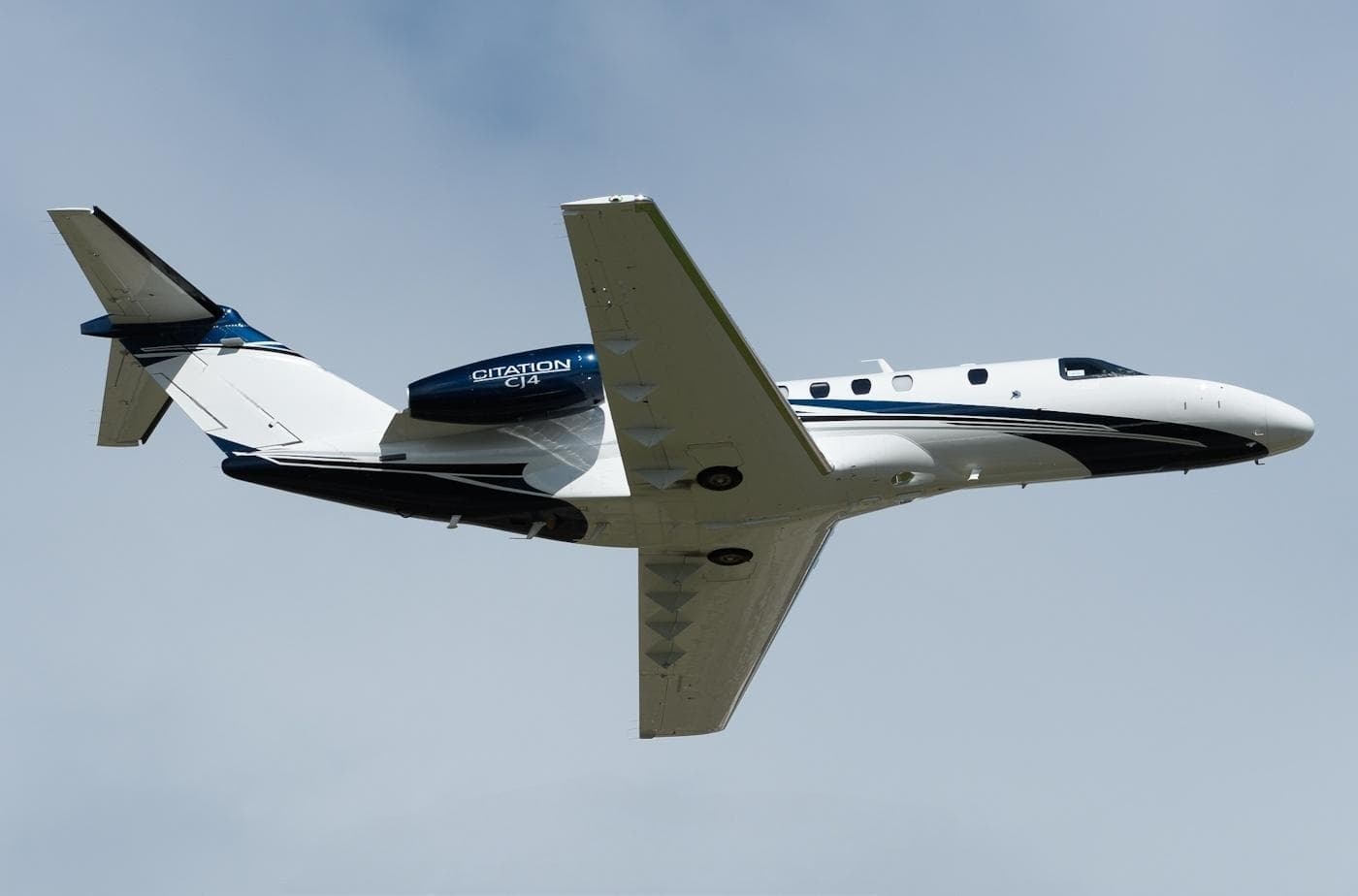 Sat, Nov 7in 4 daysSan JuanTJSJ · Luis Munoz Marin International AirportMiamiKOPF · Miami-Opa Locka Executive AirportCitation CJ49—$17,7847NovSan Juan → MiamiTJSJ → KOPF · in 4 daysCitation CJ4 · 9 seats$17,784
 Sat, Nov 7in 4 daysSan JuanTJSJ · Luis Munoz Marin International AirportVeniceKVNC · Venice Municipal AirportHawker 400XP7—$12,3207NovSan Juan → VeniceTJSJ → KVNC · in 4 daysHawker 400XP · 7 seats$12,320
- Sat, Nov 7in 4 daysSan JuanTJSJ · Luis Munoz Marin International AirportMiamiKOPF · Miami-Opa Locka Executive AirportCessna Citation CJ4 Gen28—$20,0207NovSan Juan → MiamiTJSJ → KOPF · in 4 daysCessna Citation CJ4 Gen2 · 8 seats$20,020
 TJSJ · Luis Munoz Marin International Airport
 TLPL · Hewanorra International Airport
 KTPA · Tampa International Airport
 TNCM · Princess Juliana International Airport
* Total price incl. 10% service fee, converted to your selected currency. Price subject to operator confirmation.
Empty legs to TJSJ
17 arrivals available
 Thu, Nov 5in 2 daysMiamiKOPF · Miami-Opa Locka Executive AirportSan JuanTJSJ · Luis Munoz Marin International AirportChallenger 3009—On request5NovMiami → San JuanKOPF → TJSJ · in 2 daysChallenger 300 · 9 seatsOn request
- Thu, Nov 511:00Grand CaseTFFG · L'Esperance AirportSan JuanTJSJ · Luis Munoz Marin International AirportPilatus PC12 NG8—On request5NovGrand Case → San JuanTFFG → TJSJ · 11:00Pilatus PC12 NG · 8 seatsOn request
- Thu, Nov 5in 2 daysFort LauderdaleKFXE · Fort Lauderdale Executive AirportSan JuanTJSJ · Luis Munoz Marin International AirportChallenger 3008—On request5NovFort Lauderdale → San JuanKFXE → TJSJ · in 2 daysChallenger 300 · 8 seatsOn request
- Fri, Nov 609:10ProvidencialesMBPV · Providenciales International AirportSan JuanTJSJ · Luis Munoz Marin International AirportGulfstream GV14—$22,2206NovProvidenciales → San JuanMBPV → TJSJ · 09:10Gulfstream GV · 14 seats$22,220
- Fri, Nov 6in 3 daysSt. GeorgeTAPA · V.C. Bird International AirportSan JuanTJSJ · Luis Munoz Marin International AirportGulfstream G20091hOn request6NovSt. George → San JuanTAPA → TJSJ · in 3 daysGulfstream G200 · 9 seats · 1hOn request
- Mon, Nov 9in 6 daysNaplesKAPF · Naples Municipal AirportSan JuanTJSJ · Luis Munoz Marin International AirportBombardier Challenger 35092h 39m€10,4909NovNaples → San JuanKAPF → TJSJ · in 6 daysBombardier Challenger 350 · 9 seats · 2h 39m€10,490
- Thu, Nov 12in 9 daysMiami14FA · Burrs StripSan JuanTJSJ · Luis Munoz Marin International AirportGulfstream G450——On request12NovMiami → San Juan14FA → TJSJ · in 9 daysGulfstream G450On request
 Thu, Nov 1209:30MiamiKOPF · Miami-Opa Locka Executive AirportSan JuanTJSJ · Luis Munoz Marin International AirportGulfstream G45011h 54mOn request12NovMiami → San JuanKOPF → TJSJ · 09:30Gulfstream G450 · 1 seat · 1h 54mOn request
- Sun, Nov 2216:45GustaviaTFFJ · Gustaf III AirportSan JuanTJSJ · Luis Munoz Marin International AirportPilatus PC12 NG8—On request22NovGustavia → San JuanTFFJ → TJSJ · 16:45Pilatus PC12 NG · 8 seatsOn request
 TFFG · L'Esperance Airport
 MBPV · Providenciales International Airport
 TAPA · V.C. Bird International Airport
 TFFJ · Gustaf III Airport
* Total price incl. 10% service fee, converted to your selected currency. Price subject to operator confirmation.
Map: San Juan Airport
View the location of San Juan – SJU/TJSJ. Zoom in to explore the area around the airport.
About the airport
Luis Munoz Marin International Airport (SJU/TJSJ) is the key private jet gateway for San Juan. PrivJet gives you instant access to charter flights and empty legs: fast, discreet and globally connected.
TJSJ airport FAQ
Are there any restrictions at San Juan airport (TJSJ) today?
There are currently 15 valid NOTAMs for San Juan (TJSJ). Affected: Obstacle: out of service; Obstacle lights: unserviceable; VORTAC: unserviceable; ILS outer marker: unserviceable. 2 more NOTAMs start in the coming days. For information only, not for flight planning or operational use. Always rely on an official pre-flight briefing. This list may be incomplete or out of date.
What is the weather at San Juan airport (TJSJ)?
According to the latest weather report for TJSJ (METAR, 03 Nov, 07:56 UTC): Good visual conditions (VFR). Wind 3 kt (6 km/h) from south (180°), visibility 10 km or more, temperature 27 °C (dew point 24 °C). For information only, not for flight planning. Weather can change quickly; always rely on official reports.
How long are the runways at San Juan airport (TJSJ)?
San Juan (TJSJ) has 2 runways: runway 08/26 with 3,049 m (10,002 ft), asphalt and runway 10/28 with 2,443 m (8,016 ft), concrete. The longest is 3,049 m.
What are the radio frequencies at San Juan airport (TJSJ)?
Frequencies at TJSJ: Tower 132.05 MHz, Ground 121.9 MHz and ATIS 125.8 MHz. For information only. Always rely on the published AIP.
What are the airport codes of Luis Munoz Marin International Airport?
The ICAO code is TJSJ and the IATA code is SJU. ICAO codes are used by air traffic control and pilots, e.g. in flight plans; IATA codes appear on tickets and baggage tags.
What is the elevation of TJSJ airport?
Luis Munoz Marin International Airport sits at 9 ft (3 m) above sea level. Local time zone: America/Puerto Rico.
Can I fly to TJSJ by private jet?
Whether a private jet can operate into Luis Munoz Marin International Airport depends on runway length, opening hours, customs and immigration rules as well as slot and handling availability, among other things. PrivJet checks this with the operating carrier for every request.
Are there empty legs from or to TJSJ?
There are currently 32 empty legs departing from and 17 arriving at Luis Munoz Marin International Airport. Empty legs are repositioning flights at heavily reduced prices; the list is updated several times a day.