Da Nang Airport (VVDN / DAD)
Empty legs and charters from Da Nang
VVDN airport at a glance
- ICAO code
- VVDN
- IATA code
- DAD
- City
- Da Nang
- Region
- Da Nẵng
- Country
- Vietnam
- Elevation
- 33 ft (10 m)
- Time zone
- Asia/Ho Chi Minh (UTC+7)
- Coordinates
- 16.0439° N, 108.1990° E
- Empty legs from
- 1
- Empty legs to
- 2
Weather & airport info VVDN
Current weather
Good visual conditions (VFR)observed 04 Nov, 00:00 UTC- Wind
- 1 kt (2 km/h) from southwest (230°)
- Visibility
- 10 km or more
- Clouds
- few clouds at 1,700 ft, scattered clouds at 7,000 ft
- Temperature
- 25 °C (dew point 24 °C)
- Pressure (QNH)
- 1,015 hPa
Original weather report (METAR)
METAR VVDN 040000Z 23001KT 9999 FEW017 SCT070 25/24 Q1015 TEMPO FM0100 4500 SHRA
Forecast (TAF)
- 04 Nov, 00:00–03:00 UTC5 kt (9 km/h) from southwest (220°) · visibility 8 km · scattered clouds at 1,700 ft, scattered clouds at 6,000 ft
- 04 Nov, 00:00–03:00 UTCtemporarilyvisibility 4 km · Rain showers · broken clouds at 1,300 ft, few clouds at 1,700 ft, broken clouds at 5,000 ft
- 04 Nov, 03:00–12:00 UTCbecoming10 kt (19 km/h) from east-southeast (110°) · visibility 8 km · scattered clouds at 1,700 ft, scattered clouds at 6,000 ft
- 04 Nov, 12:00–00:00 UTCbecoming5 kt (9 km/h) from west-southwest (240°) · visibility 8 km · scattered clouds at 1,700 ft, scattered clouds at 6,000 ft
- 04 Nov, 15:00–00:00 UTCtemporarilyvisibility 4 km · Rain showers · broken clouds at 1,300 ft, few clouds at 1,700 ft, broken clouds at 5,000 ft
Original forecast (TAF)
TAF VVDN 032300Z 0400/0424 22005KT 8000 SCT017 SCT060 TEMPO 0400/0403 4000 SHRA BKN013 FEW017CB BKN050 BECMG 0403/0404 11010KT BECMG 0412/0413 24005KT TEMPO 0415/0424 4000 SHRA BKN013 FEW017CB BKN050
Airport
- Elevation
- 33 ft (10 m)
- Sunrise / Sunset
- 05:45 / 17:16 local time
Runways
| Runway | Length | Surface | Lighted |
|---|---|---|---|
| 17L/35R | 3,500 m (11,483 ft) | asphalt | yes |
| 17R/35L | 3,048 m (10,000 ft) | asphalt | no |
Radio frequencies
- Approach: 125.3
- Ground: 121.6
- Tower: 125
For information only, not for flight planning. Weather can change quickly; always rely on official reports. Sources: aviationweather.gov (NOAA), OurAirports.
Airport map VVDN
Full screen →Runways white, taxiways yellow with designators, closed taxiways and runways per NOTAM in red.
Closed per NOTAM: RWY 17R/35L
Official charts
Aerodrome, approach and ground charts are published by the national air navigation service in its AIP:
EUROCONTROL: nationale AIS-Websites →For information only, not for navigation. Always use current official charts and NOTAMs.
Current NOTAMs for VVDN(8)
NOTAMs (Notices to Air Missions) announce short-term changes at an airport: closed runways or taxiways, unserviceable approach aids, obstacles, airspace restrictions.
- ClosedRunway: closedA3842/26· until 23 Nov, 10:00 UTC
Runway 17R/35L at Da Nang (VVDN) airport is temporarily closed.
Show original text
RWY 17R/35L TEMPO CLSD.
A3842/26 NOTAMR A2810/26
 Q) VVHM/QMRLC/IV/NBO/A/000/999/1603N10812E005
 A) VVDN B) 2610121026 C) 2611231000
 E) RWY 17R/35L TEMPO CLSD.
- Out of serviceAerodrome: not availableA4214/26· until 31 Dec, 16:59 UTC (estimated)
The Doppler Weather Radar System (METEOR 60DX10-S) is out of service for repair. The Low-Level Wind Shear Alert System (LLWAS) is operating normally.
Show original text
DOPPLER WX RADAR SYSTEM (METEOR 60DX10-S) U/S FOR REPAIR RMK: LOW-LEVEL WS ALERT SYSTEM (LLWAS) NML OPS.
A4214/26 NOTAMR A2652/26
 Q) VVHM/QFMAU/IV/BO/A/000/999/1603N10812E005
 A) VVDN B) 2610310911 C) 2612311659 EST
 E) DOPPLER WX RADAR SYSTEM (METEOR 60DX10-S) U/S FOR REPAIR
 RMK: LOW-LEVEL WS ALERT SYSTEM (LLWAS) NML OPS.
- Out of serviceApproach lighting: unserviceableA3847/26· until 23 Nov, 10:00 UTC (estimated)
The approach lighting system (ALS) for runway 17R/35L is out of service. Approach lighting helps pilots find the runway in poor visibility.
Show original text
ALS ON RWY 17R/35L U/S.
A3847/26 NOTAMR A2815/26
 Q) VVHM/QLAAS/IV/NBO/A/000/999/1603N10812E005
 A) VVDN B) 2610121032 C) 2611231000 EST
 E) ALS ON RWY 17R/35L U/S.
- Out of serviceAll landing area lighting: unserviceableA3846/26· until 23 Nov, 10:00 UTC (estimated)
The lighting system on runway 17R/35L is out of service. This may affect the visibility of the runway.
Show original text
LGT SYSTEM ON RWY 17R/35L U/S.
A3846/26 NOTAMR A2814/26
 Q) VVHM/QLRAS/IV/NBO/A/000/999/1603N10812E005
 A) VVDN B) 2610121030 C) 2611231000 EST
 E) LGT SYSTEM ON RWY 17R/35L U/S.
- Out of servicePAPI: unserviceableA3845/26· until 23 Nov, 10:00 UTC (estimated)
The PAPI (Precision Approach Path Indicator) for runway 17R/35L is out of service. The PAPI is a visual aid that shows pilots the correct altitude during approach.
Show original text
PAPI RWY 17R/35L U/S.
A3845/26 NOTAMR A2813/26
 Q) VVHM/QLPAS/IV/BO/A/000/999/1603N10812E005
 A) VVDN B) 2610121029 C) 2611231000 EST
 E) PAPI RWY 17R/35L U/S.
- Out of serviceILS: unserviceableA3844/26· until 23 Nov, 10:00 UTC (estimated)
ILS (instrument landing system)-localizer, glide path, DME (distance measuring) for runway 35L out of service.
Show original text
ILS-LOC, GP, DME FOR RWY 35L U/S.
A3844/26 NOTAMR A2812/26
 Q) VVHM/QICAS/I/NBO/A/000/999/1603N10812E025
 A) VVDN B) 2610121028 C) 2611231000 EST
 E) ILS-LOC, GP, DME FOR RWY 35L U/S.
- ClosedTaxiway: closedA3843/26· until 23 Nov, 10:00 UTC
Taxiways G1, G2, G4, G6, W1, W2, W4, W5, and W6 at Da Nang airport are temporarily closed. This may lead to changes in taxiing routes for aircraft.
Show original text
TAXIWAYS G1, G2, G4, G6, W1, W2, W4, W5, W6 TEMPO CLSD.
A3843/26 NOTAMR A2811/26
 Q) VVHM/QMXLC/IV/BO/A/000/999/1603N10812E005
 A) VVDN B) 2610121027 C) 2611231000
 E) TAXIWAYS G1, G2, G4, G6, W1, W2, W4, W5, W6 TEMPO CLSD.
- NoticeTaxiway: work in progressA3523/26· until 30 Dec, 23:00 UTC
Work in progress is taking place on various areas at Da Nang airport, including intersections of runway 17L/35R with taxiways E1 and E4, and sections of taxiways E, E1, E2, E3, E4, E6, and E7. The work will be conducted intermittently between flights.
Show original text
WIP ON AREAS DRG INTERMITTENT TIME BTN FLTS, DETAILS AS FLW: - AREA 1: + INT OF RWY 17L/35R AND TWY E1 + TWY E1 (PORTION 90M FM RCL 17L/35R TO THE EAST TOWARD TWY E) + TWY E (PORTION 45M FM CL OF TWY E1 TO THE SOUTH TOWARD PSN 45M FM CL OF TWY E2 TO THE NORTH) + TWY E2 (PORTION 90M FM RCL 17L/35R TO THE EAST TOWARD TWY E) - AREA 2: + TWY E (PORTION 45M FM CL OF TWY E2 TO THE NORTH TOWARD PSN 45M FM CL OF TWY E4 TO THE NORTH) + TWY E3 (PORTION 90M FM RCL 17L/35R TO THE EAST TOWARD TWY E) + INT OF RWY 17L/35R AND TWY E4 + TWY E4 (PORTION 90M FM RCL 17L/35R TO THE EAST TOWARD TWY E) - AREA 3: + TWY E (PORTION 45M FM CL OF TWY E4 TO THE NORTH TOWARD PSN 45M FM CL OF TWY E7 TO THE NORTH) + TWY E7 (PORTION 90M FM RCL 17L/35R TO THE EAST TOWARD TWY E) + INT OF RWY 17L/35R AND TWY E6 + TWY E6.
A3523/26 NOTAMN
 Q) VVHM/QMXHW/IV/BO/A/000/999/1603N10812E005
 A) VVDN B) 2610011900 C) 2612302300
 D) DAILY 1900-2300
 E) WIP ON AREAS DRG INTERMITTENT TIME BTN FLTS, DETAILS AS FLW:
 - AREA 1:
 + INT OF RWY 17L/35R AND TWY E1
 + TWY E1 (PORTION 90M FM RCL 17L/35R TO THE EAST TOWARD TWY E)
 + TWY E (PORTION 45M FM CL OF TWY E1 TO THE SOUTH TOWARD PSN
 45M FM CL OF TWY E2 TO THE NORTH)
 + TWY E2 (PORTION 90M FM RCL 17L/35R TO THE EAST TOWARD TWY E)
 - AREA 2:
 + TWY E (PORTION 45M FM CL OF TWY E2 TO THE NORTH TOWARD PSN
 45M FM CL OF TWY E4 TO THE NORTH)
 + TWY E3 (PORTION 90M FM RCL 17L/35R TO THE EAST TOWARD TWY E)
 + INT OF RWY 17L/35R AND TWY E4
 + TWY E4 (PORTION 90M FM RCL 17L/35R TO THE EAST TOWARD TWY E)
 - AREA 3:
 + TWY E (PORTION 45M FM CL OF TWY E4 TO THE NORTH TOWARD PSN
 45M FM CL OF TWY E7 TO THE NORTH)
 + TWY E7 (PORTION 90M FM RCL 17L/35R TO THE EAST TOWARD TWY E)
 + INT OF RWY 17L/35R AND TWY E6
 + TWY E6.
Hours: DAILY 1900-2300
For information only, not for flight planning or operational use. Always rely on an official pre-flight briefing. This list may be incomplete or out of date. Explanations and expanded abbreviations are generated automatically. The original text is authoritative. Source: FAA NOTAM Management Service (SWIM).
Empty legs from VVDN
1 departures available
 VVDN · Da Nang Intl
 VTBD · Don Mueang Intl
* Total price incl. 10% service fee, converted to your selected currency. Price subject to operator confirmation.
Empty legs to VVDN
2 arrivals available
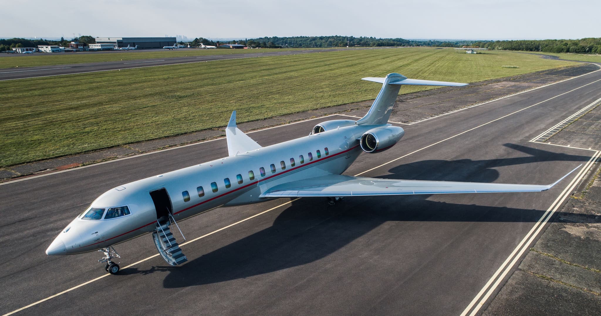 Wed, Nov 4TodayMacauVMMC · Macau International AirportDa NangVVDN · Da Nang International AirportGlobal 800014—On request4NovMacau → Da NangVMMC → VVDN · TodayGlobal 8000 · 14 seatsOn request
- Fri, Dec 408:30Phu CatVVPCTuranVVDN · Da Nang IntlHawker 850XP——On request4DecPhu Cat → TuranVVPC → VVDN · 08:30Hawker 850XPOn request
 VMMC · Macau International Airport
* Total price incl. 10% service fee, converted to your selected currency. Price subject to operator confirmation.
Map: Da Nang Airport
View the location of Da Nang – DAD/VVDN. Zoom in to explore the area around the airport.
About the airport
Da Nang International Airport (DAD/VVDN) is the key private jet gateway for Da Nang. PrivJet gives you instant access to charter flights and empty legs: fast, discreet and globally connected.
VVDN airport FAQ
Are there any restrictions at Da Nang airport (VVDN) today?
There are currently 8 valid NOTAMs for Da Nang (VVDN). According to NOTAM, at least one runway or the aerodrome itself is closed. Affected: Runway: closed; Taxiway: closed; Aerodrome: not available; Approach lighting: unserviceable and 3 more. For information only, not for flight planning or operational use. Always rely on an official pre-flight briefing. This list may be incomplete or out of date.
What is the weather at Da Nang airport (VVDN)?
According to the latest weather report for VVDN (METAR, 04 Nov, 00:00 UTC): Good visual conditions (VFR). Wind 1 kt (2 km/h) from southwest (230°), visibility 10 km or more, temperature 25 °C (dew point 24 °C). For information only, not for flight planning. Weather can change quickly; always rely on official reports.
How long are the runways at Da Nang airport (VVDN)?
Da Nang (VVDN) has 2 runways: runway 17L/35R with 3,500 m (11,483 ft), asphalt and runway 17R/35L with 3,048 m (10,000 ft), asphalt. The longest is 3,500 m.
What are the radio frequencies at Da Nang airport (VVDN)?
Frequencies at VVDN: Tower 125 MHz and Ground 121.6 MHz. For information only. Always rely on the published AIP.
What are the airport codes of Da Nang International Airport?
The ICAO code is VVDN and the IATA code is DAD. ICAO codes are used by air traffic control and pilots, e.g. in flight plans; IATA codes appear on tickets and baggage tags.
What is the elevation of VVDN airport?
Da Nang International Airport sits at 33 ft (10 m) above sea level. Local time zone: Asia/Ho Chi Minh.
Can I fly to VVDN by private jet?
Whether a private jet can operate into Da Nang International Airport depends on runway length, opening hours, customs and immigration rules as well as slot and handling availability, among other things. PrivJet checks this with the operating carrier for every request.
Are there empty legs from or to VVDN?
There are currently 1 empty legs departing from and 2 arriving at Da Nang International Airport. Empty legs are repositioning flights at heavily reduced prices; the list is updated several times a day.