Gold Coast Airport (YBCG / OOL)
Empty legs and charters from Gold Coast
YBCG airport at a glance
- ICAO code
- YBCG
- IATA code
- OOL
- City
- Gold Coast
- Region
- Queensland
- Country
- Australia
- Elevation
- 21 ft (6 m)
- Time zone
- Australia/Brisbane (UTC+10)
- Coordinates
- 28.1644° S, 153.5050° E
- Empty legs from
- 5
- Empty legs to
- 8
Weather & airport info YBCG
Current weather
Good visual conditions (VFR)observed 03 Nov, 11:30 UTC- Wind
- 8 kt (15 km/h) from north-northwest (330°)
- Visibility
- 10 km or more
- Clouds
- few clouds at 10,000 ft, scattered clouds at 12,500 ft
- Temperature
- 21 °C (dew point 19 °C)
- Pressure (QNH)
- 1,011 hPa
Original weather report (METAR)
METAR YBCG 031130Z AUTO 33008KT 9999 // FEW100 SCT125 21/19 Q1011
Forecast (TAF)
- 03 Nov, 12:00–04:00 UTC10 kt (19 km/h) from west-northwest (300°) · visibility 10 km or more · no significant weather · no significant clouds
- 04 Nov, 04:00–12:00 UTCfrom10 kt (19 km/h) from north-northeast (30°) · visibility 10 km or more · no significant weather · no significant clouds
Original forecast (TAF)
TAF AMD YBCG 031134Z 0312/0412 30010KT CAVOK FM040400 03010KT CAVOK
Airport
- Elevation
- 21 ft (6 m)
- Sunrise / Sunset
- 04:52 / 18:06 local time
Runways
| Runway | Length | Surface | Lighted |
|---|---|---|---|
| 14/32 | 2,492 m (8,176 ft) | asphalt | yes |
| 17/35 | 582 m (1,909 ft) | asphalt | no |
Radio frequencies
- ATIS: 112.3
- ATIS: 134.5
- CTAF: 118.7
- Tower: 118.7
For information only, not for flight planning. Weather can change quickly; always rely on official reports. Sources: aviationweather.gov (NOAA), OurAirports.
Airport map YBCG
Full screen →Runways white, taxiways yellow with designators, closed taxiways and runways per NOTAM in red.
Official charts
Aerodrome, approach and ground charts are published by the national air navigation service in its AIP:
Airservices Australia AIP →For information only, not for navigation. Always use current official charts and NOTAMs.
Current NOTAMs for YBCG(10)
NOTAMs (Notices to Air Missions) announce short-term changes at an airport: closed runways or taxiways, unserviceable approach aids, obstacles, airspace restrictions.
- ClosedRunway: closedJ4901/26· from 05 Nov, 12:30 UTC · until 05 Nov, 19:30 UTC
Runways 14/32 and 17/35 are closed due to work in progress (fire ant eradication program). Workers and equipment monitor the common traffic advisory frequency 118.7 and will vacate with 30 minutes prior notice.
Show original text
RWY 14/32 AND RWY 17/35 CLSD DUE WIP (FIRE ANT ERADICATION PROGRAM) WORKERS AND EQPT MNT COMMON TFC ADVISORY FREQ (CTAF) 118.7 AND WILL VACATE WITH 30MIN PN CTC AD REPORTING OFFICER CS 'CAR 25' VIA FREQ 118.7 OR TEL: 0407 755 722
J4901/26 NOTAMN
 Q) YBBB/QMRLC/IV/NBO/A/000/999/2810S15330E005
 A) YBCG
 B) 2611051230 C) 2611051930
 E) RWY 14/32 AND RWY 17/35 CLSD
 DUE WIP (FIRE ANT ERADICATION PROGRAM)
 WORKERS AND EQPT MNT COMMON TFC ADVISORY FREQ (CTAF) 118.7
 AND WILL VACATE WITH 30MIN PN
 CTC AD REPORTING OFFICER CS 'CAR 25' VIA FREQ 118.7 OR
 TEL: 0407 755 722
- Out of serviceILS: unserviceableJ4925/26· from 05 Nov, 13:00 UTC · until 05 Nov, 19:00 UTC
The Instrument Landing System (ILS) 'ICG' 111.1 for runway 14 is out of service due to ground maintenance, except with 30 minutes prior notice for operational requirements. The ILS guides aircraft to the runway in poor visibility.
Show original text
ILS 'ICG' 111.1 RWY14 U/S DUE GROUND MAINT EXC ON 30MIN PN FOR OPR RQMNTS
J4925/26 NOTAMN
 Q) YBBB/QICAS/I/NBO/A/000/999/2810S15330E005
 A) YBCG
 B) 2611051300 C) 2611051900
 E) ILS 'ICG' 111.1 RWY14 U/S
 DUE GROUND MAINT
 EXC ON 30MIN PN FOR OPR RQMNTS
- ClosedTaxiway: closedJ4902/26· from 05 Nov, 12:30 UTC · until 05 Nov, 19:30 UTC
All taxiways are closed due to work in progress (fire ant eradication program). Workers and equipment monitor the common traffic advisory frequency 118.7 and will vacate with 30 minutes prior notice.
Show original text
ALL TWY CLSD DUE WIP (FIRE ANT ERADICATION PROGRAM) WORKERS AND EQPT MNT COMMON TFC ADVISORY FREQ (CTAF) 118.7 AND WILL VACATE WITH 30MIN PN CTC AD REPORTING OFFICER CS 'CAR 25' VIA FREQ 118.7 OR TEL: 0407 755 722
J4902/26 NOTAMN
 Q) YBBB/QMXLC/IV/BO/A/000/999/2810S15330E005
 A) YBCG
 B) 2611051230 C) 2611051930
 E) ALL TWY CLSD
 DUE WIP (FIRE ANT ERADICATION PROGRAM)
 WORKERS AND EQPT MNT COMMON TFC ADVISORY FREQ (CTAF) 118.7
 AND WILL VACATE WITH 30MIN PN
 CTC AD REPORTING OFFICER CS 'CAR 25' VIA FREQ 118.7 OR
 TEL: 0407 755 722
- Out of serviceObstacle lights: unserviceableJ5035/26· until 25 Jan, 00:00 UTC (estimated)
The lighting on a tower is out of service. The tower is 115 feet above mean sea level and is located 1101 meters from the airport.
Show original text
OBST LGT ON TOWER 115FT AMSL U/S BRG 090 MAG 1101M FM ARP PSN 280958.7S 1533056.8E
J5035/26 NOTAMR J3472/26
 Q) YBBB/QOLAS/IV/M/AE/000/999/2810S15330E005
 A) YBCG
 B) 2610272333 C) 2701250000 EST
 E) OBST LGT ON TOWER 115FT AMSL U/S
 BRG 090 MAG 1101M FM ARP
 PSN 280958.7S 1533056.8E
- ClosedHeliport: closedJ4613/26· until 28 Dec, 23:00 UTC (estimated)
The western grass helicopter training area is closed.
Show original text
WESTERN GRASS HELICOPTER TRAINING AREA CLSD
J4613/26 NOTAMR J4071/26
 Q) YBBB/QFHLC/IV/NBO/A/000/999/2810S15330E005
 A) YBCG
 B) 2609282338 C) 2612282300 EST
 E) WESTERN GRASS HELICOPTER TRAINING AREA CLSD
- NoticeFire and rescue: downgradedN3756/26· until 03 Nov, 12:35 UTC
The airport's fire and rescue category is 7. This indicates the level of rescue services available.
Show original text
FIRE AND RESCUE CAT 7
N3756/26 NOTAMN
 Q) YBBB/QFFCG/IV/NBO/A/000/999/2810S15330E005
 A) YBCG
 B) 2611021945 C) 2611031235
 E) FIRE AND RESCUE CAT 7
- NoticeObstacle: erectedJ4978/26· until 22 Jan, 00:00 UTC (estimated)
A crane is erected as an obstacle. Its top is 343 ft above mean sea level and it is located 2545 meters from the airport reference point.
Show original text
OBST CRANE 343FT AMSL ERECTED PSN 281008.84S 1533148.57E BRG 090 MAG 2545M FM ARP INFRINGES INNER HORIZONTAL SFC BY 181FT
J4978/26 NOTAMR J4848/26
 Q) YBBB/QOBCE/IV/M/AE/000/999/2810S15332E001
 A) YBCG
 B) 2610230009 C) 2701220000 EST
 E) OBST CRANE 343FT AMSL ERECTED
 PSN 281008.84S 1533148.57E BRG 090 MAG 2545M FM ARP
 INFRINGES INNER HORIZONTAL SFC BY 181FT
- NoticeObstacle: erectedJ4792/26· until 22 Dec, 06:00 UTC
A crane has been erected 3464 meters east of the airport. Its top is 260 feet above sea level and it infringes the inner horizontal surface of the airport by 97 feet.
Show original text
OBST CRANE 260FT AMSL ERECTED PSN 281020.48S 1533314.01E BRG 093 MAG 3464M FM ARP INFRINGES INNER HORIZONTAL SFC BY 97FT
J4792/26 NOTAMN
 Q) YBBB/QOBCE/IV/M/AE/000/999/2810S15330E005
 A) YBCG
 B) 2610122000 C) 2612220600
 D) DAILY 2000-0600
 E) OBST CRANE 260FT AMSL ERECTED
 PSN 281020.48S 1533314.01E BRG 093 MAG 3464M FM ARP
 INFRINGES INNER HORIZONTAL SFC BY 97FT
Hours: DAILY 2000-0600
2 more NOTAMs
- Out of serviceInstrument approach procedure: not availableN3358/26· until 17 Dec, 05:00 UTC (estimated)
Arrivals from the southeast using the LAMSI YANKEE Arrival (RNAV) for Runway 32, followed by RNP Y Runway 32 (AR), are not authorized due to environmental assessment limitations.
Show original text
AIP DEP AND APCH (DAP) AMD ARRIVALS FM THE SOUTH EAST USING LAMSI YANKEE ARRIVAL (RNAV) RUNWAY 32 FOLLOWED BY RNP Y RWY 32 (AR) NOT AUTHORISED DUE TO ENVIRONMENTAL ASSESSMENT LIMITATIONS
N3358/26 NOTAMR N2147/26
 Q) YBBB/QPIAU/I/NBO/A/000/999/2810S15330E005
 A) YBCG
 B) 2610062247 C) 2612170500 EST
 E) AIP DEP AND APCH (DAP) AMD
 ARRIVALS FM THE SOUTH EAST
 USING LAMSI YANKEE ARRIVAL (RNAV)
 RUNWAY 32 FOLLOWED BY RNP Y RWY 32 (AR)
 NOT AUTHORISED
 DUE TO ENVIRONMENTAL ASSESSMENT LIMITATIONS
- NoticeUnmanned aircraft: will take placeN3257/26· until 21 Dec, 00:00 UTC (estimated)
Unmanned aircraft operations are taking place within a 3 nautical mile radius of the airport. This activity is associated with automated airspace authorisations.
Show original text
UA OPS WILL TAKE PLACE WI 3NM RADIUS OF ARP REMOTELY PILOTED AIRCRAFT SYSTEM ACTIVITY ASSOCIATED WITH AUTOMATED AIRSPACE AUTHORISATIONS CTC AIRSERVICES AUSTRALIA EMAIL: AAA(AT)AIRSERVICESAUSTRALIA.COM
N3257/26 NOTAMN
 Q) YBBB/QWULW/IV/BO/AW/000/004/2810S15330E005
 A) YBCG
 B) 2610010000 C) 2612210000 EST
 D) HJ
 E) UA OPS WILL TAKE PLACE
 WI 3NM RADIUS OF ARP
 REMOTELY PILOTED AIRCRAFT SYSTEM ACTIVITY ASSOCIATED WITH AUTOMATED
 AIRSPACE AUTHORISATIONS
 CTC AIRSERVICES AUSTRALIA EMAIL: AAA(AT)AIRSERVICESAUSTRALIA.COM
 F) SFC G) 400FT AGL
Hours: HJ
For information only, not for flight planning or operational use. Always rely on an official pre-flight briefing. This list may be incomplete or out of date. Explanations and expanded abbreviations are generated automatically. The original text is authoritative. Source: FAA NOTAM Management Service (SWIM).
Private jet traffic in Gold Coast Airport (last 30 days)
- Arrivals
- 138
- Departures
- 128
- Different jets
- 57
Most frequent origins: Port Macquarie Airport (16), Melbourne Essendon Airport (9), Sydney Kingsford Smith International Airport (9), Sydney Bankstown Airport (7), Brisbane International Airport (7).
Most frequent destinations: Port Macquarie Airport (11), Melbourne Essendon Airport (10), Brisbane International Airport (10), Sydney Bankstown Airport (10), Sydney Kingsford Smith International Airport (9).
Most common aircraft types: Beechcraft King Air 200/250 (46), Dassault Falcon 900 (37), Cessna Citation CJ2 (27), Bombardier Global 6000/6500 (25), Pilatus PC-12 (18).
Friday is the busiest day.
Our own analysis of public ADS-B signals from business jets. Not every flight is received, and jets with a removal request are excluded.
Charter operators based here
Operators with a base at this airport.
- LifeFlight Rescue Air AmbulanceBrisbane International (YBBN) · Super midsize jet, Helicopter
- Corporate AirBrisbane International (YBBN) · Turboprop, Piston aircraft
- Global Jet InternationalLight jet, Midsize jet, Super midsize jet
- Seair PacificTurboprop
- PHI International New ZealandNelson (NZNS) · Helicopter
- Air Gold CoastLight jet, Piston aircraft
Empty legs from YBCG
5 departures available
 Sat, Nov 7in 4 daysGold CoastYBCG · Gold Coast AirportSydneyYSSY · Sydney Kingsford Smith International AirportGlobal Express XRS14—A$30,9107NovGold Coast → SydneyYBCG → YSSY · in 4 daysGlobal Express XRS · 14 seatsA$30,910
- Sat, Nov 701:45Gold CoastYBCGSydneyYSSY · Kingsford Smith IntlGlobal Express——On request7NovGold Coast → SydneyYBCG → YSSY · 01:45Global ExpressOn request
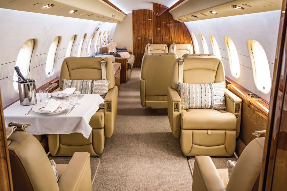 Sat, Nov 702:30Gold CoastYBCG · Gold Coast AirportSydneyYSSY · Sydney Kingsford Smith International AirportBombardier Global Express14—A$30,9107NovGold Coast → SydneyYBCG → YSSY · 02:30Bombardier Global Express · 14 seatsA$30,910
 Sat, Nov 14in 11 daysGold CoastYBCG · Gold Coast AirportMelbourneYMML · Melbourne International AirportGulfstream G35014—On request14NovGold Coast → MelbourneYBCG → YMML · in 11 daysGulfstream G350 · 14 seatsOn request
- Wed, Dec 23in 50 daysGold CoastYBCG · Gold Coast AirportMaroochydoreYBSU · Sunshine Coast AirportChallenger 604——On request23DecGold Coast → MaroochydoreYBCG → YBSU · in 50 daysChallenger 604On request
 YBCG · Gold Coast Airport
* Total price incl. 10% service fee, converted to your selected currency. Price subject to operator confirmation.
Empty legs to YBCG
8 arrivals available
- Wed, Nov 4TomorrowSydneyYSSY · Sydney Kingsford Smith International AirportGold CoastYBCG · Gold Coast AirportGlobal Express XRS14—A$30,9104NovSydney → Gold CoastYSSY → YBCG · TomorrowGlobal Express XRS · 14 seatsA$30,910
- Wed, Nov 421:40SydneyYSSY · Sydney Kingsford Smith International AirportGold CoastYBCG · Gold Coast AirportBombardier Global Express14—A$30,9104NovSydney → Gold CoastYSSY → YBCG · 21:40Bombardier Global Express · 14 seatsA$30,910
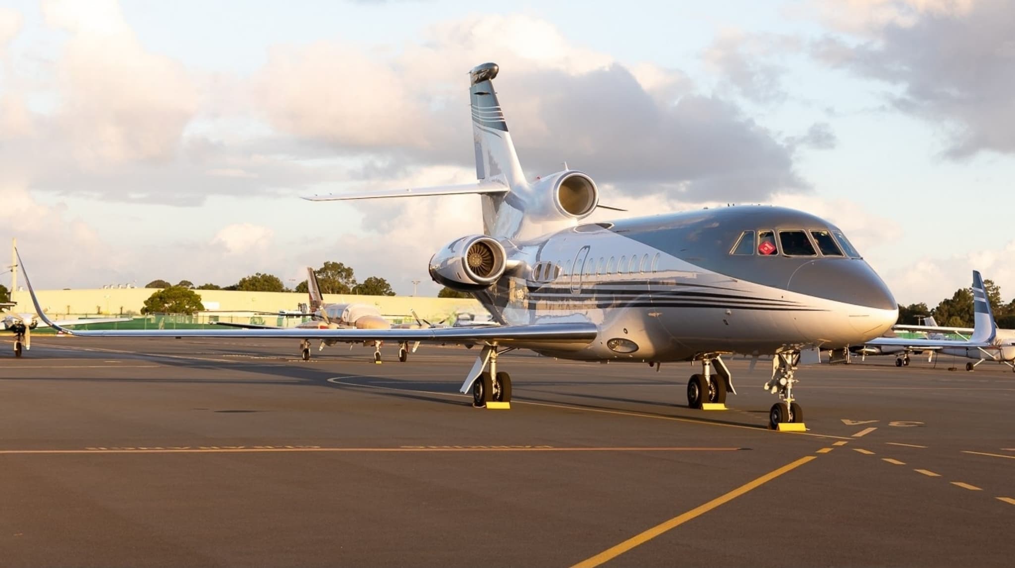 Thu, Nov 5in 2 daysSydneyYSSY · Sydney Kingsford Smith International AirportGold CoastYBCG · Gold Coast AirportFalcon 900EX12—On request5NovSydney → Gold CoastYSSY → YBCG · in 2 daysFalcon 900EX · 12 seatsOn request
- Thu, Nov 5in 2 daysSydneyYSSY · Sydney Kingsford Smith International AirportGold CoastYBCG · Gold Coast AirportGlobal Express XRS14—$21,3285NovSydney → Gold CoastYSSY → YBCG · in 2 daysGlobal Express XRS · 14 seats$21,328
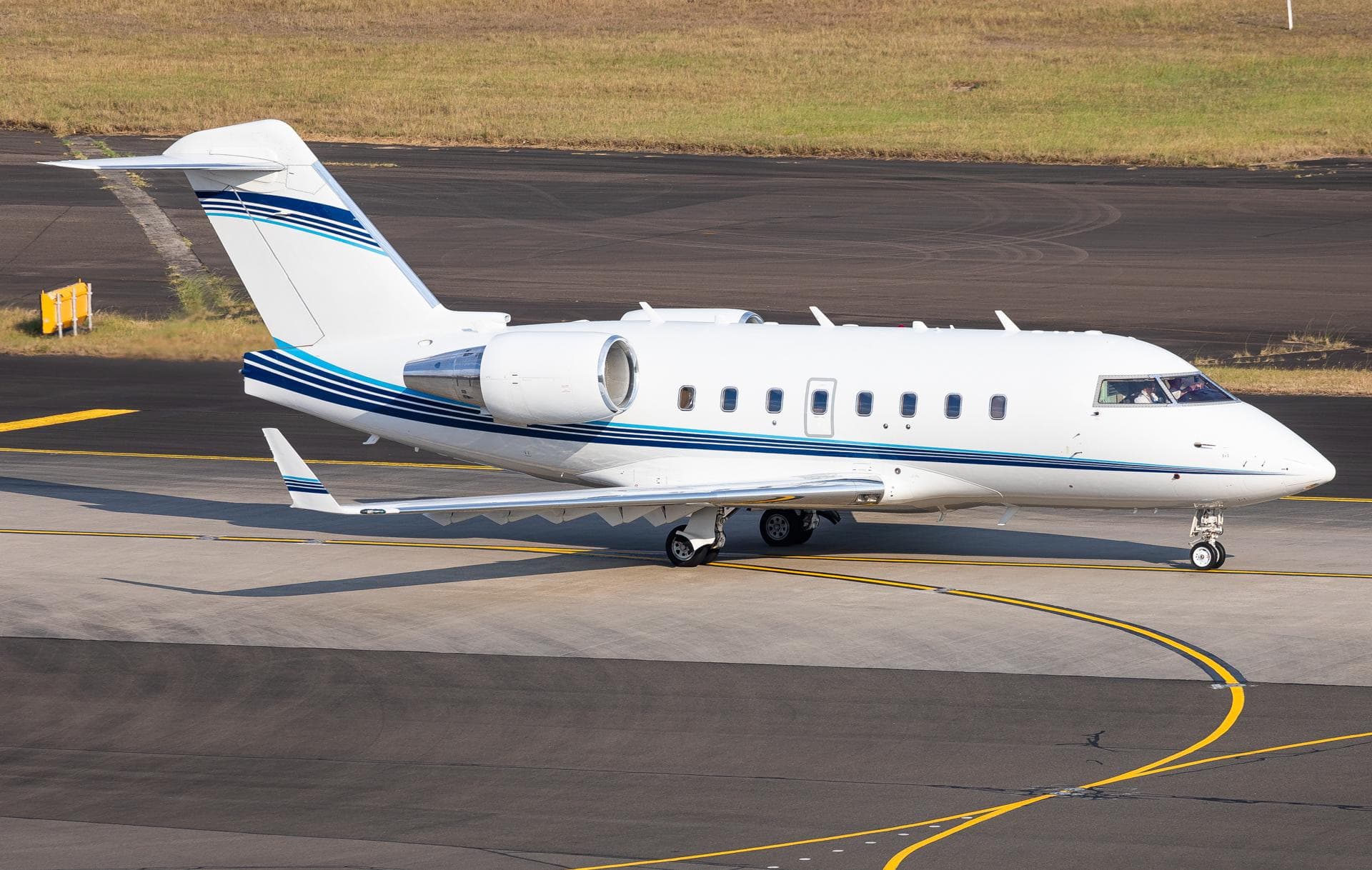 Thu, Nov 5in 2 daysCity Of BallaratYBLT · Ballarat AirportGold CoastYBCG · Gold Coast AirportChallenger 60410—On request5NovCity Of Ballarat → Gold CoastYBLT → YBCG · in 2 daysChallenger 604 · 10 seatsOn request
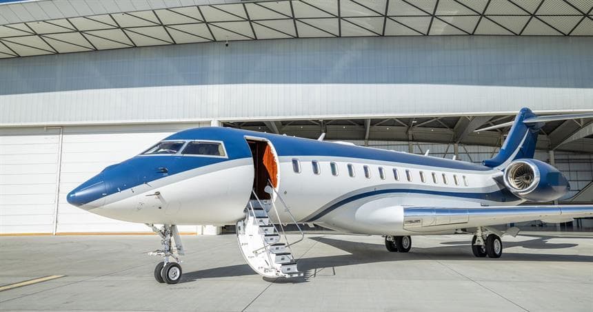 Fri, Nov 6in 3 daysSydneyYSSY · Sydney Kingsford Smith International AirportGold CoastYBCG · Gold Coast AirportGlobal Express XRS13—$16,4776NovSydney → Gold CoastYSSY → YBCG · in 3 daysGlobal Express XRS · 13 seats$16,477
- Wed, Nov 18in 15 daysMaroochydoreYBSU · Sunshine Coast AirportGold CoastYBCG · Gold Coast AirportChallenger 604——On request18NovMaroochydore → Gold CoastYBSU → YBCG · in 15 daysChallenger 604On request
- Sun, Dec 6in 33 daysBrisbaneYBBN · Brisbane International AirportGold CoastYBCG · Gold Coast AirportLegacy 600——On request6DecBrisbane → Gold CoastYBBN → YBCG · in 33 daysLegacy 600On request
* Total price incl. 10% service fee, converted to your selected currency. Price subject to operator confirmation.
Map: Gold Coast Airport
View the location of Gold Coast – OOL/YBCG. Zoom in to explore the area around the airport.
About the airport
Gold Coast Airport (OOL/YBCG) is the key private jet gateway for Gold Coast. PrivJet gives you instant access to charter flights and empty legs: fast, discreet and globally connected.
YBCG airport FAQ
Are there any restrictions at Gold Coast airport (YBCG) today?
There are currently 7 valid NOTAMs for Gold Coast (YBCG). Affected: Heliport: closed; Obstacle lights: unserviceable; Instrument approach procedure: not available. 3 more NOTAMs start in the coming days. For information only, not for flight planning or operational use. Always rely on an official pre-flight briefing. This list may be incomplete or out of date.
What is the weather at Gold Coast airport (YBCG)?
According to the latest weather report for YBCG (METAR, 03 Nov, 11:30 UTC): Good visual conditions (VFR). Wind 8 kt (15 km/h) from north-northwest (330°), visibility 10 km or more, temperature 21 °C (dew point 19 °C). For information only, not for flight planning. Weather can change quickly; always rely on official reports.
How long are the runways at Gold Coast airport (YBCG)?
Gold Coast (YBCG) has 2 runways: runway 14/32 with 2,492 m (8,176 ft), asphalt and runway 17/35 with 582 m (1,909 ft), asphalt. The longest is 2,492 m.
What are the radio frequencies at Gold Coast airport (YBCG)?
Frequencies at YBCG: Tower 118.7 MHz and ATIS 112.3 / 134.5 MHz. For information only. Always rely on the published AIP.
What are the airport codes of Gold Coast Airport?
The ICAO code is YBCG and the IATA code is OOL. ICAO codes are used by air traffic control and pilots, e.g. in flight plans; IATA codes appear on tickets and baggage tags.
What is the elevation of YBCG airport?
Gold Coast Airport sits at 21 ft (6 m) above sea level. Local time zone: Australia/Brisbane.
Can I fly to YBCG by private jet?
Whether a private jet can operate into Gold Coast Airport depends on runway length, opening hours, customs and immigration rules as well as slot and handling availability, among other things. PrivJet checks this with the operating carrier for every request.
Are there empty legs from or to YBCG?
There are currently 5 empty legs departing from and 8 arriving at Gold Coast Airport. Empty legs are repositioning flights at heavily reduced prices; the list is updated several times a day.