Halifax / Stanfield Airport (CYHZ / YHZ)
Empty legs and charters from Halifax
CYHZ airport at a glance
- ICAO code
- CYHZ
- IATA code
- YHZ
- City
- Halifax
- Region
- Nova Scotia
- Country
- Canada
- Elevation
- 477 ft (145 m)
- Time zone
- America/Halifax (UTC-4)
- Coordinates
- 44.8808° N, 63.5086° W
- Empty legs from
- 8
- Empty legs to
- 9
Weather & airport info CYHZ
Current weather
Good visual conditions (VFR)observed 03 Nov, 09:00 UTC- Wind
- 9 kt (17 km/h) from northwest (320°)
- Visibility
- 10 km or more
- Clouds
- few clouds at 7,500 ft, broken clouds at 14,000 ft
- Temperature
- 10 °C (dew point 7 °C)
- Pressure (QNH)
- 1,021 hPa
Original weather report (METAR)
METAR CYHZ 030900Z 32009KT 15SM FEW075 BKN140 10/07 A3015 RMK AC1AS6 SLP214
Forecast (TAF)
- 03 Nov, 09:00–06:00 UTC10 kt (19 km/h) from northwest (320°) · visibility 10 km or more · few clouds at 1,500 ft, scattered clouds at 5,000 ft, overcast at 12,000 ft
- 03 Nov, 09:00–12:00 UTCtemporarilyvisibility 10 km or more · Light rain showers · few clouds at 800 ft, broken clouds at 1,500 ft, overcast at 5,000 ft
- 03 Nov, 09:00–12:00 UTCbecoming10 kt (19 km/h) from north (360°) · visibility 10 km or more · few clouds at 1,500 ft, scattered clouds at 5,000 ft, overcast at 12,000 ft
- 03 Nov, 12:00–16:00 UTCfrom8 kt (15 km/h) from north (10°) · visibility 10 km or more · few clouds at 2,000 ft, broken clouds at 7,000 ft, overcast at 14,000 ft
- 03 Nov, 12:00–16:00 UTCtemporarilybroken clouds at 2,000 ft
Original forecast (TAF)
TAF CYHZ 030840Z 0309/0406 32010KT P6SM FEW015 SCT050 OVC120 TEMPO 0309/0312 P6SM -SHRA FEW008 BKN015 OVC050 BECMG 0309/0311 36010KT FM031200 01008KT P6SM FEW020 BKN070 OVC140 TEMPO 0312/0316 BKN020 FM031600 02008KT P6SM BKN040 BKN250 BECMG 0319/0321 06006KT BECMG 0323/0401 10006KT FM040200 11006KT P6SM SCT020 BKN040 OVC080 FM040400 12008KT 6SM -RA BR BKN015 OVC040 RMK NXT FCST BY 031200Z
Airport
- Elevation
- 477 ft (145 m)
- Sunrise / Sunset
- 06:54 / 17:00 local time
Runways
| Runway | Length | Surface | Lighted |
|---|---|---|---|
| 05/23 | 3,200 m (10,500 ft) | asphalt | yes |
| 14/32 | 2,347 m (7,700 ft) | asphalt | yes |
Radio frequencies
- ATIS: 121
- Clearance: 123.95
- Ground: 121.9
- Tower: 118.4
For information only, not for flight planning. Weather can change quickly; always rely on official reports. Sources: aviationweather.gov (NOAA), OurAirports.
Airport map CYHZ
Full screen →Runways white, taxiways yellow with designators, closed taxiways and runways per NOTAM in red.
Official charts
Aerodrome, approach and ground charts are published by the national air navigation service in its AIP:
NAV CANADA →For information only, not for navigation. Always use current official charts and NOTAMs.
Current NOTAMs for CYHZ(6)
NOTAMs (Notices to Air Missions) announce short-term changes at an airport: closed runways or taxiways, unserviceable approach aids, obstacles, airspace restrictions.
- Out of serviceAir/ground facility: unserviceableH7224/26· until 29 Jan, 23:59 UTC
The terminal frequency 363.8 MHz at Halifax/Stanfield International Airport is out of service.
Show original text
HALIFAX TML FREQ 363.8MHZ U/S
H7224/26 NOTAMR H5688/26
 Q) CZQM/QCAAS/IV/B/AE/000/999/4453N06331W070
 A) CYHZ B) 2610301315 C) 2701292359
 E) HALIFAX TML FREQ 363.8MHZ U/S
- Out of serviceAerodrome: not availableE6841/26· until 03 Dec, 23:00 UTC
De-icing pads 1 and 2 are closed. This may affect de-icing operations at the airport.
Show original text
DE-ICE PADS 1 AND 2 CLSD
E6841/26 NOTAMN
 Q) CZQM/QFIAU/IV/NBO/A/000/999/4453N06331W005
 A) CYHZ B) 2610291000 C) 2612032300
 E) DE-ICE PADS 1 AND 2 CLSD
- NoticeAerodromeS7297/26· until 03 Nov, 16:46 UTC
Runway surface condition 05 6/6/6 dry, dry, dry. valid Nov 03 0843 - Nov 03 1643. runway surface condition 23 6/6/6 dry, dry, dry. valid Nov 03 0843 - Nov 03 1643. runway surface condition 14 6/6/6 dry, dry, dry. valid Nov 03 0830 - Nov 03 1630. runway surface condition 32 6/6/6 dry, dry, dry. valid Nov 03 0830 - Nov 03 1630. additional NON-GRF/TALPA information:
Show original text
RSC 05 6/6/6 DRY, DRY, DRY. VALID NOV 03 0843 - NOV 03 1643. RSC 23 6/6/6 DRY, DRY, DRY. VALID NOV 03 0843 - NOV 03 1643. RSC 14 6/6/6 DRY, DRY, DRY. VALID NOV 03 0830 - NOV 03 1630. RSC 32 6/6/6 DRY, DRY, DRY. VALID NOV 03 0830 - NOV 03 1630. ADDN NON-GRF/TALPA INFO:
S7297/26 NOTAMR S7279/26
 Q) CZQM/QFAXX/IV/NBO/A/000/999/4453N06331W005
 A) CYHZ B) 2611030846 C) 2611031646
 E) RSC 05 6/6/6 DRY, DRY, DRY. VALID NOV 03 0843 - NOV 03 1643.

 RSC 23 6/6/6 DRY, DRY, DRY. VALID NOV 03 0843 - NOV 03 1643.

 RSC 14 6/6/6 DRY, DRY, DRY. VALID NOV 03 0830 - NOV 03 1630.

 RSC 32 6/6/6 DRY, DRY, DRY. VALID NOV 03 0830 - NOV 03 1630.

 ADDN NON-GRF/TALPA INFO:
- NoticeInstrument approach procedure: changedV0382/26· until 13 Nov, 21:00 UTC
The instrument approach procedures for runway 14 have been changed. The minimum height for the S-LOC 14 approach is now 760 feet above sea level with 1 mile visibility for all aircraft categories. The last altitude in the distance and altitude table has been changed to 1.0 miles distance and 760 feet above sea level.
Show original text
[US DOD PROCEDURAL NOTAM] INSTRUMENT APPROACH PROCEDURE CHANGED ILS RWY 14, AMDT 17 S-LOC 14 MINIMA TO READ CAT ABCD: 760/50 319 (400-1) DIST/ALT TABLE: LAST ALT TO READ 1.0/760 INSTEAD OF 1.0/740. OCT 26-31 1000-2000, NOV 01-13 1100-2100
V0382/26 NOTAMN
Q) CZQM/QPICH/I/BO/A/000/999/4453N06330W005
A) CYHZ
B) 2610261349
C) 2611132100
E) [US DOD PROCEDURAL NOTAM] INSTRUMENT APPROACH PROCEDURE CHANGED ILS RWY 14, AMDT 17 S-LOC 14 MINIMA TO READ CAT ABCD: 760/50 319 (400-1) DIST/ALT TABLE: LAST ALT TO READ 1.0/760 INSTEAD OF 1.0/740. OCT 26-31 1000-2000, NOV 01-13 1100-2100
- NoticeObstacle: erectedE6692/26· until 13 Nov, 21:00 UTC
A mobile crane is located approximately 2000 feet beyond the threshold of runway 14. Its top is 555 feet above sea level, 112 feet above ground. It is lighted, not painted.
Show original text
MOBILE CRANE WITHIN 66FT RADIUS CENTRED ON 445314N 0633052W APRX 2000FT BEYOND THR 14 AND 1490FT SW RCL. 112FT AGL 555FT AMSL. LGTD, NOT PAINTED.
E6692/26 NOTAMN
 Q) CZQM/QOBCE/IV/M/AE/000/006/4453N06331W005
 A) CYHZ B) 2610261000 C) 2611132100
 D) OCT 26-31 1000-2000, NOV 01-13 1100-2100
 E) MOBILE CRANE WITHIN 66FT RADIUS CENTRED ON 445314N 0633052W APRX
 2000FT BEYOND THR 14 AND 1490FT SW RCL. 112FT AGL 555FT AMSL.
 LGTD, NOT PAINTED.
Hours: OCT 26-31 1000-2000, NOV 01-13 1100-2100
- NoticeInstrument approach procedure: changedE6709/26· until 13 Nov, 21:00 UTC
Due to construction, the minimum values for the instrument landing system (ILS) approach to runway 14 have changed. The runway visual range measurement (RVR) must be 50, and the last altitude in the distance/altitude table is 1.0/760 instead of 1.0/740.
Show original text
DUE CONS: ILS RWY 14 APCH: LOC/DME MINIMA TO READ: 760 (319) 1 RVR 50 DIST/ALT TABLE: LAST ALT TO READ 1.0/760 INSTEAD OF 1.0/740
E6709/26 NOTAMN
 Q) CZQM/QPICH/I/NBO/A/000/999/4453N06331W005
 A) CYHZ B) 2610261000 C) 2611132100
 D) OCT 26-31 1000-2000, NOV 01-13 1100-2100
 E) DUE CONS:
 ILS RWY 14 APCH:
 LOC/DME MINIMA TO READ: 760 (319) 1 RVR 50
 DIST/ALT TABLE: LAST ALT TO READ 1.0/760 INSTEAD OF 1.0/740
Hours: OCT 26-31 1000-2000, NOV 01-13 1100-2100
For information only, not for flight planning or operational use. Always rely on an official pre-flight briefing. This list may be incomplete or out of date. Explanations and expanded abbreviations are generated automatically. The original text is authoritative. Source: FAA NOTAM Management Service (SWIM).
Private jet traffic in Halifax / Stanfield International Airport (last 30 days)
- Arrivals
- 338
- Departures
- 172
- Different jets
- 108
Most frequent origins: Saint John Airport (22), Sydney / J.A. Douglas McCurdy Airport (21), Ottawa Macdonald-Cartier International Airport (20), Lester B. Pearson International Airport (18), Montreal / Pierre Elliott Trudeau International Airport (15).
Most frequent destinations: Saint John Airport (20), Greater Moncton International Airport (13), Ottawa Macdonald-Cartier International Airport (12), Sydney / J.A. Douglas McCurdy Airport (11), Lester B. Pearson International Airport (10).
Most common aircraft types: Beechcraft King Air 200/250 (142), Daher TBM 850 (42), Pilatus PC-12 (36), Beechcraft King Air 350 (34), Bombardier Global 7500/8000 (31).
Our own analysis of public ADS-B signals from business jets. Not every flight is received, and jets with a removal request are excluded.
Charter operators based here
Operators with a base at this airport.
- ExecaireToronto (Pearson) (CYYZ) · Turboprop, Light jet, Midsize jet
- Canadian HelicoptersHelicopter
- PAL AirlinesMontreal (Pierre Elliott Trudeau) (CYUL) · Turboprop
- NovaJet Aviation GroupTurboprop, Light jet, Midsize jet
- Air BorealisGoose Bay (CYYR) · Turboprop
- Vision Air ServicesHelicopter
- ACASSLight jet, Super midsize jet
- Maritime Air CharterTurboprop
Empty legs from CYHZ
8 departures available
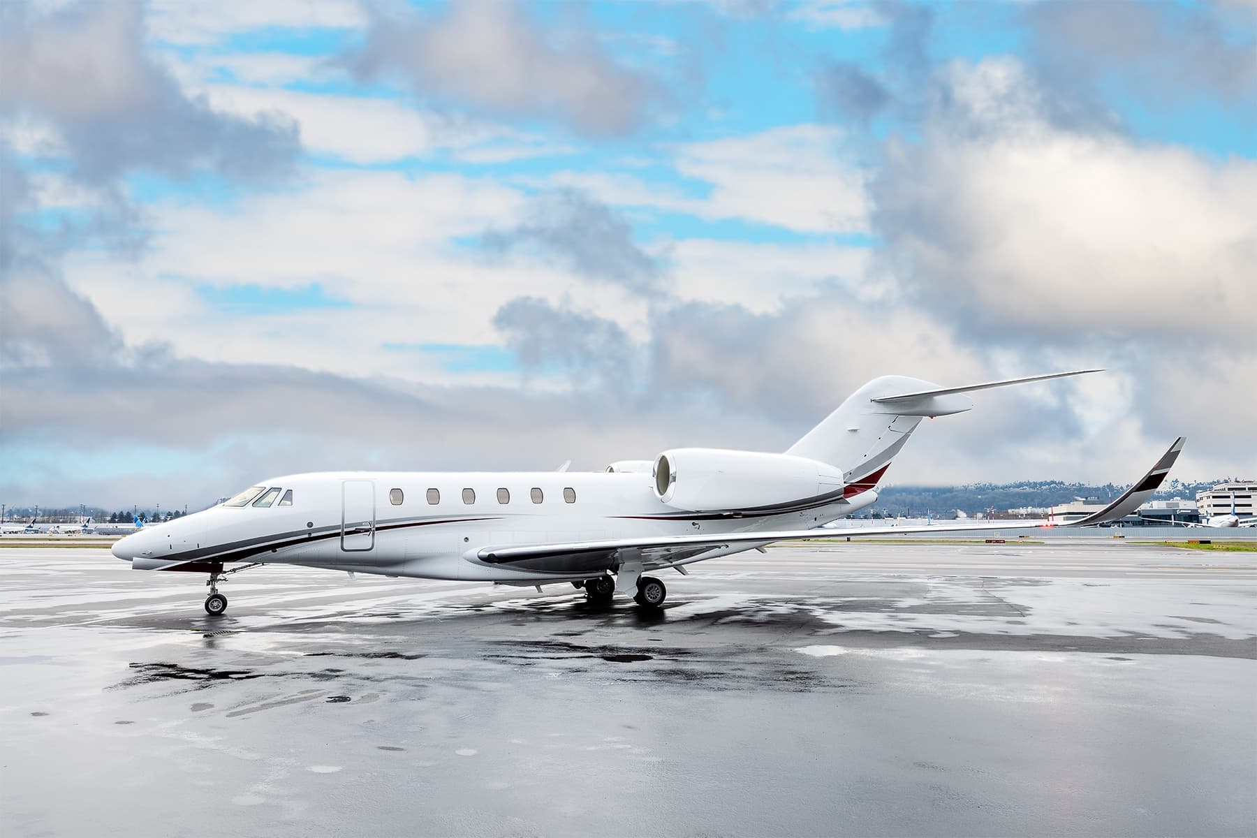 Mon, Nov 9in 6 daysHalifaxCYHZ · Halifax / Stanfield International AirportSt John'sCYYT · St. John's International AirportCitation X8—$11,5299NovHalifax → St John'sCYHZ → CYYT · in 6 daysCitation X · 8 seats$11,529
- Mon, Nov 9in 6 daysHalifaxCYHZ · Stanfield IntlTorontoCYYZ · Lester B.Pearson IntlGulfstream G100—2h 9mOn request9NovHalifax → TorontoCYHZ → CYYZ · in 6 daysGulfstream G100 · 2h 9mOn request
- Mon, Nov 905:00HalifaxCYHZ · Stanfield IntlTorontoCYYZ · Lester B. Pearson IntlGulfstream G100 (Astra SPX)7—On request9NovHalifax → TorontoCYHZ → CYYZ · 05:00Gulfstream G100 (Astra SPX) · 7 seatsOn request
- Fri, Nov 13in 10 daysHalifaxCYHZ · Halifax / Stanfield International AirportTorontoCYYZ · Toronto Lester B. Pearson International AirportGulfstream G1007—$23,32013NovHalifax → TorontoCYHZ → CYYZ · in 10 daysGulfstream G100 · 7 seats$23,320
 Fri, Nov 13in 10 daysHalifaxCYHZ · Halifax / Stanfield International AirportTorontoCYYZ · Lester B. Pearson International AirportGulfstream G100 (Astra SPX)11h 48mOn request13NovHalifax → TorontoCYHZ → CYYZ · in 10 daysGulfstream G100 (Astra SPX) · 1 seat · 1h 48mOn request
 Sat, Nov 21in 18 daysHalifaxCYHZ · Halifax / Stanfield International AirportMiamiKMIA · Miami International AirportGulfstream G20013h 36mOn request21NovHalifax → MiamiCYHZ → KMIA · in 18 daysGulfstream G200 · 1 seat · 3h 36mOn request
- Sat, Jan 2in 60 daysHalifaxCYHZ · Stanfield IntlSt. John'sCYYT · St Johns IntlChallenger 604—1h 41mOn request2JanHalifax → St. John'sCYHZ → CYYT · in 60 daysChallenger 604 · 1h 41mOn request
 Sat, Jan 2in 60 daysHalifaxCYHZ · Halifax / Stanfield International AirportSt. John'sCYYT · St. John's International AirportBombardier Challenger 60411h 24mOn request2JanHalifax → St. John'sCYHZ → CYYT · in 60 daysBombardier Challenger 604 · 1 seat · 1h 24mOn request
 CYHZ · Halifax / Stanfield International Airport
 KMIA · Miami International Airport
* Total price incl. 10% service fee, converted to your selected currency. Price subject to operator confirmation.
Empty legs to CYHZ
9 arrivals available
- Wed, Nov 4TomorrowTorontoCYYZ · Toronto Lester B. Pearson International AirportHalifaxCYHZ · Halifax / Stanfield International AirportGulfstream G1007—$10,4504NovToronto → HalifaxCYYZ → CYHZ · TomorrowGulfstream G100 · 7 seats$10,450
- Wed, Nov 405:00TorontoCYYZ · Lester B. Pearson IntlHalifaxCYHZ · Stanfield IntlGulfstream G100 (Astra SPX)7—On request4NovToronto → HalifaxCYYZ → CYHZ · 05:00Gulfstream G100 (Astra SPX) · 7 seatsOn request
- Mon, Nov 9in 6 daysMiamiKMIA · Miami International AirportHalifaxCYHZ · Halifax / Stanfield International AirportGulfstream G2009—$18,3709NovMiami → HalifaxKMIA → CYHZ · in 6 daysGulfstream G200 · 9 seats$18,370
- Wed, Nov 11in 8 daysSt John'sCYYT · St. John's International AirportHalifaxCYHZ · Halifax / Stanfield International AirportCitation X8—$12,63211NovSt John's → HalifaxCYYT → CYHZ · in 8 daysCitation X · 8 seats$12,632
 Tue, Dec 113:00MiamiKMIA · Miami International AirportHalifaxCYHZ · Halifax / Stanfield International AirportGulfstream G20010—$31,8741DecMiami → HalifaxKMIA → CYHZ · 13:00Gulfstream G200 · 10 seats$31,874
- Tue, Dec 8in 35 daysEdinburghEGPHHalifaxCYHZ · Stanfield IntlChallenger 604—6h 5mOn request8DecEdinburgh → HalifaxEGPH → CYHZ · in 35 daysChallenger 604 · 6h 5mOn request
- Tue, Dec 8in 35 daysEdinburghEGPH · Edinburgh AirportHalifaxCYHZ · Halifax / Stanfield International AirportBombardier Challenger 60415h 48mOn request8DecEdinburgh → HalifaxEGPH → CYHZ · in 35 daysBombardier Challenger 604 · 1 seat · 5h 48mOn request
- Sun, Jan 3in 61 daysNassauMYNN · Lynden Pindling IntlHalifaxCYHZ · Stanfield IntlChallenger 604—3h 49mOn request3JanNassau → HalifaxMYNN → CYHZ · in 61 daysChallenger 604 · 3h 49mOn request
- Sun, Jan 3in 61 daysNassauMYNN · Lynden Pindling International AirportHalifaxCYHZ · Halifax / Stanfield International AirportBombardier Challenger 60413h 30mOn request3JanNassau → HalifaxMYNN → CYHZ · in 61 daysBombardier Challenger 604 · 1 seat · 3h 30mOn request
 EGPH
 MYNN · Lynden Pindling Intl
* Total price incl. 10% service fee, converted to your selected currency. Price subject to operator confirmation.
Map: Halifax Airport
View the location of Halifax – YHZ/CYHZ. Zoom in to explore the area around the airport.
About the airport
Halifax / Stanfield International Airport (YHZ/CYHZ) is the key private jet gateway for Halifax. PrivJet gives you instant access to charter flights and empty legs: fast, discreet and globally connected.
CYHZ airport FAQ
Are there any restrictions at Halifax airport (CYHZ) today?
There are currently 6 valid NOTAMs for Halifax (CYHZ). Affected: Air/ground facility: unserviceable; Aerodrome: not available. For information only, not for flight planning or operational use. Always rely on an official pre-flight briefing. This list may be incomplete or out of date.
What is the weather at Halifax airport (CYHZ)?
According to the latest weather report for CYHZ (METAR, 03 Nov, 09:00 UTC): Good visual conditions (VFR). Wind 9 kt (17 km/h) from northwest (320°), visibility 10 km or more, temperature 10 °C (dew point 7 °C). For information only, not for flight planning. Weather can change quickly; always rely on official reports.
How long are the runways at Halifax airport (CYHZ)?
Halifax (CYHZ) has 2 runways: runway 05/23 with 3,200 m (10,500 ft), asphalt and runway 14/32 with 2,347 m (7,700 ft), asphalt. The longest is 3,200 m.
What are the radio frequencies at Halifax airport (CYHZ)?
Frequencies at CYHZ: Tower 118.4 MHz, Ground 121.9 MHz and ATIS 121 MHz. For information only. Always rely on the published AIP.
What are the airport codes of Halifax / Stanfield International Airport?
The ICAO code is CYHZ and the IATA code is YHZ. ICAO codes are used by air traffic control and pilots, e.g. in flight plans; IATA codes appear on tickets and baggage tags.
What is the elevation of CYHZ airport?
Halifax / Stanfield International Airport sits at 477 ft (145 m) above sea level. Local time zone: America/Halifax.
Can I fly to CYHZ by private jet?
Whether a private jet can operate into Halifax / Stanfield International Airport depends on runway length, opening hours, customs and immigration rules as well as slot and handling availability, among other things. PrivJet checks this with the operating carrier for every request.
Are there empty legs from or to CYHZ?
There are currently 8 empty legs departing from and 9 arriving at Halifax / Stanfield International Airport. Empty legs are repositioning flights at heavily reduced prices; the list is updated several times a day.