Baton Rouge Metropolitan Ryan Field Airport (KBTR / BTR)
Empty legs and charters from Baton Rouge
KBTR airport at a glance
- ICAO code
- KBTR
- IATA code
- BTR
- City
- Baton Rouge
- Region
- Louisiana
- Country
- United States
- Elevation
- 70 ft (21 m)
- Time zone
- America/Chicago (UTC-6)
- Coordinates
- 30.5332° N, 91.1496° W
- Empty legs from
- 14
- Empty legs to
- 15
Weather & airport info KBTR
Current weather
Good visual conditions (VFR)observed 03 Nov, 05:23 UTC- Wind
- 10 kt (19 km/h) from east (100°)
- Visibility
- 10 km or more
- Clouds
- scattered clouds at 1,400 ft
- Temperature
- 22 °C (dew point 20 °C)
- Pressure (QNH)
- 1,016 hPa
Original weather report (METAR)
SPECI KBTR 030523Z 10010KT 10SM SCT014 22/20 A2999 RMK AO1 T02220200 PNO
Forecast (TAF)
- 03 Nov, 06:00–08:00 UTC8 kt (15 km/h) from east-southeast (120°) · visibility 10 km or more · broken clouds at 1,500 ft
- 03 Nov, 08:00–10:00 UTCfrom7 kt (13 km/h) from east-southeast (120°) · visibility 10 km or more · scattered clouds at 2,000 ft, broken clouds at 4,500 ft
- 03 Nov, 10:00–11:00 UTCfrom6 kt (11 km/h) from east-southeast (120°) · visibility 10 km or more · broken clouds at 2,000 ft
- 03 Nov, 11:00–14:00 UTCfrom6 kt (11 km/h) from east-southeast (110°) · visibility 10 km or more · broken clouds at 1,000 ft, broken clouds at 2,000 ft
- 03 Nov, 14:00–03:00 UTCfrom7 kt (13 km/h) from east-southeast (120°) · visibility 10 km or more · broken clouds at 1,500 ft, broken clouds at 2,500 ft
Original forecast (TAF)
TAF KBTR 030520Z 0306/0406 12008KT P6SM BKN015 FM030800 12007KT P6SM SCT020 BKN045 FM031000 12006KT P6SM BKN020 FM031100 11006KT P6SM BKN010 BKN020 FM031400 12007KT P6SM BKN015 BKN025 PROB30 0400/0403 4SM -SHRA BKN015 FM040300 00000KT P6SM BKN015 BKN025 PROB30 0403/0406 2SM -SHRA OVC008
Airport
- Elevation
- 70 ft (21 m)
- Sunrise / Sunset
- 06:20 / 17:15 local time
Runways
| Runway | Length | Surface | Lighted |
|---|---|---|---|
| 04L/22R | 2,286 m (7,500 ft) | concrete | yes |
| 13/31 | 2,135 m (7,005 ft) | asphalt | yes |
| 04R/22L | 1,158 m (3,799 ft) | asphalt | yes |
Radio frequencies
- ATIS: 125.2
- Clearance: 119.4
- CTAF: 118.45
- Ground: 121.9
- Tower: 118.45
- UNICOM: 122.95
For information only, not for flight planning. Weather can change quickly; always rely on official reports. Sources: aviationweather.gov (NOAA), OurAirports.
Airport map KBTR
Full screen →Runways white, taxiways yellow with designators, closed taxiways and runways per NOTAM in red.
Closed per NOTAM: TWY G* (* partly closed)
Official charts (FAA)
Cycle 2611, valid until 0901Z 11/26/26
Airport diagram (FAA)
Airport diagram (1)
Instrument approaches (7)
Minimums (2)
Hot spots (1)
For information only, not for navigation. Always use current official charts and NOTAMs.
Current NOTAMs for KBTR(24)
NOTAMs (Notices to Air Missions) announce short-term changes at an airport: closed runways or taxiways, unserviceable approach aids, obstacles, airspace restrictions.
- Out of serviceTerminal area surveillance radar: unserviceableA0684/26· from 09 Nov, 13:00 UTC · until 09 Nov, 22:00 UTC
The Terminal Area Radar (TAR) and Secondary Surveillance Radar (SSR) are out of service. These radar systems are used to monitor air traffic near the airport.
Show original text
SVC TAR/SSR U/S
A0684/26 NOTAMN
Q) KZHU/QCTAS////000/999/3031N09109W005
A) KBTR
B) 2611091300
C) 2611092200
E) SVC TAR/SSR U/S
- Out of serviceTerminal area surveillance radar: unserviceableA0683/26· from 08 Nov, 13:00 UTC · until 08 Nov, 22:00 UTC
The air traffic control service for the Terminal Area Radar and Secondary Surveillance Radar is out of service. These systems help air traffic control locate and identify aircraft near the airport.
Show original text
SVC TAR/SSR U/S
A0683/26 NOTAMN
Q) KZHU/QCTAS////000/999/3031N09109W005
A) KBTR
B) 2611081300
C) 2611082200
E) SVC TAR/SSR U/S
- Out of serviceTerminal area surveillance radar: unserviceableA0678/26· from 05 Nov, 13:00 UTC · until 05 Nov, 22:00 UTC
The secondary surveillance radar (SSR) is out of service.
Show original text
SVC TAR/SSR U/S
A0678/26 NOTAMN
Q) KZHU/QCTAS////000/999/3031N09109W005
A) KBTR
B) 2611051300
C) 2611052200
E) SVC TAR/SSR U/S
- Out of serviceLanding direction indicator: unserviceableA0686/26· from 03 Nov, 15:00 UTC · until 03 Nov, 23:59 UTC
All runway visual range (RVR) measurements at Baton Rouge Metropolitan Airport are out of service.
Show original text
AD AP RVR ALL U/S
A0686/26 NOTAMN
Q) KZHU/QFTAS////000/999/3031N09109W005
A) KBTR
B) 2611031500
C) 2611032359
E) AD AP RVR ALL U/S
- Out of serviceTerminal area surveillance radar: unserviceableA0682/26· from 03 Nov, 12:30 UTC · until 03 Nov, 23:00 UTC
The Terminal Area Radar (TAR) is out of service. This radar system helps air traffic control monitor aircraft near the airport.
Show original text
SVC TAR U/S
A0682/26 NOTAMN
Q) KZHU/QCTAS////000/999/3031N09109W005
A) KBTR
B) 2611031230
C) 2611032300
E) SVC TAR U/S
- Out of serviceObstacle lights: unserviceableA0685/26· until 02 Dec, 16:27 UTC
Tower light (ASR 1027697) (2.1 NM south of BTR) 218 ft above sea level (166 ft above ground) out of service
Show original text
TOWER LGT (ASR 1027697) 302952.00N0910920.00W (2.1NM S BTR) 218FT (166FT AGL) U/S
A0685/26 NOTAMN
Q) KZHU/QOLAS/IV/M/AE/000/999/3029N09109W001
A) KBTR
B) 2611021627
C) 2612021627
E) TOWER LGT (ASR 1027697) 302952.00N0910920.00W (2.1NM S BTR) 218FT (166FT AGL) U/S
- Out of serviceObstacle11/005· until 31 Jan, 13:32 UTC
Obstacle light on tower (ASR 1215923) (11.3 NM east-southeast of BTR) 299.9 ft above sea level (257.9 ft above ground) out of service
Show original text
OBST TOWER LGT (ASR 1215923) 302901.50N0905626.10W (11.3NM ESE BTR) 299.9FT (257.9FT AGL) U/S
- Out of serviceTaxiway11/001· until 30 Nov, 23:59 UTC
The taxiway B holding position sign light on the west side for runway 04/22 is out of service.
Show original text
TWY B HLDG PSN SIGN WEST SIDE FOR RWY 04/22 LGT U/S
16 more NOTAMs
- Out of serviceServices10/088· until 18 Dec, 20:00 UTC (estimated)
The remote communication outlet (REMOTE COM OUTLET) on frequency 122.200 is out of service. This affects a communication option for aircraft.
Show original text
COM REMOTE COM OUTLET 122.200 U/S
- Out of serviceObstacle10/078· until 30 Nov, 23:59 UTC
A tower near the airport, with its top at 275.6 feet above sea level and 221.8 feet above ground, has its lighting out of service.
Show original text
OBST TOWER LGT (ASR 1023231) 302808.00N0911123.00W (4.4NM SSW BTR) 275.6FT (221.8FT AGL) U/S
- Out of serviceObstacle lights: unserviceableA0670/26· until 11 Dec, 06:33 UTC
A tower light (ASR 1020970) 7.5 nautical miles southwest of the airport is out of service. Its top is 368 feet above sea level, 351 feet above ground.
Show original text
TOWER LGT (ASR 1020970) 302747.70N0911610.90W (7.5NM SW BTR) 368FT (351FT AGL) U/S
A0670/26 NOTAMN
Q) KZHU/QOLAS/IV/M/E/000/999/3027N09116W001
A) KBTR
B) 2610270033
C) 2612110633
E) TOWER LGT (ASR 1020970) 302747.70N0911610.90W (7.5NM SW BTR) 368FT (351FT AGL) U/S
- Out of serviceObstacle10/061· until 19 Jan, 04:00 UTC
The lighting on a tower (ASR 1222289) 12.1 nautical miles south-southwest of the airport is out of service. Its top is 332.0 ft above sea level, 319.9 ft above ground.
Show original text
OBST TOWER LGT (ASR 1222289) 302149.40N0911631.90W (12.1NM SSW BTR) 332.0FT (319.9FT AGL) U/S
- Out of serviceObstacle10/047· until 18 Nov, 23:59 UTC
Obstacle light on tower (ASN 2024-ASW-14391-OE) (4.6 NM southwest of BTR) 271 ft above sea level (248 ft above ground) out of service
Show original text
OBST TOWER LGT (ASN 2024-ASW-14391-OE) 302835N0911236W (4.6NM SW BTR) 271FT (248FT AGL) U/S
- Out of serviceObstacle10/036· until 11 Jan, 10:59 UTC
An obstacle, a tower light, is out of service. Its top is 277.9 ft above sea level, 270.0 ft above ground, and it is located 11.7 nautical miles south-southeast of the airport.
Show original text
OBST TOWER LGT (ASR 1223733) 302036.40N0910513.20W (11.7NM SSE BTR) 277.9FT (270.0FT AGL) U/S
- Out of serviceObstacle10/035· until 13 Nov, 23:59 UTC
A tower light (ASR 1027697) 2.1 nautical miles south of the airport is out of service. The top of the tower is 217.2 ft above sea level, 165.0 ft above ground.
Show original text
OBST TOWER LGT (ASR 1027697) 302952.00N0910920.00W (2.1NM S BTR) 217.2FT (165.0FT AGL) U/S
10/035 NOTAMN<BR>
<B>Q) </B>KZHU/QOLAS/IV/M/AE/000/003/3031N09108W005<BR>
<B>A) </B>KBTR<BR>
<B>B) </B>2610130134<BR>
<B>C) </B>2611132359<BR>
<B>E) </B> TOWER LGT (ASR 1027697) 302952.00N0910920.00W (2.1NM S BTR) 217.2FT (165.0FT AGL) U/S<BR>
- Out of serviceObstacle10/033· until 11 Jan, 23:59 UTC
A tower light (ASR 1042553) 5.3 nautical miles south-southeast of the airport is out of service. Its top is 529.9 ft above sea level, 480.0 ft above ground.
Show original text
OBST TOWER LGT (ASR 1042553) 302701.00N0910633.00W (5.3NM SSE BTR) 529.9FT (480.0FT AGL) U/S
- Out of serviceObstacle10/029· until 09 Nov, 23:00 UTC
A tower light located 19.6 nautical miles northeast of the airport is out of service. The top of the obstacle is 643 ft above sea level, 383 ft above ground.
Show original text
OBST TOWER LGT (ASN 1996-ASW-199-OE) 305121N0910500W (19.6NM NE BTR) 643FT (383FT AGL) U/S
- ClosedTaxiway: closedA0648/26· until 31 Dec, 23:59 UTC
Taxiway G between runway 04L/22R and taxiway E is closed.
Show original text
TWY G BTN RWY 04L/22R AND TWY E CLSD
A0648/26 NOTAMN
Q) KZHU/QMXLC////000/999/3031N09108W005
A) KBTR
B) 2610072108
C) 2612312359
E) TWY G BTN RWY 04L/22R AND TWY E CLSD
- Out of serviceILS category II: not availableA0687/26· from 03 Nov, 15:00 UTC · until 03 Nov, 23:59 UTC
The Instrument Landing System (ILS) Category II for runway 22 at Baton Rouge Metropolitan, Ryan Field airport, is not available. The ILS guides aircraft to the runway in poor visibility.
Show original text
BTR NAV ILS RWY 22 CAT II NA
A0687/26 NOTAMN
Q) KZHU/QITAU////000/999/3031N09109W005
A) KBTR
B) 2611031500
C) 2611032359
E) BTR NAV ILS RWY 22 CAT II NA
- NoticeRunway10/086· until 31 Dec, 23:59 UTC
The holding position sign for runway 22 is not standard.
Show original text
RWY 22 HLDG PSN SIGN NOT STD
- NoticeRunway10/085· until 31 Dec, 23:59 UTC
The holding position sign for runway 04 is not standard.
Show original text
RWY 04 HLDG PSN SIGN NOT STD
- NoticeRunway centre line lightsA0680/26· until 31 Dec, 23:59 UTC
The runway centerline lights (RCLL) for runway 04/22 are not standard.
Show original text
RWY 04/22 RCLL NOT STD
A0680/26 NOTAMN
Q) KZHU/QLCXX////000/999/3031N09109W005
A) KBTR
B) 2610291719
C) 2612312359
E) RWY 04/22 RCLL NOT STD
- NoticeTaxiwayA0613/26· permanent
Taxiway E between taxiway E1 and taxiway G is a non-movement area. Aircraft are not permitted to move there without specific clearance.
Show original text
TWY E BTN TWY E1 AND TWY G NONMOVEMENT AREA
A0613/26 NOTAMN
Q) KZHU/QMXXX////000/999/3031N09108W005
A) KBTR
B) 2609291816
C) PERM
E) TWY E BTN TWY E1 AND TWY G NONMOVEMENT AREA
- NoticeDaylight markings09/096· until 31 Dec, 12:00 UTC
The taxiway B centerline markings between runway 04L/22R and taxiway L are not standard.
Show original text
TWY B CL MARKINGS BTN RWY 04L/22R AND TWY L NOT STD
09/096 NOTAMR
Q) KZHU/QMMXX/V/M/A/000/999/3031N09108W005
A) KBTR
B) 2609251257
C) 2612311200

E) TWY B CL MARKINGS BTN RWY 04L/22R AND TWY L NOT STD
For information only, not for flight planning or operational use. Always rely on an official pre-flight briefing. This list may be incomplete or out of date. Explanations and expanded abbreviations are generated automatically. The original text is authoritative. Source: FAA NOTAM Management Service (SWIM).
Private jet traffic in Baton Rouge Metropolitan Ryan Field (last 30 days)
- Arrivals
- 683
- Departures
- 594
- Different jets
- 383
Most frequent origins: Birmingham-Shuttlesworth International Airport (15), Lakefront Airport (13), Louis Armstrong New Orleans International Airport (11), Dallas Love Field (11), William P Hobby Airport (11).
Most frequent destinations: Birmingham-Shuttlesworth International Airport (33), Texas Gulf Coast Regional Airport (23), Destin Fort Walton Beach Airport (15), Dallas Love Field (15), Lakefront Airport (15).
Most common aircraft types: Pilatus PC-12 (160), Embraer Phenom 300 (98), Bombardier Challenger 350/3500 (95), HondaJet (73), Cessna Citation Latitude (72).
Thursday is the busiest day.
Our own analysis of public ADS-B signals from business jets. Not every flight is received, and jets with a removal request are excluded.
Charter operators based here
Operators with a base at this airport.
- BTR Air Charter & ManagementTurboprop, Light jet
- Mid-Coast Air CharterTurboprop
Empty legs from KBTR
14 departures available
 Fri, Nov 6in 3 daysBaton RougeKBTR · Baton Rouge Metropolitan Ryan FieldPontiacKPTK · Oakland County International AirportLearjet 608—$14,3006NovBaton Rouge → PontiacKBTR → KPTK · in 3 daysLearjet 60 · 8 seats$14,300
- Fri, Nov 619:00Baton RougeKBTR · Baton Rouge Metropolitan Ryan FieldDallasKADS · Addison AirportBombardier Challenger 85011h 6mOn request6NovBaton Rouge → DallasKBTR → KADS · 19:00Bombardier Challenger 850 · 1 seat · 1h 6mOn request
 Fri, Nov 616:06Baton RougeKBTR · Baton Rouge Metropolitan Ryan FieldHoustonKDWH · David Wayne Hooks Memorial AirportBombardier Learjet 60154m$5,9406NovBaton Rouge → HoustonKBTR → KDWH · 16:06Bombardier Learjet 60 · 1 seat · 54m$5,940
- Fri, Nov 6in 3 daysBaton RougeKBTR · Baton Rouge Metropolitan Ryan FieldHoustonKDWH · David Wayne Hooks Memorial AirportLearjet Lear 607—$6,6006NovBaton Rouge → HoustonKBTR → KDWH · in 3 daysLearjet Lear 60 · 7 seats$6,600
- Fri, Nov 6in 3 daysBaton RougeKBTR · Baton Rouge Metropolitan Ryan FieldDallasKADS · Addison AirportBombardier Inc CRJ20019—$10,4506NovBaton Rouge → DallasKBTR → KADS · in 3 daysBombardier Inc CRJ200 · 19 seats$10,450
- Sat, Nov 7in 4 daysBaton RougeKBTR · Baton Rouge Metropolitan AirportNew OrleansKNBG · New Orleans NAS JRB/Alvin Callender FieldCessna CitationJet5—$4,0707NovBaton Rouge → New OrleansKBTR → KNBG · in 4 daysCessna CitationJet · 5 seats$4,070
- Sat, Nov 7in 4 daysBaton RougeKBTR · Baton Rouge Metropolitan AirportPontiacKPTK · Oakland County International AirportBombardier Learjet 607—$17,4907NovBaton Rouge → PontiacKBTR → KPTK · in 4 daysBombardier Learjet 60 · 7 seats$17,490
- Sat, Nov 702:14Baton RougeKBTR · Metropolitan IntlDallasKADS · AddisonBombardier Global Express19—On request7NovBaton Rouge → DallasKBTR → KADS · 02:14Bombardier Global Express · 19 seatsOn request
- Sat, Nov 7in 4 daysBaton RougeKBTR · Metropolitan IntlNew OrleansKMSY · Louis Armstrong IntlMidsize Jet6—On request7NovBaton Rouge → New OrleansKBTR → KMSY · in 4 daysMidsize Jet · 6 seatsOn request
 KBTR · Baton Rouge Metropolitan Ryan Field
* Total price incl. 10% service fee, converted to your selected currency. Price subject to operator confirmation.
Empty legs to KBTR
15 arrivals available
- Thu, Nov 5in 2 daysDaytonKFFO · Wright Patterson Air Force BaseBaton RougeKBTR · Baton Rouge Metropolitan Ryan FieldEmbraer Phenom 300E7—$7,5905NovDayton → Baton RougeKFFO → KBTR · in 2 daysEmbraer Phenom 300E · 7 seats$7,590
- Thu, Nov 5in 2 daysPattersonKPTN · Harry P Williams Memorial AirportBaton RougeKBTR · Metropolitan IntlSuper Midsize Jet6—On request5NovPatterson → Baton RougeKPTN → KBTR · in 2 daysSuper Midsize Jet · 6 seatsOn request
- Sat, Nov 7in 4 daysDallasKADS · Addison AirportBaton RougeKBTR · Baton Rouge Metropolitan Ryan FieldBombardier Global Express191h 14mOn request7NovDallas → Baton RougeKADS → KBTR · in 4 daysBombardier Global Express · 19 seats · 1h 14mOn request
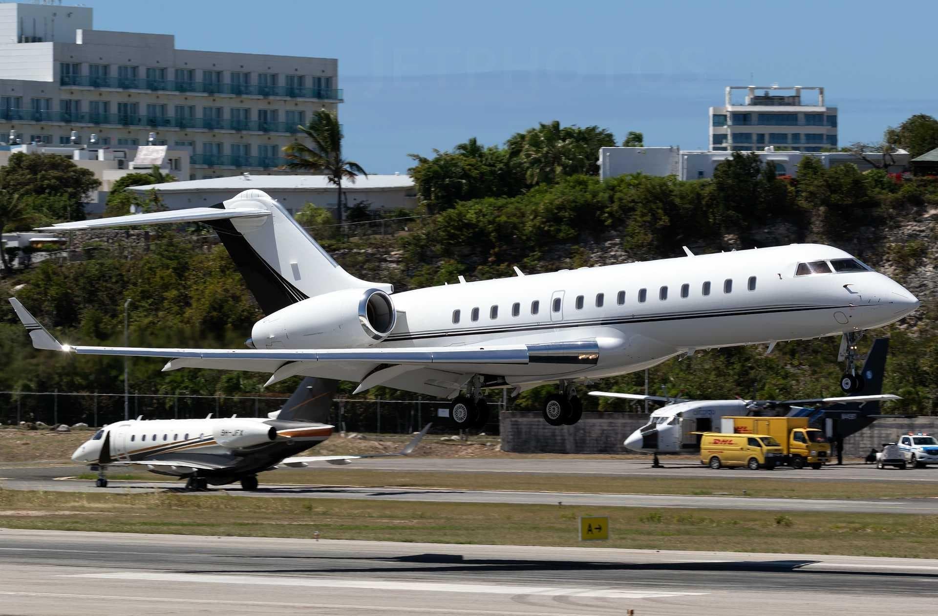 Sun, Nov 8in 5 daysDallasKADS · Addison AirportBaton RougeKBTR · Baton Rouge Metropolitan Ryan FieldGlobal Express19—On request8NovDallas → Baton RougeKADS → KBTR · in 5 daysGlobal Express · 19 seatsOn request
- Sun, Nov 812:43DallasKADS · Addison AirportBaton RougeKBTR · Baton Rouge Metropolitan AirportBombardier Challenger 85015—$9,4608NovDallas → Baton RougeKADS → KBTR · 12:43Bombardier Challenger 850 · 15 seats$9,460
 Sun, Nov 812:30MiamiKOPF · Miami-Opa Locka Executive AirportBaton RougeKBTR · Baton Rouge Metropolitan Ryan FieldBombardier Learjet 6011h 54m$13,6408NovMiami → Baton RougeKOPF → KBTR · 12:30Bombardier Learjet 60 · 1 seat · 1h 54m$13,640
- Sun, Nov 8in 5 daysDallasKADS · Addison AirportBaton RougeKBTR · Baton Rouge Metropolitan Ryan FieldBombardier Inc CRJ20019—$10,4508NovDallas → Baton RougeKADS → KBTR · in 5 daysBombardier Inc CRJ200 · 19 seats$10,450
- Fri, Nov 13in 10 daysNew OrleansKMSY · Louis Armstrong New Orleans International AirportBaton RougeKBTR · Baton Rouge Metropolitan Ryan FieldGulfstream G-IV1630mOn request13NovNew Orleans → Baton RougeKMSY → KBTR · in 10 daysGulfstream G-IV · 16 seats · 30mOn request
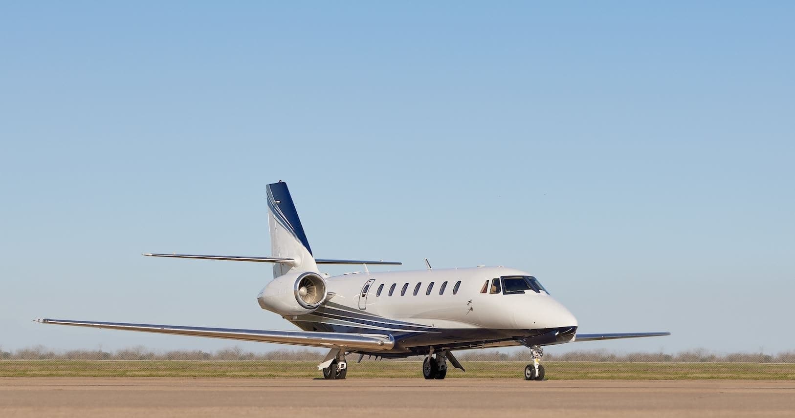 Sat, Nov 14in 11 daysHoustonKTME · Houston Executive AirportBaton RougeKBTR · Baton Rouge Metropolitan Ryan FieldCitation Sovereign9—On request14NovHouston → Baton RougeKTME → KBTR · in 11 daysCitation Sovereign · 9 seatsOn request
* Total price incl. 10% service fee, converted to your selected currency. Price subject to operator confirmation.
Map: Baton Rouge Airport
View the location of Baton Rouge – BTR/KBTR. Zoom in to explore the area around the airport.
About the airport
Baton Rouge Metropolitan Ryan Field (BTR/KBTR) is the key private jet gateway for Baton Rouge. PrivJet gives you instant access to charter flights and empty legs: fast, discreet and globally connected.
KBTR airport FAQ
Are there any restrictions at Baton Rouge airport (KBTR) today?
There are currently 18 valid NOTAMs for Baton Rouge (KBTR). Affected: Taxiway: closed; Obstacle lights: unserviceable; Obstacle: out of service; Taxiway: out of service and 1 more. 6 more NOTAMs start in the coming days. For information only, not for flight planning or operational use. Always rely on an official pre-flight briefing. This list may be incomplete or out of date.
What is the weather at Baton Rouge airport (KBTR)?
According to the latest weather report for KBTR (METAR, 03 Nov, 05:23 UTC): Good visual conditions (VFR). Wind 10 kt (19 km/h) from east (100°), visibility 10 km or more, temperature 22 °C (dew point 20 °C). For information only, not for flight planning. Weather can change quickly; always rely on official reports.
How long are the runways at Baton Rouge airport (KBTR)?
Baton Rouge (KBTR) has 3 runways: runway 04L/22R with 2,286 m (7,500 ft), concrete, runway 13/31 with 2,135 m (7,005 ft), asphalt and runway 04R/22L with 1,158 m (3,799 ft), asphalt. The longest is 2,286 m.
What are the radio frequencies at Baton Rouge airport (KBTR)?
Frequencies at KBTR: Tower 118.45 MHz, Ground 121.9 MHz and ATIS 125.2 MHz. For information only. Always rely on the published AIP.
What are the airport codes of Baton Rouge Metropolitan Ryan Field?
The ICAO code is KBTR and the IATA code is BTR. ICAO codes are used by air traffic control and pilots, e.g. in flight plans; IATA codes appear on tickets and baggage tags.
What is the elevation of KBTR airport?
Baton Rouge Metropolitan Ryan Field sits at 70 ft (21 m) above sea level. Local time zone: America/Chicago.
Can I fly to KBTR by private jet?
Whether a private jet can operate into Baton Rouge Metropolitan Ryan Field depends on runway length, opening hours, customs and immigration rules as well as slot and handling availability, among other things. PrivJet checks this with the operating carrier for every request.
Are there empty legs from or to KBTR?
There are currently 14 empty legs departing from and 15 arriving at Baton Rouge Metropolitan Ryan Field. Empty legs are repositioning flights at heavily reduced prices; the list is updated several times a day.