Detroit Metropolitan Wayne County Airport (KDTW / DTW)
Empty legs and charters from Detroit
KDTW airport at a glance
- ICAO code
- KDTW
- IATA code
- DTW
- City
- Detroit
- Region
- Michigan
- Country
- United States
- Elevation
- 645 ft (197 m)
- Time zone
- America/Detroit (UTC-5)
- Coordinates
- 42.2124° N, 83.3534° W
- Empty legs from
- 12
- Empty legs to
- 14
Weather & airport info KDTW
Current weather
Good visual conditions (VFR)observed 03 Nov, 18:53 UTC- Wind
- 9 kt (17 km/h) from south (190°), gusts up to 19 kt
- Visibility
- 10 km or more
- Clouds
- few clouds at 3,500 ft, scattered clouds at 5,500 ft, scattered clouds at 22,000 ft
- Temperature
- 23 °C (dew point 15 °C)
- Pressure (QNH)
- 1,017 hPa
Original weather report (METAR)
METAR KDTW 031853Z 19009G19KT 10SM FEW035 SCT055 SCT220 23/15 A3002 RMK AO2 SLP165 T02330150
Airport
- Elevation
- 645 ft (197 m)
- Sunrise / Sunset
- 07:08 / 17:25 local time
Runways
| Runway | Length | Surface | Lighted |
|---|---|---|---|
| 04R/22L | 3,659 m (12,003 ft) | concrete | yes |
| 03R/21L | 3,048 m (10,001 ft) | concrete | yes |
| 04L/22R | 3,048 m (10,000 ft) | concrete | yes |
| 09L/27R | 2,654 m (8,708 ft) | asphalt/concrete | yes |
| 03L/21R | 2,591 m (8,501 ft) | asphalt/concrete | yes |
| 09R/27L | 2,591 m (8,500 ft) | concrete | yes |
Radio frequencies
- Approach: 118.575
- ATIS: 133.675
- Clearance: 120.65
- Ground: 119.25
- Tower: 118.4
- UNICOM: 122.95
For information only, not for flight planning. Weather can change quickly; always rely on official reports. Sources: aviationweather.gov (NOAA), OurAirports.
Airport map KDTW
Full screen →Runways white, taxiways yellow with designators, closed taxiways and runways per NOTAM in red.
Closed per NOTAM: RWY 9R/27L, TWY P*, TWY K*, TWY T3 (* partly closed)
Official charts (FAA)
Cycle 2611, valid until 0901Z 11/26/26
Airport diagram (FAA)
Airport diagram (1)
Instrument approaches (52)
- ILS OR LOC RWY 03R
- ILS OR LOC RWY 04R
- ILS OR LOC RWY 21L
- ILS OR LOC RWY 22L
- ILS OR LOC RWY 27L
- ILS OR LOC RWY 27R
- ILS Z OR LOC RWY 04L
- ILS Z OR LOC RWY 22R
- ILS Y RWY 04L
- ILS Y RWY 22R
- ILS RWY 03R (SA CAT I)
- ILS RWY 04R (SA CAT I)
- ILS RWY 22L (SA CAT I)
- ILS RWY 21L (SA CAT I - II)
- ILS RWY 27L (SA CAT I - II)
- ILS Z RWY 22R (SA CAT I - II)
- ILS RWY 03R (CAT II - III)
- ILS RWY 04R (CAT II - III)
- ILS Z RWY 04L (CAT II - III)
- RNAV (RNP) U RWY 04L
- RNAV (RNP) U RWY 22R
- RNAV (RNP) W RWY 03R
- RNAV (RNP) W RWY 04L
- RNAV (RNP) W RWY 21L
- RNAV (RNP) W RWY 22R
- RNAV (RNP) X RWY 03R
- RNAV (RNP) X RWY 04L
- RNAV (RNP) X RWY 04R
- RNAV (RNP) X RWY 21L
- RNAV (RNP) X RWY 22L
- RNAV (RNP) X RWY 22R
- RNAV (GPS) RWY 27L
- RNAV (GPS) RWY 27R
- RNAV (GPS) Y RWY 04L
- RNAV (GPS) Y RWY 22R
- RNAV (GPS) Z RWY 03R
- RNAV (GPS) Z RWY 04L
- RNAV (GPS) Z RWY 04R
- RNAV (GPS) Z RWY 21L
- RNAV (GPS) Z RWY 22L
- RNAV (GPS) Z RWY 22R
- PRM AAUP
- ILS PRM RWY 04R
- ILS PRM RWY 22L
- ILS PRM Y RWY 04L
- ILS PRM Y RWY 22R
- ILS PRM RWY 04R (SA CAT I)
- ILS PRM RWY 04R (CAT II - III)
- RNAV (GPS) PRM Y RWY 04L
- RNAV (GPS) PRM Y RWY 22R
- RNAV (GPS) PRM Z RWY 04R
- RNAV (GPS) PRM Z RWY 22L
Departure procedures (29)
- BARII THREE (RNAV)
- BARII THREE (RNAV), CONT.1
- CCOBB THREE (RNAV)
- CCOBB THREE (RNAV), CONT.1
- CLVIN THREE (RNAV)
- CLVIN THREE (RNAV), CONT.1
- CLVIN THREE (RNAV), CONT.2
- HHOWE FOUR (RNAV)
- HHOWE FOUR (RNAV), CONT.1
- KAYLN THREE (RNAV)
- KAYLN THREE (RNAV), CONT.1
- KZLOV TWO (RNAV)
- KZLOV TWO (RNAV), CONT.1
- LIDDS FOUR (RNAV)
- LIDDS FOUR (RNAV), CONT.1
- METRO FOUR
- METRO FOUR, CONT.1
- MIGGY THREE (RNAV)
- MIGGY THREE (RNAV), CONT.1
- PAVYL THREE (RNAV)
- PAVYL THREE (RNAV), CONT.1
- SNDRS THREE (RNAV)
- SNDRS THREE (RNAV), CONT.1
- SNDRS THREE (RNAV), CONT.2
- TRMML FOUR (RNAV)
- TRMML FOUR (RNAV), CONT.1
- ZETTR FOUR (RNAV)
- ZETTR FOUR (RNAV), CONT.1
- ZETTR FOUR (RNAV), CONT.2
Minimums (1)
Other (23)
- BONZZ TWO (RNAV)
- BONZZ TWO (RNAV), CONT.1
- CRAKN TWO (RNAV)
- CUUGR TWO (RNAV)
- FERRL TWO (RNAV)
- GRAYT TWO (RNAV)
- GRAYT TWO (RNAV), CONT.1
- HANBL THREE (RNAV)
- HANBL THREE (RNAV), CONT.1
- HAYLL THREE (RNAV)
- HTROD TWO (RNAV)
- KKISS TWO (RNAV)
- KKISS TWO (RNAV), CONT.1
- KLYNK THREE (RNAV)
- LAYKS TWO (RNAV)
- LECTR THREE (RNAV)
- RKCTY TWO (RNAV)
- TPGUN TWO (RNAV)
- VCTRZ TWO (RNAV)
- VCTRZ TWO (RNAV), CONT.1
- WNGNT TWO (RNAV)
- RNAV DP AAUP
- RNAV DP AAUP, CONT.1
For information only, not for navigation. Always use current official charts and NOTAMs.
Current NOTAMs for KDTW(31)
NOTAMs (Notices to Air Missions) announce short-term changes at an airport: closed runways or taxiways, unserviceable approach aids, obstacles, airspace restrictions.
- ClosedRunway: closedA2278/26· until 31 Dec, 23:59 UTC
Runway 09R/27L is closed, except with a prior permission required 2 hours in advance by calling 734-942-3685.
Show original text
RWY 09R/27L CLSD EXC 2HR PPR 734-942-3685
A2278/26 NOTAMN
Q) KZOB/QMRLC////000/999/4212N08321W005
A) KDTW
B) 2610162156
C) 2712312359
E) RWY 09R/27L CLSD EXC 2HR PPR 734-942-3685
- Out of serviceILS: unserviceableA2581/26· from 04 Nov, 01:00 UTC · until 04 Nov, 05:00 UTC
The Instrument Landing System (ILS) for Runway 04L at Detroit Metro Wayne County Airport is out of service. The ILS guides aircraft to the runway in poor visibility.
Show original text
DTW NAV ILS RWY 04L U/S
A2581/26 NOTAMN
Q) KZOB/QICAS////000/999/4212N08321W005
A) KDTW
B) 2611040100
C) 2611040500
E) DTW NAV ILS RWY 04L U/S
- Out of serviceILS: unserviceableA2611/26· until 03 Nov, 23:59 UTC
DTW navigation: ILS (instrument landing system) runway 04L out of service
Show original text
DTW NAV ILS RWY 04L U/S
A2611/26 NOTAMN
Q) KZOB/QICAS////000/999/4212N08321W005
A) KDTW
B) 2611031900
C) 2611032359
E) DTW NAV ILS RWY 04L U/S
- Out of serviceILS: unserviceableA2612/26· until 03 Nov, 23:59 UTC
DTW navigation: ILS (instrument landing system) runway 22R out of service
Show original text
DTW NAV ILS RWY 22R U/S
A2612/26 NOTAMN
Q) KZOB/QICAS////000/999/4212N08321W005
A) KDTW
B) 2611031900
C) 2611032359
E) DTW NAV ILS RWY 22R U/S
- Out of serviceRunway end identifier lights: unserviceableA2508/26· until 30 Apr, 20:00 UTC
The runway end identification lights (RWY END ID LGT) for runway 09R are out of service.
Show original text
RWY 09R RWY END ID LGT U/S
A2508/26 NOTAMN
Q) KZOB/QLIAS////000/999/4212N08321W005
A) KDTW
B) 2610292021
C) 2704302000
E) RWY 09R RWY END ID LGT U/S
- Out of serviceOther2772/26· until 08 Jun, 15:22 UTC (estimated)
The I-HJT inner marker for the instrument approach Z to runway 4L is out of service. The ILS Category II approach is not available except for aircraft equipped with a radio altimeter.
Show original text
IAP DETROIT METRO WAYNE COUNTY, DETROIT, MI. ILS Z RWY 4L (CAT II AND III), AMDT 4C ... S-ILS 4L CAT II NA EXCEPT FOR AIRCRAFT EQUIPPED WITH RADIO ALTIMETER. I-HJT INNER MARKER OUT OF SERVICE. 2610271522-2706081522EST
Q) KZOB/QXXXX/I/NBO/A/000/999/4212N08321W025
A) KDTW
B) 2610271522
C) 2706081522EST
E) IAP DETROIT METRO WAYNE COUNTY, DETROIT, MI.
ILS Z RWY 4L (CAT II AND III), AMDT 4C ...
S-ILS 4L CAT II NA EXCEPT FOR AIRCRAFT EQUIPPED WITH RADIO ALTIMETER. I-HJT INNER MARKER OUT OF SERVICE.
- Out of serviceInstrument approach procedure: changedA2458/26· until 08 Jun, 15:22 UTC
Instrument approach procedure DETROIT METRO WAYNE COUNTY, DETROIT, MI. ILS (instrument landing system) Z runway 4L (category II and III), amendment 4C... S-ILS (instrument landing system) 4L category II not available except for aircraft equipped with RADIO ALTIMETER. I-HJT INNER MARKER out of service.
Show original text
IAP DETROIT METRO WAYNE COUNTY, DETROIT, MI. ILS Z RWY 4L (CAT II AND III), AMDT 4C ... S-ILS 4L CAT II NA EXCEPT FOR AIRCRAFT EQUIPPED WITH RADIO ALTIMETER. I-HJT INNER MARKER OUT OF SERVICE.
A2458/26 NOTAMN
Q) KZOB/QPICH/I/NBO/A/000/999/4212N08321W005
A) KDTW
B) 2610271522
C) 2706081522
E) IAP DETROIT METRO WAYNE COUNTY, DETROIT, MI. ILS Z RWY 4L (CAT II AND III), AMDT 4C ... S-ILS 4L CAT II NA EXCEPT FOR AIRCRAFT EQUIPPED WITH RADIO ALTIMETER. I-HJT INNER MARKER OUT OF SERVICE.
- ClosedApron: closed10/287· until 30 Nov, 23:59 UTC
The deice pad for runway 03L, spot 1, is closed.
Show original text
APRON DEICE PAD FOR RWY 03L SPOT 1 CLSD
A2301/26 NOTAMN
Q) KZOB/QMNLC////000/999/4212N08321W005
A) KDTW
B) 2610171350
C) 2611302359
E) APRON DEICE PAD FOR RWY 03L SPOT 1 CLSD
23 more NOTAMs
- ClosedApron: closedA2301/26· until 30 Nov, 23:59 UTC
The deice pad for runway 03L, spot 1, is closed.
Show original text
APRON DEICE PAD FOR RWY 03L SPOT 1 CLSD
A2301/26 NOTAMN Q) KZOB/QMNLC////000/999/4212N08321W005 A) KDTW B) 2610171350 C) 2611302359 E) APRON DEICE PAD FOR RWY 03L SPOT 1 CLSD
- Out of servicePAPI: unserviceableA2288/26· until 06 Nov, 20:00 UTC
The PAPI (Precision Approach Path Indicator) for runway 27R is out of service. The PAPI helps pilots find the correct glide path for landing.
Show original text
RWY 27R PAPI U/S
A2288/26 NOTAMN
Q) KZOB/QLPAS////000/999/4212N08321W005
A) KDTW
B) 2610162231
C) 2611062000
E) RWY 27R PAPI U/S
- Out of servicePAPI: unserviceableA2289/26· until 06 Nov, 20:00 UTC
The PAPI (Precision Approach Path Indicator) for runway 27L is out of service. The PAPI helps pilots find the correct glide path for landing.
Show original text
RWY 27L PAPI U/S
A2289/26 NOTAMN
Q) KZOB/QLPAS////000/999/4212N08321W005
A) KDTW
B) 2610162231
C) 2611062000
E) RWY 27L PAPI U/S
- Out of serviceApproach lighting: unserviceableA2286/26· until 06 Nov, 20:00 UTC
The approach lighting system (ALS) for runway 27R is out of service. The approach lighting system helps pilots with visual orientation during the approach.
Show original text
RWY 27R ALS U/S
A2286/26 NOTAMN
Q) KZOB/QLAAS////000/999/4212N08321W005
A) KDTW
B) 2610162230
C) 2611062000
E) RWY 27R ALS U/S
- Out of serviceApproach lighting: unserviceableA2287/26· until 06 Nov, 20:00 UTC
The approach lighting system (ALS) for runway 27L is out of service. The approach lighting system helps pilots with visual orientation during the approach.
Show original text
RWY 27L ALS U/S
A2287/26 NOTAMN
Q) KZOB/QLAAS////000/999/4212N08321W005
A) KDTW
B) 2610162230
C) 2611062000
E) RWY 27L ALS U/S
- Out of serviceILS: unserviceableA2284/26· until 06 Nov, 20:00 UTC
The instrument landing system (ILS) for runway 27L is out of service. The ILS guides aircraft to the runway in poor visibility.
Show original text
NAV ILS RWY 27L U/S
A2284/26 NOTAMN
Q) KZOB/QICAS////000/999/4212N08321W005
A) KDTW
B) 2610162228
C) 2611062000
E) NAV ILS RWY 27L U/S
- Out of serviceILS: unserviceableA2285/26· until 06 Nov, 20:00 UTC
The instrument landing system (ILS) for runway 27R is out of service. The ILS guides aircraft to the runway in poor visibility.
Show original text
NAV ILS RWY 27R U/S
A2285/26 NOTAMN
Q) KZOB/QICAS////000/999/4212N08321W005
A) KDTW
B) 2610162228
C) 2611062000
E) NAV ILS RWY 27R U/S
- ClosedTaxiway: limited toA1991/26· until 31 May, 23:59 UTC
Taxiway P between taxiway PP south end and the de-icing pad for runway 03L spot 1 is closed to aircraft with a wingspan of more than 118 ft.
Show original text
TWY P BTN TXL PP SOUTH END AND DEICE PAD FOR RWY 03L SPOT 1 CLSD TO ACFT WINGSPAN MORE THAN 118FT
A1991/26 NOTAMN
Q) KZOB/QMXLT////000/999/4212N08321W005
A) KDTW
B) 2610081051
C) 2705312359
E) TWY P BTN TXL PP SOUTH END AND DEICE PAD FOR RWY 03L SPOT 1 CLSD TO ACFT WINGSPAN MORE THAN 118FT
- ClosedApron: limited toA1972/26· until 13 Nov, 12:00 UTC
The de-icing pad for runway 04R is closed, except for remaining overnight parking.
Show original text
APRON DEICE PAD FOR RWY 04R CLSD EXC REMAIN OVER NIGHT PRKG
A1972/26 NOTAMN
Q) KZOB/QMNLT////000/999/4212N08321W005
A) KDTW
B) 2610071155
C) 2611131200
E) APRON DEICE PAD FOR RWY 04R CLSD EXC REMAIN OVER NIGHT PRKG
- ClosedTaxiway: closedA1699/26· until 19 Nov, 23:59 UTC
Taxiway K between Gate B10 and taxiway U is closed. Aircraft cannot use this section of the taxiway.
Show original text
TWY K BTN GATE B10 AND TWY U CLSD
A1699/26 NOTAMN
Q) KZOB/QMXLC////000/999/4212N08321W005
A) KDTW
B) 2609281421
C) 2611192359
E) TWY K BTN GATE B10 AND TWY U CLSD
- ClosedTaxiway: closedA1679/26· until 31 Jan, 23:59 UTC
Taxiway T3 is closed. This means that this specific taxiway at Detroit Metro Wayne County airport cannot be used at the moment.
Show original text
TWY T3 CLSD
A1679/26 NOTAMN
Q) KZOB/QMXLC////000/999/4212N08321W005
A) KDTW
B) 2609271629
C) 2701312359
E) TWY T3 CLSD
- NoticeAirspace11/012· until 05 Nov, 21:00 UTC
The airspace is restricted for unmanned aircraft systems (drones) within a 2 nautical mile radius, 3.3 nautical miles southeast of Detroit airport, from the surface up to 300 feet above ground.
Show original text
AIRSPACE UAS WI AN AREA DEFINED AS 2NM RADIUS OF 422202.90N0825758.90W (3.3NM SSE DET) SFC-300FT
- NoticeTaxiway11/018· until 13 Nov, 23:59 UTC
The direction markings on taxiway J for taxiway K are not marked. This means the ground markings guiding aircraft on taxiway J towards taxiway K are missing.
Show original text
TWY J DIRECTION MARKINGS FOR TWY K NOT MARKED
- NoticeTaxiway edge lightsA2586/26· until 13 Nov, 23:59 UTC
Taxiway Q edge lights between taxiway J and taxiway T not STD
Show original text
TWY Q EDGE LGT BTN TWY J AND TWY T NOT STD
A2586/26 NOTAMN
Q) KZOB/QLYXX////000/999/4212N08321W005
A) KDTW
B) 2611020120
C) 2611132359
E) TWY Q EDGE LGT BTN TWY J AND TWY T NOT STD
- NoticeTaxiway edge lightsA2587/26· until 13 Nov, 23:59 UTC
The edge lighting of taxiway Y between taxiway U and taxiway K2 is not standard. This may affect the visibility of the taxiway in darkness or poor weather.
Show original text
TWY Y EDGE LGT BTN TWY U AND TWY K2 NOT STD
A2587/26 NOTAMN
Q) KZOB/QLYXX////000/999/4212N08321W005
A) KDTW
B) 2611020120
C) 2611132359
E) TWY Y EDGE LGT BTN TWY U AND TWY K2 NOT STD
- NoticeTaxiway edge lightsA2584/26· until 13 Nov, 23:59 UTC
The edge lighting for taxiway J between taxiway Y and taxiway Q at Detroit Metro Wayne County Airport is not standard. This may affect the visibility of the taxiway.
Show original text
TWY J EDGE LGT BTN TWY Y AND TWY Q NOT STD
A2584/26 NOTAMN
Q) KZOB/QLYXX////000/999/4212N08321W005
A) KDTW
B) 2611020119
C) 2611132359
E) TWY J EDGE LGT BTN TWY Y AND TWY Q NOT STD
- NoticeApron10/418· until 05 Dec, 23:59 UTC
The apron taxiway Q surface markings between taxiway Q3 and taxiway U are not standard due to repainting.
Show original text
APRON TXL Q BTN TXL Q3 AND TWY U SFC MARKINGS NOT STD REPAINTING
- NoticeVOR/DME10/370· until 03 Nov, 20:00 UTC
The DXO VOR/DME navigation system is not monitored, so it may not be reliable.
Show original text
DXO NAV VOR/DME NOT MNT
A2451/26 NOTAMN Q) KZOB/QNMXX////000/999/4212N08321W005 A) KDTW B) 2610271129 C) 2611032000 E) DXO NAV VOR/DME NOT MNT
- NoticeAirspace10/326· until 05 Nov, 23:59 UTC
An unmanned aircraft system (UAS) is active within an area defined as a 1 nautical mile radius of 4.6 nautical miles south of Detroit, from the surface to 200 feet above ground.
Show original text
AIRSPACE UAS WI AN AREA DEFINED AS 1NM RADIUS OF 422015N0830103W (4.6NM S DET) SFC-200FT AGL
- NoticeApron10/030· until 31 Mar, 23:59 UTC
On the east side of taxiway J11 on the apron, a de-icing frequency sign is missing.
Show original text
APRON TXL J11 EAST SIDE DEICE FREQ SIGN MISSING
- NoticeInstrument approach procedure6382/26· until 30 Sept, 15:50 UTC (estimated)
For the RNAV (RNP) X approach to runway 22L, the decision altitude is 952 ft above sea level (315 ft above ground) for all categories, with a required runway visual range of 4000 ft for all categories.
Show original text
IAP DETROIT METRO WAYNE COUNTY, DETROIT, MI. RNAV (RNP) X RWY 22L, ORIG... RNP 0.15 DA 952/HAT 315 ALL CATS, VIS RVR 4000 ALL CATS. 2609301551-2809301550EST
Q) KZOB/QPIXX/I/NBO/A/000/999/4212N08321W005
A) KDTW
B) 2609301551
C) 2809301550EST
E) DTW DETROIT METRO WAYNE COUNTY, DETROIT, MI.
RNAV (RNP) X RWY 22L, ORIG...
RNP 0.15 DA 952/HAT 315 ALL CATS, VIS RVR 4000 ALL CATS.
- NoticeInstrument approach procedure: changedA1730/26· until 30 Sept, 15:50 UTC
Instrument approach procedure DETROIT METRO WAYNE COUNTY, DETROIT, MI. RNAV (area navigation) (RNP) X runway 22L, ORIG... RNP 0.15 decision altitude 952/HAT 315 all categories, VIS runway visual range (RVR) 4000 all categories.
Show original text
IAP DETROIT METRO WAYNE COUNTY, DETROIT, MI. RNAV (RNP) X RWY 22L, ORIG... RNP 0.15 DA 952/HAT 315 ALL CATS, VIS RVR 4000 ALL CATS.
A1730/26 NOTAMN
Q) KZOB/QPICH/I/NBO/A/000/999/4212N08321W005
A) KDTW
B) 2609301551
C) 2809301550
E) IAP DETROIT METRO WAYNE COUNTY, DETROIT, MI. RNAV (RNP) X RWY 22L, ORIG... RNP 0.15 DA 952/HAT 315 ALL CATS, VIS RVR 4000 ALL CATS.
- NoticeAirspace09/446· until 06 Sept, 23:59 UTC
The airspace is restricted for unmanned aircraft systems (drones) within an area of 1.8 nautical miles radius, 9.8 nautical miles west of Detroit airport, from the surface up to 400 feet above ground.
Show original text
AIRSPACE UAS WI AN AREA DEFINED AS 1.8NM RADIUS OF 422237.30N0831329.40W (9.8NM W DET) SFC-400FT AGL
For information only, not for flight planning or operational use. Always rely on an official pre-flight briefing. This list may be incomplete or out of date. Explanations and expanded abbreviations are generated automatically. The original text is authoritative. Source: FAA NOTAM Management Service (SWIM).
Private jet traffic in Detroit Metropolitan Wayne County Airport (last 30 days)
- Arrivals
- 320
- Departures
- 278
- Different jets
- 232
Most frequent origins: Teterboro Airport (15), Lester B. Pearson International Airport (13), San Francisco International Airport (9), Oakland County International Airport (9), Chicago Midway International Airport (6).
Most frequent destinations: Teterboro Airport (13), Oakland County International Airport (12), Chicago Midway International Airport (9), San Francisco International Airport (7), Pittsburgh International Airport (5).
Most common aircraft types: Embraer Phenom 300 (53), Gulfstream G550/GV (45), Cessna Citation Latitude (32), Gulfstream G450/GIV (31), Gulfstream G600 (30).
Our own analysis of public ADS-B signals from business jets. Not every flight is received, and jets with a removal request are excluded.
Charter operators based here
Operators with a base at this airport.
- Hantz AirSuper midsize jet
Empty legs from KDTW
12 departures available
- Mon, Nov 9in 6 daysDetroitKDTW · Detroit Metropolitan Wayne County AirportCharlotteKCLT · Charlotte Douglas International AirportCessna Citation X9—On request9NovDetroit → CharlotteKDTW → KCLT · in 6 daysCessna Citation X · 9 seatsOn request
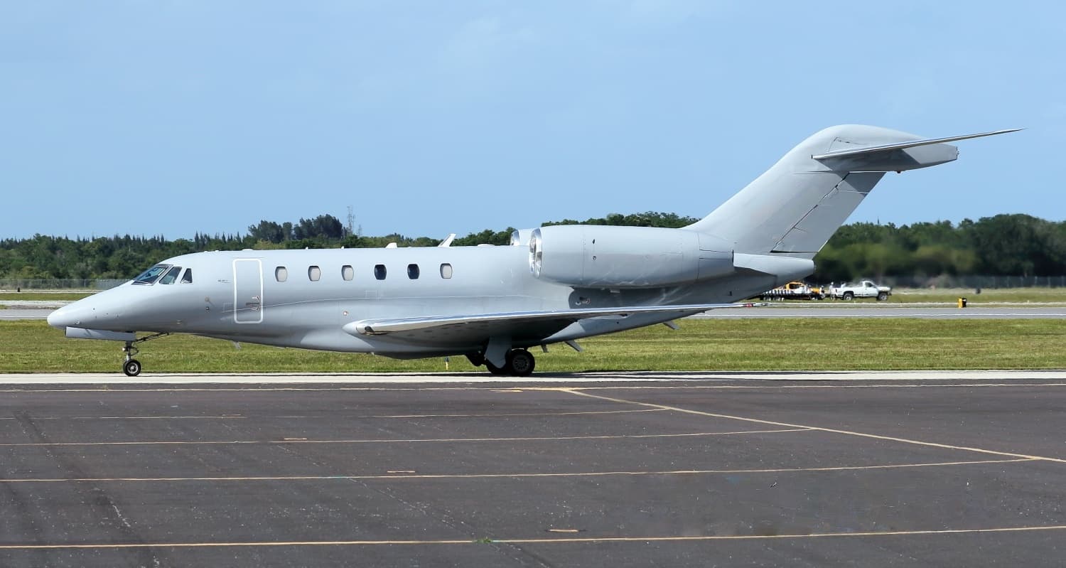 Wed, Nov 11in 8 daysDetroitKDTW · Detroit Metropolitan Wayne County AirportNew YorkKTEB · Teterboro AirportCitation X8—On request11NovDetroit → New YorkKDTW → KTEB · in 8 daysCitation X · 8 seatsOn request
- Wed, Nov 18in 15 daysDetroitKDTW · Detroit Metropolitan Wayne County AirportMilwaukeeKMKE · General Mitchell International AirportCessna Citation CJ48—On request18NovDetroit → MilwaukeeKDTW → KMKE · in 15 daysCessna Citation CJ4 · 8 seatsOn request
- Sat, Nov 28in 25 daysDetroitKDTW · Detroit Metropolitan Wayne County AirportTitusvilleKTIX · Space Coast Regional AirportBombardier Learjet 60XR7—On request28NovDetroit → TitusvilleKDTW → KTIX · in 25 daysBombardier Learjet 60XR · 7 seatsOn request
 Sat, Nov 2819:06DetroitKDTW · Detroit Metropolitan Wayne County AirportTitusvilleKTIX · Space Coast Regional AirportBombardier Learjet 6012h 12m$14,63028NovDetroit → TitusvilleKDTW → KTIX · 19:06Bombardier Learjet 60 · 1 seat · 2h 12m$14,630
- Sat, Nov 28in 25 daysDetroitKDTW · Detroit Metropolitan Wayne County AirportTitusvilleKTIX · Space Coast Regional AirportLearjet Lear 607—$13,26828NovDetroit → TitusvilleKDTW → KTIX · in 25 daysLearjet Lear 60 · 7 seats$13,268
- Sun, Nov 29in 26 daysDetroitKDTW · Detroit Metropolitan Wayne County AirportLeesburgKLEE · Leesburg International AirportHawker 9008—$14,41029NovDetroit → LeesburgKDTW → KLEE · in 26 daysHawker 900 · 8 seats$14,410
- Sun, Nov 2919:54DetroitKDTW · Detroit Metropolitan IntlLeesburgKJYO · Leesburg ExecutiveBombardier Learjet 607—$8,16829NovDetroit → LeesburgKDTW → KJYO · 19:54Bombardier Learjet 60 · 7 seats$8,168
- Sun, Nov 2900:06DetroitKDTW · Detroit Metropolitan IntlTitusvilleKTIX · Space Coast RegionalBombardier Learjet 608—$21,78029NovDetroit → TitusvilleKDTW → KTIX · 00:06Bombardier Learjet 60 · 8 seats$21,780
 KDTW · Detroit Metropolitan Wayne County Airport
* Total price incl. 10% service fee, converted to your selected currency. Price subject to operator confirmation.
Empty legs to KDTW
14 arrivals available
- Tue, Nov 3TodayParisLFPB · Paris-Le Bourget AirportDetroitKDTW · Detroit Metropolitan Wayne County AirportGlobal Express13—On request3NovParis → DetroitLFPB → KDTW · TodayGlobal Express · 13 seatsOn request
 Thu, Nov 510:42BismarckKBIS · Bismarck Municipal AirportDetroitKDTW · Detroit Metropolitan Wayne County AirportBombardier Challenger 30012h$18,6495NovBismarck → DetroitKBIS → KDTW · 10:42Bombardier Challenger 300 · 1 seat · 2h$18,649
- Thu, Nov 5in 2 daysBismarckKBIS · Bismarck Municipal AirportDetroitKDTW · Detroit Metropolitan Wayne County AirportBombardier Inc Challenger 300/3509—$18,4015NovBismarck → DetroitKBIS → KDTW · in 2 daysBombardier Inc Challenger 300/350 · 9 seats$18,401
- Thu, Nov 5in 2 daysVan NuysKVNY · Van Nuys AirportDetroitKDTW · Detroit Metropolitan Wayne County AirportCitation CJ3+7—On request5NovVan Nuys → DetroitKVNY → KDTW · in 2 daysCitation CJ3+ · 7 seatsOn request
- Fri, Nov 6in 3 daysAtlantic CityKACY · Atlantic City International AirportDetroitKDTW · Detroit Metropolitan Wayne County AirportCessna Citation X8—$15,4006NovAtlantic City → DetroitKACY → KDTW · in 3 daysCessna Citation X · 8 seats$15,400
- Tue, Nov 24in 21 daysLeesburgKLEE · Leesburg International AirportDetroitKDTW · Detroit Metropolitan Wayne County AirportHawker 9008—$17,05024NovLeesburg → DetroitKLEE → KDTW · in 21 daysHawker 900 · 8 seats$17,050
- Wed, Nov 25in 22 daysMontgomeryKMGM · Montgomery Regional (Dannelly Field) AirportDetroitKDTW · Detroit Metropolitan Wayne County AirportBombardier Learjet 60XR7—On request25NovMontgomery → DetroitKMGM → KDTW · in 22 daysBombardier Learjet 60XR · 7 seatsOn request
 Wed, Nov 2512:12MontgomeryKMGM · Montgomery Regional (Dannelly Field) AirportDetroitKDTW · Detroit Metropolitan Wayne County AirportBombardier Learjet 6011h 42m$11,44025NovMontgomery → DetroitKMGM → KDTW · 12:12Bombardier Learjet 60 · 1 seat · 1h 42m$11,440
- Wed, Nov 2516:48DallasKDAL · Dallas Love FieldDetroitKDTW · Detroit Metropolitan IntlBombardier Learjet 608—$19,66325NovDallas → DetroitKDAL → KDTW · 16:48Bombardier Learjet 60 · 8 seats$19,663
 LFPB · Paris-Le Bourget Airport
* Total price incl. 10% service fee, converted to your selected currency. Price subject to operator confirmation.
Map: Detroit Airport
View the location of Detroit – DTW/KDTW. Zoom in to explore the area around the airport.
About the airport
Detroit Metropolitan Wayne County Airport (DTW/KDTW) is the key private jet gateway for Detroit. PrivJet gives you instant access to charter flights and empty legs: fast, discreet and globally connected.
KDTW airport FAQ
Are there any restrictions at Detroit airport (KDTW) today?
There are currently 30 valid NOTAMs for Detroit (KDTW). According to NOTAM, at least one runway or the aerodrome itself is closed. Affected: Runway: closed; Apron: closed; Taxiway: limited to; Apron: limited to and 7 more. 1 more NOTAM starts in the coming days. For information only, not for flight planning or operational use. Always rely on an official pre-flight briefing. This list may be incomplete or out of date.
What is the weather at Detroit airport (KDTW)?
According to the latest weather report for KDTW (METAR, 03 Nov, 18:53 UTC): Good visual conditions (VFR). Wind 9 kt (17 km/h) from south (190°), gusts up to 19 kt, visibility 10 km or more, temperature 23 °C (dew point 15 °C). For information only, not for flight planning. Weather can change quickly; always rely on official reports.
How long are the runways at Detroit airport (KDTW)?
Detroit (KDTW) has 6 runways: runway 04R/22L with 3,659 m (12,003 ft), concrete, runway 03R/21L with 3,048 m (10,001 ft), concrete, runway 04L/22R with 3,048 m (10,000 ft), concrete, runway 09L/27R with 2,654 m (8,708 ft), asphalt/concrete, runway 03L/21R with 2,591 m (8,501 ft), asphalt/concrete and runway 09R/27L with 2,591 m (8,500 ft), concrete. The longest is 3,659 m.
What are the radio frequencies at Detroit airport (KDTW)?
Frequencies at KDTW: Tower 118.4 MHz, Ground 119.25 MHz and ATIS 133.675 MHz. For information only. Always rely on the published AIP.
What are the airport codes of Detroit Metropolitan Wayne County Airport?
The ICAO code is KDTW and the IATA code is DTW. ICAO codes are used by air traffic control and pilots, e.g. in flight plans; IATA codes appear on tickets and baggage tags.
What is the elevation of KDTW airport?
Detroit Metropolitan Wayne County Airport sits at 645 ft (197 m) above sea level. Local time zone: America/Detroit.
Can I fly to KDTW by private jet?
Whether a private jet can operate into Detroit Metropolitan Wayne County Airport depends on runway length, opening hours, customs and immigration rules as well as slot and handling availability, among other things. PrivJet checks this with the operating carrier for every request.
Are there empty legs from or to KDTW?
There are currently 12 empty legs departing from and 14 arriving at Detroit Metropolitan Wayne County Airport. Empty legs are repositioning flights at heavily reduced prices; the list is updated several times a day.