Las Vegas Henderson Executive Airport (KHND / HSH)
Empty legs and charters from Las Vegas
KHND airport at a glance
- ICAO code
- KHND
- IATA code
- HSH
- City
- Las Vegas
- Region
- Nevada
- Country
- United States
- Elevation
- 2,492 ft (760 m)
- Time zone
- America/Los Angeles (UTC-8)
- Coordinates
- 35.9728° N, 115.1340° W
- Empty legs from
- 100
- Empty legs to
- 100
Private jet terminal & FBOs at Las Vegas Henderson Executive
- Henderson Executive Airport FBO (county-operated terminal)3500 Executive Terminal Drive, Suite 100, Henderson, NV 89052
Weather & airport info KHND
Current weather
Good visual conditions (VFR)observed 03 Nov, 07:56 UTC- Wind
- 6 kt (11 km/h) from south (190°)
- Visibility
- 10 km or more
- Clouds
- no significant clouds
- Temperature
- 11 °C (dew point 6 °C)
- Pressure (QNH)
- 1,022 hPa
Original weather report (METAR)
METAR KHND 030756Z AUTO 19006KT 10SM CLR 11/06 A3019 RMK AO2 SLP233 T01060061 $
Forecast (TAF)
- 03 Nov, 06:00–17:00 UTC6 kt (11 km/h) from south (190°) · visibility 10 km or more · broken clouds at 20,000 ft
- 03 Nov, 17:00–01:00 UTCfrom6 kt (11 km/h) from northeast (40°) · visibility 10 km or more · broken clouds at 20,000 ft
- 04 Nov, 01:00–06:00 UTCfrom3 kt (6 km/h) from variable directions · visibility 10 km or more · no significant clouds
Original forecast (TAF)
TAF KHND 030520Z 0306/0406 19006KT P6SM BKN200 FM031700 04006KT P6SM BKN200 FM040100 VRB03KT P6SM SKC
Airport
- Elevation
- 2,492 ft (760 m)
- Sunrise / Sunset
- 06:04 / 16:43 local time
Runways
| Runway | Length | Surface | Lighted |
|---|---|---|---|
| 17R/35L | 1,982 m (6,501 ft) | asphalt | yes |
| 17L/35R | 1,524 m (5,001 ft) | asphalt | yes |
Radio frequencies
- CTAF: 125.1
- Ground: 127.8
- Tower: 125.1
- UNICOM: 122.95
For information only, not for flight planning. Weather can change quickly; always rely on official reports. Sources: aviationweather.gov (NOAA), OurAirports.
Airport map KHND
Full screen →Runways white, taxiways yellow with designators, closed taxiways and runways per NOTAM in red.
Official charts (FAA)
Cycle 2611, valid until 0901Z 11/26/26
Airport diagram (FAA)
Airport diagram (1)
Instrument approaches (2)
Departure procedures (4)
Minimums (2)
Hot spots (1)
For information only, not for navigation. Always use current official charts and NOTAMs.
Current NOTAMs for KHND(5)
NOTAMs (Notices to Air Missions) announce short-term changes at an airport: closed runways or taxiways, unserviceable approach aids, obstacles, airspace restrictions.
- Out of serviceObstacle lights: unserviceable11/003· until 01 Mar, 23:24 UTC
A tower near Henderson Executive Airport has a light that is out of service. Its top is 3480.0 ft above sea level, 252.0 ft above ground.
Show original text
OBST TOWER LGT (ASR 1009985) 360036.40N1150022.70W (6.6NM ENE HND) 3480.0FT (252.0FT AGL) U/S
11/003 NOTAMN<br/>
<b>Q) </b>KZLA/QOLAS/IV/M/E/000/035/3558N11508W005<br/>
<b>A) </b>KHND<br/>
<b>B) </b>2611012324<br/>
<b>C) </b>2703012324<br/>
<b>E) </b> TOWER LGT (ASR 1009985) 360036.40N1150022.70W (6.6NM ENE HND) 3480.0FT (252.0FT AGL) U/S<br/>
- Out of serviceObstacle lights: unserviceable11/001· until 01 Mar, 09:12 UTC
A tower light is out of service. The tower is located 6.6 nautical miles east-northeast of the airport. Its top is 3505 feet above sea level, 253 feet above ground.
Show original text
OBST TOWER LGT (ASR 1304131) 360034.43N1150023.04W (6.6NM ENE HND) 3505FT (253FT AGL) U/S
11/001 NOTAMN<br/>
<b>Q) </b>KZLA/QOLAS/IV/M/E/000/036/3558N11508W005<br/>
<b>A) </b>KHND<br/>
<b>B) </b>2611010912<br/>
<b>C) </b>2703010912<br/>
<b>E) </b> TOWER LGT (ASR 1304131) 360034.43N1150023.04W (6.6NM ENE HND) 3505FT (253FT AGL) U/S<br/>
- Out of serviceObstacle lights: unserviceable11/002· until 01 Mar, 09:12 UTC
A tower light is out of service. The tower is located 6.6 nautical miles east-northeast of the airport. Its top is 3505 feet above sea level, 253 feet above ground.
Show original text
OBST TOWER LGT (ASR 1304131) 360034.43N1150023.04W (6.6NM ENE HND) 3505FT (253FT AGL) U/S
11/002 NOTAMN<br/>
<b>Q) </b>KZLA/QOLAS/IV/M/E/000/036/3558N11508W005<br/>
<b>A) </b>KHND<br/>
<b>B) </b>2611010912<br/>
<b>C) </b>2703010912<br/>
<b>E) </b> TOWER LGT (ASR 1304131) 360034.43N1150023.04W (6.6NM ENE HND) 3505FT (253FT AGL) U/S<br/>
- Out of serviceObstacle09/013· until 01 Jan, 23:59 UTC
The lighting of an obstacle tower (ASR 1234294) 6.6 nautical miles east-northeast of the airport is out of service. Its top is 3589.9 ft above sea level, 273.0 ft above ground.
Show original text
OBST TOWER LGT (ASR 1234294) 360031.00N1150020.00W (6.6NM ENE HND) 3589.9FT (273.0FT AGL) U/S
09/013 NOTAMN<BR>
<B>Q) </B>KZLA/QOLAS/IV/M/E/000/036/3558N11508W005<BR>
<B>A) </B>KHND<BR>
<B>B) </B>2609301021<BR>
<B>C) </B>2701012359<BR>
<B>E) </B> TOWER LGT (ASR 1234294) 360031.00N1150020.00W (6.6NM ENE HND) 3589.9FT (273.0FT AGL) U/S<BR>
- NoticeObstacle10/017· from 03 Nov, 14:00 UTC · until 05 Nov, 23:59 UTC
A crane is an obstacle 1 nautical mile north of the approach end of runway 17L. Its top is 2491 feet above sea level, 180 feet above ground, flagged and lighted daily from 14:00 to 23:59.
Show original text
OBST CRANE (ASN UNKNOWN) 355952N1150758W (1NM N APCH END RWY 17L) 2491FT (180FT AGL) FLAGGED AND LGTD DLY 1400-2359
Hours: DLY 1400-2359
For information only, not for flight planning or operational use. Always rely on an official pre-flight briefing. This list may be incomplete or out of date. Explanations and expanded abbreviations are generated automatically. The original text is authoritative. Source: FAA NOTAM Management Service (SWIM).
Private jet traffic in Henderson Executive Airport (last 30 days)
- Arrivals
- 1,191
- Departures
- 1,192
- Different jets
- 867
Most frequent origins: John Wayne Airport-Orange County Airport (67), Van Nuys Airport (50), Scottsdale Airport (36), Mc Clellan-Palomar Airport (30), Phoenix Sky Harbor International Airport (29).
Most frequent destinations: John Wayne Airport-Orange County Airport (74), Van Nuys Airport (51), Scottsdale Airport (36), Harry Reid International Airport (29), Salt Lake City International Airport (29).
Most common aircraft types: Pilatus PC-12 (193), Beechcraft Premier I (155), Cessna Citation Excel/XLS (98), Cessna Citation CJ3 (91), Cirrus Vision Jet (91).
Sunday is the busiest day.
Our own analysis of public ADS-B signals from business jets. Not every flight is received, and jets with a removal request are excluded.
Charter operators based here
Operators with a base at this airport.
- Jet Edge InternationalVan Nuys (KVNY) · Midsize jet, Super midsize jet, Heavy jet
- STA JetsSanta Ana (John Wayne) (KSNA) · Midsize jet, Super midsize jet, Heavy jet
- Thrive AviationLas Vegas (Harry Reid) (KLAS) · Light jet, Midsize jet, Super midsize jet
- Air Maui Helicopter ToursMaui Island (Kahului) (PHOG) · Helicopter
- Century AviationDallas (Love Field) (KDAL) · Midsize jet, Super midsize jet
- Hangar 7 AviationLight jet, Midsize jet, Super midsize jet
- Prestige Air GroupLight jet
- Sundance HelicoptersHelicopter
Empty legs from KHND
100 departures available
 Tue, Nov 3TodayLas VegasKHND · Henderson Executive AirportCoeur D'aleneKCOE · Coeur D'Alene - Pappy Boyington FieldPremier I6—$4,4003NovLas Vegas → Coeur D'aleneKHND → KCOE · TodayPremier I · 6 seats$4,400
- Tue, Nov 3TodayLas VegasKHND · Henderson Executive AirportSan DiegoCA84 · Torrey Pines GliderportCessna Citation Sovereign——On request3NovLas Vegas → San DiegoKHND → CA84 · TodayCessna Citation SovereignOn request
 Tue, Nov 3TodayLas VegasKHND · Henderson Executive AirportScottsdaleKSDL · Scottsdale AirportBeechcraft Premier I148m$4,4003NovLas Vegas → ScottsdaleKHND → KSDL · TodayBeechcraft Premier I · 1 seat · 48m$4,400
- Tue, Nov 3TodayLas VegasKHND · Henderson Executive AirportMurrietaKF70 · French Valley AirportM27—On request3NovLas Vegas → MurrietaKHND → KF70 · TodayM2 · 7 seatsOn request
- Wed, Nov 4TomorrowLas VegasKHND · Henderson Executive AirportSan DiegoCA84 · Torrey Pines GliderportCessna Citation Sovereign——On request4NovLas Vegas → San DiegoKHND → CA84 · TomorrowCessna Citation SovereignOn request
- Wed, Nov 4TomorrowLas VegasKHND · Henderson Executive AirportCoeur d'AleneKCOE · Coeur D'Alene - Pappy Boyington FieldBeechcraft Premier I12h 18m$4,4004NovLas Vegas → Coeur d'AleneKHND → KCOE · TomorrowBeechcraft Premier I · 1 seat · 2h 18m$4,400
- Thu, Nov 5in 2 daysLas VegasKHND · Henderson Executive AirportLouisvilleKSDF · Louisville Muhammad Ali International AirportEmbraer Phenom 300E7—$8,2505NovLas Vegas → LouisvilleKHND → KSDF · in 2 daysEmbraer Phenom 300E · 7 seats$8,250
- Thu, Nov 5in 2 daysLas VegasKHND · Henderson Executive AirportAspenKASE · Aspen-Pitkin County Airport (Sardy Field)Cessna CitationJet5—$7,2605NovLas Vegas → AspenKHND → KASE · in 2 daysCessna CitationJet · 5 seats$7,260
- Thu, Nov 5in 2 daysLas VegasKHND · Henderson Executive AirportCabo San LucasMMSL · Cabo San Lucas International AirportCessna Citation Excel8—On request5NovLas Vegas → Cabo San LucasKHND → MMSL · in 2 daysCessna Citation Excel · 8 seatsOn request
 KHND · Henderson Executive Airport
 MMSL · Cabo San Lucas International Airport
* Total price incl. 10% service fee, converted to your selected currency. Price subject to operator confirmation.
Empty legs to KHND
100 arrivals available
- Tue, Nov 3TodayScottsdaleKSDL · Scottsdale AirportLas VegasKHND · Henderson Executive AirportPremier I6—$4,4003NovScottsdale → Las VegasKSDL → KHND · TodayPremier I · 6 seats$4,400
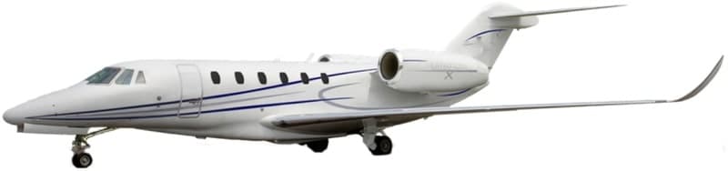 Tue, Nov 3TodayWest Palm BeachKDJT · President Donald J. Trump International AirportLas VegasKHND · Henderson Executive AirportCitation X8—On request3NovWest Palm Beach → Las VegasKDJT → KHND · TodayCitation X · 8 seatsOn request
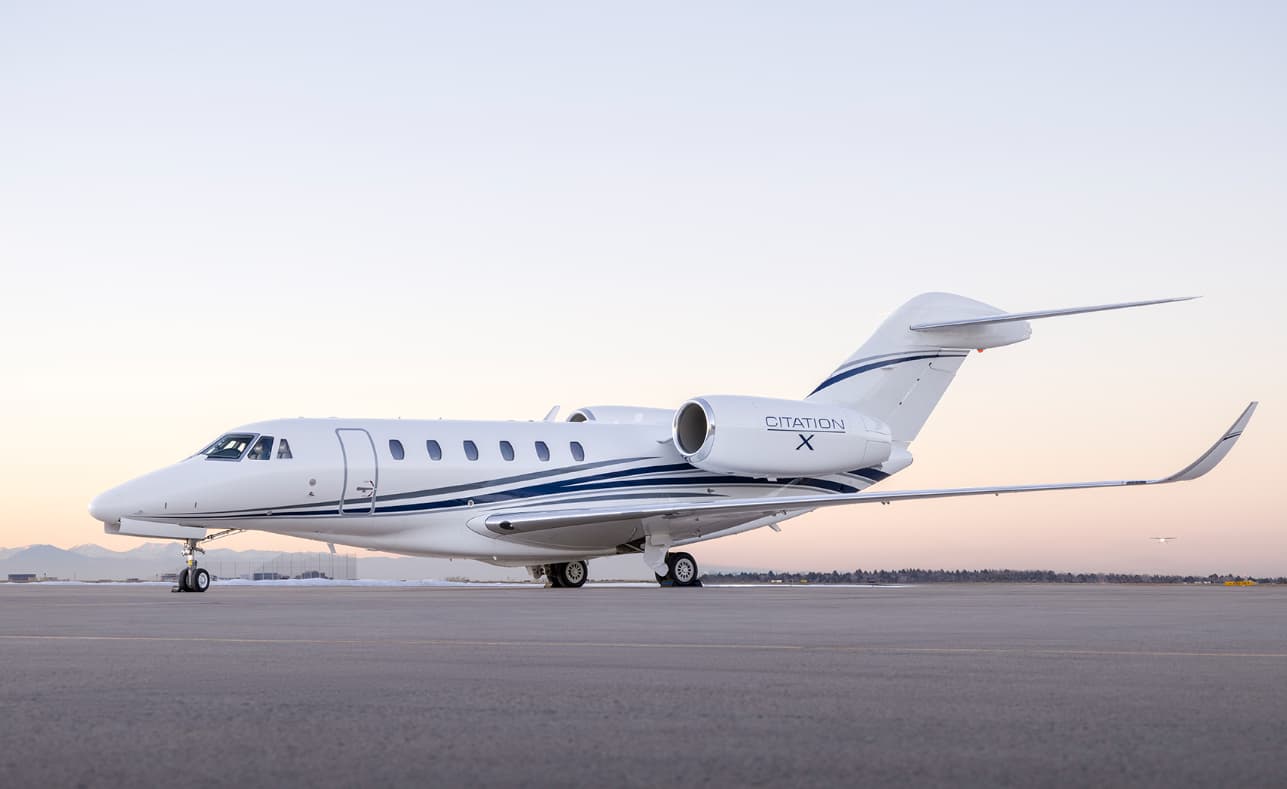 Tue, Nov 3TodayWashingtonKIAD · Washington Dulles International AirportLas VegasKHND · Henderson Executive AirportCitation X9—On request3NovWashington → Las VegasKIAD → KHND · TodayCitation X · 9 seatsOn request
- Tue, Nov 3TodaySan Jose del CaboMMSD · Los Cabos International AirportLas VegasKHND · Henderson Executive AirportCessna Citation Longitude——On request3NovSan Jose del Cabo → Las VegasMMSD → KHND · TodayCessna Citation LongitudeOn request
- Tue, Nov 3TodaySanta AnaKSNA · John Wayne Airport-Orange County AirportLas VegasKHND · Henderson Executive AirportGulfstream G600——On request3NovSanta Ana → Las VegasKSNA → KHND · TodayGulfstream G600On request
- Tue, Nov 3TodayLivermoreKLVK · Livermore Municipal AirportLas VegasKHND · Henderson Executive AirportBeechcraft Premier I11h 12m$4,4003NovLivermore → Las VegasKLVK → KHND · TodayBeechcraft Premier I · 1 seat · 1h 12m$4,400
- Tue, Nov 3TodayVan NuysKVNYHendersonKHND · Henderson ExecutiveDassault Falcon 20008—On request3NovVan Nuys → HendersonKVNY → KHND · TodayDassault Falcon 2000 · 8 seatsOn request
- Wed, Nov 4TomorrowTucsonKRYN · Ryan FieldLas VegasKHND · Henderson Executive AirportPremier I6—On request4NovTucson → Las VegasKRYN → KHND · TomorrowPremier I · 6 seatsOn request
- Wed, Nov 4TomorrowRenoKRNO · Reno Tahoe International AirportLas VegasKHND · Henderson Executive AirportCessna Citation Longitude——On request4NovReno → Las VegasKRNO → KHND · TomorrowCessna Citation LongitudeOn request
* Total price incl. 10% service fee, converted to your selected currency. Price subject to operator confirmation.
Map: Las Vegas Airport
View the location of Las Vegas – HSH/KHND. Zoom in to explore the area around the airport.
About the airport
Henderson Executive Airport (HSH/KHND) is the key private jet gateway for Las Vegas. PrivJet gives you instant access to charter flights and empty legs: fast, discreet and globally connected.
KHND airport FAQ
Are there any restrictions at Las Vegas airport (KHND) today?
There are currently 4 valid NOTAMs for Las Vegas (KHND). Affected: Obstacle lights: unserviceable; Obstacle: out of service. 1 more NOTAM starts in the coming days. For information only, not for flight planning or operational use. Always rely on an official pre-flight briefing. This list may be incomplete or out of date.
What is the weather at Las Vegas airport (KHND)?
According to the latest weather report for KHND (METAR, 03 Nov, 07:56 UTC): Good visual conditions (VFR). Wind 6 kt (11 km/h) from south (190°), visibility 10 km or more, temperature 11 °C (dew point 6 °C). For information only, not for flight planning. Weather can change quickly; always rely on official reports.
How long are the runways at Las Vegas airport (KHND)?
Las Vegas (KHND) has 2 runways: runway 17R/35L with 1,982 m (6,501 ft), asphalt and runway 17L/35R with 1,524 m (5,001 ft), asphalt. The longest is 1,982 m.
What are the radio frequencies at Las Vegas airport (KHND)?
Frequencies at KHND: Tower 125.1 MHz and Ground 127.8 MHz. For information only. Always rely on the published AIP.
What are the airport codes of Henderson Executive Airport?
The ICAO code is KHND and the IATA code is HSH. ICAO codes are used by air traffic control and pilots, e.g. in flight plans; IATA codes appear on tickets and baggage tags.
What is the elevation of KHND airport?
Henderson Executive Airport sits at 2,492 ft (760 m) above sea level. Local time zone: America/Los Angeles.
Where do private jets land at Las Vegas Henderson Executive?
Private jet passengers at KHND are handled through Henderson Executive Airport FBO (county-operated terminal) (3500 Executive Terminal Drive, Suite 100, Henderson, NV 89052). The operator confirms the exact meeting point with your flight confirmation.
Can I fly to KHND by private jet?
Whether a private jet can operate into Henderson Executive Airport depends on runway length, opening hours, customs and immigration rules as well as slot and handling availability, among other things. PrivJet checks this with the operating carrier for every request.
Are there empty legs from or to KHND?
There are currently 100 empty legs departing from and 100 arriving at Henderson Executive Airport. Empty legs are repositioning flights at heavily reduced prices; the list is updated several times a day.