Hyannis Cape Cod Gateway Airport (KHYA / HYA)
Empty legs and charters from Hyannis
KHYA airport at a glance
- ICAO code
- KHYA
- IATA code
- HYA
- City
- Hyannis
- Region
- Massachusetts
- Country
- United States
- Elevation
- 54 ft (16 m)
- Time zone
- America/New York (UTC-5)
- Coordinates
- 41.6693° N, 70.2804° W
- Empty legs from
- 3
- Empty legs to
- 11
Weather & airport info KHYA
Current weather
No current weather report is available for this airport.
Airport
- Elevation
- 54 ft (16 m)
- Sunrise / Sunset
- 06:15 / 16:33 local time
Runways
| Runway | Length | Surface | Lighted |
|---|---|---|---|
| 06/24 | 1,654 m (5,425 ft) | asphalt | yes |
| 15/33 | 1,602 m (5,255 ft) | asphalt | yes |
Radio frequencies
- ATIS: 123.8
- Clearance: 125.15
- CTAF: 119.5
- Ground: 121.9
- Tower: 119.5
- UNICOM: 122.95
For information only, not for flight planning. Weather can change quickly; always rely on official reports. Sources: aviationweather.gov (NOAA), OurAirports.
Airport map KHYA
Full screen →Runways white, taxiways yellow with designators, closed taxiways and runways per NOTAM in red.
Official charts (FAA)
Cycle 2611, valid until 0901Z 11/26/26
Airport diagram (FAA)
Airport diagram (1)
Instrument approaches (6)
Minimums (2)
LAHSO (1)
For information only, not for navigation. Always use current official charts and NOTAMs.
Current NOTAMs for KHYA(20)
NOTAMs (Notices to Air Missions) announce short-term changes at an airport: closed runways or taxiways, unserviceable approach aids, obstacles, airspace restrictions.
- Out of serviceServices11/005· until 16 Nov, 23:59 UTC (estimated)
The radio frequency 125.15 for clearance delivery is out of service. Pilots cannot receive departure clearances on this frequency.
Show original text
COM CLR DELIVERY 125.15 U/S
- Out of serviceInstrument approach procedure4624/26· until 25 Nov, 23:59 UTC
The LFV VOR (VHF Omnidirectional Range) navigation beacon is out of service. This affects the ILS or LOC instrument approach procedure for runway 15 at Cape Cod Gateway airport.
Show original text
IAP CAPE COD GATEWAY, HYANNIS, MA. ILS OR LOC RWY 15, AMDT 5C... MISSED APPROACH: CLIMB TO 1000 THEN CLIMBING LEFT TURN TO 1800 ON HEADING 090 AND ON ACK VOR/DME R-359 TO BOGEY INT/MVY 26.89 DME AND HOLD, LFV VOR OUT OF SERVICE. 2611021708-2611252359EST
Q) KZBW/QPIXX/I/NBO/A/000/999/4140N07016W005
A) KHYA
B) 2311050137
C) 2311110136EST
E) HYA CAPE COD GATEWAY, HYANNIS, MA.
ILS OR LOC RWY 15, AMDT 5C...
MISSED APPROACH: CLIMB TO 1000 THEN CLIMBING LEFT TURN TO 1800 ON HEADING 090 AND ON ACK VOR/DME R-359 TO BOGEY INT/MVY 26.89 DME AND HOLD,
LFV VOR U/S.
- Out of serviceInstrument approach procedure: changedA1896/26· until 25 Nov, 23:59 UTC
The LFV VOR, a radio beacon for navigation, is out of service. This affects the instrument approach procedure (ILS or LOC) for runway 15 at Cape Cod Gateway airport.
Show original text
IAP CAPE COD GATEWAY, HYANNIS, MA. ILS OR LOC RWY 15, AMDT 5C... MISSED APPROACH: CLIMB TO 1000 THEN CLIMBING LEFT TURN TO 1800 ON HEADING 090 AND ON ACK VOR/DME R-359 TO BOGEY INT/MVY 26.89 DME AND HOLD, LFV VOR OUT OF SERVICE.
A1896/26 NOTAMN
Q) KZBW/QPICH/I/NBO/A/000/999/4140N07016W005
A) KHYA
B) 2611021708
C) 2611252359
E) IAP CAPE COD GATEWAY, HYANNIS, MA. ILS OR LOC RWY 15, AMDT 5C... MISSED APPROACH: CLIMB TO 1000 THEN CLIMBING LEFT TURN TO 1800 ON HEADING 090 AND ON ACK VOR/DME R-359 TO BOGEY INT/MVY 26.89 DME AND HOLD, LFV VOR OUT OF SERVICE.
- Out of serviceObstacle10/050· until 11 Nov, 23:59 UTC
A tower, 6.1 nautical miles east-northeast of the airport, is an obstacle, its top is 294.9 feet above sea level and 250.0 feet above ground. The tower lighting is out of service.
Show original text
OBST TOWER LGT (ASR 1234471) 414130.50N0700847.80W (6.1NM ENE HYA) 294.9FT (250.0FT AGL) U/S
- ClosedApron: closed10/049· until 27 Nov, 19:00 UTC
The central de-icing pad on the apron is closed.
Show original text
APRON CENTRAL DEICE PAD CLSD
A1886/26 NOTAMN Q) KZBW/QMNLC////000/999/4140N07016W005 A) KHYA B) 2610280053 C) 2611271900 E) APRON CENTRAL DEICE PAD CLSD
- Out of serviceOther10/037· until 31 May, 20:00 UTC
Airport: WINDCONE PRI light out of service
Show original text
AD AP WINDCONE PRI LGT U/S
A1871/26 NOTAMN
Q) KZBW/QXXXX////000/999/4140N07016W005
A) KHYA
B) 2610171655
C) 2705312000
E) AD AP WINDCONE PRI LGT U/S
- Out of servicePAPI: unserviceable10/038· until 30 Nov, 19:00 UTC
Runway 06 PAPI (approach slope lights) out of service
Show original text
RWY 06 PAPI U/S
A1872/26 NOTAMN
Q) KZBW/QLPAS////000/999/4140N07016W005
A) KHYA
B) 2610171655
C) 2711301900
E) RWY 06 PAPI U/S
- Out of serviceOtherA1871/26· until 31 May, 20:00 UTC
The primary lighting for the airport wind cone is out of service.
Show original text
AD AP WINDCONE PRI LGT U/S
A1871/26 NOTAMN Q) KZBW/QXXXX////000/999/4140N07016W005 A) KHYA B) 2610171655 C) 2705312000 E) AD AP WINDCONE PRI LGT U/S
12 more NOTAMs
- Out of servicePAPI: unserviceableA1872/26· until 30 Nov, 19:00 UTC
The PAPI (Precision Approach Path Indicator) for Runway 06 is out of service. The PAPI helps pilots maintain the correct glide path to the runway.
Show original text
RWY 06 PAPI U/S
A1872/26 NOTAMN Q) KZBW/QLPAS////000/999/4140N07016W005 A) KHYA B) 2610171655 C) 2711301900 E) RWY 06 PAPI U/S
- Out of serviceTaxiway edge lights: unserviceable10/035· until 31 May, 20:00 UTC
The edge lighting for Taxiway D between Runway 06/24 and Taxiway B is out of service.
Show original text
TWY D EDGE LGT BTN RWY 06/24 AND TWY B U/S
A1870/26 NOTAMN Q) KZBW/QLYAS////000/999/4140N07016W005 A) KHYA B) 2610171654 C) 2705312000 E) TWY D EDGE LGT BTN RWY 06/24 AND TWY B U/S
- Out of serviceTaxiway edge lights: unserviceable10/036· until 31 May, 20:00 UTC
Taxiway B edge lighting is out of service.
Show original text
TWY B EDGE LGT U/S
A1869/26 NOTAMN
Q) KZBW/QLYAS////000/999/4140N07016W005
A) KHYA
B) 2610171654
C) 2705312000
E) TWY B EDGE LGT U/S
- Out of serviceTaxiway edge lights: unserviceableA1869/26· until 31 May, 20:00 UTC
The edge lighting for Taxiway B is out of service.
Show original text
TWY B EDGE LGT U/S
A1869/26 NOTAMN Q) KZBW/QLYAS////000/999/4140N07016W005 A) KHYA B) 2610171654 C) 2705312000 E) TWY B EDGE LGT U/S
- Out of serviceTaxiway edge lights: unserviceableA1870/26· until 31 May, 20:00 UTC
The edge lighting for Taxiway D between Runway 06/24 and Taxiway B is out of service.
Show original text
TWY D EDGE LGT BTN RWY 06/24 AND TWY B U/S
A1870/26 NOTAMN
Q) KZBW/QLYAS////000/999/4140N07016W005
A) KHYA
B) 2610171654
C) 2705312000
E) TWY D EDGE LGT BTN RWY 06/24 AND TWY B U/S
- NoticeObstacle: erectedA1893/26· until 06 Nov, 23:00 UTC
A crane near the airport, 1.0 nautical miles west of HYA, is an obstacle. Its top is 178 feet above sea level, 120 feet above ground, and it is flagged.
Show original text
OBST CRANE (ASN 2025-ANE-3450-OE) 413958N0701811W (1.0NM W HYA) 178FT (120FT AGL) FLAGGED
A1893/26 NOTAMN
Q) KZBW/QOBCE/IV/M/AE/000/999/4140N07016W005
A) KHYA
B) 2611021131
C) 2611062300
E) OBST CRANE (ASN 2025-ANE-3450-OE) 413958N0701811W (1.0NM W HYA) 178FT (120FT AGL) FLAGGED
- NoticeObstacle: erectedA1894/26· until 06 Nov, 23:00 UTC
A crane near the airport (2.4 nautical miles east of HYA) is an obstacle. Its top is 230 feet above sea level, 210 feet above ground, and it is flagged.
Show original text
OBST CRANE (ASN 2025-ANE-857-OE) 413945N0701334W (2.4NM E HYA) 230FT (210FT AGL) FLAGGED
A1894/26 NOTAMN
Q) KZBW/QOBCE/IV/M/AE/000/999/4140N07016W005
A) KHYA
B) 2611021131
C) 2611062300
E) OBST CRANE (ASN 2025-ANE-857-OE) 413945N0701334W (2.4NM E HYA) 230FT (210FT AGL) FLAGGED
- Out of serviceInstrument approach procedure4214/26· until 20 Nov, 23:59 UTC
Alternate minimums for the instrument approach procedure (ILS or LOC runway 24) at Cape Cod Gateway airport are not available, unless the aircraft is equipped with a suitable RNAV system with GPS and the VOR/DME system at Nantucket is unmonitored.
Show original text
IAP CAPE COD GATEWAY, HYANNIS, MA. ILS OR LOC RWY 24, AMDT 19B... ALTERNATE MINIMUMS NA EXCEPT FOR ACFT EQUIPPED WITH SUITABLE RNAV SYSTEM WITH GPS, ACK VOR/DME UNMONITORED. 2611011252-2611202359EST
Q) KZBW/QPIXX/I/NBO/A/000/999/4140N07016W005
A) KHYA
B) 2404040756
C) 2411140755EST
E) HYA CAPE COD GATEWAY, HYANNIS, MA.
ILS OR LOC RWY 24, AMDT 19B...
ALTERNATE MNM NA EXCEPT FOR ACFT EQUIPPED WITH SUITABLE RNAV SYSTEM WITH GPS,
ACK VOR/DME NOT MNT.
- Out of serviceInstrument approach procedure: changedA1891/26· until 20 Nov, 23:59 UTC
For Cape Cod Gateway airport, alternate minimums for approaches are not available unless the aircraft is equipped with a suitable RNAV system with GPS. The VOR/DME system at ACK is unmonitored.
Show original text
IAP CAPE COD GATEWAY, HYANNIS, MA. ILS OR LOC RWY 24, AMDT 19B... ALTERNATE MINIMUMS NA EXCEPT FOR ACFT EQUIPPED WITH SUITABLE RNAV SYSTEM WITH GPS, ACK VOR/DME UNMONITORED.
A1891/26 NOTAMN
Q) KZBW/QPICH/I/NBO/A/000/999/4140N07016W005
A) KHYA
B) 2611011252
C) 2611202359
E) IAP CAPE COD GATEWAY, HYANNIS, MA. ILS OR LOC RWY 24, AMDT 19B... ALTERNATE MINIMUMS NA EXCEPT FOR ACFT EQUIPPED WITH SUITABLE RNAV SYSTEM WITH GPS, ACK VOR/DME UNMONITORED.
- NoticeInstrument approach procedure3682/26· until 01 Jun, 16:15 UTC (estimated)
The instrument approach procedures for Runway 15 (ILS or LOC, Amendment 5C) and Runway 24 (ILS or LOC, Amendment 19B) have been changed. The minimum safe altitude (MSA) from MVY VOR/DME is 2100 feet for the sector from 270 degrees clockwise to 360 degrees, and 1900 feet for the sector from 360 degrees clockwise to 270 degrees. A permanent obstacle (2020-WTE-6308-OE) is noted.
Show original text
IAP CAPE COD GATEWAY, HYANNIS, MA. ILS OR LOC RWY 15, AMDT 5C... ILS OR LOC RWY 24, AMDT 19B... MSA FROM MVY VOR/DME 25NM 270 CW 360 MINIMUM ALTITUDE 2100, 360 CW 270 MINIMUM ALTITUDE 1900. (PERM OBST 2020-WTE-6308-OE). 2610291435-2706011615EST
Q) KZBW/QPIXX/I/NBO/A/000/999/4140N07016W005
A) KHYA
B) 2610291435
C) 2706101435EST
E) HYA CAPE COD GATEWAY, HYANNIS, MA.
ILS OR LOC RWY 15, AMDT 5C...
ILS OR LOC RWY 24, AMDT 19B...
MSA FROM MVY VOR/DME 25NM 270 CW 360 MINIMUM ALTITUDE 2100, 360 CW 270 MINIMUM ALTITUDE 1900. (PERM OBST 2020-WTE-6308-OE).
- NoticeInstrument approach procedure: changedA1888/26· until 01 Jun, 16:15 UTC
The instrument approach procedures for Runway 15 (ILS or LOC, Amendment 5C) and Runway 24 (ILS or LOC, Amendment 19B) have been changed. The minimum safe altitude (MSA) from MVY VOR/DME is 2100 feet for the sector from 270 degrees clockwise to 360 degrees, and 1900 feet for the sector from 360 degrees clockwise to 270 degrees. A permanent obstacle (2020-WTE-6308-OE) is noted.
Show original text
IAP CAPE COD GATEWAY, HYANNIS, MA. ILS OR LOC RWY 15, AMDT 5C... ILS OR LOC RWY 24, AMDT 19B... MSA FROM MVY VOR/DME 25NM 270 CW 360 MINIMUM ALTITUDE 2100, 360 CW 270 MINIMUM ALTITUDE 1900. (PERM OBST 2020-WTE-6308-OE).
A1888/26 NOTAMN
Q) KZBW/QPICH/I/NBO/A/000/999/4140N07016W005
A) KHYA
B) 2610291435
C) 2706011615
E) IAP CAPE COD GATEWAY, HYANNIS, MA. ILS OR LOC RWY 15, AMDT 5C... ILS OR LOC RWY 24, AMDT 19B... MSA FROM MVY VOR/DME 25NM 270 CW 360 MINIMUM ALTITUDE 2100, 360 CW 270 MINIMUM ALTITUDE 1900. (PERM OBST 2020-WTE-6308-OE).
- NoticeTaxiway10/033· until 31 May, 19:00 UTC (estimated)
Taxiway E surface painted holding position signs at runway 33/15 are not standard.
Show original text
TWY E SFC PAINTED HLDG PSN SIGNS AT RWY 33/15 NOT STD
For information only, not for flight planning or operational use. Always rely on an official pre-flight briefing. This list may be incomplete or out of date. Explanations and expanded abbreviations are generated automatically. The original text is authoritative. Source: FAA NOTAM Management Service (SWIM).
Private jet traffic in Cape Cod Gateway Airport (last 30 days)
- Arrivals
- 301
- Departures
- 256
- Different jets
- 261
Most frequent origins: Laurence G Hanscom Field (24), Teterboro Airport (21), Westchester County Airport (15), Washington Dulles International Airport (8), General Edward Lawrence Logan International Airport (7).
Most frequent destinations: Teterboro Airport (16), Westchester County Airport (12), Naples Municipal Airport (12), Nantucket Memorial Airport (11), Boca Raton Airport (11).
Most common aircraft types: Embraer Phenom 300 (63), Cessna Citation Latitude (50), Cessna Citation Excel/XLS (40), Bombardier Challenger 350/3500 (39), Pilatus PC-12 (34).
Sunday is the busiest day.
Our own analysis of public ADS-B signals from business jets. Not every flight is received, and jets with a removal request are excluded.
Charter operators based here
Operators with a base at this airport.
- Cape AirPiston aircraft
- Shoreline AviationMarshfield Municipal - George Harlow Field (KGHG) · Turboprop, Midsize jet, Super midsize jet
- Gull AirPiston aircraft
Empty legs from KHYA
3 departures available
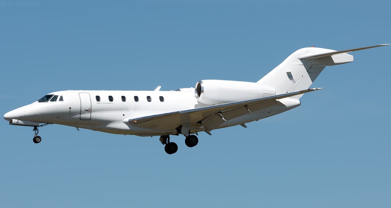 Tue, Nov 3TodayHyannisKHYA · Cape Cod Gateway AirportBostonKPSM · Portsmouth International at Pease AirportCitation X8—On request3NovHyannis → BostonKHYA → KPSM · TodayCitation X · 8 seatsOn request
 Thu, Nov 19in 16 daysHyannisKHYA · Cape Cod Gateway AirportDanburyKDXR · Danbury Municipal AirportCitation CJ37—On request19NovHyannis → DanburyKHYA → KDXR · in 16 daysCitation CJ3 · 7 seatsOn request
- Sun, Sep 19in 320 daysHyannisKHYA · Cape Cod Gateway AirportVan NuysKVNY · Van Nuys AirportGulfstream G-IVSP135h 54mOn request19SepHyannis → Van NuysKHYA → KVNY · in 320 daysGulfstream G-IVSP · 13 seats · 5h 54mOn request
 KHYA · Cape Cod Gateway Airport
* Total price incl. 10% service fee, converted to your selected currency. Price subject to operator confirmation.
Empty legs to KHYA
11 arrivals available
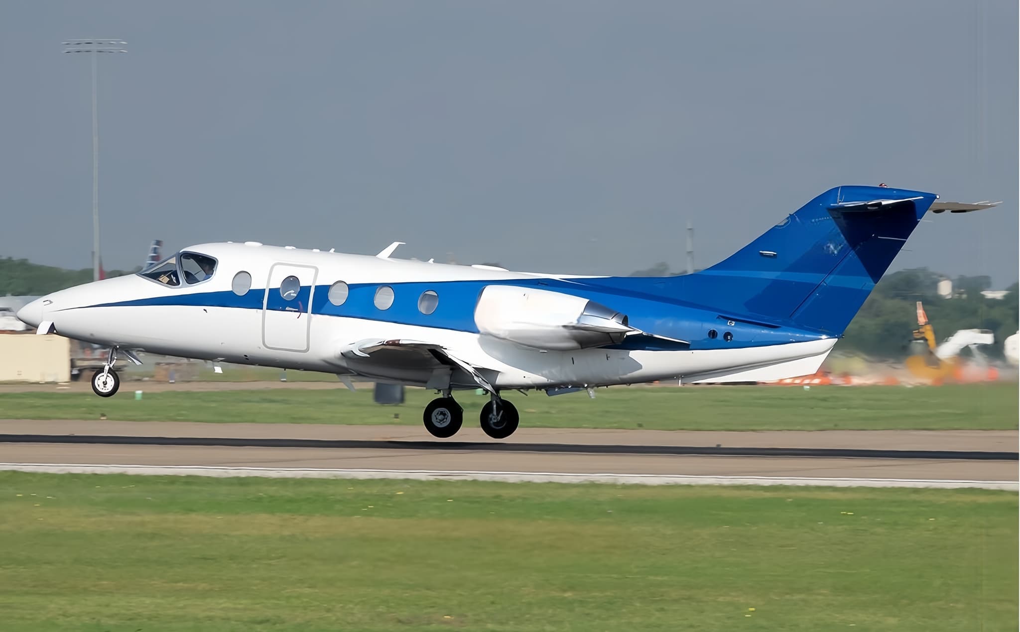 Wed, Nov 4TomorrowNew YorkKTEB · Teterboro AirportHyannisKHYA · Cape Cod Gateway AirportHawker 400XP8—$5,5004NovNew York → HyannisKTEB → KHYA · TomorrowHawker 400XP · 8 seats$5,500
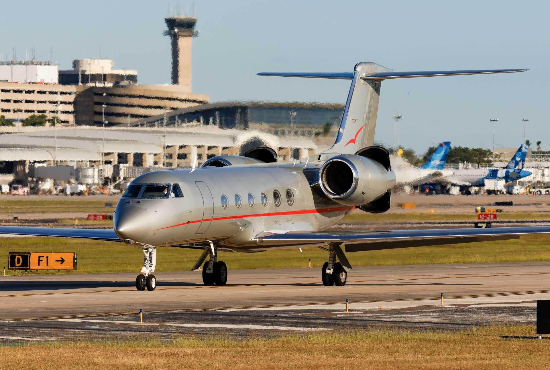 Wed, Nov 4TomorrowWashingtonKDCA · Ronald Reagan Washington National AirportHyannisKHYA · Cape Cod Gateway AirportGulfstream GIV14—On request4NovWashington → HyannisKDCA → KHYA · TomorrowGulfstream GIV · 14 seatsOn request
- Wed, Nov 4TomorrowWhite PlainsKHPN · Westchester County AirportHyannisKHYA · Cape Cod Gateway AirportCessna CitationJet5—$4,5104NovWhite Plains → HyannisKHPN → KHYA · TomorrowCessna CitationJet · 5 seats$4,510
 Wed, Nov 414:24White PlainsKHPN · Westchester County AirportHyannisKHYA · Cape Cod Gateway AirportBombardier Challenger 300136mOn request4NovWhite Plains → HyannisKHPN → KHYA · 14:24Bombardier Challenger 300 · 1 seat · 36mOn request
 Wed, Nov 4TomorrowWhite PlainsKHPN · Westchester County AirportHyannisKHYA · Cape Cod Gateway AirportChallenger 3009—On request4NovWhite Plains → HyannisKHPN → KHYA · TomorrowChallenger 300 · 9 seatsOn request
- Wed, Nov 4TomorrowTitusvilleKTIX · Space Coast Regional AirportHyannisKHYA · Cape Cod Gateway AirportBombardier Global 5000122h 34m€17,7754NovTitusville → HyannisKTIX → KHYA · TomorrowBombardier Global 5000 · 12 seats · 2h 34m€17,775
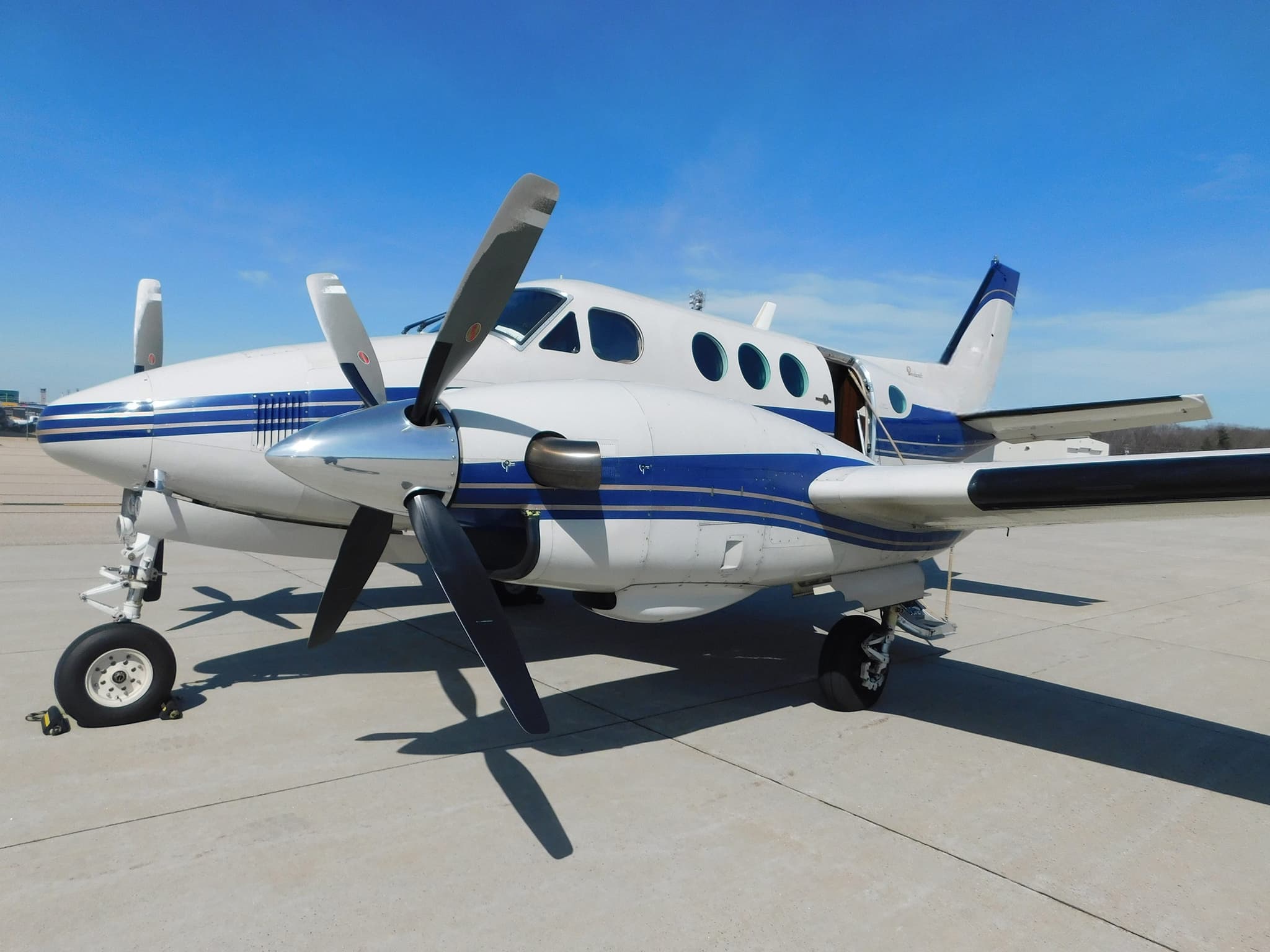 Fri, Nov 6in 3 daysBostonKPSM · Portsmouth International at Pease AirportHyannisKHYA · Cape Cod Gateway AirportKing Air 906—On request6NovBoston → HyannisKPSM → KHYA · in 3 daysKing Air 90 · 6 seatsOn request
- Fri, Nov 6in 3 daysPortsmouthKPSM · Portsmouth International at Pease AirportHyannisKHYA · Cape Cod Gateway AirportBeechcraft King Air C90551mOn request6NovPortsmouth → HyannisKPSM → KHYA · in 3 daysBeechcraft King Air C90 · 5 seats · 51mOn request
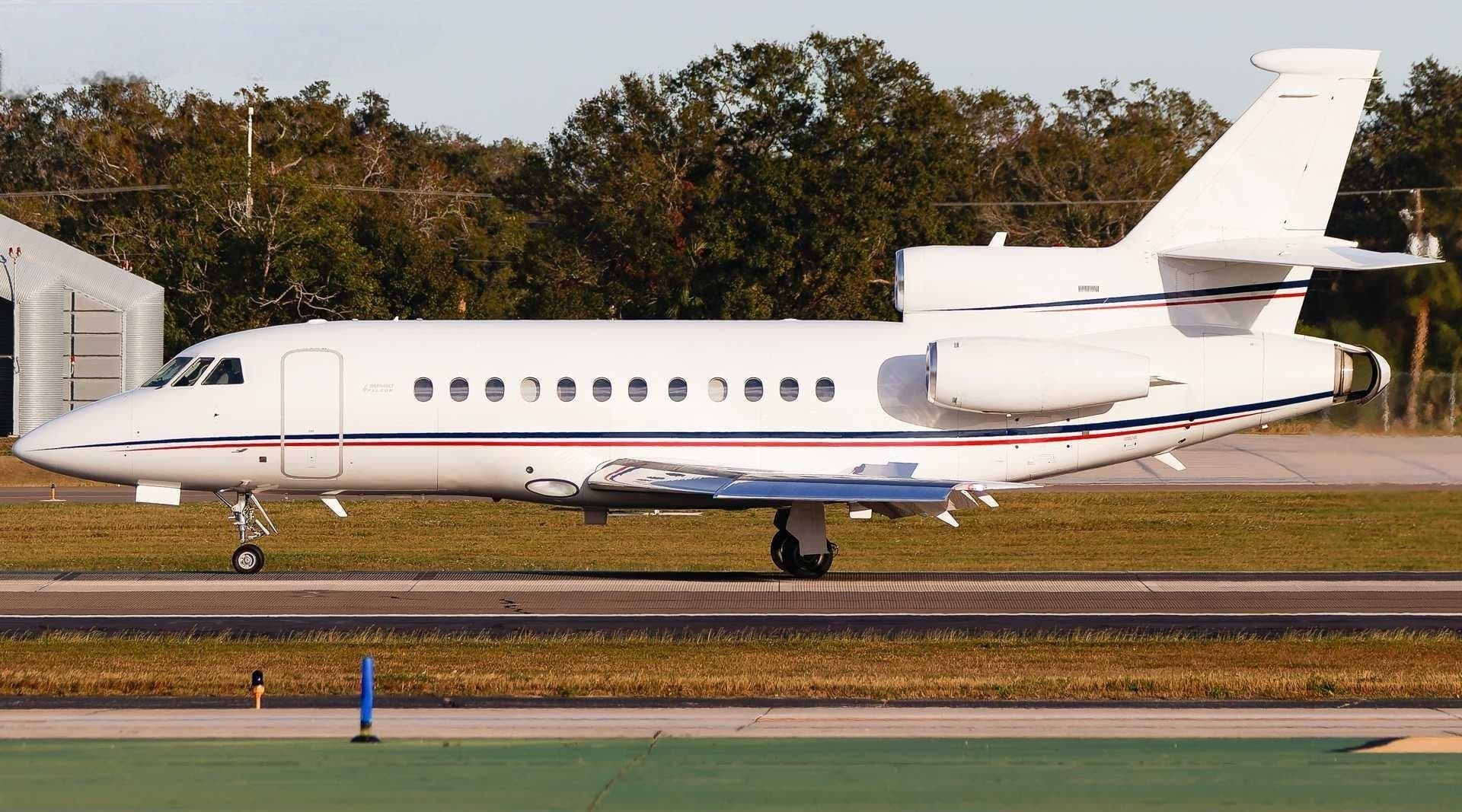 Sun, Nov 8in 5 daysNew YorkKTEB · Teterboro AirportHyannisKHYA · Cape Cod Gateway AirportFalcon 900B12—$7,0408NovNew York → HyannisKTEB → KHYA · in 5 daysFalcon 900B · 12 seats$7,040
* Total price incl. 10% service fee, converted to your selected currency. Price subject to operator confirmation.
Map: Hyannis Airport
View the location of Hyannis – HYA/KHYA. Zoom in to explore the area around the airport.
About the airport
Cape Cod Gateway Airport (HYA/KHYA) is the key private jet gateway for Hyannis. PrivJet gives you instant access to charter flights and empty legs: fast, discreet and globally connected.
KHYA airport FAQ
Are there any restrictions at Hyannis airport (KHYA) today?
There are currently 20 valid NOTAMs for Hyannis (KHYA). Affected: Apron: closed; Services: out of service; Instrument approach procedure; Instrument approach procedure: changed and 4 more. For information only, not for flight planning or operational use. Always rely on an official pre-flight briefing. This list may be incomplete or out of date.
How long are the runways at Hyannis airport (KHYA)?
Hyannis (KHYA) has 2 runways: runway 06/24 with 1,654 m (5,425 ft), asphalt and runway 15/33 with 1,602 m (5,255 ft), asphalt. The longest is 1,654 m.
What are the radio frequencies at Hyannis airport (KHYA)?
Frequencies at KHYA: Tower 119.5 MHz, Ground 121.9 MHz and ATIS 123.8 MHz. For information only. Always rely on the published AIP.
What are the airport codes of Cape Cod Gateway Airport?
The ICAO code is KHYA and the IATA code is HYA. ICAO codes are used by air traffic control and pilots, e.g. in flight plans; IATA codes appear on tickets and baggage tags.
What is the elevation of KHYA airport?
Cape Cod Gateway Airport sits at 54 ft (16 m) above sea level. Local time zone: America/New York.
Can I fly to KHYA by private jet?
Whether a private jet can operate into Cape Cod Gateway Airport depends on runway length, opening hours, customs and immigration rules as well as slot and handling availability, among other things. PrivJet checks this with the operating carrier for every request.
Are there empty legs from or to KHYA?
There are currently 3 empty legs departing from and 11 arriving at Cape Cod Gateway Airport. Empty legs are repositioning flights at heavily reduced prices; the list is updated several times a day.