Las Vegas Harry Reid Airport (KLAS / LAS)
Empty legs and charters from Las Vegas
KLAS airport at a glance
- ICAO code
- KLAS
- IATA code
- LAS
- City
- Las Vegas
- Region
- Nevada
- Country
- United States
- Elevation
- 2,181 ft (665 m)
- Time zone
- America/Los Angeles (UTC-8)
- Coordinates
- 36.0801° N, 115.1520° W
- Empty legs from
- 100
- Empty legs to
- 100
Private jet terminal & FBOs at Las Vegas Harry Reid
- Signature Aviation LAS6005 Las Vegas Boulevard South, Las Vegas, NV 89119
- Atlantic Aviation LAS275 East Tropicana Ave., Las Vegas, NV 89169
Weather & airport info KLAS
Current weather
Good visual conditions (VFR)observed 02 Nov, 23:56 UTC- Wind
- 6 kt (11 km/h) from east-northeast (70°)
- Visibility
- 10 km or more
- Clouds
- few clouds at 10,000 ft, scattered clouds at 20,000 ft
- Temperature
- 20 °C (dew point 1 °C)
- Pressure (QNH)
- 1,021 hPa
Original weather report (METAR)
METAR KLAS 022356Z 07006KT 10SM FEW100 SCT200 20/01 A3016 RMK AO2 SLP200 T02000006 10206 20178 58005
Forecast (TAF)
- 03 Nov, 00:00–04:00 UTC6 kt (11 km/h) from north-northeast (30°) · visibility 10 km or more · few clouds at 20,000 ft
- 03 Nov, 04:00–17:00 UTCfrom6 kt (11 km/h) from west-southwest (240°) · visibility 10 km or more · broken clouds at 20,000 ft
- 03 Nov, 17:00–03:00 UTCfrom6 kt (11 km/h) from east-northeast (60°) · visibility 10 km or more · broken clouds at 20,000 ft
- 04 Nov, 03:00–06:00 UTCfrom6 kt (11 km/h) from southwest (230°) · visibility 10 km or more · no significant clouds
Original forecast (TAF)
TAF KLAS 022320Z 0300/0406 03006KT P6SM FEW200 FM030400 24006KT P6SM BKN200 FM031700 06006KT P6SM BKN200 FM040300 23006KT P6SM SKC
Airport
- Elevation
- 2,181 ft (665 m)
- Sunrise / Sunset
- 06:05 / 16:43 local time
Runways
| Runway | Length | Surface | Lighted |
|---|---|---|---|
| 08L/26R | 4,522 m (14,835 ft) | asphalt | yes |
| 08R/26L | 3,208 m (10,526 ft) | asphalt | yes |
| 01L/19R | 2,978 m (9,770 ft) | concrete | yes |
| 01R/19L | 2,978 m (9,769 ft) | asphalt | yes |
Radio frequencies
- Approach: 125.025
- ATIS: 132.4
- Clearance: 118
- Ground: 121.1
- Tower: 119.9
- UNICOM: 122.95
For information only, not for flight planning. Weather can change quickly; always rely on official reports. Sources: aviationweather.gov (NOAA), OurAirports.
Airport map KLAS
Full screen →Runways white, taxiways yellow with designators, closed taxiways and runways per NOTAM in red.
Closed per NOTAM: TWY M*, TWY L*, TWY D1*, TWY D* (* partly closed)
Official charts (FAA)
Cycle 2611, valid until 0901Z 11/26/26
Airport diagram (FAA)
Airport diagram (1)
Instrument approaches (15)
Departure procedures (23)
- FRNCK ONE (RNAV)
- GIDGT FOUR (RNAV)
- GIDGT FOUR (RNAV), CONT.1
- GIDGT FOUR (RNAV), CONT.2
- HOOVER EIGHT
- HOOVER EIGHT, CONT.1
- JOHKR FIVE (RNAV)
- JOHKR FIVE (RNAV), CONT.1
- JOHKR FIVE (RNAV), CONT.2
- LOHLA THREE (RNAV)
- LOHLA THREE (RNAV), CONT.1
- MCCARRAN EIGHT
- MCCARRAN EIGHT, CONT.1
- NIITZ FOUR (RNAV)
- NIITZ FOUR (RNAV), CONT.1
- NIITZ FOUR (RNAV), CONT.2
- RADYR TWO (RNAV)
- RADYR TWO (RNAV), CONT.1
- RADYR TWO (RNAV), CONT.2
- RASLR THREE (RNAV)
- RASLR THREE (RNAV), CONT.1
- RATPK THREE (RNAV)
- RATPK THREE (RNAV), CONT.1
Minimums (2)
Hot spots (1)
LAHSO (1)
Other (20)
- BLAID TWO
- CHOWW FOUR (RNAV)
- CHOWW FOUR (RNAV), CONT.1
- CHOWW FOUR (RNAV), CONT.2
- COKTL FOUR (RNAV)
- COKTL FOUR (RNAV), CONT.1
- COKTL FOUR (RNAV), CONT.2
- CRESO FIVE
- GAMES TWO (RNAV)
- ISHEE TWO
- JAYSN THREE (RNAV)
- JAYSN THREE (RNAV), CONT.1
- LARKK ONE
- PUMLE ONE
- RKSTR FOUR (RNAV)
- RKSTR FOUR (RNAV), CONT.1
- RKSTR FOUR (RNAV), CONT.2
- RNDRZ FOUR (RNAV)
- RNDRZ FOUR (RNAV), CONT.1
- RNDRZ FOUR (RNAV), CONT.2
For information only, not for navigation. Always use current official charts and NOTAMs.
Current NOTAMs for KLAS(22)
NOTAMs (Notices to Air Missions) announce short-term changes at an airport: closed runways or taxiways, unserviceable approach aids, obstacles, airspace restrictions.
- ClosedAerodrome: closedA2861/26· until 27 Jan, 23:00 UTC
The airport is closed to non-scheduled transient general aviation aircraft, except with 24 hours prior permission required by calling 702-261-7775.
Show original text
AD AP CLSD TO NON SKED TRANSIENT GA ACFT EXC 24HR PPR 702-261-7775
A2861/26 NOTAMN
Q) KZLA/QFALC////000/999/3604N11509W005
A) KLAS
B) 2610281926
C) 2701272300
E) AD AP CLSD TO NON SKED TRANSIENT GA ACFT EXC 24HR PPR 702-261-7775
- Out of serviceStandard instrument departure: changed4433/26· from 03 Nov, 15:00 UTC · until 03 Nov, 23:55 UTC (estimated)
The DOVE CREEK TRANSITION for the standard departure route (SID) HOOVER EIGHT DEPARTURE is not available, except for aircraft equipped with a suitable RNAV system with GPS, because the PGA VOR/DME is out of service.
Show original text
SID HARRY REID INTL, LAS VEGAS, NV. HOOVER EIGHT DEPARTURE... DOVE CREEK TRANSITION NA EXCEPT FOR ACFT EQUIPPED WITH SUITABLE RNAV SYSTEM WITH GPS, PGA VOR/DME OUT OF SERVICE. 2611031500-2611032355EST
Q) KZLA/QPDCH/I/NBO/A/000/999/3604N11509W005
A) KLAS
B) 2611021631
C) 2706141631EST
E) LAS HARRY REID INTL, LAS VEGAS, NV.
HOOVER EIGHT DEPARTURE...
DOVE CREEK TRANSITION NA EXCEPT FOR ACFT EQUIPPED WITH SUITABLE RNAV SYSTEM WITH GPS,
PGA VOR/DME U/S.
- Out of serviceStandard instrument departure: changedA2907/26· from 03 Nov, 15:00 UTC · until 03 Nov, 23:55 UTC
The Hoover Eight Departure Standard Departure Route (SID) with Dove Creek Transition is out of service because the PGA VOR/DME navigation system is not working. The procedure is only available for aircraft equipped with a suitable RNAV system with GPS.
Show original text
SID HARRY REID INTL, LAS VEGAS, NV. HOOVER EIGHT DEPARTURE... DOVE CREEK TRANSITION NA EXCEPT FOR ACFT EQUIPPED WITH SUITABLE RNAV SYSTEM WITH GPS, PGA VOR/DME OUT OF SERVICE.
A2907/26 NOTAMN
Q) KZLA/QPDCH/I/NBO/A/000/999/3604N11509W005
A) KLAS
B) 2611031500
C) 2611032355
E) SID HARRY REID INTL, LAS VEGAS, NV. HOOVER EIGHT DEPARTURE... DOVE CREEK TRANSITION NA EXCEPT FOR ACFT EQUIPPED WITH SUITABLE RNAV SYSTEM WITH GPS, PGA VOR/DME OUT OF SERVICE.
- ClosedTaxiway: closedA2857/26· until 27 Jan, 23:00 UTC
Taxiway M between runway 01R/19L and taxiway D is closed to aircraft with a wingspan of more than 135 feet.
Show original text
TWY M BTN RWY 01R/19L AND TWY D CLSD TO ACFT WINGSPAN MORE THAN 135FT
A2857/26 NOTAMN
Q) KZLA/QMXLC////000/999/3604N11509W005
A) KLAS
B) 2610281924
C) 2701272300
E) TWY M BTN RWY 01R/19L AND TWY D CLSD TO ACFT WINGSPAN MORE THAN 135FT
- ClosedTaxiway: closedA2855/26· until 27 Jan, 23:00 UTC
Taxiway L between runway 01R/19L and taxiway D is closed to aircraft with a wingspan of more than 135 feet.
Show original text
TWY L BTN RWY 01R/19L AND TWY D CLSD TO ACFT WINGSPAN MORE THAN 135FT
A2855/26 NOTAMN
Q) KZLA/QMXLC////000/999/3604N11509W005
A) KLAS
B) 2610281923
C) 2701272300
E) TWY L BTN RWY 01R/19L AND TWY D CLSD TO ACFT WINGSPAN MORE THAN 135FT
- ClosedTaxiway: closedA2853/26· until 27 Jan, 23:00 UTC
Taxiway D1 between the approach end of runway 19L and taxiway D is closed to aircraft with a wingspan of more than 135 feet.
Show original text
TWY D1 BTN APCH END RWY 19L AND TWY D CLSD TO ACFT WINGSPAN MORE THAN 135FT
A2853/26 NOTAMN
Q) KZLA/QMXLC////000/999/3604N11509W005
A) KLAS
B) 2610281922
C) 2701272300
E) TWY D1 BTN APCH END RWY 19L AND TWY D CLSD TO ACFT WINGSPAN MORE THAN 135FT
- ClosedTaxiway: closedA2852/26· until 27 Jan, 23:00 UTC
Taxiway D between taxiway D1 and taxiway N is closed to aircraft with a wingspan of more than 135 feet.
Show original text
TWY D BTN TWY D1 AND TWY N CLSD TO ACFT WINGSPAN MORE THAN 135FT
A2852/26 NOTAMN
Q) KZLA/QMXLC////000/999/3604N11509W005
A) KLAS
B) 2610281920
C) 2701272300
E) TWY D BTN TWY D1 AND TWY N CLSD TO ACFT WINGSPAN MORE THAN 135FT
- NoticeObstacle: erectedA2908/26· from 03 Nov, 14:00 UTC · until 03 Nov, 23:59 UTC
A crane is an obstacle 0.58 nautical miles west of the approach end of runway 19R. Its top is 2254 feet above sea level, 130 feet above ground, flagged and lighted.
Show original text
OBST CRANE (ASN UNKNOWN) 360551N1151010W (.58NM W APCH END RWY 19R) 2254FT (130FT AGL) FLAGGED AND LGTD
A2908/26 NOTAMN
Q) KZLA/QOBCE/IV/M/AE/000/999/3604N11509W005
A) KLAS
B) 2611031400
C) 2611032359
E) OBST CRANE (ASN UNKNOWN) 360551N1151010W (.58NM W APCH END RWY 19R) 2254FT (130FT AGL) FLAGGED AND LGTD
14 more NOTAMs
- NoticeObstacle: erectedA2909/26· from 03 Nov, 11:00 UTC · until 03 Nov, 15:00 UTC
A crane is an obstacle 0.54 nautical miles northwest of the approach end of runway 26R. Its top is 120 feet above ground, flagged and lighted.
Show original text
OBST CRANE (ASN UNKNOWN) 360458N1150743W (0.54NM NW APCH END RWY 26R) UNKNOWN (120FT AGL) FLAGGED AND LGTD
A2909/26 NOTAMN
Q) KZLA/QOBCE/IV/M/AE/000/999/3604N11509W005
A) KLAS
B) 2611031100
C) 2611031500
E) OBST CRANE (ASN UNKNOWN) 360458N1150743W (0.54NM NW APCH END RWY 26R)
UNKNOWN (120FT AGL) FLAGGED AND LGTD
- NoticeObstacle: erectedA2892/26· from 03 Nov, 06:00 UTC · until 03 Nov, 16:00 UTC
An obstacle, a crane, is located 1 nautical mile northwest of the airport. Its top is 2385 ft above sea level, 262 ft above ground, and it is flagged and lighted.
Show original text
OBST CRANE (ASN UNKNOWN) 360618N1151018W (1NM NW LAS) 2385FT (262FT AGL) FLAGGED AND LGTD
A2892/26 NOTAMN
Q) KZLA/QOBCE/IV/M/AE/000/999/3604N11509W005
A) KLAS
B) 2611030600
C) 2611031600
E) OBST CRANE (ASN UNKNOWN) 360618N1151018W (1NM NW LAS) 2385FT (262FT AGL) FLAGGED AND LGTD
- NoticeObstacle: erectedA2870/26· until 27 Jan, 23:00 UTC
A crane near the airport, 1.5 nautical miles northwest of LAS, is an obstacle. Its top is 2530 feet above sea level, 416 feet above ground, flagged and lighted.
Show original text
OBST CRANE (ASN 2025-AWP-5047-OE) 360559N1151016W (1.5NM NW LAS) 2530FT (416FT AGL) FLAGGED AND LGTD
A2870/26 NOTAMN
Q) KZLA/QOBCE/IV/M/AE/000/999/3604N11509W005
A) KLAS
B) 2610281937
C) 2701272300
E) OBST CRANE (ASN 2025-AWP-5047-OE) 360559N1151016W (1.5NM NW LAS) 2530FT (416FT AGL) FLAGGED AND LGTD
- NoticeObstacle: erectedA2866/26· until 27 Jan, 23:00 UTC
A crane near the airport, 2.7 nautical miles north-northwest of LAS, is an obstacle. Its top is 2845 feet above sea level, 739 feet above ground, flagged and lighted.
Show original text
OBST CRANE (ASN 2025-AWP-178-OE) 360719N1151025W (2.7NM NNW LAS) 2845FT (739FT AGL) FLAGGED AND LGTD
A2866/26 NOTAMN
Q) KZLA/QOBCE/IV/M/AE/000/999/3604N11509W005
A) KLAS
B) 2610281934
C) 2701272300
E) OBST CRANE (ASN 2025-AWP-178-OE) 360719N1151025W (2.7NM NNW LAS) 2845FT (739FT AGL) FLAGGED AND LGTD
- NoticeObstacle: erectedA2867/26· until 27 Jan, 23:00 UTC
A crane near the airport, 0.4 nautical miles north-northeast of the approach end of runway 19L, is an obstacle. Its top is 79 feet above ground, flagged and lighted.
Show original text
OBST CRANE (ASN UNKNOWN) 360616N1150903W (0.4NM NNE APCH END RWY 19L) UNKNOWN (79FT AGL) FLAGGED AND LGTD
A2867/26 NOTAMN
Q) KZLA/QOBCE/IV/M/AE/000/999/3604N11509W005
A) KLAS
B) 2610281931
C) 2701272300
E) OBST CRANE (ASN UNKNOWN) 360616N1150903W (0.4NM NNE APCH END RWY 19L)
UNKNOWN (79FT AGL) FLAGGED AND LGTD
- NoticeObstacle10/161· until 27 Jan, 23:00 UTC
A rig near the airport, 1.1 nautical miles northeast of LAS, is an obstacle. Its top is 2108 feet above sea level, 30 feet above ground, flagged and lighted.
Show original text
OBST RIG (ASN 2025-AWP-4561-NRA) 360552N1150904W (1.1NM NE LAS) 2108FT (30FT AGL) FLAGGED AND LGTD
10/161 NOTAMN
Q) KZLA/QOBXX/IV/M//000//3604N11509W005
A) KLAS
B) 2610281929
C) 2701272300
E) RIG (ASN 2025-AWP-4561-NRA) 360552N1150904W (1.1NM NE LAS) 2108FT (30FT AGL) FLAGGED AND LGTD
- NoticeTaxiway: work in progressA2860/26· until 27 Jan, 23:00 UTC
On taxiway D1 between the approach end of runway 19L and taxiway D, construction work is in progress along the east edge, which is lighted and barricaded.
Show original text
TWY D1 BTN APCH END RWY 19L AND TWY D WIP CONST ADJ EAST EDGE LGTD AND BARRICADED
A2860/26 NOTAMN
Q) KZLA/QMXHW////000/999/3604N11509W005
A) KLAS
B) 2610281926
C) 2701272300
E) TWY D1 BTN APCH END RWY 19L AND TWY D WIP CONST ADJ EAST EDGE LGTD AND BARRICADED
- NoticeTaxiway: work in progressA2862/26· until 27 Jan, 23:00 UTC
On taxiway D between taxiway D1 and taxiway N, construction work is in progress along the east edge, which is lighted and barricaded.
Show original text
TWY D BTN TWY D1 AND TWY N WIP CONST ADJ EAST EDGE LGTD AND BARRICADED
A2862/26 NOTAMN
Q) KZLA/QMXHW////000/999/3604N11509W005
A) KLAS
B) 2610281925
C) 2701272300
E) TWY D BTN TWY D1 AND TWY N WIP CONST ADJ EAST EDGE LGTD AND BARRICADED
- NoticeRunway10/153· until 27 Jan, 23:00 UTC
The center line markings for runway 01L/19R are obscured.
Show original text
RWY 01L/19R CL MARKINGS OBSC
- NoticeRunway10/152· until 27 Jan, 23:00 UTC
The center line markings for runway 01R/19L are obscured.
Show original text
RWY 01R/19L CL MARKINGS OBSC
- NoticeRunway10/151· until 27 Jan, 23:00 UTC
The center line markings for runway 08R/26L are obscured.
Show original text
RWY 08R/26L CL MARKINGS OBSC
- NoticeObstacle10/027· until 04 Nov, 13:00 UTC
Near the airport, there is an obstacle: a rig, whose top is 2118 ft above sea level and 40 ft above ground. It is flagged and lighted.
Show original text
OBST RIG (ASN 2025-AWP-12221-OE) 360603N1150924W (1.3NM N LAS) 2118FT (40FT AGL) FLAGGED AND LGTD
- Out of serviceInstrument approach procedure5316/26· until 06 May, 15:18 UTC (estimated)
For the ILS or LOC Runway 1L instrument approach, the LOC MAP I-CUA is 1.7 DME. The I-CUA Localizer is unusable 0.20 NM from the threshold.
Show original text
IAP HARRY REID INTL, LAS VEGAS, NV. ILS OR LOC RWY 1L, AMDT 4... S-ILS 1L DA 2527/HAT 351, VIS 1 ALL CATS. CIRCLING CAT A MDA 3040/HAA 859. LOC MAP I-CUA 1.7 DME. S-LOC 1L VIS ALL CATS 1 1/2. VDP NA. NOTE PROFILE NOTE: I-CUA LOC UNUSABLE 0.20 NM FROM THRESHOLD. DISREGARD NOTE: FOR INOP ALS, INCREASE S-ILS 1L ALL CATS VISIBILITY 7/8 SM. 2609241518-2705061518EST
Q) KZLA/QPIXX/I/NBO/A/000/999/3604N11509W005
A) KLAS
B) 2609241518
C) 2705061518EST
E) LAS HARRY REID INTL, LAS VEGAS, NV.
ILS OR LOC RWY 1L, AMDT 4...
S-ILS 1L DA 2527/HAT 351, VIS 1 ALL CATS.
CIRCLING CAT A MDA 3040/HAA 859.
LOC MAP I-CUA 1.7 DME. S-LOC 1L VIS ALL CATS 1 1/2. VDP NA.
NOTE PROFILE NOTE: I-CUA LOC UNUSABLE 0.20 NM FROM THRESHOLD.
DISREGARD NOTE: FOR INOP ALS, INCREASE S-ILS 1L ALL CATS VISIBILITY 7/8 SM.
- Out of serviceInstrument approach procedure: changedA2546/26· until 06 May, 15:18 UTC
The instrument approach procedure for runway 1L has been amended. The instrument landing system (ILS) for runway 1L is unusable 0.20 nautical miles from the threshold.
Show original text
IAP HARRY REID INTL, LAS VEGAS, NV. ILS OR LOC RWY 1L, AMDT 4... S-ILS 1L DA 2527/HAT 351, VIS 1 ALL CATS. CIRCLING CAT A MDA 3040/HAA 859. LOC MAP I-CUA 1.7 DME. S-LOC 1L VIS ALL CATS 1 1/2. VDP NA. NOTE PROFILE NOTE: I-CUA LOC UNUSABLE 0.20 NM FROM THRESHOLD. DISREGARD NOTE: FOR INOP ALS, INCREASE S-ILS 1L ALL CATS VISIBILITY 7/8 SM.
A2546/26 NOTAMN
Q) KZLA/QPICH/I/NBO/A/000/999/3604N11509W005
A) KLAS
B) 2609241518
C) 2705061518
E) IAP HARRY REID INTL, LAS VEGAS, NV. ILS OR LOC RWY 1L, AMDT 4... S-ILS 1L DA 2527/HAT 351, VIS 1 ALL CATS. CIRCLING CAT A MDA 3040/HAA 859. LOC MAP I-CUA 1.7 DME. S-LOC 1L VIS ALL CATS 1 1/2. VDP NA. NOTE PROFILE NOTE: I-CUA LOC UNUSABLE 0.20 NM FROM THRESHOLD. DISREGARD NOTE: FOR INOP ALS, INCREASE S-ILS 1L ALL CATS VISIBILITY 7/8 SM.
For information only, not for flight planning or operational use. Always rely on an official pre-flight briefing. This list may be incomplete or out of date. Explanations and expanded abbreviations are generated automatically. The original text is authoritative. Source: FAA NOTAM Management Service (SWIM).
Private jet traffic in Harry Reid International Airport (last 30 days)
- Arrivals
- 2,821
- Departures
- 2,756
- Different jets
- 1,784
Most frequent origins: Van Nuys Airport (181), John Wayne Airport-Orange County Airport (105), Los Angeles International Airport (95), Scottsdale Airport (84), Norman Y. Mineta San Jose International Airport (70).
Most frequent destinations: Van Nuys Airport (177), John Wayne Airport-Orange County Airport (124), Los Angeles International Airport (87), Norman Y. Mineta San Jose International Airport (75), Salt Lake City International Airport (68).
Most common aircraft types: Cessna Citation Latitude (445), Bombardier Challenger 350/3500 (400), Embraer Phenom 300 (353), Gulfstream G450/GIV (317), Cessna Citation Longitude (279).
Sunday is the busiest day.
Our own analysis of public ADS-B signals from business jets. Not every flight is received, and jets with a removal request are excluded.
Charter operators based here
Operators with a base at this airport.
- Solairus AviationVan Nuys (KVNY) · Turboprop, Light jet, Midsize jet
- Executive Jet ManagementWhite Plains (Westchester County) (KHPN) · Light jet, Midsize jet, Super midsize jet
- Jet Aviation Flight ServicesTeterboro (KTEB) · Light jet, Super midsize jet, Heavy jet
- Cirrus Aviation ServicesLight jet, Midsize jet, Super midsize jet
- Thrive AviationLight jet, Midsize jet, Super midsize jet
- Wing Aviation Charter ServicesHouston (William P Hobby) (KHOU) · Turboprop, Light jet, Midsize jet
- Worldwide Jet CharterTeterboro (KTEB) · Midsize jet, Super midsize jet, Heavy jet
- JSXDallas (Love Field) (KDAL) · Turboprop, Super midsize jet
- Legacy JetsScottsdale (KSDL) · Light jet, Midsize jet
- 5 Star Grand Canyon Helicopter ToursHelicopter
Empty legs from KLAS
100 departures available
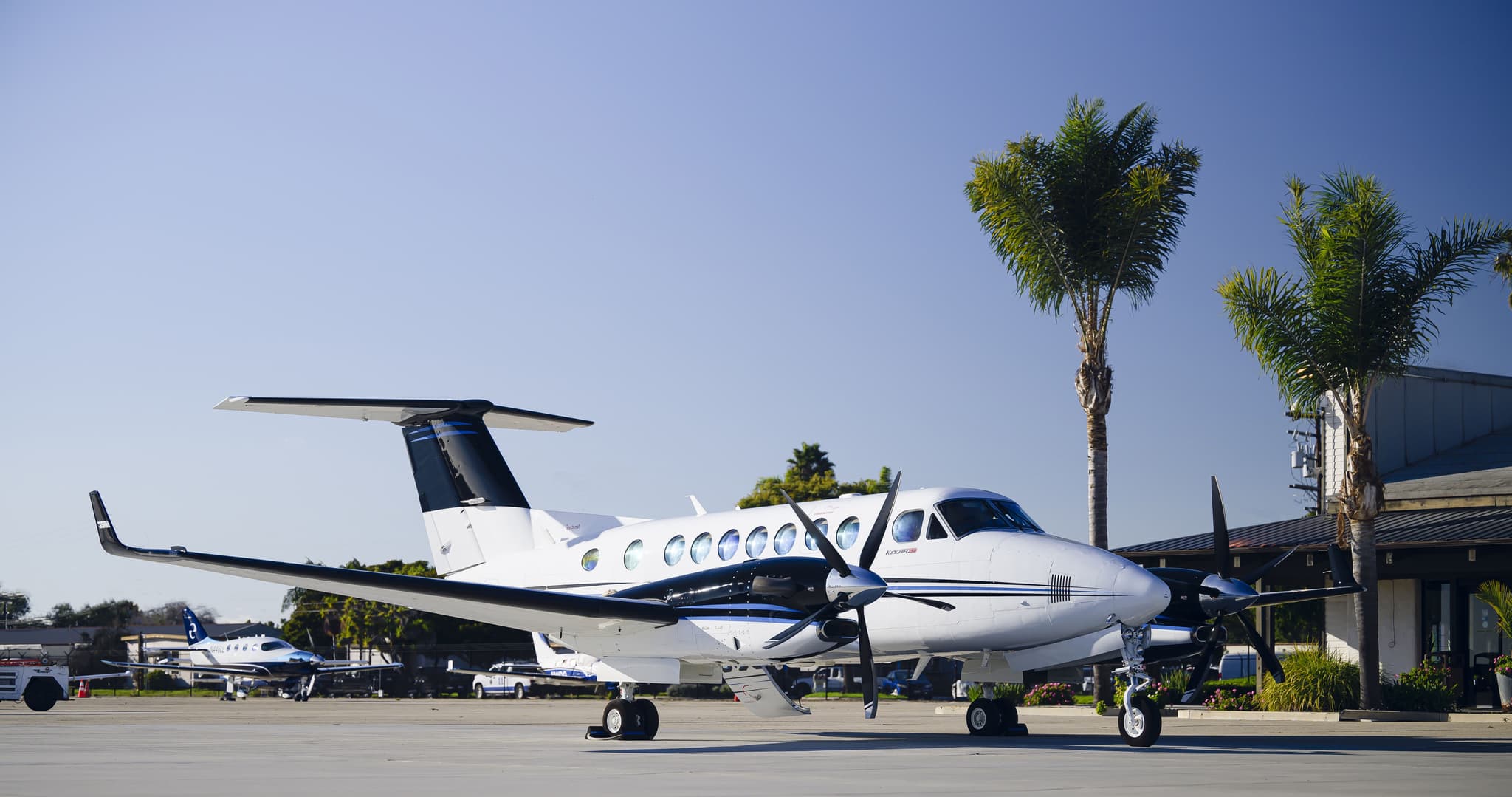 Tue, Nov 3TodayLas VegasKLAS · Harry Reid International AirportLos AngelesKVNY · Van Nuys AirportKing Air 3509—On request3NovLas Vegas → Los AngelesKLAS → KVNY · TodayKing Air 350 · 9 seatsOn request
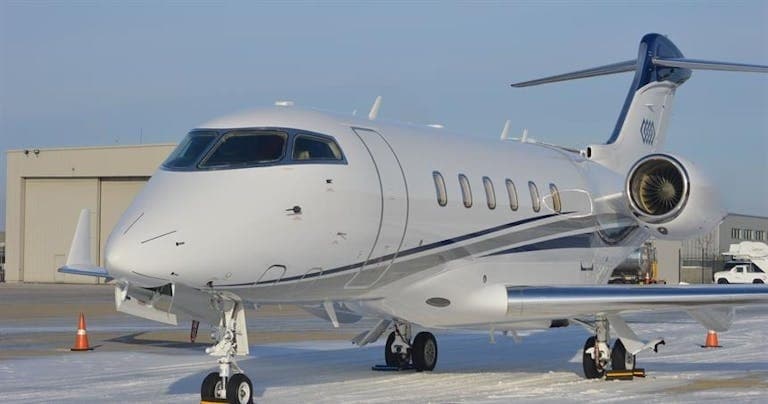 Tue, Nov 3TodayLas VegasKLAS · Harry Reid International AirportLos AngelesKVNY · Van Nuys AirportChallenger 3008—On request3NovLas Vegas → Los AngelesKLAS → KVNY · TodayChallenger 300 · 8 seatsOn request
- Tue, Nov 310:00Las VegasKLAS · Harry Reid International AirportSan DiegoKSAN · San Diego International AirportCessna Citation Sovereign9—$5,9403NovLas Vegas → San DiegoKLAS → KSAN · 10:00Cessna Citation Sovereign · 9 seats$5,940
- Tue, Nov 308:15Las VegasKLAS · Harry Reid International AirportProvoKPVU · Provo-Utah Lake International AirportBombardier Learjet 607—$4,6203NovLas Vegas → ProvoKLAS → KPVU · 08:15Bombardier Learjet 60 · 7 seats$4,620
- Tue, Nov 323:45Las VegasKLAS · Harry Reid International AirportPortlandKPDX · Portland International AirportBombardier Learjet 607—$5,8303NovLas Vegas → PortlandKLAS → KPDX · 23:45Bombardier Learjet 60 · 7 seats$5,830
- Tue, Nov 3TodayLas VegasKLAS · Harry Reid International AirportMercedKMER · Castle AirportBeechcraft Hawker 900XP8—$13,5303NovLas Vegas → MercedKLAS → KMER · TodayBeechcraft Hawker 900XP · 8 seats$13,530
 Tue, Nov 319:03Las VegasKLAS · Harry Reid International AirportVan NuysKVNY · Van Nuys AirportBeechcraft King Air 350i11h 6mOn request3NovLas Vegas → Van NuysKLAS → KVNY · 19:03Beechcraft King Air 350i · 1 seat · 1h 6mOn request
- Tue, Nov 315:44Las VegasKLAS · Harry Reid IntlSan AngeloKSJT · Mathis FieldBombardier Learjet 607—$17,2433NovLas Vegas → San AngeloKLAS → KSJT · 15:44Bombardier Learjet 60 · 7 seats$17,243
- Tue, Nov 316:25Las VegasKLAS · Harry Reid IntlVancouverCYVR · Vancouver IntlGulfstream G45016—On request3NovLas Vegas → VancouverKLAS → CYVR · 16:25Gulfstream G450 · 16 seatsOn request
 KLAS · Harry Reid International Airport
 CYVR · Vancouver Intl
* Total price incl. 10% service fee, converted to your selected currency. Price subject to operator confirmation.
Empty legs to KLAS
100 arrivals available
 Tue, Nov 3TodayLos AngelesKVNY · Van Nuys AirportLas VegasKLAS · Harry Reid International AirportLearjet 459—On request3NovLos Angeles → Las VegasKVNY → KLAS · TodayLearjet 45 · 9 seatsOn request
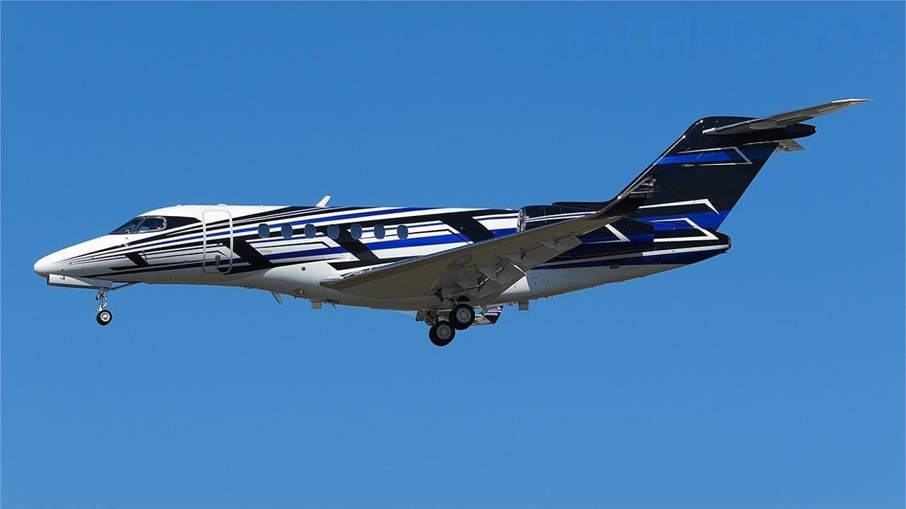 Tue, Nov 3TodayDallasKDAL · Dallas Love FieldLas VegasKLAS · Harry Reid International AirportCitation Longitude9—On request3NovDallas → Las VegasKDAL → KLAS · TodayCitation Longitude · 9 seatsOn request
- Tue, Nov 3TodayCarlsbadKCRQ · McClellan-Palomar AirportLas VegasKLAS · Harry Reid International AirportEmbraer Phenom 1004—$3,3003NovCarlsbad → Las VegasKCRQ → KLAS · TodayEmbraer Phenom 100 · 4 seats$3,300
- Tue, Nov 3TodaySan Jose del CaboMMSD · Los Cabos International AirportLas VegasKLAS · Harry Reid International AirportCessna Citation Longitude9—$17,7103NovSan Jose del Cabo → Las VegasMMSD → KLAS · TodayCessna Citation Longitude · 9 seats$17,710
- Tue, Nov 308:15Van NuysKVNY · Van Nuys AirportLas VegasKLAS · Harry Reid International AirportBombardier Learjet 45XR8—$3,9603NovVan Nuys → Las VegasKVNY → KLAS · 08:15Bombardier Learjet 45XR · 8 seats$3,960
- Tue, Nov 3TodaySanta AnaKSNA · John Wayne Orange County International AirportLas VegasKLAS · Harry Reid International AirportGulfstream GV14—$13,7503NovSanta Ana → Las VegasKSNA → KLAS · TodayGulfstream GV · 14 seats$13,750
 Tue, Nov 316:10Santa AnaKSNA · John Wayne Airport-Orange County AirportLas VegasKLAS · Harry Reid International AirportGulfstream G600(GVII)136mOn request3NovSanta Ana → Las VegasKSNA → KLAS · 16:10Gulfstream G600(GVII) · 1 seat · 36mOn request
- Tue, Nov 320:56ScottsdaleKSDLLas VegasKLAS · Harry Reid IntlBombardier Learjet 607—$8,1683NovScottsdale → Las VegasKSDL → KLAS · 20:56Bombardier Learjet 60 · 7 seats$8,168
- Tue, Nov 320:14El PasoKELP · El Paso IntlLas VegasKLAS · Harry Reid IntlBombardier Learjet 607—$15,4283NovEl Paso → Las VegasKELP → KLAS · 20:14Bombardier Learjet 60 · 7 seats$15,428
 MMSD · Los Cabos International Airport
* Total price incl. 10% service fee, converted to your selected currency. Price subject to operator confirmation.
Map: Las Vegas Airport
View the location of Las Vegas – LAS/KLAS. Zoom in to explore the area around the airport.
About the airport
Harry Reid International Airport (LAS/KLAS) is the key private jet gateway for Las Vegas. PrivJet gives you instant access to charter flights and empty legs: fast, discreet and globally connected.
KLAS airport FAQ
Are there any restrictions at Las Vegas airport (KLAS) today?
There are currently 17 valid NOTAMs for Las Vegas (KLAS). According to NOTAM, at least one runway or the aerodrome itself is closed. Affected: Aerodrome: closed; Taxiway: closed; Instrument approach procedure; Instrument approach procedure: changed. 5 more NOTAMs start in the coming days. For information only, not for flight planning or operational use. Always rely on an official pre-flight briefing. This list may be incomplete or out of date.
What is the weather at Las Vegas airport (KLAS)?
According to the latest weather report for KLAS (METAR, 02 Nov, 22:56 UTC): Good visual conditions (VFR). Wind Calm, visibility 10 km or more, temperature 21 °C (dew point 1 °C). For information only, not for flight planning. Weather can change quickly; always rely on official reports.
How long are the runways at Las Vegas airport (KLAS)?
Las Vegas (KLAS) has 4 runways: runway 08L/26R with 4,522 m (14,835 ft), asphalt, runway 08R/26L with 3,208 m (10,526 ft), asphalt, runway 01L/19R with 2,978 m (9,770 ft), concrete and runway 01R/19L with 2,978 m (9,769 ft), asphalt. The longest is 4,522 m.
What are the radio frequencies at Las Vegas airport (KLAS)?
Frequencies at KLAS: Tower 119.9 MHz, Ground 121.1 MHz and ATIS 132.4 MHz. For information only. Always rely on the published AIP.
What are the airport codes of Harry Reid International Airport?
The ICAO code is KLAS and the IATA code is LAS. ICAO codes are used by air traffic control and pilots, e.g. in flight plans; IATA codes appear on tickets and baggage tags.
What is the elevation of KLAS airport?
Harry Reid International Airport sits at 2,181 ft (665 m) above sea level. Local time zone: America/Los Angeles.
Where do private jets land at Las Vegas Harry Reid?
KLAS has 2 private jet terminals or FBOs: Signature Aviation LAS and Atlantic Aviation LAS. Your flight confirmation says which one your operator uses.
Can I fly to KLAS by private jet?
Whether a private jet can operate into Harry Reid International Airport depends on runway length, opening hours, customs and immigration rules as well as slot and handling availability, among other things. PrivJet checks this with the operating carrier for every request.
Are there empty legs from or to KLAS?
There are currently 100 empty legs departing from and 100 arriving at Harry Reid International Airport. Empty legs are repositioning flights at heavily reduced prices; the list is updated several times a day.