Cincinnati Municipal Airport Lunken Field Airport (KLUK / LUK)
Empty legs and charters from Cincinnati
KLUK airport at a glance
- ICAO code
- KLUK
- IATA code
- LUK
- City
- Cincinnati
- Region
- Ohio
- Country
- United States
- Elevation
- 483 ft (147 m)
- Time zone
- America/New York (UTC-5)
- Coordinates
- 39.1033° N, 84.4186° W
- Empty legs from
- 22
- Empty legs to
- 29
Weather & airport info KLUK
Current weather
No current weather report is available for this airport.
Airport
- Elevation
- 483 ft (147 m)
- Sunrise / Sunset
- 07:07 / 17:35 local time
Runways
| Runway | Length | Surface | Lighted |
|---|---|---|---|
| 03R/21L | 1,860 m (6,101 ft) | asphalt | yes |
| 07/25 | 1,563 m (5,127 ft) | asphalt | yes |
| 03L/21R | 1,159 m (3,802 ft) | asphalt | yes |
Radio frequencies
- ATIS: 120.25
- Clearance: 121.9
- CTAF: 118.7
- Ground: 121.9
- Tower: 118.7
- UNICOM: 122.95
For information only, not for flight planning. Weather can change quickly; always rely on official reports. Sources: aviationweather.gov (NOAA), OurAirports.
Airport map KLUK
Full screen →Runways white, taxiways yellow with designators, closed taxiways and runways per NOTAM in red.
Official charts (FAA)
Cycle 2611, valid until 0901Z 11/26/26
Airport diagram (FAA)
Airport diagram (1)
Instrument approaches (4)
Minimums (2)
Hot spots (1)
For information only, not for navigation. Always use current official charts and NOTAMs.
Current NOTAMs for KLUK(10)
NOTAMs (Notices to Air Missions) announce short-term changes at an airport: closed runways or taxiways, unserviceable approach aids, obstacles, airspace restrictions.
- Out of serviceObstacle10/034· until 28 Jan, 23:59 UTC
An obstacle tower light is out of service 3.5 nautical miles west of the airport. Its top is 1003.9 feet above sea level, 219.8 feet above ground.
Show original text
OBST TOWER LGT (ASR 1012835) 390651.00N0842932.00W (3.5NM W LUK) 1003.9FT (219.8FT AGL) U/S
10/034 NOTAMN<BR>
<B>Q) </B>KZID/QOLAS/IV/M/AE/000/011/3906N08425W005<BR>
<B>A) </B>KLUK<BR>
<B>B) </B>2610281609<BR>
<B>C) </B>2701282359<BR>
<B>E) </B> TOWER LGT (ASR 1012835) 390651.00N0842932.00W (3.5NM W LUK) 1003.9FT (219.8FT AGL) U/S<BR>
- Out of serviceInstrument approach procedure2121/26· until 06 Nov, 23:59 UTC
The Instrument Landing System (ILS) or Localizer (LOC) for runway 21 at Cincinnati/Lunken Field airport is affected. If the local altimeter setting is not received, pilots must use the Cincinnati/Northern Kentucky International altimeter setting, which results in increased decision altitudes and minimum visibility requirements.
Show original text
IAP CINCINNATI MUNI/LUNKEN FLD, CINCINNATI, OH. ILS OR LOC RWY 21, ORIG-A... WHEN LOCAL ALTIMETER SETTING NOT RECEIVED, USE CINCINNATI/NORTH KENTUCKY INTL ALTIMETER SETTING AND INCREASE S-ILS 21 DA TO 880 FEET; INCREASE ALL MDAS 100 FEET; INCREASE S-LOC 21 VISIBILITY CATS C AND D 1/4 SM, AND CIRCLING VISIBILITY CATS A, B AND C 1/2 SM. VDP NA WHEN USING CINCINNATI/NORTH KENTUCKY INTL ALTIMETER SETTING. FOR INOPERATIVE ALS WHEN USING CINCINNATI/NORTH KENTUCKY INTL ALTIMETER SETTING AND INCREASE S-ILS 21 ALL CATS VISIBILITY TO RVR 6000. LUK ASOS OUT OF SERVICE. 2610250600-2611062359EST
Q) KZID/QPIXX/I/NBO/A/000/999/3906N08425W005
A) KLUK
B) 2608181958
C) 2703301958EST
E) LUK CINCINNATI MUNI/LUNKEN FLD, CINCINNATI, OH.
ILS OR LOC RWY 21, ORIG-A...
WHEN LOCAL ALTIMETER SETTING NOT RECEIVED, USE CINCINNATI/NORTH KENTUCKY INTL ALTIMETER SETTING AND INCREASE S-ILS 21 DA TO 880 FEET; INCREASE ALL MDAS 100 FEET; INCREASE S-LOC 21 VISIBILITY CATS C AND D 1/4 SM, AND CIRCLING VISIBILITY CATS A, B AND C 1/2 SM. VDP NA WHEN USING CINCINNATI/NORTH KENTUCKY INTL ALTIMETER SETTING. FOR INOPERATIVE ALS WHEN USING CINCINNATI/NORTH KENTUCKY INTL ALTIMETER SETTING AND INCREASE S-ILS 21 ALL CATS VISIBILITY TO RVR 6000. LUK ASOS OUT OF SERVICE.
- Out of serviceInstrument approach procedure2122/26· until 06 Nov, 23:59 UTC
The RNAV (GPS) approach for runway 3 at Cincinnati/Lunken Field airport is affected. If the local altimeter setting is not received, pilots must use the Cincinnati/Northern Kentucky International altimeter setting, which results in increased minimum descent altitudes and visibility requirements.
Show original text
IAP CINCINNATI MUNI/LUNKEN FLD, CINCINNATI, OH. RNAV (GPS) RWY 3, ORIG... WHEN LOCAL ALTIMETER SETTING NOT RECEIVED, USE CINCINNATI/NORTH KENTUCKY INTL ALTIMETER SETTING AND INCREASE ALL MDAS 100 FEET AND LNAV CAT C AND D VISIBILITY 1/2 SM; INCREASE CIRCLING CAT A/B/C VISIBILITY 1/2 SM. VDP NA WHEN USING CINCINNATI/NORTH KENTUCKY INTL ALTIMETER SETTING. LUK ASOS OUT OF SERVICE. 2610250600-2611062359EST
Q) KZID/QPIXX/I/NBO/A/000/999/3906N08425W005
A) KLUK
B) 2608181959
C) 2703301959EST
E) LUK CINCINNATI MUNI/LUNKEN FLD, CINCINNATI, OH.
RNAV (GPS) RWY 3, ORIG...
WHEN LOCAL ALTIMETER SETTING NOT RECEIVED, USE CINCINNATI/NORTH KENTUCKY INTL ALTIMETER SETTING AND INCREASE ALL MDAS 100 FEET AND LNAV CAT C AND D VISIBILITY 1/2 SM; INCREASE CIRCLING CAT A/B/C VISIBILITY 1/2 SM. VDP NA WHEN USING CINCINNATI/NORTH KENTUCKY INTL ALTIMETER SETTING. LUK ASOS OUT OF SERVICE.
- Out of serviceInstrument approach procedure2123/26· until 06 Nov, 23:59 UTC
The RNAV (GPS) approach for runway 21 at Cincinnati/Lunken Field airport is affected. If the local altimeter setting is not received, pilots must use the Cincinnati/Northern Kentucky International altimeter setting, which results in increased decision altitudes and minimum visibility requirements.
Show original text
IAP CINCINNATI MUNI/LUNKEN FLD, CINCINNATI, OH. RNAV (GPS) RWY 21, AMDT 1... WHEN LOCAL ALTIMETER SETTING NOT RECEIVED, USE CVG ALTIMETER SETTING AND INCREASE LPV DA TO 880 FEET; INCREASE LNAV/VNAV DA TO 1227 FEET AND ALL VISIBILITIES 1/4 SM; INCREASE ALL MDAS 100 FEET AND LNAV VISIBILITY CAT C AND D 1/4 SM, AND CIRCLING VISIBILITY CAT A, B AND C 1/2 SM. BARO-VNAV AND VDP NA WHEN USING CVG ALTIMETER SETTING. FOR INOPERATIVE ALS WHEN USING CVG ALTIMETER SETTING, INCREASE LPV ALL CATS VISIBILITY TO RVR 6000, LNAV/VNAV ALL CATS VISIBILITY TO 2 1/2 SM, LNAV CAT B VISIBILITY TO 1 1/4 SM AND CATS C AND D VISIBILITY TO 2 1/2 SM. LUK ASOS OUT OF SERVICE. 2610250600-2611062359EST
Q) KZID/QPIXX/I/NBO/A/000/999/3906N08425W005
A) KLUK
B) 2608182000
C) 2703301959EST
E) LUK CINCINNATI MUNI/LUNKEN FLD, CINCINNATI, OH.
RNAV (GPS) RWY 21, AMDT 1...
WHEN LOCAL ALTIMETER SETTING NOT RECEIVED, USE CVG ALTIMETER SETTING AND INCREASE LPV DA TO 880 FEET; INCREASE LNAV/VNAV DA TO 1227 FEET AND ALL VISIBILITIES 1/4 SM; INCREASE ALL MDAS 100 FEET AND LNAV VISIBILITY CAT C AND D 1/4 SM, AND CIRCLING VISIBILITY CAT A, B AND C 1/2 SM. BARO-VNAV AND VDP NA WHEN USING CVG ALTIMETER SETTING. FOR INOPERATIVE ALS WHEN USING CVG ALTIMETER SETTING, INCREASE LPV ALL CATS VISIBILITY TO RVR 6000, LNAV/VNAV ALL CATS VISIBILITY TO 2 1/2 SM, LNAV CAT B VISIBILITY TO 1 1/4 SM AND CATS C AND D VISIBILITY TO 2 1/2 SM. LUK ASOS OUT OF SERVICE.
- Out of serviceObstacle10/026· until 05 Dec, 11:21 UTC
A tower near the airport, 5.9 nautical miles south of Cincinnati Muni/Lunken Fld, with its top at 1158 feet above sea level and 349 feet above ground, has its lighting out of service.
Show original text
OBST TOWER LGT (ASR 1045299) 390021.40N0842634.30W (5.9NM S LUK) 1158FT (349FT AGL) U/S
- Out of serviceObstacle10/017· until 02 Dec, 05:13 UTC
A tower 5.9 nautical miles south of the airport, with its top 1168 ft above sea level (358 ft above ground), has its lighting out of service.
Show original text
OBST TOWER LGT (ASR 1045298) 390026.00N0842635.00W (5.9NM S LUK) 1168FT (358FT AGL) U/S
- Out of serviceObstacle10/016· until 17 Dec, 23:59 UTC
An obstacle, a tower light near the airport, is out of service. Its top is 1126 feet above sea level, 297 feet above ground.
Show original text
OBST TOWER LGT (ASN 2017-ASO-19343-OE) 390459N0843228W (5.8NM WSW LUK) 1126FT (297FT AGL) U/S
10/016 NOTAMN<BR>
<B>Q) </B>KZID/QOLAS/IV/M/E/000/012/3906N08425W005<BR>
<B>A) </B>KLUK<BR>
<B>B) </B>2610171609<BR>
<B>C) </B>2612172359<BR>
<B>E) </B> TOWER LGT (ASN 2017-ASO-19343-OE) 390459N0843228W (5.8NM WSW LUK) 1126FT (297FT AGL) U/S<BR>
- Out of serviceObstacle lights: unserviceable09/031· until 28 Dec, 04:00 UTC
A tower 11.7 nautical miles south of Cincinnati Muni/Lunken Field airport has a light that is out of service. Its top is 1111.2 ft above sea level, 262.1 ft above ground.
Show original text
OBST TOWER LGT (ASR 1209842) 385441.40N0842739.30W (11.7NM S LUK) 1111.2FT (262.1FT AGL) U/S
09/031 NOTAMN<br/>
<b>Q) </b>KZID/QOLAS/IV/M/E/000/012/3906N08425W005<br/>
<b>A) </b>KLUK<br/>
<b>B) </b>2609291106<br/>
<b>C) </b>2612280400<br/>
<b>E) </b> TOWER LGT (ASR 1209842) 385441.40N0842739.30W (11.7NM S LUK) 1111.2FT (262.1FT AGL) U/S<br/>
2 more NOTAMs
- Out of serviceObstacle09/025· until 07 Nov, 23:59 UTC
A tower light is out of service. This tower is located 2.6 nautical miles north of Cincinnati Muni/Lunken Fld airport; its top is 853.0 ft above sea level, 231.0 ft above ground.
Show original text
OBST TOWER LGT (ASR 1014857) 390843.60N0842542.10W (2.6NM N LUK) 853.0FT (231.0FT AGL) U/S
09/025 NOTAMN<BR>
<B>Q) </B>KZID/QOLAS/IV/M/AE/000/009/3906N08425W005<BR>
<B>A) </B>KLUK<BR>
<B>B) </B>2609231810<BR>
<B>C) </B>2611072359<BR>
<B>E) </B> TOWER LGT (ASR 1014857) 390843.60N0842542.10W (2.6NM N LUK) 853.0FT (231.0FT AGL) U/S<BR>
- NoticeTaxiway: work in progress10/031· until 20 Nov, 23:00 UTC
Work in progress on taxiway A between Hangar 30 ramp and taxiway G. An open excavation adjacent to the west edge is lighted and barricaded.
Show original text
TWY A BTN HANGAR 30 RAMP AND TWY G WIP OPN EXCAVATION ADJ WEST EDGE LGTD AND BARRICADED
10/031 NOTAMN
Q) KZID/QMXHW/IV/M/A/000/999/3906N08425W005
A) KLUK
B) 2610241019
C) 2611202300

E) TWY A BTN HANGAR 30 RAMP AND TWY G WIP OPN EXCAVATION ADJ WEST EDGE LGTD AND BARRICADED
For information only, not for flight planning or operational use. Always rely on an official pre-flight briefing. This list may be incomplete or out of date. Explanations and expanded abbreviations are generated automatically. The original text is authoritative. Source: FAA NOTAM Management Service (SWIM).
Private jet traffic in Cincinnati Municipal Airport Lunken Field (last 30 days)
- Arrivals
- 1,043
- Departures
- 999
- Different jets
- 616
Most frequent origins: Teterboro Airport (43), Chicago Midway International Airport (18), Washington Dulles International Airport (18), Westchester County Airport (15), Naples Municipal Airport (14).
Most frequent destinations: Teterboro Airport (37), Allegheny County Airport (31), Naples Municipal Airport (29), Dupage Airport (26), Chicago Midway International Airport (23).
Most common aircraft types: Cessna Citation Latitude (191), Pilatus PC-12 (188), Embraer Phenom 300 (169), Cessna Citation Excel/XLS (110), Bombardier Challenger 350/3500 (101).
Monday is the busiest day.
Our own analysis of public ADS-B signals from business jets. Not every flight is received, and jets with a removal request are excluded.
Charter operators based here
Operators with a base at this airport.
- Executive Jet ManagementWhite Plains (Westchester County) (KHPN) · Light jet, Midsize jet, Super midsize jet
- Presidential AviationFort Lauderdale Executive (KFXE) · Light jet, Midsize jet, Super midsize jet
- Reynolds JetLight jet, Midsize jet, Super midsize jet
- Jet Air LLCMidsize jet
- OnFlightMidsize jet
Empty legs from KLUK
22 departures available
- Wed, Nov 414:24CincinnatiKLUK · Cincinnati Municipal Airport Lunken FieldColumbusKCMH · John Glenn Columbus International AirportCessna Citation Bravo7—$9,9004NovCincinnati → ColumbusKLUK → KCMH · 14:24Cessna Citation Bravo · 7 seats$9,900
 Sat, Nov 7in 4 daysCincinnatiKLUK · Cincinnati Municipal Airport Lunken FieldDubuqueKDBQ · Dubuque Regional AirportPhenom 3008—On request7NovCincinnati → DubuqueKLUK → KDBQ · in 4 daysPhenom 300 · 8 seatsOn request
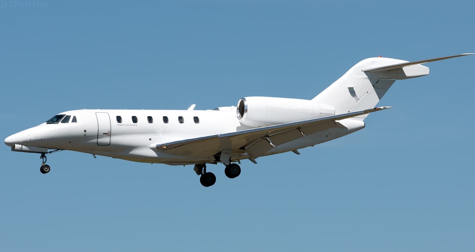 Sun, Nov 8in 5 daysCincinnatiKLUK · Cincinnati Municipal Airport Lunken FieldLebanonKLEB · Lebanon Municipal AirportCitation X8—On request8NovCincinnati → LebanonKLUK → KLEB · in 5 daysCitation X · 8 seatsOn request
 Sat, Nov 14in 11 daysCincinnatiKLUK · Cincinnati Municipal Airport Lunken FieldNashvilleKBNA · Nashville International AirportFalcon 2000EX EASy8—On request14NovCincinnati → NashvilleKLUK → KBNA · in 11 daysFalcon 2000EX EASy · 8 seatsOn request
- Sat, Nov 14in 11 daysCincinnatiKLUK · Cincinnati Municipal Airport Lunken FieldNashvilleKBNA · Nashville International AirportDassault Falcon 20008—On request14NovCincinnati → NashvilleKLUK → KBNA · in 11 daysDassault Falcon 2000 · 8 seatsOn request
- Sat, Nov 14in 11 daysCincinnatiKLUK · Cincinnati Municipal Airport Lunken FieldNashvilleKBNA · Nashville International AirportDassault Falcon 2000LXS8—On request14NovCincinnati → NashvilleKLUK → KBNA · in 11 daysDassault Falcon 2000LXS · 8 seatsOn request
- Sun, Nov 1504:24CincinnatiKLUK · Cincinnati Municipal - Lunken FieldNashvilleKBNA · Nashville IntlDassault Falcon 2000EX EASy8—On request15NovCincinnati → NashvilleKLUK → KBNA · 04:24Dassault Falcon 2000EX EASy · 8 seatsOn request
- Sat, Nov 21in 18 daysCincinnatiKLUK · Cincinnati Municipal Airport Lunken FieldNew OrleansKNBG · New Orleans NAS JRB/Alvin Callender FieldBeechcraft Hawker 900XP8—$11,11021NovCincinnati → New OrleansKLUK → KNBG · in 18 daysBeechcraft Hawker 900XP · 8 seats$11,110
- Sat, Nov 21in 18 daysCincinnatiKLUK · Cincinnati Municipal - Lunken FieldNew OrleansKMSY · Louis Armstrong IntlMidsize Jet6—On request21NovCincinnati → New OrleansKLUK → KMSY · in 18 daysMidsize Jet · 6 seatsOn request
 KLUK · Cincinnati Municipal Airport Lunken Field
* Total price incl. 10% service fee, converted to your selected currency. Price subject to operator confirmation.
Empty legs to KLUK
29 arrivals available
 Tue, Nov 3TodayChicagoKDPA · Dupage AirportCincinnatiKLUK · Cincinnati Municipal Airport Lunken FieldPhenom 1005—On request3NovChicago → CincinnatiKDPA → KLUK · TodayPhenom 100 · 5 seatsOn request
 Tue, Nov 3TodayMiamiKOPF · Miami-Opa Locka Executive AirportCincinnatiKLUK · Cincinnati Municipal Airport Lunken FieldGulfstream GIV-SP15—On request3NovMiami → CincinnatiKOPF → KLUK · TodayGulfstream GIV-SP · 15 seatsOn request
 Tue, Nov 3TodayNew YorkKTEB · Teterboro AirportCincinnatiKLUK · Cincinnati Municipal Airport Lunken FieldPhenom 3007—On request3NovNew York → CincinnatiKTEB → KLUK · TodayPhenom 300 · 7 seatsOn request
- Tue, Nov 319:24Chicago/West ChicagoKDPA · Dupage AirportCincinnatiKLUK · Cincinnati Municipal Airport Lunken FieldEmbraer Phenom 100E11hOn request3NovChicago/West Chicago → CincinnatiKDPA → KLUK · 19:24Embraer Phenom 100E · 1 seat · 1hOn request
- Wed, Nov 400:24West ChicagoKDPA · DuPageCincinnatiKLUK · Cincinnati Municipal - Lunken FieldEmbraer Phenom 100E5—On request4NovWest Chicago → CincinnatiKDPA → KLUK · 00:24Embraer Phenom 100E · 5 seatsOn request
 Wed, Nov 4TomorrowChicago/west ChicagoKDPA · Dupage AirportCincinnatiKLUK · Cincinnati Municipal Airport Lunken FieldPhenom 1005—On request4NovChicago/west Chicago → CincinnatiKDPA → KLUK · TomorrowPhenom 100 · 5 seatsOn request
- Thu, Nov 5in 2 daysElkhartKEKM · Elkhart MunCincinnatiKLUK · Cincinnati Mun LunkenHawker 400XP——On request5NovElkhart → CincinnatiKEKM → KLUK · in 2 daysHawker 400XPOn request
- Thu, Nov 5in 2 daysWaukeshaKUES · Waukesha County AirportCincinnatiKLUK · Cincinnati Municipal Airport Lunken FieldCessna Citation CJ48—On request5NovWaukesha → CincinnatiKUES → KLUK · in 2 daysCessna Citation CJ4 · 8 seatsOn request
- Thu, Nov 505:59TampaKTPA · Tampa International AirportCincinnatiKLUK · Cincinnati Municipal Airport Lunken FieldCitation CJ48—On request5NovTampa → CincinnatiKTPA → KLUK · 05:59Citation CJ4 · 8 seatsOn request
* Total price incl. 10% service fee, converted to your selected currency. Price subject to operator confirmation.
Map: Cincinnati Airport
View the location of Cincinnati – LUK/KLUK. Zoom in to explore the area around the airport.
About the airport
Cincinnati Municipal Airport Lunken Field (LUK/KLUK) is the key private jet gateway for Cincinnati. PrivJet gives you instant access to charter flights and empty legs: fast, discreet and globally connected.
KLUK airport FAQ
Are there any restrictions at Cincinnati airport (KLUK) today?
There are currently 10 valid NOTAMs for Cincinnati (KLUK). Affected: Obstacle: out of service; Instrument approach procedure; Obstacle lights: unserviceable. For information only, not for flight planning or operational use. Always rely on an official pre-flight briefing. This list may be incomplete or out of date.
How long are the runways at Cincinnati airport (KLUK)?
Cincinnati (KLUK) has 3 runways: runway 03R/21L with 1,860 m (6,101 ft), asphalt, runway 07/25 with 1,563 m (5,127 ft), asphalt and runway 03L/21R with 1,159 m (3,802 ft), asphalt. The longest is 1,860 m.
What are the radio frequencies at Cincinnati airport (KLUK)?
Frequencies at KLUK: Tower 118.7 MHz, Ground 121.9 MHz and ATIS 120.25 MHz. For information only. Always rely on the published AIP.
What are the airport codes of Cincinnati Municipal Airport Lunken Field?
The ICAO code is KLUK and the IATA code is LUK. ICAO codes are used by air traffic control and pilots, e.g. in flight plans; IATA codes appear on tickets and baggage tags.
What is the elevation of KLUK airport?
Cincinnati Municipal Airport Lunken Field sits at 483 ft (147 m) above sea level. Local time zone: America/New York.
Can I fly to KLUK by private jet?
Whether a private jet can operate into Cincinnati Municipal Airport Lunken Field depends on runway length, opening hours, customs and immigration rules as well as slot and handling availability, among other things. PrivJet checks this with the operating carrier for every request.
Are there empty legs from or to KLUK?
There are currently 22 empty legs departing from and 29 arriving at Cincinnati Municipal Airport Lunken Field. Empty legs are repositioning flights at heavily reduced prices; the list is updated several times a day.