Milwaukee General Mitchell Airport (KMKE / MKE)
Empty legs and charters from Milwaukee
KMKE airport at a glance
- ICAO code
- KMKE
- IATA code
- MKE
- City
- Milwaukee
- Region
- Wisconsin
- Country
- United States
- Elevation
- 723 ft (220 m)
- Time zone
- America/Chicago (UTC-6)
- Coordinates
- 42.9472° N, 87.8966° W
- Empty legs from
- 48
- Empty legs to
- 46
Weather & airport info KMKE
Current weather
Good visual conditions (VFR)observed 03 Nov, 15:09 UTC- Wind
- 13 kt (24 km/h) from south (190°), gusts up to 27 kt
- Visibility
- 10 km or more
- Clouds
- scattered clouds at 1,800 ft, broken clouds at 4,000 ft, broken clouds at 25,000 ft
- Temperature
- 20 °C (dew point 16 °C)
- Pressure (QNH)
- 1,011 hPa
Original weather report (METAR)
SPECI KMKE 031509Z 19013G27KT 10SM SCT018 BKN040 BKN250 20/16 A2985 RMK AO2 PK WND 21027/1502 T02000156
Airport
- Elevation
- 723 ft (220 m)
- Sunrise / Sunset
- 06:28 / 16:41 local time
Runways
| Runway | Length | Surface | Lighted |
|---|---|---|---|
| 01L/19R | 3,045 m (9,990 ft) | asphalt/concrete | yes |
| 07R/25L | 2,530 m (8,300 ft) | asphalt/concrete | yes |
| 13/31 | 1,688 m (5,537 ft) | asphalt | yes |
| 07L/25R | 1,462 m (4,797 ft) | asphalt | yes |
| 01R/19L | 1,275 m (4,182 ft) | asphalt | yes |
Radio frequencies
- Approach: 118
- ATIS: 126.4
- Clearance: 120.8
- Ground: 121.8
- Tower: 119.1
- UNICOM: 122.95
For information only, not for flight planning. Weather can change quickly; always rely on official reports. Sources: aviationweather.gov (NOAA), OurAirports.
Airport map KMKE
Full screen →Runways white, taxiways yellow with designators, closed taxiways and runways per NOTAM in red.
Closed per NOTAM: RWY 7R/25L, RWY 1R/19L*, RWY 13/31*, TWY R*, TWY R4 (* partly closed)
Official charts (FAA)
Cycle 2611, valid until 0901Z 11/26/26
Airport diagram (FAA)
Airport diagram (1)
Instrument approaches (17)
- ILS OR LOC RWY 01L
- ILS OR LOC RWY 07R
- ILS OR LOC RWY 19R
- ILS RWY 01L (CAT II - III)
- RNAV (RNP) Y RWY 07R
- RNAV (RNP) Y RWY 25L
- RNAV (GPS) RWY 01L
- RNAV (GPS) RWY 01R
- RNAV (GPS) RWY 07L
- RNAV (GPS) RWY 13
- RNAV (GPS) RWY 19L
- RNAV (GPS) RWY 19R
- RNAV (GPS) RWY 25R
- RNAV (GPS) RWY 31
- RNAV (GPS) Z RWY 07R
- RNAV (GPS) Z RWY 25L
- LOC RWY 25L
Departure procedures (3)
Minimums (1)
Other (1)
For information only, not for navigation. Always use current official charts and NOTAMs.
Current NOTAMs for KMKE(31)
NOTAMs (Notices to Air Missions) announce short-term changes at an airport: closed runways or taxiways, unserviceable approach aids, obstacles, airspace restrictions.
- ClosedRunway: closedA9561/26· until 03 Nov, 23:58 UTC
Runway 07R/25L at General Mitchell International Airport is closed.
Show original text
RWY 07R/25L CLSD
A9561/26 NOTAMN
Q) KZAU/QMRLC////000/999/4256N08753W005
A) KMKE
B) 2611031559
C) 2611032358
E) RWY 07R/25L CLSD
- ClosedRunway: closedA8469/26· until 30 Dec, 23:59 UTC
Runway 01R/19L is closed, except for taxiing between runway 13/31 and taxiway S.
Show original text
RWY 01R/19L CLSD EXC TAX BTN RWY 13/31 AND TWY S
A8469/26 NOTAMN
Q) KZAU/QMRLC////000/999/4256N08753W005
A) KMKE
B) 2609290454
C) 2612302359
E) RWY 01R/19L CLSD EXC TAX BTN RWY 13/31 AND TWY S
- Out of serviceAerodrome: not availableA9560/26· from 04 Nov, 15:00 UTC · until 04 Nov, 20:00 UTC
The microburst and wind shear detection system is not available. This system warns of sudden, strong winds.
Show original text
SVC MBST/WS DETECTION SYSTEM NOT AVBL
A9560/26 NOTAMN
Q) KZAU/QFMAU////000/999/4256N08753W005
A) KMKE
B) 2611041500
C) 2611042000
E) SVC MBST/WS DETECTION SYSTEM NOT AVBL
- ClosedTaxiway: closedA9562/26· until 03 Nov, 23:58 UTC
Taxiway R between taxiway A and taxiway Y closed
Show original text
TWY R BTN TWY A AND TWY Y CLSD
A9562/26 NOTAMN
Q) KZAU/QMXLC////000/999/4256N08753W005
A) KMKE
B) 2611031649
C) 2611032358
E) TWY R BTN TWY A AND TWY Y CLSD
- Out of serviceAerodrome: not available10/419· until 03 Nov, 19:00 UTC
The microburst and wind shear detection system is not available. This system warns of dangerous wind phenomena.
Show original text
SVC MBST/WS DETECTION SYSTEM NOT AVBL
A9286/26 NOTAMN Q) KZAU/QFMAU////000/999/4256N08753W005 A) KMKE B) 2611031500 C) 2611031900 E) SVC MBST/WS DETECTION SYSTEM NOT AVBL
- ClosedTaxiway: closedA9405/26· until 30 Nov, 23:59 UTC
Taxiway R4 is closed to aircraft with a wingspan of more than 171 feet.
Show original text
TWY R4 CLSD TO ACFT WINGSPAN MORE THAN 171FT
A9405/26 NOTAMN
Q) KZAU/QMXLC////000/999/4256N08753W005
A) KMKE
B) 2610302140
C) 2611302359
E) TWY R4 CLSD TO ACFT WINGSPAN MORE THAN 171FT
- Out of serviceILS: unserviceableA9400/26· until 20 Nov, 19:00 UTC
MKE navigation: ILS (instrument landing system) runway 01L out of service
Show original text
MKE NAV ILS RWY 01L U/S
A9400/26 NOTAMN
Q) KZAU/QICAS////000/999/4256N08753W005
A) KMKE
B) 2610301538
C) 2611201900
E) MKE NAV ILS RWY 01L U/S
- Out of serviceObstacle lights: unserviceableA9133/26· until 04 Dec, 14:23 UTC
A tower light 7.6 nautical miles west of General Mitchell airport is out of service. The tower's top is 1072 feet above sea level and 247 feet above ground.
Show original text
TOWER LGT (ASR 1045572) 425832.00N0880357.00W (7.6NM W MK 1072FT (247FT AGL) U/S
A9133/26 NOTAMN
Q) KZAU/QOLAS/IV/M/E/000/999/4258N08803W001
A) KMKE
B) 2610201423
C) 2612041423
E) TOWER LGT (ASR 1045572) 425832.00N0880357.00W (7.6NM W MKE) 1072FT (247FT AGL) U/S
23 more NOTAMs
- Out of serviceObstacle lights: unserviceableA8847/26· until 26 Nov, 10:39 UTC
A tower light 7.6 nautical miles west of the airport is out of service. Its top is 1072 ft above sea level, 247 ft above ground.
Show original text
TOWER LGT (ASR 1045570) 425830.00N0880358.00W (7.6NM W MK 1072FT (247FT AGL) U/S
A8847/26 NOTAMN
Q) KZAU/QOLAS/IV/M/E/000/999/4258N08803W001
A) KMKE
B) 2610121039
C) 2611261039
E) TOWER LGT (ASR 1045570) 425830.00N0880358.00W (7.6NM W MKE) 1072FT (247FT AGL) U/S
- Out of servicePilot-controlled lighting: unserviceableA8768/26· until 12 Nov, 20:00 UTC
The PAPI (Precision Approach Path Indicator) for runway 31, which is controlled via PCL (Pilot Controlled Lighting), is out of service. This system helps pilots maintain the correct glide path to the runway.
Show original text
SVC PCL RWY 31 PAPI U/S
A8768/26 NOTAMN
Q) KZAU/QLGAS////000/999/4256N08753W005
A) KMKE
B) 2610082007
C) 2611122000
E) SVC PCL RWY 31 PAPI U/S
- ClosedTaxiway: closedA8467/26· until 30 Dec, 23:59 UTC
The surface painted holding position signs on the north side of taxiway V for runway 13/31 are not standard.
Show original text
TWY V SFC PAINTED HLDG PSN SIGNS FOR RWY 13/31 NORTH SIDE NOT STD
A8467/26 NOTAMN
Q) KZAU/QMXLC////000/999/4256N08753W005
A) KMKE
B) 2609290443
C) 2612302359
E) TWY V SFC PAINTED HLDG PSN SIGNS FOR RWY 13/31 NORTH SIDE NOT STD
- NoticeApronA9570/26· until 04 Nov, 16:57 UTC
Apron all surface condition patchy wet observed at 3 Nov 16:57 UTC.
Show original text
APRON ALL FICON PATCHY WET OBS AT 2611031657.
A9570/26 NOTAMN
Q) KZAU/QMNXX////000/999/4256N08753W005
A) KMKE
B) 2611031657
C) 2611041657
E) APRON ALL FICON PATCHY WET OBS AT 2611031657.
- NoticeTaxiwayA9569/26· until 04 Nov, 16:54 UTC
Taxiway all surface condition patchy wet observed at 3 Nov 16:54 UTC.
Show original text
TWY ALL FICON PATCHY WET OBS AT 2611031654.
A9569/26 NOTAMN
Q) KZAU/QMXXX////000/999/4256N08753W005
A) KMKE
B) 2611031654
C) 2611041654
E) TWY ALL FICON PATCHY WET OBS AT 2611031654.
- NoticeTaxiway11/052· until 09 Nov, 23:59 UTC
The surface painted holding position signs on taxiway A5 at the approach end of runway 07R are not marked. This may make orientation more difficult.
Show original text
TWY A5 SFC PAINTED HLDG PSN SIGNS AT RWY 07R APPROACH END NOT MARKED
- NoticeApron: work in progressA9518/26· until 24 Dec, 23:59 UTC
Work in progress on the terminal ramp adjacent to gate C-14. The area is lit and barricaded.
Show original text
APRON TERMINAL RAMP WIP ADJ GATE C-14 LGTD AND BARRICADED
A9518/26 NOTAMN
Q) KZAU/QMNHW////000/999/4256N08753W005
A) KMKE
B) 2611021610
C) 2612242359
E) APRON TERMINAL RAMP WIP ADJ GATE C-14 LGTD AND BARRICADED
- NoticeApron: work in progressA9403/26· until 30 Nov, 23:59 UTC
There is work in progress (WIP) construction adjacent to Gate D27 on the terminal ramp, which is lighted and barricaded.
Show original text
APRON TERMINAL RAMP WIP CONSTRUCTION ADJ GATE D27 LGTD AND BARRICADED
A9403/26 NOTAMN
Q) KZAU/QMNHW////000/999/4256N08753W005
A) KMKE
B) 2610302136
C) 2611302359
E) APRON TERMINAL RAMP WIP CONSTRUCTION ADJ GATE D27 LGTD AND BARRICADED
- NoticeTaxiway10/469· until 29 Nov, 23:59 UTC
The surface painted holding position signs for runway 01L/19R on taxiway R3 at General Mitchell airport are not standard.
Show original text
TWY R3 SFC PAINTED HLDG PSN SIGNS FOR RWY 01L/19R NOT STD
- NoticeApron: work in progressA9335/26· until 04 Dec, 23:59 UTC
Construction work is in progress on the terminal ramp adjacent to Gate D30. The area is lighted and barricaded.
Show original text
APRON TERMINAL RAMP WIP CONST ADJ GATE D30 LGTD AND BARRICADED
A9335/26 NOTAMN
Q) KZAU/QMNHW////000/999/4256N08753W005
A) KMKE
B) 2610290458
C) 2612042359
E) APRON TERMINAL RAMP WIP CONST ADJ GATE D30 LGTD AND BARRICADED
- NoticeApron: work in progress10/364· until 04 Nov, 23:59 UTC
On the north apron, at the Fixed Base Operator (FBO) ramp, construction work is in progress. It extends from the east end to 120 feet west and is lit and barricaded.
Show original text
APRON NORTH FIXED BASE OPR RAMP WIP CONSTRUCTION ADJ E END TO 120 FEET WEST LGTD AND BARRICADED
A9180/26 NOTAMN
Q) KZAU/QMNHW////000/999/4256N08753W005
A) KMKE
B) 2610212155
C) 2611042359
E) APRON NORTH FIXED BASE OPR RAMP WIP CONSTRUCTION ADJ E END TO 120 FEET WEST LGTD AND BARRICADED
- NoticeApron: work in progressA9180/26· until 04 Nov, 23:59 UTC
Construction work is in progress on the north fixed base operator ramp of the airport. The area from the east end to 120 feet west is lit and barricaded.
Show original text
APRON NORTH FIXED BASE OPR RAMP WIP CONSTRUCTION ADJ E END TO 120 FEET WEST LGTD AND BARRICADED
A9180/26 NOTAMN Q) KZAU/QMNHW////000/999/4256N08753W005 A) KMKE B) 2610212155 C) 2611042359 E) APRON NORTH FIXED BASE OPR RAMP WIP CONSTRUCTION ADJ E END TO 120 FEET WEST LGTD AND BARRICADED
- NoticeApron: work in progress10/362· until 21 Dec, 23:59 UTC
Work in progress on the terminal ramp apron adjacent to Gate C12. The area is lit and barricaded.
Show original text
APRON TERMINAL RAMP WIP ADJ GATE C12 LGTD AND BARRICADED
A9177/26 NOTAMN
Q) KZAU/QMNHW////000/999/4256N08753W005
A) KMKE
B) 2610211643
C) 2612212359
E) APRON TERMINAL RAMP WIP ADJ GATE C12 LGTD AND BARRICADED
- NoticeApron: work in progressA9177/26· until 21 Dec, 23:59 UTC
Work in progress on the terminal ramp apron adjacent to Gate C12. The area is lit and barricaded.
Show original text
APRON TERMINAL RAMP WIP ADJ GATE C12 LGTD AND BARRICADED
A9177/26 NOTAMN Q) KZAU/QMNHW////000/999/4256N08753W005 A) KMKE B) 2610211643 C) 2612212359 E) APRON TERMINAL RAMP WIP ADJ GATE C12 LGTD AND BARRICADED
- NoticeTaxiway10/308· until 30 Dec, 23:59 UTC
On taxiway S, the surface painted holding position signs at runway 1L/19R on the east side are not standard.
Show original text
TWY S SFC PAINTED HLDG PSN SIGNS AT RWY 1L/19R EAST SIDE NOT STD
- NoticeTaxiway09/548· until 30 Dec, 23:59 UTC
The taxiway A1 holding position sign on the west side for runway 07R/25L is missing.
Show original text
TWY A1 HLDG PSN SIGN WEST SIDE FOR RWY 07R/25L MISSING
- NoticeTaxiway09/545· until 30 Dec, 23:59 UTC
The taxiway G surface painted holding position signs between runway 13/31 and taxiway U are faded.
Show original text
TWY G SFC PAINTED HLDG PSN SIGNS BTN RWY 13/31 AND TWY U FADED
- NoticeRunway09/544· until 30 Dec, 23:59 UTC
The surface markings for runway 01R/19L are faded.
Show original text
RWY 01R/19L SFC MARKINGS FADED
- NoticeTaxiway09/543· until 30 Dec, 23:59 UTC
The surface painted holding position signs on taxiway F for runway 13/31 are not standard.
Show original text
TWY F SFC PAINTED HLDG PSN SIGNS FOR RWY 13/31 NOT STD
- NoticeTaxiway09/542· until 30 Dec, 23:59 UTC
The holding position sign on the west side of taxiway D for runway 07L/25R is missing.
Show original text
TWY D HLDG PSN SIGN WEST SIDE FOR RWY 07L/25R MISSING
- NoticeTaxiway09/541· until 30 Dec, 23:59 UTC
The surface painted holding position signs on the north side of taxiway E for runway 13/31 are not standard.
Show original text
TWY E SFC PAINTED HLDG PSN SIGNS FOR RWY 13/31 NORTH SIDE NOT STD
- NoticeTaxiway09/536· until 30 Dec, 23:59 UTC
The direction markings on taxiway A3 between runway 07R/25L and taxiway A are not standard.
Show original text
TWY A3 DIRECTION MARKINGS BTN RWY 07R/25L AND TWY A NOT STD
- NoticeTaxiway09/535· until 30 Dec, 23:59 UTC
At General Mitchell International airport, the surface painted holding position signs on taxiway A5 for the approach end of runway 07R are faded.
Show original text
TWY A5 SFC PAINTED HLDG PSN SIGNS FOR APCH END RWY 07R FADED
For information only, not for flight planning or operational use. Always rely on an official pre-flight briefing. This list may be incomplete or out of date. Explanations and expanded abbreviations are generated automatically. The original text is authoritative. Source: FAA NOTAM Management Service (SWIM).
Private jet traffic in General Mitchell International Airport (last 30 days)
- Arrivals
- 697
- Departures
- 594
- Different jets
- 478
Most frequent origins: Teterboro Airport (29), Chicago Executive Airport (17), Nashville International Airport (16), Gerald R. Ford International Airport (14), Chicago Midway International Airport (12).
Most frequent destinations: Teterboro Airport (21), Chicago Executive Airport (18), Chicago Midway International Airport (13), Gerald R. Ford International Airport (13), Dane County Regional Truax Field (12).
Most common aircraft types: Cessna Citation CJ4 (160), Embraer Phenom 300 (90), Cessna Citation Latitude (86), Cessna Citation Excel/XLS (66), Hawker 800/900 (57).
Our own analysis of public ADS-B signals from business jets. Not every flight is received, and jets with a removal request are excluded.
Charter operators based here
Operators with a base at this airport.
- Northern JetGrand Rapids (Gerald Ford International) (KGRR) · Turboprop, Light jet, Midsize jet
- Jet OutFort Worth (Meacham International) (KFTW) · Light jet
- Air Charter ExpressTurboprop
- West Bend AirPiston aircraft
- Air Cargo CarriersTurboprop
Empty legs from KMKE
48 departures available
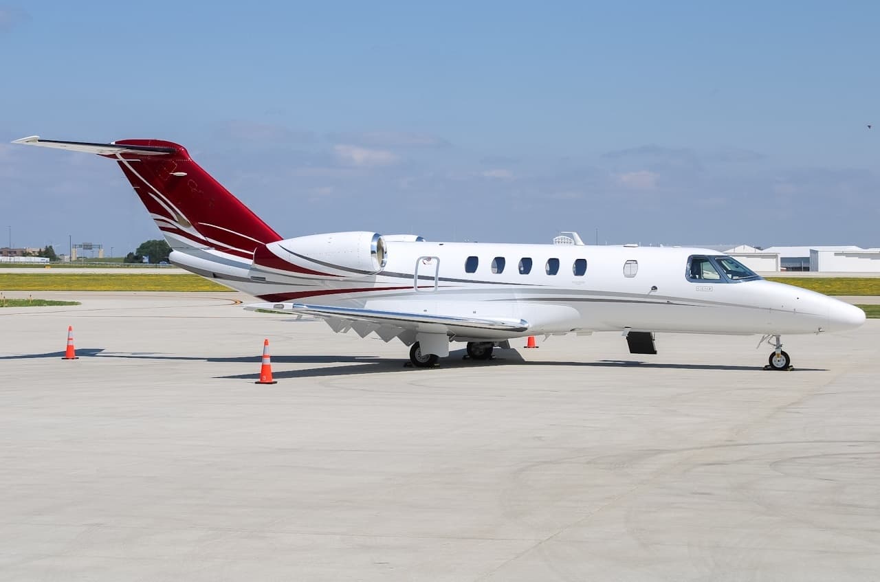 Tue, Nov 3TodayMilwaukeeKMKE · General Mitchell International AirportNew YorkKTEB · Teterboro AirportCitation CJ49—$13,7503NovMilwaukee → New YorkKMKE → KTEB · TodayCitation CJ4 · 9 seats$13,750
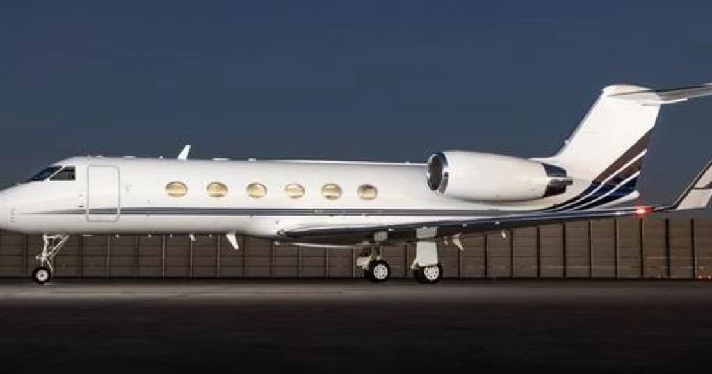 Tue, Nov 3TodayMilwaukeeKMKE · General Mitchell International AirportNew YorkKTEB · Teterboro AirportGulfstream G30014—$21,9453NovMilwaukee → New YorkKMKE → KTEB · TodayGulfstream G300 · 14 seats$21,945
- Tue, Nov 3TodayMilwaukeeKMKE · General Mitchell International AirportTraverse CityKTVC · Cherry Capital AirportCessna Citation CJ48—On request3NovMilwaukee → Traverse CityKMKE → KTVC · TodayCessna Citation CJ4 · 8 seatsOn request
- Wed, Nov 4TomorrowMilwaukeeKMKE · General Mitchell International AirportDuluthKDLH · Duluth International AirportCessna Citation CJ48—On request4NovMilwaukee → DuluthKMKE → KDLH · TomorrowCessna Citation CJ4 · 8 seatsOn request
- Thu, Nov 523:18MilwaukeeKMKE · General Mitchell International AirportTulsaKRVS · Tulsa Riverside AirportBombardier Learjet 607—$20,6805NovMilwaukee → TulsaKMKE → KRVS · 23:18Bombardier Learjet 60 · 7 seats$20,680
- Fri, Nov 6in 3 daysMilwaukeeKMKE · General Mitchell International AirportDullesKIAD · Washington Dulles International AirportBombardier Learjet 60XR7—On request6NovMilwaukee → DullesKMKE → KIAD · in 3 daysBombardier Learjet 60XR · 7 seatsOn request
 Fri, Nov 621:00MilwaukeeKMKE · General Mitchell International AirportDullesKIAD · Washington Dulles International AirportBombardier Learjet 6011h 30m$13,0906NovMilwaukee → DullesKMKE → KIAD · 21:00Bombardier Learjet 60 · 1 seat · 1h 30m$13,090
- Fri, Nov 617:48MilwaukeeKMKE · General Mitchell IntlLongviewKGGG · East Texas RgnlBombardier Learjet 608—$21,7806NovMilwaukee → LongviewKMKE → KGGG · 17:48Bombardier Learjet 60 · 8 seats$21,780
- Fri, Nov 619:30MilwaukeeKMKE · General Mitchell IntlHoustonKDWH · D. Wayne HooksBombardier Learjet 608—$25,5626NovMilwaukee → HoustonKMKE → KDWH · 19:30Bombardier Learjet 60 · 8 seats$25,562
 KMKE · General Mitchell International Airport
* Total price incl. 10% service fee, converted to your selected currency. Price subject to operator confirmation.
Empty legs to KMKE
46 arrivals available
- Tue, Nov 3TodayNorth EleutheraMYEH · North Eleuthera AirportMilwaukeeKMKE · General Mitchell International AirportCitation CJ49—$19,2503NovNorth Eleuthera → MilwaukeeMYEH → KMKE · TodayCitation CJ4 · 9 seats$19,250
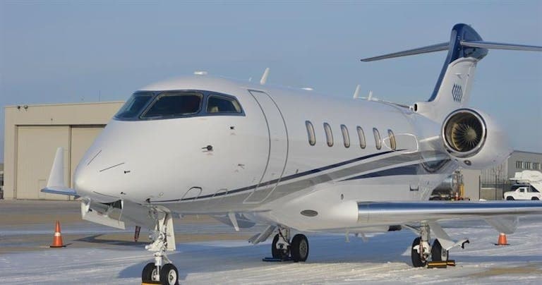 Tue, Nov 3TodayNew YorkKTEB · Teterboro AirportMilwaukeeKMKE · General Mitchell International AirportChallenger 3008—$13,1853NovNew York → MilwaukeeKTEB → KMKE · TodayChallenger 300 · 8 seats$13,185
- Wed, Nov 413:20SedonaKSEZ · Sedona AirportMilwaukeeKMKE · General Mitchell International AirportCessna Citation CJ48—$16,0604NovSedona → MilwaukeeKSEZ → KMKE · 13:20Cessna Citation CJ4 · 8 seats$16,060
- Thu, Nov 5in 2 daysMarco IslandKMKY · Marco Island AirportMilwaukeeKMKE · General Mitchell International AirportCitation CJ49—$19,1185NovMarco Island → MilwaukeeKMKY → KMKE · in 2 daysCitation CJ4 · 9 seats$19,118
- Thu, Nov 5in 2 daysNew OrleansKMSY · Louis Armstrong New Orleans International AirportMilwaukeeKMKE · General Mitchell International AirportCessna Citation CJ48—On request5NovNew Orleans → MilwaukeeKMSY → KMKE · in 2 daysCessna Citation CJ4 · 8 seatsOn request
- Thu, Nov 5in 2 daysMarco IslandKMKY · Marco Island AirportMilwaukeeKMKE · General Mitchell International AirportCitation CJ4 Gen28—€14,2355NovMarco Island → MilwaukeeKMKY → KMKE · in 2 daysCitation CJ4 Gen2 · 8 seats€14,235
- Fri, Nov 6in 3 daysDenverKAPA · Centennial AirportMilwaukeeKMKE · General Mitchell International AirportCitation CJ49—$13,7506NovDenver → MilwaukeeKAPA → KMKE · in 3 daysCitation CJ4 · 9 seats$13,750
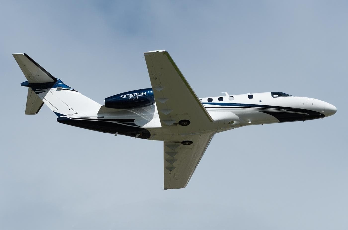 Sun, Nov 8in 5 daysMiamiKOPF · Miami-Opa Locka Executive AirportMilwaukeeKMKE · General Mitchell International AirportCitation CJ49—$19,1188NovMiami → MilwaukeeKOPF → KMKE · in 5 daysCitation CJ4 · 9 seats$19,118
- Sun, Nov 8in 5 daysDaytonKMGY · Dayton Wright Brothers AirportMilwaukeeKMKE · General Mitchell International AirportCessna Citation CJ48—On request8NovDayton → MilwaukeeKMGY → KMKE · in 5 daysCessna Citation CJ4 · 8 seatsOn request
 MYEH · North Eleuthera Airport
* Total price incl. 10% service fee, converted to your selected currency. Price subject to operator confirmation.
Map: Milwaukee Airport
View the location of Milwaukee – MKE/KMKE. Zoom in to explore the area around the airport.
About the airport
General Mitchell International Airport (MKE/KMKE) is the key private jet gateway for Milwaukee. PrivJet gives you instant access to charter flights and empty legs: fast, discreet and globally connected.
KMKE airport FAQ
Are there any restrictions at Milwaukee airport (KMKE) today?
There are currently 30 valid NOTAMs for Milwaukee (KMKE). According to NOTAM, at least one runway or the aerodrome itself is closed. Affected: Runway: closed; Taxiway: closed; Aerodrome: not available; ILS: unserviceable and 2 more. 1 more NOTAM starts in the coming days. For information only, not for flight planning or operational use. Always rely on an official pre-flight briefing. This list may be incomplete or out of date.
What is the weather at Milwaukee airport (KMKE)?
According to the latest weather report for KMKE (METAR, 03 Nov, 15:09 UTC): Good visual conditions (VFR). Wind 13 kt (24 km/h) from south (190°), gusts up to 27 kt, visibility 10 km or more, temperature 20 °C (dew point 16 °C). For information only, not for flight planning. Weather can change quickly; always rely on official reports.
How long are the runways at Milwaukee airport (KMKE)?
Milwaukee (KMKE) has 5 runways: runway 01L/19R with 3,045 m (9,990 ft), asphalt/concrete, runway 07R/25L with 2,530 m (8,300 ft), asphalt/concrete, runway 13/31 with 1,688 m (5,537 ft), asphalt, runway 07L/25R with 1,462 m (4,797 ft), asphalt and runway 01R/19L with 1,275 m (4,182 ft), asphalt. The longest is 3,045 m.
What are the radio frequencies at Milwaukee airport (KMKE)?
Frequencies at KMKE: Tower 119.1 MHz, Ground 121.8 MHz and ATIS 126.4 MHz. For information only. Always rely on the published AIP.
What are the airport codes of General Mitchell International Airport?
The ICAO code is KMKE and the IATA code is MKE. ICAO codes are used by air traffic control and pilots, e.g. in flight plans; IATA codes appear on tickets and baggage tags.
What is the elevation of KMKE airport?
General Mitchell International Airport sits at 723 ft (220 m) above sea level. Local time zone: America/Chicago.
Can I fly to KMKE by private jet?
Whether a private jet can operate into General Mitchell International Airport depends on runway length, opening hours, customs and immigration rules as well as slot and handling availability, among other things. PrivJet checks this with the operating carrier for every request.
Are there empty legs from or to KMKE?
There are currently 48 empty legs departing from and 46 arriving at General Mitchell International Airport. Empty legs are repositioning flights at heavily reduced prices; the list is updated several times a day.