Madison Dane County Regional Truax Field Airport (KMSN / MSN)
Empty legs and charters from Madison
KMSN airport at a glance
- ICAO code
- KMSN
- IATA code
- MSN
- City
- Madison
- Region
- Wisconsin
- Country
- United States
- Elevation
- 887 ft (270 m)
- Time zone
- America/Chicago (UTC-6)
- Coordinates
- 43.1399° N, 89.3375° W
- Empty legs from
- 7
- Empty legs to
- 6
Weather & airport info KMSN
Current weather
Poor visibility, instrument conditions (IFR)observed 03 Nov, 05:53 UTC- Wind
- 14 kt (26 km/h) from south (180°), gusts up to 24 kt
- Visibility
- 10 km or more
- Weather
- Light rain, mist
- Clouds
- overcast at 800 ft
- Temperature
- 17 °C (dew point 16 °C)
- Pressure (QNH)
- 1,011 hPa
Original weather report (METAR)
METAR KMSN 030553Z AUTO 18014G24KT 6SM -RA BR OVC008 17/16 A2985 RMK AO2 SLP107 P0012 60019 T01670156 10167 20144 401670122 58007
Forecast (TAF)
- 03 Nov, 06:00–10:00 UTC13 kt (24 km/h) from south (180°), gusts up to 21 kt · visibility 8 km · Light rain · overcast at 600 ft
- 03 Nov, 10:00–15:00 UTCfrom14 kt (26 km/h) from south (180°), gusts up to 23 kt · visibility 10 km or more · overcast at 600 ft
- 03 Nov, 15:00–20:00 UTCfrom15 kt (28 km/h) from south (180°), gusts up to 25 kt · visibility 10 km or more · Light rain · overcast at 800 ft
- 03 Nov, 20:00–00:00 UTCfrom13 kt (24 km/h) from south (180°), gusts up to 23 kt · visibility 10 km or more · Light rain · overcast at 1,200 ft
- 04 Nov, 00:00–06:00 UTCfrom12 kt (22 km/h) from south (170°), gusts up to 20 kt · visibility 10 km or more · Light rain · overcast at 900 ft
Original forecast (TAF)
TAF KMSN 030540Z 0306/0406 18013G21KT 5SM -RA OVC006 FM031000 18014G23KT P6SM OVC006 FM031500 18015G25KT 6SM -RA OVC008 FM032000 18013G23KT 6SM -RA OVC012 FM040000 17012G20KT 6SM -RA OVC009
Airport
- Elevation
- 887 ft (270 m)
- Sunrise / Sunset
- 06:34 / 16:47 local time
Runways
| Runway | Length | Surface | Lighted |
|---|---|---|---|
| 18/36 | 2,745 m (9,006 ft) | concrete | yes |
| 03/21 | 2,195 m (7,200 ft) | concrete | yes |
| 14/32 | 1,782 m (5,846 ft) | concrete | yes |
Radio frequencies
- Approach: 120.1
- ATIS: 124.65
- Clearance: 121.62
- CTAF: 119.3
- Ground: 121.9
- Tower: 119.3
- UNICOM: 122.95
For information only, not for flight planning. Weather can change quickly; always rely on official reports. Sources: aviationweather.gov (NOAA), OurAirports.
Airport map KMSN
Full screen →Runways white, taxiways yellow with designators, closed taxiways and runways per NOTAM in red.
Official charts (FAA)
Cycle 2611, valid until 0901Z 11/26/26
Airport diagram (FAA)
Airport diagram (1)
Instrument approaches (16)
Minimums (2)
Hot spots (1)
LAHSO (1)
For information only, not for navigation. Always use current official charts and NOTAMs.
Current NOTAMs for KMSN(16)
NOTAMs (Notices to Air Missions) announce short-term changes at an airport: closed runways or taxiways, unserviceable approach aids, obstacles, airspace restrictions.
- Out of serviceTaxiway10/130· until 30 Nov, 23:59 UTC
The taxiway direction sign light for taxiway B5 on taxiway B at Dane County Regional/Truax Field airport is out of service.
Show original text
TWY B TWY DIRECTION SIGN FOR TWY B5 LGT U/S
- Out of serviceObstacle lights: unserviceableA3452/26· until 17 Jan, 23:59 UTC
The lighting of a tower obstacle 4.6 nautical miles south of the airport is out of service. Its top is 1141 feet above sea level, 221 feet above ground.
Show original text
TOWER LGT (ASR 1047790) 430358.00N0891826.20W (4.6NM S MSN) 1141FT (221FT AGL) U/S
A3452/26 NOTAMN
Q) KZAU/QOLAS/IV/M/E/000/999/4303N08918W001
A) KMSN
B) 2610201406
C) 2701172359
E) TOWER LGT (ASR 1047790) 430358.00N0891826.20W (4.6NM S MSN) 1141FT (221FT AGL) U/S
- Out of serviceILS: unserviceableA3400/26· until 18 Nov, 20:00 UTC
The instrument landing system (ILS) for runway 21 is out of service. The ILS guides aircraft to the runway in poor visibility.
Show original text
NAV ILS RWY 21 U/S
A3400/26 NOTAMN
Q) KZAU/QICAS////000/999/4308N08920W005
A) KMSN
B) 2610131058
C) 2611182000
E) NAV ILS RWY 21 U/S
- NoticeRunwayA3542/26· until 04 Nov, 05:04 UTC
Runway 21 surface condition 5/5/5 100 percent wet observed at 3 Nov 05:04 UTC.
Show original text
RWY 21 FICON 5/5/5 100 PCT WET OBS AT 2611030504.
A3542/26 NOTAMN
Q) KZAU/QMRXX////000/999/4308N08920W005
A) KMSN
B) 2611030504
C) 2611040504
E) RWY 21 FICON 5/5/5 100 PCT WET OBS AT 2611030504.
- NoticeRunwayA3543/26· until 04 Nov, 05:04 UTC
Runway 14 surface condition 5/5/5 100 percent wet observed at 3 Nov 05:04 UTC.
Show original text
RWY 14 FICON 5/5/5 100 PCT WET OBS AT 2611030504.
A3543/26 NOTAMN
Q) KZAU/QMRXX////000/999/4308N08920W005
A) KMSN
B) 2611030504
C) 2611040504
E) RWY 14 FICON 5/5/5 100 PCT WET OBS AT 2611030504.
- NoticeRunwayA3541/26· until 04 Nov, 05:03 UTC
Runway 18 surface condition 5/5/5 100 percent wet observed at 3 Nov 05:03 UTC.
Show original text
RWY 18 FICON 5/5/5 100 PCT WET OBS AT 2611030503.
A3541/26 NOTAMN
Q) KZAU/QMRXX////000/999/4308N08920W005
A) KMSN
B) 2611030503
C) 2611040503
E) RWY 18 FICON 5/5/5 100 PCT WET OBS AT 2611030503.
- NoticeApron10/131· until 30 Nov, 23:59 UTC
The surface markings on the east ramp apron between taxiway H and taxiway J have been removed.
Show original text
APRON EAST RAMP BTN TWY H AND TWY J SFC MARKINGS REMOVED
- NoticeILS10/108· until 18 Dec, 20:00 UTC
The Instrument Landing System (ILS) for runway 21 is not monitored. The ILS guides aircraft to the runway in poor visibility.
Show original text
MSN NAV ILS RWY 21 NOT MNT
A3486/26 NOTAMN
Q) KZAU/QICXX////000/999/4308N08920W005
A) KMSN
B) 2610261159
C) 2612182000
E) MSN NAV ILS RWY 21 NOT MNT
8 more NOTAMs
- NoticeILSA3486/26· until 18 Dec, 20:00 UTC
The Instrument Landing System (ILS) for runway 21 is not monitored. The ILS guides aircraft to the runway in poor visibility.
Show original text
MSN NAV ILS RWY 21 NOT MNT
A3486/26 NOTAMN Q) KZAU/QICXX////000/999/4308N08920W005 A) KMSN B) 2610261159 C) 2612182000 E) MSN NAV ILS RWY 21 NOT MNT
- NoticeInstrument approach procedure1983/26· until 23 Oct, 18:50 UTC (estimated)
Instrument approach procedure U.S. DOD DANE COUNTY RGNL/TRUAX FLD, MADISON, within. HI - TACAN runway 18, amendment 1B... S-18 category C/D/E minimum descent altitude 1400/HAT 536. 23 Oct 18:50 UTC -2810231850EST
Show original text
IAP U.S. DOD DANE COUNTY RGNL/TRUAX FLD, MADISON, WI. HI - TACAN RWY 18, AMDT 1B... S-18 CAT C/D/E MDA 1400/HAT 536. 2610231850-2810231850EST
Q) KZAU/QPIXX/I/NBO/A/000/999/4308N08920W005
A) KMSN
B) 2610231850
C) 2706041849EST
E) MSN DANE COUNTY RGNL/TRUAX FLD, MADISON, WI.
HI - TACAN RWY 18, AMDT 1B...
S-18 CAT C/D/E MDA 1400/HAT 536.
- NoticeInstrument approach procedure: changedA3481/26· until 23 Oct, 18:50 UTC
The instrument approach procedures for runway 18, amendment 1B, have a minimum descent altitude of 1400 feet and a height above touchdown of 536 feet for categories C/D/E.
Show original text
IAP U.S. DOD DANE COUNTY RGNL/TRUAX FLD, MADISON, WI. HI - TACAN RWY 18, AMDT 1B... S-18 CAT C/D/E MDA 1400/HAT 536.
A3481/26 NOTAMN
Q) KZAU/QPICH/I/NBO/A/000/999/4308N08920W005
A) KMSN
B) 2610231850
C) 2810231850
E) IAP U.S. DOD DANE COUNTY RGNL/TRUAX FLD, MADISON, WI. HI - TACAN RWY 18, AMDT 1B... S-18 CAT C/D/E MDA 1400/HAT 536.
- NoticeApron10/062· until 30 Nov, 23:00 UTC
The boundary markings on the southeast side of the east ramp, a non-movement area on the apron, are not marked.
Show original text
APRON EAST RAMP NONMOVEMENT AREA BDRY MARKINGS SE SIDE NOT MARKED
- NoticeTaxiway10/061· until 30 Nov, 23:00 UTC
The surface markings for taxiway E between the East Ramp and runway 14/32, and for taxiway H between the East Ramp and the approach end of runway 32, are not standard.
Show original text
TWY E BTN EAST RAMP AND RWY 14/32, TWY H BTN EAST RAMP AND APCH END RWY 32 SFC MARKINGS NOT STD
- NoticeInstrument approach procedure8370/26· until 05 Oct, 09:01 UTC (estimated)
For the Instrument Approach Procedure (IAP) RNAV (GPS) Runway 3 at Dane County Regional/Truax Field, Madison, WI, a note has been added to the profile view stating that the Visual Glide Slope Indicator (VGSI) and the RNAV glideslope are not coincident (VGSI angle 3.00/Threshold Crossing Height 49).
Show original text
IAP DANE COUNTY RGNL/TRUAX FLD, MADISON, WI. RNAV (GPS) RWY 3, ORIG-E... ADD PROFILE VIEW NOTE: VGSI AND RNAV GLIDEPATH NOT COINCIDENT (VGSI ANGLE 3.00/TCH 49). 2610081339-2810050901EST
Q) KZAU/QPIXX/I/NBO/A/000/999/4308N08920W005
A) KMSN
B) 2610081338
C) 2705201336EST
E) MSN DANE COUNTY RGNL/TRUAX FLD, MADISON, WI.
RNAV (GPS) RWY 3, ORIG-E...
ADD PROFILE VIEW NOTE: VGSI AND RNAV GLIDEPATH NOT COINCIDENT (VGSI ANGLE 3.00/TCH 49).
- NoticeInstrument approach procedure: changedA3369/26· until 05 Oct, 09:01 UTC
For the Instrument Approach Procedure (IAP) RNAV (GPS) Runway 3 at Dane County Regional/Truax Field, Madison, WI, a note has been added to the profile view stating that the Visual Glide Slope Indicator (VGSI) and the RNAV glideslope are not coincident (VGSI angle 3.00/Threshold Crossing Height 49).
Show original text
IAP DANE COUNTY RGNL/TRUAX FLD, MADISON, WI. RNAV (GPS) RWY 3, ORIG-E... ADD PROFILE VIEW NOTE: VGSI AND RNAV GLIDEPATH NOT COINCIDENT (VGSI ANGLE 3.00/TCH 49).
A3369/26 NOTAMN
Q) KZAU/QPICH/I/NBO/A/000/999/4308N08920W005
A) KMSN
B) 2610081339
C) 2810050901
E) IAP DANE COUNTY RGNL/TRUAX FLD, MADISON, WI. RNAV (GPS) RWY 3, ORIG-E... ADD PROFILE VIEW NOTE: VGSI AND RNAV GLIDEPATH NOT COINCIDENT (VGSI ANGLE 3.00/TCH 49).
- NoticeAerodrome: military operations onlyM0037/26· until 12 Nov, 21:00 UTC
The use of HI-TACAN to all runways for F-35 aircraft is prohibited due to significant course deviation. TACAN is a navigation system for military aircraft.
Show original text
AERODROME HI-TACAN TO ALL RUNWAYS FOR F-35 ACFT PROHIBITED DUE TO SIGNIFICANT COURSE DEVIATION
M0037/26 NOTAMN Q) ZAU/QFAAM/IV/NBO/A/000/999/4308N08920W005 A) KMSN B) 2609281853 C) 2611122100 E) AERODROME HI-TACAN TO ALL RUNWAYS FOR F-35 ACFT PROHIBITED DUE TO SIGNIFICANT COURSE DEVIATION
For information only, not for flight planning or operational use. Always rely on an official pre-flight briefing. This list may be incomplete or out of date. Explanations and expanded abbreviations are generated automatically. The original text is authoritative. Source: FAA NOTAM Management Service (SWIM).
Private jet traffic in Dane County Regional Truax Field (last 30 days)
- Arrivals
- 547
- Departures
- 450
- Different jets
- 355
Most frequent origins: Austin Straubel International Airport (17), Nashville International Airport (13), Teterboro Airport (12), General Mitchell International Airport (12), Chicago Executive Airport (9).
Most frequent destinations: Austin Straubel International Airport (14), Waukesha County Airport (12), Chicago Executive Airport (9), Teterboro Airport (9), La Crosse Municipal Airport (8).
Most common aircraft types: Embraer Phenom 300 (94), Cessna Citation CJ3 (68), Cessna Citation CJ2 (68), Pilatus PC-12 (65), Cessna Citation Latitude (63).
Sunday is the busiest day.
Our own analysis of public ADS-B signals from business jets. Not every flight is received, and jets with a removal request are excluded.
Charter operators based here
Operators with a base at this airport.
- Wisconsin AviationTurboprop, Light jet, Piston aircraft
Empty legs from KMSN
7 departures available
 Tue, Nov 3TodayMadisonKMSN · Dane County Regional Truax FieldFort MyersKFMY · Page FieldPhenom 1005—$8,4153NovMadison → Fort MyersKMSN → KFMY · TodayPhenom 100 · 5 seats$8,415
- Wed, Nov 4TomorrowMadisonKMSN · Dane County Regional Truax FieldFort MyersKFMY · Page FieldEmbraer Phenom 1004—$11,2204NovMadison → Fort MyersKMSN → KFMY · TomorrowEmbraer Phenom 100 · 4 seats$11,220
- Wed, Nov 1115:00MadisonKMSN · Dane County Regional Truax FieldBuena VistaKAEJ · Central Colorado Regional AirportBombardier Learjet 458—$11,55011NovMadison → Buena VistaKMSN → KAEJ · 15:00Bombardier Learjet 45 · 8 seats$11,550
 Wed, Nov 1115:00MadisonKMSN · Dane County Regional Truax FieldBuena VistaKAEJ · Central Colorado Regional AirportBombardier Learjet 45XR12h 12mOn request11NovMadison → Buena VistaKMSN → KAEJ · 15:00Bombardier Learjet 45XR · 1 seat · 2h 12mOn request
 Sat, Nov 2817:26MadisonKMSN · Dane County Regional Truax FieldTeterboroKTEB · Teterboro AirportGulfstream G45011h 30mOn request28NovMadison → TeterboroKMSN → KTEB · 17:26Gulfstream G450 · 1 seat · 1h 30mOn request
 Sun, Nov 29in 26 daysMadisonKMSN · Dane County Regional Truax FieldTeterboroKTEB · Teterboro AirportGulfStream G45013—On request29NovMadison → TeterboroKMSN → KTEB · in 26 daysGulfStream G450 · 13 seatsOn request
 Mon, Nov 3012:26MadisonKMSN · Dane County Regional Truax FieldTeterboroKTEB · Teterboro AirportGulfstream G45016—$18,51330NovMadison → TeterboroKMSN → KTEB · 12:26Gulfstream G450 · 16 seats$18,513
 KMSN · Dane County Regional Truax Field
* Total price incl. 10% service fee, converted to your selected currency. Price subject to operator confirmation.
Empty legs to KMSN
6 arrivals available
 Tue, Nov 17in 14 daysChicagoKDPA · Dupage AirportMadisonKMSN · Dane County Regional Truax FieldHawker 800XP9—On request17NovChicago → MadisonKDPA → KMSN · in 14 daysHawker 800XP · 9 seatsOn request
- Wed, Nov 18in 15 daysPontiacKPTK · Oakland County IntlMadisonKMSN · Dane County Rgnl-Truax FieldChallenger 604—1h 10mOn request18NovPontiac → MadisonKPTK → KMSN · in 15 daysChallenger 604 · 1h 10mOn request
- Wed, Nov 1804:51PontiacKPTK · Oakland County International AirportMadisonKMSN · Dane County Regional Truax FieldBombardier Challenger 60410—$13,64018NovPontiac → MadisonKPTK → KMSN · 04:51Bombardier Challenger 604 · 10 seats$13,640
- Wed, Nov 25in 22 daysBedfordKBED · Laurence G Hanscom FieldMadisonKMSN · Dane County Regional Truax FieldDassault Falcon 900B142h 36m$25,30025NovBedford → MadisonKBED → KMSN · in 22 daysDassault Falcon 900B · 14 seats · 2h 36m$25,300
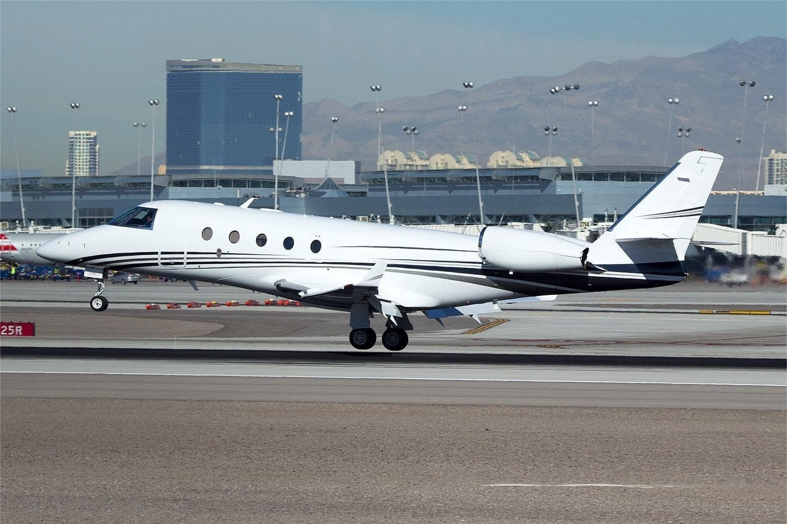 Thu, Nov 26in 23 daysBedfordKBED · Laurence G Hanscom FieldMadisonKMSN · Dane County Regional Truax FieldFalcon 900B14—$30,32526NovBedford → MadisonKBED → KMSN · in 23 daysFalcon 900B · 14 seats$30,325
- Sun, Dec 27in 54 daysToledoKTOL · Toledo Express AirportMadisonKMSN · Dane County Regional Truax FieldCessna Citation X——On request27DecToledo → MadisonKTOL → KMSN · in 54 daysCessna Citation XOn request
* Total price incl. 10% service fee, converted to your selected currency. Price subject to operator confirmation.
Map: Madison Airport
View the location of Madison – MSN/KMSN. Zoom in to explore the area around the airport.
About the airport
Dane County Regional Truax Field (MSN/KMSN) is the key private jet gateway for Madison. PrivJet gives you instant access to charter flights and empty legs: fast, discreet and globally connected.
KMSN airport FAQ
Are there any restrictions at Madison airport (KMSN) today?
There are currently 16 valid NOTAMs for Madison (KMSN). Affected: Taxiway: out of service; Obstacle lights: unserviceable; ILS: unserviceable. For information only, not for flight planning or operational use. Always rely on an official pre-flight briefing. This list may be incomplete or out of date.
What is the weather at Madison airport (KMSN)?
According to the latest weather report for KMSN (METAR, 03 Nov, 05:53 UTC): Poor visibility, instrument conditions (IFR). Wind 14 kt (26 km/h) from south (180°), gusts up to 24 kt, visibility 10 km or more, temperature 17 °C (dew point 16 °C). Light rain, mist. For information only, not for flight planning. Weather can change quickly; always rely on official reports.
How long are the runways at Madison airport (KMSN)?
Madison (KMSN) has 3 runways: runway 18/36 with 2,745 m (9,006 ft), concrete, runway 03/21 with 2,195 m (7,200 ft), concrete and runway 14/32 with 1,782 m (5,846 ft), concrete. The longest is 2,745 m.
What are the radio frequencies at Madison airport (KMSN)?
Frequencies at KMSN: Tower 119.3 MHz, Ground 121.9 MHz and ATIS 124.65 MHz. For information only. Always rely on the published AIP.
What are the airport codes of Dane County Regional Truax Field?
The ICAO code is KMSN and the IATA code is MSN. ICAO codes are used by air traffic control and pilots, e.g. in flight plans; IATA codes appear on tickets and baggage tags.
What is the elevation of KMSN airport?
Dane County Regional Truax Field sits at 887 ft (270 m) above sea level. Local time zone: America/Chicago.
Can I fly to KMSN by private jet?
Whether a private jet can operate into Dane County Regional Truax Field depends on runway length, opening hours, customs and immigration rules as well as slot and handling availability, among other things. PrivJet checks this with the operating carrier for every request.
Are there empty legs from or to KMSN?
There are currently 7 empty legs departing from and 6 arriving at Dane County Regional Truax Field. Empty legs are repositioning flights at heavily reduced prices; the list is updated several times a day.