Metropolitan Oakland Airport (KOAK / OAK)
Empty legs and charters from Oakland
KOAK airport at a glance
- ICAO code
- KOAK
- IATA code
- OAK
- City
- Oakland
- Region
- California
- Country
- United States
- Elevation
- 9 ft (3 m)
- Time zone
- America/Los Angeles (UTC-8)
- Coordinates
- 37.7213° N, 122.2210° W
- Empty legs from
- 100
- Empty legs to
- 100
Private jet terminal & FBOs at Metropolitan Oakland
- Signature Aviation OAK8433 Earhart Road, Oakland, CA 94621
- KaiserAir Oakland8735 Earhart Road, Gate N, Oakland, CA 94621
Weather & airport info KOAK
Current weather
Good visual conditions (VFR)observed 03 Nov, 01:53 UTC- Wind
- 4 kt (7 km/h) from north (360°)
- Visibility
- 10 km or more
- Clouds
- broken clouds at 25,000 ft
- Temperature
- 15 °C (dew point 11 °C)
- Pressure (QNH)
- 1,020 hPa
Original weather report (METAR)
METAR KOAK 030153Z 36004KT 10SM BKN250 15/11 A3012 RMK AO2 SLP200 T01500111
Forecast (TAF)
- 03 Nov, 00:00–06:00 UTC5 kt (9 km/h) from west-southwest (250°) · visibility 10 km or more · broken clouds at 20,000 ft
- 03 Nov, 06:00–15:00 UTCfrom7 kt (13 km/h) from south (180°) · visibility 10 km or more · broken clouds at 10,000 ft
- 03 Nov, 15:00–18:00 UTCfrom9 kt (17 km/h) from south-southeast (150°) · visibility 10 km or more · Showers in the vicinity · overcast at 5,000 ft
- 03 Nov, 18:00–20:00 UTCfrom12 kt (22 km/h) from south-southeast (150°) · visibility 10 km or more · Light rain · broken clouds at 2,500 ft, overcast at 5,000 ft
- 03 Nov, 20:00–03:00 UTCfrom7 kt (13 km/h) from south (190°) · visibility 10 km or more · Light rain showers · few clouds at 2,000 ft, broken clouds at 3,000 ft
Original forecast (TAF)
TAF KOAK 022336Z 0300/0406 25005KT P6SM BKN200 FM030600 18007KT P6SM BKN100 FM031500 15009KT P6SM VCSH OVC050 FM031800 15012KT 6SM -RA BKN025 OVC050 FM032000 19007KT P6SM -SHRA FEW020 BKN030 FM040300 VRB03KT P6SM -SHRA FEW020 BKN030
Airport
- Elevation
- 9 ft (3 m)
- Sunrise / Sunset
- 06:36 / 17:08 local time
Runways
| Runway | Length | Surface | Lighted |
|---|---|---|---|
| 12/30 | 3,206 m (10,520 ft) | asphalt | yes |
| 10R/28L | 1,894 m (6,213 ft) | asphalt | yes |
| 10L/28R | 1,663 m (5,457 ft) | asphalt | yes |
| 15/33 | 1,029 m (3,376 ft) | asphalt | yes |
Radio frequencies
- Approach: 31.76
- Approach: 125.35
- ATIS: 133.775
- Clearance: 121.1
- Ground: 121.75
- Tower: 118.3
- UNICOM: 122.95
For information only, not for flight planning. Weather can change quickly; always rely on official reports. Sources: aviationweather.gov (NOAA), OurAirports.
Airport map KOAK
Full screen →Runways white, taxiways yellow with designators, closed taxiways and runways per NOTAM in red.
Official charts (FAA)
Cycle 2611, valid until 0901Z 11/26/26
Airport diagram (FAA)
Airport diagram (1)
Instrument approaches (17)
- ILS OR LOC RWY 12
- ILS OR LOC RWY 28R
- ILS OR LOC RWY 30
- ILS RWY 12 (SA CAT I)
- ILS RWY 30 (SA CAT I)
- ILS RWY 30 (CAT II - III)
- RNAV (RNP) Z RWY 12
- RNAV (RNP) Z RWY 28L
- RNAV (RNP) Z RWY 28R
- RNAV (RNP) Z RWY 30
- RNAV (GPS) RWY 10L
- RNAV (GPS) RWY 10R
- RNAV (GPS) Y RWY 12
- RNAV (GPS) Y RWY 28L
- RNAV (GPS) Y RWY 28R
- RNAV (GPS) Y RWY 30
- VOR RWY 10R
Departure procedures (18)
Hot spots (1)
For information only, not for navigation. Always use current official charts and NOTAMs.
Current NOTAMs for KOAK(38)
NOTAMs (Notices to Air Missions) announce short-term changes at an airport: closed runways or taxiways, unserviceable approach aids, obstacles, airspace restrictions.
- ClosedRunway: closedA2550/26· from 05 Nov, 16:30 UTC · until 06 Nov, 22:30 UTC
Runway 10L/28R is closed.
Show original text
RWY 10L/28R CLSD
A2550/26 NOTAMN
Q) KZOA/QMRLC////000/999/3743N12213W005
A) KOAK
B) 2611051630
C) 2611062230
D) DLY 1630-2230
E) RWY 10L/28R CLSD
Hours: DLY 1630-2230
- ClosedRunway: closedA2547/26· from 03 Nov, 16:30 UTC · until 04 Nov, 22:30 UTC
Runway 10R/28L is closed.
Show original text
RWY 10R/28L CLSD
A2547/26 NOTAMN
Q) KZOA/QMRLC////000/999/3743N12213W005
A) KOAK
B) 2611031630
C) 2611042230
E) RWY 10R/28L CLSD
- ClosedTaxiway: closedA2551/26· from 05 Nov, 16:30 UTC · until 06 Nov, 22:30 UTC
Taxiways E, C1, H, and G are closed.
Show original text
TWY E, C1, H, G CLSD
A2551/26 NOTAMN
Q) KZOA/QMXLC////000/999/3743N12213W005
A) KOAK
B) 2611051630
C) 2611062230
D) DLY 1630-2230
E) TWY E, C1, H, G CLSD
Hours: DLY 1630-2230
- ClosedApron: closedA2552/26· from 04 Nov, 16:30 UTC · until 04 Nov, 22:30 UTC
Apron taxiway S between UPS spot F and Gate 1 ramp is closed. Aircraft cannot use this section of the taxiway.
Show original text
APRON TXL S BTN UPS SPOT F AND GATE 1 RAMP CLSD
A2552/26 NOTAMN
Q) KZOA/QMNLC////000/999/3743N12213W005
A) KOAK
B) 2611041630
C) 2611042230
E) APRON TXL S BTN UPS SPOT F AND GATE 1 RAMP CLSD
- Out of serviceILS glide path: unserviceableA2559/26· from 03 Nov, 17:00 UTC · until 03 Nov, 23:00 UTC
The instrument landing system (ILS) for runway 30, specifically the glide path (GP), is out of service. The ILS guides aircraft to the runway in poor visibility.
Show original text
OAK NAV ILS RWY 30 GP U/S
A2559/26 NOTAMN
Q) KZOA/QIGAS////000/999/3743N12213W005
A) KOAK
B) 2611031700
C) 2611032300
E) OAK NAV ILS RWY 30 GP U/S
- ClosedOtherA2548/26· from 03 Nov, 16:30 UTC · until 04 Nov, 22:30 UTC
Taxiways G, H, P, and J are closed. Taxiway G is closed between runway 10L/28R and runway 10R/28L. Taxiway H is closed between runway 10L/28R and runway 10R/28L. Taxiway P is closed between runway 10R/28L and runway 10L/28R. Taxiway J is closed between the approach end of runway 10R and runway 10L/28R. Taxiway K is closed between taxiway F and taxiway J.
Show original text
TWY G BTN RWY 10L/28R AND RWY 10R/28L, TWY H BTN RWY 10L/28R AND RWY 10R/28L, TWY P BTN RWY 10R/28L AND RWY 10L/28R, TWY J BTN APCH END RWY 10R AND RWY 10L/28R, TWY K BTN TWY F AND TWY J CLSD
A2548/26 NOTAMN
Q) KZOA/QXXXX////000/999/3743N12213W005
A) KOAK
B) 2611031630
C) 2611042230
D) DLY 1630-2230
E) TWY G BTN RWY 10L/28R AND RWY 10R/28L, TWY H BTN RWY 10L/28R AND RWY 10R/28L, TWY P BTN RWY 10R/28L AND RWY 10L/28R, TWY J BTN APCH END RWY 10R AND RWY 10L/28R, TWY K BTN TWY F AND TWY J CLSD
Hours: DLY 1630-2230
- Out of serviceStandard instrument departure: not available4748/26· from 03 Nov, 16:00 UTC · until 04 Nov, 01:00 UTC (estimated)
The standard departure route (SID) "SILENT FOUR DEPARTURE" at Oakland San Francisco Bay airport is out of service because the SFO VOR navigation beacon is out of service. It can only be used by aircraft equipped with a suitable RNAV system with GPS.
Show original text
SID OAKLAND SAN FRANCISCO BAY, OAKLAND, CA. SILENT FOUR DEPARTURE... DEPARTURE PROCEDURE NA EXCEPT FOR ACFT EQUIPPED WITH SUITABLE RNAV SYSTEM WITH GPS, SFO VOR OUT OF SERVICE. 2611031600-2611040100EST
Q) KZOA/QPDAU/I/NBO/A/000/999/3743N12213W005
A) KOAK
B) 2611022226
C) 2706142226EST
E) OAK OAKLAND SAN FRANCISCO BAY, OAKLAND, CA.
SILENT FOUR DEPARTURE...
DEPARTURE PROCEDURE NA EXCEPT FOR ACFT EQUIPPED WITH SUITABLE RNAV SYSTEM WITH GPS,
SFO VOR U/S.
- Out of serviceInstrument approach procedure: operational4749/26· from 03 Nov, 16:00 UTC · until 04 Nov, 01:00 UTC (estimated)
For the VOR runway 10R instrument approach (IAP), amendment 10A, DME is required unless the aircraft is equipped with a suitable RNAV system with GPS, because the SFO VOR is out of service.
Show original text
IAP OAKLAND SAN FRANCISCO BAY, OAKLAND, CA. VOR RWY 10R, AMDT 10A... DME REQUIRED EXCEPT FOR ACFT EQUIPPED WITH SUITABLE RNAV SYSTEM WITH GPS, SFO VOR OUT OF SERVICE. 2611031600-2611040100EST
Q) KZOA/QPIAO/I/NBO/A/000/999/3743N12213W005
A) KOAK
B) 2611022229
C) 2706142229EST
E) OAK OAKLAND SAN FRANCISCO BAY, OAKLAND, CA.
VOR RWY 10R, AMDT 10A...
DME REQUIRED EXCEPT FOR ACFT EQUIPPED WITH SUITABLE RNAV SYSTEM WITH GPS,
SFO VOR U/S.
30 more NOTAMs
- Out of serviceStandard instrument departure: changed4853/26· from 03 Nov, 16:00 UTC · until 03 Nov, 23:00 UTC
The GAVIOTA TRANSITION of the standard departure route (SID) COAST NINE DEPARTURE at Metro Oakland Intl airport is not available, except for aircraft equipped with a suitable RNAV system with GPS, because the GVO VORTAC is out of service.
Show original text
SID METRO OAKLAND INTL, OAKLAND, CA. COAST NINE DEPARTURE... GAVIOTA TRANSITION NA EXCEPT FOR ACFT EQUIPPED WITH SUITABLE RNAV SYSTEM WITH GPS, GVO VORTAC OUT OF SERVICE. 2611031600-2611032300EST
Q) KZOA/QPDCH/I/NBO/A/000/999/3743N12213W005
A) KOAK
B) 2403271802
C) 2411061802EST
E) OAK METRO OAKLAND INTL, OAKLAND, CA.
COAST NINE DEPARTURE...
GAVIOTA TRANSITION NA EXCEPT FOR ACFT EQUIPPED WITH SUITABLE RNAV SYSTEM WITH GPS,
GVO VORTAC U/S.
- Out of serviceStandard instrument departure: changedA2557/26· from 03 Nov, 16:00 UTC · until 04 Nov, 01:00 UTC
The SFO VOR (VHF omnidirectional radio range) is out of service. The SILENT FOUR standard departure route (SID) is not available, unless the aircraft is equipped with a suitable RNAV system with GPS.
Show original text
SID OAKLAND SAN FRANCISCO BAY, OAKLAND, CA. SILENT FOUR DEPARTURE... DEPARTURE PROCEDURE NA EXCEPT FOR ACFT EQUIPPED WITH SUITABLE RNAV SYSTEM WITH GPS, SFO VOR OUT OF SERVICE.
A2557/26 NOTAMN
Q) KZOA/QPDCH/I/NBO/A/000/999/3743N12213W005
A) KOAK
B) 2611031600
C) 2611040100
E) SID OAKLAND SAN FRANCISCO BAY, OAKLAND, CA. SILENT FOUR DEPARTURE... DEPARTURE PROCEDURE NA EXCEPT FOR ACFT EQUIPPED WITH SUITABLE RNAV SYSTEM WITH GPS, SFO VOR OUT OF SERVICE.
- Out of serviceInstrument approach procedure: changedA2558/26· from 03 Nov, 16:00 UTC · until 04 Nov, 01:00 UTC
For the VOR runway 10R instrument approach (IAP), amendment 10A, a distance measuring equipment (DME) is required, except for aircraft equipped with a suitable RNAV system with GPS, as the SFO VOR is out of service.
Show original text
IAP OAKLAND SAN FRANCISCO BAY, OAKLAND, CA. VOR RWY 10R, AMDT 10A... DME REQUIRED EXCEPT FOR ACFT EQUIPPED WITH SUITABLE RNAV SYSTEM WITH GPS, SFO VOR OUT OF SERVICE.
A2558/26 NOTAMN
Q) KZOA/QPICH/I/NBO/A/000/999/3743N12213W005
A) KOAK
B) 2611031600
C) 2611040100
E) IAP OAKLAND SAN FRANCISCO BAY, OAKLAND, CA. VOR RWY 10R, AMDT 10A... DME REQUIRED EXCEPT FOR ACFT EQUIPPED WITH SUITABLE RNAV SYSTEM WITH GPS, SFO VOR OUT OF SERVICE.
- Out of serviceStandard instrument departure: changedA2560/26· from 03 Nov, 16:00 UTC · until 03 Nov, 23:00 UTC
The Standard Instrument Departure (SID) "COAST NINE DEPARTURE" with the "GAVIOTA TRANSITION" is not available, unless the aircraft is equipped with a suitable RNAV system with GPS, because the GVO VORTAC is out of service.
Show original text
SID METRO OAKLAND INTL, OAKLAND, CA. COAST NINE DEPARTURE... GAVIOTA TRANSITION NA EXCEPT FOR ACFT EQUIPPED WITH SUITABLE RNAV SYSTEM WITH GPS, GVO VORTAC OUT OF SERVICE.
A2560/26 NOTAMN
Q) KZOA/QPDCH/I/NBO/A/000/999/3743N12213W005
A) KOAK
B) 2611031600
C) 2611032300
E) SID METRO OAKLAND INTL, OAKLAND, CA. COAST NINE DEPARTURE... GAVIOTA TRANSITION NA EXCEPT FOR ACFT EQUIPPED WITH SUITABLE RNAV SYSTEM WITH GPS, GVO VORTAC OUT OF SERVICE.
- Out of servicePAPI: unserviceableA2538/26· until 09 Nov, 23:59 UTC
The Precision Approach Path Indicator (PAPI) for runway 28R is out of service. The PAPI helps pilots find the correct glide path to the runway.
Show original text
SVC PCL RWY 28R PAPI U/S
A2538/26 NOTAMN
Q) KZOA/QLPAS////000/999/3743N12213W005
A) KOAK
B) 2610301524
C) 2611092359
E) SVC PCL RWY 28R PAPI U/S
- Out of serviceOther4030/26· until 18 Nov, 23:00 UTC (estimated)
The NUEVO NINE standard departure route is only available for aircraft equipped with a suitable RNAV system with GPS, as the SAU VOR/DME is out of service.
Show original text
SID OAKLAND SAN FRANCISCO BAY, OAKLAND, CA. NUEVO NINE DEPARTURE ... DEPARTURE PROCEDURE NA EXCEPT FOR ACFT EQUIPPED WITH SUITABLE RNAV SYSTEM WITH GPS, SAU VOR/DME OUT OF SERVICE. 2610301301-2611182300EST
Q) KZOA/QXXXX/I/NBO/A/000/999/3743N12213W025
A) KOAK
B) 2610301300
C) 2706111300EST
E) SID OAKLAND SAN FRANCISCO BAY, OAKLAND, CA.
NUEVO NINE DEPARTURE ...
DEPARTURE PROCEDURE NA EXCEPT FOR ACFT EQUIPPED WITH SUITABLE RNAV SYSTEM WITH GPS,
SAU VOR/DME OUT OF SERVICE.
- Out of serviceStandard instrument departure: changedA2536/26· until 18 Nov, 23:00 UTC
The NUEVO NINE standard departure route is only available for aircraft equipped with a suitable RNAV system with GPS, as the SAU VOR/DME is out of service.
Show original text
SID OAKLAND SAN FRANCISCO BAY, OAKLAND, CA. NUEVO NINE DEPARTURE ... DEPARTURE PROCEDURE NA EXCEPT FOR ACFT EQUIPPED WITH SUITABLE RNAV SYSTEM WITH GPS, SAU VOR/DME OUT OF SERVICE.
A2536/26 NOTAMN
Q) KZOA/QPDCH/I/NBO/A/000/999/3743N12213W005
A) KOAK
B) 2610301301
C) 2611182300
E) SID OAKLAND SAN FRANCISCO BAY, OAKLAND, CA. NUEVO NINE DEPARTURE ... DEPARTURE PROCEDURE NA EXCEPT FOR ACFT EQUIPPED WITH SUITABLE RNAV SYSTEM WITH GPS, SAU VOR/DME OUT OF SERVICE.
- Out of serviceInstrument approach procedure3809/26· until 18 Nov, 23:00 UTC
The SAU VOR/DME is out of service, affecting the missed approach procedures for the ILS OR LOC RWY 30, ILS RWY 30 (SA CAT I), and ILS RWY 30 (CAT II-III) instrument approach procedures.
Show original text
IAP OAKLAND SAN FRANCISCO BAY, OAKLAND, CA. ILS OR LOC RWY 30, AMDT 32... ILS RWY 30 (SA CAT I), AMDT 32... ILS RWY 30 (CAT II-III), AMDT 32... MISSED APPROACH: CLIMB TO 4000 THEN RIGHT TURN DIRECT OAK VOR/DME AND HOLD NW, RT, 120.00 INBOUND, SAU VOR/DME OUT OF SERVICE. 2610291855-2611182300EST
Q) KZOA/QPIXX/I/NBO/A/000/999/3743N12213W005
A) KOAK
B) 2512152109
C) 2607272106EST
E) OAK OAKLAND SAN FRANCISCO BAY, OAKLAND, CA.
ILS OR LOC RWY 30, AMDT 32...
ILS RWY 30 (SA CAT I), AMDT 32...
ILS RWY 30 (CAT II-III), AMDT 32...
MISSED APPROACH: CLIMB TO 4000 THEN RIGHT TURN DIRECT OAK VOR/DME AND HOLD NW, RT, 120.00 INBOUND,
SAU VOR/DME U/S.
- Out of serviceOther3828/26· until 18 Nov, 23:00 UTC (estimated)
The NIMITZ SIX DEPARTURE standard departure route for lost communications is only available for aircraft equipped with a suitable RNAV system with GPS, as the SAU VOR/DME is out of service.
Show original text
SID OAKLAND SAN FRANCISCO BAY, OAKLAND, CA. NIMITZ SIX DEPARTURE ... DEPARTURE PROCEDURE LOST COMMUNICATIONS NA EXCEPT FOR ACFT EQUIPPED WITH SUITABLE RNAV SYSTEM WITH GPS, SAU VOR/DME OUT OF SERVICE. 2610291855-2611182300EST
Q) KZOA/QXXXX/I/NBO/A/000/999/3743N12213W025
A) KOAK
B) 2610201404
C) 2610302000EST
E) SID OAKLAND SAN FRANCISCO BAY, OAKLAND, CA.
NIMITZ SIX DEPARTURE ...
DEPARTURE PROCEDURE LOST COMMUNICATIONS NA EXCEPT FOR ACFT EQUIPPED WITH SUITABLE RNAV SYSTEM WITH GPS,
SAU VOR/DME OUT OF SERVICE.
- Out of serviceStandard instrument departure: changedA2528/26· until 18 Nov, 23:00 UTC
The NIMITZ SIX DEPARTURE standard departure route for lost communications is only available for aircraft equipped with a suitable RNAV system with GPS, as the SAU VOR/DME is out of service.
Show original text
SID OAKLAND SAN FRANCISCO BAY, OAKLAND, CA. NIMITZ SIX DEPARTURE ... DEPARTURE PROCEDURE LOST COMMUNICATIONS NA EXCEPT FOR ACFT EQUIPPED WITH SUITABLE RNAV SYSTEM WITH GPS, SAU VOR/DME OUT OF SERVICE.
A2528/26 NOTAMN
Q) KZOA/QPDCH/I/NBO/A/000/999/3743N12213W005
A) KOAK
B) 2610291855
C) 2611182300
E) SID OAKLAND SAN FRANCISCO BAY, OAKLAND, CA. NIMITZ SIX DEPARTURE ... DEPARTURE PROCEDURE LOST COMMUNICATIONS NA EXCEPT FOR ACFT EQUIPPED WITH SUITABLE RNAV SYSTEM WITH GPS, SAU VOR/DME OUT OF SERVICE.
- Out of serviceInstrument approach procedure: changedA2529/26· until 18 Nov, 23:00 UTC
For the missed approach procedure during the ILS or LOC instrument approach to runway 30 at Oakland San Francisco Bay Airport, the SAU VOR/DME is out of service.
Show original text
IAP OAKLAND SAN FRANCISCO BAY, OAKLAND, CA. ILS OR LOC RWY 30, AMDT 32... ILS RWY 30 (SA CAT I), AMDT 32... ILS RWY 30 (CAT II-III), AMDT 32... MISSED APPROACH: CLIMB TO 4000 THEN RIGHT TURN DIRECT OAK VOR/DME AND HOLD NW, RT, 120.00 INBOUND, SAU VOR/DME OUT OF SERVICE.
A2529/26 NOTAMN
Q) KZOA/QPICH/I/NBO/A/000/999/3743N12213W005
A) KOAK
B) 2610291855
C) 2611182300
E) IAP OAKLAND SAN FRANCISCO BAY, OAKLAND, CA. ILS OR LOC RWY 30, AMDT 32... ILS RWY 30 (SA CAT I), AMDT 32... ILS RWY 30 (CAT II-III), AMDT 32... MISSED APPROACH: CLIMB TO 4000 THEN RIGHT TURN DIRECT OAK VOR/DME AND HOLD NW, RT, 120.00 INBOUND, SAU VOR/DME OUT OF SERVICE.
- Out of serviceObstacle10/260· until 22 Jan, 23:59 UTC
The lighting of a tower 10.2 nautical miles west-northwest of the airport is out of service. Its top is 703.7 feet above sea level, 358.3 feet above ground.
Show original text
OBST TOWER LGT (ASR 1023253) 374736.00N1222451.00W (10.2NM WNW OAK) 703.7FT (358.3FT AGL) U/S
- NoticeTaxiway: work in progressA2549/26· from 04 Nov, 16:30 UTC · until 04 Nov, 22:30 UTC
Taxiway B between the approach end of runway 28L and taxiway B1 has adjacent work in progress. Exercise caution in this area.
Show original text
TWY B BTN APCH END RWY 28L AND TWY B1 WIP ADJ
A2549/26 NOTAMN
Q) KZOA/QMXHW////000/999/3743N12213W005
A) KOAK
B) 2611041630
C) 2611042230
E) TWY B BTN APCH END RWY 28L AND TWY B1 WIP ADJ
- NoticeTaxiway: grass cutting in progressA2546/26· from 03 Nov, 16:30 UTC · until 03 Nov, 22:30 UTC
On taxiways F, K, and L, work in progress for grass cutting is taking place adjacent to them.
Show original text
TWY F, K, L WIP GRASS CUTTING ADJ
A2546/26 NOTAMN
Q) KZOA/QMXHG////000/999/3743N12213W005
A) KOAK
B) 2611031630
C) 2611032230
E) TWY F, K, L WIP GRASS CUTTING ADJ
- NoticeAirspace11/007· until 04 Nov, 01:00 UTC
The airspace within a 0.5 nautical mile radius, 3.8 nautical miles north of the airport, is restricted for unmanned aircraft systems (drones) up to 400 feet above ground.
Show original text
AIRSPACE UAS WI AN AREA DEFINED AS 0.5NM RADIUS OF 374658.70N1221214.20W (3.8NM N OAK) SFC-400FT AGL
- Out of serviceILS category III: not availableA2553/26· until 06 Nov, 23:59 UTC
The instrument landing system (ILS) for runway 30, which guides aircraft to the runway in poor visibility, is not available for Category III operations.
Show original text
OAK NAV ILS RWY 30 CAT III NA
A2553/26 NOTAMN
Q) KZOA/QIUAU////000/999/3743N12213W005
A) KOAK
B) 2610302146
C) 2611062359
E) OAK NAV ILS RWY 30 CAT III NA
- NoticeObstacle10/336· until 08 Nov, 01:00 UTC
An obstacle, a rig, is located 0.1 nautical miles north of the approach end of runway 28R. Its top is 45 ft above sea level, 40 ft above ground, and it is flagged.
Show original text
OBST RIG (ASN UNKNOWN) 374335N1221215W (0.1NM N APCH END RWY 28R) 45FT (40FT AGL) FLAGGED FRI SAT MON TUE WED THU 1400-0100
- NoticeOther2292/26· until 29 Oct, 13:32 UTC (estimated)
For the Standard Departure Route (SID) HUSSH THREE DEPARTURE (RNAV) from Oakland San Francisco Bay, Oakland, CA, takeoff minimums for runway 30 are: standard with a minimum climb of 500 FT per nautical mile to 520 FT. All other data remains as published.
Show original text
SID OAKLAND SAN FRANCISCO BAY, OAKLAND, CA. HUSSH THREE DEPARTURE (RNAV) ... TAKEOFF MINIMUMS: RWY 30: STANDARD WITH MINIMUM CLIMB OF 500 FT/NM TO 520. ALL OTHER DATA REMAINS AS PUBLISHED. 2610290500-2810291332EST
Q) KZOA/QXXXX/I/NBO/A/000/999/3743N12213W025
A) KOAK
B) 2609301142
C) 2705121141EST
E) SID OAKLAND SAN FRANCISCO BAY, OAKLAND, CA.
HUSSH THREE DEPARTURE (RNAV) ...
TAKEOFF MINIMUMS: RWY 30: STANDARD WITH MINIMUM CLIMB OF 500 FT/NM TO 520.  ALL OTHER DATA REMAINS AS PUBLISHED.
- NoticeStandard instrument departure: changedA2480/26· until 29 Oct, 13:32 UTC
For the standard departure route (SID) HUSSH THREE DEPARTURE (RNAV) from runway 30, takeoff minimums apply with a minimum climb of 500 feet per nautical mile to 520 feet. All other data remains as published.
Show original text
SID OAKLAND SAN FRANCISCO BAY, OAKLAND, CA. HUSSH THREE DEPARTURE (RNAV) ... TAKEOFF MINIMUMS: RWY 30: STANDARD WITH MINIMUM CLIMB OF 500 FT/NM TO 520. ALL OTHER DATA REMAINS AS PUBLISHED.
A2480/26 NOTAMN
Q) KZOA/QPDCH/I/NBO/A/000/999/3743N12213W005
A) KOAK
B) 2610290500
C) 2810291332
E) SID OAKLAND SAN FRANCISCO BAY, OAKLAND, CA. HUSSH THREE DEPARTURE (RNAV) ... TAKEOFF MINIMUMS: RWY 30: STANDARD WITH MINIMUM CLIMB OF 500 FT/NM TO 520. ALL OTHER DATA REMAINS AS PUBLISHED.
- NoticeInstrument approach procedure2704/26· until 22 Jan, 14:54 UTC (estimated)
For the RNAV (GPS) Y approach to runway 28L, AMDT 5, there is a temporary crane up to 190 feet above mean sea level, starting 1.5 nautical miles southeast of runway 28L. The minimum descent altitude for LNAV (LNAV MDA) is 500 feet above mean sea level and the height above threshold (HAT) is 491 feet for all aircraft categories, unless advised by Air Traffic Control (ATC) that the crane is down.
Show original text
IAP OAKLAND SAN FRANCISCO BAY, OAKLAND, CA. RNAV (GPS) Y RWY 28L, AMDT 5... LNAV MDA 500/HAT 491 ALL CATS, UNLESS ADVISED BY ATC THE CRANE DOWN. TEMPORARY CRANE, UP TO 190 MSL, STARTING AT 1.5NM SE OF RWY 28L (2025-AWP-12780-OE). 2610271455-2701221454EST
Q) KZOA/QPIXX/I/NBO/A/000/999/3743N12213W005
A) KOAK
B) 2610271455
C) 2701221454EST
E) OAK OAKLAND SAN FRANCISCO BAY, OAKLAND, CA.
RNAV (GPS) Y RWY 28L, AMDT 5...
LNAV MDA 500/HAT 491 ALL CATS, UNLESS ADVISED BY ATC THE CRANE DOWN.
TEMPORARY CRANE, UP TO 190 MSL, STARTING AT 1.5NM SE OF RWY 28L (2025-AWP-12780-OE).
- NoticeInstrument approach procedure2705/26· until 22 Jan, 14:55 UTC (estimated)
For the ILS or LOC approach to runway 28R, AMDT 38, there is a temporary crane up to 190 feet above mean sea level, starting 1.5 nautical miles southeast of runway 28L. The minimum descent altitude for LNAV (LNAV MDA) is 500 feet above mean sea level and the height above threshold (HAT) is 493 feet for all aircraft categories, unless advised by Air Traffic Control (ATC) that the crane is down.
Show original text
IAP OAKLAND SAN FRANCISCO BAY, OAKLAND, CA. ILS OR LOC RWY 28R, AMDT 38... SIDESTEP 28L: MDA 500/HAT 491 ALL CATS.LNAV MDA 500/HAT 493 ALL CATS, UNLESS ADVISED BY ATC THE CRANE DOWN. TEMPORARY CRANE, UP TO 190 MSL, STARTING AT 1.5NM SE OF RWY 28L (2025-AWP-12780-OE). 2610271455-2701221455EST
Q) KZOA/QPIXX/I/NBO/A/000/999/3743N12213W005
A) KOAK
B) 2610271455
C) 2701221455EST
E) OAK OAKLAND SAN FRANCISCO BAY, OAKLAND, CA.
ILS OR LOC RWY 28R, AMDT 38...
SIDESTEP 28L: MDA 500/HAT 491 ALL CATS.LNAV MDA 500/HAT 493 ALL CATS, UNLESS ADVISED BY ATC THE CRANE DOWN.
 TEMPORARY CRANE, UP TO 190 MSL, STARTING AT 1.5NM SE OF RWY 28L (2025-AWP-12780-OE).
- NoticeInstrument approach procedure: changedA2486/26· until 22 Jan, 14:54 UTC
For the RNAV (GPS) Y approach to runway 28L, AMDT 5, there is a temporary crane up to 190 feet above mean sea level, starting 1.5 nautical miles southeast of runway 28L. The minimum descent altitude for LNAV (LNAV MDA) is 500 feet above mean sea level and the height above threshold (HAT) is 491 feet for all aircraft categories, unless advised by Air Traffic Control (ATC) that the crane is down.
Show original text
IAP OAKLAND SAN FRANCISCO BAY, OAKLAND, CA. RNAV (GPS) Y RWY 28L, AMDT 5... LNAV MDA 500/HAT 491 ALL CATS, UNLESS ADVISED BY ATC THE CRANE DOWN. TEMPORARY CRANE, UP TO 190 MSL, STARTING AT 1.5NM SE OF RWY 28L (2025-AWP-12780-OE).
A2486/26 NOTAMN
Q) KZOA/QPICH/I/NBO/A/000/999/3743N12213W005
A) KOAK
B) 2610271455
C) 2701221454
E) IAP OAKLAND SAN FRANCISCO BAY, OAKLAND, CA. RNAV (GPS) Y RWY 28L, AMDT 5... LNAV MDA 500/HAT 491 ALL CATS, UNLESS ADVISED BY ATC THE CRANE DOWN. TEMPORARY CRANE, UP TO 190 MSL, STARTING AT 1.5NM SE OF RWY 28L (2025-AWP-12780-OE).
- NoticeInstrument approach procedure: changedA2488/26· until 22 Jan, 14:55 UTC
For the ILS or LOC approach to runway 28R, AMDT 38, there is a temporary crane up to 190 feet above mean sea level, starting 1.5 nautical miles southeast of runway 28L. The minimum descent altitude for LNAV (LNAV MDA) is 500 feet above mean sea level and the height above threshold (HAT) is 493 feet for all aircraft categories, unless advised by Air Traffic Control (ATC) that the crane is down.
Show original text
IAP OAKLAND SAN FRANCISCO BAY, OAKLAND, CA. ILS OR LOC RWY 28R, AMDT 38... SIDESTEP 28L: MDA 500/HAT 491 ALL CATS.LNAV MDA 500/HAT 493 ALL CATS, UNLESS ADVISED BY ATC THE CRANE DOWN. TEMPORARY CRANE, UP TO 190 MSL, STARTING AT 1.5NM SE OF RWY 28L (2025-AWP-12780-OE).
A2488/26 NOTAMN
Q) KZOA/QPICH/I/NBO/A/000/999/3743N12213W005
A) KOAK
B) 2610271455
C) 2701221455
E) IAP OAKLAND SAN FRANCISCO BAY, OAKLAND, CA. ILS OR LOC RWY 28R, AMDT 38... SIDESTEP 28L: MDA 500/HAT 491 ALL CATS.LNAV MDA 500/HAT 493 ALL CATS, UNLESS ADVISED BY ATC THE CRANE DOWN. TEMPORARY CRANE, UP TO 190 MSL, STARTING AT 1.5NM SE OF RWY 28L (2025-AWP-12780-OE).
- NoticeInstrument approach procedure2702/26· until 29 Jan, 14:54 UTC (estimated)
For the RNAV (GPS) Y approach to runway 28R, AMDT 4, there is a temporary crane up to 190 feet above mean sea level, starting 1.7 nautical miles southeast of runway 28R. The minimum descent altitude for LNAV (LNAV MDA) is 500 feet above mean sea level and the height above threshold (HAT) is 493 feet for all aircraft categories, unless advised by Air Traffic Control (ATC) that the crane is down.
Show original text
IAP OAKLAND SAN FRANCISCO BAY, OAKLAND, CA. RNAV (GPS) Y RWY 28R, AMDT 4... LNAV MDA 500/HAT 493 ALL CATS, UNLESS ADVISED BY ATC THE CRANE DOWN. TEMPORARY CRANE, UP TO 190 MSL, STARTING AT 1.7NM SE OF RWY 28R (2025-AWP-12780-OE). 2610271454-2701291454EST
Q) KZOA/QPIXX/I/NBO/A/000/999/3743N12213W005
A) KOAK
B) 2610271454
C) 2701291454EST
E) OAK OAKLAND SAN FRANCISCO BAY, OAKLAND, CA.
RNAV (GPS) Y RWY 28R, AMDT 4...
LNAV MDA 500/HAT 493 ALL CATS, UNLESS ADVISED BY ATC THE CRANE DOWN.
TEMPORARY CRANE, UP TO 190 MSL, STARTING AT 1.7NM SE OF RWY 28R (2025-AWP-12780-OE).
- NoticeInstrument approach procedure: changedA2487/26· until 29 Jan, 14:54 UTC
Instrument approach procedure OAKLAND SAN FRANCISCO BAY, OAKLAND, CA. RNAV (area navigation) (GPS) Y runway 28R, amendment 4... LNAV minimum descent altitude 500/HAT 493 all categories, UNLESS ADVISED by air traffic control the crane DOWN. TEMPORARY crane, UP to 190 MSL, STARTING at 1.7 NM SE of runway 28R (2025-AWP-12780-OE).
Show original text
IAP OAKLAND SAN FRANCISCO BAY, OAKLAND, CA. RNAV (GPS) Y RWY 28R, AMDT 4... LNAV MDA 500/HAT 493 ALL CATS, UNLESS ADVISED BY ATC THE CRANE DOWN. TEMPORARY CRANE, UP TO 190 MSL, STARTING AT 1.7NM SE OF RWY 28R (2025-AWP-12780-OE).
A2487/26 NOTAMN
Q) KZOA/QPICH/I/NBO/A/000/999/3743N12213W005
A) KOAK
B) 2610271454
C) 2701291454
E) IAP OAKLAND SAN FRANCISCO BAY, OAKLAND, CA. RNAV (GPS) Y RWY 28R, AMDT 4... LNAV MDA 500/HAT 493 ALL CATS, UNLESS ADVISED BY ATC THE CRANE DOWN. TEMPORARY CRANE, UP TO 190 MSL, STARTING AT 1.7NM SE OF RWY 28R (2025-AWP-12780-OE).
- Out of serviceAir/ground facility: completely withdrawn10/250· permanent
The remote communication outlet 122.5 has been decommissioned.
Show original text
COM REMOTE COM OUTLET 122.5 DECOMMISSIONED
10/250 NOTAMN
Q) KZOA/QCAAW/IV/B/AE/000/999/3743N12213W025
A) KOAK
B) 2610220027
C) PERM

E) REMOTE COM OUTLET 122.5 DECOMMISSIONED
- NoticeDaylight markings10/089· until 11 Dec, 00:01 UTC
The holding position markings on taxiway B between taxiway A and the approach end of runway 28L are not standard.
Show original text
TWY B HLDG PSN MARKINGS BTN TWY A AND APCH END RWY 28L NOT STD
10/089 NOTAMN
Q) KZOA/QMMXX/V/M/A/000/999/3743N12213W005
A) KOAK
B) 2610081828
C) 2612110001

E) TWY B HLDG PSN MARKINGS BTN TWY A AND APCH END RWY 28L NOT STD
- NoticeDaylight markings10/088· until 10 Dec, 00:01 UTC
The holding position markings on taxiway P at runway 28L are not standard.
Show original text
TWY P HLDG PSN MARKINGS AT RWY 28L NOT STD
10/088 NOTAMR
Q) KZOA/QMMXX/V/M/A/000/999/3743N12213W005
A) KOAK
B) 2610081820
C) 2612100001

E) TWY P HLDG PSN MARKINGS AT RWY 28L NOT STD
- NoticeStandard instrument departure: operational5325/26· until 06 May, 15:21 UTC
PART 1 of 2 ODP OAKLAND SAN FRANCISCO BAY, OAKLAND, CA. TAKEOFF MINIMUMS and (obstacle) DEPARTURE PROCEDURES amendment 7... ADD TAKEOFF obstacle NOTES: runway 15, TEMPORARY crane 4226 ft from DER, 823 ft RIGHT of CENTERLINE, 125 ft above ground / 129 ft MSL (2022-AWP-3447-NRA), TEMPORARY construction EQUIP 1113 ft from DER, 491 ft RIGHT of CENTERLINE, 30 ft above ground / 37 ft MSL (2023-AWP-3806-NRA). runway 28R, construction EQUIP BEGINNING 815 ft from DER, 404 ft RIGHT of CENTERLINE, 35 ft above ground / 37 ft MSL (2022-AWP-4822 through 4825-NRA).runway 30, TEMPORARY cranes STARTING 95 ft from DER, 565 ft LEFT of CENTERLINE, UP to 40 ft above ground / 58 ft MSL (2025-AWP-3315 through 3351-NRA). construction EQUIP BEGINNING 266 ft from DER, 531 ft RIGHT of CENTERLINE, UP to 48 ft above ground / 58 ft MSL (2020-AWP-2531/2532/2533/2534/2535/2536/2539/2540/2541/2542/2543-NR A). construction EQUIP BEGINNING 201 ft from DER, 493 ft LEFT of CENTERLINE, UP to 36 ft above ground / 50 ft MSL (2020-AWP-2466/2467/2468/2469/2470/2473/2474/2476-NRA), construction EQUIP BEGINNING 406 ft from DER, 423 ft RIGHT of CENTERLINE, UP to 36 ft above ground / 48 ft MSL (2020-AWP-2488/2489/2490/2491/2492/2537/2538-NRA). construction EQUIP BEGINNING 458 ft from DER, 457 ft LEFT of CENTERLINE, UP to 36 ft above ground / 48 ft MSL (2020-AWP-2475/2483/2484/2498-NRA). construction EQUIP BEGINNING 498 ft END PART 1 of 2 PART 2 of 2 from DER, LEFT and RIGHT of CENTERLINE, UP to all OTHER DATA REMAINS as PUBLISHED. OAKLAND SAN FRANCISCO BAY, OAKLAND, CA. 36 ft above ground / 48 ft MSL (2020-AWP-2479/2480/2481/2485/2486/2487/2493/2494/2495/2496/2497-NR A). all OTHER DATA REMAINS as PUBLISHED. END PART 2 of 2
Show original text
PART 1 OF 2 ODP OAKLAND SAN FRANCISCO BAY, OAKLAND, CA. TAKEOFF MINIMUMS AND (OBSTACLE) DEPARTURE PROCEDURES AMDT 7... ADD TAKEOFF OBSTACLE NOTES: RWY 15, TEMPORARY CRANE 4226FT FROM DER, 823FT RIGHT OF CENTERLINE, 125FT AGL/129FT MSL (2022-AWP-3447-NRA), TEMPORARY CONST EQUIP 1113FT FROM DER, 491FT RIGHT OF CENTERLINE, 30FT AGL/37FT MSL (2023-AWP-3806-NRA). RWY 28R, CONST EQUIP BEGINNING 815FT FROM DER, 404FT RIGHT OF CENTERLINE, 35FT AGL/37FT MSL (2022-AWP-4822 THRU 4825-NRA).RWY 30, TEMPORARY CRANES STARTING 95FT FROM DER, 565FT LEFT OF CENTERLINE, UP TO 40FT AGL/58 FT MSL (2025-AWP-3315 THRU 3351-NRA). CONST EQUIP BEGINNING 266FT FROM DER, 531FT RIGHT OF CENTERLINE, UP TO 48FT AGL/58FT MSL (2020-AWP-2531/2532/2533/2534/2535/2536/2539/2540/2541/2542/2543-NR A). CONST EQUIP BEGINNING 201FT FROM DER, 493FT LEFT OF CENTERLINE, UP TO 36FT AGL/50FT MSL (2020-AWP-2466/2467/2468/2469/2470/2473/2474/2476-NRA), CONST EQUIP BEGINNING 406FT FROM DER, 423FT RIGHT OF CENTERLINE, UP TO 36FT AGL/48FT MSL (2020-AWP-2488/2489/2490/2491/2492/2537/2538-NRA). CONST EQUIP BEGINNING 458FT FROM DER, 457FT LEFT OF CENTERLINE, UP TO 36FT AGL/48FT MSL (2020-AWP-2475/2483/2484/2498-NRA). CONST EQUIP BEGINNING 498FT END PART 1 OF 2 PART 2 OF 2 FROM DER, LEFT AND RIGHT OF CENTERLINE, UP TO ALL OTHER DATA REMAINS AS PUBLISHED. OAKLAND SAN FRANCISCO BAY, OAKLAND, CA. 36FT AGL/48FT MSL (2020-AWP-2479/2480/2481/2485/2486/2487/2493/2494/2495/2496/2497-NR A). ALL OTHER DATA REMAINS AS PUBLISHED. END PART 2 OF 2
Q) KZOA/QPDAO/I/NBO/A/000/999/3743N12213W005
A) KOAK
B) 2609241521
C) 2705061521EST
E) OAK OAKLAND SAN FRANCISCO BAY, OAKLAND, CA.
TAKEOFF MINIMUMS AND (OBSTACLE) DEPARTURE PROCEDURES AMDT 7...
ADD TAKEOFF OBSTACLE NOTES: RWY 15, TEMPORARY CRANE 4226FT FROM DER, 823FT RIGHT OF CENTERLINE, 125FT AGL/129FT MSL (2022-AWP-3447-NRA), TEMPORARY CONST EQUIP 1113FT FROM DER, 491FT RIGHT OF CENTERLINE, 30FT AGL/37FT MSL (2023-AWP-3806-NRA). RWY 28R, CONST EQUIP BEGINNING 815FT FROM DER, 404FT RIGHT OF CENTERLINE, 35FT AGL/37FT MSL (2022-AWP-4822 THRU 4825-NRA).RWY 30, TEMPORARY CRANES STARTING 95FT FROM DER, 565FT LEFT OF CENTERLINE, UP TO 40FT AGL/58 FT MSL (2025-AWP-3315 THRU 3351-NRA).
CONST EQUIP BEGINNING 266FT FROM DER, 531FT RIGHT OF CENTERLINE, UP TO 48FT AGL/58FT MSL (2020-AWP-2531/2532/2533/2534/2535/2536/2539/2540/2541/2542/2543-NRA). CONST EQUIP BEGINNING 201FT FROM DER, 493FT LEFT OF CENTERLINE, UP TO 36FT AGL/50FT MSL (2020-AWP-2466/2467/2468/2469/2470/2473/2474/2476-NRA), CONST EQUIP BEGINNING 406FT FROM DER, 423FT RIGHT OF CENTERLINE, UP TO 36FT AGL/48FT MSL (2020-AWP-2488/2489/2490/2491/2492/2537/2538-NRA). CONST EQUIP BEGINNING 458FT FROM DER, 457FT LEFT OF CENTERLINE, UP TO 36FT AGL/48FT MSL (2020-AWP-2475/2483/2484/2498-NRA). CONST EQUIP BEGINNING 498FT FROM DER, LEFT AND RIGHT OF CENTERLINE, UP TO 36FT AGL/48FT MSL (2020-AWP-2479/2480/2481/2485/2486/2487/2493/2494/2495/2496/2497-NRA).
ALL OTHER DATA REMAINS AS PUBLISHED.
- NoticeObstacle clearance altitude: changedA2225/26· until 06 May, 15:21 UTC
ODP OAKLAND SAN FRANCISCO BAY, OAKLAND, CA. TAKEOFF MINIMUMS and (obstacle) DEPARTURE PROCEDURES amendment 7... ADD TAKEOFF obstacle NOTES: runway 15, TEMPORARY crane 4226 ft from DER, 823 ft RIGHT of CENTERLINE, 125 ft above ground / 129 ft MSL (2022-AWP-3447-NRA), TEMPORARY construction EQUIP 1113 ft from DER, 491 ft RIGHT of CENTERLINE, 30 ft above ground / 37 ft MSL (2023-AWP-3806-NRA). runway 28R, construction EQUIP BEGINNING 815 ft from DER, 404 ft RIGHT of CENTERLINE, 35 ft above ground / 37 ft MSL (2022-AWP-4822 through 4825-NRA).runway 30, TEMPORARY cranes STARTING 95 ft from DER, 565 ft LEFT of CENTERLINE, UP to 40 ft above ground / 58 ft MSL (2025-AWP-3315 through 3351-NRA). construction EQUIP BEGINNING 266 ft from DER, 531 ft RIGHT of CENTERLINE, UP to 48 ft above ground / 58 ft MSL (2020-AWP-2531/2532/2533/2534/2535/2536/2539/2540/2541/2542/2543-NR A). construction EQUIP BEGINNING 201 ft from DER, 493 ft LEFT of CENTERLINE, UP to 36 ft above ground / 50 ft MSL (2020-AWP-2466/2467/2468/2469/2470/2473/2474/2476-NRA), construction EQUIP BEGINNING 406 ft from DER, 423 ft RIGHT of CENTERLINE, UP to 36 ft above ground / 48 ft MSL (2020-AWP-2488/2489/2490/2491/2492/2537/2538-NRA). construction EQUIP BEGINNING 458 ft from DER, 457 ft LEFT of CENTERLINE, UP to 36 ft above ground / 48 ft MSL (2020-AWP-2475/2483/2484/2498-NRA). construction EQUIP BEGINNING 498 ft from DER, LEFT and RIGHT of CENTERLINE, UP to all OTHER DATA REMAINS as PUBLISHED. OAKLAND SAN FRANCISCO BAY, OAKLAND, CA. 36 ft above ground / 48 ft MSL (2020-AWP-2479/2480/2481/2485/2486/2487/2493/2494/2495/2496/2497-NR A). all OTHER DATA REMAINS as PUBLISHED. ODP OAKLAND SAN FRANCISCO BAY, OAKLAND, CA. TAKEOFF MINIMUMS and (obstacle) DEPARTURE PROCEDURES amendment 7... ADD TAKEOFF obstacle NOTES: runway 15, TEMPORARY crane 4226 ft from DER, 823 ft RIGHT of CENTERLINE, 125 ft above ground / 129 ft MSL (2022-AWP-3447-NRA), TEMPORARY construction EQUIP 1113 ft from DER, 491 ft RIGHT of CENTERLINE, 30 ft above ground / 37 ft MSL (2023-AWP-3806-NRA). runway 28R, construction EQUIP BEGINNING 815 ft from DER, 404 ft RIGHT of CENTERLINE, 35 ft above ground / 37 ft MSL (2022-AWP-4822 through 4825-NRA).runway 30, TEMPORARY cranes STARTING 95 ft from DER, 565 ft LEFT of CENTERLINE, UP to 40 ft above ground / 58 ft MSL (2025-AWP-3315 through 3351-NRA). construction EQUIP BEGINNING 266 ft from DER, 531 ft RIGHT of CENTERLINE, UP to 48 ft above ground / 58 ft MSL (2020-AWP-2531/2532/2533/2534/2535/2536/2539/2540/2541/2542/2543-NR A). construction EQUIP BEGINNING 201 ft from DER, 493 ft LEFT of CENTERLINE, UP to 36 ft above ground / 50 ft MSL (2020-AWP-2466/2467/2468/2469/2470/2473/2474/2476-NRA), construction EQUIP BEGINNING 406 ft from DER, 423 ft RIGHT of CENTERLINE, UP to 36 ft above ground / 48 ft MSL (2020-AWP-2488/2489/2490/2491/2492/2537/2538-NRA). construction EQUIP BEGINNING 458 ft from DER, 457 ft LEFT of CENTERLINE, UP to 36 ft above ground / 48 ft MSL (2020-AWP-2475/2483/2484/2498-NRA). construction EQUIP BEGINNING 498 ft from DER, LEFT and RIGHT of CENTERLINE, UP to all OTHER DATA REMAINS as PUBLISHED. OAKLAND SAN FRANCISCO BAY, OAKLAND, CA. 36 ft above ground / 48 ft MSL (2020-AWP-2479/2480/2481/2485/2486/2487/2493/2494/2495/2496/2497-NR A). all OTHER DATA REMAINS as PUBLISHED.
Show original text
ODP OAKLAND SAN FRANCISCO BAY, OAKLAND, CA. TAKEOFF MINIMUMS AND (OBSTACLE) DEPARTURE PROCEDURES AMDT 7... ADD TAKEOFF OBSTACLE NOTES: RWY 15, TEMPORARY CRANE 4226FT FROM DER, 823FT RIGHT OF CENTERLINE, 125FT AGL/129FT MSL (2022-AWP-3447-NRA), TEMPORARY CONST EQUIP 1113FT FROM DER, 491FT RIGHT OF CENTERLINE, 30FT AGL/37FT MSL (2023-AWP-3806-NRA). RWY 28R, CONST EQUIP BEGINNING 815FT FROM DER, 404FT RIGHT OF CENTERLINE, 35FT AGL/37FT MSL (2022-AWP-4822 THRU 4825-NRA).RWY 30, TEMPORARY CRANES STARTING 95FT FROM DER, 565FT LEFT OF CENTERLINE, UP TO 40FT AGL/58 FT MSL (2025-AWP-3315 THRU 3351-NRA). CONST EQUIP BEGINNING 266FT FROM DER, 531FT RIGHT OF CENTERLINE, UP TO 48FT AGL/58FT MSL (2020-AWP-2531/2532/2533/2534/2535/2536/2539/2540/2541/2542/2543-NR A). CONST EQUIP BEGINNING 201FT FROM DER, 493FT LEFT OF CENTERLINE, UP TO 36FT AGL/50FT MSL (2020-AWP-2466/2467/2468/2469/2470/2473/2474/2476-NRA), CONST EQUIP BEGINNING 406FT FROM DER, 423FT RIGHT OF CENTERLINE, UP TO 36FT AGL/48FT MSL (2020-AWP-2488/2489/2490/2491/2492/2537/2538-NRA). CONST EQUIP BEGINNING 458FT FROM DER, 457FT LEFT OF CENTERLINE, UP TO 36FT AGL/48FT MSL (2020-AWP-2475/2483/2484/2498-NRA). CONST EQUIP BEGINNING 498FT FROM DER, LEFT AND RIGHT OF CENTERLINE, UP TO ALL OTHER DATA REMAINS AS PUBLISHED. OAKLAND SAN FRANCISCO BAY, OAKLAND, CA. 36FT AGL/48FT MSL (2020-AWP-2479/2480/2481/2485/2486/2487/2493/2494/2495/2496/2497-NR A). ALL OTHER DATA REMAINS AS PUBLISHED. ODP OAKLAND SAN FRANCISCO BAY, OAKLAND, CA. TAKEOFF MINIMUMS AND (OBSTACLE) DEPARTURE PROCEDURES AMDT 7... ADD TAKEOFF OBSTACLE NOTES: RWY 15, TEMPORARY CRANE 4226FT FROM DER, 823FT RIGHT OF CENTERLINE, 125FT AGL/129FT MSL (2022-AWP-3447-NRA), TEMPORARY CONST EQUIP 1113FT FROM DER, 491FT RIGHT OF CENTERLINE, 30FT AGL/37FT MSL (2023-AWP-3806-NRA). RWY 28R, CONST EQUIP BEGINNING 815FT FROM DER, 404FT RIGHT OF CENTERLINE, 35FT AGL/37FT MSL (2022-AWP-4822 THRU 4825-NRA).RWY 30, TEMPORARY CRANES STARTING 95FT FROM DER, 565FT LEFT OF CENTERLINE, UP TO 40FT AGL/58 FT MSL (2025-AWP-3315 THRU 3351-NRA). CONST EQUIP BEGINNING 266FT FROM DER, 531FT RIGHT OF CENTERLINE, UP TO 48FT AGL/58FT MSL (2020-AWP-2531/2532/2533/2534/2535/2536/2539/2540/2541/2542/2543-NR A). CONST EQUIP BEGINNING 201FT FROM DER, 493FT LEFT OF CENTERLINE, UP TO 36FT AGL/50FT MSL (2020-AWP-2466/2467/2468/2469/2470/2473/2474/2476-NRA), CONST EQUIP BEGINNING 406FT FROM DER, 423FT RIGHT OF CENTERLINE, UP TO 36FT AGL/48FT MSL (2020-AWP-2488/2489/2490/2491/2492/2537/2538-NRA). CONST EQUIP BEGINNING 458FT FROM DER, 457FT LEFT OF CENTERLINE, UP TO 36FT AGL/48FT MSL (2020-AWP-2475/2483/2484/2498-NRA). CONST EQUIP BEGINNING 498FT FROM DER, LEFT AND RIGHT OF CENTERLINE, UP TO ALL OTHER DATA REMAINS AS PUBLISHED. OAKLAND SAN FRANCISCO BAY, OAKLAND, CA. 36FT AGL/48FT MSL (2020-AWP-2479/2480/2481/2485/2486/2487/2493/2494/2495/2496/2497-NR A). ALL OTHER DATA REMAINS AS PUBLISHED.
A2225/26 NOTAMN Q) KZOA/QPOCH/I/NBO/A/000/999/3743N12213W005 A) KOAK  PART 1 OF 2  B) 2609241521  C) 2705061521  E) ODP OAKLAND SAN FRANCISCO BAY, OAKLAND, CA. TAKEOFF MINIMUMS AND (OBSTACLE) DEPARTURE PROCEDURES AMDT 7... ADD TAKEOFF OBSTACLE NOTES: RWY 15, TEMPORARY CRANE 4226FT FROM DER, 823FT RIGHT OF CENTERLINE, 125FT AGL/129FT MSL (2022-AWP-3447-NRA), TEMPORARY CONST EQUIP 1113FT FROM DER, 491FT RIGHT OF CENTERLINE, 30FT AGL/37FT MSL (2023-AWP-3806-NRA). RWY 28R, CONST EQUIP BEGINNING 815FT FROM DER, 404FT RIGHT OF CENTERLINE, 35FT AGL/37FT MSL (2022-AWP-4822 THRU 4825-NRA).RWY 30, TEMPORARY CRANES STARTING 95FT FROM DER, 565FT LEFT OF CENTERLINE, UP TO 40FT AGL/58 FT MSL (2025-AWP-3315 THRU 3351-NRA). CONST EQUIP BEGINNING 266FT FROM DER, 531FT RIGHT OF CENTERLINE, UP TO 48FT AGL/58FT MSL (2020-AWP-2531/2532/2533/2534/2535/2536/2539/2540/2541/2542/2543-NR A). CONST EQUIP BEGINNING 201FT FROM DER, 493FT LEFT OF CENTERLINE, UP TO 36FT AGL/50FT MSL (2020-AWP-2466/2467/2468/2469/2470/2473/2474/2476-NRA), CONST EQUIP BEGINNING 406FT FROM DER, 423FT RIGHT OF CENTERLINE, UP TO 36FT AGL/48FT MSL (2020-AWP-2488/2489/2490/2491/2492/2537/2538-NRA). CONST EQUIP BEGINNING 458FT FROM DER, 457FT LEFT OF CENTERLINE, UP TO 36FT AGL/48FT MSL (2020-AWP-2475/2483/2484/2498-NRA). CONST EQUIP BEGINNING 498FT END PART 1 OF 2
A2225/26 NOTAMN Q) KZOA/QPOCH/I/NBO/A/000/999/3743N12213W005 A) KOAK  PART 2 OF 2  B) 2609241521  C) 2705061521  E) FROM DER, LEFT AND RIGHT OF CENTERLINE, UP TO ALL OTHER DATA REMAINS AS PUBLISHED. OAKLAND SAN FRANCISCO BAY, OAKLAND, CA. 36FT AGL/48FT MSL (2020-AWP-2479/2480/2481/2485/2486/2487/2493/2494/2495/2496/2497-NR A). ALL OTHER DATA REMAINS AS PUBLISHED. END PART 2 OF 2
For information only, not for flight planning or operational use. Always rely on an official pre-flight briefing. This list may be incomplete or out of date. Explanations and expanded abbreviations are generated automatically. The original text is authoritative. Source: FAA NOTAM Management Service (SWIM).
Private jet traffic in Metropolitan Oakland International Airport (last 30 days)
- Arrivals
- 1,048
- Departures
- 1,000
- Different jets
- 732
Most frequent origins: Van Nuys Airport (74), Teterboro Airport (42), Santa Barbara Municipal Airport (36), Norman Y. Mineta San Jose International Airport (33), John Wayne Airport-Orange County Airport (31).
Most frequent destinations: Van Nuys Airport (66), Harry Reid International Airport (44), Teterboro Airport (43), Santa Barbara Municipal Airport (41), John Wayne Airport-Orange County Airport (29).
Most common aircraft types: Embraer Phenom 300 (138), Bombardier Challenger 350/3500 (137), Gulfstream G450/GIV (120), Gulfstream G550/GV (118), Cessna Citation CJ3 (107).
Sunday is the busiest day.
Our own analysis of public ADS-B signals from business jets. Not every flight is received, and jets with a removal request are excluded.
Charter operators based here
Operators with a base at this airport.
- Solairus AviationVan Nuys (KVNY) · Turboprop, Light jet, Midsize jet
- Executive Jet ManagementWhite Plains (Westchester County) (KHPN) · Light jet, Midsize jet, Super midsize jet
- Mira Vista AviationVan Nuys (KVNY) · Light jet, Heavy jet
- Pacific Coast JetTurboprop, Light jet, Super midsize jet
- Dreamline AviationVan Nuys (KVNY) · Turboprop, Light jet, Midsize jet
- JSXDallas (Love Field) (KDAL) · Turboprop, Super midsize jet
- KaiserAirHeavy jet
- Portland Jets CharterSanta Barbara (KSBA) · Light jet, Heavy jet
- Sky PartnersLivermore (KLVK) · Super midsize jet, Heavy jet
Empty legs from KOAK
100 departures available
 Tue, Nov 3TodaySan FranciscoKOAK · Metropolitan Oakland International AirportSpringfieldKSGF · Springfield Branson National AirportCitation CJ36—On request3NovSan Francisco → SpringfieldKOAK → KSGF · TodayCitation CJ3 · 6 seatsOn request
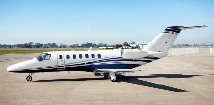 Tue, Nov 3TodaySan FranciscoKOAK · Metropolitan Oakland International AirportSanta AnaKSNA · John Wayne Airport-Orange County AirportCitation CJ36—On request3NovSan Francisco → Santa AnaKOAK → KSNA · TodayCitation CJ3 · 6 seatsOn request
- Tue, Nov 3TodayOaklandKOAK · Oakland IntlWhite PlainsKHPN · Westchester CountyCessna Citation Sovereign9—On request3NovOakland → White PlainsKOAK → KHPN · TodayCessna Citation Sovereign · 9 seatsOn request
 Tue, Nov 3TodayOaklandKOAK · Metropolitan Oakland International AirportWhite PlainsKHPN · Westchester County AirportCitation Sovereign8—On request3NovOakland → White PlainsKOAK → KHPN · TodayCitation Sovereign · 8 seatsOn request
 Tue, Nov 3TodayOaklandKOAK · Metropolitan Oakland International AirportTeterboroKTEB · Teterboro AirportGulfstream G55014—On request3NovOakland → TeterboroKOAK → KTEB · TodayGulfstream G550 · 14 seatsOn request
 Wed, Nov 4TomorrowSan FranciscoKOAK · Metropolitan Oakland International AirportLas VegasKLAS · Harry Reid International AirportCitation X8—$10,5484NovSan Francisco → Las VegasKOAK → KLAS · TomorrowCitation X · 8 seats$10,548
- Wed, Nov 4TomorrowOaklandKOAK · San Francisco Bay Oakland International AirportMissoulaKMSO · Missoula International AirportCessna Citation CJ3+7—$10,0104NovOakland → MissoulaKOAK → KMSO · TomorrowCessna Citation CJ3+ · 7 seats$10,010
- Wed, Nov 408:00OaklandKOAK · San Francisco Bay Oakland International AirportNapaKAPC · Napa County AirportCessna Citation CJ3+7—$3,7404NovOakland → NapaKOAK → KAPC · 08:00Cessna Citation CJ3+ · 7 seats$3,740
 Wed, Nov 420:00OaklandKOAK · Metropolitan Oakland International AirportSpringfieldKSGF · Springfield Branson National AirportCessna Citation CJ314h 12mOn request4NovOakland → SpringfieldKOAK → KSGF · 20:00Cessna Citation CJ3 · 1 seat · 4h 12mOn request
 KOAK · Metropolitan Oakland International Airport
* Total price incl. 10% service fee, converted to your selected currency. Price subject to operator confirmation.
Empty legs to KOAK
100 arrivals available
 Tue, Nov 3TodayLos AngelesKVNY · Van Nuys AirportSan FranciscoKOAK · Metropolitan Oakland International AirportCitation X8—$10,5483NovLos Angeles → San FranciscoKVNY → KOAK · TodayCitation X · 8 seats$10,548
- Tue, Nov 3TodayLong BeachKLGB · Long Beach Airport (Daugherty Field)OaklandKOAK · San Francisco Bay Oakland International AirportCitation X12—$9,4603NovLong Beach → OaklandKLGB → KOAK · TodayCitation X · 12 seats$9,460
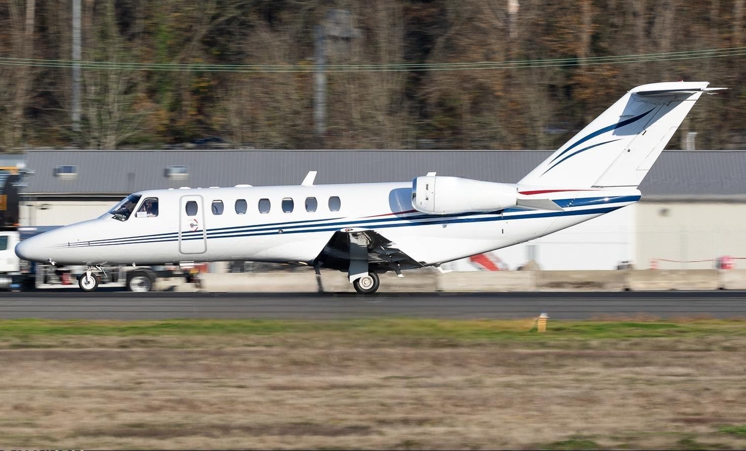 Wed, Nov 4TomorrowGunnisonKGUC · Gunnison Crested Butte Regional AirportSan FranciscoKOAK · Metropolitan Oakland International AirportCitation CJ36—On request4NovGunnison → San FranciscoKGUC → KOAK · TomorrowCitation CJ3 · 6 seatsOn request
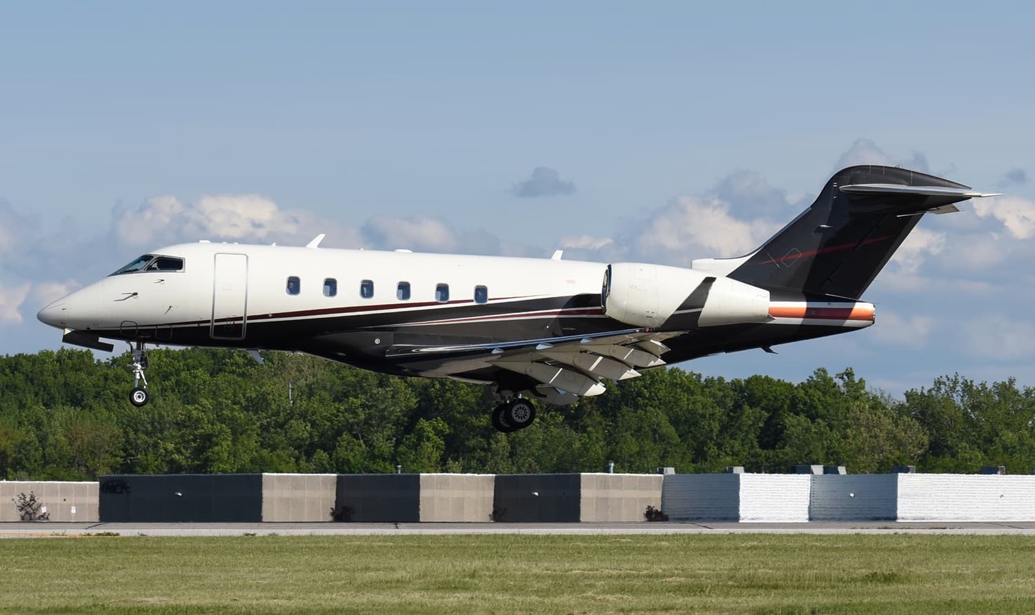 Wed, Nov 4TomorrowLos AngelesKVNY · Van Nuys AirportSan FranciscoKOAK · Metropolitan Oakland International AirportChallenger 3008—$10,5484NovLos Angeles → San FranciscoKVNY → KOAK · TomorrowChallenger 300 · 8 seats$10,548
- Wed, Nov 421:03San FranciscoKSFO · San Francisco International AirportOaklandKOAK · Metropolitan Oakland International AirportCitation CJ36—On request4NovSan Francisco → OaklandKSFO → KOAK · 21:03Citation CJ3 · 6 seatsOn request
- Wed, Nov 4TomorrowGunnisonKGUC · Gunnison Crested Butte Regional AirportOaklandKOAK · Metropolitan Oakland International AirportCessna CJ37—On request4NovGunnison → OaklandKGUC → KOAK · TomorrowCessna CJ3 · 7 seatsOn request
- Wed, Nov 4TomorrowSanta AnaKSNA · John Wayne Orange County International AirportOaklandKOAK · San Francisco Bay Oakland International AirportChallenger 30010—$9,4604NovSanta Ana → OaklandKSNA → KOAK · TomorrowChallenger 300 · 10 seats$9,460
- Wed, Nov 4TomorrowBedfordKBED · Laurence G Hanscom FieldOaklandKOAK · Metropolitan Oakland International AirportCitation Sovereign8—On request4NovBedford → OaklandKBED → KOAK · TomorrowCitation Sovereign · 8 seatsOn request
- Thu, Nov 5in 2 daysGunnisonKGUC · Gunnison Crested Butte Regional AirportOaklandKOAK · San Francisco Bay Oakland International AirportCessna Citation CJ3+7—$10,4505NovGunnison → OaklandKGUC → KOAK · in 2 daysCessna Citation CJ3+ · 7 seats$10,450
* Total price incl. 10% service fee, converted to your selected currency. Price subject to operator confirmation.
Map: Oakland Airport
View the location of Oakland – OAK/KOAK. Zoom in to explore the area around the airport.
About the airport
Metropolitan Oakland International Airport (OAK/KOAK) is the key private jet gateway for Oakland. PrivJet gives you instant access to charter flights and empty legs: fast, discreet and globally connected.
KOAK airport FAQ
Are there any restrictions at Oakland airport (KOAK) today?
There are currently 24 valid NOTAMs for Oakland (KOAK). Affected: PAPI: unserviceable; Other: out of service; Standard instrument departure: changed; Instrument approach procedure and 4 more. 14 more NOTAMs start in the coming days. For information only, not for flight planning or operational use. Always rely on an official pre-flight briefing. This list may be incomplete or out of date.
What is the weather at Oakland airport (KOAK)?
According to the latest weather report for KOAK (METAR, 03 Nov, 01:53 UTC): Good visual conditions (VFR). Wind 4 kt (7 km/h) from north (360°), visibility 10 km or more, temperature 15 °C (dew point 11 °C). For information only, not for flight planning. Weather can change quickly; always rely on official reports.
How long are the runways at Oakland airport (KOAK)?
Oakland (KOAK) has 4 runways: runway 12/30 with 3,206 m (10,520 ft), asphalt, runway 10R/28L with 1,894 m (6,213 ft), asphalt, runway 10L/28R with 1,663 m (5,457 ft), asphalt and runway 15/33 with 1,029 m (3,376 ft), asphalt. The longest is 3,206 m.
What are the radio frequencies at Oakland airport (KOAK)?
Frequencies at KOAK: Tower 118.3 MHz, Ground 121.75 MHz and ATIS 133.775 MHz. For information only. Always rely on the published AIP.
What are the airport codes of Metropolitan Oakland International Airport?
The ICAO code is KOAK and the IATA code is OAK. ICAO codes are used by air traffic control and pilots, e.g. in flight plans; IATA codes appear on tickets and baggage tags.
What is the elevation of KOAK airport?
Metropolitan Oakland International Airport sits at 9 ft (3 m) above sea level. Local time zone: America/Los Angeles.
Where do private jets land at Metropolitan Oakland?
KOAK has 2 private jet terminals or FBOs: Signature Aviation OAK and KaiserAir Oakland. Your flight confirmation says which one your operator uses.
Can I fly to KOAK by private jet?
Whether a private jet can operate into Metropolitan Oakland International Airport depends on runway length, opening hours, customs and immigration rules as well as slot and handling availability, among other things. PrivJet checks this with the operating carrier for every request.
Are there empty legs from or to KOAK?
There are currently 100 empty legs departing from and 100 arriving at Metropolitan Oakland International Airport. Empty legs are repositioning flights at heavily reduced prices; the list is updated several times a day.