North Kingstown Quonset State Airport (KOQU / NCO)
Empty legs and charters from North Kingstown
KOQU airport at a glance
- ICAO code
- KOQU
- IATA code
- NCO
- City
- North Kingstown
- Region
- Rhode Island
- Country
- United States
- Elevation
- 18 ft (5 m)
- Time zone
- America/New York (UTC-5)
- Coordinates
- 41.5971° N, 71.4121° W
- Empty legs from
- 6
- Empty legs to
- 4
Weather & airport info KOQU
Current weather
No current weather report is available for this airport.
Airport
- Elevation
- 18 ft (5 m)
- Sunrise / Sunset
- 06:19 / 16:38 local time
Runways
| Runway | Length | Surface | Lighted |
|---|---|---|---|
| 16/34 | 2,134 m (7,000 ft) | asphalt/concrete | yes |
| 05/23 | 1,219 m (4,000 ft) | asphalt | yes |
Radio frequencies
- CTAF: 126.35
- Ground: 134.5
- Tower: 126.35
- UNICOM: 122.95
For information only, not for flight planning. Weather can change quickly; always rely on official reports. Sources: aviationweather.gov (NOAA), OurAirports.
Airport map KOQU
Full screen →Runways white, taxiways yellow with designators, closed taxiways and runways per NOTAM in red.
Official charts (FAA)
Cycle 2611, valid until 0901Z 11/26/26
Airport diagram (FAA)
Airport diagram (1)
Instrument approaches (5)
Minimums (2)
Other (1)
For information only, not for navigation. Always use current official charts and NOTAMs.
Current NOTAMs for KOQU(10)
NOTAMs (Notices to Air Missions) announce short-term changes at an airport: closed runways or taxiways, unserviceable approach aids, obstacles, airspace restrictions.
- Out of serviceServices11/001· from 04 Nov, 16:00 UTC · until 04 Nov, 18:30 UTC
Service: AUTOMATED weather BCST SYSTEM out of service
Show original text
SVC AUTOMATED WX BCST SYSTEM U/S
- Out of serviceObstacle10/013· until 05 Nov, 10:00 UTC
The lighting of a crane (ASN 2026-ANE-1959-OE) 1.3 nautical miles west-northwest of the airport is out of service. Its top is 97 feet above sea level, 75 feet above ground.
Show original text
OBST CRANE LGT (ASN 2026-ANE-1959-OE) 413619N0712628W (1.3NM WNW OQU) 97FT (75FT AGL) U/S
10/013 NOTAMN<BR>
<B>Q) </B>KZBW/QOLAS/IV/M/AE/000/001/4135N07124W005<BR>
<B>A) </B>KOQU<BR>
<B>B) </B>2611031000<BR>
<B>C) </B>2611051000<BR>
<B>E) </B> CRANE LGT (ASN 2026-ANE-1959-OE) 413619N0712628W (1.3NM WNW OQU) 97FT (75FT AGL) U/S<BR>
- Out of servicePAPI: unserviceable10/006· until 15 Nov, 23:59 UTC
The PAPI (Precision Approach Path Indicator) for runway 34 is out of service. The PAPI helps pilots find the correct glide path for landing.
Show original text
RWY 34 PAPI U/S
10/006 NOTAMN
Q) KZBW/QLPAS/IV/BO/A/000/999/4135N07124W005
A) KOQU
B) 2610151949
C) 2611152359

E) RWY 34 PAPI U/S
- Out of servicePAPI: unserviceable10/005· until 15 Nov, 23:59 UTC
The PAPI (Precision Approach Path Indicator) for runway 16 is out of service. The PAPI helps pilots find the correct glide path for landing.
Show original text
RWY 16 PAPI U/S
10/005 NOTAMN
Q) KZBW/QLPAS/IV/BO/A/000/999/4135N07124W005
A) KOQU
B) 2610151941
C) 2611152359

E) RWY 16 PAPI U/S
- NoticeAirspace11/002· until 16 Nov, 21:00 UTC
Overwater wing in ground craft testing is taking place within an area 2 nautical miles radius, 3 nautical miles east-northeast of OQU. This affects the airspace from the surface to 60 ft above ground.
Show original text
AIRSPACE OVERWATER WING IN GROUND CRAFT TESTING WI AN AREA DEFINED AS 2NM RADIUS OF 413820N0712254W (3NM ENE OQU) SFC-60FT DLY 1300-2100
Hours: DLY 1300-2100
- NoticeAirspace10/015· until 13 Nov, 22:00 UTC
A crane is located 0.9 nautical miles south of QUONSET STATE airport. Its top is 120 feet above ground, it is flagged but not lighted.
Show original text
AIRSPACE CRANE (ASN UNKNOWN) 413536N0712540W (.9NM S OQU) UNKNOWN (120FT AGL) FLAGGED, NOT LGTD DLY 0900-2200
Hours: DLY 0900-2200
- NoticeOtherM0023/26· until 08 Jan, 22:30 UTC
The Air Guard ramp, Taxiway November, and the Rhode Island Air National Guard ramp adjacent to Taxiway A are restricted areas. They are accessible only for 143rd Airlift Wing C130 aircraft or with prior permission.
Show original text
AIR GUARD RAMP - TAXIWAY NOVEMBER AND RHODE ISLAND AIR NATIONAL GUARD RAMP ADJACENT TO TAXIWAY A RESTRICTED AREA -143 AW C130 AIRCRAFT OR PPR ONLY.
M0023/26 NOTAMN
Q) ZBW/QXXXX/IV/NBO/A/000/999/4135N07124W005
A) KOQU
B) 2610201123
C) 2701082230
E) AIR GUARD RAMP - TAXIWAY NOVEMBER AND RHODE ISLAND AIR NATIONAL GUARD RAMP ADJACENT TO TAXIWAY A RESTRICTED AREA -143 AW C130 AIRCRAFT OR PPR ONLY.
- NoticeOtherM0022/26· until 08 Jan, 22:30 UTC
Aerodrome MILITARY aircraft - ARFF CAPABILITY is CLS for all aircraft.
Show original text
AERODROME MILITARY AIRCRAFT - ARFF CAPABILITY IS CLS FOR ALL AIRCRAFT.
M0022/26 NOTAMN
Q) ZBW/QXXXX/IV/NBO/A/000/999/4135N07124W005
A) KOQU
B) 2610201121
C) 2701082230
E) AERODROME MILITARY AIRCRAFT - ARFF CAPABILITY IS CLS FOR ALL AIRCRAFT.
2 more NOTAMs
- Out of serviceOtherM0020/26· until 08 Jan, 22:30 UTC
Aerodrome MILITARY C-130J aircraft &,150; instrument approach procedure QUONSET STATE, north KINGSTOWN, RI. IPRA runway 16 and IPRA runway 34 APPROVED for USE UNDER instrument flights (IFR). IPRA runway 34 MVY FEEDER FIX not available. IPRA runway 34 (TEMP) not available. IPRA runway 23 for visual flights (VFR) USE only. AVAIL only DURING OPERATING hours of PVD APPROACH. NON-143AW ASSIGNED AIRCREWS, prior permission required REQUIRED PRIOR to FLYING UNDER instrument flights (IFR) CLEARANCE.
Show original text
AERODROME MILITARY C-130J AIRCRAFT &,150; IAP QUONSET STATE, NORTH KINGSTOWN, RI. IPRA RWY 16 AND IPRA RWY 34 APPROVED FOR USE UNDER IFR. IPRA RWY 34 MVY FEEDER FIX NA. IPRA RWY 34 (TEMP) NA. IPRA RWY 23 FOR VFR USE ONLY. AVAIL ONLY DURING OPERATING HOURS OF PVD APPROACH. NON-143AW ASSIGNED AIRCREWS, PPR REQUIRED PRIOR TO FLYING UNDER IFR CLEARANCE.
M0020/26 NOTAMN
Q) ZBW/QXXXX/IV/NBO/A/000/999/4135N07124W005
A) KOQU
B) 2610131337
C) 2701082230
E) AERODROME MILITARY C-130J AIRCRAFT &,150; IAP QUONSET STATE, NORTH KINGSTOWN, RI. IPRA RWY 16 AND IPRA RWY 34 APPROVED FOR USE UNDER IFR. IPRA RWY 34 MVY FEEDER FIX NA. IPRA RWY 34 (TEMP) NA. IPRA RWY 23 FOR VFR USE ONLY. AVAIL ONLY DURING OPERATING HOURS OF PVD APPROACH. NON-143AW ASSIGNED AIRCREWS, PPR REQUIRED PRIOR TO FLYING UNDER IFR CLEARANCE.
- NoticeServices09/032· until 29 Sept, 03:00 UTC
Tower services are operational; see the Chart Supplement for more details.
Show original text
SVC TWR OPN PLUS SEE CHART SUPPLEMENT
For information only, not for flight planning or operational use. Always rely on an official pre-flight briefing. This list may be incomplete or out of date. Explanations and expanded abbreviations are generated automatically. The original text is authoritative. Source: FAA NOTAM Management Service (SWIM).
Private jet traffic in Quonset State Airport (last 30 days)
- Arrivals
- 164
- Departures
- 135
- Different jets
- 143
Most frequent origins: Teterboro Airport (11), Washington Dulles International Airport (5), Laurence G Hanscom Field (5), Republic Airport (4), Westchester County Airport (4).
Most frequent destinations: Witham Field (7), Teterboro Airport (7), Naples Municipal Airport (6), Northeast Philadelphia Airport (5), Westchester County Airport (4).
Most common aircraft types: Cessna Citation Latitude (34), Embraer Phenom 300 (22), Cessna Citation X (20), Embraer Legacy 450/Praetor 500 (19), Gulfstream G450/GIV (19).
Friday is the busiest day.
Our own analysis of public ADS-B signals from business jets. Not every flight is received, and jets with a removal request are excluded.
Charter operators based here
Operators with a base at this airport.
- Heliservice USAHelicopter
Empty legs from KOQU
6 departures available
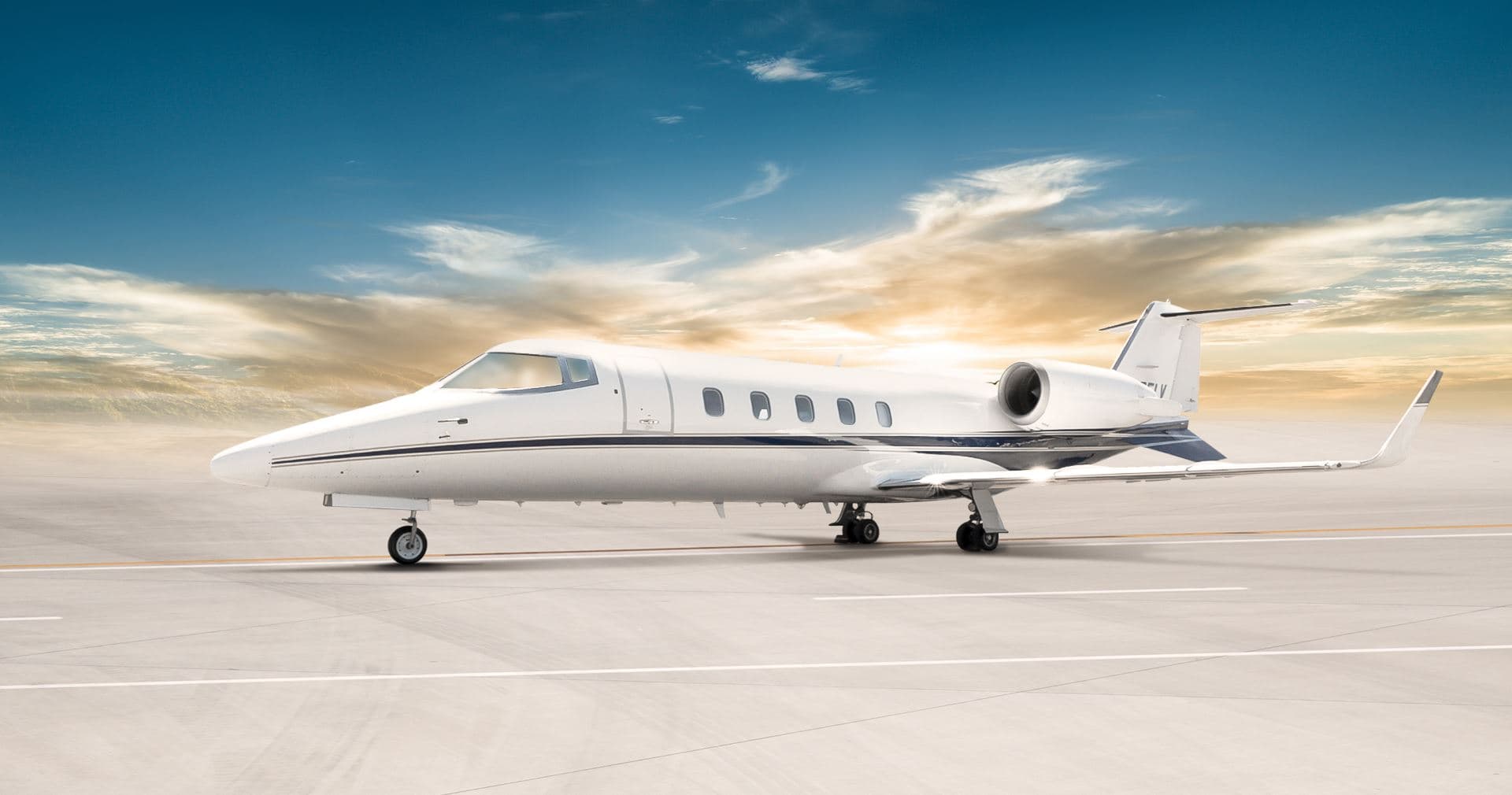 Mon, Nov 23in 20 daysQuonset PointKOQU · Quonset State AirportTorontoCYYZ · Lester B. Pearson International AirportLearjet 607—$15,40023NovQuonset Point → TorontoKOQU → CYYZ · in 20 daysLearjet 60 · 7 seats$15,400
- Mon, Nov 23in 20 daysNorth KingstownKOQU · Quonset State AirportTorontoCYYZ · Lester B. Pearson International AirportBombardier Learjet 60XR7—On request23NovNorth Kingstown → TorontoKOQU → CYYZ · in 20 daysBombardier Learjet 60XR · 7 seatsOn request
- Mon, Nov 23in 20 daysNorth KingstownKOQU · Quonset State AirportTorontoCYYZ · Lester B. Pearson International AirportLearjet Lear 607—$7,45023NovNorth Kingstown → TorontoKOQU → CYYZ · in 20 daysLearjet Lear 60 · 7 seats$7,450
- Tue, Nov 2400:42North KingstownKOQU · Quonset StateTorontoCYYZ · Lester B. Pearson IntlBombardier Learjet 607—$13,61324NovNorth Kingstown → TorontoKOQU → CYYZ · 00:42Bombardier Learjet 60 · 7 seats$13,613
 Thu, Nov 2618:00North KingstownKOQU · Quonset State AirportTeterboroKTEB · Teterboro AirportGulfstream G V16—On request26NovNorth Kingstown → TeterboroKOQU → KTEB · 18:00Gulfstream G V · 16 seatsOn request
 Fri, Nov 27in 24 daysNorth KingstownKOQU · Quonset State AirportTeterboroKTEB · Teterboro AirportGulfStream GV14—On request27NovNorth Kingstown → TeterboroKOQU → KTEB · in 24 daysGulfStream GV · 14 seatsOn request
 KOQU · Quonset State Airport
 CYYZ · Lester B. Pearson International Airport
* Total price incl. 10% service fee, converted to your selected currency. Price subject to operator confirmation.
Empty legs to KOQU
4 arrivals available
- Tue, Nov 3TodayDullesKIAD · Washington Dulles International AirportNorth KingstownKOQU · Quonset State AirportCitation X8—$9,4603NovDulles → North KingstownKIAD → KOQU · TodayCitation X · 8 seats$9,460
- Tue, Nov 3TodayTeterboroKTEB · Teterboro AirportNorth KingstownKOQU · Quonset State AirportCitation X12—$9,4603NovTeterboro → North KingstownKTEB → KOQU · TodayCitation X · 12 seats$9,460
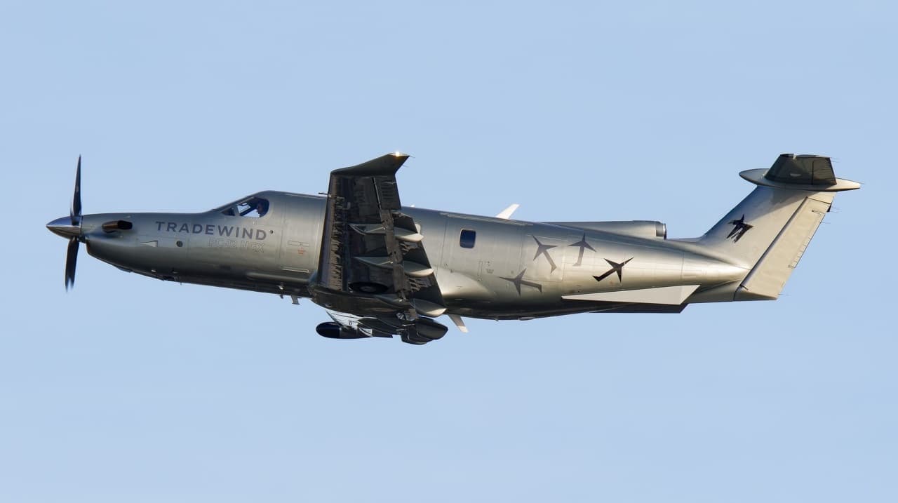 Fri, Nov 6in 3 daysSelinsgroveKSEG · Penn Valley AirportQuonset PointKOQU · Quonset State AirportPilatus PC-128—On request6NovSelinsgrove → Quonset PointKSEG → KOQU · in 3 daysPilatus PC-12 · 8 seatsOn request
- Tue, Nov 1005:24AlcoaKTYS · McGhee Tyson AirportNorth KingstownKOQU · Quonset State AirportCessna Citation CJ3+7—$14,74010NovAlcoa → North KingstownKTYS → KOQU · 05:24Cessna Citation CJ3+ · 7 seats$14,740
* Total price incl. 10% service fee, converted to your selected currency. Price subject to operator confirmation.
Map: North Kingstown Airport
View the location of North Kingstown – NCO/KOQU. Zoom in to explore the area around the airport.
About the airport
Quonset State Airport (NCO/KOQU) is the key private jet gateway for North Kingstown. PrivJet gives you instant access to charter flights and empty legs: fast, discreet and globally connected.
KOQU airport FAQ
Are there any restrictions at North Kingstown airport (KOQU) today?
There are currently 9 valid NOTAMs for North Kingstown (KOQU). Affected: Obstacle: out of service; PAPI: unserviceable; Other: out of service. 1 more NOTAM starts in the coming days. For information only, not for flight planning or operational use. Always rely on an official pre-flight briefing. This list may be incomplete or out of date.
How long are the runways at North Kingstown airport (KOQU)?
North Kingstown (KOQU) has 2 runways: runway 16/34 with 2,134 m (7,000 ft), asphalt/concrete and runway 05/23 with 1,219 m (4,000 ft), asphalt. The longest is 2,134 m.
What are the radio frequencies at North Kingstown airport (KOQU)?
Frequencies at KOQU: Tower 126.35 MHz and Ground 134.5 MHz. For information only. Always rely on the published AIP.
What are the airport codes of Quonset State Airport?
The ICAO code is KOQU and the IATA code is NCO. ICAO codes are used by air traffic control and pilots, e.g. in flight plans; IATA codes appear on tickets and baggage tags.
What is the elevation of KOQU airport?
Quonset State Airport sits at 18 ft (5 m) above sea level. Local time zone: America/New York.
Can I fly to KOQU by private jet?
Whether a private jet can operate into Quonset State Airport depends on runway length, opening hours, customs and immigration rules as well as slot and handling availability, among other things. PrivJet checks this with the operating carrier for every request.
Are there empty legs from or to KOQU?
There are currently 6 empty legs departing from and 4 arriving at Quonset State Airport. Empty legs are repositioning flights at heavily reduced prices; the list is updated several times a day.