Sarmellek Airport (LHSM / SOB)
Empty legs and charters from Sarmellek
LHSM airport at a glance
- ICAO code
- LHSM
- IATA code
- SOB
- City
- Sarmellek
- Region
- Zala
- Country
- Hungary
- Elevation
- 408 ft (124 m)
- Time zone
- Europe/Budapest (UTC+1)
- Coordinates
- 46.6864° N, 17.1591° E
- Empty legs from
- 1
- Empty legs to
- 2
Weather & airport info LHSM
Current weather
Marginal visual conditions (MVFR)observed 03 Nov, 10:45 UTC- Wind
- 11 kt (20 km/h) from north (10°)
- Visibility
- 10 km or more
- Clouds
- overcast at 2,300 ft
- Temperature
- 7 °C (dew point 4 °C)
- Pressure (QNH)
- 1,024 hPa
Original weather report (METAR)
METAR LHSM 031045Z AUTO 01011KT 9999 OVC023 07/04 Q1024 NOSIG
Forecast (TAF)
- 03 Nov, 09:00–18:00 UTC12 kt (22 km/h) from north (360°), gusts up to 22 kt · visibility 10 km or more · Light rain · overcast at 2,300 ft
- 03 Nov, 09:00–15:00 UTCtemporarilyvisibility 6 km · broken clouds at 800 ft, overcast at 2,500 ft
Original forecast (TAF)
TAF LHSM 030815Z 0309/0318 36012G22KT 9999 -RA OVC023 TEMPO 0309/0315 6000 BKN008 OVC025
Airport
- Elevation
- 408 ft (124 m)
- Sunrise / Sunset
- 06:35 / 16:34 local time
Runways
| Runway | Length | Surface | Lighted |
|---|---|---|---|
| 16/34 | 2,500 m (8,202 ft) | concrete | yes |
Radio frequencies
- Flight information: 127.6
- Tower: 127.6
For information only, not for flight planning. Weather can change quickly; always rely on official reports. Sources: aviationweather.gov (NOAA), OurAirports.
Airport map LHSM
Full screen →Runways white, taxiways yellow with designators, closed taxiways and runways per NOTAM in red.
Official charts
Aerodrome, approach and ground charts are published by the national air navigation service in its AIP:
EUROCONTROL: nationale AIS-Websites →For information only, not for navigation. Always use current official charts and NOTAMs.
Current NOTAMs for LHSM(8)
NOTAMs (Notices to Air Missions) announce short-term changes at an airport: closed runways or taxiways, unserviceable approach aids, obstacles, airspace restrictions.
- ClosedTaxiway: closedA7927/26· until 29 Jan, 22:59 UTC (estimated)
Taxiway S is closed. No entry signs at taxiway S entrance may not be visible to pilots before turning onto taxiway S.
Show original text
TWY S CLSD. NO ENTRY SIGNS AT TWY S ENTRANCE MAY NOT BE VISIBLE TO PILOTS BEFORE TURNING ONTO TWY S.
A7927/26 NOTAMR A5139/26
 Q) LHCC/QMXLC/IV/BO /A /000/999/4641N01710E005
 A) LHSM B) 2610290858 C) 2701292259EST
 E) TWY S CLSD. NO ENTRY SIGNS AT TWY S ENTRANCE MAY NOT BE VISIBLE
 TO PILOTS BEFORE TURNING ONTO TWY S.
- NoticeAerodrome: available on requestA8078/26· from 03 Nov, 15:00 UTC · until 03 Nov, 19:00 UTC
Airport services are only available on request. An extra fee must be paid for all flights.
Show original text
AIRPORT SERVICES ONLY AVBL ON REQUEST. EXTRA FEE SHALL BE PAID FOR ALL TRAFFIC. FOR FURTHER INFO PLEASE CONTACT: CKI(AT)HEVIZAIRPORT.COM.
A8078/26 NOTAMN
 Q) LHCC/QFAAR/IV/NBO/A /000/999/4641N01710E005
 A) LHSM B) 2611031500 C) 2611031900
 E) AIRPORT SERVICES ONLY AVBL ON REQUEST.
 EXTRA FEE SHALL BE PAID FOR ALL TRAFFIC.
 FOR FURTHER INFO PLEASE CONTACT: CKI(AT)HEVIZAIRPORT.COM.
- NoticeApron: limited toA7931/26· until 29 Jan, 22:59 UTC (estimated)
Follow-Me guidance is mandatory on apron 3 due to degraded markings and non-standard stand markings. Pilots must follow the instructions of the Follow-Me vehicle or marshaller.
Show original text
FOLLOW-ME GUIDANCE MANDATORY ON APRON 3 DUE TO DEGRADED MARKINGS AND NON-STANDARD STAND MARKINS. PILOTS SHALL FOLLOW-ME/MARSHALLER INSTRUCTIONS.
A7931/26 NOTAMR A5144/26
 Q) LHCC/QMNLT/IV/NBO/A /000/999/4641N01710E005
 A) LHSM B) 2610290921 C) 2701292259EST
 E) FOLLOW-ME GUIDANCE MANDATORY ON APRON 3 DUE TO DEGRADED MARKINGS
 AND NON-STANDARD STAND MARKINS. PILOTS SHALL FOLLOW-ME/MARSHALLER
 INSTRUCTIONS.
- NoticeTaxiwayA7929/26· until 29 Jan, 22:59 UTC (estimated)
The runway 16 Category I holding position sign on taxiway A3 is provided on one side only. The Category I runway holding position marking is available.
Show original text
RWY 16 CAT I HOLDING POSITION SIGN ON TWY A3 PROVIDED ON ONE SIDE ONLY. CAT I RWY HOLDING POSITION MARKING AVAILABLE.
A7929/26 NOTAMR A5143/26
 Q) LHCC/QMXXX/IV/NBO/A /000/999/4641N01710E005
 A) LHSM B) 2610290912 C) 2701292259EST
 E) RWY 16 CAT I HOLDING POSITION SIGN ON TWY A3 PROVIDED ON ONE SIDE
 ONLY. CAT I RWY HOLDING POSITION MARKING AVAILABLE.
- NoticeRunway: limited toA7928/26· until 29 Jan, 22:59 UTC (estimated)
Runway 34 AIMING POINT MARKING not COINCIDENT with runway 34 PAPI (approach slope lights) VISUAL APPROACH PATH REFERENCE. runway 34 PAPI (approach slope lights) SERVICEABLE. PILOTS SHALL USE PAPI (approach slope lights) INDICATIONS for VISUAL APPROACH PATH GUIDANCE.
Show original text
RWY 34 AIMING POINT MARKING NOT COINCIDENT WITH RWY 34 PAPI VISUAL APPROACH PATH REFERENCE. RWY 34 PAPI SERVICEABLE. PILOTS SHALL USE PAPI INDICATIONS FOR VISUAL APPROACH PATH GUIDANCE.
A7928/26 NOTAMR A5142/26
 Q) LHCC/QMRLT/IV/NBO/A /000/999/4641N01710E005
 A) LHSM B) 2610290906 C) 2701292259EST
 E) RWY 34 AIMING POINT MARKING NOT COINCIDENT WITH RWY 34 PAPI
 VISUAL APPROACH PATH REFERENCE. RWY 34 PAPI SERVICEABLE. PILOTS
 SHALL USE PAPI INDICATIONS FOR VISUAL APPROACH PATH GUIDANCE.
- NoticeObstacle: erectedA7670/26· until 20 Jan, 23:59 UTC (estimated)
Two electrical poles have been erected next to apron 3. Their height is 20 meters above ground and they are equipped with obstacle lighting.
Show original text
TWO OBSTACLES ERECTED NEXT TO APRON 3. THE HEIGHT OF THE ELECTRICAL POLES ARE 20M AGL. PSN OF THE POLES ARE 464143.07N 0170936.65E AND 464151.37N 0170932.05E. OBST LIGHTING INSTALLED ACCORDING TO ICAO ANNEX 14.
A7670/26 NOTAMR A4877/26
 Q) LHCC/QOBCE/IV/M  /A /000/999/4641N01710E005
 A) LHSM B) 2610201307 C) 2701202359EST
 E) TWO OBSTACLES ERECTED NEXT TO APRON 3.
 THE HEIGHT OF THE ELECTRICAL POLES ARE 20M AGL.
 PSN OF THE POLES ARE 464143.07N 0170936.65E AND 464151.37N
 0170932.05E. OBST LIGHTING INSTALLED ACCORDING TO ICAO ANNEX 14.
- NoticeObstacle clearance altitude: changedA7382/26· permanent
OCA(H) VALUES RAISED as follows: LPV RNP approach runway 16: A 638(230), B 650(242), C 658(250), D 669(261). due to INADEQUATE PROTECTION PROVIDED in the MISSED APPROACH SEGMENT for SOME NAVIGATION SYSTEMS AUTHORISED for LPV OPERATIONS. see AIP aerodrome 2-LHSM-RNP-16.
Show original text
OCA(H) VALUES RAISED AS FOLLOWS: LPV RNP APCH RWY 16: A 638(230), B 650(242), C 658(250), D 669(261). DUE TO INADEQUATE PROTECTION PROVIDED IN THE MISSED APPROACH SEGMENT FOR SOME NAVIGATION SYSTEMS AUTHORISED FOR LPV OPERATIONS. REF AIP AD 2-LHSM-RNP-16.
A7382/26 NOTAMR A7034/26
 Q) LHCC/QPOCH/I /NBO/A /000/999/4641N01710E005
 A) LHSM B) 2610130742 C) PERM
 E) OCA(H) VALUES RAISED AS FOLLOWS:
 LPV RNP APCH RWY 16: A 638(230), B 650(242), C 658(250), D 669(261).
 DUE TO INADEQUATE PROTECTION PROVIDED IN THE MISSED APPROACH SEGMENT
 FOR SOME NAVIGATION SYSTEMS AUTHORISED FOR LPV OPERATIONS.
 REF AIP AD 2-LHSM-RNP-16.
- NoticeObstacle clearance altitude: changedA7381/26· permanent
The obstacle clearance altitude/height (OCA(H)) values for the LPV RNP approach to runway 34 have been raised. This affects categories A, B, C, and D and is due to inadequate protection in the missed approach segment for some navigation systems.
Show original text
OCA(H) VALUES RAISED AS FOLLOWS: LPV RNP APCH RWY 34: A 661(262), B 673(274), C 682(283), D 692(293). DUE TO INADEQUATE PROTECTION PROVIDED IN THE MISSED APPROACH SEGMENT FOR SOME NAVIGATION SYSTEMS AUTHORISED FOR LPV OPERATIONS. REF AIP AD 2-LHSM-RNP-34.
A7381/26 NOTAMR A7035/26
 Q) LHCC/QPOCH/I /NBO/A /000/999/4641N01710E005
 A) LHSM B) 2610130740 C) PERM
 E) OCA(H) VALUES RAISED AS FOLLOWS:
 LPV RNP APCH RWY 34: A 661(262), B 673(274), C 682(283), D 692(293).
 DUE TO INADEQUATE PROTECTION PROVIDED IN THE MISSED APPROACH SEGMENT
 FOR SOME NAVIGATION SYSTEMS AUTHORISED FOR LPV OPERATIONS.
 REF AIP AD 2-LHSM-RNP-34.
For information only, not for flight planning or operational use. Always rely on an official pre-flight briefing. This list may be incomplete or out of date. Explanations and expanded abbreviations are generated automatically. The original text is authoritative. Source: FAA NOTAM Management Service (SWIM).
Empty legs from LHSM
1 departures available
 LHSM · Sarmellek International Airport
 EDDF · Frankfurt am Main International Airport
* Total price incl. 10% service fee, converted to your selected currency. Price subject to operator confirmation.
Empty legs to LHSM
2 arrivals available
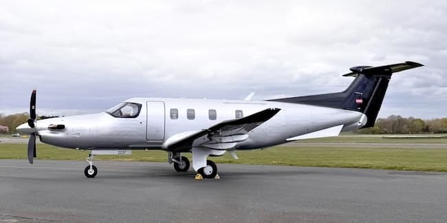 Fri, Nov 6in 3 daysWiener NeustadtLOAN · Wiener Neustadt East AirportBalatonLHSM · Sarmellek International AirportPilatus PC-126—$2,0866NovWiener Neustadt → BalatonLOAN → LHSM · in 3 daysPilatus PC-12 · 6 seats$2,086
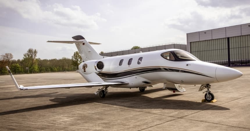
- Sun, Nov 808:24RiminiLIPR · Rimini / Miramare - Federico Fellini International AirportSarmellekLHSM · Sarmellek International AirportHondaJet5—On request8NovRimini → SarmellekLIPR → LHSM · 08:24HondaJet · 5 seatsOn request
 LOAN · Wiener Neustadt East Airport
 LIPR · Rimini / Miramare - Federico Fellini International Airport
* Total price incl. 10% service fee, converted to your selected currency. Price subject to operator confirmation.
Map: Sarmellek Airport
View the location of Sarmellek – SOB/LHSM. Zoom in to explore the area around the airport.
About the airport
Sarmellek International Airport (SOB/LHSM) is the key private jet gateway for Sarmellek. PrivJet gives you instant access to charter flights and empty legs: fast, discreet and globally connected.
LHSM airport FAQ
Are there any restrictions at Sarmellek airport (LHSM) today?
There are currently 7 valid NOTAMs for Sarmellek (LHSM). Affected: Taxiway: closed. 1 more NOTAM starts in the coming days. For information only, not for flight planning or operational use. Always rely on an official pre-flight briefing. This list may be incomplete or out of date.
What is the weather at Sarmellek airport (LHSM)?
According to the latest weather report for LHSM (METAR, 03 Nov, 10:45 UTC): Marginal visual conditions (MVFR). Wind 11 kt (20 km/h) from north (10°), visibility 10 km or more, temperature 7 °C (dew point 4 °C). For information only, not for flight planning. Weather can change quickly; always rely on official reports.
How long are the runways at Sarmellek airport (LHSM)?
Sarmellek (LHSM) has one runway: runway 16/34 with 2,500 m (8,202 ft), concrete.
What are the radio frequencies at Sarmellek airport (LHSM)?
Frequencies at LHSM: Tower 127.6 MHz. For information only. Always rely on the published AIP.
What are the airport codes of Sarmellek International Airport?
The ICAO code is LHSM and the IATA code is SOB. ICAO codes are used by air traffic control and pilots, e.g. in flight plans; IATA codes appear on tickets and baggage tags.
What is the elevation of LHSM airport?
Sarmellek International Airport sits at 408 ft (124 m) above sea level. Local time zone: Europe/Budapest.
Can I fly to LHSM by private jet?
Whether a private jet can operate into Sarmellek International Airport depends on runway length, opening hours, customs and immigration rules as well as slot and handling availability, among other things. PrivJet checks this with the operating carrier for every request.
Are there empty legs from or to LHSM?
There are currently 1 empty legs departing from and 2 arriving at Sarmellek International Airport. Empty legs are repositioning flights at heavily reduced prices; the list is updated several times a day.