Faro Airport (LPFR / FAO)
Empty legs and charters from Faro
LPFR airport at a glance
- ICAO code
- LPFR
- IATA code
- FAO
- City
- Faro
- Region
- Faro
- Country
- Portugal
- Elevation
- 24 ft (7 m)
- Time zone
- Europe/Lisbon (UTC±0)
- Coordinates
- 37.0144° N, 7.9659° W
- Empty legs from
- 8
- Empty legs to
- 12
Weather & airport info LPFR
Current weather
Good visual conditions (VFR)observed 03 Nov, 01:00 UTC- Wind
- 4 kt (7 km/h) from west (280°)
- Visibility
- 10 km or more
- Clouds
- no significant clouds
- Temperature
- 16 °C (dew point 15 °C)
- Pressure (QNH)
- 1,015 hPa
Original weather report (METAR)
METAR LPFR 030100Z 28004KT CAVOK 16/15 Q1015
Forecast (TAF)
- 03 Nov, 00:00–10:00 UTC2 kt (4 km/h) from variable directions · visibility 10 km or more · no significant weather · no significant clouds
- 03 Nov, 10:00–17:00 UTCbecoming10 kt (19 km/h) from south-southwest (200°) · visibility 10 km or more · no significant weather · no significant clouds
- 03 Nov, 17:00–00:00 UTCbecoming10 kt (19 km/h) from west-northwest (290°) · visibility 10 km or more · no significant weather · no significant clouds
Original forecast (TAF)
TAF LPFR 022300Z 0300/0324 VRB02KT CAVOK BECMG 0310/0312 20010KT BECMG 0317/0319 29010KT
Airport
- Elevation
- 24 ft (7 m)
- Sunrise / Sunset
- 06:57 / 17:33 local time
Runways
| Runway | Length | Surface | Lighted |
|---|---|---|---|
| 10/28 | 2,490 m (8,169 ft) | asphalt | yes |
Radio frequencies
- Approach: 119.4
- ATIS: 124.2
- Ground: 118.575
- Tower: 118.2
For information only, not for flight planning. Weather can change quickly; always rely on official reports. Sources: aviationweather.gov (NOAA), OurAirports.
Airport map LPFR
Full screen →Runways white, taxiways yellow with designators, closed taxiways and runways per NOTAM in red.
Closed per NOTAM: TWY C1, TWY F
Official charts
Aerodrome, approach and ground charts are published by the national air navigation service in its AIP:
NAV Portugal AIS →For information only, not for navigation. Always use current official charts and NOTAMs.
Current NOTAMs for LPFR(11)
NOTAMs (Notices to Air Missions) announce short-term changes at an airport: closed runways or taxiways, unserviceable approach aids, obstacles, airspace restrictions.
- ClosedAerodrome: closedA6156/26· until 30 Nov, 05:30 UTC
The aerodrome is closed except for medical emergency and force majeure flights, including medevac helicopter operations.
Show original text
AERODROME CLSD EXCEPT FOR MEDICAL EMERGENCY AND FORCE MAJEURE FLIGHTS, INCLUDING MEDEVAC HELICOPTER OPERATIONS.
A6156/26 NOTAMR A6153/26
 Q) LPPC/QFALC/IV/NBO/A /000/999/3701N00758W005
 A) LPFR B) 2610242323 C) 2611300530
 D) MON-SUN 0030-0530
 E) AERODROME CLSD EXCEPT FOR MEDICAL EMERGENCY AND FORCE MAJEURE
 FLIGHTS, INCLUDING MEDEVAC HELICOPTER OPERATIONS.
Hours: MON-SUN 0030-0530
- ClosedTaxiway: closedA6242/26· until 06 Nov, 05:30 UTC (estimated)
Taxiway C1 is closed due to work in progress and is signalized day and night.
Show original text
TWY C1 CLSD DUE TO WIP. DAY AND NIGHT SIGNALIZED.
A6242/26 NOTAMR A6155/26
 Q) LPPC/QMXLC/IV/BO /A /000/999/3701N00758W005
 A) LPFR B) 2610301536 C) 2611060530EST
 E) TWY C1 CLSD DUE TO WIP. DAY AND NIGHT SIGNALIZED.
- ClosedTaxiway: closedA6154/26· until 30 Nov, 05:30 UTC (estimated)
Taxiway F is closed due to work in progress. The work site is signalized day and night.
Show original text
TWY F CLSD DUE TO WIP. DAY AND NIGHT SIGNALIZED.
A6154/26 NOTAMR A6152/26
 Q) LPPC/QMXLC/IV/BO /A /000/999/3701N00758W005
 A) LPFR B) 2610240435 C) 2611300530EST
 E) TWY F CLSD DUE TO WIP. DAY AND NIGHT SIGNALIZED.
- NoticeILS category I: operating but ground checked onlyA6290/26· until 03 Nov, 17:00 UTC
The Instrument Landing System (ILS) Category 1 for runway 10 is undergoing a flight check and must not be used. The ILS guides aircraft to the runway in poor visibility. Delays may occur for arriving and departing flights.
Show original text
ILS CATEGORY 1 RWY 10 UNDER FLTCK, DO NOT USE. DELAYS MAY OCCUR FOR ARRIVING/DEPARTING TRAFFIC.
A6290/26 NOTAMN
 Q) LPPC/QISAG/I /BO /A /000/999/3701N00758W005
 A) LPFR B) 2611021200 C) 2611031700
 D) 02 1200-1800, 03 1200-1700
 E) ILS CATEGORY 1 RWY 10 UNDER FLTCK, DO NOT USE.
 DELAYS MAY OCCUR FOR ARRIVING/DEPARTING TRAFFIC.
Hours: 02 1200-1800, 03 1200-1700
- NoticeILS: operating but ground checked onlyA6292/26· until 03 Nov, 17:00 UTC
The instrument landing system (ILS) for runway 28, which guides aircraft to the runway in poor visibility, is undergoing a flight check and is out of service. Delays may occur for arriving and departing aircraft.
Show original text
ILS CATEGORY II RWY 28 UNDER FLTCK, DO NOT USE. DELAYS MAY OCCUR FOR ARRIVING/DEPARTING TRAFFIC.
A6292/26 NOTAMN
 Q) LPPC/QICAG/I /BO /A /000/999/3701N00758W005
 A) LPFR B) 2611021200 C) 2611031700
 D) 02 1200-1800, 03 1200-1700
 E) ILS CATEGORY II RWY 28 UNDER FLTCK, DO NOT USE.
 DELAYS MAY OCCUR FOR ARRIVING/DEPARTING TRAFFIC.
Hours: 02 1200-1800, 03 1200-1700
- NoticeAerodrome: limited toA6247/26· until 03 Nov, 09:00 UTC
Meteorological services are limited due to industrial action.
Show original text
MET SERVICES LIMITED DUE TO INDUSTRIAL ACTION.
A6247/26 NOTAMN
 Q) LPPC/QFMLT/IV/BO /A /000/999/3701N00758W005
 A) LPFR B) 2611012000 C) 2611030900
 E) MET SERVICES LIMITED DUE TO INDUSTRIAL ACTION.
- NoticeInstrument approach procedure: changedA6200/26· permanent
The RNP approach chart for runway 28 has changed altitude (height) values for specific distances from the runway threshold. For example, the altitude 8 nautical miles from the threshold is now 2620 feet (2602 feet above ground).
Show original text
IAP RNP RWY 28 ON TABLE ALTITUDE (HEIGHT) CHANGE TO: DIST THR NM 8 - ALTITUDE (HEIGHT) 2620 (2602) DIST THR NM 7 - ALTITUDE (HEIGHT) 2300 (2282) DIST THR NM 6 - ALTITUDE (HEIGHT) 1980 (1962) DIST THR NM 5 - ALTITUDE (HEIGHT) 1660 (1642) DIST THR NM 2 - ALTITUDE (HEIGHT) 710 (692) DIST THR NM 1 - ALTITUDE (HEIGHT) 390 (372) DIST THR NM 3 AND 4 UNCHANGED. REF AIP PORTUGAL LPFR AD 2.24.12-13 INSTRUMENT APPROACH CHART RNP RWY 28.
A6200/26 NOTAMN
 Q) LPPC/QPICH/I /NBO/A /000/999/3701N00758W005
 A) LPFR B) 2610281419 C) PERM
 E) IAP RNP RWY 28 ON TABLE ALTITUDE (HEIGHT) CHANGE TO:
 DIST THR NM 8 - ALTITUDE (HEIGHT) 2620 (2602)
 DIST THR NM 7 - ALTITUDE (HEIGHT) 2300 (2282)
 DIST THR NM 6 - ALTITUDE (HEIGHT) 1980 (1962)
 DIST THR NM 5 - ALTITUDE (HEIGHT) 1660 (1642)
 DIST THR NM 2 - ALTITUDE (HEIGHT) 710 (692)
 DIST THR NM 1 - ALTITUDE (HEIGHT) 390 (372)
 DIST THR NM 3 AND 4 UNCHANGED.
 REF AIP PORTUGAL LPFR AD 2.24.12-13 INSTRUMENT APPROACH CHART RNP
 RWY 28.
- NoticeInstrument approach procedure: changedA6199/26· permanent
The ILS or LOC approach chart for runway 28 has changed altitude (height) values for specific distances from the runway threshold. For example, the altitude 8 nautical miles from the threshold is now 2620 feet (2602 feet above ground).
Show original text
IAP ILS OR LOC RWY 28 ON TABLE ALTITUDE (HEIGHT) CHANGE TO: DIST THR NM 8 - ALTITUDE (HEIGHT) 2620 (2602) DIST THR NM 7 - ALTITUDE (HEIGHT) 2300 (2282) DIST THR NM 6 - ALTITUDE (HEIGHT) 1980 (1962) DIST THR NM 5 - ALTITUDE (HEIGHT) 1660 (1642) DIST THR NM 2 - ALTITUDE (HEIGHT) 710 (692) DIST THR NM 1 - ALTITUDE (HEIGHT) 390 (372) DIST THR NM 3 AND 4 UNCHANGED. REF AIP PORTUGAL LPFR AD 2.24.12-7 INSTRUMENT APPROACH CHART ILS OR LOC RWY 28.
A6199/26 NOTAMN
 Q) LPPC/QPICH/I /NBO/A /000/999/3701N00758W005
 A) LPFR B) 2610281417 C) PERM
 E) IAP ILS OR LOC RWY 28 ON TABLE ALTITUDE (HEIGHT) CHANGE TO:
 DIST THR NM 8 - ALTITUDE (HEIGHT) 2620 (2602)
 DIST THR NM 7 - ALTITUDE (HEIGHT) 2300 (2282)
 DIST THR NM 6 - ALTITUDE (HEIGHT) 1980 (1962)
 DIST THR NM 5 - ALTITUDE (HEIGHT) 1660 (1642)
 DIST THR NM 2 - ALTITUDE (HEIGHT) 710 (692)
 DIST THR NM 1 - ALTITUDE (HEIGHT) 390 (372)
 DIST THR NM 3 AND 4 UNCHANGED.
 REF AIP PORTUGAL LPFR AD 2.24.12-7 INSTRUMENT APPROACH CHART ILS OR
 LOC RWY 28.
3 more NOTAMs
- NoticeInstrument approach procedure: changedA6198/26· permanent
The RNP approach chart for runway 10 has a changed altitude (height) value 5 nautical miles from the runway threshold. The altitude there is now 1670 feet (1646 feet above ground).
Show original text
IAP RNP RWY 10 ON TABLE ALTITUDE (HEIGHT) ON DIST THR NM 5 CHANGE TO 1670 (1646). DIST THR NM 8, 7, 6, 4, 3, 2 AND 1 UNCHANGED. REF AIP PORTUGAL LPFR AD 2.24.12-9 INSTRUMENT APPROACH CHART RNP RWY 10.
A6198/26 NOTAMN
 Q) LPPC/QPICH/I /NBO/A /000/999/3701N00758W005
 A) LPFR B) 2610281414 C) PERM
 E) IAP RNP RWY 10 ON TABLE ALTITUDE (HEIGHT) ON DIST THR NM 5 CHANGE
 TO 1670 (1646).
 DIST THR NM 8, 7, 6, 4, 3, 2 AND 1 UNCHANGED.
 REF AIP PORTUGAL LPFR AD 2.24.12-9 INSTRUMENT APPROACH CHART RNP RWY
 10.
- NoticeInstrument approach procedure: changedA6197/26· permanent
The ILS or LOC approach chart for runway 10 has a changed altitude (height) value 5 nautical miles from the runway threshold. The altitude there is now 1670 feet (1646 feet above ground).
Show original text
IAP ILS OR LOC RWY 10 ON TABLE ALTITUDE (HEIGHT) ON DIST THR NM 5 CHANGE TO 1670 (1646). DIST THR NM 8, 7, 6, 4, 3, 2 AND 1 UNCHANGED. REF AIP PORTUGAL LPFR AD 2.24.12-5 INSTRUMENT APPROACH CHART ILS OR LOC RWY 10.
A6197/26 NOTAMN
 Q) LPPC/QPICH/I /NBO/A /000/999/3701N00758W005
 A) LPFR B) 2610281412 C) PERM
 E) IAP ILS OR LOC RWY 10 ON TABLE ALTITUDE (HEIGHT) ON DIST THR NM 5
 CHANGE TO 1670 (1646).
 DIST THR NM 8, 7, 6, 4, 3, 2 AND 1 UNCHANGED.
 REF AIP PORTUGAL LPFR AD 2.24.12-5 INSTRUMENT APPROACH CHART ILS OR
 LOC RWY 10.
- NoticeInstrument approach procedure: changedA6196/26· permanent
The DVOR approach chart for runway 28 has a changed altitude (height) value 5 nautical miles from the runway threshold. The altitude there is now 1660 feet (1642 feet above ground).
Show original text
IAP DVOR RWY 28 ON TABLE ALTITUDE (HEIGHT) ON DIST THR NM 5 CHANGE TO 1660 (1642). DIST THR NM 6, 4, 3, 2 AND 1 UNCHANGED. REF AIP PORTUGAL LPFR AD 2.24.12-3 INSTRUMENT APPROACH CHART DVOR RWY 28.
A6196/26 NOTAMN
 Q) LPPC/QPICH/I /NBO/A /000/999/3701N00758W005
 A) LPFR B) 2610281410 C) PERM
 E) IAP DVOR RWY 28 ON TABLE ALTITUDE (HEIGHT) ON DIST THR NM 5
 CHANGE TO 1660 (1642).
 DIST THR NM 6, 4, 3, 2 AND 1 UNCHANGED.
 REF AIP PORTUGAL LPFR AD 2.24.12-3 INSTRUMENT APPROACH CHART DVOR
 RWY 28.
For information only, not for flight planning or operational use. Always rely on an official pre-flight briefing. This list may be incomplete or out of date. Explanations and expanded abbreviations are generated automatically. The original text is authoritative. Source: FAA NOTAM Management Service (SWIM).
Private jet traffic in Faro Airport (last 30 days)
- Arrivals
- 246
- Departures
- 142
- Different jets
- 178
Most frequent origins: Madrid Barajas International Airport (10), Lisbon Portela Airport (10), Farnborough Airport (10), Paris-Le Bourget Airport (9), Nice-Cote d'Azur Airport (6).
Most frequent destinations: Farnborough Airport (7), Cascais Airport (5), Manchester Airport (5), Paris-Le Bourget Airport (5), Madrid Barajas International Airport (4).
Most common aircraft types: Cessna Citation Excel/XLS (87), Embraer Phenom 300 (67), Cessna Citation Latitude (25), Bombardier Challenger 350/3500 (22), Pilatus PC-24 (17).
Sunday is the busiest day.
Our own analysis of public ADS-B signals from business jets. Not every flight is received, and jets with a removal request are excluded.
Charter operators based here
Operators with a base at this airport.
- Air Charter ScotlandLondon (Stansted) (EGSS) · Midsize jet, Super midsize jet
Empty legs from LPFR
8 departures available
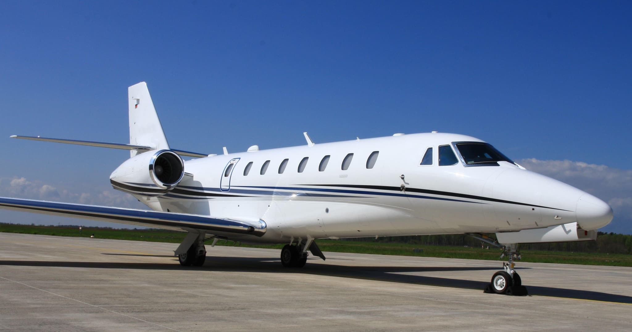 Tue, Nov 3TodayFaroLPFR · Faro AirportOlbiaLIEO · Olbia / Costa Smeralda AirportCitation Sovereign+9—On request3NovFaro → OlbiaLPFR → LIEO · TodayCitation Sovereign+ · 9 seatsOn request
 Thu, Nov 5in 2 daysFaroLPFR · Faro AirportPalmaLEPA · Palma De Mallorca AirportPhenom 3009—On request5NovFaro → PalmaLPFR → LEPA · in 2 daysPhenom 300 · 9 seatsOn request
- Fri, Nov 612:50FaroLPFR · Faro AirportSevillaLEZL · Sevilla AirportCessna Citation XLS+8—$15,5106NovFaro → SevillaLPFR → LEZL · 12:50Cessna Citation XLS+ · 8 seats$15,510
- Fri, Nov 6in 3 daysFaroLPFR · Faro AirportPalma De MallorcaLEPA · Palma De Mallorca AirportCitation XLS+8—On request6NovFaro → Palma De MallorcaLPFR → LEPA · in 3 daysCitation XLS+ · 8 seatsOn request
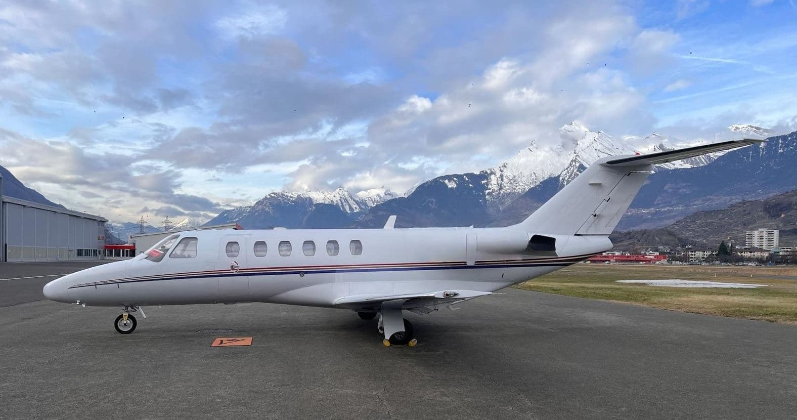 Wed, Nov 25in 22 daysFaroLPFR · Faro AirportMilanLIML · Linate AirportCitation CJ25—€11,03925NovFaro → MilanLPFR → LIML · in 22 daysCitation CJ2 · 5 seats€11,039
 Mon, Dec 28in 55 daysFaro/AlgarveLPFRLondon LutonEGGWEmbraer Legacy 650132h 45mOn request28DecFaro/Algarve → London LutonLPFR → EGGW · in 55 daysEmbraer Legacy 650 · 13 seats · 2h 45mOn request
- Sun, Jun 20in 229 daysFaro/AlgarveLPFRLondon LutonEGGWEmbraer Legacy 650132h 45mOn request20JunFaro/Algarve → London LutonLPFR → EGGW · in 229 daysEmbraer Legacy 650 · 13 seats · 2h 45mOn request
 Mon, Aug 23in 293 daysFaro/AlgarveLPFRBirmingham InternationalEGBBEmbraer Legacy 50082h 40mOn request23AugFaro/Algarve → Birmingham InternationalLPFR → EGBB · in 293 daysEmbraer Legacy 500 · 8 seats · 2h 40mOn request
 LPFR · Faro Airport
 LIEO · Olbia / Costa Smeralda Airport
 LEPA · Palma De Mallorca Airport
 EGGW
* Total price incl. 10% service fee, converted to your selected currency. Price subject to operator confirmation.
Empty legs to LPFR
12 arrivals available
- Tue, Nov 3TodayMarrakechGMMX · Menara AirportFaroLPFR · Faro AirportBombardier Challenger 35081h 15m€4,9283NovMarrakech → FaroGMMX → LPFR · TodayBombardier Challenger 350 · 8 seats · 1h 15m€4,928
 Wed, Nov 4TomorrowSanta Cruz De TenerifeGCTS · Tenerife South AirportFaroLPFR · Faro AirportCitation XLS+8—On request4NovSanta Cruz De Tenerife → FaroGCTS → LPFR · TomorrowCitation XLS+ · 8 seatsOn request
- Thu, Nov 5in 2 daysLisbonLPPT · Lisbon Portela AirportFaroLPFR · Faro AirportCessna Citation XLS739m€2,9575NovLisbon → FaroLPPT → LPFR · in 2 daysCessna Citation XLS · 7 seats · 39m€2,957
- Fri, Nov 6in 3 daysGenevaLSGG · Geneva Cointrin International AirportFaroLPFR · Faro AirportCitation Sovereign+9—On request6NovGeneva → FaroLSGG → LPFR · in 3 daysCitation Sovereign+ · 9 seatsOn request
- Sat, Nov 706:30BerlinEDDB · Berlin Brandenburg AirportFaroLPFRCessna Citation XLS+—3h 49mOn request7NovBerlin → FaroEDDB → LPFR · 06:30Cessna Citation XLS+ · 3h 49mOn request
- Sun, Nov 8in 5 daysFarnboroughEGLF · Farnborough AirportFaroLPFR · Faro AirportCitation CJ2——On request8NovFarnborough → FaroEGLF → LPFR · in 5 daysCitation CJ2On request
- Sun, Nov 8in 5 daysFarnboroughEGLF · Farnborough AirportFaroLPFR · Faro AirportCitation CJ26—On request8NovFarnborough → FaroEGLF → LPFR · in 5 daysCitation CJ2 · 6 seatsOn request
 Fri, Nov 13in 10 daysReusLERS · Reus Air BaseFaroLPFR · Faro AirportPilatus PC-248—On request13NovReus → FaroLERS → LPFR · in 10 daysPilatus PC-24 · 8 seatsOn request
 Mon, Nov 16in 13 daysMadridLEMD · Madrid Barajas International AirportFaroLPFR · Faro AirportHawker 400XP7—On request16NovMadrid → FaroLEMD → LPFR · in 13 daysHawker 400XP · 7 seatsOn request
 GMMX · Menara Airport
 LSGG · Geneva Cointrin International Airport
 EDDB · Berlin Brandenburg Airport
* Total price incl. 10% service fee, converted to your selected currency. Price subject to operator confirmation.
Map: Faro Airport
View the location of Faro – FAO/LPFR. Zoom in to explore the area around the airport.
About the airport
Faro Airport (FAO/LPFR) is the key private jet gateway for Faro. PrivJet gives you instant access to charter flights and empty legs: fast, discreet and globally connected.
LPFR airport FAQ
Are there any restrictions at Faro airport (LPFR) today?
There are currently 11 valid NOTAMs for Faro (LPFR). According to NOTAM, at least one runway or the aerodrome itself is closed. Affected: Aerodrome: closed; Taxiway: closed. For information only, not for flight planning or operational use. Always rely on an official pre-flight briefing. This list may be incomplete or out of date.
What is the weather at Faro airport (LPFR)?
According to the latest weather report for LPFR (METAR, 03 Nov, 01:00 UTC): Good visual conditions (VFR). Wind 4 kt (7 km/h) from west (280°), visibility 10 km or more, temperature 16 °C (dew point 15 °C). For information only, not for flight planning. Weather can change quickly; always rely on official reports.
How long are the runways at Faro airport (LPFR)?
Faro (LPFR) has one runway: runway 10/28 with 2,490 m (8,169 ft), asphalt.
What are the radio frequencies at Faro airport (LPFR)?
Frequencies at LPFR: Tower 118.2 MHz, Ground 118.575 MHz and ATIS 124.2 MHz. For information only. Always rely on the published AIP.
What are the airport codes of Faro Airport?
The ICAO code is LPFR and the IATA code is FAO. ICAO codes are used by air traffic control and pilots, e.g. in flight plans; IATA codes appear on tickets and baggage tags.
What is the elevation of LPFR airport?
Faro Airport sits at 24 ft (7 m) above sea level. Local time zone: Europe/Lisbon.
Can I fly to LPFR by private jet?
Whether a private jet can operate into Faro Airport depends on runway length, opening hours, customs and immigration rules as well as slot and handling availability, among other things. PrivJet checks this with the operating carrier for every request.
Are there empty legs from or to LPFR?
There are currently 8 empty legs departing from and 12 arriving at Faro Airport. Empty legs are repositioning flights at heavily reduced prices; the list is updated several times a day.