Subang Sultan Abdul Aziz Shah Airport (WMSA / SZB)
Empty legs and charters from Subang
WMSA airport at a glance
- ICAO code
- WMSA
- IATA code
- SZB
- City
- Subang
- Country
- Malaysia
- Elevation
- 90 ft (27 m)
- Time zone
- Asia/Kuala Lumpur (UTC+8)
- Coordinates
- 3.1306° N, 101.5490° E
- Empty legs from
- 5
- Empty legs to
- 10
Weather & airport info WMSA
Current weather
Good visual conditions (VFR)observed 03 Nov, 10:00 UTC- Wind
- 3 kt (6 km/h) from variable directions
- Visibility
- 10 km or more
- Weather
- Thunderstorm
- Clouds
- few clouds at 1,700 ft
- Temperature
- 25 °C (dew point 24 °C)
- Pressure (QNH)
- 1,009 hPa
Original weather report (METAR)
METAR WMSA 031000Z VRB03KT 9999 TS FEW017CB 25/24 Q1009 RETSRA
Forecast (TAF)
- 03 Nov, 06:00–06:00 UTC3 kt (6 km/h) from variable directions · visibility 10 km or more · few clouds at 1,800 ft
- 03 Nov, 06:00–11:00 UTCtemporarilyvisibility 5 km · Thunderstorm with rain · few clouds at 1,700 ft, scattered clouds at 2,000 ft
Original forecast (TAF)
TAF WMSA 030500Z 0306/0406 VRB03KT 9999 FEW018 TEMPO 0306/0311 5000 TSRA FEW017CB SCT020
Airport
- Elevation
- 90 ft (27 m)
- Sunrise / Sunset
- 06:57 / 18:57 local time
Runways
| Runway | Length | Surface | Lighted |
|---|---|---|---|
| 15/33 | 3,780 m (12,401 ft) | asphalt | yes |
Radio frequencies
- ATIS: 127.6
- Clearance: 126
- Ground: 121.9
- Tower: 118.2
For information only, not for flight planning. Weather can change quickly; always rely on official reports. Sources: aviationweather.gov (NOAA), OurAirports.
Airport map WMSA
Full screen →Runways white, taxiways yellow with designators, closed taxiways and runways per NOTAM in red.
Official charts
Aerodrome, approach and ground charts are published by the national air navigation service in its AIP:
EUROCONTROL: nationale AIS-Websites →For information only, not for navigation. Always use current official charts and NOTAMs.
Current NOTAMs for WMSA(12)
NOTAMs (Notices to Air Missions) announce short-term changes at an airport: closed runways or taxiways, unserviceable approach aids, obstacles, airspace restrictions.
- Out of serviceTerminal area surveillance radar: unserviceableA4371/26· from 05 Nov, 01:00 UTC · until 05 Nov, 04:00 UTC
The primary and secondary surveillance radar (PSR/SSR) at Subang Airport is out of service for maintenance. This radar is used to monitor air traffic.
Show original text
SUBANG PSR/SSR RADAR WITHDRAWN FOR MAINT
A4371/26 NOTAMN
 Q) WMFC/QCTAS/I /B  /AE/000/999/0307N10133E250
 A) WMSA B) 2611050100 C) 2611050400
 E) SUBANG PSR/SSR RADAR WITHDRAWN FOR MAINT
- NoticeUnmanned aircraft: will take placeA4361/26· from 09 Nov, 01:00 UTC · until 30 Nov, 10:00 UTC
Unmanned aircraft (UA) activities will take place along the Mass Rapid Transit (MRT) line (Kelana Jaya Line). This may affect air traffic in that area.
Show original text
UA ACT WILL TAKE PLACE ALONG MASS RAPID TRANSIT LINE WI FLW COORD: 030558.04N 1013636.73E-030616.90N 1014134.15E-030842.74N 1014137.10E-030659.51N 1014042.22E (KELANA JAYA LINE)
A4361/26 NOTAMN
 Q) WMFC/QWULW/IV/BO /AW/000/005/0303N10136E005
 A) WMSA B) 2611090100 C) 2611301000
 D)DLY 0100-1000
 E)UA ACT WILL TAKE PLACE ALONG MASS RAPID TRANSIT LINE WI FLW COORD:

 030558.04N 1013636.73E-030616.90N 1014134.15E-030842.74N
 1014137.10E-030659.51N 1014042.22E

 (KELANA JAYA LINE)

 F) GND                             G) 380FT AGL
Hours: DLY 0100-1000
- NoticeUnmanned aircraft: will take placeA4359/26· from 05 Nov, 23:00 UTC · until 02 Feb, 11:00 UTC
Unmanned aircraft (drone) activities will take place in a defined area near the airport, specifically along the PLUS-NKVE Highway.
Show original text
UA ACT WILL TAKE PLACE WI FLW COORD: 030519.37N 1013256.14E-030449.20N 1013300.12E-030448.47N 1013312.34E- 030520.92N 1013307.15E (PLUS-NKVE HIGHWAY)
A4359/26 NOTAMN
 Q) WMFC/QWULW/IV/BO /AW/000/003/0305N10133E001
 A) WMSA B) 2611052300 C) 2702021100
 D)DLY 2300-1100
 E)UA ACT WILL TAKE PLACE WI FLW COORD:

 030519.37N 1013256.14E-030449.20N 1013300.12E-030448.47N 1013312.34E-
 030520.92N 1013307.15E

 (PLUS-NKVE HIGHWAY)
 F) GND                             G) 275FT AGL
Hours: DLY 2300-1100
- NoticeUnmanned aircraft: will take placeA4360/26· from 05 Nov, 23:00 UTC · until 02 Feb, 11:00 UTC
Unmanned aircraft activities will take place in an area near the NKVE, Shah Alam Section 21 to Section 13.
Show original text
UA ACT WILL TAKE PLACE WI FLW COORD: 030346.15N 1013314.09E-030345.23N 1013339.20E-030448.48N 1013312.38E- 030448.92N 1013300.04E (NKVE,SHAH ALAM SECTION 21 - SECTION 13)
A4360/26 NOTAMN
 Q) WMFC/QWULW/IV/BO /AW/000/005/0304N10133E001
 A) WMSA B) 2611052300 C) 2702021100
 D)DLY 2300-1100
 E)UA ACT WILL TAKE PLACE WI FLW COORD:

 030346.15N 1013314.09E-030345.23N 1013339.20E-030448.48N 1013312.38E-
 030448.92N 1013300.04E

 (NKVE,SHAH ALAM SECTION 21 - SECTION 13)
 F) GND                             G) 400FT AGL
Hours: DLY 2300-1100
- NoticeUnmanned aircraft: will take placeA4301/26· until 28 Dec, 10:00 UTC
Unmanned aircraft activities will take place in the Kwasa Damansara area.
Show original text
UA ACT WILL TAKE PLACE WI FLW COORD: 031049.42N 1013414.19E - 031043.89N 1013416.22E - 031037.86N 1013410.02E - 031039.94N 1013405.41E - 031049.42N 1013414.19E (KWASA DAMANSARA)
A4301/26 NOTAMN Q) WMFC/QWULW/IV/BO /AW/000/006/0310N10134E001 A) WMSA B) 2611020100 C) 2612281000 D) DLY 0100 - 1000 E) UA ACT WILL TAKE PLACE WI FLW COORD: 031049.42N 1013414.19E - 031043.89N 1013416.22E - 031037.86N 1013410.02E - 031039.94N 1013405.41E - 031049.42N 1013414.19E (KWASA DAMANSARA) F) GND G) 370FT AGLHours: DLY 0100 - 1000
- NoticeUnmanned aircraft: will take placeA4303/26· until 30 Nov, 10:00 UTC
Unmanned aircraft activities will take place along the MRT line near the airport. This may lead to increased airspace activity.
Show original text
UA ACT WILL TAKE PLACE ALONG MRT LINE WI FLW COORD: 030558.04N 1013636.73E - 030616.90N 1014115.15E - 030842.74N 1014119.91E - 030659.51N 1013644.22E - 030558.04N 1013636.73E (KELANA JAYA LINE)
A4303/26 NOTAMN Q) WMFC/QWULW/IV/BO /AW/000/008/0307N10138E003 A) WMSA B) 2610310100 C) 2611301000 D) DLY 0100 - 1000 E) UA ACT WILL TAKE PLACE ALONG MRT LINE WI FLW COORD: 030558.04N 1013636.73E - 030616.90N 1014115.15E - 030842.74N 1014119.91E - 030659.51N 1013644.22E - 030558.04N 1013636.73E (KELANA JAYA LINE) F) GND G) 380FT AGLHours: DLY 0100 - 1000
- NoticeUnmanned aircraft: will take placeA4163/26· until 30 Nov, 10:00 UTC
Unmanned aircraft (UA ACT) activities will take place along the MRT line (KELANA JAYA LINE).
Show original text
UA ACT WILL TAKE PLACE ALONG MRT LINE WI FLW COORD: 030503.64N 1013523.12E 030504.26N 1013523.03E 030617.43N 1013639.00E 030726.57N 1013631.60E 030635.36N 1013446.38E 030518.90N 1013511.89E 030503.64N 1013523.12E (KELANA JAYA LINE)
A4163/26 NOTAMN
 Q) WMFC/QWULW/IV/BO /AW/000/003/0306N10135E002
 A) WMSA B) 2610260100 C) 2611301000
 D)0100-1000
 E)UA ACT WILL TAKE PLACE ALONG MRT LINE WI FLW COORD:

 030503.64N 1013523.12E
 030504.26N 1013523.03E
 030617.43N 1013639.00E
 030726.57N 1013631.60E
 030635.36N 1013446.38E
 030518.90N 1013511.89E
 030503.64N 1013523.12E

 (KELANA JAYA LINE)

 F) GND                             G) 218FT AGL
Hours: 0100-1000
- NoticeUnmanned aircraft: will take placeA4164/26· until 30 Nov, 10:00 UTC
Unmanned aircraft (UA ACT) activities will take place along the MRT line (KELANA JAYA LINE).
Show original text
UA ACT WILL TAKE PLACE ALONG MRT LINE WI FLW COORD: 030200.44N 1013447.20E 030116.50N 1013449.00E 030353.90N 1013635.52E 030533.41N 1013448.55E 030200.44N 1013447.20E (KELANA JAYA LINE)
A4164/26 NOTAMN
 Q) WMFC/QWULW/IV/BO /AW/000/002/0303N10135E003
 A) WMSA B) 2610260100 C) 2611301000
 E)UA ACT WILL TAKE PLACE ALONG MRT LINE WI FLW COORD:

 030200.44N 1013447.20E
 030116.50N 1013449.00E
 030353.90N 1013635.52E
 030533.41N 1013448.55E
 030200.44N 1013447.20E

 (KELANA JAYA LINE)

 F) GND                             G) 85FT AGL
4 more NOTAMs
- NoticeUnmanned aircraft: will take placeA4165/26· until 30 Nov, 10:00 UTC
Unmanned aircraft (UA ACT) activities will take place along the MRT line (KELANA JAYA LINE).
Show original text
UA ACT WILL TAKE PLACE ALONG MRT LINE WI FLW COORD: 030001.16N 1013322.77E 025914.15N 1013500.66E 030046.46N 1013504.75E 030234.03N 1013435.20E 030001.16N 1013322.77E (KELANA JAYA LINE)
A4165/26 NOTAMN
 Q) WMFC/QWULW/IV/BO /AW/000/005/0300N10134E002
 A) WMSA B) 2610260100 C) 2611301000
 E)UA ACT WILL TAKE PLACE ALONG MRT LINE WI FLW COORD:

 030001.16N 1013322.77E
 025914.15N 1013500.66E
 030046.46N 1013504.75E
 030234.03N 1013435.20E
 030001.16N 1013322.77E

 (KELANA JAYA LINE)

 F) GND                             G) 400FT AGL
- NoticeUnmanned aircraft: will take placeA4166/26· until 30 Nov, 10:00 UTC
Unmanned aircraft (UA ACT) activities will take place along the MRT line (AMPANG LINE).
Show original text
UA ACT WILL TAKE PLACE ALONG MRT LINE WI FLW COORD: 030317.19N 1013714.20E 030239.58N 1013742.20E 030316.05N 1014021.51E 030357.67N 1014049.84E 030348.57N 1013914.68E 030317.19N 1013714.20E (AMPANG LINE)
A4166/26 NOTAMN
 Q) WMFC/QWULW/IV/BO /AW/000/005/0303N10139E002
 A) WMSA B) 2610260100 C) 2611301000
 E)UA ACT WILL TAKE PLACE ALONG MRT LINE WI FLW COORD:

 030317.19N 1013714.20E
 030239.58N 1013742.20E
 030316.05N 1014021.51E
 030357.67N 1014049.84E
 030348.57N 1013914.68E
 030317.19N 1013714.20E

 (AMPANG LINE)

 F) GND                             G) 370FT AGL
- NoticeUnmanned aircraft: will take placeA4167/26· until 30 Nov, 10:00 UTC
UA active will TAKE PLACE ALONG MRT LINE within FLW COORD: (AMPANG LINE)
Show original text
UA ACT WILL TAKE PLACE ALONG MRT LINE WI FLW COORD: 025951.13N 1013528.85E 025925.65N 1013526.26E 030020.14N 1013617.06E 030238.05N 1013740.00E 030316.58N 1013714.10E 025951.13N 1013528.85E (AMPANG LINE)
A4167/26 NOTAMN
 Q) WMFC/QWULW/IV/BO /AW/000/005/0301N10136E003
 A) WMSA B) 2610260100 C) 2611301000
 E)UA ACT WILL TAKE PLACE ALONG MRT LINE WI FLW COORD:

 025951.13N 1013528.85E
 025925.65N 1013526.26E
 030020.14N 1013617.06E
 030238.05N 1013740.00E
 030316.58N 1013714.10E
 025951.13N 1013528.85E

 (AMPANG LINE)

 F) GND                             G) 430FT AGL
- NoticeUnmanned aircraft: will take placeA4171/26· until 30 Nov, 10:00 UTC
Unmanned aircraft (UA ACT) activities will take place along the MRT line (AMPANG LINE).
Show original text
UA ACT WILL TAKE PLACE ALONG MRT LINE WI FLW COORD: 025955.74N 1013414.05E 025908.80N 1013430.57E 025908.93N 1013430.66E 025918.81N 1013528.58E 025953.22N 1013524.47E (AMPANG LINE)
A4171/26 NOTAMN
 Q) WMFC/QWULW/IV/BO /AW/000/005/0259N10134E002
 A) WMSA B) 2610260100 C) 2611301000
 D)OCT 26 NOV 2,9,16,23,30 0100-1000
 E)UA ACT WILL TAKE PLACE ALONG MRT LINE WI FLW COORD:

 025955.74N 1013414.05E
 025908.80N 1013430.57E
 025908.93N 1013430.66E
 025918.81N 1013528.58E
 025953.22N 1013524.47E

 (AMPANG LINE)

 F) GND                             G) 400FT AGL
Hours: OCT 26 NOV 2,9,16,23,30 0100-1000
For information only, not for flight planning or operational use. Always rely on an official pre-flight briefing. This list may be incomplete or out of date. Explanations and expanded abbreviations are generated automatically. The original text is authoritative. Source: FAA NOTAM Management Service (SWIM).
Private jet traffic in Sultan Abdul Aziz Shah International Airport (last 30 days)
- Arrivals
- 209
- Departures
- 171
- Different jets
- 112
Most frequent origins: Seletar Airport (23), Senai International Airport (12), Chek Lap Kok International Airport (10), Don Mueang International Airport (6), Ninoy Aquino International Airport (5).
Most frequent destinations: Seletar Airport (34), Senai International Airport (14), Don Mueang International Airport (9), Chek Lap Kok International Airport (8), Soekarno-Hatta International Airport (5).
Most common aircraft types: Gulfstream G450/GIV (42), Gulfstream G650 (38), Gulfstream G550/GV (33), Beechcraft King Air 350 (29), Bombardier Global 6000/6500 (28).
Our own analysis of public ADS-B signals from business jets. Not every flight is received, and jets with a removal request are excluded.
Charter operators based here
Operators with a base at this airport.
- Luxaviation San MarinoAccra (Kotoka) (DGAA) · Midsize jet, Super midsize jet, Heavy jet
- MHS AviationKuala Lumpur International (WMKK) · Helicopter
- Sabah Air AviationKota Kinabalu International (WBKK) · Turboprop, Helicopter
- Weststar General AviationHeavy jet, Helicopter
- Aerotree Defence & ServicesTurboprop, Light jet
- Berjaya AirTurboprop
- Helistar ResourcesHelicopter
- Hongkong JetJakarta (Halim Perdanakusuma) (WIHH) · Midsize jet
- Sin-Kung AviationTurboprop
- Weststar Aviation ServicesDen Helder (De Kooy) (EHKD) · Helicopter
Empty legs from WMSA
5 departures available
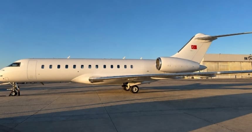 Tue, Nov 3TodayKuala LumpurWMSA · Sultan Abdul Aziz Shah International AirportIstanbulLTBA · Ataturk International AirportGlobal Express12—On request3NovKuala Lumpur → IstanbulWMSA → LTBA · TodayGlobal Express · 12 seatsOn request
- Fri, Nov 6in 3 daysSubangWMSA · Sultan Abdul Aziz Shah International AirportSeletarWSSL · Seletar AirportBombardier Global 60001249m€6,8826NovSubang → SeletarWMSA → WSSL · in 3 daysBombardier Global 6000 · 12 seats · 49m€6,882
- Mon, Nov 9in 6 daysSubangWMSA · Sultan Abdul Aziz Shah International AirportSeletarWSSL · Seletar AirportBombardier Global 75001254m€9,8329NovSubang → SeletarWMSA → WSSL · in 6 daysBombardier Global 7500 · 12 seats · 54m€9,832
- Thu, Nov 1216:00SubangWMSA · Sultan Abdul Aziz Shah International AirportBangkokVTBD · Don Mueang International AirportDassault Falcon 7X14—$38,61012NovSubang → BangkokWMSA → VTBD · 16:00Dassault Falcon 7X · 14 seats$38,610
- Fri, Nov 1319:45SubangWMSA · Sultan Abdul Aziz Shah International AirportSeletarWSSL · Seletar AirportDassault Falcon 7X14—$14,96013NovSubang → SeletarWMSA → WSSL · 19:45Dassault Falcon 7X · 14 seats$14,960
 WMSA · Sultan Abdul Aziz Shah International Airport
 LTBA · Ataturk International Airport
 WSSL · Seletar Airport
 VTBD · Don Mueang International Airport
* Total price incl. 10% service fee, converted to your selected currency. Price subject to operator confirmation.
Empty legs to WMSA
10 arrivals available
 Tue, Nov 3TodaySingaporeWSSL · Seletar AirportKuala LumpurWMSA · Sultan Abdul Aziz Shah International AirportGlobal 600014—On request3NovSingapore → Kuala LumpurWSSL → WMSA · TodayGlobal 6000 · 14 seatsOn request
- Tue, Nov 3TodayHong KongVHHH · Chek Lap Kok International AirportSubangWMSA · Sultan Abdul Aziz Shah International AirportBombardier Global 7500143h 39m€36,0503NovHong Kong → SubangVHHH → WMSA · TodayBombardier Global 7500 · 14 seats · 3h 39m€36,050
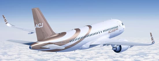 Wed, Nov 4TomorrowDohaOTBD · Doha International AirportKuala LumpurWMSA · Sultan Abdul Aziz Shah International AirportAirbus ACJ A31919—On request4NovDoha → Kuala LumpurOTBD → WMSA · TomorrowAirbus ACJ A319 · 19 seatsOn request
 Wed, Nov 4TomorrowSingaporeWSSL · Seletar AirportKuala LumpurWMSA · Sultan Abdul Aziz Shah International AirportGlobal 600014—On request4NovSingapore → Kuala LumpurWSSL → WMSA · TomorrowGlobal 6000 · 14 seatsOn request
- Wed, Nov 4TomorrowPhnom PenhVDTI · Techo International AirportSubangWMSA · Sultan Abdul Aziz Shah International AirportBombardier Global 6000121h 45m€12,0434NovPhnom Penh → SubangVDTI → WMSA · TomorrowBombardier Global 6000 · 12 seats · 1h 45m€12,043
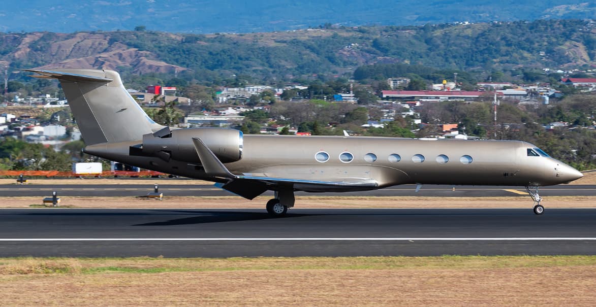 Thu, Nov 5in 2 daysSingaporeWSSL · Seletar AirportKuala LumpurWMSA · Sultan Abdul Aziz Shah International AirportGulfstream G55014—On request5NovSingapore → Kuala LumpurWSSL → WMSA · in 2 daysGulfstream G550 · 14 seatsOn request
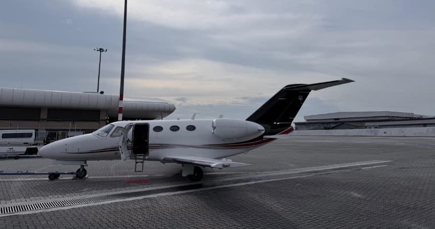 Thu, Nov 5in 2 daysSingaporeWSSL · Seletar AirportKuala LumpurWMSA · Sultan Abdul Aziz Shah International AirportCitation Mustang4—On request5NovSingapore → Kuala LumpurWSSL → WMSA · in 2 daysCitation Mustang · 4 seatsOn request
 Thu, Nov 5in 2 daysSingaporeWSSL · Seletar AirportKuala LumpurWMSA · Sultan Abdul Aziz Shah International AirportChallenger 60512—On request5NovSingapore → Kuala LumpurWSSL → WMSA · in 2 daysChallenger 605 · 12 seatsOn request
- Sat, Nov 7in 4 daysSeletarWSSL · Seletar AirportSubangWMSA · Sultan Abdul Aziz Shah International AirportBombardier Challenger 605101h€4,9167NovSeletar → SubangWSSL → WMSA · in 4 daysBombardier Challenger 605 · 10 seats · 1h€4,916
 VHHH · Chek Lap Kok International Airport
 OTBD · Doha International Airport
 VDTI · Techo International Airport
* Total price incl. 10% service fee, converted to your selected currency. Price subject to operator confirmation.
Map: Subang Airport
View the location of Subang – SZB/WMSA. Zoom in to explore the area around the airport.
About the airport
Sultan Abdul Aziz Shah International Airport (SZB/WMSA) is the key private jet gateway for Subang. PrivJet gives you instant access to charter flights and empty legs: fast, discreet and globally connected.
WMSA airport FAQ
Are there any restrictions at Subang airport (WMSA) today?
There are currently 8 valid NOTAMs for Subang (WMSA). 4 more NOTAMs start in the coming days. For information only, not for flight planning or operational use. Always rely on an official pre-flight briefing. This list may be incomplete or out of date.
What is the weather at Subang airport (WMSA)?
According to the latest weather report for WMSA (METAR, 03 Nov, 10:00 UTC): Good visual conditions (VFR). Wind 3 kt (6 km/h) from variable directions, visibility 10 km or more, temperature 25 °C (dew point 24 °C). Thunderstorm. For information only, not for flight planning. Weather can change quickly; always rely on official reports.
How long are the runways at Subang airport (WMSA)?
Subang (WMSA) has one runway: runway 15/33 with 3,780 m (12,401 ft), asphalt.
What are the radio frequencies at Subang airport (WMSA)?
Frequencies at WMSA: Tower 118.2 MHz, Ground 121.9 MHz and ATIS 127.6 MHz. For information only. Always rely on the published AIP.
What are the airport codes of Sultan Abdul Aziz Shah International Airport?
The ICAO code is WMSA and the IATA code is SZB. ICAO codes are used by air traffic control and pilots, e.g. in flight plans; IATA codes appear on tickets and baggage tags.
What is the elevation of WMSA airport?
Sultan Abdul Aziz Shah International Airport sits at 90 ft (27 m) above sea level. Local time zone: Asia/Kuala Lumpur.
Can I fly to WMSA by private jet?
Whether a private jet can operate into Sultan Abdul Aziz Shah International Airport depends on runway length, opening hours, customs and immigration rules as well as slot and handling availability, among other things. PrivJet checks this with the operating carrier for every request.
Are there empty legs from or to WMSA?
There are currently 5 empty legs departing from and 10 arriving at Sultan Abdul Aziz Shah International Airport. Empty legs are repositioning flights at heavily reduced prices; the list is updated several times a day.