New in the Private Jet Tracker
Fly along in the cockpit — live.
Pick a private jet that is in the air right now and see the world from its flight deck: like a flight simulator, with a head-up display, real weather, runway lights and 3D cities.
Opens the most exciting jet in the sky – ideally one on final approach.
In TV mode- Free
- In your browser and in the app
- No sign-up


- Live ADS-B
- METAR weather
- PAPI from glide angle
- Sun position
- 3D cities
Features
A flight simulator fed by real flights
Position, speed, altitude and weather are real – the view from the cockpit is computed from them.
A business-jet head-up display
Speed and altitude tapes, track, vertical speed, flight path marker and runway designator – drawn in cyan over the landscape, modelled on the HUDs of modern business jets.
Live ADS-B data
Position, altitude, speed and track arrive every few seconds from public ADS-B receiver networks. In between, the view carries the motion on smoothly.
Real weather from the METAR
Clouds you fly through, plus rain, snow, fog and thunderstorms – taken from the latest weather report of the airport the jet is approaching or has just left, and in cruise from the nearest one.
Runways, markings, lights
ICAO-standard markings and schematic lighting including PAPI: the four glide-path lights show red and white according to the jet’s actual approach angle.
Day, dusk and night
Time of day follows the sun at the jet’s position – a starry sky over Nice, lit windows in the cities below, and in the demo flight a sunset glow over Geneva.
Photorealistic 3D cities
On capable devices, cities appear – where available – as Google’s photorealistic 3D model, otherwise as satellite imagery with 3D buildings. Quality adapts automatically.
Gallery
Live and demo flights
Captured in the cockpit view – live with real jets or in the demo flight. Every image is labelled.
LiveLive on iPhone: night landing in Boston
Gulfstream G550 · N51VE · Boston Logan (KBOS) · 26 Sep 2026
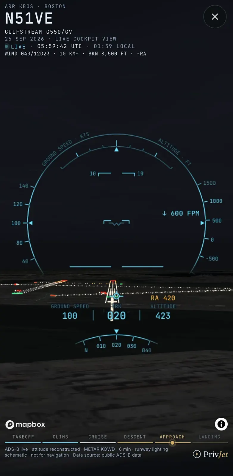
01420 ft above ground – runway ahead
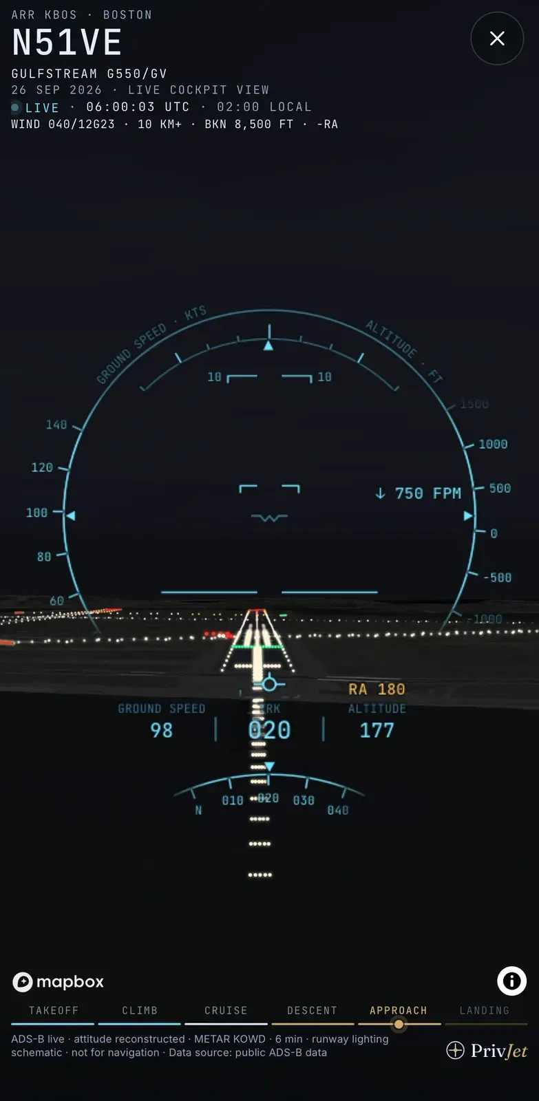
02180 ft – through the approach lights
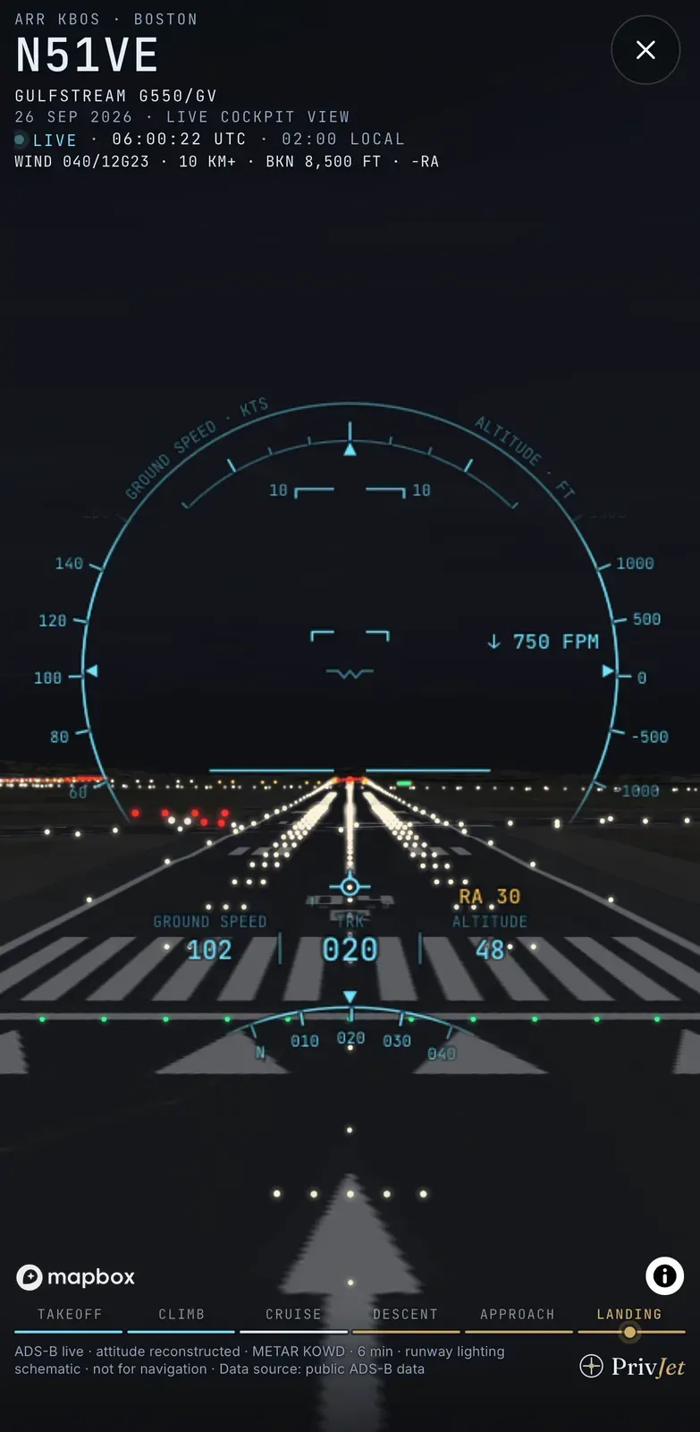
0330 ft – over the threshold
© Mapbox © OpenStreetMap © Maxar
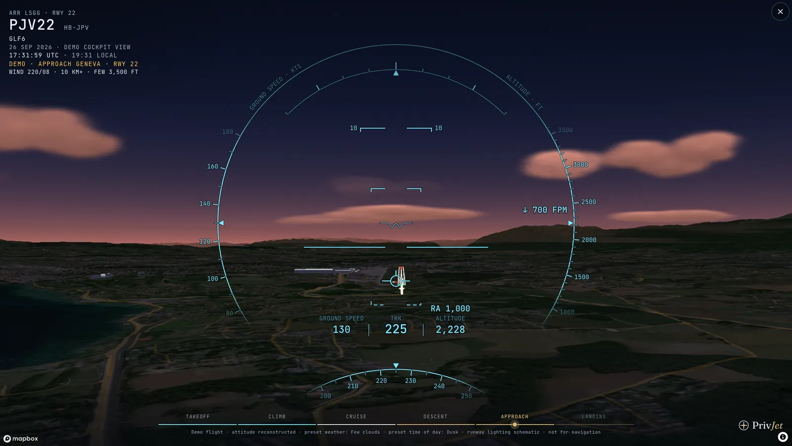
DemoApproach to Geneva runway 22 at dusk 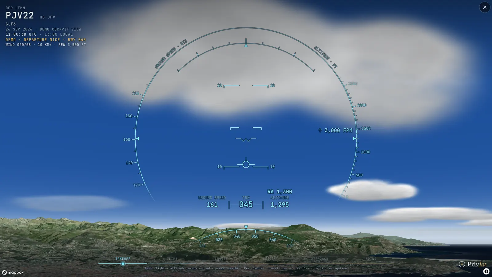
DemoClimbing out of Nice, clouds ahead 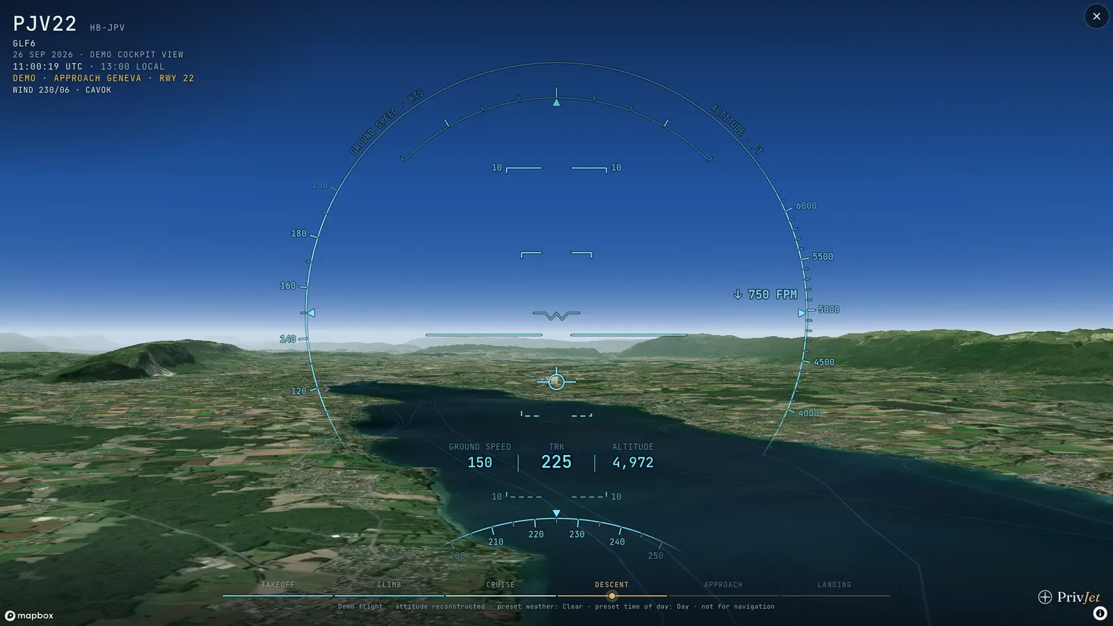
DemoDescent over Lake Geneva in CAVOK weather 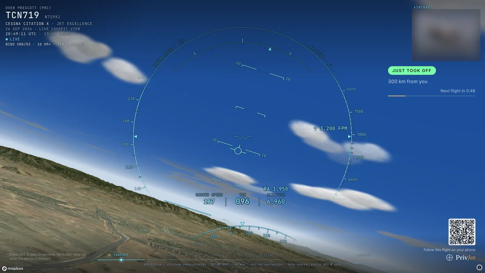
LiveTV mode: climb-out over Prescott, Arizona
Map and satellite imagery: © Mapbox © OpenStreetMap © Maxar. Positions and registrations from public ADS-B data. Aircraft photos shown in the view are blurred here.
How it works
From a radio message to a cockpit view
- 01
Receive the position
Every few seconds the jet broadcasts its position, altitude, speed and track via ADS-B. Public receiver networks pick it up, and our tracker reads along.
- 02
Reconstruct the attitude
Bank is calculated from the turn rate, pitch from the climb or descent rate. Between two messages the motion continues smoothly.
- 03
Build the world around it
Satellite imagery, terrain and 3D buildings, runways with markings and lights, the current METAR weather and the sun at the jet’s position.
- 04
Overlay the HUD
Speed, altitude, track and vertical speed from the live data, plus the flight phase from take-off to landing.
App
Also in the PrivJet app
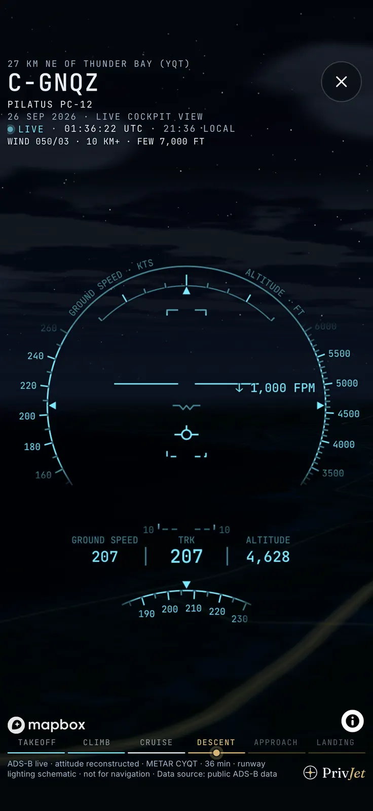
The cockpit view lives in the live map of the PrivJet app. Already installed? Then it takes three steps:
- 1Open the live map
- 2Tap a jet in the air
- 3Choose “Cockpit view”


Cockpit view: frequently asked questions
Is this real video from the cockpit?
No. The view is computed from public ADS-B data: the jet’s position, altitude, speed and track are real, and the view from the cockpit is a simulation on top of them. There is no camera on board and we show no footage from the aircraft.
Which jets can I watch?
Any private jet our tracker currently sees in the air: tap it on the live map and choose “Cockpit view”. “Fly along live now” automatically picks the most exciting jet for you, ideally one on final approach. Jets with a removal request are never shown.
How current is the view?
Position data arrives every few seconds, so the view runs a few seconds behind the real flight and carries the motion on smoothly between two messages. If the signal drops, the view tells you.
Where does the weather come from?
From the latest METAR, the weather report of an airport. On approach, on departure and on the ground, the view uses the report of the airport the jet is approaching, leaving or standing at; otherwise that of the nearest station within 100 kilometres. It turns that into clouds, visibility, rain, snow, fog and thunderstorms. If there is no report in range, the sky stays clear.
Do I need an app or an account?
No. The cockpit view runs free in your browser, on your phone too, without signing up. In the PrivJet app you’ll find it on the live map. On less powerful devices it switches off details such as 3D buildings or precipitation by itself.
Can I use it to navigate or plan a flight?
No. The view is for entertainment and illustration: lighting and markings are schematic, and the data arrives delayed and without guarantee. For flight planning and navigation, only official sources apply.
Data sources & notes
Data source: public ADS-B data
All positions come from publicly broadcast ADS-B signals that every aircraft transmits unencrypted and that volunteers around the world receive. Data may be delayed, incomplete or inaccurate.
Linking an aircraft to a well-known person is based on public sources such as media reports and registry data. "Jet attributed to X" explicitly does not mean that this person is on board or ordered the flight — aircraft are also chartered, sold or used by others.
All information is provided without warranty; no liability is accepted for accuracy or completeness. CO₂ figures are estimates based on typical fuel burn for the aircraft class.
Using this data to harass, track or stalk people is prohibited.
Removal requests and corrections to [email protected].
Cleared for approach?
One click and you’re in the cockpit of the most exciting jet in the sky right now.